Tough Miles

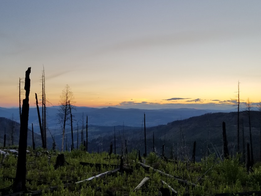
July 24, 2018. From Thirteen Mile Mountain to stealth camp on Forest Road before Ogle Creek.

In spite of the strong moonlight, I woke up rested. I broke camp relatively quickly.

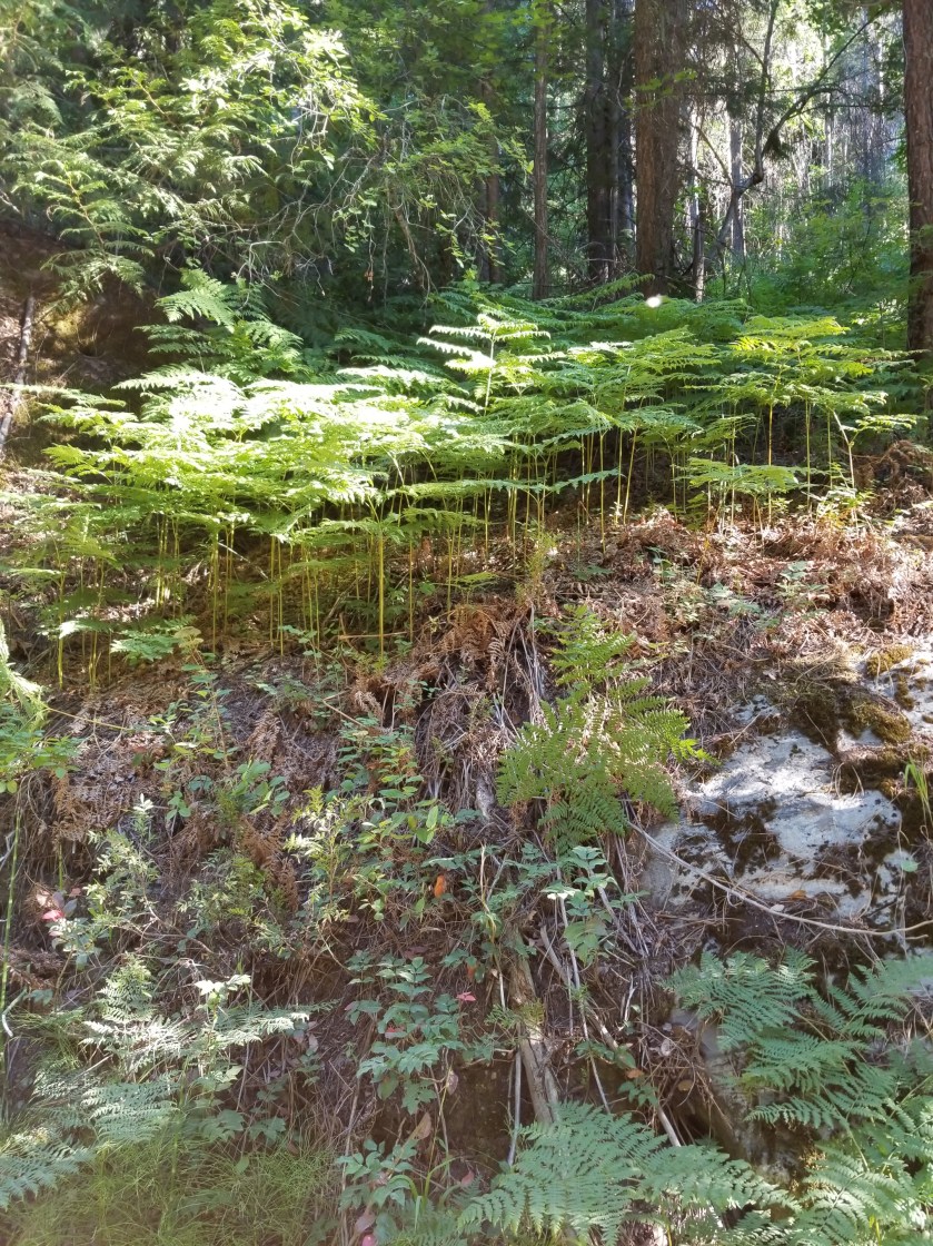
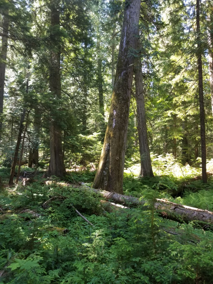
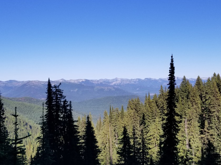
It was a brilliant, beautiful morning going slightly up and down on trail through grassy ponderosa forests. Great views.

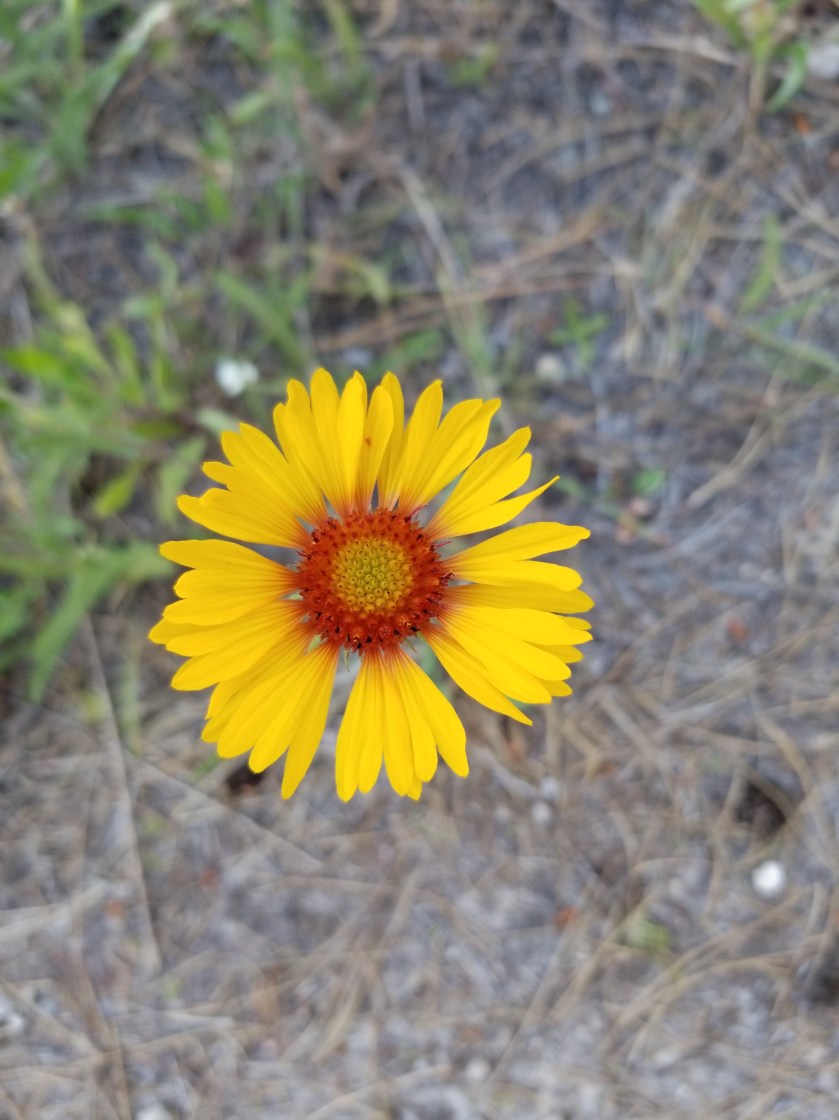
Later in the morning I was cruising downhill, I went from sunny slope to a sharp shaded corner. That was where the accident happened. For my part, it took me two full steps before I recognized the sound of a rattlesnake. For his part, he waited until I was next to him before rattling as he wound himself up underneath a Bush. We both screwed up. I went back to see him and he had beautiful green markings. The video does not do it justice, but you can understand I did not want to stress the creature or, more to the point, get bit and die all for the sake of a more clear video. This isn’t Mutual of Omaha, people.

Later, I crossed a road with a trailhead. I loved it. There was a description of Thirteen Mile Trail. Best part? The length of the trail. All of my avid blog followers know I love goofy signs. So, both of them can understand my glee over the Thirteen Mile Trail being 16 miles. What do you think happened?

I was too tired to consider how a difficulty rating of difficult worked.

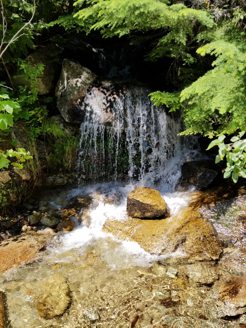
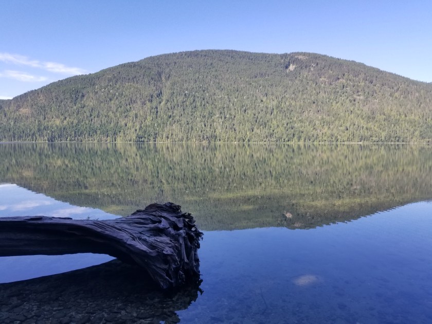
I dropped down an amazing canyon of Thirteen Mile Creek. It had huge 500 foot sheer walls and a churning stream. Suddenly, the stream disappeared. Just as suddenly, it reappeared, apparently choosing to run undergroundfor a quarter mile.

The photo fails to capture how high and sheer the cliffs were.

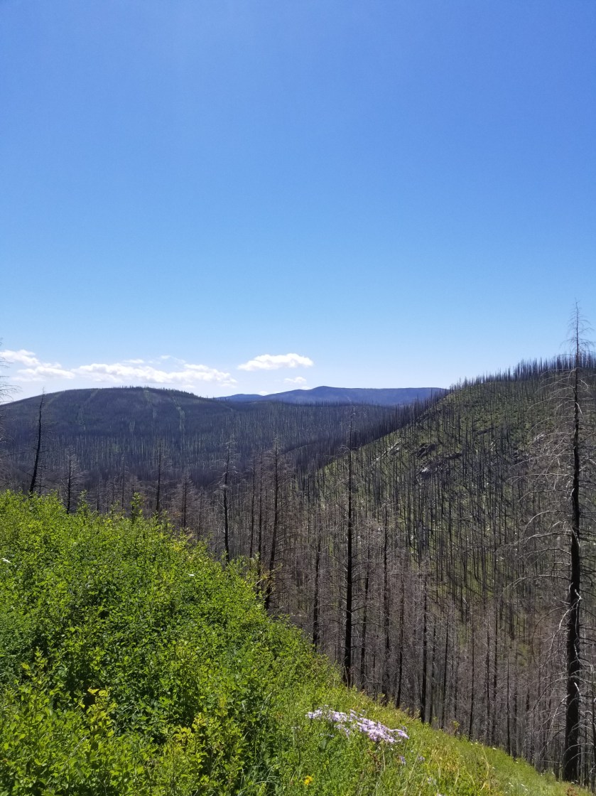
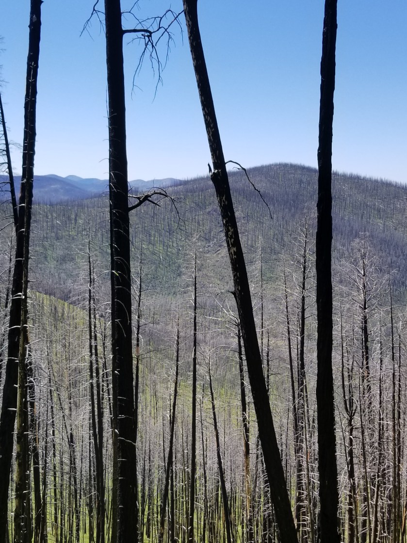
I next had a 2 mile walk on a highway with no shoulder. The Guidebook said this was the Grand Canyon of Washington. I was not impressed. Plus, there were a couple jerk drivers who clearly could’ve moved over, but chose to hug the lane and almost clip me.

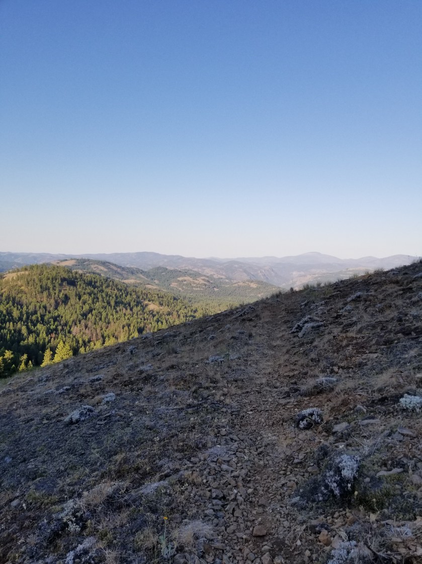
Off the road, I had a dry trail uphill for several miles. It was tough. I had one of my oddest wildlife experiences. Given the amount of time until my next resupply and chance to charge batteries, I have been turning off my phone which is my camera. At a road junction, I was looking at my printed map. A spotted fawn trotted out of the woods. I reached for my phone and turned it on. On a whim, I told the fawn to “calm down.” Unexpectedly, it turned and came right to me. It was panting. It was obviously stressed, but I knew taking my pack off to give it water would spook it. By the time my phone turned on, the fawn was trotting away through the woods. So bizarre.

Late in the day, after passing cattle and timber harvesting, I came to a “V” in the road. A sudden crashing in the bushes uphill made me reach for my phone. I spied some black ears and a scalp. I wasn’t sure if it was a wolf or a black bear. As I was getting my camera ready to video, the bear cub came into the open. “Oh shit”. I hightailed it out of there not waiting a nanosecond to see where momma was.

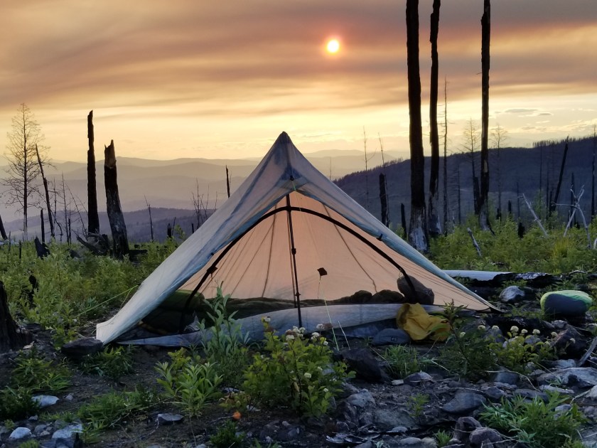
An eventful day drew to a close when I found a beautiful grassy plateau for my camp. I hung my food far away and went to sleep. Or tried. It turns out I was on a bit of a lump, plus the zipper on my tent failed. So I spent a lot of the night fidgeting to find a comfortable position and waking to a mosquito buzzing my ear.

Long Day in a Burned Forest

July 21, 2018. Stealth camp near Kettle River to unnamed saddle in Kettle Mountains.

The night was very still. I heard some coyotes around midnight doing roll call. No problem with the camping.

As I continued down the road to cross the Kettle River, I walked along a quarter mile of the plateau and not a single private property sign was posted. I was relieved.

After crossing the river and highway 395, I was on a gravel road, passing a large piece of private property which had been logged. As best I can tell, the way landowners make a living is to graze cattle on their forest land and then periodically harvest timber. I would imagine lumber shortages and tariffs probably pushed a lot of folks to harvest lumber sooner rather than later.

Today I was feeling a little sluggish on the relentless gradual climb. I tried hydrating more, but it was tough. Plus, there were about six young guys on motor bikes whipping up and down the trail leaving annoying dust clouds. The scenery was nice, though.

These ferns grabbed a slice of morning light as they grew on top of a boulder.
Indian paintbrush (red/orange) and lupine (purple) are attention getters in meadows.

The day changed tremendously when I entered the burn area. In 2015, a massive complex of fires swept over a large swath of this country. I entered an area of standing deadwood, charred fallen logs, fireweed, and lupine. The trail dwindled from a gravel road used to salvage usable burned wood to abandoned forest service roads with multiple blowdowns.

It is such a contrast between the massive carnage of a forest fire and the rapid evolution of plants scrambling to seize the open terrain. Lupine has an explosive takeover strategy. It develops seed pods that twist and then pop open, scattering seeds. The most interesting thing to me was the absence of pine, spruce, and larch seedlings. They must bide their time and rely on their height genetics to overcome the early lead of other plants.

I’ve only seen two sets of footprints. That is, until I got to an intersection with a paved road. Then, a new pair of prints appeared. This was the famous Kettle Crest Trail.

Kettle Crest was a well maintained trail. I could not recall how many days since I had been on a real trail. It was good, but again seemed more like a bike trail than a hike trail.

I was able to get my last water supply and then followed the trail as it switched back and forth uphill. The map showed three turns, but there were at least six.

Fireweed
Sorry for bad focus, but seeing fireweed next to something that looks like a delphinium was an unusual sight.

Eventually, I reached the saddle I was shooting for. There was about 45 minutes before sunset. An odd cloud of smoke hung in the air. Plus, for once, it was windy. So, I made camp quickly, avoiding standing dead trees. I pointed the open end of my tent away from the wind. I had to put on my wool hoody plus my down puffy.

View from the saddle. The mountain saddle; I’m not on horseback.
Sun behind smoke cloud.

As a shock element, while I was eating my dinner, a mountain bike went whizzing past. Not sure if he saw me, but I hoped he made it to the road before dark.

My Zpacks Altaplex tent. The company stopped making them. Too bad because they were great for tall people.
First fire, then wind carved this.

It was the first cold night in weeks. I liked it and I liked sleeping up so high. It was a long hard day, but tucking in to a warm sleeping bag was a great reward.

My Worst Day

July 14, 2018 From Pyramid Lake to stealth camp on Lion Creek.

I woke up way early and forced myself to stay still for a bit. I knew the family wouldn’t be up. I snuck out to get a sunrise pic of the lake and grab my food hang.

Another sunny day. It would start with a climb to two nearby lakes. From there it would be bushwhacking. In case you are wondering, bushwhacking means taking a course between two points with no established trail. As the name implies, you must go through bushes, downed trees, bogs, etc to achieve your goal. Without these obstacles it would be walking or traipsing or strolling or perambulating or something.

The first lake (Upper Ball) was beautiful and I regret not having the daylight or energy to get there the previous day. The second lake (Lower Ball) had families with barking dogs.

I scaled a hill and the first part of the bushwhack began: cross a mountainside. It was a little steep, but manageable. Until the rock slides. Then, I had to edge my way uphill to get above the steep area with no apparent footholds. This happened a second time as well. Falling here would be unpleasant, to say the least.

The only consolation was that some of the rocks at the ending ridgeline appeared to have fossils. It reminded me of Sandia Crest near Albuquerque where I found fossils at 6,500 feet elevation. This old earth sure moves around.

The rock on the left had formations that looked like fossilized sea anemones.

The next installment was to go down a heavily vegetated hillside, veering west slightly to end up in a particular canyon.

At first there was a trail, but after about 100 yards it disappeared. Most of the bushes are alders ( I believe). They grow about 4 to 8 foot branches. The devilish part is they grow in the same manner as crabgrass: the branches shoot out, then up. So, they end up interweaving their branches. This makes for tough hiking.

Downhill, I eventually made my way to the right location. Allegedly, there was an old faint trail. While this was true at times, other times it wasn’t. In fact, the further down Lion Creek I got, the more frequently the “faint” trail disappeared.

The main point is that it is slow and difficult to push your way through shrubs and step over downed trees on a hot day. I reached a point where the guidebook and GPS map said I should be connecting with a real road, but that was simply untrue.

I eventually stumbled out of the woods sweat-soaked, bleeding from lacerated arms and legs and in a foul mood and odor. Immediately I met a family pulling a wheeled igloo cooler in swimsuits. We both looked at each other like WTH?

The back of my legs.

After several more people passed me in flip flops and swimsuits, I asked a couple what the attraction was. Apparently there is a natural waterslide famous with the locals. This trail eventually turned to a road, but before it did there were several cool streams that provided needed refreshment.

Exhausted, beat up and late in the day, I weighed my options. The official trail climbed a mountain to a….Lookout! And then climbed down to meet the gravel forest road I was now on. Hmmm.

So I stayed on the current forest road, listening to an audiobook. One kind couple stopped and asked me if I wanted a ride. Tempting as it was, I demurred. Near the bottom where the stream I had been following almost all day (Lion Creek) was going to feed into Upper Priest Lake, I found a stealth camp away from the road but near the creek.

I ate dinner and then washed my wounds in the cool creek water. It reminded me of why I always filter water.

* * *

P.S. an obvious question is why don’t I wear pants. The answer is that pants, on me, get sweaty and thus tug and bunch and chafe. None of us are here for an anatomy lesson, but suffice it to say I chose the coolness and flexibility of shorts even if it means scratches.

Rebound to a Good Day

July 15th, 2018. From stealth camp on Lion Creek to Mankato Mountain.

It was warm to start. Normally, camping by a creek can lead to waking up with a damp temp as cold wet air sinks. Not this morning. It was going to be warm.

I cruised past all the RVs and boats and jet skis and ATVs at the campground. When I get home, u want to add up how much America spends on all of these and I will bet it probably ranks in the GDP equivalent of some European countries.

Don’t get me wrong. I am not trying to be self righteous and insist my way of enjoying the outdoors is best or right. Instead, I am concerned that people take so many mechanical distractions with them to the wilderness.

Off of my soap box, I traveled past Upper Priest Lake and some great campsites. Then, without warning, I entered an area that was epic. Recently society has screwed up the word epic by applying it to common things. Thus we lose the true impact of epic when used appropriately.

I entered a land of giants. Cedars. Trunks 12 or 20 feet in circumference. Crowns reaching hundreds of feet high. Walking on a forest floor of decades of fallen needles and cones. A smooth green shag carpet of ferns wherever a ray of sunlight would penetrate. No wind. Once in awhile a whitetail. This went on for several miles. I’ve been to the Sequoias and redwoods, but this was so unexpected and vast that I have to call it epic.

But then hot road walking kicked in. Eventually it switched to trail. Finally, it switched to uphill forested trail.

I climbed up along Jackson Creek. I was very thankful for the tree cover because it was hot. The guidebook suggested collecting a lot of water at the bottom. I did and was lugging five liters which is 10 lbs.

Surprisingly, the mosquitoes were horrendous. At least 20 or 30 around me at all times. I used DEET 100. Some people hate it and I may end with numerous tumors and lesions, but by God did I get relief from the little bastards. Except, of course, when it dropped in my eye along with sweat which is a feeling comparable to someone grinding lemon juice with tobasco into you cornea.

Except for the mosquitoes and passing dozens of streams with plentiful water, I felt good and trudged my way up. I entered a burn area with fantastic views. I had my eye on a saddle between peaks that was level and I could have sunset and sunrise views.

Finally, as I approached, I saw tents. There were three ladies camping there, enjoying their dinner and my view. We chatted a bit, but I pushed off, hoping that the saddle in a half mile would offer similar views.

Upon arrival, I found the Washington Trail Association trail crew. This was great because these were the heroes cutting up blowdowns and making the trail clear. Selfishly, it sucked because the next flat area on my map was a half hour away and it was getting dark.

Out of the blue, I spied a little flat area about 50 feet downhill from the trail. I was able to scratch out an area big enough for my tent. As is my custom, I sent out a satellite note to my family identifying my stopping point. I was surprised to see I was on the slopes of Mount Mankato. In Minnesota, Mankato is a sleepy college town on flat land, so I have no idea how this mountain got named.

Just glad to be laying down, I watched as darkness enveloped the valleys below while the relentless mosquitoes still tried to get in my tent.

A (Not So) Brief Recap of Bonners Ferry

July 12, 2018. Zero Day in Bonners Ferry.

If you have been reading this blog for some time then there are two things: you need to get better reading material and you know I love to hate bad signs. You’ll have to resolve the first thing and I’m not sure where the latter comes from. It could be EOGOG (Early Onset Grumpy Old Guy), but is it really all that much to ask that people who make big, permanent, useful signs take maybe just a second to double check their work?

With that set-up you know exactly what I had to accomplish today: where the hell did the apostrophe go? Edwin Bonner from Walla Walla, Washington ( a town they loved so much they named it twice) had one of the few official licenses to ferry people across the Kootenai River. So, why was it not Bonner’s Ferry?

Until the historical society opened, I first mailed home some extra gear, bought mosquito repellent, and then went to the library to catch up on blog posts, perform some financial stuff, and research the town I was in. I must say librarians, contrary to stereotypes, are generally friendly and extremely helpful.

In case you forgot or are hamstrung by youth, the Ruby Ridge incident occurred here in 1992. Oddly, it happened on Caribou Ridge. Long story short, federal law enforcement agencies had a shoot-out, then a siege, with a reclusive family. The man at the center lost his wife (sniper shot) and son and dog. A US Marshal died as well.

At the time, my simple mind encapsulated it as nut job shoot out with trigger happy feds. More nuanced than that, in the beneficial light of hindsight, it really was a tragedy. Weaver really should’ve just gone with the flow and appeared in court and not escalated things. The feds really made a mountain out of a molehill and got way too aggressive. In short, it was a bunch of guys who wouldn’t back down or compromise.

Back to the hot topic of the day, I noted the time and went to the Historical Society for Boundary County. When I walked in, a bearded fellow who must clearly perform some Santa Claus work in season, put down his browned historical newspaper and greeted me. I explained I am hiking the PNT and like to learn about the towns I visit and asked if he could give me an overview of the museum.

Immediately, I got the sense they tend to get one type of visitor. His smooth opening line explained there was a $2.00 admission fee and the bathrooms were down the hall.

Having cleared that up, he overviewed the following areas / collections

  • Railroad
  • Mining
  • Farming (early, 1930s, today)
  • Chinese workers
  • Women’s roles through time
  • Wooden clock collection
  • portrait gallery
  • Saloon
  • First Doctor
  • Native Kootenai history
  • Gun collection

And a whole lot else that I didn’t catch. Fearful he might grab me by the elbow and show me all of it, I broke off to the railroad & farming.

Wouldn’t you know it, one of the first exhibits about farming was a large display contrasting early versus current farming.

I patiently extracted my $2.00 worth of value. They truly had tons of stuff. I’m not sure many people died in Boundary County without naming the historical society as a beneficiary. Indeed, there was a collection of about 30 large wooden clocks. They were all elaborate scroll cut pieces with a generic clock put in it. Clearly these were kits. The blessed retiree obviously spent 1,000s of hours on his hobby. However, I’m sure his long-suffering wife must’ve pleaded like crazy to be sure the entire collection was donated to the historical society to get it out of the house.

The portrait gallery was surprisingly large if not awfully good. One early hero was painted with quite a fetching style.

There was one truly remarkable exhibit. An albino woodland caribou. Native Americans killed it in the late 1800s and a local saloon owner obtained it and made it his mascot.

At last, I returned to the front. I said “I am not an English teacher, but I cannot find an answer to why Bonners Ferry doesn’t have an apostrophe?” He sighed, looked down at the old newspaper and said “For a long time we tried to correct it, but it just became customary to use Bonners.”

I grumbled my way back to the motel. Letting the matter go was cathartic. After all, we have a grocery store back home established by Russell Lund and it is not called Lund’s, just Lunds. I was hungry and just wished this town had a McDonald’s.

On the walk back I noticed a few pickup trucks with Confederate and US flags flying. The ignorant, hopeful part of me tipped my hat to these scholars who were passionate about state’s rights, but the realistic me accepted I was in the heart of Aryan Nation country.

Leaving Bonners Ferry, I was brooding. It is a beautiful town in a sumptuous valley where the untamed Kootenai River created a fertile flood plain. When the river was dammed, the land could be farmed. Mining and lumber come and go. It would be stunning to have a house on one of the local ridges, catching both sunrise and sunset, witnessing the first snowfall on the all-surrounding mountains or the bright yellow canola crops in the summer. However, like many smaller towns, meth is a problem and there is the white supremacists stigma. However, every worker I met from motel owner to the restaurant employees to librarians were all hard working and considerate. Like Montana, people here look you right in the eye. I like that.

In summary, I am glad I spent a whole day in town. A roadtrip here could be in my future. Maybe I’ll get a modified camper van and call it Kevins Van.

Why Brave the CDT?

I have committed to hiking the Continental Divide Trail starting in June, 2016. Here is a little bit more information about the trail and why I selected it.

What does CDT stand for?

The most relevant meaning of CDT is the Continental Divide Trail.  It connects the northern and southern borders of the United States while striving to stay as high as possible along the Continental Divide of the U.S.  Officially, it is the Continental Divide National Scenic Trail as defined by the National Park Service (NPS).   The NPS lists 10 National Scenic Trails.  Most people familiar with backpacking in the United states think of the three main north-south routes: the Appalachian, Pacific Crest, and Continental Divide trails. Completion of  the three main trails earns the title of “Triple Crown” although as American Pharoah might clarify, it is a backpacking triple crown.

The route crosses all forms of land ownership.  While mostly on federal government lands, the trail also crosses state and private land.  It combines formally marked trails with roads, paths, and, at times, sketchy bushwhacks.  Indeed, there are actually a variety of routes one can take that fulfill the spirit of the trail compared to the formal “official” 3,100 route.  My brief survey of southbound hikers who kept journals on either Trail Journals or Postholer between 2006 and 2014  found that there were 38 succesful completions.  Of these the  average trail distance was 2,491 miles and they completed with an average time of 141 days.  (Aside:  I noticed an inverse correlation between the amount of pre-hike journal posting and the likelihood of success.  Thus, I will try to only write a few pre-hike blog entries to avoid jinxing my trip.)

Who manages the CDT?

There is an umbrella non-profit organization that attempts to coordinate all matters concerning the CDT. Although the NPS has overall stewardship of the National Scenic Trails, it relies on non-profit groups to actually coordinate the day-to-day management of trails.  In the case of the CDT,  It is the Continental Divide Trail Coalition (CDTC).  I have donated money over the last few years and hope that others will also contribute as the CDTC leads lobbying, trail maintenance, and community relations efforts.  I did receive a t-shirt from them with their motto:  Brave the CDT.

Besides Central Daylight Time, CDT is also the acronym for Clostridium Difficile Toxin.  I had that little bacterial gut bomb  after my appendectomy several years ago.  You can look up the symptoms and treatments yourself, otherwise you can take my word that having CDT makes you feel crappy.  I recovered and now hope to complete this hike and Brave the CDT a second time.