A long distance hike requires planning. At a minimum, there’s the path and mileage and opportunities to get food and water. For the most popular trails, there has evolved a basic set of GPS locations, topographical maps, and descriptions of communities along the way that might provide food, shelter, resupply packages, or other services.
You first need to decide on a direction. The Triple Crown of U.S. trails (Appalachian, Continental, and Pacific Trails) have historically been followed from south to north. The arguments for this approach include following warmer weather (snow melt) north, starting and finishing earlier, and tradition. Going in a northbound direction is called a “NoBo.” The problem with this approach is that in the case of western trails (PCT and CDT) you are likely to experience two snow challenges in mountains. The first is early on when entering the Sierras or San Juan’s. Remaining winter snow can be a challenge. And if you are not careful towards the northern end, early fall snow in the Cascades or Rockies can be a risk.
A southbound (“SoBo”) trip has some advantages. Satellite imagery and snow sensors tell exactly what starting conditions will be like relative to snowpack. Additionally it is less crowded. The biggest negative is the challenge of getting through the southern end of mountain ranges before winter snows begin.
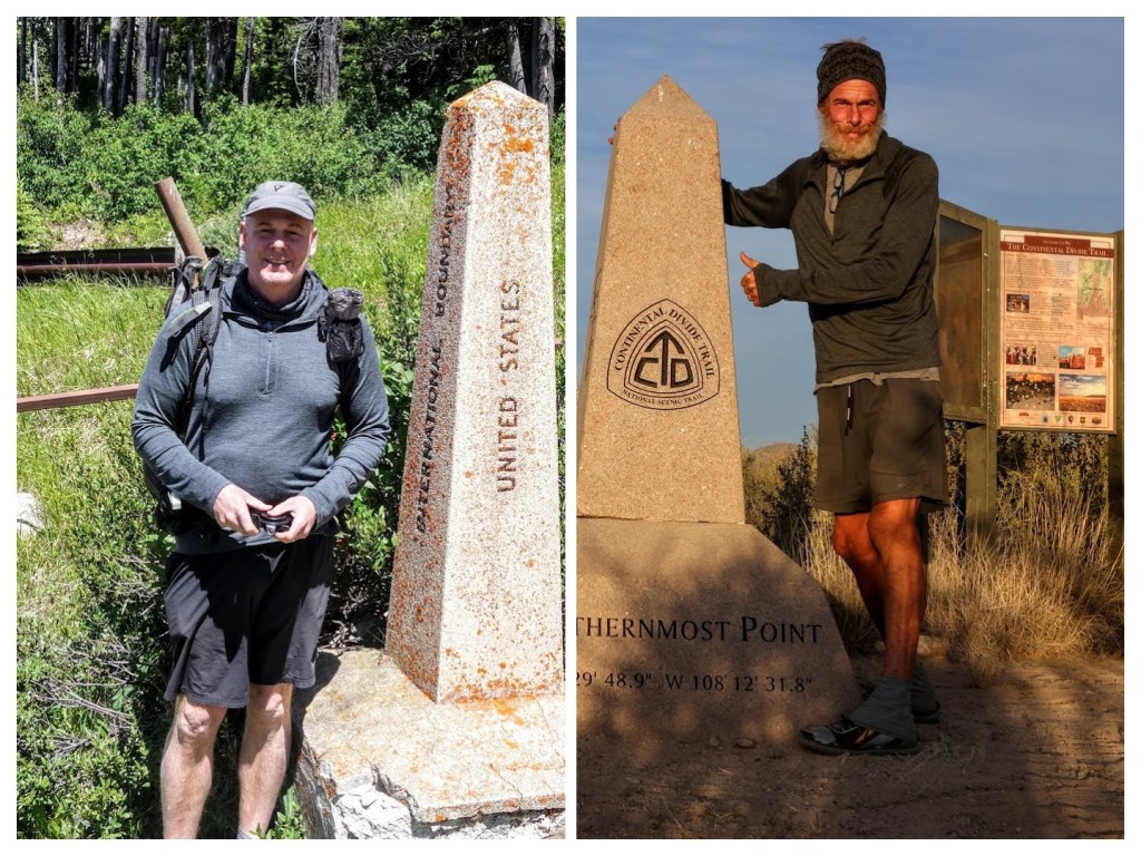
I’m going SoBo on this trip. I have estimated hiking speeds and developed a resupply plan. One goal will be to eat more. On my CDT SoBo, I lost about 50 pounds.
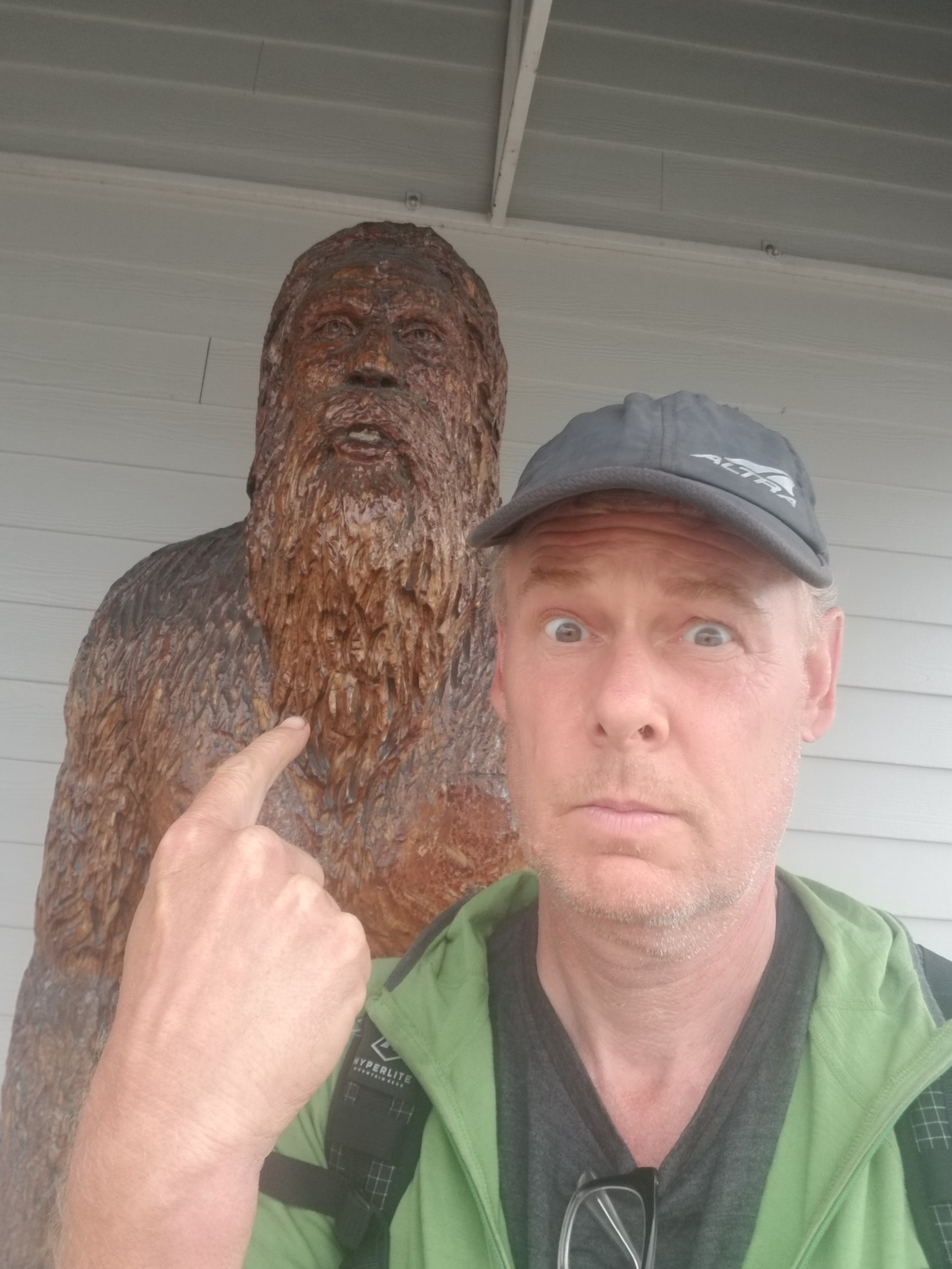
In 2016 I was able to convert my body fat to facial hair.
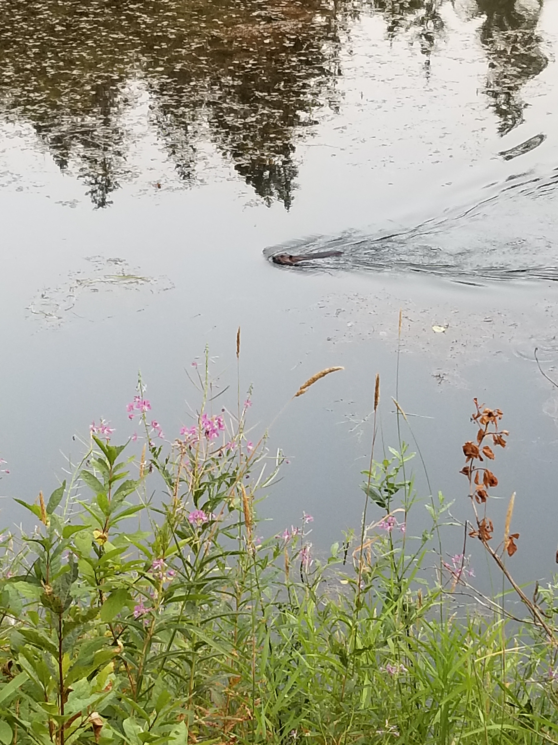
August 23, 2018. Deer Lake to Bogachiel Campground
Since I camped in a meadow near a lake, it was inevitable my tent was covered with condensation. It was just a little brisk as I gathered the bear canister and packed.
I went out past the toilet. Given the soil composition and number of visitors, the human waste goes into what can only be described as modified coolers. When necessary, a batch of full ones is swapped (via helicopter I presume) with empty ones. The main takeaway for me was to never, ever buy a used cooler.
I started climbing up from Deer Lake via a different trail. It was 6:30, but once I got past the two main camping areas I was pretty assertive with the “Hey bear” mantra. I didn’t want to startle a black bear sleeping on the trail with a huckleberry hangover.
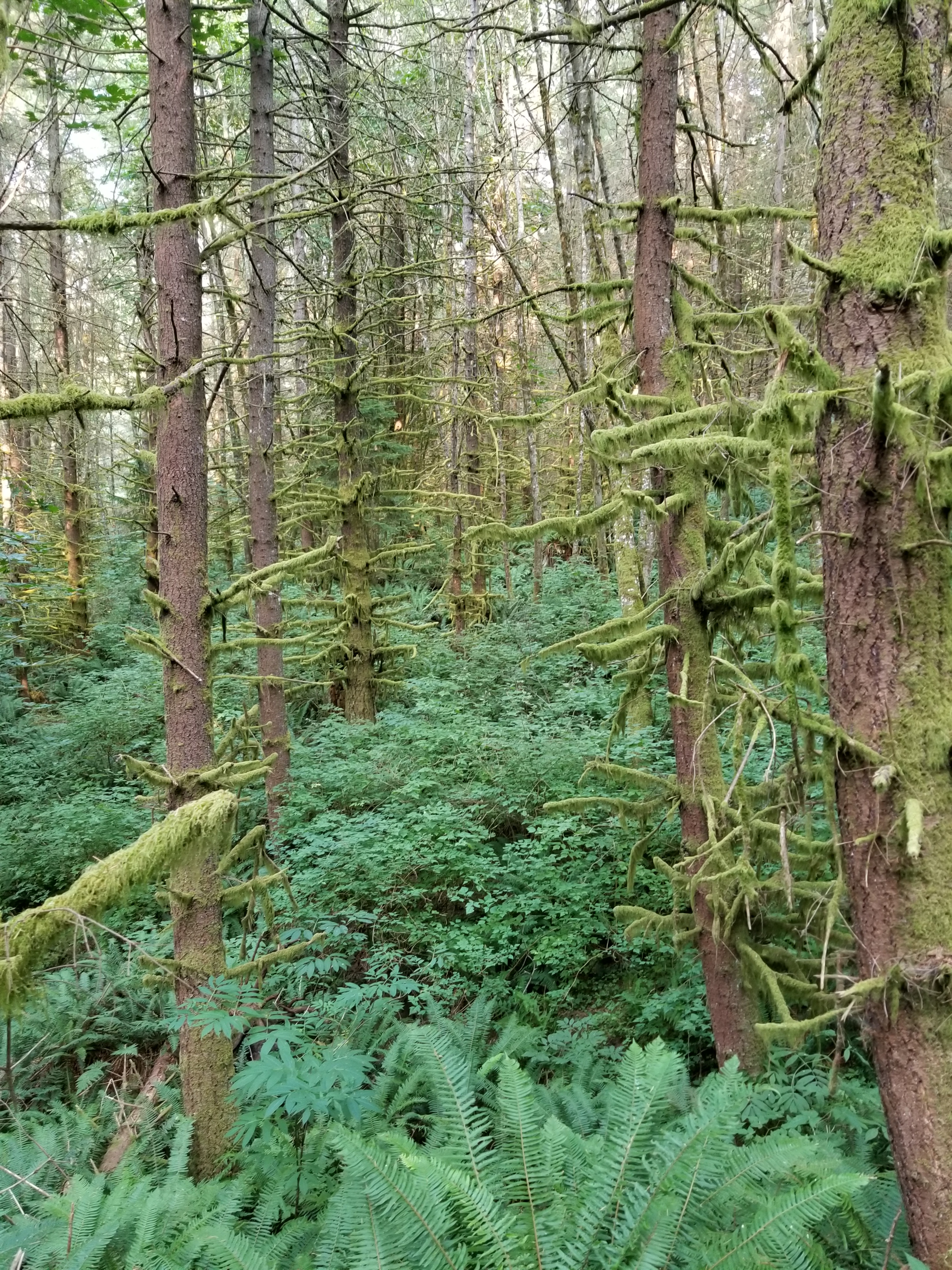
Although the trail was climbing out of the Deer Lake basin, it did so in a gradual manner through pretty country. At the peak, I started walking along a tree covered ridge. It was perfect as far as I was concerned: up high on smooth trail with cool air.
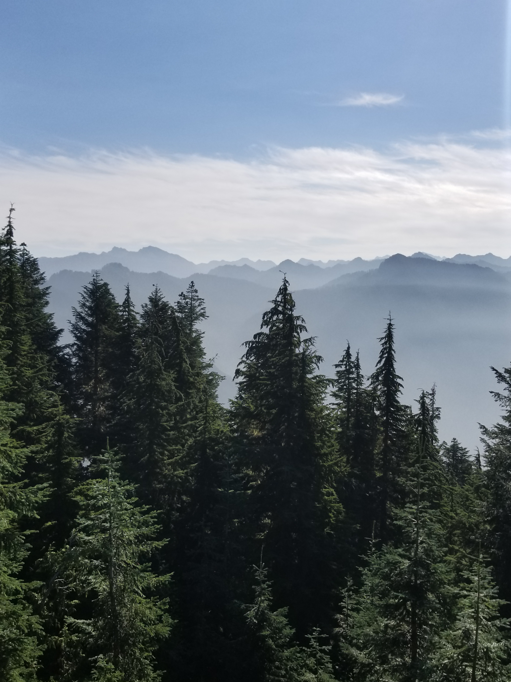
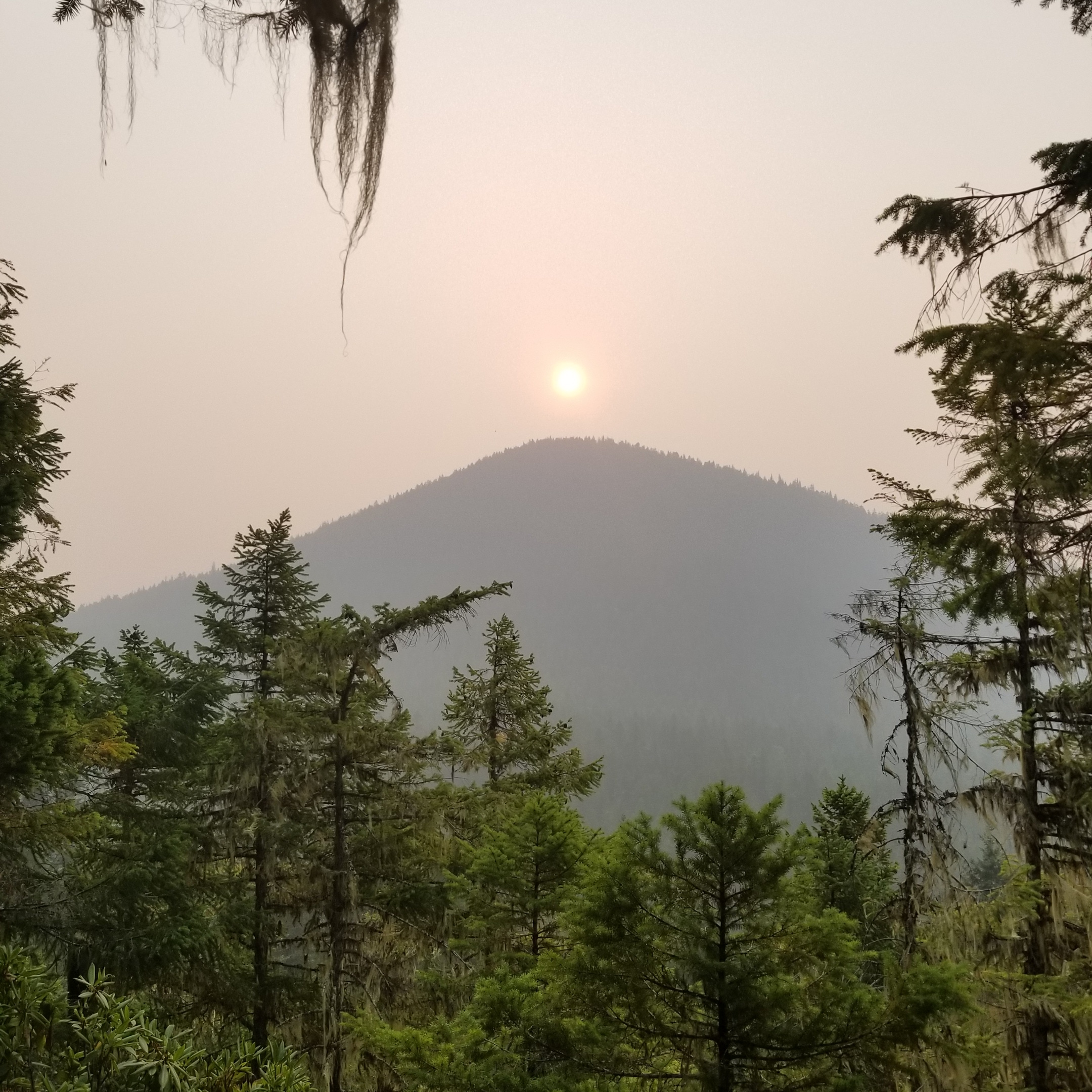
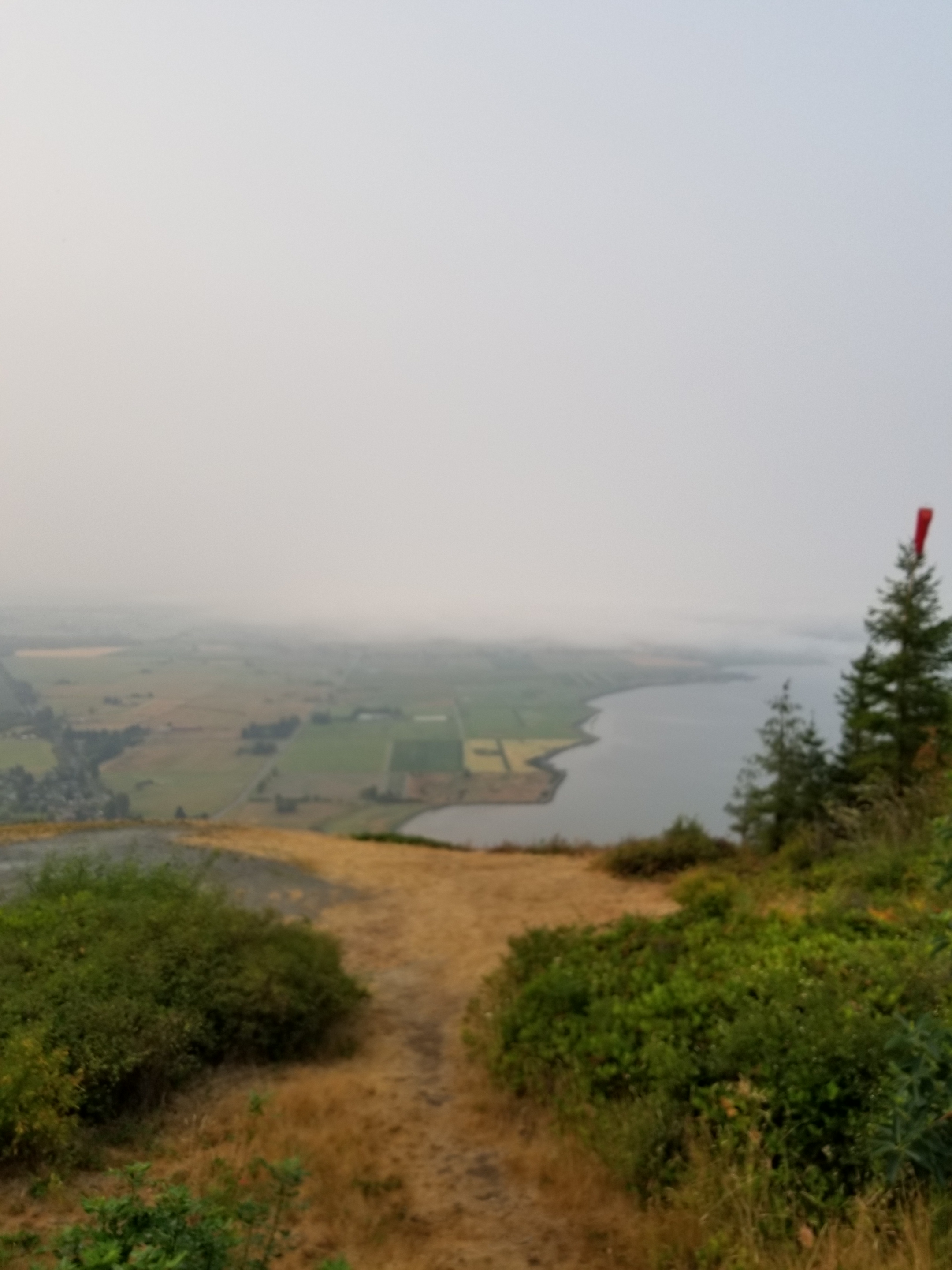
After a few miles, I reached a break in the trees. I was surprised to see that upper level winds had blown away the smoke from some mountain tops given gorgeous views.
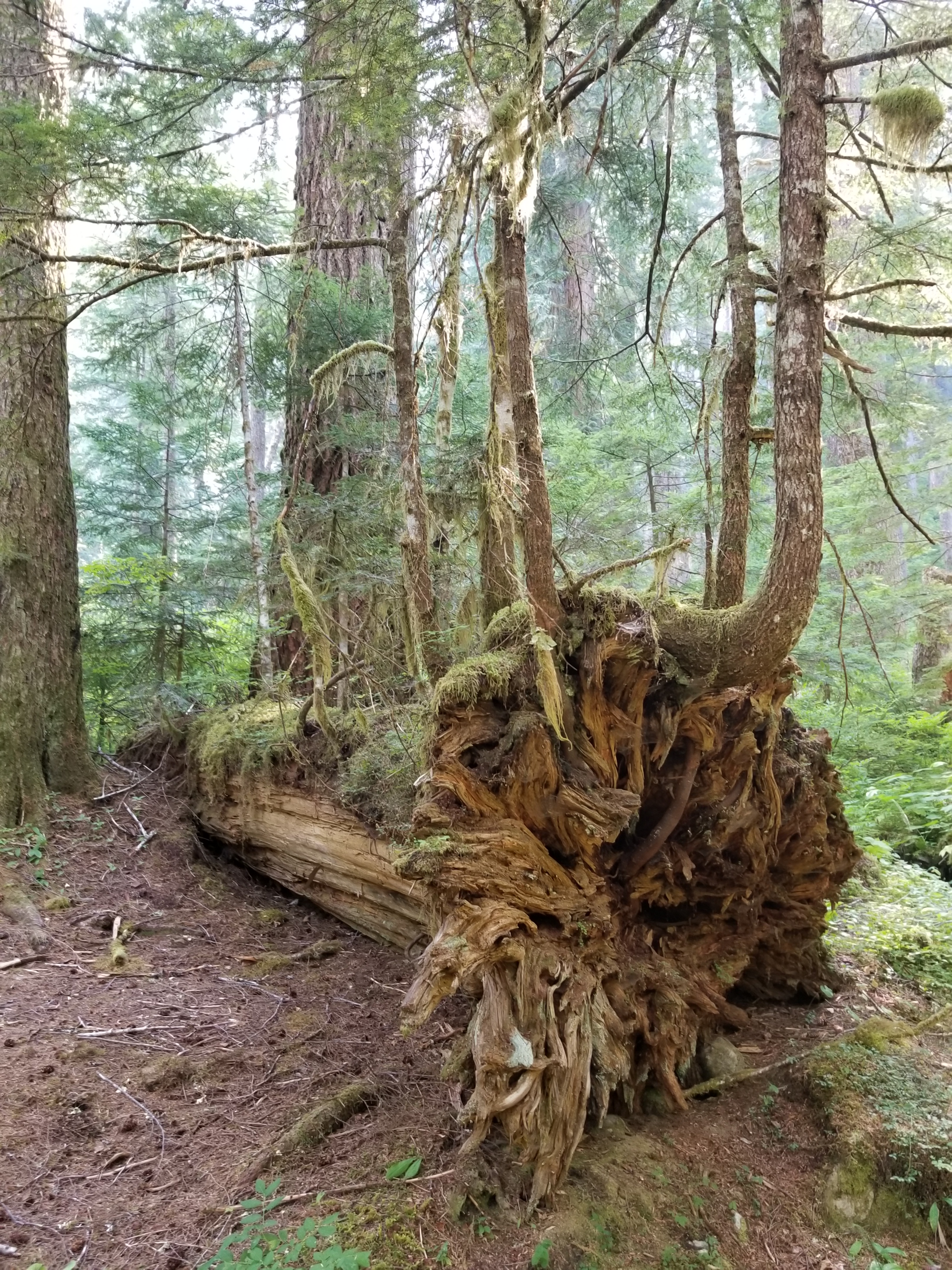
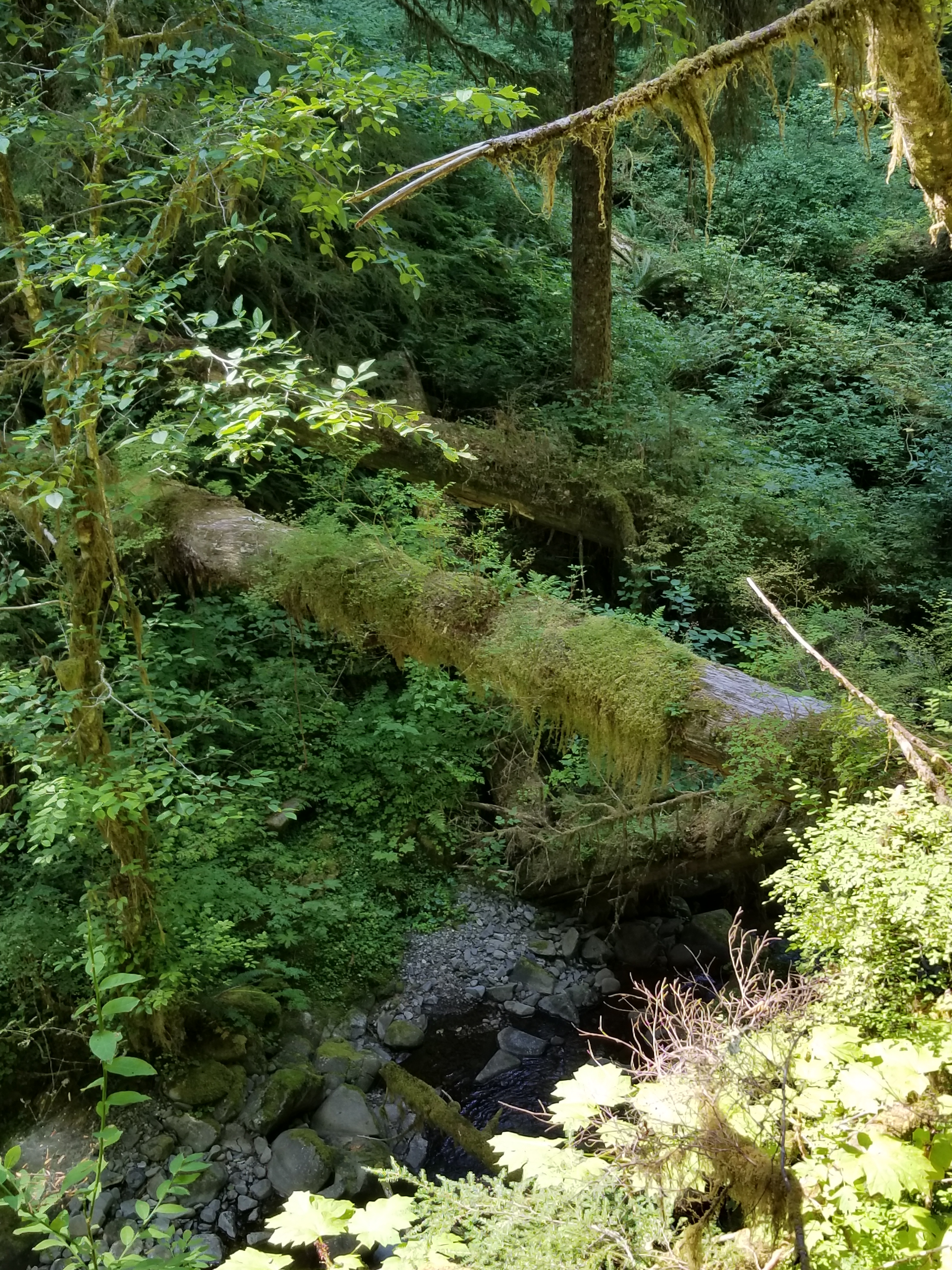
Soon after, the honeymoon was over as the trail descended. The trail turned into a rocky dry creek bed with blow downs. Although the forest was pretty, the condition of the trail detracted from the enjoyment.
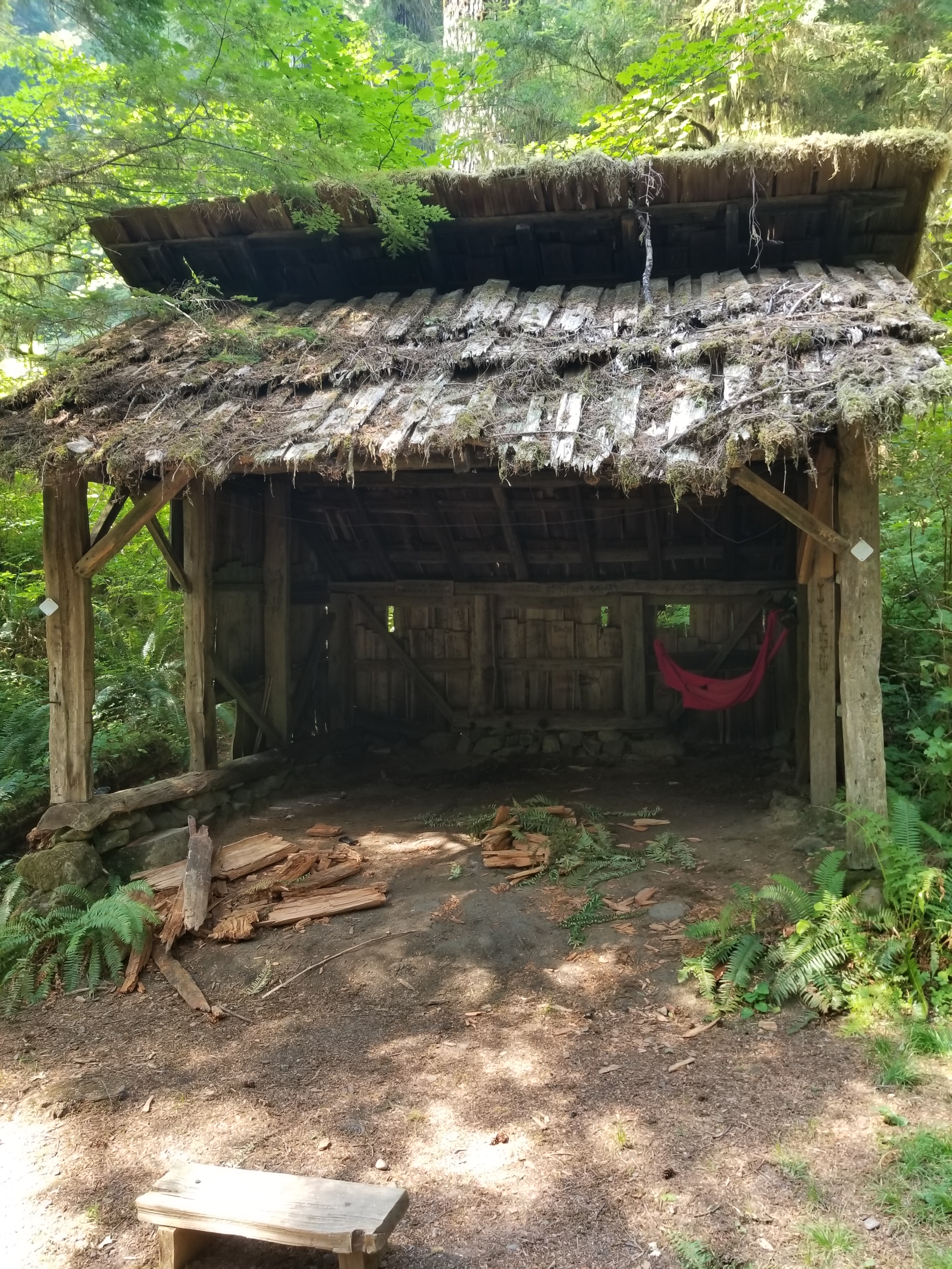
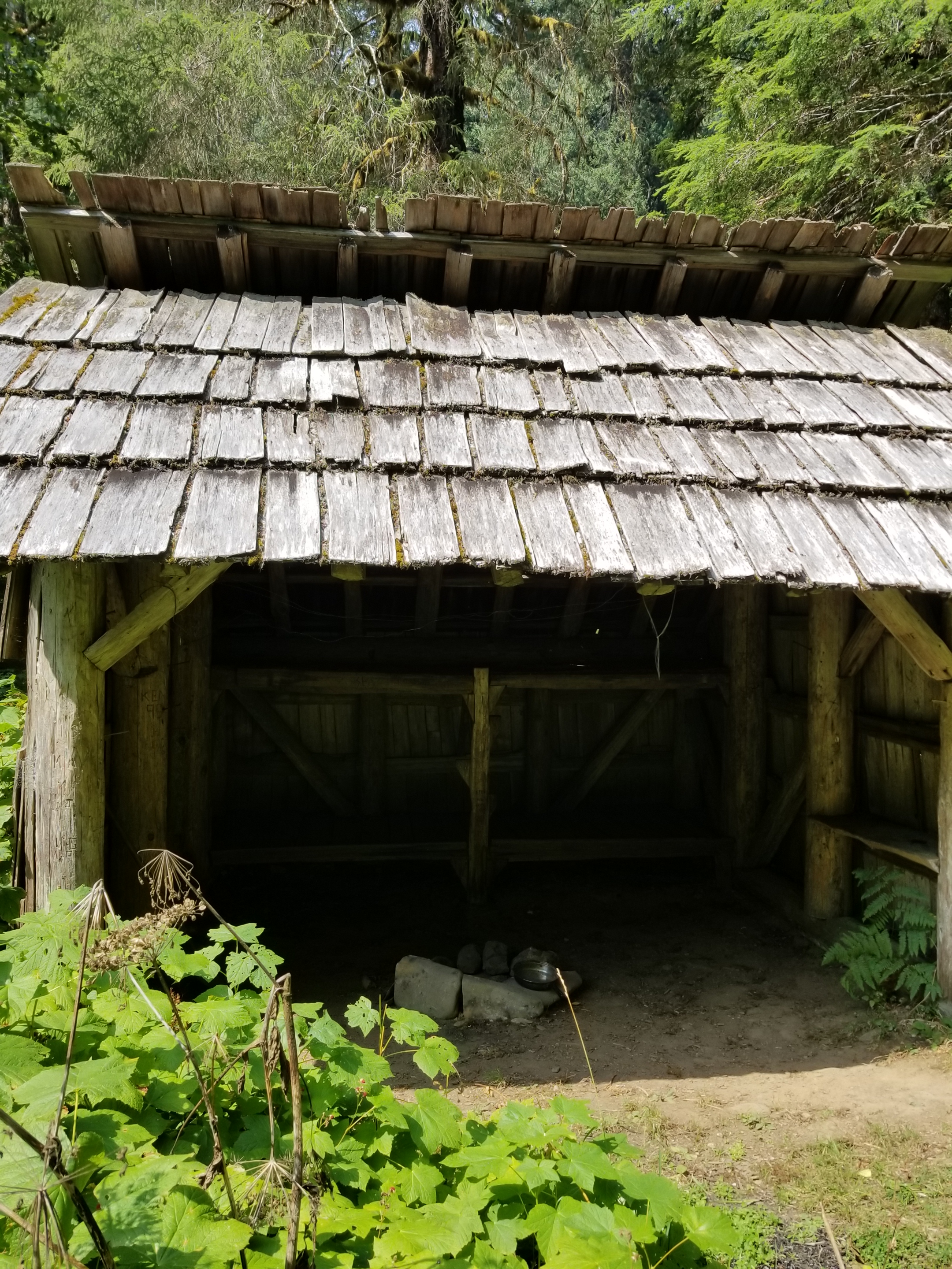
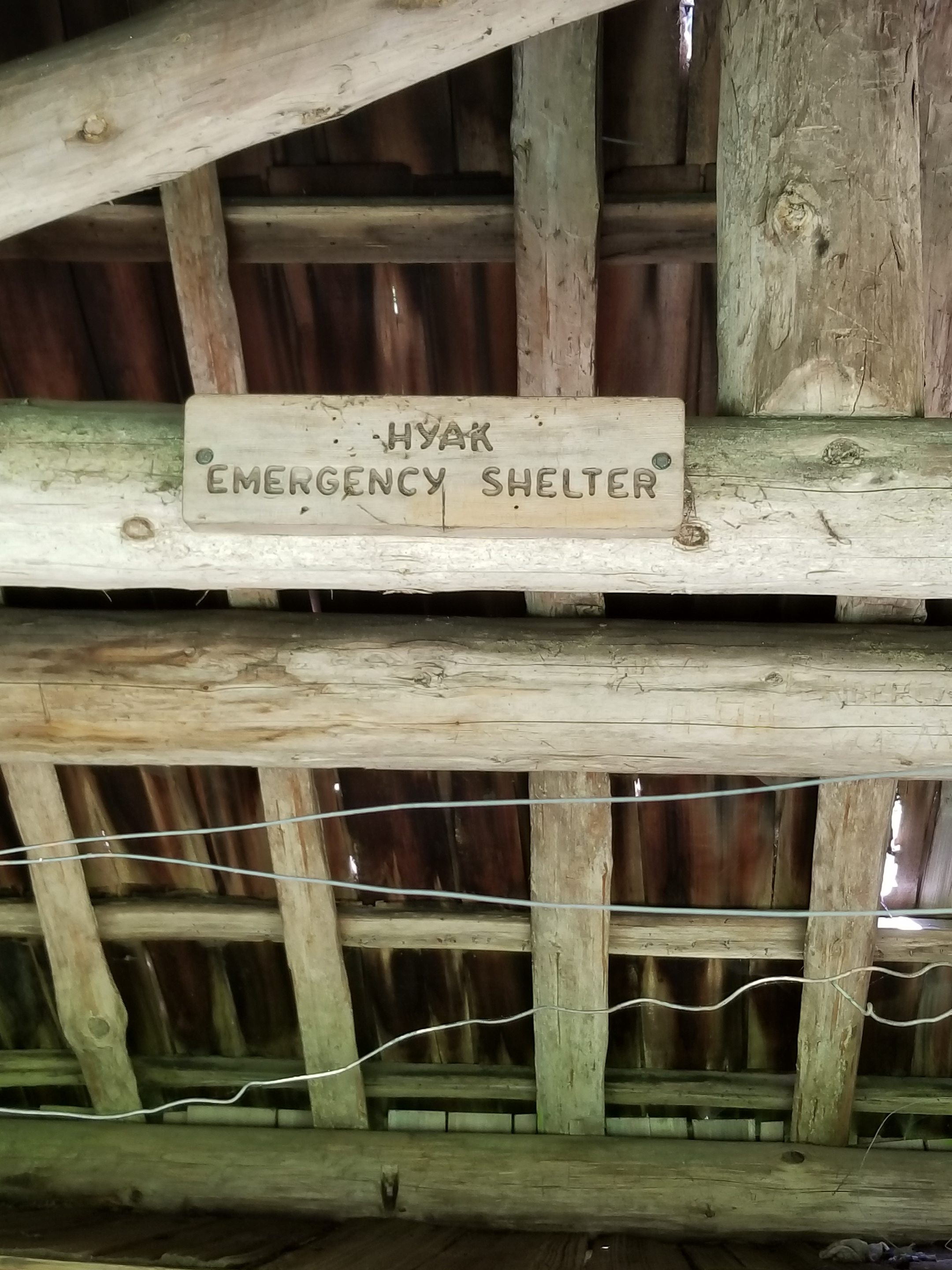
Along this portion of trail, some emergency shelters had been constructed many years ago. I am speculating, but I think they were meant for people unprepared for a snow storm. Essentially, they were three sided lean-tos.
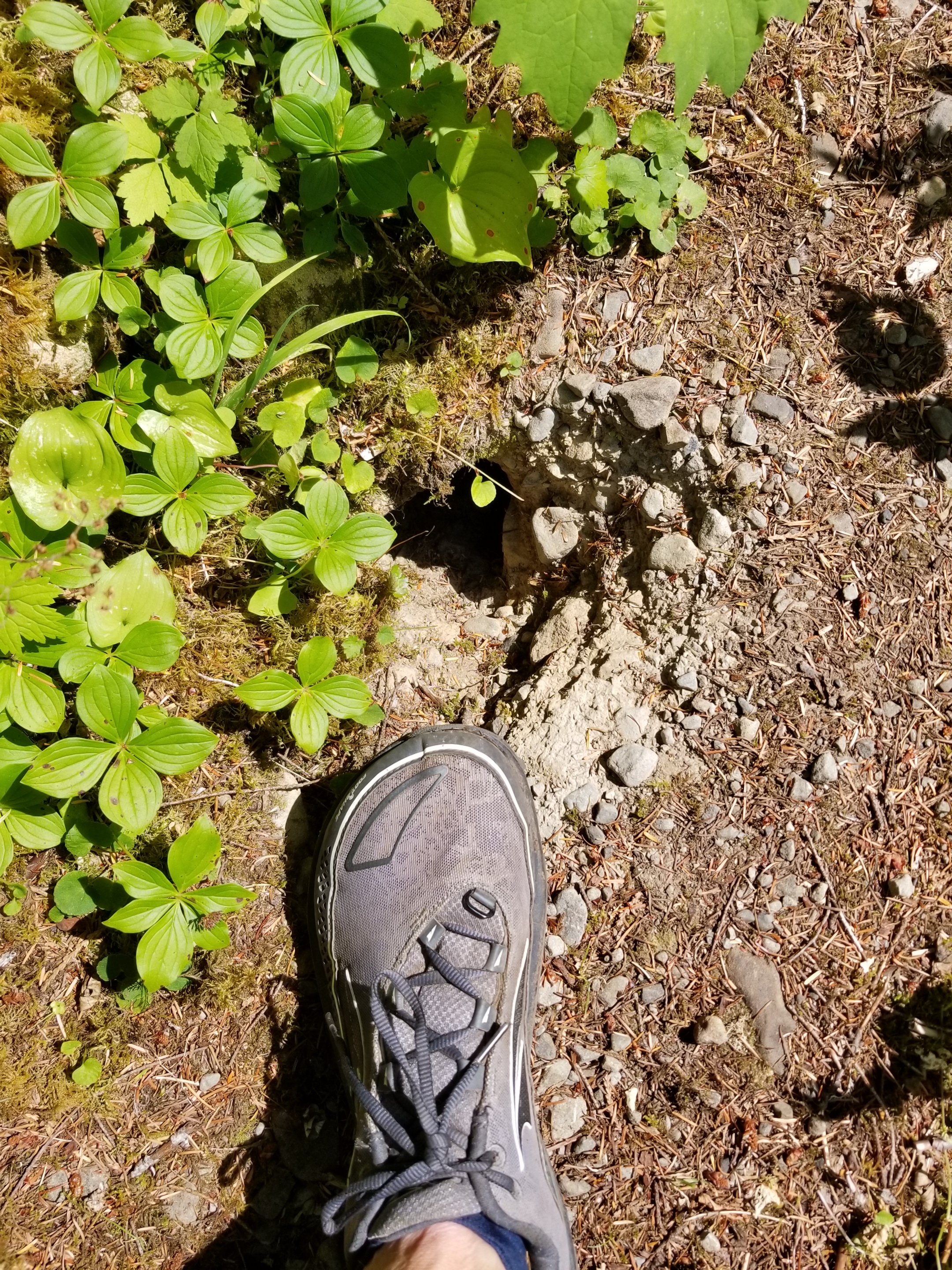
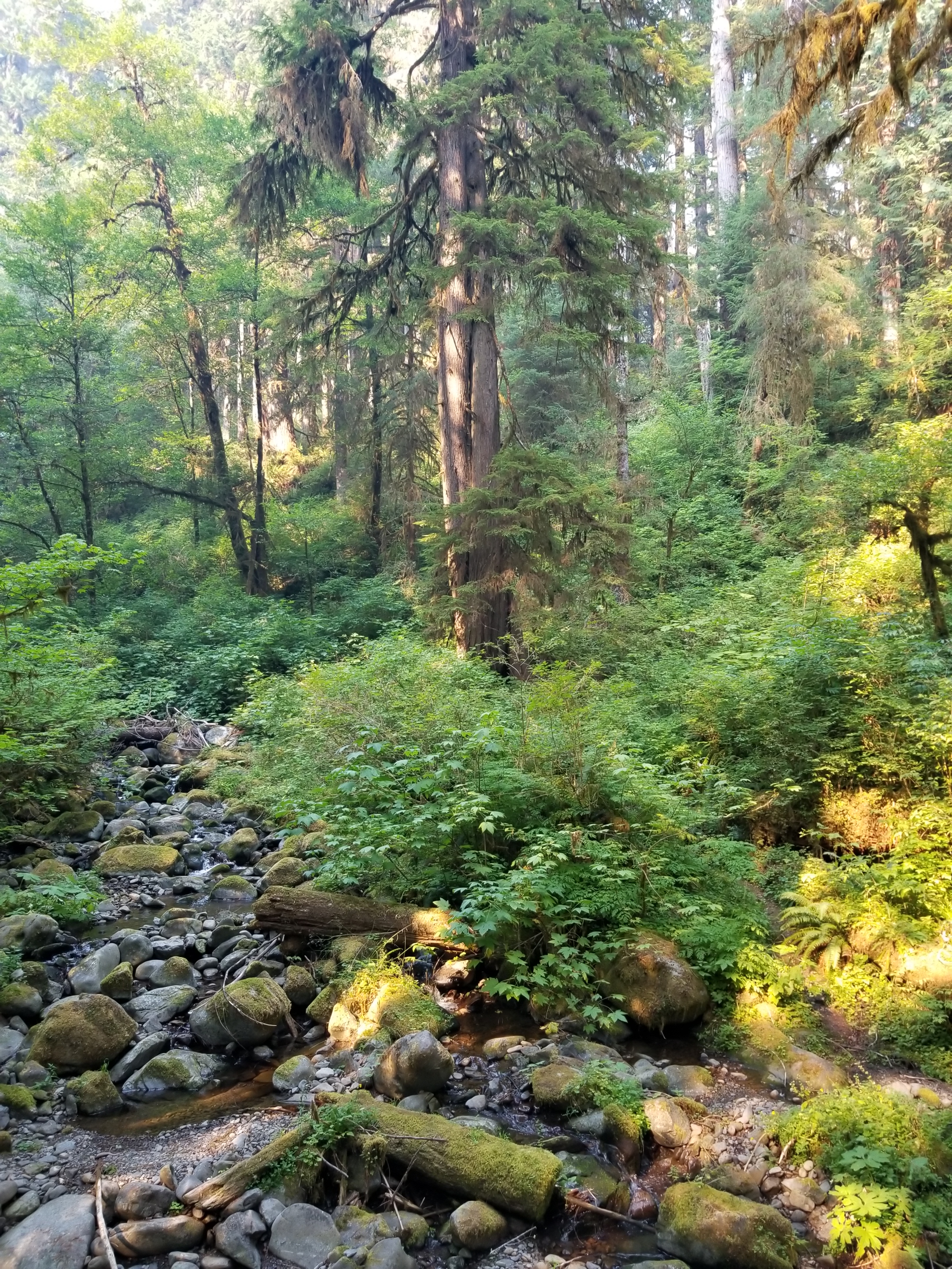
The trail followed the Bogachiel River as it grew in size during its descent. Once the trail and river leveled, portions of the trail were overgrown with plants up to my chest and head. What made it treacherous was the occasional hole dug by a badger (or similar sized creature) that could easily swallow a foot and really mess up an ankle.
I pushed to reach a camp on the map called Bogachiel Camp and Ranger Station. It was a challenge, but I got there. Unfortunately, it was missing just two things: a camp and a ranger station. I walked the area three times and found nothing. Instead, I shoehorned myself into a cramped spot in the dark. It was not ideal, but it was my home for the night.
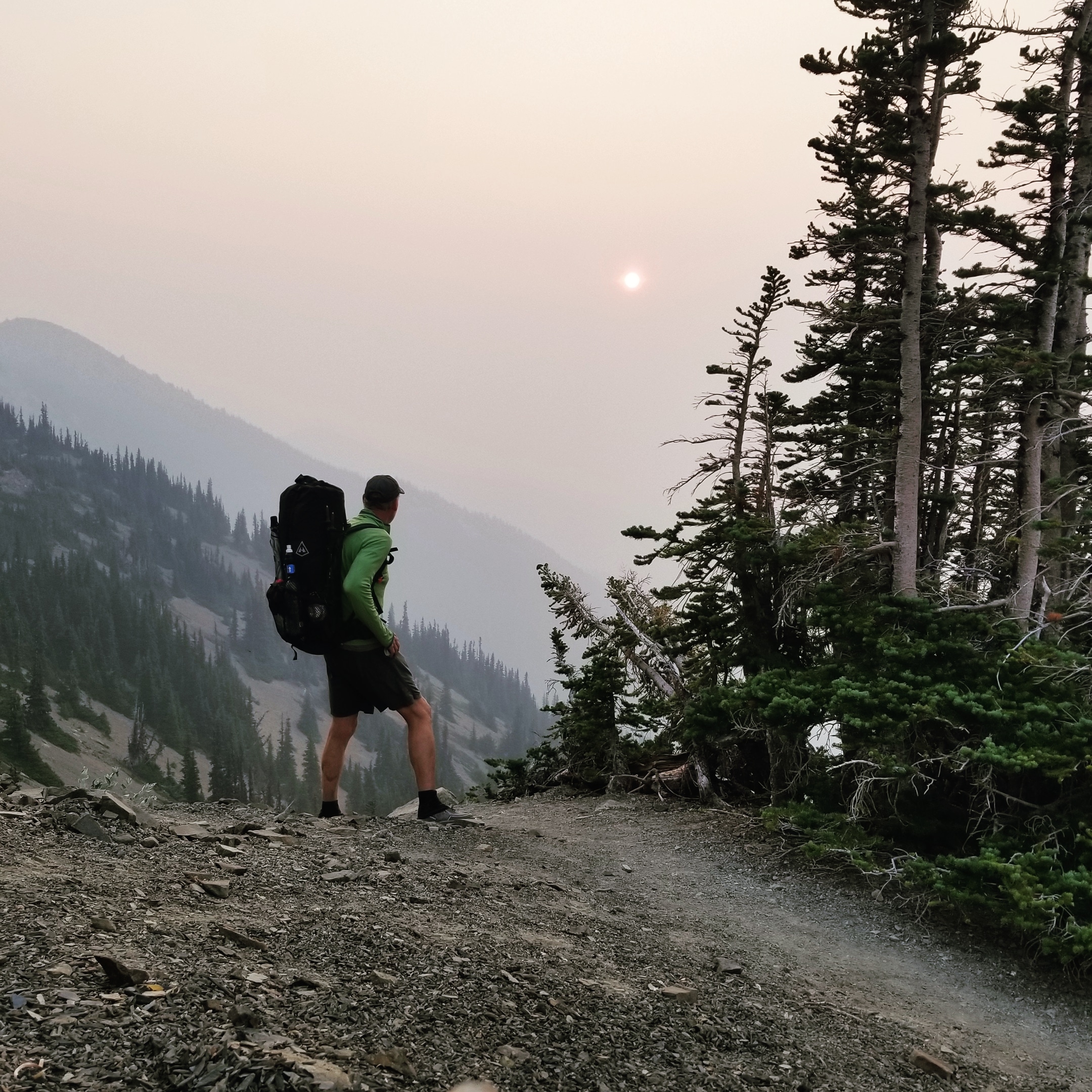
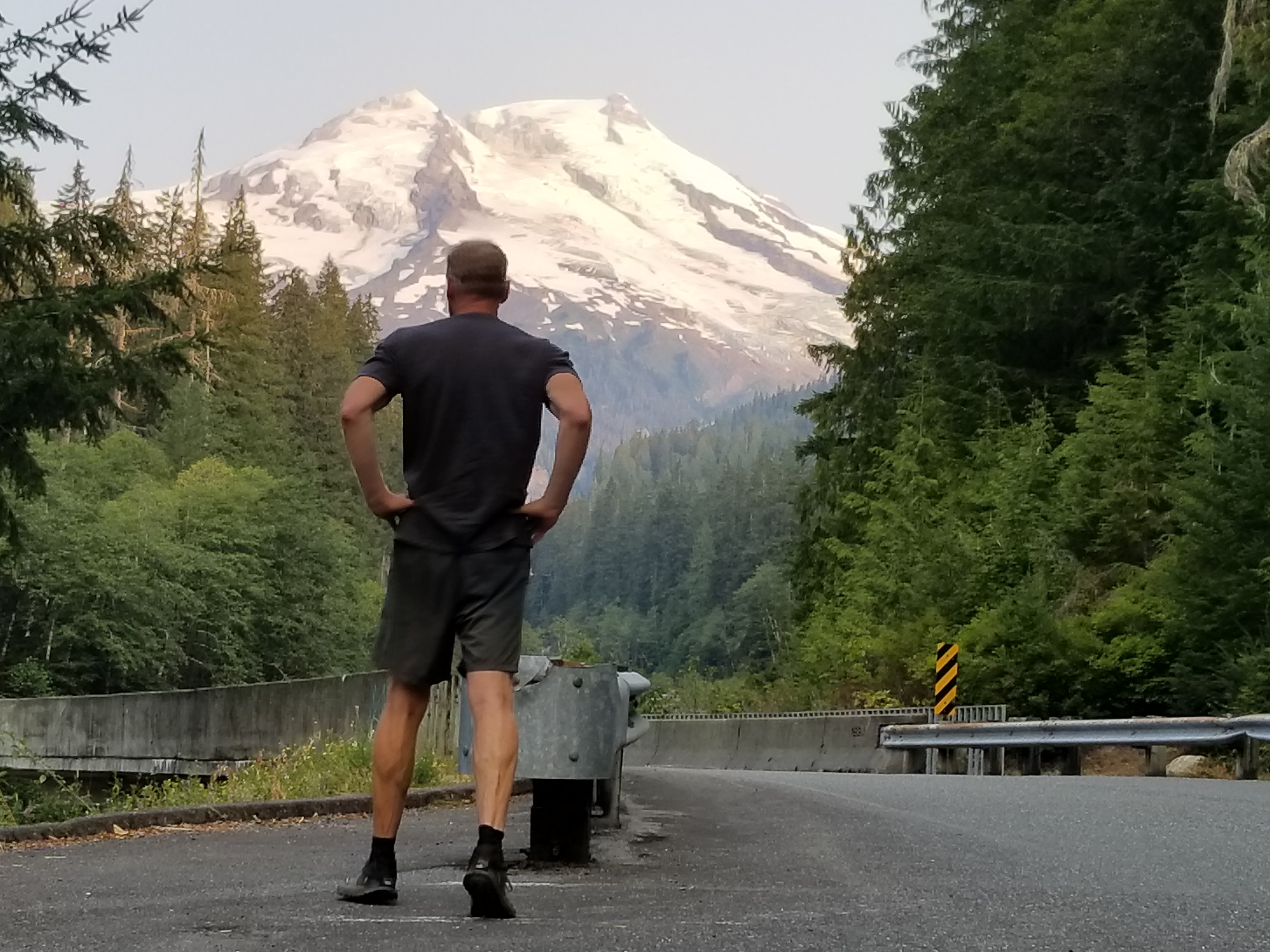
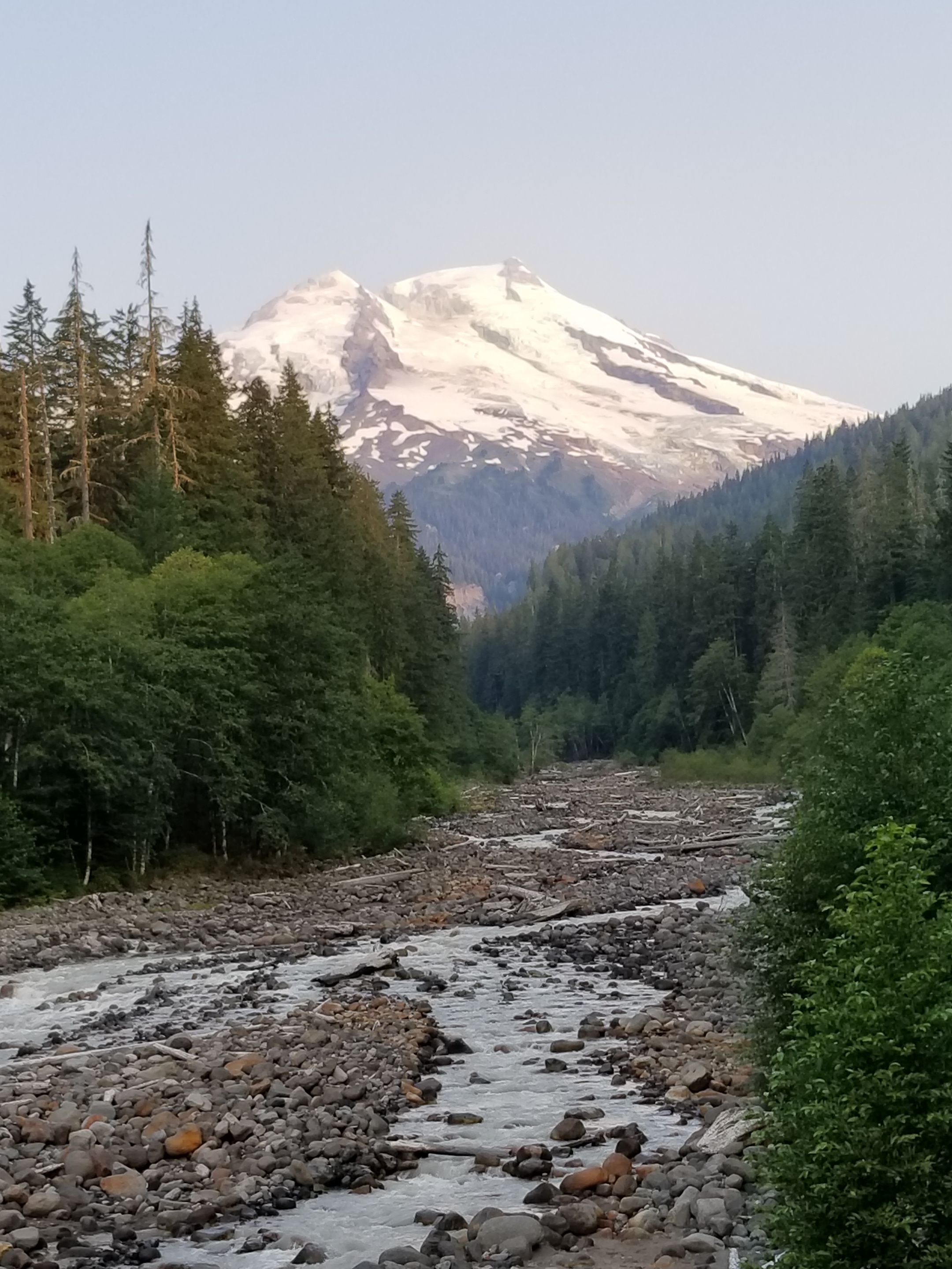
August 21, 2018 Roaring Winds campsite to Boulder Creek Campground
I woke up early knowing this was going to be a tough 27 mile day. I would start above treeline and end up in semi-rainforest. A gross drop in elevation from 6,700 feet above sea level to 360 feet above sea level. I took a moment to thank my knee cartilage for years of dedicated service and bid a fond farewell.
It was smoky still. The sun crept higher looking like a shaded spotlight.
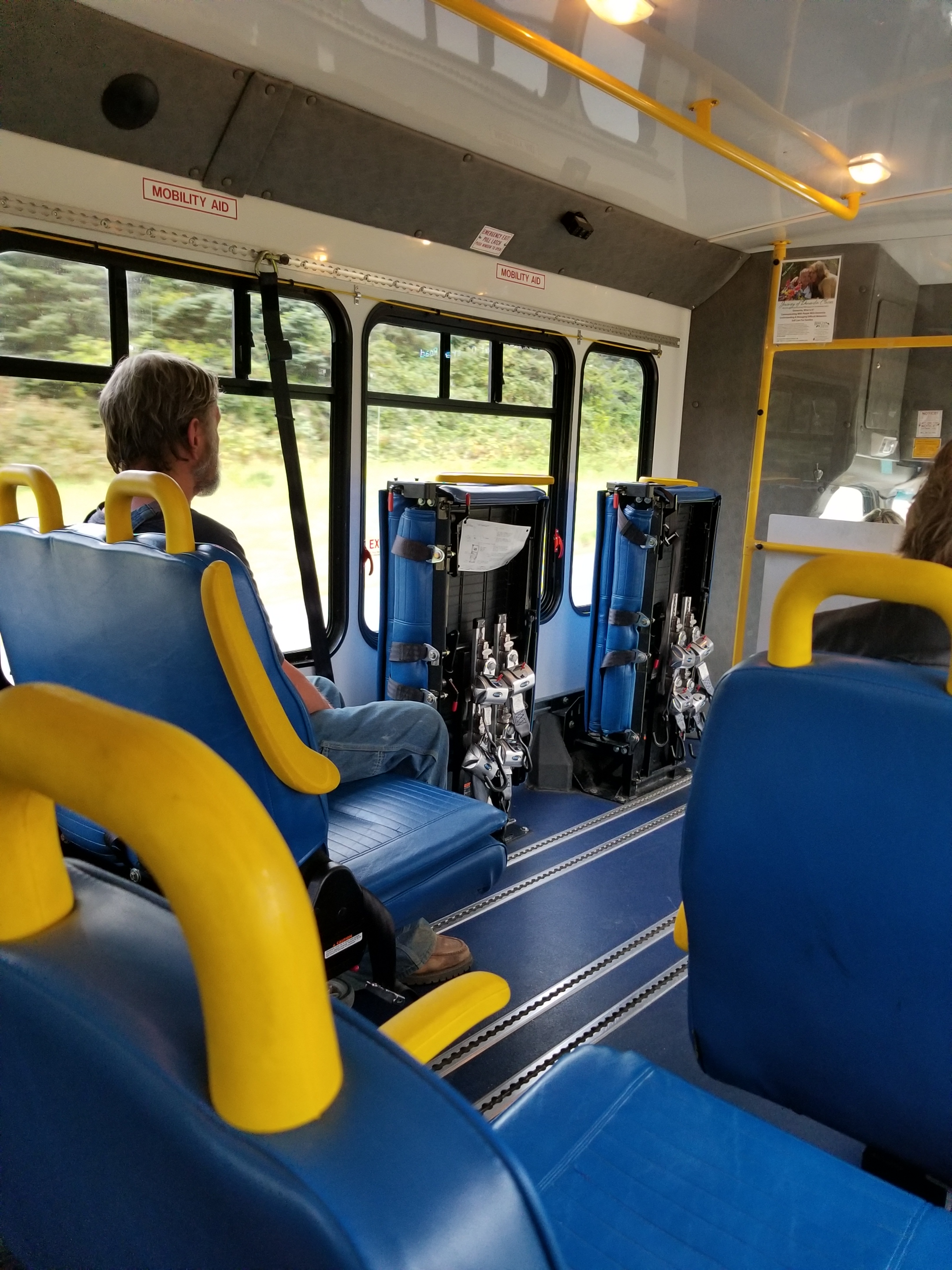
My mandated bear canister took up the top third of my pack.
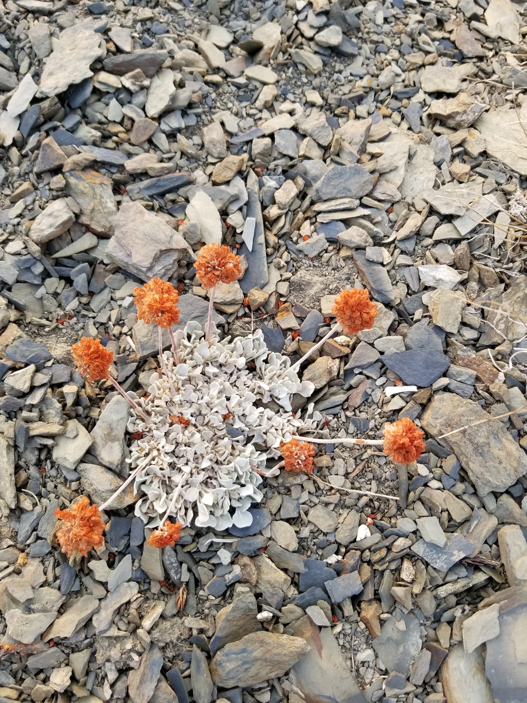
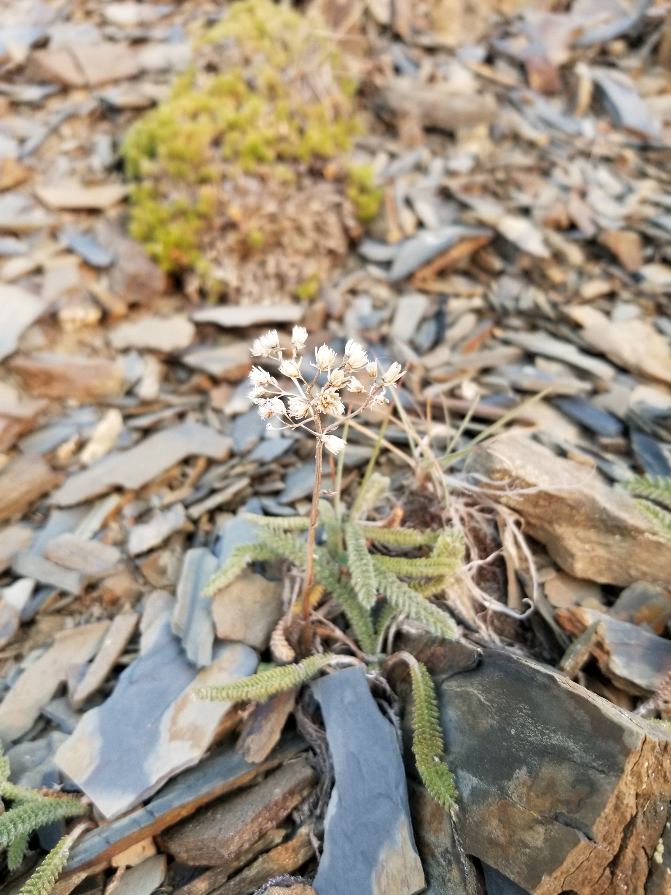
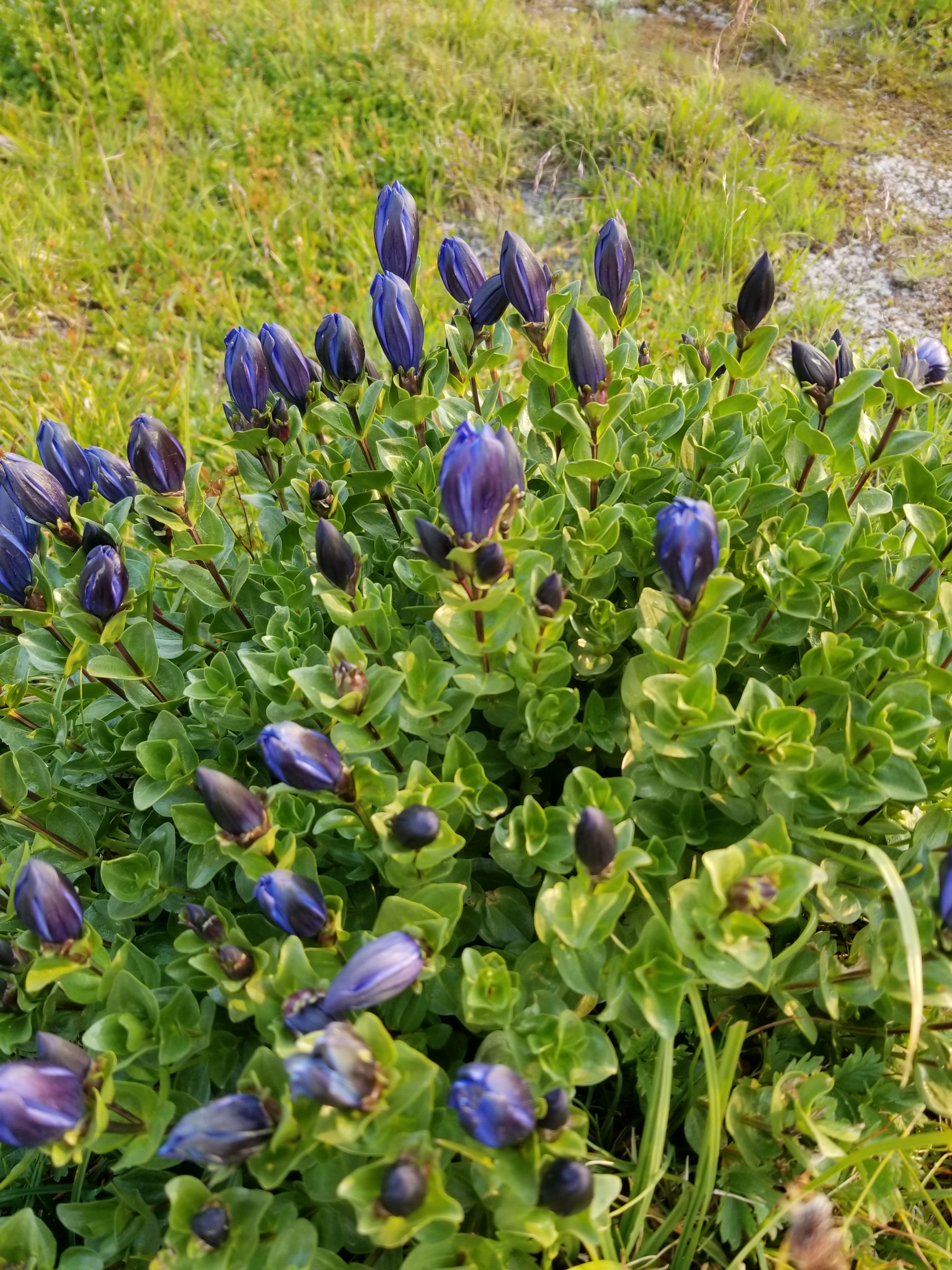
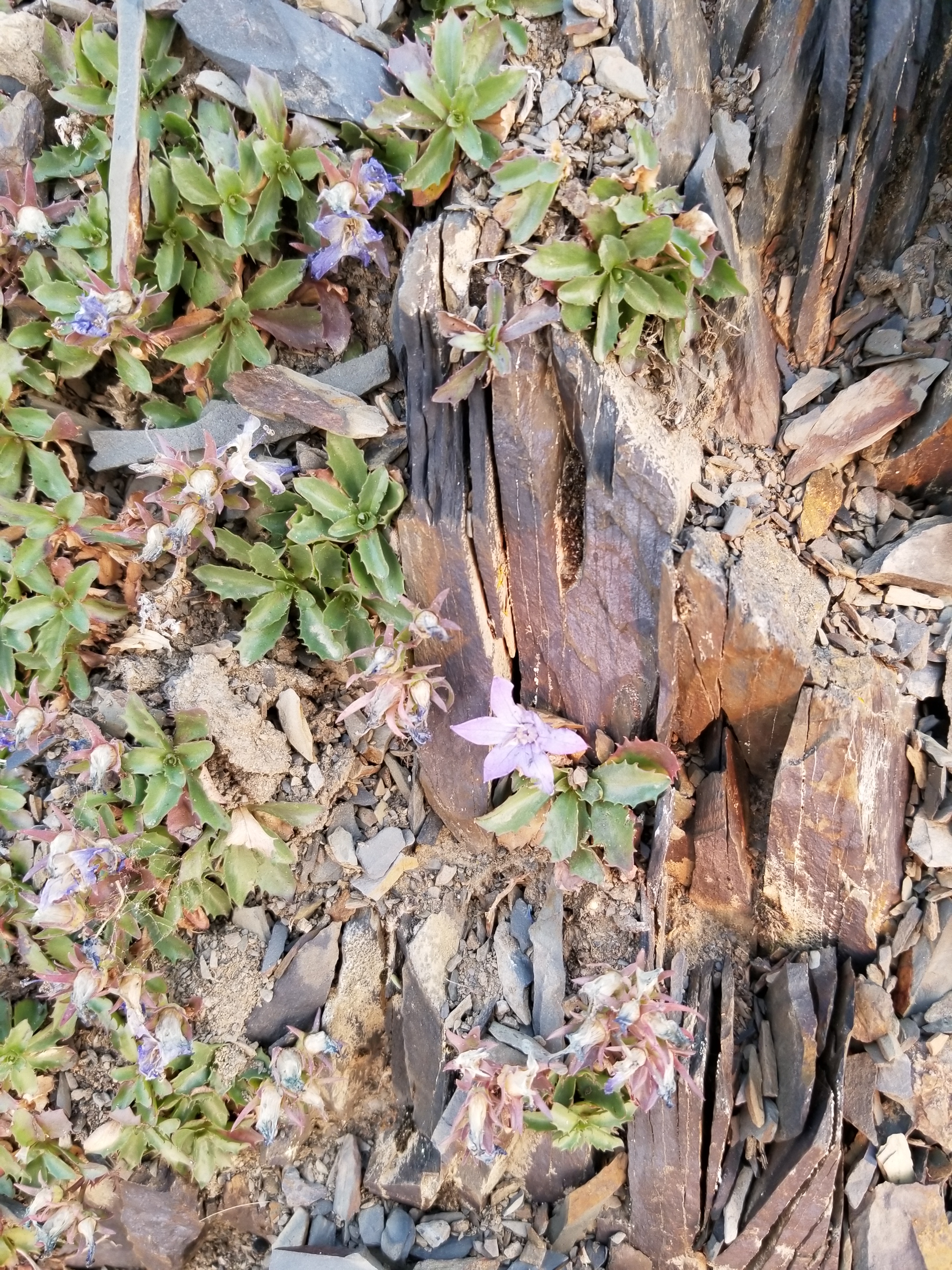
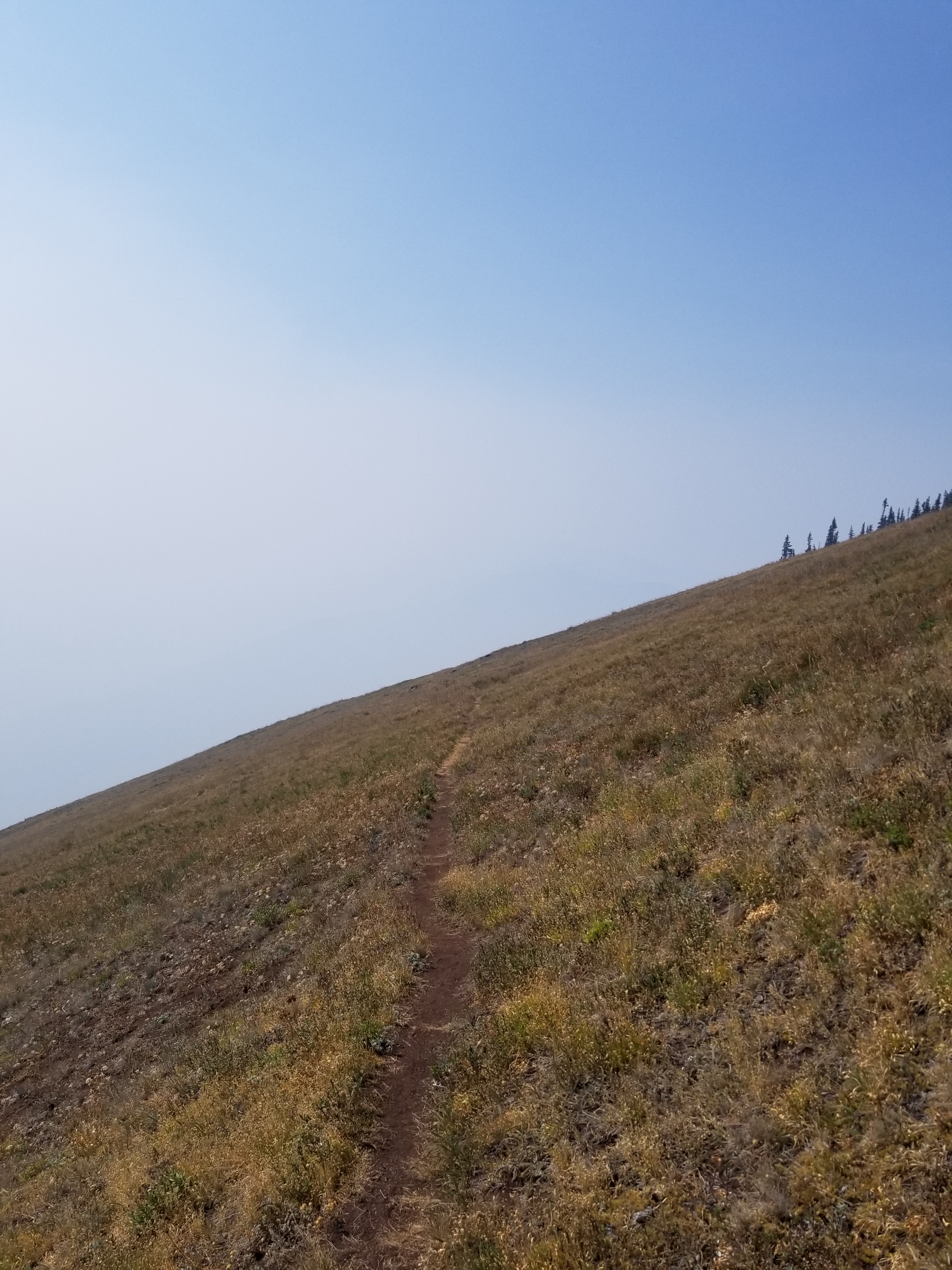
I was well above tree line for most of the morning, but the tough, beautiful, sparse plants provided plenty of interest.
I could not tell whether this was two plants ( orange pine in a white cushion) or one plant
Again, I could not tell if these were two different plants or one.
These toughies appeared to be growing only in rock and crushed rock.
I was also graced with the presence of birds.
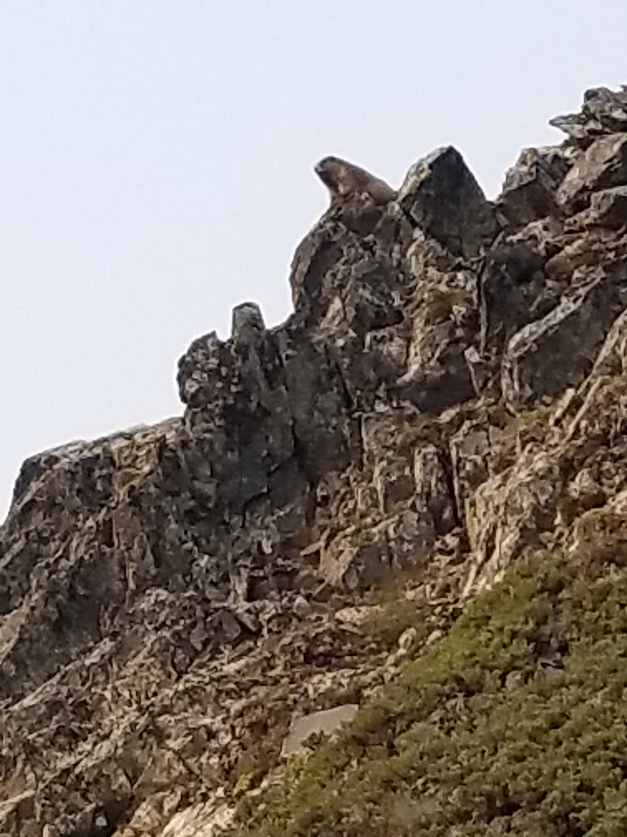
Have I ever mentioned marmots? My morning was marmot heavy.
This lone marmot appeared to be by himself. He called out a warning, but I saw no others.
A bit before noon, I reached the Hurricane Hill Visitors Center.
I feared it would be a tourist zoo as this is the primary driving destination in the park, normally offering gorgeous views after an easy drive. Perversely, the smoke worked in my favor as the huge parking was only 10% full.
When I went inside to the top of two layers, I was immediately able to complete some backpacker chores: find electrical outlet, water, and properly dispose of garbage. While charging, I casually reviewed some exhibits.
Then, I moved over to what seemed the nerve center of the building: Information. When I got to the counter, a gray-haired, uniformed park ranger asked how she could help. I asked “Are there any closures?” (My permit was issued over a week prior and between construction, fires, and, I’m not making this up, Goat Relocation, I knew there was a possibility a portion of my permitted route might be closed.) The blank look in her eyes made it clear I was in for some fun.
“What closures?”
“I was hoping you could tell me. I am backpacking and just wanted to see if there are any road or trail closures I should know about.”
“Oh. If you’re backpacking you need to get a permit. They will know about any closures. ”
“Sorry, I already have a permit issued several days ago, but I just wanted to see if anything has closed recently.”
“You’ll have to talk to the permit people downstairs. We have no information on closures.”
Involuntarily, I stepped back and looked at the sign to make sure it hadn’t said “No Information. ”
Honestly, I tried very hard to ask politely “What information do you have.”
She curtly replied that they help visitors learn about park programs and nearby day hikes they could take. About to ask her what she would do if a day hike route were closed, I thought better of it and left, thanking her for time. I felt empty, without closure.
The best part, though, was when I went downstairs, to the holy land of closure information. It was a gift shop and snack bar! Torn, I couldn’t guess whether trail closure information would most likely come from the fry cook or the lady selling stuffed animals.
I chose the snack booth. I ordered the fish and chips: three pieces of fish and fries for $13. When I got the order, it was two pieces of fish. I asked the person if they were having a two-for-three special. She said “No, its regular price.”
After about a half hour, I had enough and got going. I had a fairly steep downhill, but first I had to go up the popular Hurricane Hill trail. There were many helpful signs explaining the two different trail closures coming up in the next few days.
It was hazy and hot on the open hillside. I opened up my umbrella to create shade. I got a few smirks, but it kept the sun off and let the small breeze through.
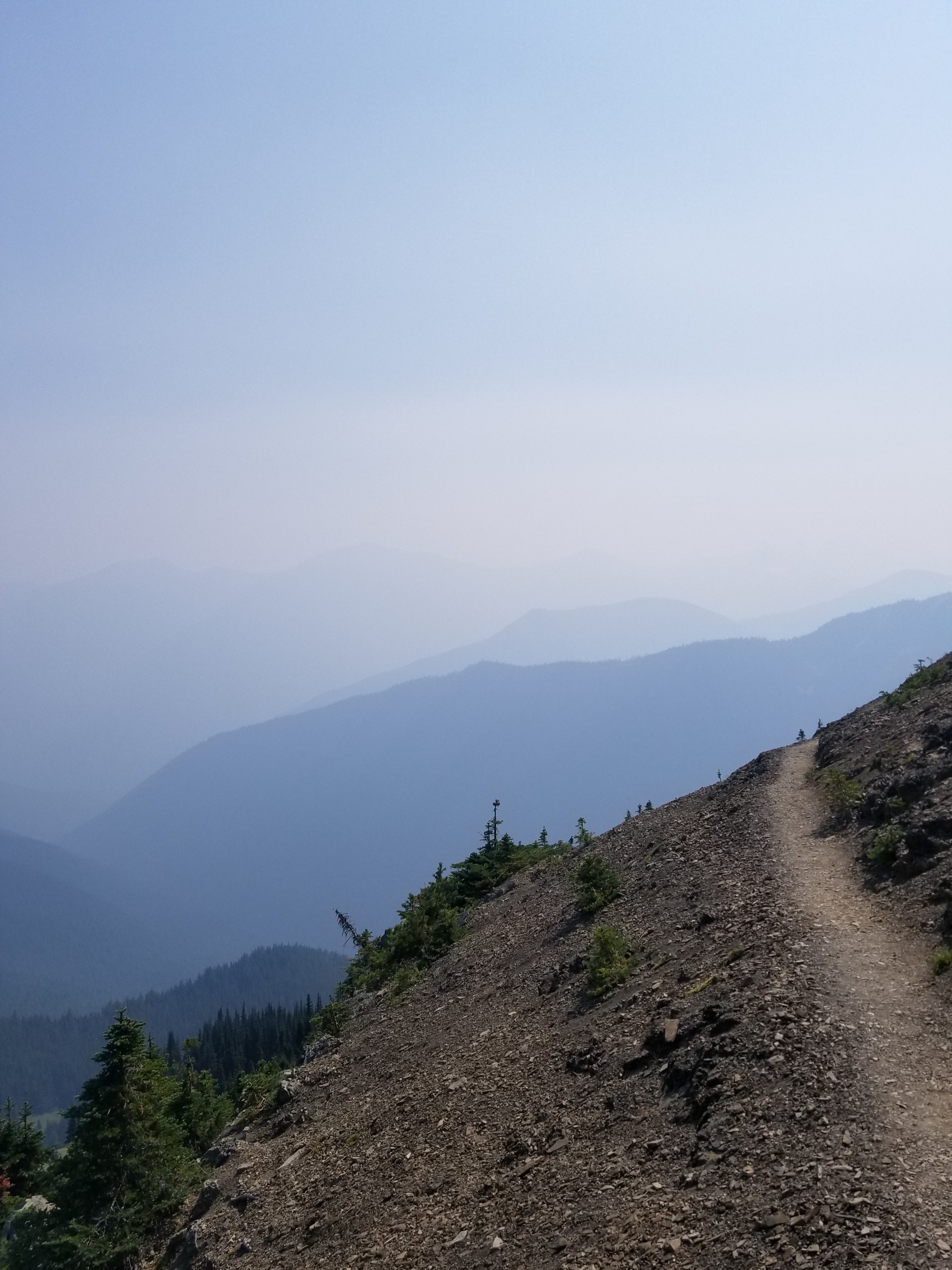
A faint trail leads over the smoky edge.
Eventually, I began my descent. Over the next several hours I walked down from above tree-line to subalpine to grassland, dry ponderosa to rainforest. Early on, it was incredibly steep and I nearly wiped out as I tripped and my top-heavy pack wanted to carry me down.
A
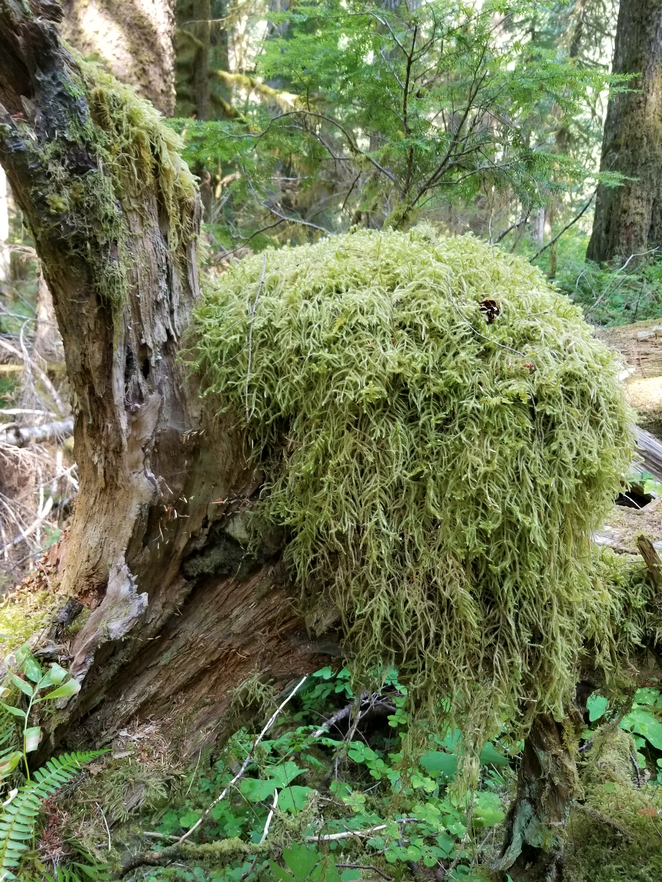
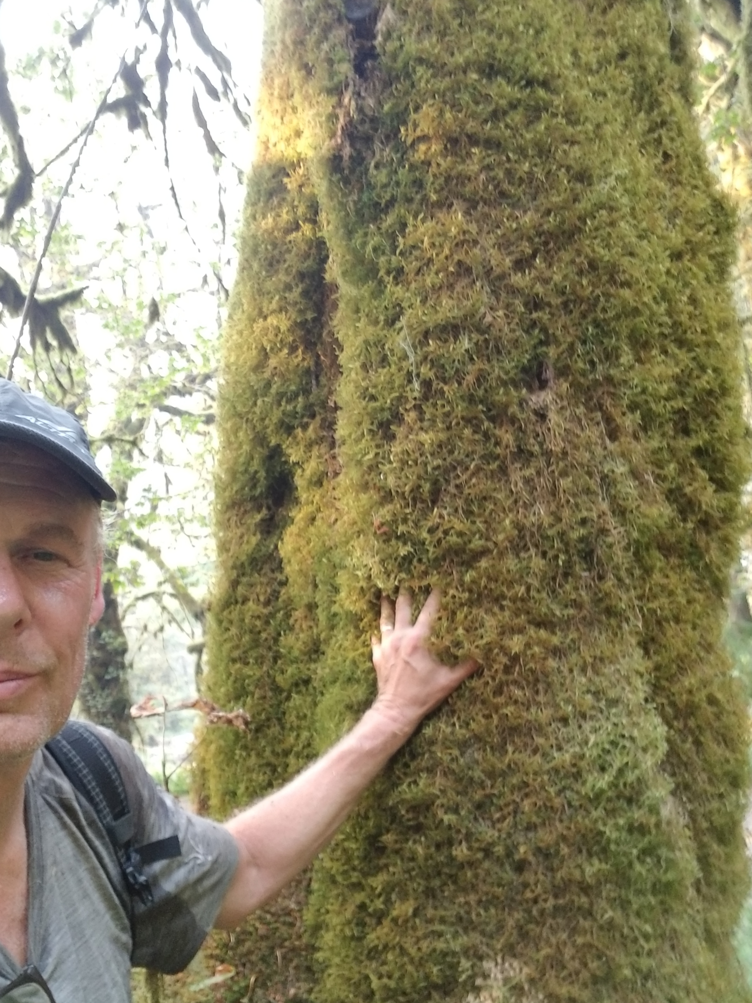
No, I do not have tiny hands! The most covering this tree was deep, reminiscent of a shag carpet from the 70s.
Around 5:00 I reached the bottom. The ONP was in the midst of major renovations, having removed a hydroelectric dam and replacing the roofing on the nearby ranger station. As a result, a major roadway was closed to vehicle traffic. After so many perilous hours on narrow shoulders of busy highways, strolling along a wide paved Avenue through the trees was a beautiful change.
I passed two couples. One was on bike and the others hiked. Both couples were returning from the Olympic Hot Springs.
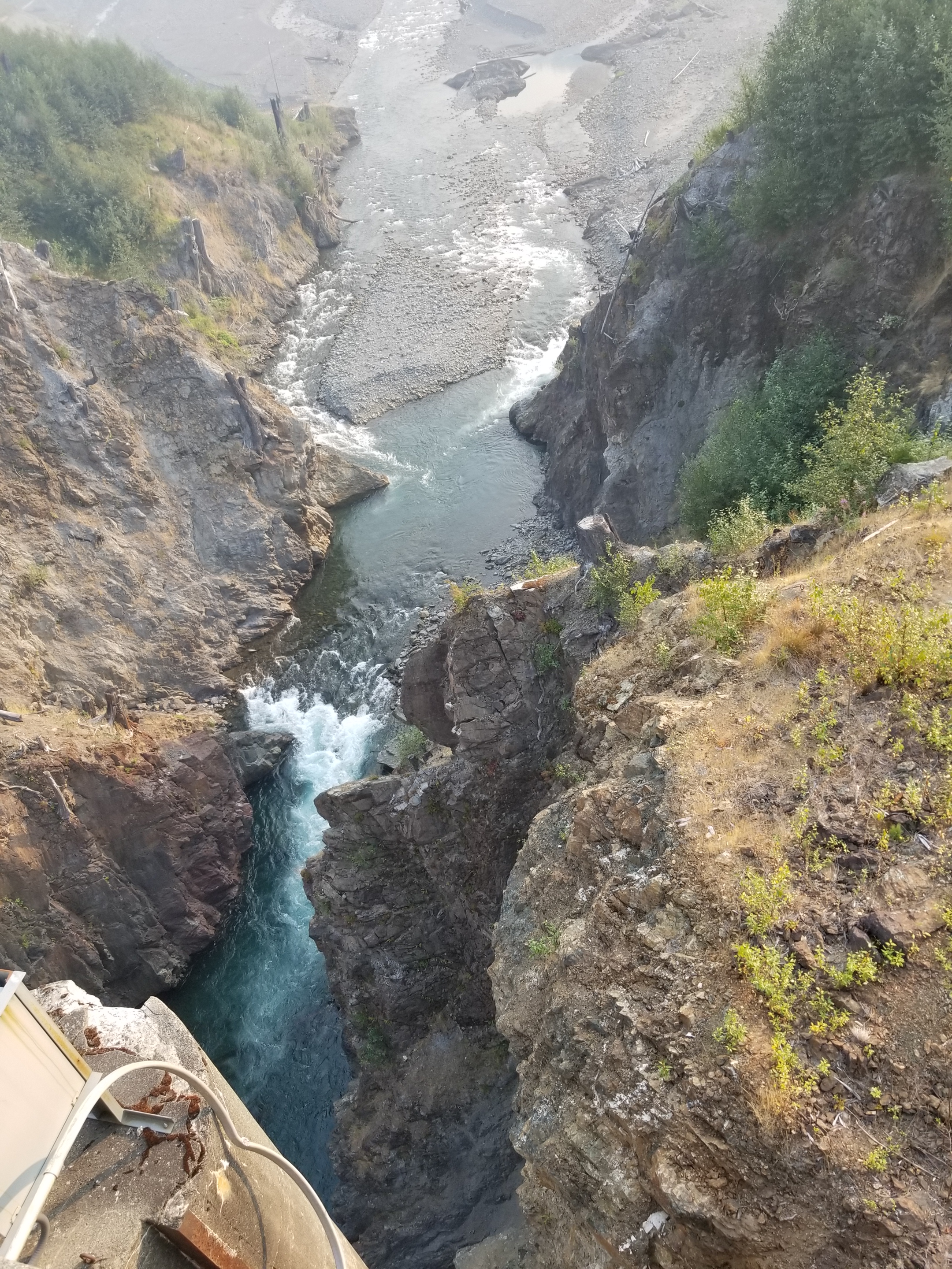
I had a gradual nine mile, 1800 foot elevation gain ahead of me. My knees were sore, but it was simply a matter of grinding out the miles. I did stop to look at the remnants of the dam.
The concrete on the left was part of the removed dam.
I ate dinner as I walked. Finally, about two miles before the hot springs / campsite, the paved road ended and turned to trail. It was close to dark so I got water and took out my headlamp. I’m not a fan of night hiking, so I was walking as fast as I could. Just as it was getting to the point where I couldn’t see 10 feet in front of me, I reached the campground. It was huge. A few years back, vehicles could drive all the way to the hot springs and thus the campground was large.
I hung my food, pitched my tent, and put my creaky bones and sore muscles down to sleep. Just as I was dozing off, a group of female hikers walked past with their headlamps blazing, returning from the springs to their campsite. Finally, after they got their food hung, the campsite was dead still and quiet. At last, my eyes found closure.
August 20, 2018. From Deer Creek Trail Head to Roaring Winds.
I woke up a little groggy. The smoke from the Canadian fires came in strong overnight. A couple times during the night I woke up because of the smell of smoke. You would think my sense of smell would be used to smoke by now.
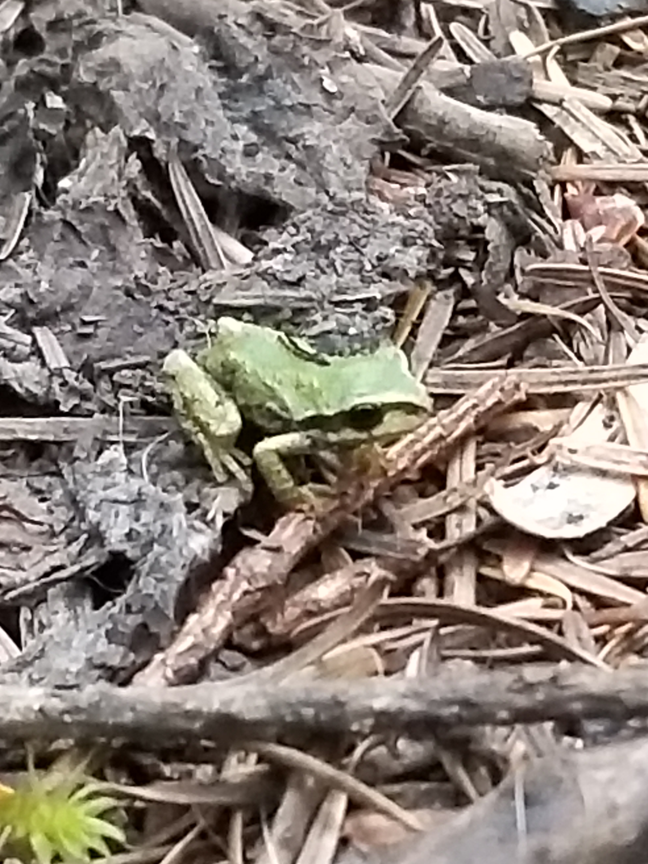
There was a curious little tree peeper that watched me pack. He was so small I might’ve stepped on him if not for the bright color.
This guy was so tiny.
After packing, I started up the Deer Ridge Trail. At first, it was a nice steady climb. While I was messing around with a very weak cell signal, a day hiker came along. His name was Dave and he was a peak bagger. A peak bagger is somebody who sets goals of certain mountain peaks they want to climb. Typically, they try to hike up without the special gear that moutain climbers use. One of the best example is Coloradans striving to climb all peaks in their state 14,000 feet or more above sea level, called 14ers for short.
The sun struggles to shine through the morning smoke.
As the trail steepened and Dave conversed easily while I huffed and puffed, it was clear this 67 year old was in great shape. He was very knowledgeable about almost every Washington mountain I had seen. He lived nearby and even offered a place to stay on my way home if needed. I would consider myself lucky to be like him.
We parted company at the first camp inside ONP, Deer Park. My first and foremost job was to find water. I went to the ranger station to ask, but a sign said “On Patrol”, which I cynically took to mean napping.
I did find beautiful water right at the trailhead. My trail and campsite were all high and dry, so I tanked enough for the rest of the day and tomorrow morning. After filtering, I made a rookie backpacking mistake. Lost in thought, I took some big swigs out of the bottle in my hand. Looking down, I realized I had been drinking out of my “dirty” water bottle which is used to push water through my filter. I hoped I was so high and close to the water source it was safe from giardia and cryptosporidium. Well, I would definitely be the first to know.
As I started on the trail, I noticed some excellent trail work. In particular, the drainage was being done beautifully. In a mile, o met the two gentlemen responsible for the good work. They both were volunteers. I complimented and thanked them.
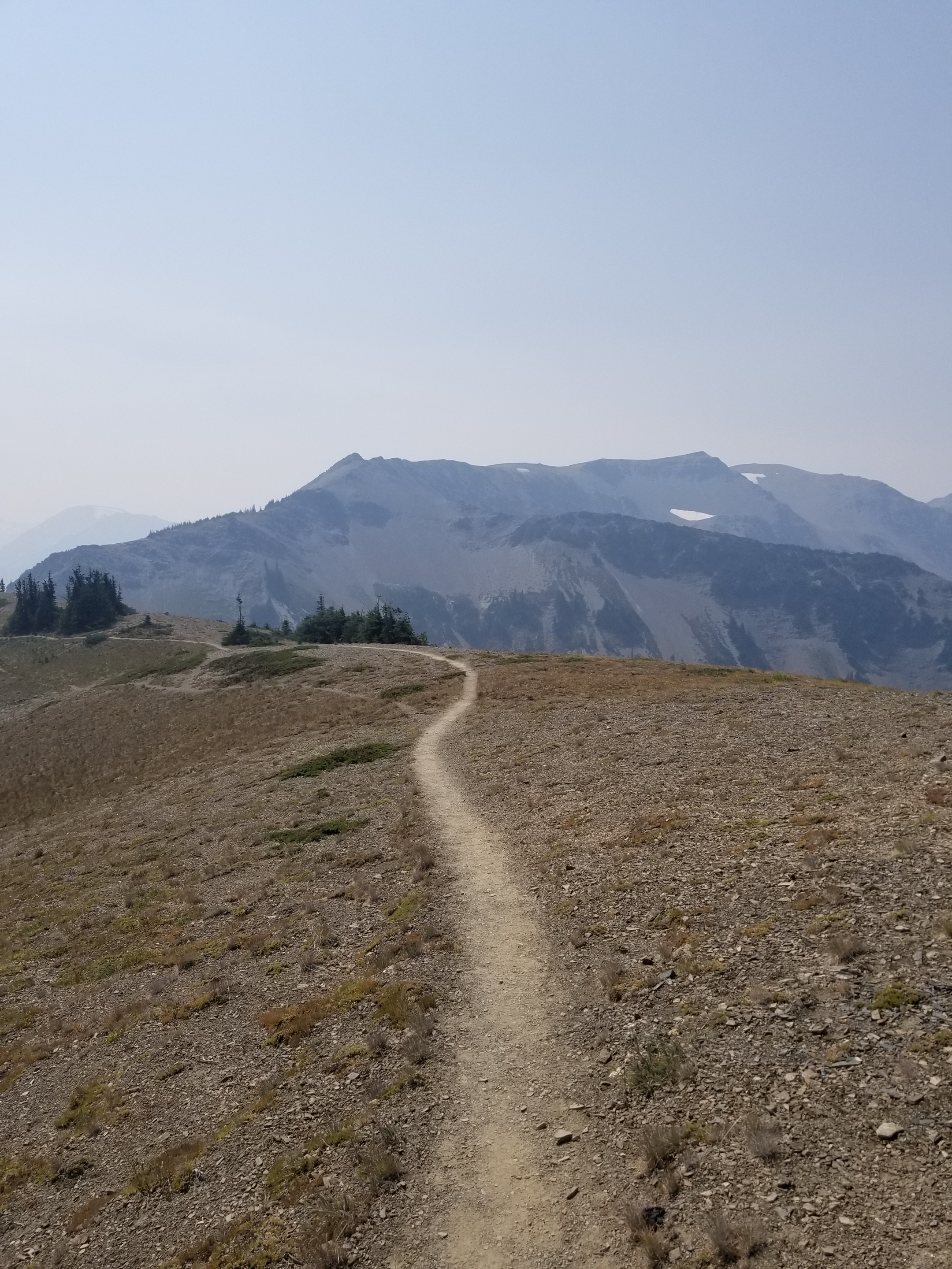
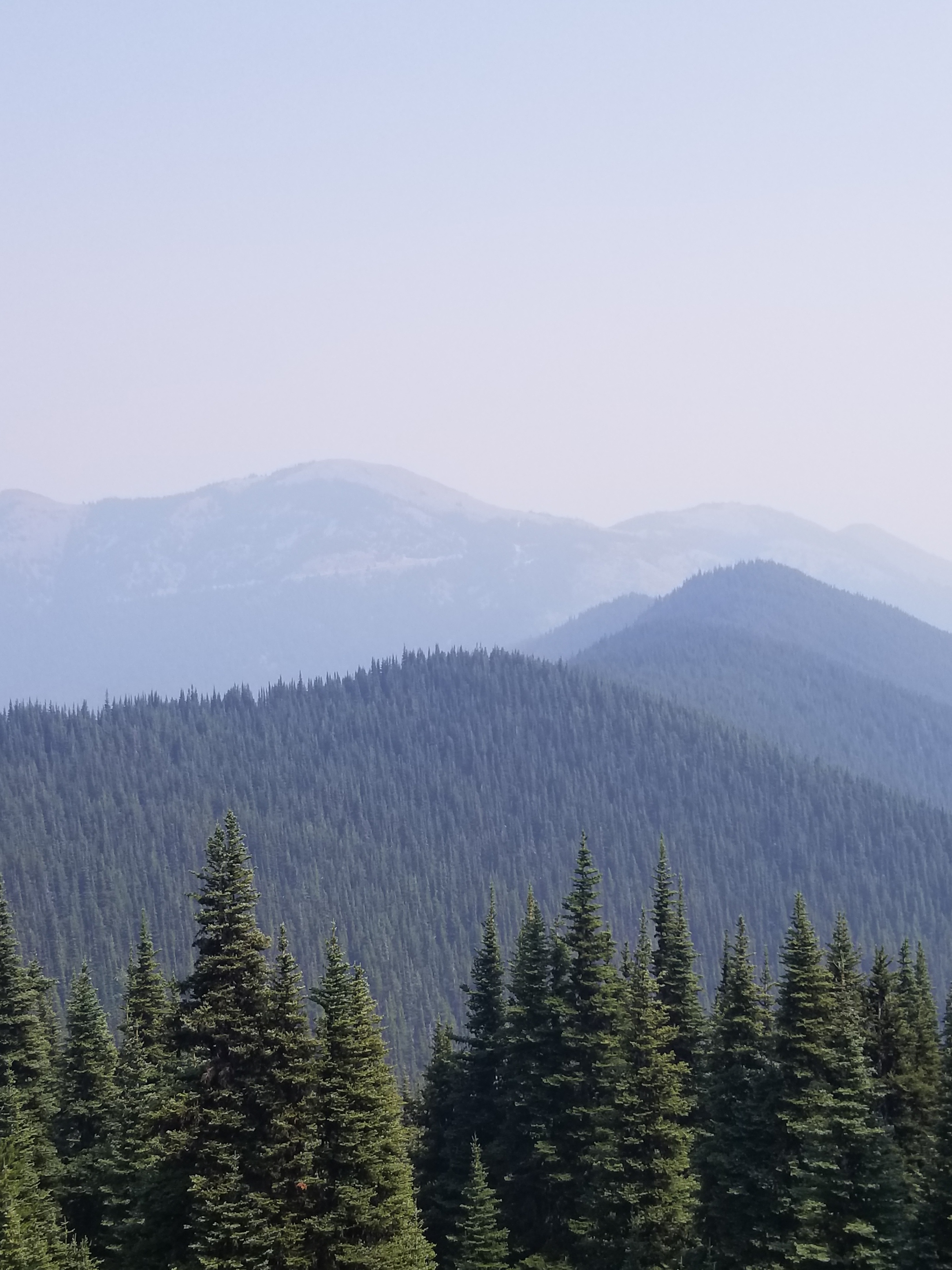
The hike was high and gorgeous even though the valleys were smoke filled. I passed about a dozen hikers, half of them day hikers.
Hazy views
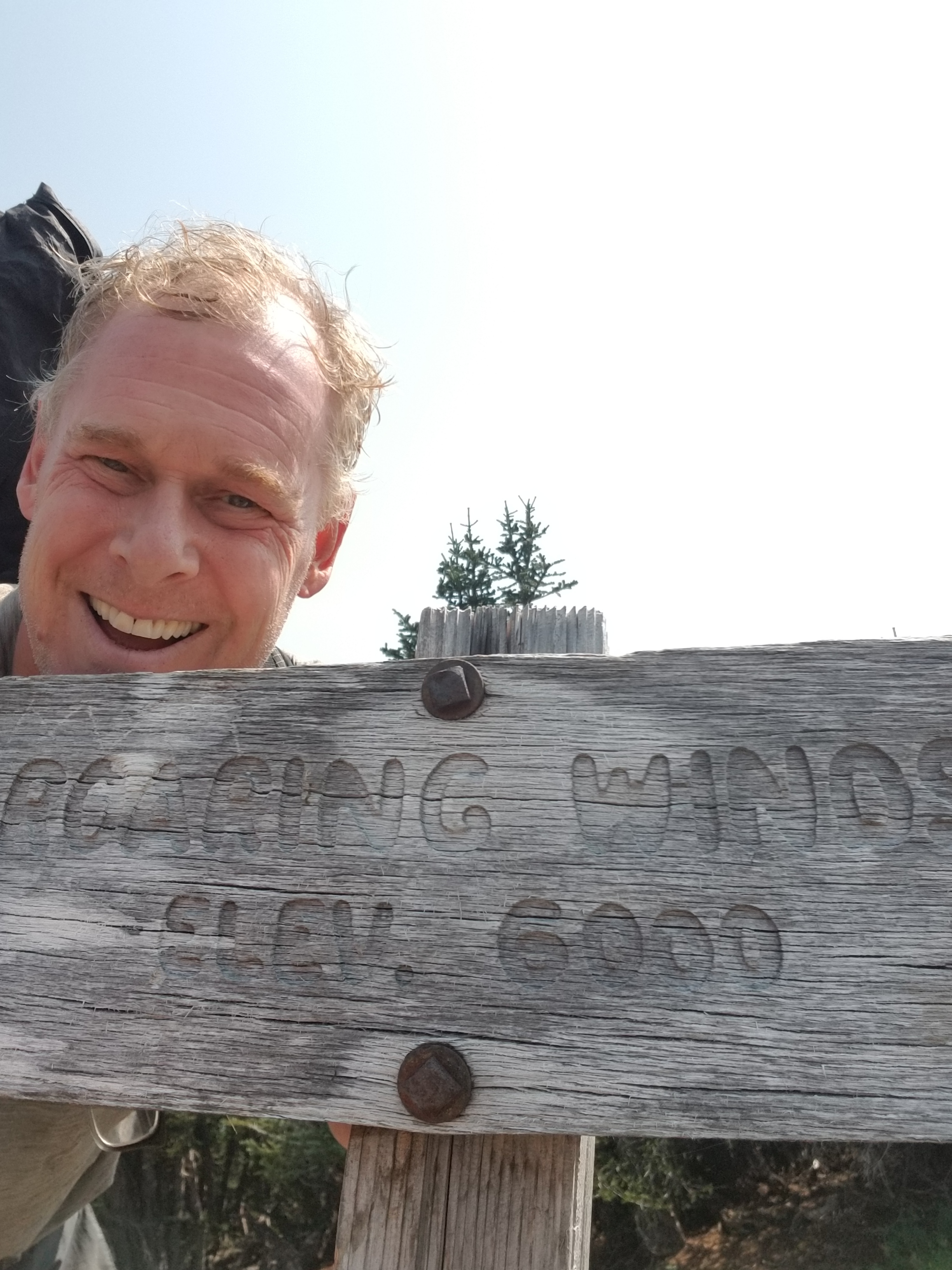
Midafternoon I reached my assigned campsite called Roaring Winds. It was on a saddle between peaks and had a reputation of living up to its name. Nobody was there, so I snapped up the most protected of the four sparse sites.
The Roaring Winds messed up my fancy hair.
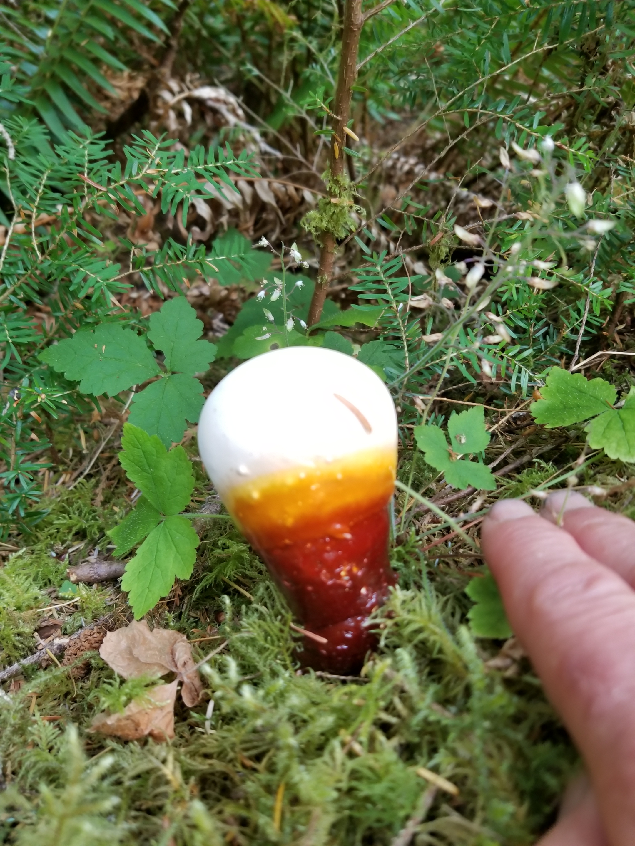
I wasn’t sure whether this butterfly was attracted to the yellow color or wanting to send an SOS.
Wouldn’t you know it, the wind ceased around 5:00. Above, there was a predictable roar of navy jet engines returning to base every 15 minutes. Such a juxtaposition: a quiet, still national park interrupted by the scream of fighter jet engines.
Nobody else showed up at any of the other three sites.
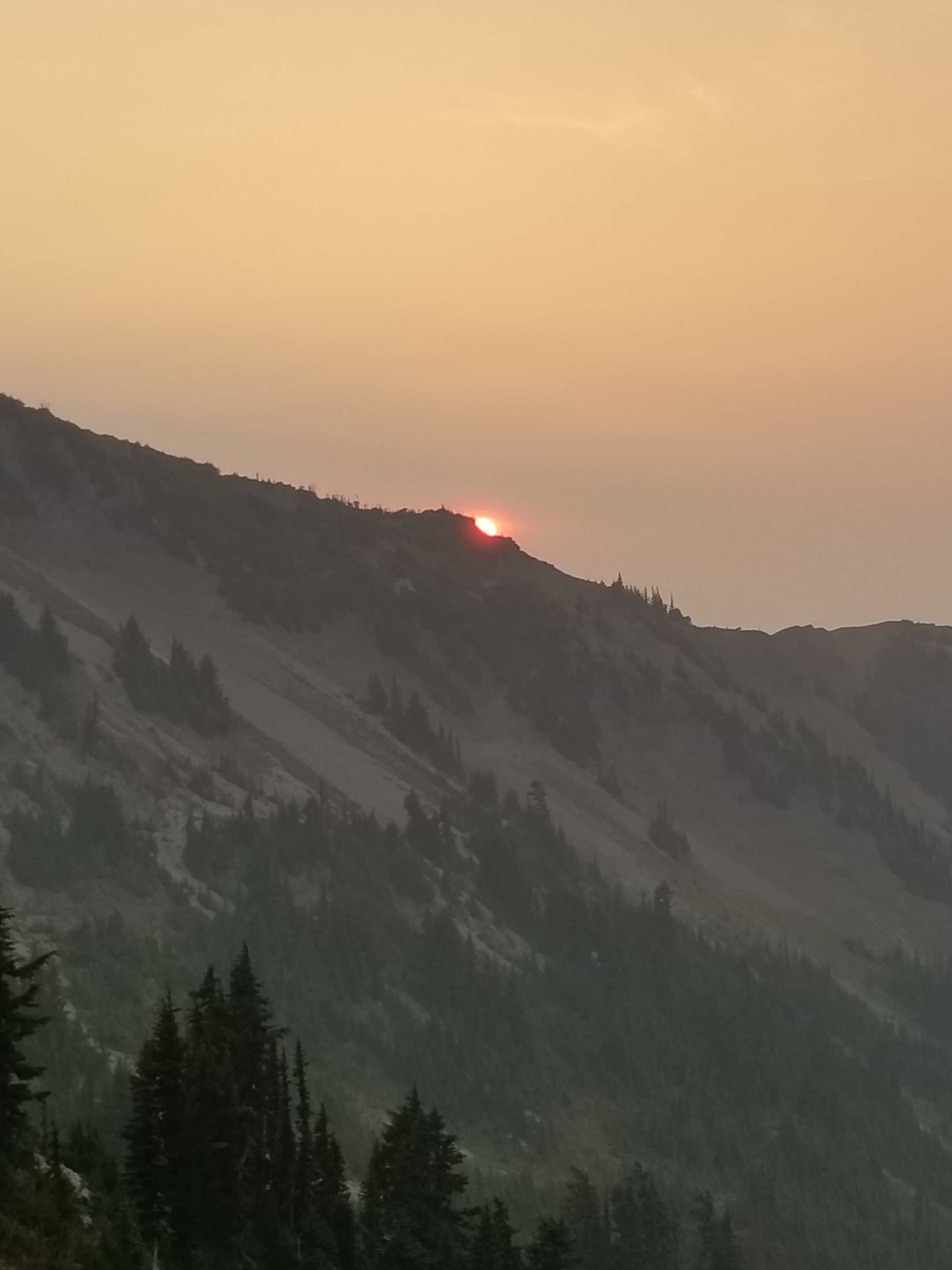
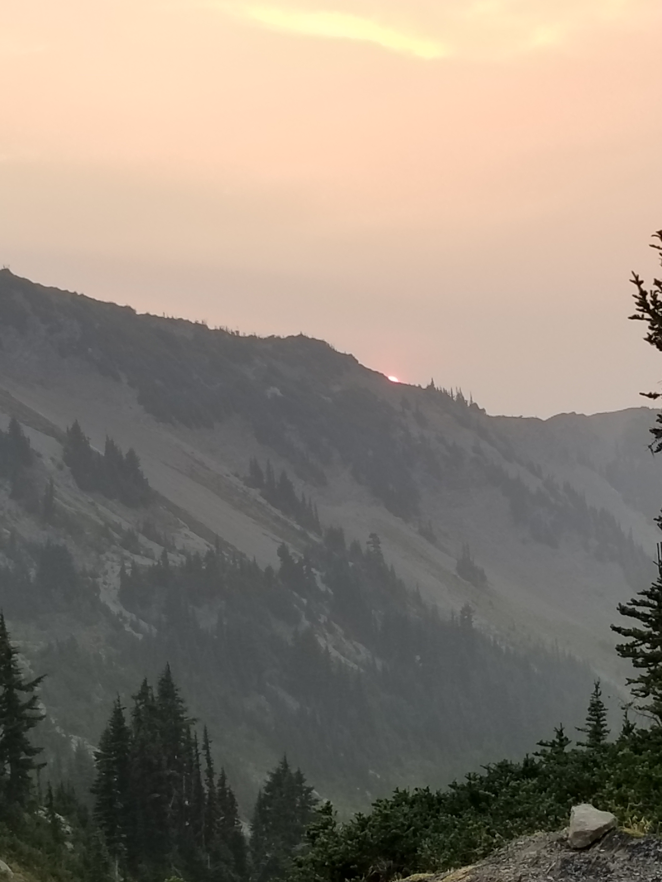
As the sun set over the flank of Obstruction Point, I grabbed a few photos before calling it an early night.
Last night an expletive-filled domestic dispute. Tonight, not even a breeze, let alone a Roaring Wind, to make a sound.
I did leave early, but somehow I managed to wake up Not Guilty. I said good-bye and we thought we’d meet in the next town (7 miles) for breakfast.
There was a timber harvest going on so there were some temporary trail closures that got me confused at times. Still, I made good time while the sun rose through the smoke filled air.
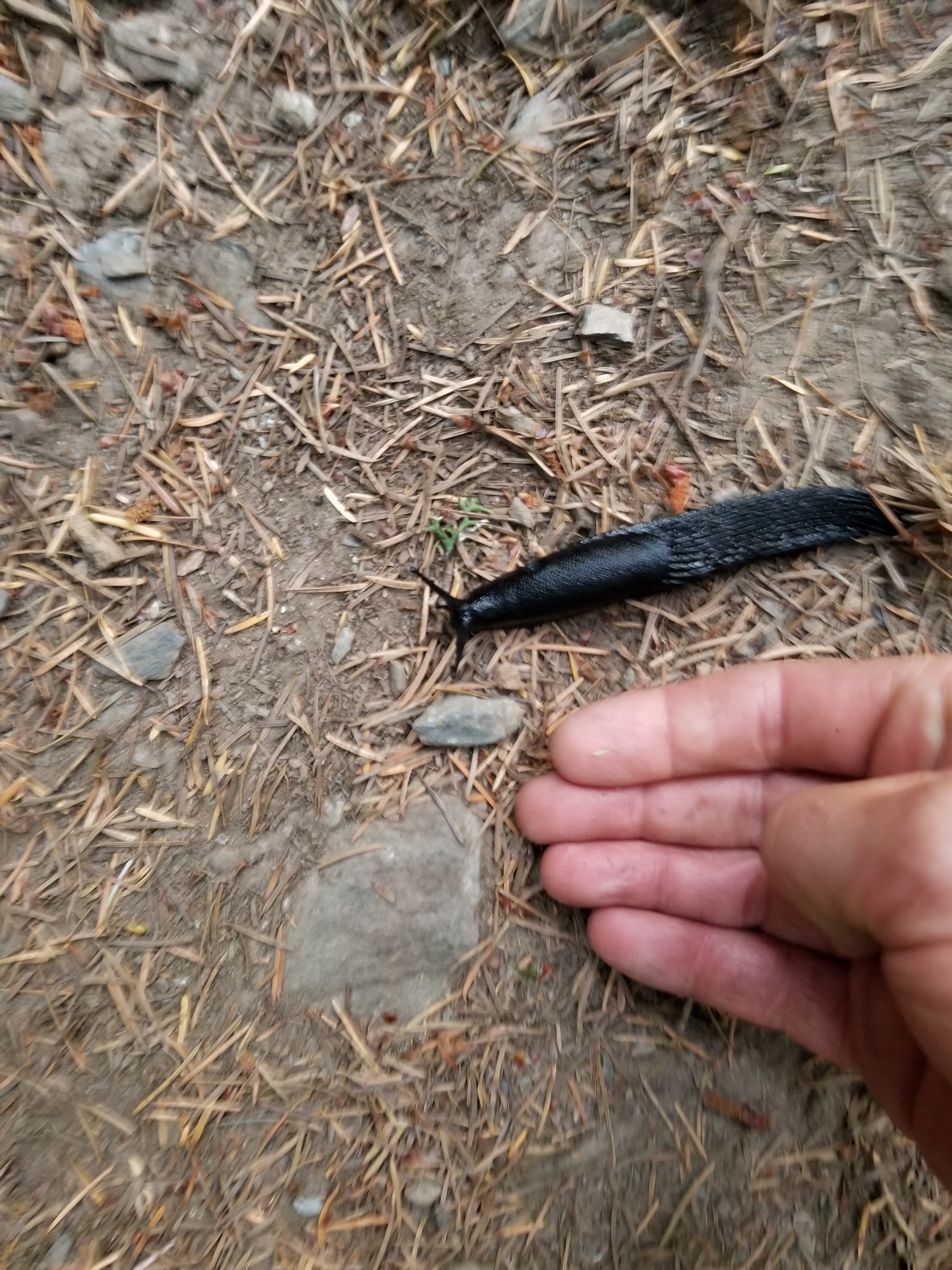
How would you like to wake up to this crawling across you?
I loved how the most covered the dead branches.
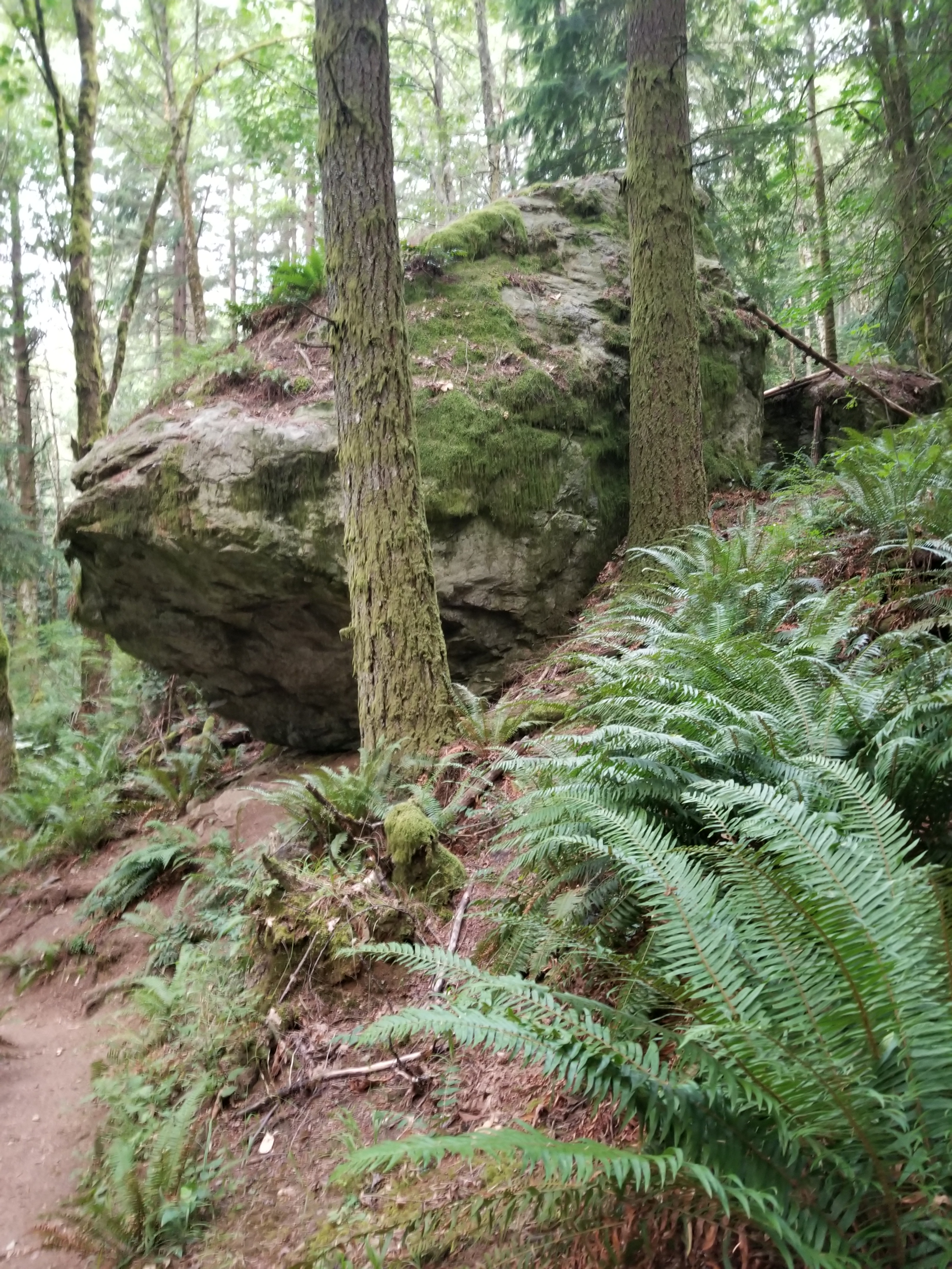
This boulder, I believe it might be classified as an erratic, was huge.
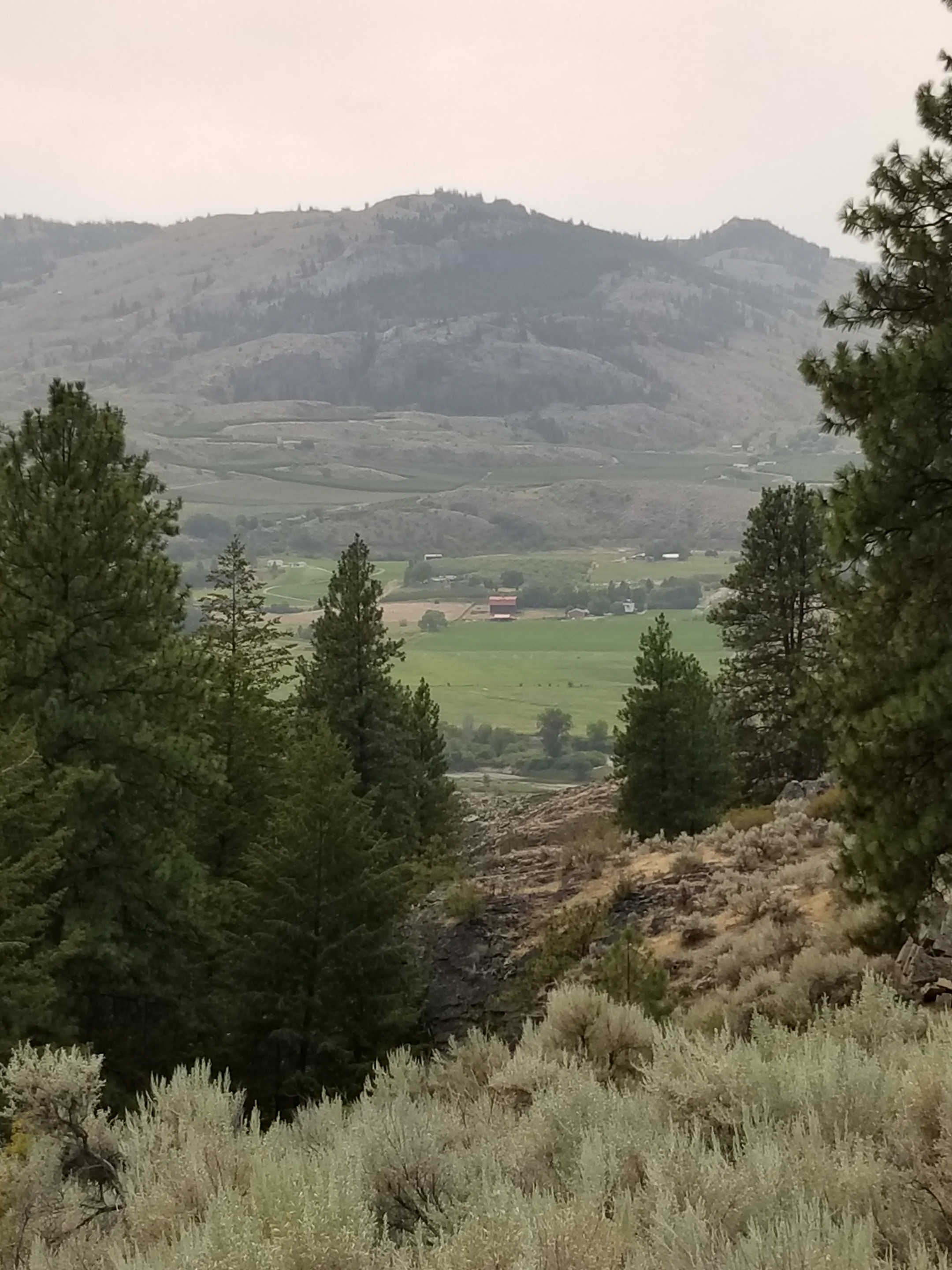
I got my first glimpse of Puget Sound, but a glimpse was all given the haze. This would be a spectacular trail on a clear day. At the bottom of the trail, there was a carved stone marker related to the PNT. All the words were spelled correctly. However, the math did catch my eye, not adding up to even 1,100 miles when the trail today is over 1,200 miles. Must be reroutes and other changes.
When this monument was made. The trail only covered 1 106 miles.
I finished walking down the mountain on Highway 11. A bizarre event happened when a shiny new black pickup pulled up next to me and asked me oif I had camped up on the mountain. The driver looked like a cop. I said yes. He asked if I had seen anybody else. I explained Not Guilty was on his way down, but otherwise no. He revealed he was with the railroad police and was looking in to somebody shining a green laser into a train engine last night.
Once the road flattened on the coastal plain, I started seeing a lot of bicyclists. It was flat, open farm country that backed up to the Chuckanut range. When I reached the small town of Edison, there were two cafes right there. Both, unfortunately, were closed. I went up to see the hours, but was disheartened to see they were both closed on Monday and Tuesday. Yup, I was in a tourist area.
While I was on the porch, a lady in a Subaru rolled down her window and asked “Can I help you?” which I interpreted as “what the hell are you doing peering in the window, bum?” When I explained I was looking to see when it would open, she said everything was pretty much closed, but down the road about a mile there was a bakery open. She then offered a ride, which I declined. I clearly had misinterpreted her.
When I got to the bakery, the same lady was out front, caring for the decorative flowers in front. I said hi and thanked her again for her help. We chatted for a bit. Under the heading “Small World” she was from Wayzata, Minnesota which is the town adjacent to where I live.
I ordered some delicious looking baked goods at the bakery (called ‘Breadfarm”). She came in, gave me a bunch of organic carrots she grew herself and paid for my food. I thanked her profusely and then decided to pay it forward.
I told the lady at the counter that a backpacker named Not Guilty would probably come in. Last night he had told me how much he loved good focaccia bread. So I prepaid for a small loaf and described him. I hope it worked out.
The rest of the day was a long but pleasant roadwalk near the coast. That is, until I reached Highway 20. I pulled the ultimate bonehead hiker move. There was a gas station where the trail put me on Highway 20. I got water and a coffee and put my feet up. Then, I started walking along Highway 20. About a mile later I saw some road signs that did not make sense. I then checked my phone app and discovered I had walked a mile the wrong direction. Fortunately, I was near an intersection and able to safely cross the highway.
Just as a I was heading back, a Mercedes van pulled over in front of me. The driver popped out heading towards me. He didn’t look like a nut job so I wasn’t too nervous. Turns out he was a PCT veteran heading to PCT days and thought I looked like a PNT hiker. I confessed I was, declined hi generous offer of a ride and learned his trail name was “Meander”. Neither he nor I mentioned I was about a mile off course. There is honor among backapckers.
The next few miles were simultaneously boring and life threatening as I followed Highway 20 in the right direction. Along the way I was amazed to see how many birds are killed by cars. I also found some dude’s paycheck. I took it into town and would mail it to his employer. Lastly, I went over this huge bridge that thankfully had a separate passenger path.
Rather than take in the whole scenic walk around an entire oil refinery, I took a minor short cut. Then the trail goes over Fidalgo Bay for almost a half mile on a hike/bike trail. The tide was coming in and there were harbor seals and an otter feeding just off the bridge. It was fun to watch.
My last unusual human interaction happened when I finally made it to Anacortes proper. A bicyclist pulled up and asked me if I had been much further up the coast earlier in the day. I said yes. He said he had seem me walk by his office and recognized me just as he was getting home. Nice guy and he gave me a solid restaurant recommendation.
The restaurant was great (Naung Mai Thai Kitchen). Stuffed, I tried to go to sleep early, with some success.
August 12, 2018 From motel in Sedro-Woolley to Lily Lake on Chukanut Mountain.
I was foggy from a bad sleep and seemed to pack in a similar manner. I only had around 20 miles today and most would be on pavement. Reluctantly, I left my smoky crime-scene room.
I stopped at a lonely gas station and got a coffee and corn nuts, a champion’s breakfast. Fortunately, I had also purchased hard-boiled eggs from the grocery last night.
I needed to take a few connecting backroads to get me over to “old Highway 99” which went north to Alger and later intercepted the trail. It was a pleasant walk with little Sunday morning traffic. A few dairy farms provided me with an audience.
Later, I passed a classic farmhouse that was in great condition. The owner was out ffront and we started chatting. Then his wife and their dog also came out. They had questions about the rail and the man was an avid mountain biker who knew many of the areas the PNT traversed. They were so kind, offering me waffles, other food, and water. Truly one of the great things about backpacking is running into such kind, helpful people.
The walk up old 99 was boring, with less RV and truck traffic than 20 or Baker Lake Road. I was able to finish one audio book {WHEN: The Scientific Secrets of Perfect Timing, by Daniel Pink…apologies for not remembering the MLA way to cite a book.}
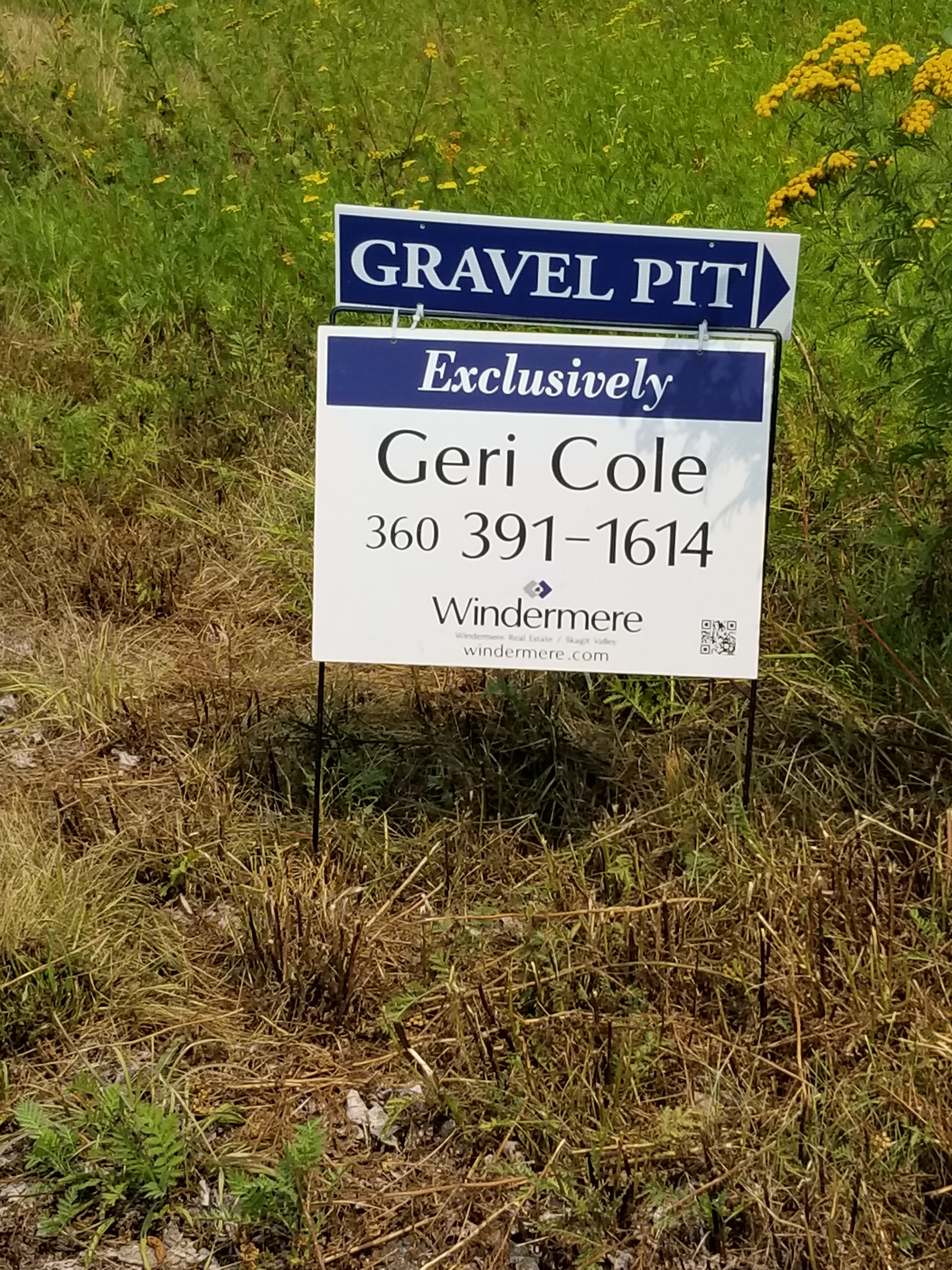
“Break out the champagne! I landed the gravel pit listing!”
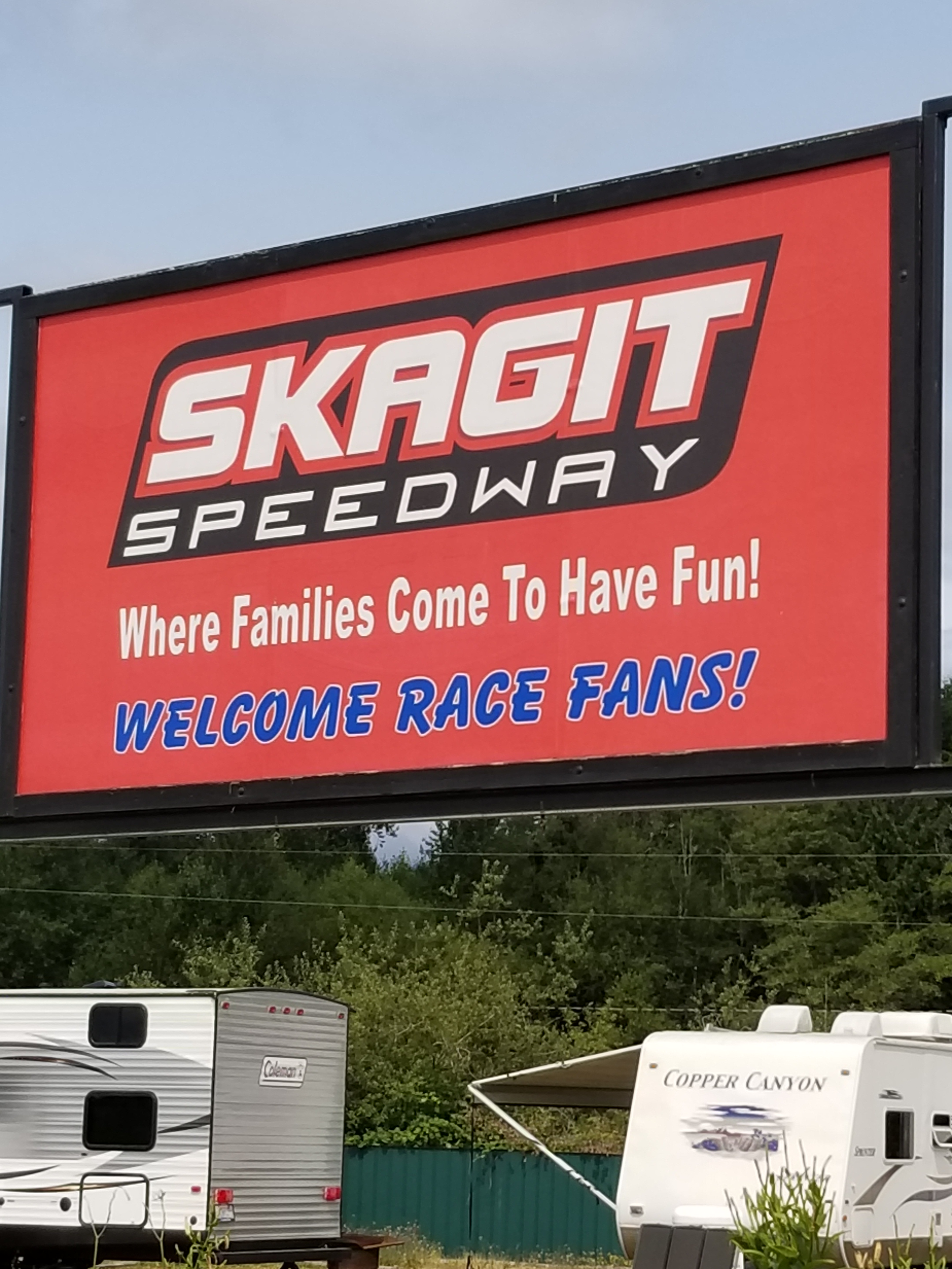
Up the road was Alger. During planning I had picked out Alger as a resupply place. Indeed, we mailed a resupply package to the motel there already. However, when looking for a place to send replacement shoes, Alger was sold out. Apparently DirtCUP 2018 was happening at the Skagit Raceway and that naturally drew in a crowd. When I went by, there were only a handful of RVs left at the Skagit Raceway. I learned also that yesterday/last night had been Ladies Night, a huge draw I’m sure.
I ate at the local pub. If you like good food, sticky tables, worn carpeting, and love the 65-year old Harley couple scene, this place would be heaven for you.
I trudged up the Old 99. Just before it intersected the trail and passed under Interstate 5, a couple asked me if anyone was looking for a dog. They had found it in a county park. Can you believe it was not on a leash when they found it? About 20 minutes later, I came across a “Lost Dog” flyer for a different dog that was lost locally.
Late in the day I finally got off pavement as the trail went into a forest area owned by the state Department of Natural Resources. It was a confusing route, not matching the maps. Indeed, some old-school person had placed white trail markings correctly.
Amazingly, just when I was getting a little lost, I ran into another backpacker. It was a hiker with the trail name of Not Guilty. We found the trail and hiked together until reaching Lily Lake, a pretty good campground right next to the trail. It was nice to finally meet somebody else hiking the trail. An experienced backpacker, he was enjoyable to spend time with. He said he was a late sleeper, I said I was an early riser, but he said it is hard to wake him up, so I said I’d probably be gone when he got up. Tomorrow would be his birthday. I told him I did not get him anything.
I had a new sleeping pad. It was nice and clean, but a little squeaky. The first time I had shared a campsite since Glacier and I am sleeping on a pad that makes a lot of noise anytime I move. Staying as still as possible, I eventually nodded off.
August 11, 2018. From stealth site above Concrete to Sedro-woolley motel.
I had set my alarm for 4:30. Right after it went off I was moving. Since it was still dark, I did everything by headlamp. However, once it came time to hike, I turned of the light. Clouds had rolled in as the forecast had predicted. Presumably, rain would come later. For now, though, the clouds trapped enough light that I could safely hike on the gravel road with no headlamp.
Only one car whipped past me on the curvy road down to town.
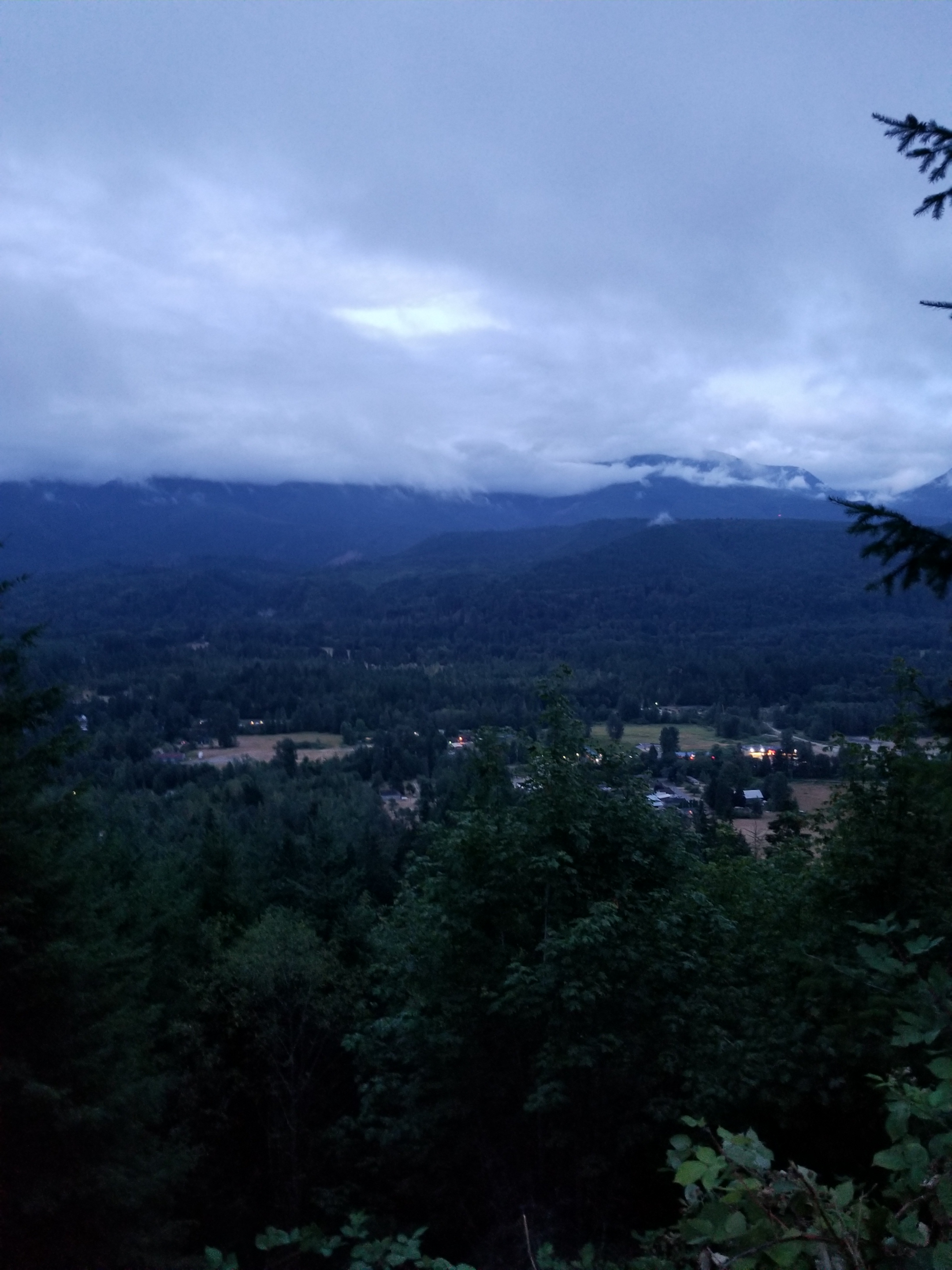
Low clouds hang over Concrete
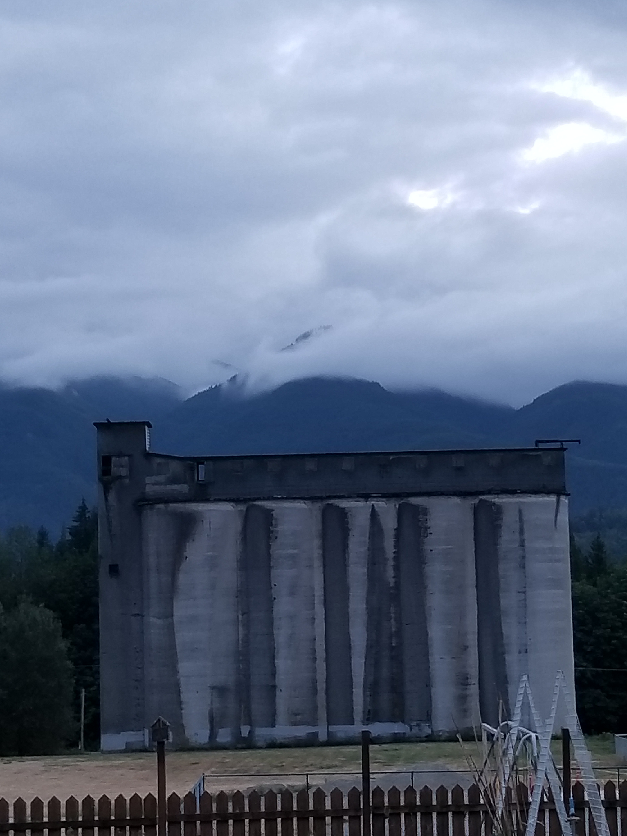
In town there were a few historical displays. No surprise that its claim to fame was a large cement production plant. If you consider just the hydroelectric facilities I had passed, it is not hard to imagine the historical demand for concrete in this part of the country. One thing I learned was the ecological damage from a concrete plant. Sure, I assumed it would be dusty inside, but apparently a wide swath of surrounding countryside was often dusted with a heavy layer of waste.
I was waiting when the 5B bakery opened. I order corned beef hash. Then a danish. Then a cinnamon roll. The bus left at 9:30, so I had some time to kill. Eventually, people started flocking in. By the time I left, the line went almost out the door.
The bus made me feel right at home. It was populated with older men who looked either homeless or on some kind of work release furlough. Indeed, the two guys in front of me almost came to blows on how little money they paid for their used bib overalls. Yes, I was among my tribe.
Where did you get them overalls?
It felt so weird to go so fast. I had not been in a motor vehicle since Oroville. Out the window I caught glimpses of the 22 mile rail-to-trail route I was skipping.
Sedro-Wooley was a fair sized town, a little spread out. Until the Library opened at 11, I educated and amused myself by going to the museum. The lady who welcomed me had not heard of the PNT, so I gave her some history on it. Many of the displays were awfully close to looking like a very well organized garage sale. However, there were some real gems.
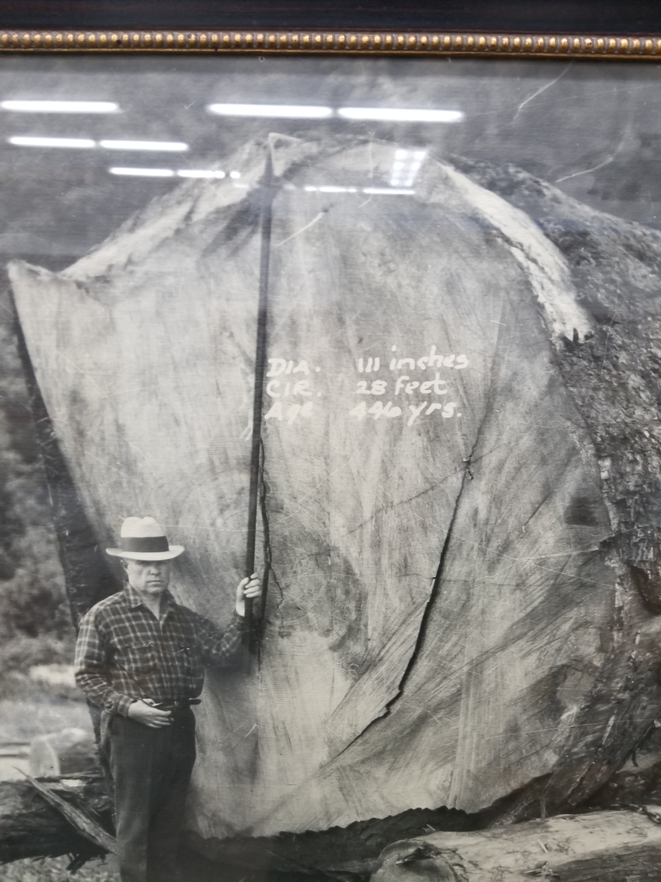
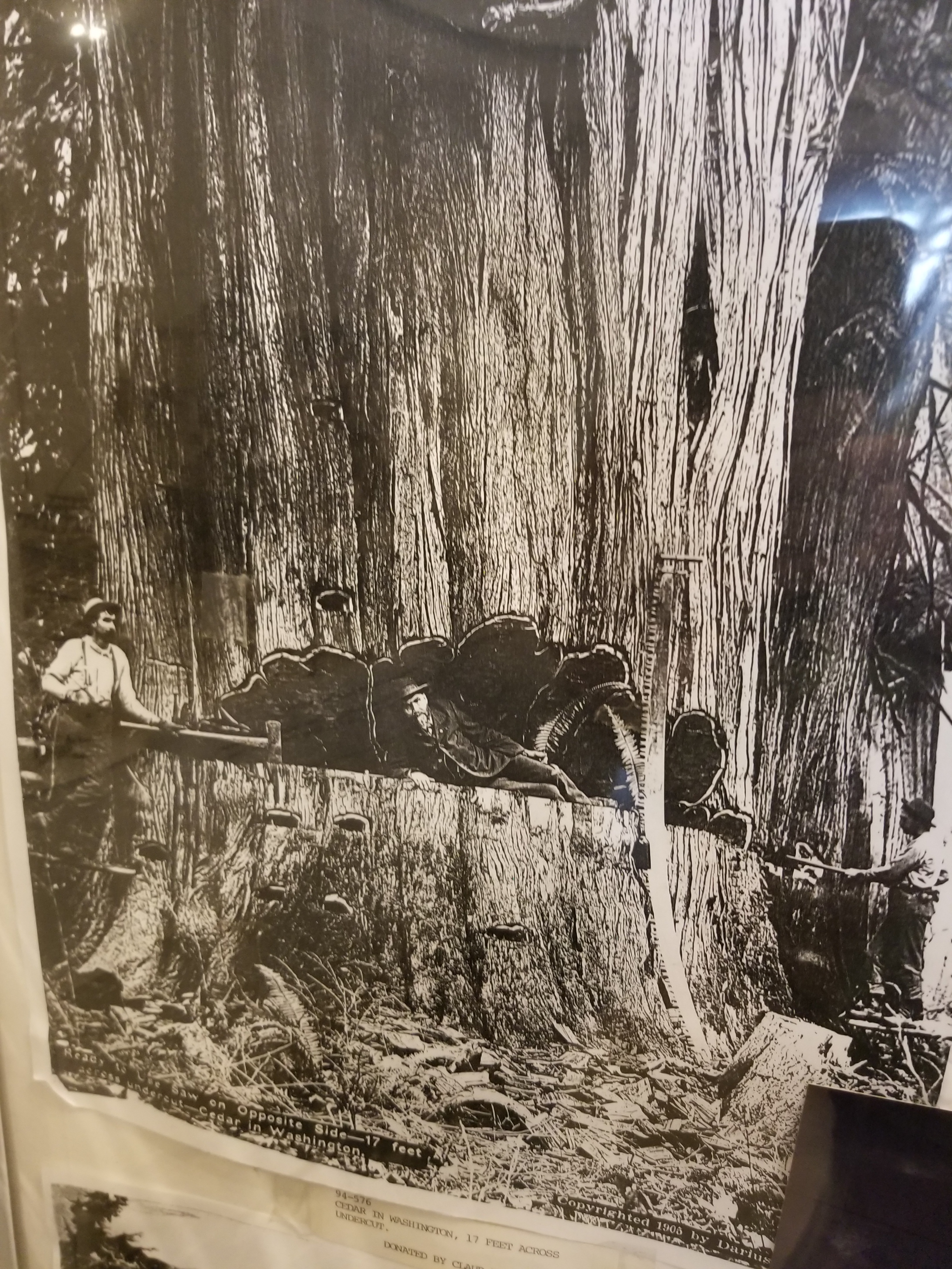
First, they had great photographs of early logging and railroad. There were some huge trees harvested in the Skagit Valley in the early years. Tow transport the logs, railroads were built, sometimes traveling over 130 high trestles.
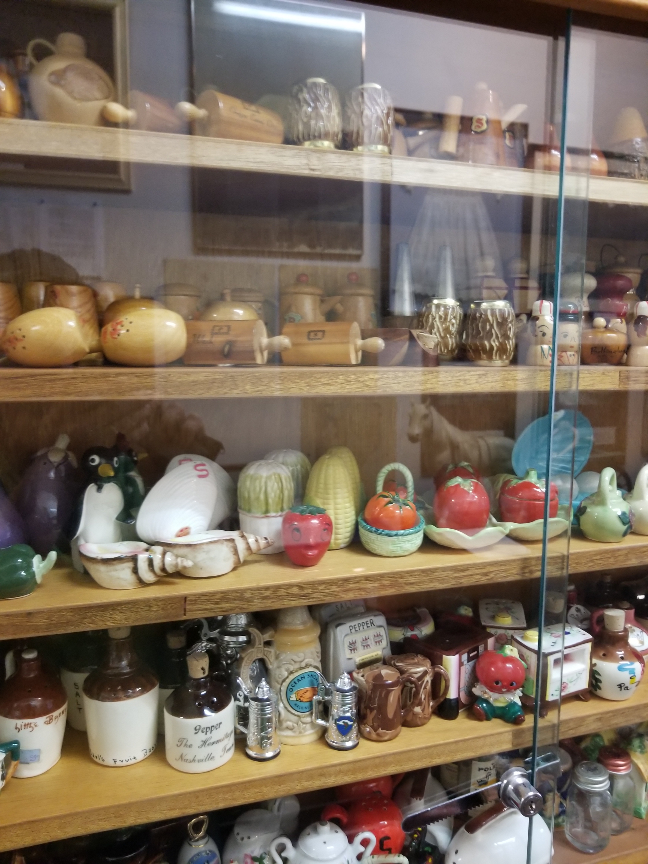
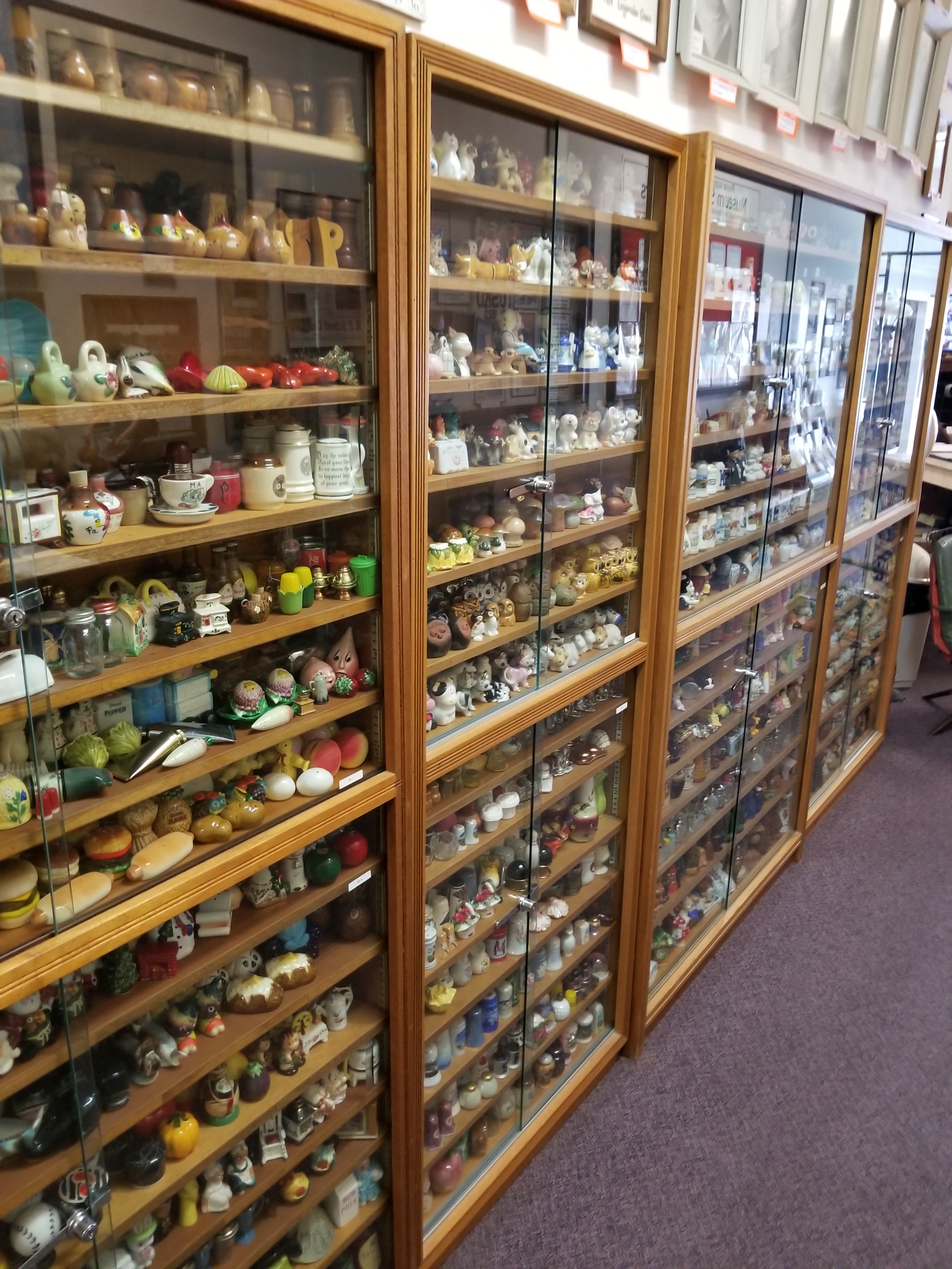
Second, and more endearing, was the 2,334 pairs of salt and pepper shaker collection. Over her lifetime, Ida Mae Quarles collected them. As you can imagine, she was probably the easiest person in the word to buy gifts for. At least early on. She had custom display shelves built. Four of them. She left them to one of her daughters. Again, no surprise, the daughter demurred and donated the entire collection (with a few sentimental favorites withheld) to the museum.
Happy at this unique discovery, I went to the library to attempt to catch up on this blog. With energy being scarce, I had not made many entries. Indeed, I found a pen at some point and just wrote down some bullet points about each day. I made a couple entries, ordered a few supplies, and pushed off before the library closed at 3:00.
My motel was over a mile away, most of the walking to be done along busy Highway 20. I powered up my resolve by getting a burger at Hal’s drive in. Then, I walked, thankful the forecasted rain had not materialized. I was pleased to see I had a full-sized grocery store near the motel and some restaurants.
About a quarter mile from the motel, the skies unloaded. It was a sprinkle at first. I took the clue and popped open my umbrella. As the rain intensified, I did stay dry under the umbrella, but the splash from the cars whipping by next to me soaked me on the one side.
I got to the motel. It was an interesting place. After some fits and starts, I eventually got settled in. The room had a couple interesting stains on the floor, both appearing to be from a human and one almost certainly from blood. The previous tenant was apparently better than the rest of us because they had smoked cigarettes heavily. As an ex-smoker, I am nota crazy zealot, but it was annoying to have that reminder of making a bad choice everyday for 28 years.
I got my new shoes, and ate and bought groceries. I knew tomorrow would be mostly road walking so I bought crappy munching food at the grocery.
Stupidly, I turned on the news before going to sleep. I tried to sleep, but it did not come very easily.
August 10, 2018. From Park Creek Campground to stealth camp in commercial forest above Concrete.
I was the first one up in the campground. The family reunion people must felt at home because they simply let their dogs out to roam. They were pretty well behaved and sniffed their way through my camp.
I had another day of highway walking. My Chief Logistics Officer has informed me of a potential bus route in the small town of Concrete that would get me to Sedro-Woolley where she had reserved a motel and where new shoes awaited me. Tomorrow, Saturday, it only ran twice: early in the morning and late in the afternoon. All I had to do on this day was get close to Concrete and camp so I could pop in to town, eat, and get on the bus.
At first the early morning walk was beautiful with no traffic. I did, however, encounter a tragedy. On a bridge with solid concrete walls, hundreds, if not thousands, of tiny toads were trying desperately to get into the water. I don’t know how they got there, but it was hard to catch and rescue them. After 15 minutes, I stopped trying to help and turned my back. Once traffic started, that bridge was going to be unpleasant.
Highway walking is boring. It is repetitive motion, so your feet and legs, which have become accustomed to intense variety, get numbed by the repetition. Mentally, there is not much there other than avoiding being killed. So, I tried listening to an audio book. However, this got to be a hassle because to hear it over the sound of the occasional truck or massive RV, I had to have the volume up too loud.
Late morning I came to a stream that was recommended as a good water source. I walked down and there was a lady sitting on the rocks at the stream’s edge about 20 feet upstream. We exchanged hellos. She had a smaller backpack, more like what a student would use than a backpacker. I went about filtering water. Out of the corner of my eye, I could see she was just sitting there sometimes tossing a rock in the stream. I must’ve been too focused on my water because I looked up and she was walking right near me. She said sorry as she brushed past and up close I could see from her skin and teeth she was leading a pretty tough life. She had vanished by the time I got back up on the road.
I eventually jumped off the busy Baker Lake Road and went on the shoulder-less Burpee Hill Road. Since all of the motels in Concrete had been sold out for weeks, my plan was to sleep up on the bluff overlooking town and then drop down early in the morning. Hopefully, there would be some public land I could camp on.
Early on, my plan seemed bad. All the land appeared to be privately owned. Just before the road began its curvy descent to town, I passed a gate. It was across a road and said “No Cars Allowed.” It did not say no trespassing or have any other warnings. Earlier, along Baker Lake Road, I had seen similar gates and they did have additional prohibitions. Seeing no overt prohibition, I hiked at least a half mile up the gravel road. It was maintained and used, but judging by the foliage growing in the tire tracks, not very often.
While I waited, a doe and her two fawns snuck out of the woods and foraged before seeing me. You can get a sense of the mosquito level by their twitching.
I waited until dark to pitch my tent. I managed to pitch my tent on what felt like a rock quarry. However, the promise of town food, a bus ride, and new shoes proved a powerful elixir.
July 28th. 2018. Stealth camp to Whistler Canyon Trailhead.
Immediately, I could tell it was going to be a hot day. I cruised downhill through a ranch. Some cattle, instead of running, treat you like a rock star. This herd started coming towards me so I thought they were going to crowd me.
This morning I could choose between a quiet public road for 5 miles or an official quiet public road plus a trail that gained and lost 700 feet over 10 miles. I chose the former.
I met an older lady on her way downhill to a Saturday morning yoga class. She loved living up high in the woods.
Eventually, I came to an area where the road walk and official trail met. For the next ten miles I’d follow a trail a group of local horsemen had developed. Up high, it was hot and sunny. For the first time, I got to the point where I just found a shady spot and took a power nap. I awoke refreshed. Within 100 steps, I looked back to see the PNT hiker from Bonaparte Lake.
We hiked together for the next few hours as the trail descended to the valley where Oroville awaited. He was young and enthusiastic about many things. He was going to hitch in to town. Knowing I had two nights of reservations ahead already, I opted to camp at the trailhead on the edge of town (technically 2 1/2 miles, but to a backpacker that’s an edge).
Though smokey. You could see the valley below.
Nearing the bottom, there was a sign mentioning an alternate trail with a water crossing and then a connection to “W.C.” The main trail was just to connect to “W.C.” While I am not British, I could not figure out why trail signs out here would suddenly reference water closets. Still, I needed water and cut over to the alternate, wishing my fellow hiker good luck. “W.C” stood for Whistler Canyon, the local trail name.
Just a few yards from the main trail, the alternate revealed a gurgling stream. There were a couple teens there trying to make out. I awkwardly blurted out “I’m just getting some water” and went past them upstream 30 feet. As the Dad of daughters, I fought hard to keep from asking the girl if her Dad knew she was up here with this loser.
With enough water to rehydrate and get me through the night, I descended. I was surprised the trailhead was so spacious. I found a place on the fence near an apple orchard. I propped up my backpack and opened my umbrella to create a shady spot in the 96 degree heat.
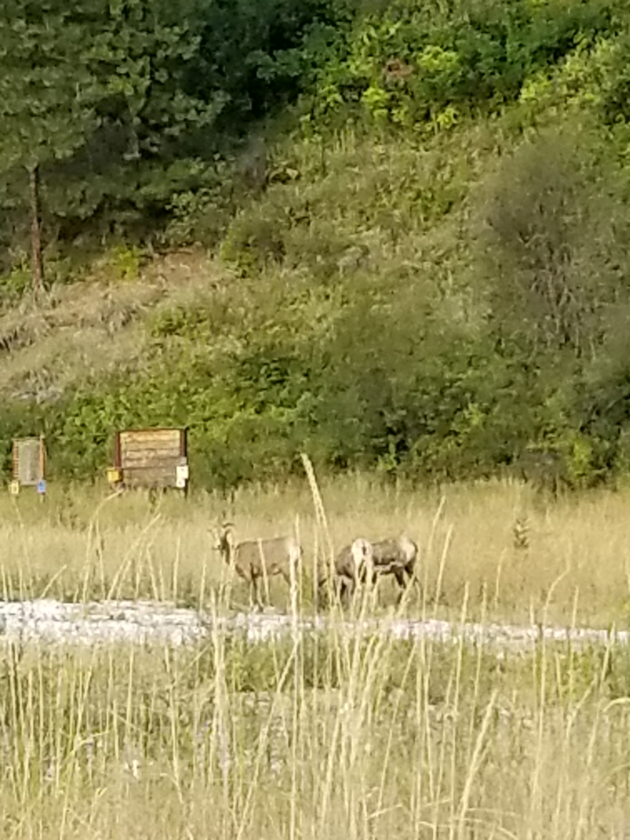
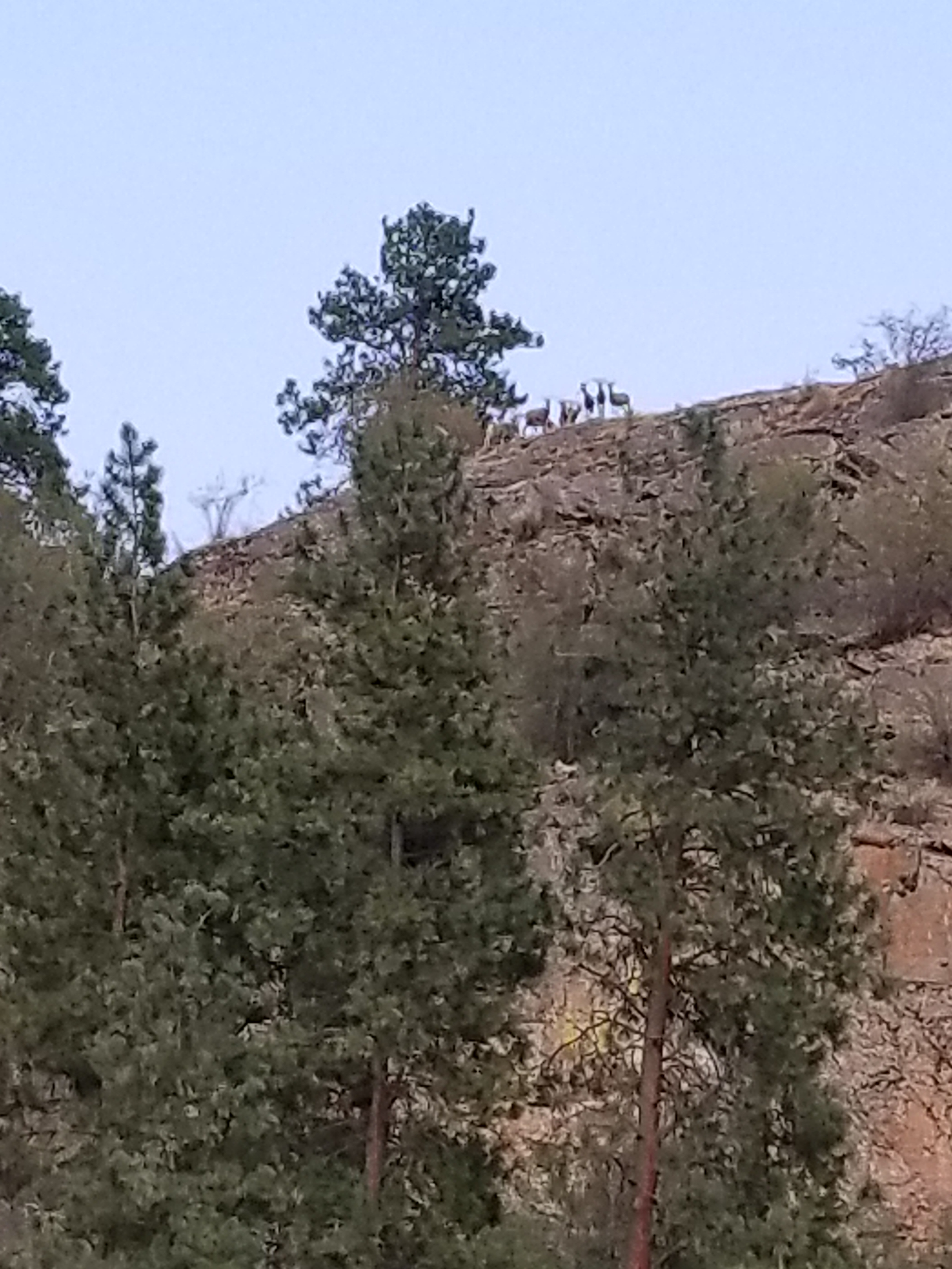
For amusement, a herd of mountain sheep went up and down the hillside in front of me. The younger ones even came down to eat. However, when the dominant Male returned, they just watched me and even when I got in my tent he would not let any of them come down.
The younger ones came down to feed while adults remained up high.
Once the alpha Male returned, he kept the herd up high looking down on me.
July 25, 2018. From Okanogan Forest camp to Cougar Creek camp. 22 miles
I was not well rested after the rough night. Still, I packed efficiently and even forced myself to eat my breakfast of cold-soaked 10 grain cereal.
It was a beautiful day for hiking along this seldom-used road. I had seen no cars on it yesterday. With this solitude, you would not be surprised that when it came time to perform an important bodily function, I simply took off my pack and went a few yards into the woods to dig my cat-hole and take care of business. Well, as Murphy’s Law would have it, another hiker, heading the opposite direction, comes walking down the road. Nobody for days and this guy walks up on my dump. I tried to recover as quickly as possible, but it was certainly awkward.
We chatted briefly, but I was eager to get on with my life.
Later, as the day got hotter, I took the aptly named Sweat Creek Trail. It was a tough climb on a hot afternoon. Perhaps some steep climbs, I heard the chainsaws of a trail crew. After waiting in the distance for them to see me, I had a good, short visit. It was two adults and three teenage helpers. They were a legitime PNT crew. I expressed my gratitude for all the work they do and showed the younger ones all the scars on my legs from going over blowdowns, etc. Also, I let them know I was a dues paying PNTA member.
Their work is hot and difficult. I whine about carrying a backpack in hot weather, but these folks get up, put on long pants, work boots, hard hats, carry their gear uphill to the worksite, and labor in the sun all day. I thanked them again and let them get back to work.
Part of the work this crew had to remedy was eliminating misleading cattle paths. Generally, cattle are fairly good trail makers, sometimes they riff on their own. What this means is they will very often follow the main human trail, but, when it suits their bovine fancy, they cut a new path. Thus, in many areas a hiker has a very difficult time telling the difference between the human and cow paths.
On my way downhill, I could see the trail crew had a lot of tree and cattle work. As if to prove the point, I encountered a small herd of about three pairs of cows and calves. Always, I stop and talk in a calm manner when I see cattle on the trail. While sometimes they amble off safely, other times, like this one, one bolts and the others follow. You might be surprised how agile these animals at going downhill at speed, jumping over obstacles. I waited a few minutes so they would not feel threatened. I don’t want either a calf or cow to get hurt running.
Unfortunately, I’ve seen this movie before and was not surprised to have the same process repeated. Two more times. In all, they probably ran downhill for a 750 foot elevation loss over a mile. Finally, one of the cows went left off the trail and the calves, who normally choose the trails, chose to follow her.
It was evening by the time I reached the bottom of the trail. The guide book made a vague reference that the trail seemed to go on private property but to veer left. Mild understatement. The trail basically dumps right in to someone’s yard. I didn’t see a dog, but clearly somebody lived in the trailer parked there. I went immediately over to the edge of the yard and moved quickly and quietly away.
Eerily, the occupant(s) had a fascination with skulls and decorated their yard with several plastic skulls and skeletal parts. At age 56, I am just too damned old to be abducted and converted by some cult. Think about it. You never hear about guys like me getting captured and converted, it is always younger people. So, I kicked in to high gear and got the heck out of there.
I came out on a public road. It switched between private property and public land. There were definitely some unique homesteads along the way. Maybe you live in a suburb or a nice urban setting. Indeed, you’ve also probably seen poor, blighted urban areas. However, taking a long walk really draws out a different variation of the American dream. There are rural areas where it is either the start, or fulfillment, of the dream to get a piece of land and park an RV or Camper on it and call that home. Sometimes there is evidence of a more permanent, traditional structure in various stages of completion. I can sort of understand the pride of ownership angle, but most of the situations appear to never convert to permanent housing. Instead a second or a third trailer is added. (I shudder to think what their septic solution looks like.) Pointedly, most of these smaller homesteads were the most prominent displayers of “Private Property” or “Keep Out” with a few specifically mentioning government officials. (Note I have the honor of working with municipal employees in my community and can’t recall any kind of professional that works harder to be fair, judicious, and considerate.)
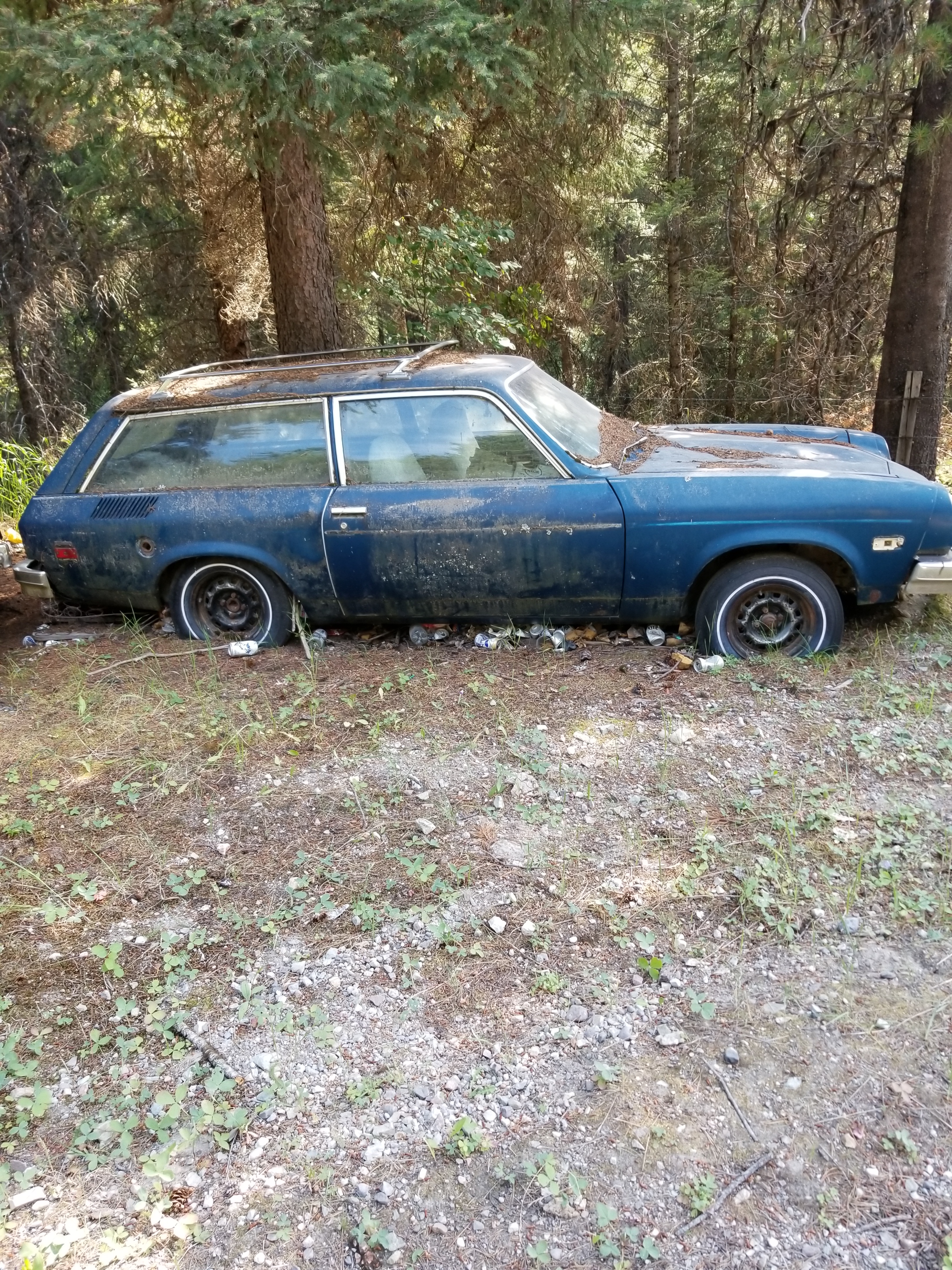
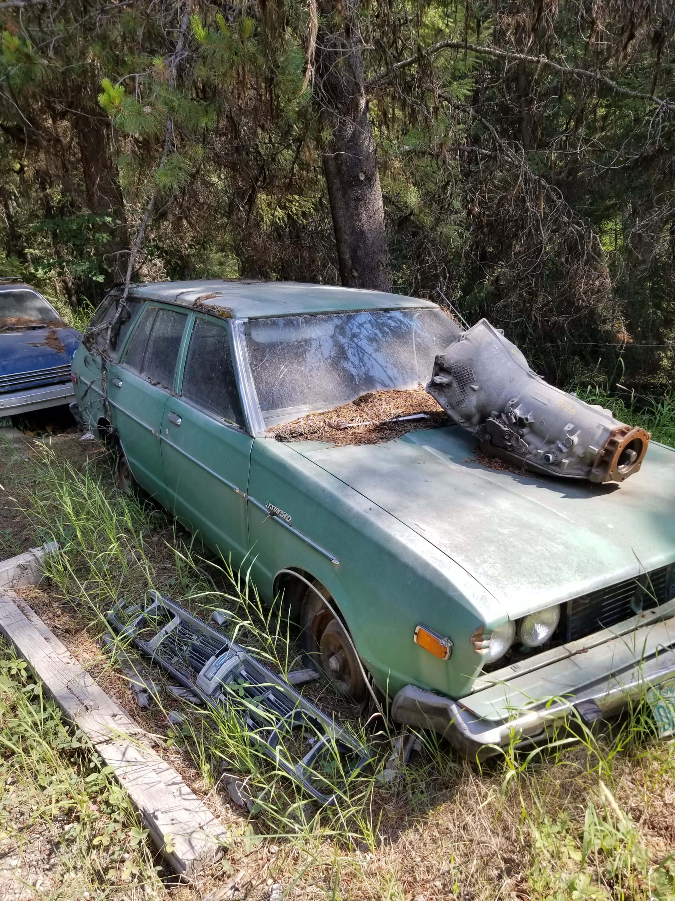
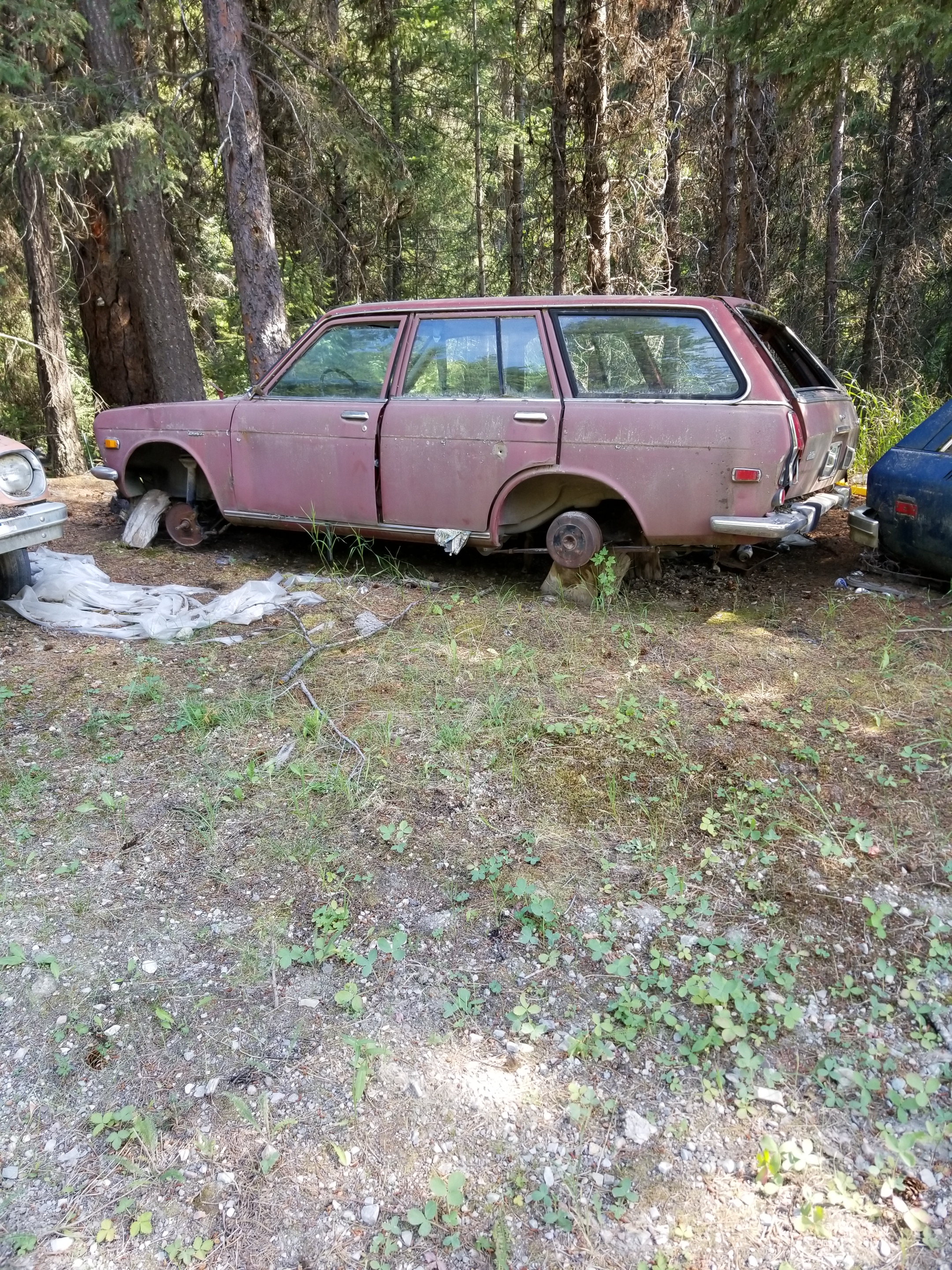
I passed a few properties where they spilled some of their excesses on to the public right of way. I’m not a “car guy” but one place was occupied by one who convinced himself (and perhaps a long suffering wife), that he would hold on to junkers to “part them out.” To nobody’s surprise, the Dodge Aries and various Datsun models did not generate much demand, so these vehicles decorated the road.
Eventually, I found a flat secluded spot on public property down by the creek. It got darker faster in the narrow valley. I ate my dinner while shooing away yellowjackets. I pitched my tent, hydrated some more, and went to bed.
While I initially dropped right off to sleep, in the night I was awakened by a sound. Not one crunching in the woods or brushing against the tent. Eerily, it came from underneath the tent. In the ground, there were subtle digging sounds and then a muffled pig-like snort. Being a guy and having lived in apartments, I naturally reacted by pounding on the ground. That produced silence. For a few hours. I had to repeat this one more time. In the morning, when i packed my tent, I could not see any obvious signs of tunneling or disturbed earth. I’ll never know what it was.
I find it fascinating that spruce trees will “feel” that they are dying and produce these clusters of robust growth, kind of like the opposite of cancer cells. I’m not sure if these anomalous growths are then intended to jumpstart regeneration when the tree falls.
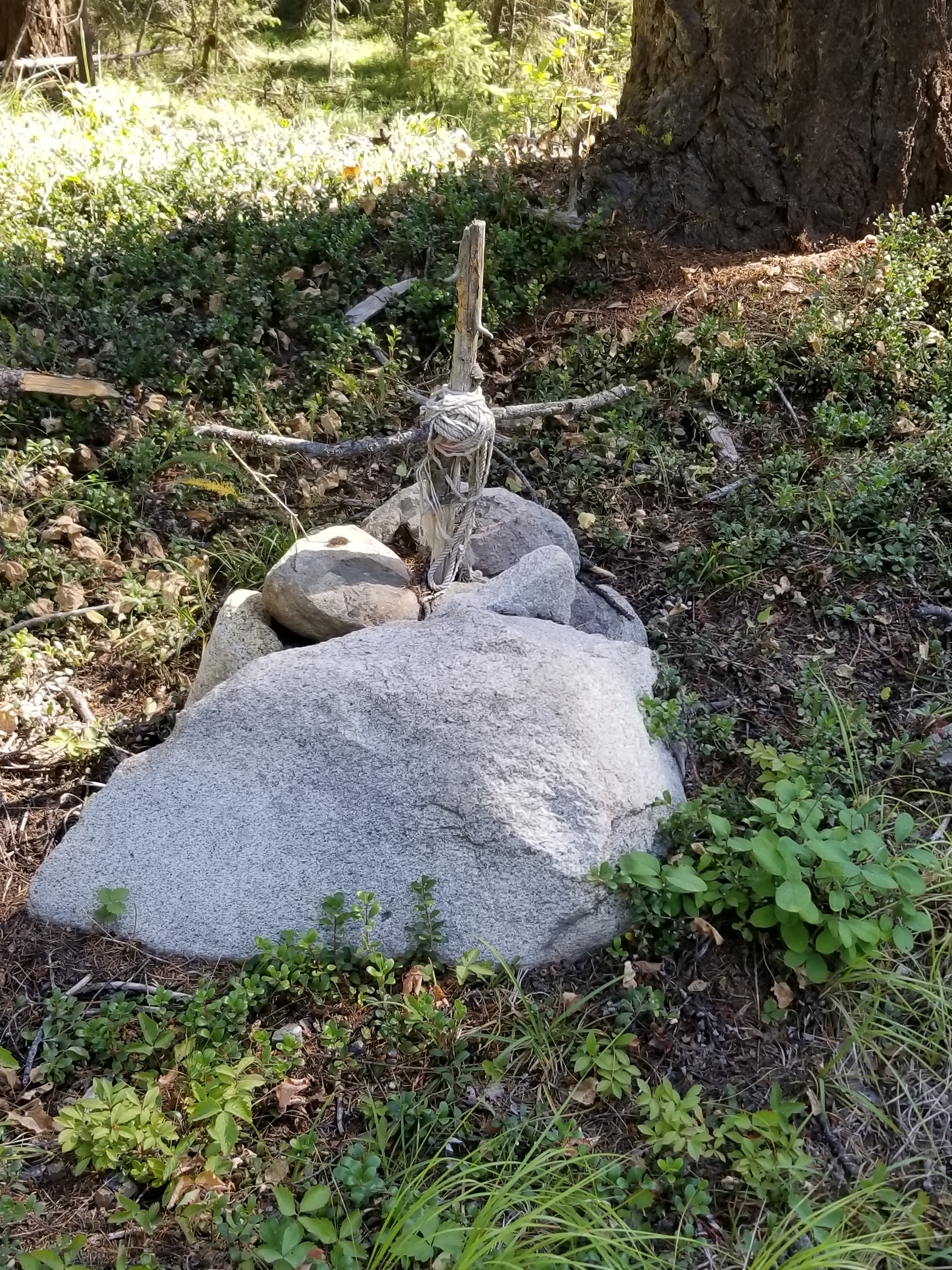
Saw this grave marker along the gravel road this morning. Couldn’t tell if it was for a pet or an unpopular relative.