Penultimate Day

August 26, 2018. Stealth camp before cedar Creek to stealth camp before Yellow Bank.

I got up early because low tide was around 7:30. The first part of my morning was easy hiking on firm sand. It was overcast with de minimis drizzle.

After the easy hiking, I rounded one headland and fortunately hit another lengthy sand beach leading up to the Norwegian Memorial and the adjacent campsite. The Prince Arthur of Norway crashed on the rocks nearby in 1903 and a monument was erected in honor. There were some appropriate mementos at the base of the memorial (flags for the US and Norway) and inappropriate (a shoe insert).

I could’ve stayed at this campsite, but it was still morning and high tide would not happen until after 1:00. However, designated campsites after Norwegian required a reservation. I opted to get close to the first restricted site (Yellow Banks), leaving just six miles of beach before reaching the trail’s end at Cape Alava tomorrow.

Based on this decision, I had to do some rock scrambling. Along the way I found an amazing variety and volume of waste on the beach. Fishing nets, flotation devices, cable protectors, rusty barrels. The most depressing was the sheer volume of plastic water bottles. Worse, so many of them were half full. Terrible.

Fortunately, no head was attached.
I was shocked by the large amount of netting that had washed up.
Try as I might, I couldn’t come up with an explanation.
OK. So just once in college I did experiment with Happy Time Assortment.
No comment.
This headless skeleton appeared to from a sea lion.

I found a cove that seemed very remote based on the amount of material washed up. It had little beach and a lot of driftwood. Since high tide would be in soon, I opted to get up high and wait for the tide to recede. I found a good spot and even managed a short nap.

Moving again, I soon approached Yellow Banks. Before it, there was a well-used campsite that I grabbed. I had a late dinner and watched the horizon, hoping for a repeat of last night’s show. Unfortunately, the sky remained gray. As this was my last night, I reflected a bit but did not get sentimental. It was time to finish.

This decoration marked the entrance to my camping spot.
Looking up the cove, I could barely see the Yellow Banks.

A Little Goes a Long Way

August 25, 2018. From Forks to a stealth camp between the Chilean Memorial and Cedar Creek campsites.

I enjoyed my last shower and went to the transit station. I was going to take a local bus over a 6 mile stretch of highway with non-existent shoulders. It would drop me off at a corner gas station from which I would walk five plus miles to ONP and Rialto Beach.

The skies were gray and damp, promising rain. The bus stop at the corner station served breakfast. I couldn’t refuse. The only choice was a breakfast burrito. I grabbed my coffee and sat down to wait while they cooked it.

While checking my maps and tide tables, a backpacker came in and asked if I was doing the PNT. He was doing a short coast hike, but recognized the PNT maps from a few years back. His trail name was Tiger Lily.

The breakfast burrito was simply a frozen one they microwaved. Alas, beggars can’t be choosers, so I ate with gusto. And a hell of a lot of salsa.

I refilled my coffee and wandered out to begin hiking down Mora Road. Almost immediately it started drizzling. I got out my umbrella. I must’ve looked like a sissy backpacker with my umbrella in one hand and my coffee in the other.

Not caring what I looked like, I made steady progress west. At times there was no shoulder. Almost always cars gave me ample room. If I could hear a car approaching from behind and see one coming I just stepped off into the bushes. When I reached the ONP boundary, the speed limit mercifully dropped to 25 mph.

I arrived at Rialto Beach. Despite the drizzle and cold, the parking lot was full. I used the faucet to fill up on fresh water. Like most tourist locations, about 70% of the people stayed within 500 feet of their car, so very quickly I was on uncrowded beach.

This beach was mostly sand with driftwood stacked up past the high tide line. The tide was coming in, so I found a sheltered spot, got out rain gear, and with my umbrella made a dry spot where I tried to nap with limited success.

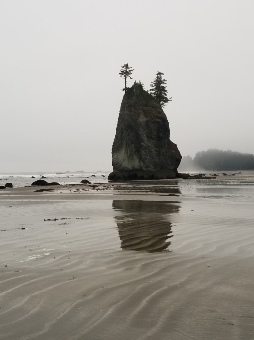
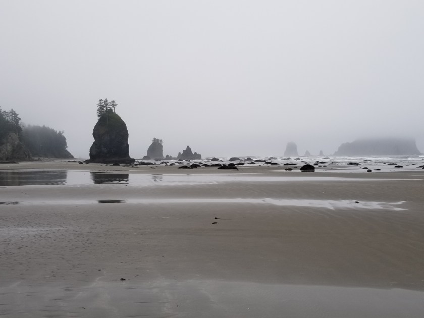
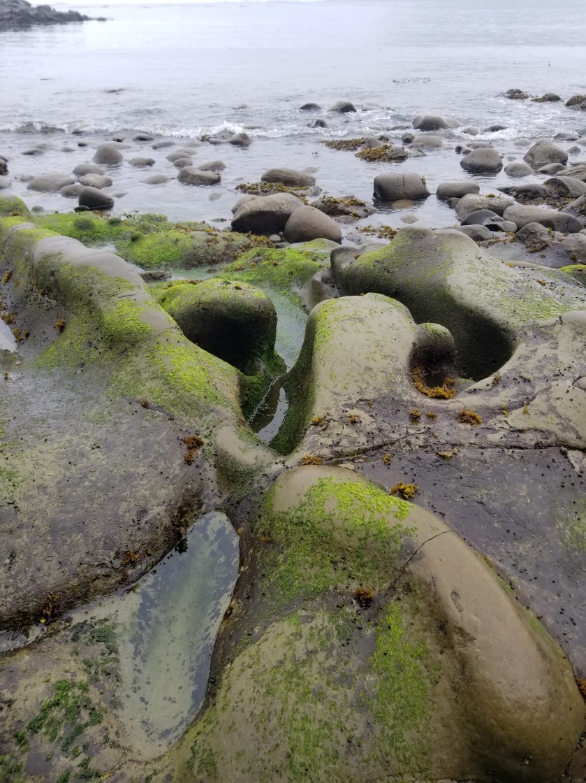
As the tide turned, I packed up and went north towards Hole-in-the-wall. If you’ve never backpacked on a sandy beach, it primarily consists of trying to find the firmest sand. Soft sand saps energy. On rocks, the name of the game is not putting all your weight on the slippery rocks and plants. Plus, have trekking poles or a stick to help with balance. I didn’t want to break my expensive trekking poles on the last couple days so I just found a sturdy stick.

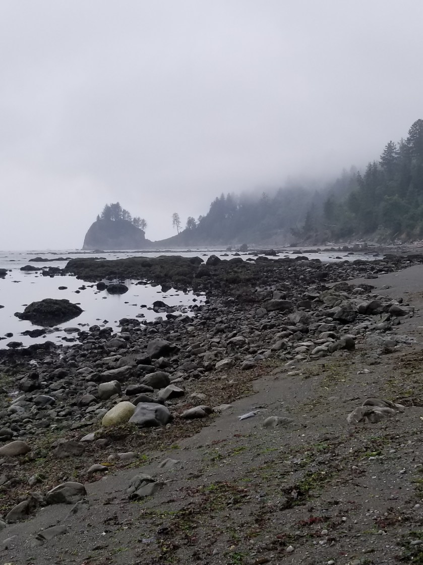
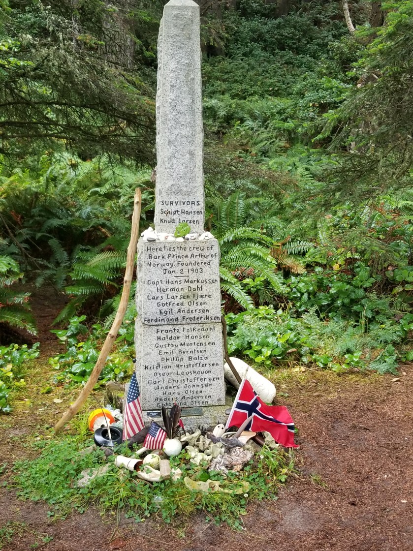
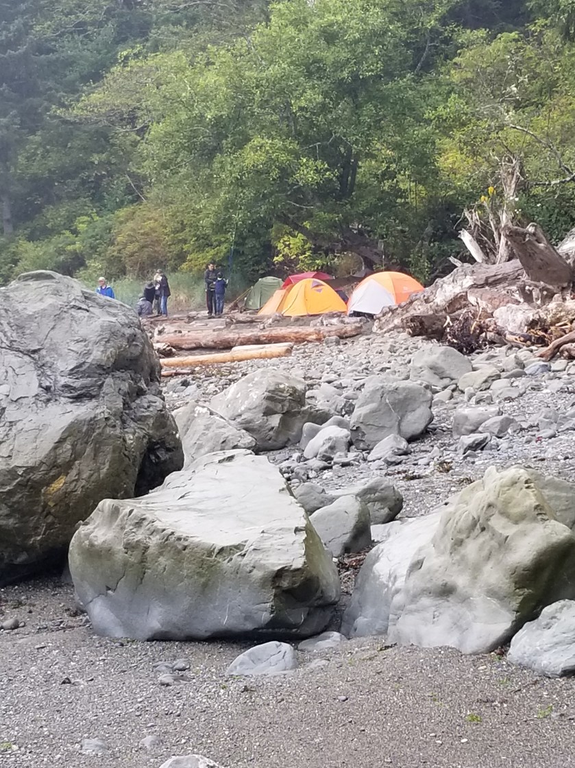
I cleared Hole-in-the-wall easily. I loosely joined three guys hiking north to their campsite, the Chilean Memorial so named for a monument honoring the sailors from a Chilean ship that wrecked off the coast in the 1900s. The guys were from the Seattle area and doing an out-and-back. We navigated some slippery rocks.

At Chilean Memorial there was a dense tent-city. I was glad I wasn’t camping there. Instead, I was aiming for a stream about three miles north.

Coincidentally, I ran in to Tiger Lilly. We talked for about an hour to let the tide drop further to ease hiking around Cape Johnson. He was a Park Ranger, off duty, and had extensive hiking experience.

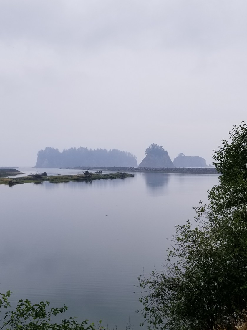
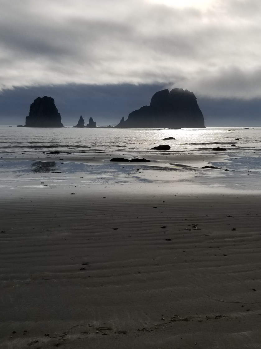
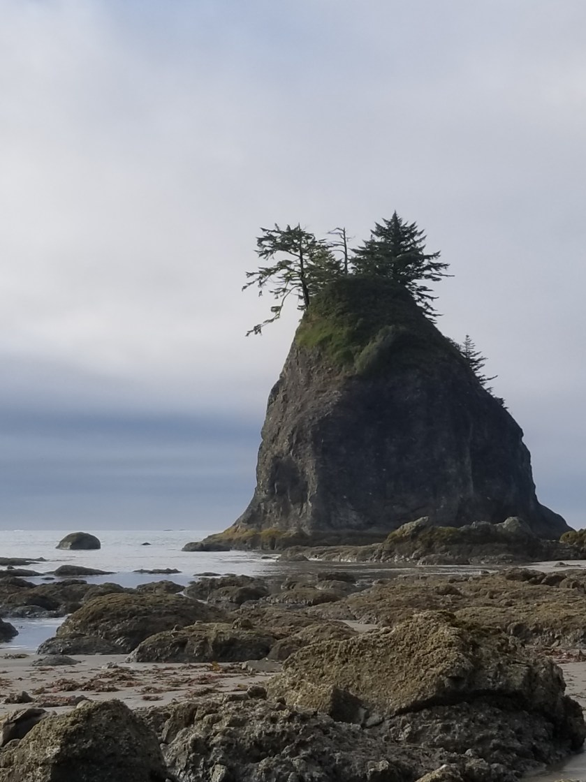
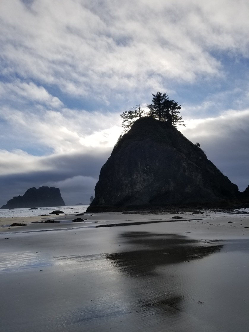
I crossed one headland using the ropes, but most I went around. As the afternoon ground towards evening, the drizzle ended and the sun even poked out. This was especially nice to highlight the various islands near the shore.

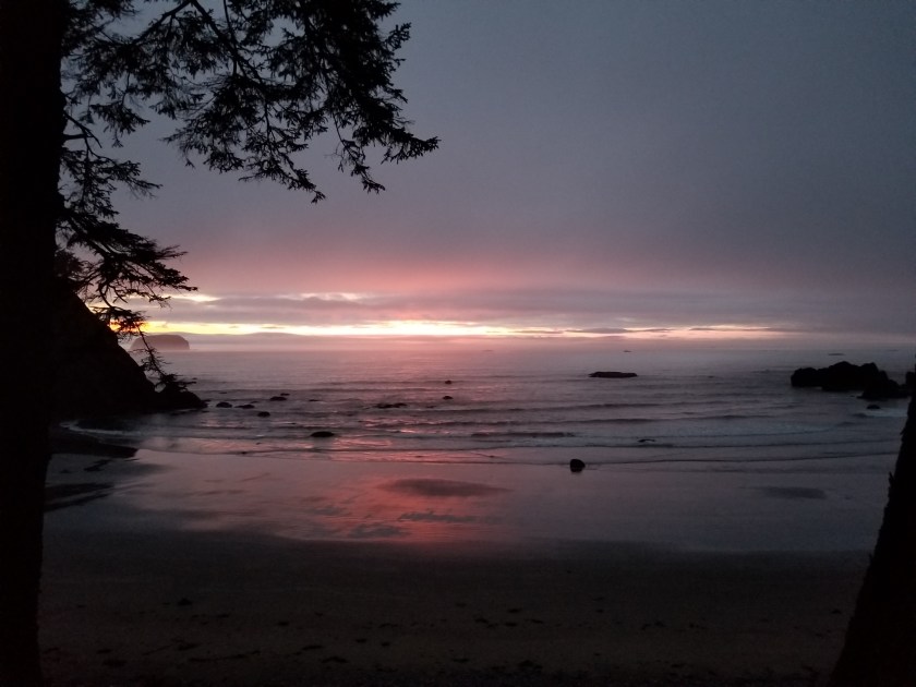
Around 7:30 I found a great campsite. It was about 60 feet up a bluff, under a large pine. It even had a fire circle which would’ve been nice.

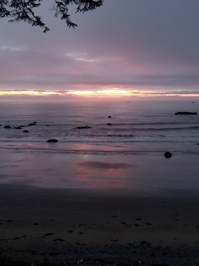
I enjoyed my next to last dinner watching the tide recede towards the setting sun. To my delight, the sun actually pierced the clouds on the horizon giving me a light show before bed.

I put my bear canister in the bushes a distance away. They say it is not bears so much as raccoons that necessitate the canister precautions. It turned out to be a great day.

Long Day in a Burned Forest

July 21, 2018. Stealth camp near Kettle River to unnamed saddle in Kettle Mountains.

The night was very still. I heard some coyotes around midnight doing roll call. No problem with the camping.

As I continued down the road to cross the Kettle River, I walked along a quarter mile of the plateau and not a single private property sign was posted. I was relieved.

After crossing the river and highway 395, I was on a gravel road, passing a large piece of private property which had been logged. As best I can tell, the way landowners make a living is to graze cattle on their forest land and then periodically harvest timber. I would imagine lumber shortages and tariffs probably pushed a lot of folks to harvest lumber sooner rather than later.

Today I was feeling a little sluggish on the relentless gradual climb. I tried hydrating more, but it was tough. Plus, there were about six young guys on motor bikes whipping up and down the trail leaving annoying dust clouds. The scenery was nice, though.

These ferns grabbed a slice of morning light as they grew on top of a boulder.
Indian paintbrush (red/orange) and lupine (purple) are attention getters in meadows.

The day changed tremendously when I entered the burn area. In 2015, a massive complex of fires swept over a large swath of this country. I entered an area of standing deadwood, charred fallen logs, fireweed, and lupine. The trail dwindled from a gravel road used to salvage usable burned wood to abandoned forest service roads with multiple blowdowns.

It is such a contrast between the massive carnage of a forest fire and the rapid evolution of plants scrambling to seize the open terrain. Lupine has an explosive takeover strategy. It develops seed pods that twist and then pop open, scattering seeds. The most interesting thing to me was the absence of pine, spruce, and larch seedlings. They must bide their time and rely on their height genetics to overcome the early lead of other plants.

I’ve only seen two sets of footprints. That is, until I got to an intersection with a paved road. Then, a new pair of prints appeared. This was the famous Kettle Crest Trail.

Kettle Crest was a well maintained trail. I could not recall how many days since I had been on a real trail. It was good, but again seemed more like a bike trail than a hike trail.

I was able to get my last water supply and then followed the trail as it switched back and forth uphill. The map showed three turns, but there were at least six.

Fireweed
Sorry for bad focus, but seeing fireweed next to something that looks like a delphinium was an unusual sight.

Eventually, I reached the saddle I was shooting for. There was about 45 minutes before sunset. An odd cloud of smoke hung in the air. Plus, for once, it was windy. So, I made camp quickly, avoiding standing dead trees. I pointed the open end of my tent away from the wind. I had to put on my wool hoody plus my down puffy.

View from the saddle. The mountain saddle; I’m not on horseback.
Sun behind smoke cloud.

As a shock element, while I was eating my dinner, a mountain bike went whizzing past. Not sure if he saw me, but I hoped he made it to the road before dark.

My Zpacks Altaplex tent. The company stopped making them. Too bad because they were great for tall people.
First fire, then wind carved this.

It was the first cold night in weeks. I liked it and I liked sleeping up so high. It was a long hard day, but tucking in to a warm sleeping bag was a great reward.