Hello California

Day 41. August 6

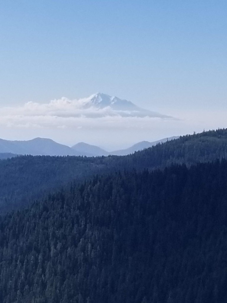
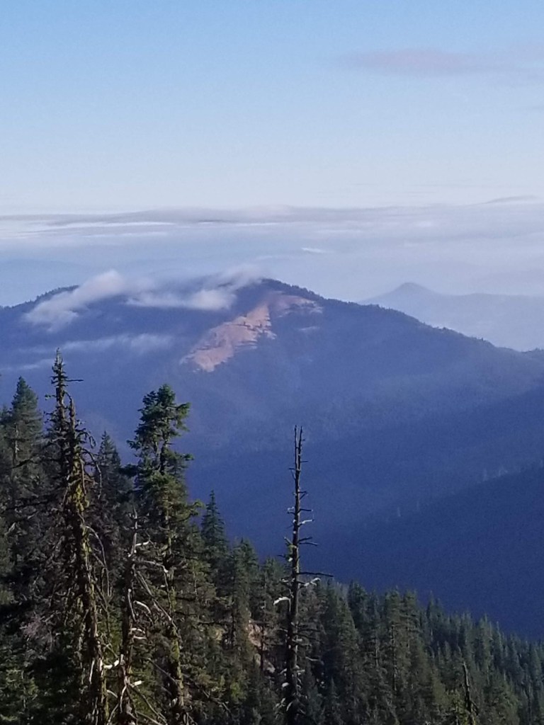
It was a pretty view in the morning. I was up high. There was a ceiling of clouds just above me. Low clouds skittered around the hills below.

Remaining clouds burning off in the morning sun.
Perfect trail

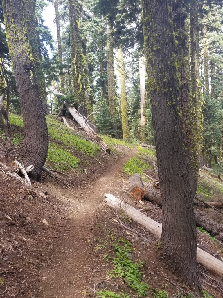
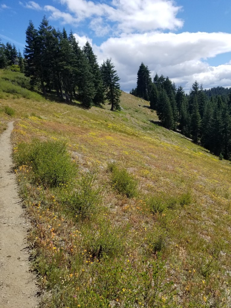
It was a great day of hiking, mostly slight ups and downs along ridges. In the late morning I came up to a wonderful water source: a spring that had been tapped with a pipe.

Spring Water.

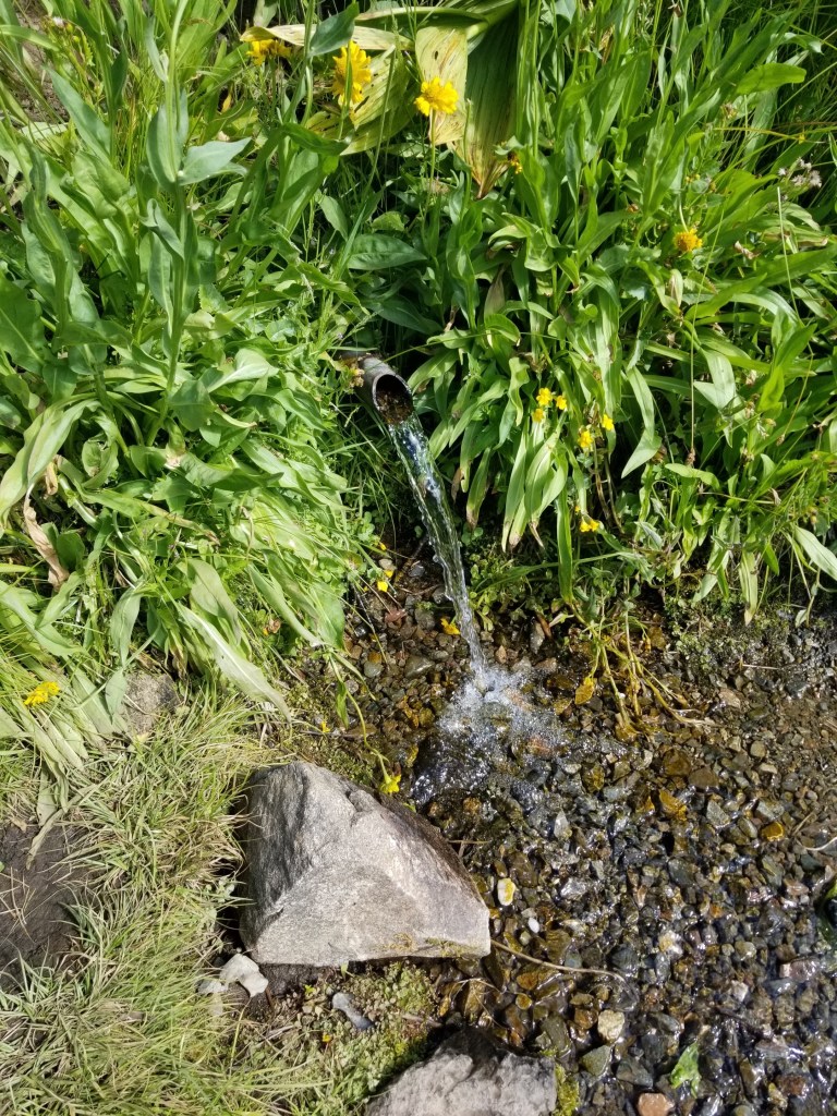
A trio of ladies came to the spring as I was filling up. They were retired and had been doing PCT section hikes for years. All at least in their 60s, they were boisterous and energetic and brightened my day.

I was just walking along later in the day when I heard some people getting out of cars and preparing to go on a day hike. I said “Hi” and kept walking. Their energetic Labrador kept running to me and then back to them. I was surprised to stumble on the trail marker noting the state line between Oregon and California. I tried taking some selfies and the day hikers were nice enough to snap a photo. Dutifully I wrote my name in the trail register and continued on, feeling a lot better knowing I had walked from the northern border of Oregon to its southern border.

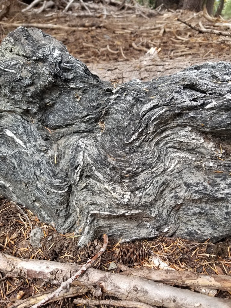
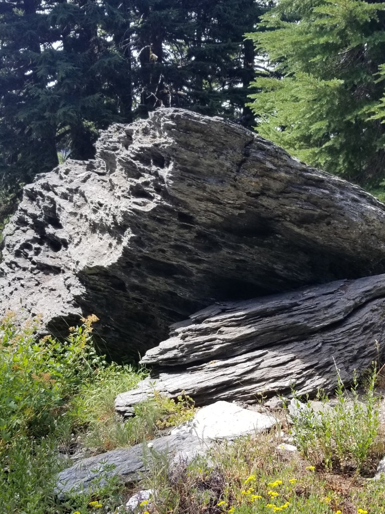
Water was just a little scarce. I filled at a creek where cattle grazed (not the best) and late in the day settled for a stagnant pond. However, there were some very interesting rocks. They had multiple thin layers. Some of them reminded me of how croissants are made…with layer upon layer of thin dough.

Layered like croissants but much tougher to chew….

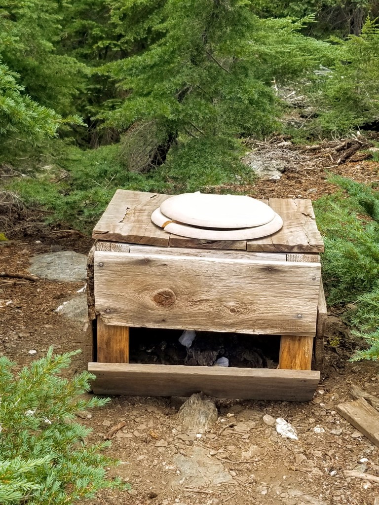
More puzzling was a strange toilet fixture. I had encountered variations of these a few times before on backpacking trips and puzzled on their purpose. They are usually a toilet seat on a wood frame about 12 to 18 inches high. Being a man who cannot rest unless I am able to unravel the mysteries of the universe, I had found that hunters make these and keep them near their hunting camps. In season, they dig a good size hole, place the fixture on top, and then have a functional, open air toilet for several days. At first, I wondered why they left them in the woods. However, when I considered the alternative of explaining to your spouse why you brought it home and your plan to keep it in the garage, the wisdom of just leaving it in the woods made tremendous sense. Sadly, I was dumb enough to go lift the lid. Even more sadly, some people had actually used the fixture and left their product just sitting there.

Leave no trace….

As the sun set, I had some sub-optimal tent-site choices. I ended up setting my tent within five feet of the trail. I always think this looks like a rookie move and didn’t like doing it. However, it was getting late and I knew I wanted to get up early and get going so I could drop down to my next resupply town, the Seiad Valley. My tent barely fit into the spot. I was surprised the temperature was falling so quickly and put on my down puffy and hat. I ended up sleeping in them, too, after setting my alarm for 4:00 am. With no wind, I was certain that if any animal walked along the trail at night that close to my tent, I would have some form of a coronary event.

Shasta sometimes seemed to just float in the distance.

Strawberry Creek

Today was a real hiking day. Lucky, Steven the Destroyer (STD), and I left for a destination called Strawberry Creek.

Initially we walked along old 4 wheel drive roads.  We ascended over some blowdowns (trees that have fallen down across the trail).  The day saw us walk in environments ranging from open, recovering burn ares, to thick forests.

At one point we came to a meadow that sloped up and the morn I ng breeze blew down the hill. Lucky saw a black bear at the top of the meadow.  It eventually heard us,got on it’s hind legs,  and ultimately bolted away. 

Towards the latter part of the day we came to a juncture.  The map indicated a traditional route around a lake or an “alternative” that was shorter but of mixed quality.  While Lucky and STD rested, I went ahead on what I thought was the traditional route.  Quickly, I became aware it was the alternate.


I thrashed back and forth through a thick bog with a lot of down trees.  My feet were soaked.  Eventually, I just decided to climb up hill, relying more on common sense than electronics.  Finally reached the trail and wanted to leave signs for the other guys.  I made an arrow and wrote “Lucky” but hesitated to add  “STD” to avoid the perplexion a traveller might have coming across a sign pointing to Lucky STD.


The trail took me through an area tha had just burned this year.  It was eerie.  Scarecly any green penetrated the harsh black, only ocaisionally broken by stark white rock.  At last, coming over a pass I found a meadow which had fresh water, greenery, and campsites.   I hoped that Lucky and STD would catch up, but was not sure.  Eventually they did and we camped in a meadow for a night that was clearly going to get cold.

Impressive First Day

Fun-filled first day capped off with a bear.

Well, that bear video I discussed yesterday was tested today.

Before that, a little background.   I shuttled to the border crossing with three experienced hikers.  After border photos we started hiking around 2:00. Very easy hiking with great weather.

image

We basically walked up a valley to a lake for 10 + miles.  At the lake the mountains climb sharply from the shore. 

image

image

image

Great first day.

Oh, I almost forgot. We had a large grizzly come through camp like he owned the place.  The only thing that eventually spooked him was one of the guys I’m hiking with banged on the metal bear box.  The hiker’s trail name?  Grizzly Bait.  Couldn’t make this up if I tried.

image

On reflection, we all had bear spray,  stayed as a group and walked backwards away.  So far, good script.  Bear had not seen video and kept coming down path through camp.  He knew where cooking area was and could not care less how much we yelled.  In the sequel, loud percussion will be featured. 

Can’t wait for tomorrow as it is supposed to snow and we climb 2400 feet up over Red Gap Pass which allegedly has a steep snow field to traverse. Yes!

Why Brave the CDT?

I have committed to hiking the Continental Divide Trail starting in June, 2016. Here is a little bit more information about the trail and why I selected it.

What does CDT stand for?

The most relevant meaning of CDT is the Continental Divide Trail.  It connects the northern and southern borders of the United States while striving to stay as high as possible along the Continental Divide of the U.S.  Officially, it is the Continental Divide National Scenic Trail as defined by the National Park Service (NPS).   The NPS lists 10 National Scenic Trails.  Most people familiar with backpacking in the United states think of the three main north-south routes: the Appalachian, Pacific Crest, and Continental Divide trails. Completion of  the three main trails earns the title of “Triple Crown” although as American Pharoah might clarify, it is a backpacking triple crown.

The route crosses all forms of land ownership.  While mostly on federal government lands, the trail also crosses state and private land.  It combines formally marked trails with roads, paths, and, at times, sketchy bushwhacks.  Indeed, there are actually a variety of routes one can take that fulfill the spirit of the trail compared to the formal “official” 3,100 route.  My brief survey of southbound hikers who kept journals on either Trail Journals or Postholer between 2006 and 2014  found that there were 38 succesful completions.  Of these the  average trail distance was 2,491 miles and they completed with an average time of 141 days.  (Aside:  I noticed an inverse correlation between the amount of pre-hike journal posting and the likelihood of success.  Thus, I will try to only write a few pre-hike blog entries to avoid jinxing my trip.)

Who manages the CDT?

There is an umbrella non-profit organization that attempts to coordinate all matters concerning the CDT. Although the NPS has overall stewardship of the National Scenic Trails, it relies on non-profit groups to actually coordinate the day-to-day management of trails.  In the case of the CDT,  It is the Continental Divide Trail Coalition (CDTC).  I have donated money over the last few years and hope that others will also contribute as the CDTC leads lobbying, trail maintenance, and community relations efforts.  I did receive a t-shirt from them with their motto:  Brave the CDT.

Besides Central Daylight Time, CDT is also the acronym for Clostridium Difficile Toxin.  I had that little bacterial gut bomb  after my appendectomy several years ago.  You can look up the symptoms and treatments yourself, otherwise you can take my word that having CDT makes you feel crappy.  I recovered and now hope to complete this hike and Brave the CDT a second time.