Another motel continental breakfast got a bit of food and coffee in my system. I left the motel and found a route that would intercept the official PNT right near the coast. I perhaps owe an explanation. There was a state park where I could’ve camped in my tent. It was about another 6 miles. However, with a perfectly good town nearby, I grabbed a motel and a cooked meal.
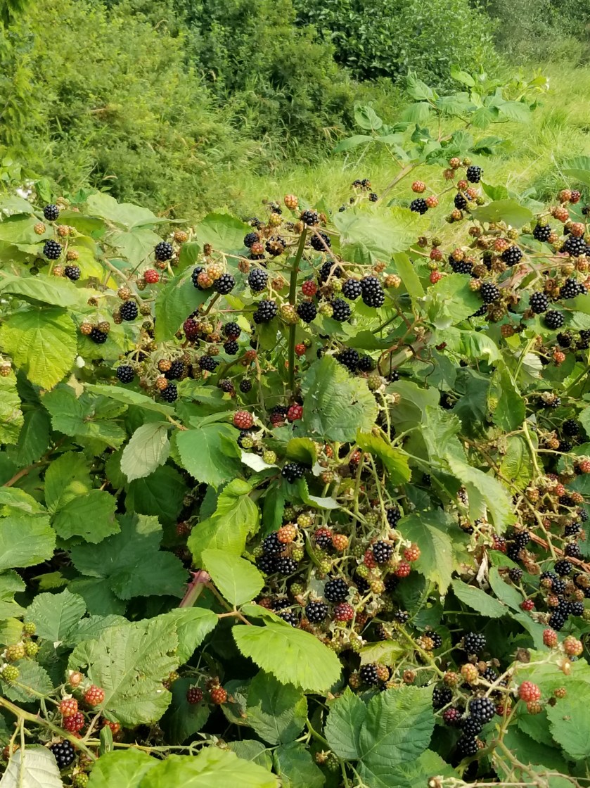
The route I chose did walk me through this military-based town. I went by huge walls of blackberry plants and finally encountered people harvesting these beauties. Back home, I would probably pay $5 for a pint, but out here the plant is a nuisance and it is amazing to see so much ripe fruit just waste away on the vine.
When I reached the beach, the tide was high so I walked the nearby road. It was fairly boring. In another unique PNT moment I was walking along and a car came towards me, looked at me, and slowed down. In about a minute it had turned around and crept up beside me and the lady inside asked if I was a PNT hiker. She was the local trail angel and she and her husband hosted hikers, including the Brits currently.
She offered a lift and encouraged me to stop by. I stuck to the road walking and reflected how nice it is that people are actually keeping an eye out for hikers.
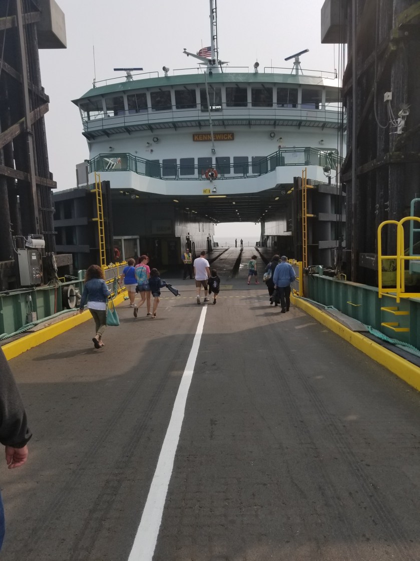
Once again I found myself near the dreaded Highway 20. Fortunately, there was a nice bike path that was parallel and I took that until I could cut over on farm roads towards the ferry. I was walking down a quiet Engle Road and was about two miles from the ferry terminal when a small local transit bus went flying by. It braked hard. It started backing up. I shook my head, indicating I was not looking for the bus, but still it backed-up the road. The driver asked if I was going to the ferry, I said yes and before I could explain that I wanted to walk, he got urgent and said we could just make the next one but I had to hurry. There was another, older couple on the bus. The driver was a little edgy, like he had downed a lot of coffee, but he got us to the terminal just in time.
I kind of like ferry rides. Even though this one is short and despite the smoke in the air, you could still see the outlines of islands. Port Townsend appeared as we docked and I was close to a motel and a zero day.
I did leave early, but somehow I managed to wake up Not Guilty. I said good-bye and we thought we’d meet in the next town (7 miles) for breakfast.
There was a timber harvest going on so there were some temporary trail closures that got me confused at times. Still, I made good time while the sun rose through the smoke filled air.
How would you like to wake up to this crawling across you?I loved how the most covered the dead branches.This boulder, I believe it might be classified as an erratic, was huge.
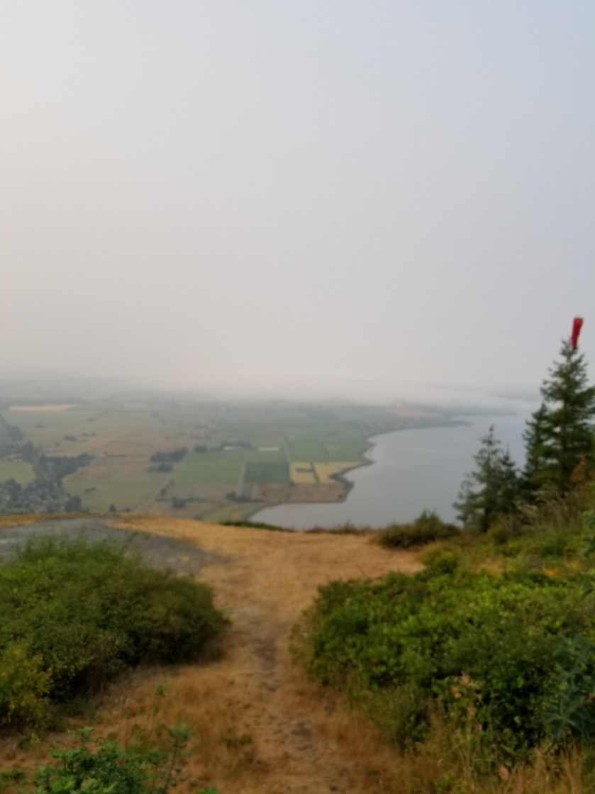
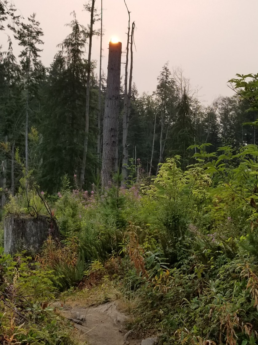
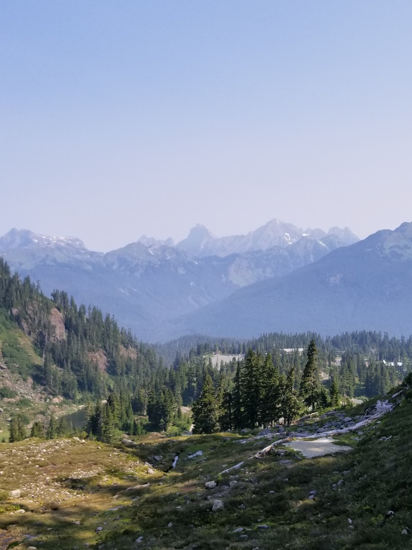
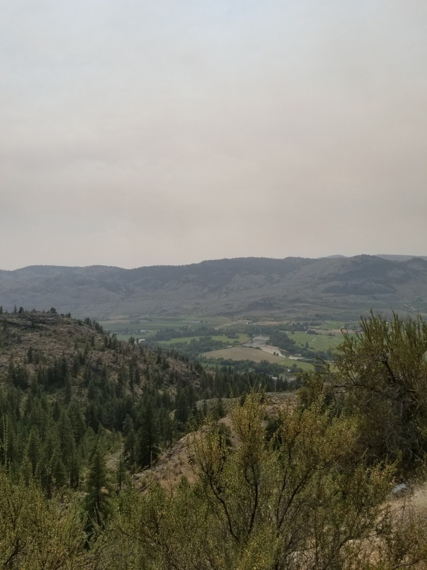
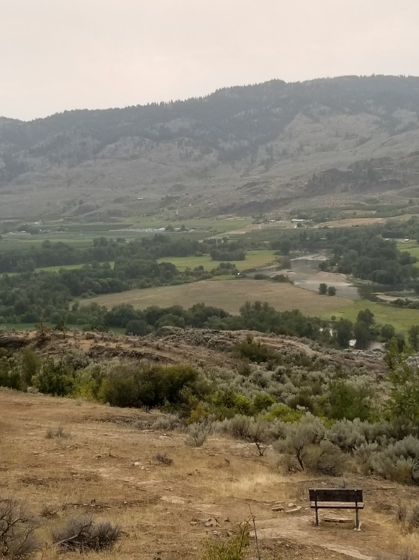
I got my first glimpse of Puget Sound, but a glimpse was all given the haze. This would be a spectacular trail on a clear day. At the bottom of the trail, there was a carved stone marker related to the PNT. All the words were spelled correctly. However, the math did catch my eye, not adding up to even 1,100 miles when the trail today is over 1,200 miles. Must be reroutes and other changes.
When this monument was made. The trail only covered 1 106 miles.
I finished walking down the mountain on Highway 11. A bizarre event happened when a shiny new black pickup pulled up next to me and asked me oif I had camped up on the mountain. The driver looked like a cop. I said yes. He asked if I had seen anybody else. I explained Not Guilty was on his way down, but otherwise no. He revealed he was with the railroad police and was looking in to somebody shining a green laser into a train engine last night.
Once the road flattened on the coastal plain, I started seeing a lot of bicyclists. It was flat, open farm country that backed up to the Chuckanut range. When I reached the small town of Edison, there were two cafes right there. Both, unfortunately, were closed. I went up to see the hours, but was disheartened to see they were both closed on Monday and Tuesday. Yup, I was in a tourist area.
While I was on the porch, a lady in a Subaru rolled down her window and asked “Can I help you?” which I interpreted as “what the hell are you doing peering in the window, bum?” When I explained I was looking to see when it would open, she said everything was pretty much closed, but down the road about a mile there was a bakery open. She then offered a ride, which I declined. I clearly had misinterpreted her.
When I got to the bakery, the same lady was out front, caring for the decorative flowers in front. I said hi and thanked her again for her help. We chatted for a bit. Under the heading “Small World” she was from Wayzata, Minnesota which is the town adjacent to where I live.
I ordered some delicious looking baked goods at the bakery (called ‘Breadfarm”). She came in, gave me a bunch of organic carrots she grew herself and paid for my food. I thanked her profusely and then decided to pay it forward.
I told the lady at the counter that a backpacker named Not Guilty would probably come in. Last night he had told me how much he loved good focaccia bread. So I prepaid for a small loaf and described him. I hope it worked out.
The rest of the day was a long but pleasant roadwalk near the coast. That is, until I reached Highway 20. I pulled the ultimate bonehead hiker move. There was a gas station where the trail put me on Highway 20. I got water and a coffee and put my feet up. Then, I started walking along Highway 20. About a mile later I saw some road signs that did not make sense. I then checked my phone app and discovered I had walked a mile the wrong direction. Fortunately, I was near an intersection and able to safely cross the highway.
Just as a I was heading back, a Mercedes van pulled over in front of me. The driver popped out heading towards me. He didn’t look like a nut job so I wasn’t too nervous. Turns out he was a PCT veteran heading to PCT days and thought I looked like a PNT hiker. I confessed I was, declined hi generous offer of a ride and learned his trail name was “Meander”. Neither he nor I mentioned I was about a mile off course. There is honor among backapckers.
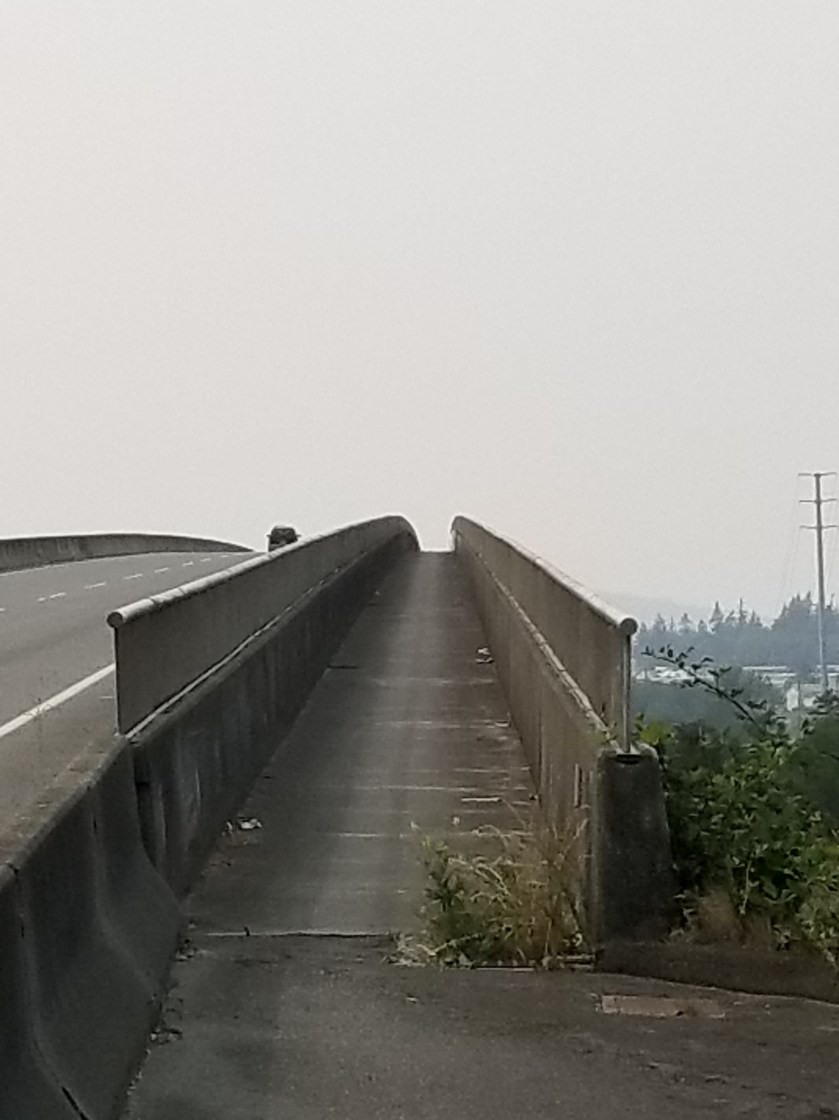
The next few miles were simultaneously boring and life threatening as I followed Highway 20 in the right direction. Along the way I was amazed to see how many birds are killed by cars. I also found some dude’s paycheck. I took it into town and would mail it to his employer. Lastly, I went over this huge bridge that thankfully had a separate passenger path.
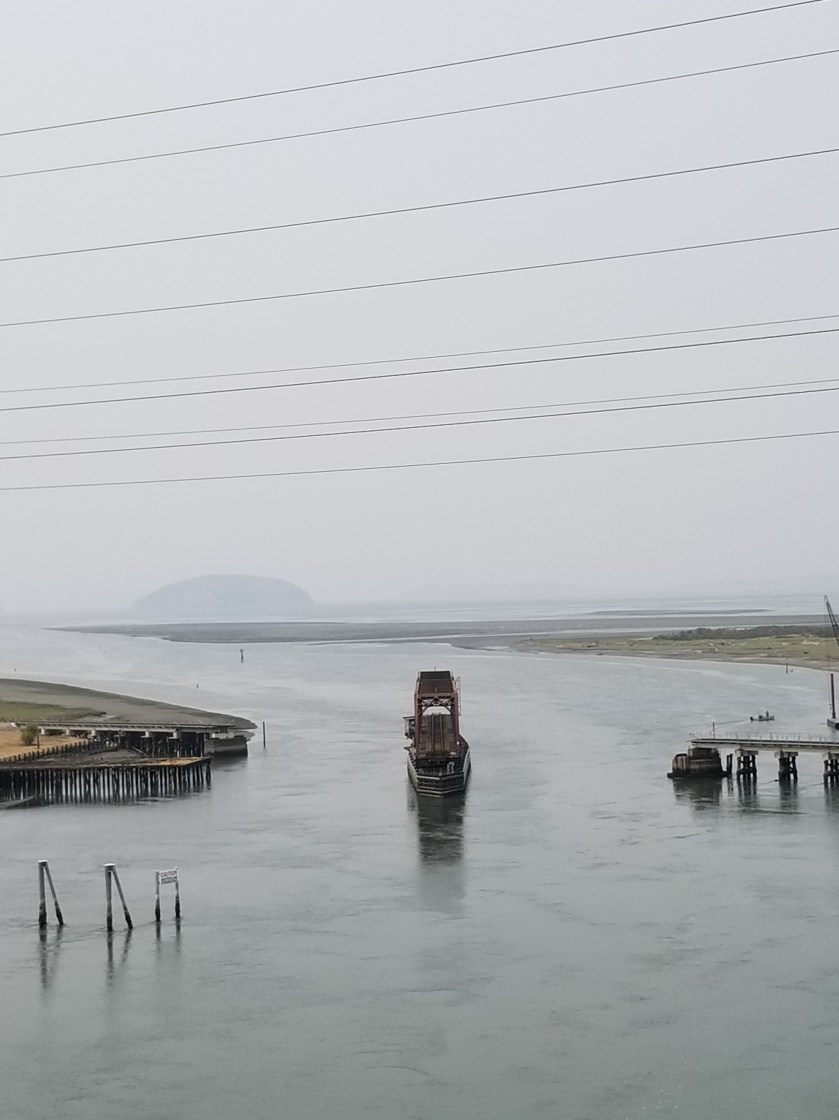
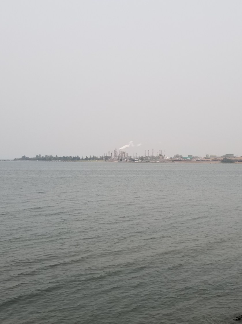
Rather than take in the whole scenic walk around an entire oil refinery, I took a minor short cut. Then the trail goes over Fidalgo Bay for almost a half mile on a hike/bike trail. The tide was coming in and there were harbor seals and an otter feeding just off the bridge. It was fun to watch.
My last unusual human interaction happened when I finally made it to Anacortes proper. A bicyclist pulled up and asked me if I had been much further up the coast earlier in the day. I said yes. He said he had seem me walk by his office and recognized me just as he was getting home. Nice guy and he gave me a solid restaurant recommendation.
The restaurant was great (Naung Mai Thai Kitchen). Stuffed, I tried to go to sleep early, with some success.
August 12, 2018 From motel in Sedro-Woolley to Lily Lake on Chukanut Mountain.
I was foggy from a bad sleep and seemed to pack in a similar manner. I only had around 20 miles today and most would be on pavement. Reluctantly, I left my smoky crime-scene room.
I stopped at a lonely gas station and got a coffee and corn nuts, a champion’s breakfast. Fortunately, I had also purchased hard-boiled eggs from the grocery last night.
I needed to take a few connecting backroads to get me over to “old Highway 99” which went north to Alger and later intercepted the trail. It was a pleasant walk with little Sunday morning traffic. A few dairy farms provided me with an audience.
Later, I passed a classic farmhouse that was in great condition. The owner was out ffront and we started chatting. Then his wife and their dog also came out. They had questions about the rail and the man was an avid mountain biker who knew many of the areas the PNT traversed. They were so kind, offering me waffles, other food, and water. Truly one of the great things about backpacking is running into such kind, helpful people.
The walk up old 99 was boring, with less RV and truck traffic than 20 or Baker Lake Road. I was able to finish one audio book {WHEN: The Scientific Secrets of Perfect Timing, by Daniel Pink…apologies for not remembering the MLA way to cite a book.}
“Break out the champagne! I landed the gravel pit listing!”
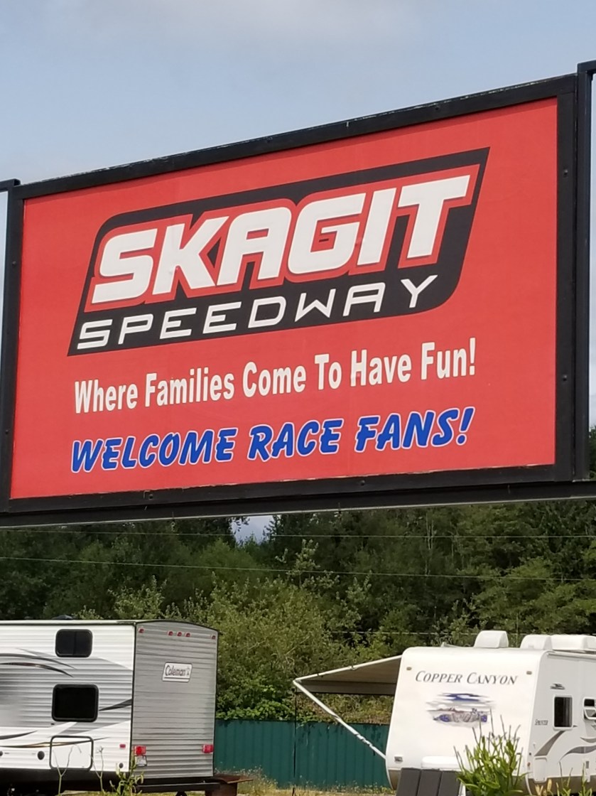
Up the road was Alger. During planning I had picked out Alger as a resupply place. Indeed, we mailed a resupply package to the motel there already. However, when looking for a place to send replacement shoes, Alger was sold out. Apparently DirtCUP 2018 was happening at the Skagit Raceway and that naturally drew in a crowd. When I went by, there were only a handful of RVs left at the Skagit Raceway. I learned also that yesterday/last night had been Ladies Night, a huge draw I’m sure.
I ate at the local pub. If you like good food, sticky tables, worn carpeting, and love the 65-year old Harley couple scene, this place would be heaven for you.
I trudged up the Old 99. Just before it intersected the trail and passed under Interstate 5, a couple asked me if anyone was looking for a dog. They had found it in a county park. Can you believe it was not on a leash when they found it? About 20 minutes later, I came across a “Lost Dog” flyer for a different dog that was lost locally.
Late in the day I finally got off pavement as the trail went into a forest area owned by the state Department of Natural Resources. It was a confusing route, not matching the maps. Indeed, some old-school person had placed white trail markings correctly.
Amazingly, just when I was getting a little lost, I ran into another backpacker. It was a hiker with the trail name of Not Guilty. We found the trail and hiked together until reaching Lily Lake, a pretty good campground right next to the trail. It was nice to finally meet somebody else hiking the trail. An experienced backpacker, he was enjoyable to spend time with. He said he was a late sleeper, I said I was an early riser, but he said it is hard to wake him up, so I said I’d probably be gone when he got up. Tomorrow would be his birthday. I told him I did not get him anything.
I had a new sleeping pad. It was nice and clean, but a little squeaky. The first time I had shared a campsite since Glacier and I am sleeping on a pad that makes a lot of noise anytime I move. Staying as still as possible, I eventually nodded off.
August 11, 2018. From stealth site above Concrete to Sedro-woolley motel.
I had set my alarm for 4:30. Right after it went off I was moving. Since it was still dark, I did everything by headlamp. However, once it came time to hike, I turned of the light. Clouds had rolled in as the forecast had predicted. Presumably, rain would come later. For now, though, the clouds trapped enough light that I could safely hike on the gravel road with no headlamp.
Only one car whipped past me on the curvy road down to town.
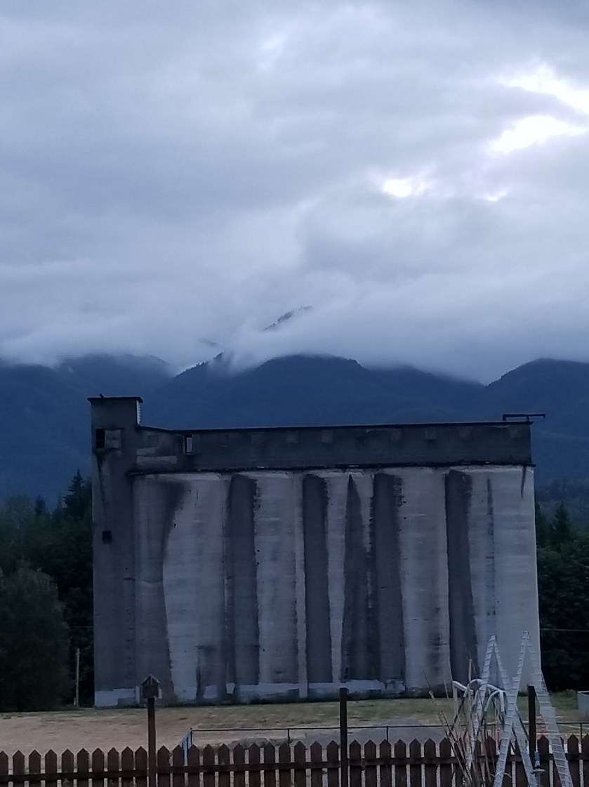
Low clouds hang over Concrete
In town there were a few historical displays. No surprise that its claim to fame was a large cement production plant. If you consider just the hydroelectric facilities I had passed, it is not hard to imagine the historical demand for concrete in this part of the country. One thing I learned was the ecological damage from a concrete plant. Sure, I assumed it would be dusty inside, but apparently a wide swath of surrounding countryside was often dusted with a heavy layer of waste.
I was waiting when the 5B bakery opened. I order corned beef hash. Then a danish. Then a cinnamon roll. The bus left at 9:30, so I had some time to kill. Eventually, people started flocking in. By the time I left, the line went almost out the door.
The bus made me feel right at home. It was populated with older men who looked either homeless or on some kind of work release furlough. Indeed, the two guys in front of me almost came to blows on how little money they paid for their used bib overalls. Yes, I was among my tribe.
Where did you get them overalls?
It felt so weird to go so fast. I had not been in a motor vehicle since Oroville. Out the window I caught glimpses of the 22 mile rail-to-trail route I was skipping.
Sedro-Wooley was a fair sized town, a little spread out. Until the Library opened at 11, I educated and amused myself by going to the museum. The lady who welcomed me had not heard of the PNT, so I gave her some history on it. Many of the displays were awfully close to looking like a very well organized garage sale. However, there were some real gems.
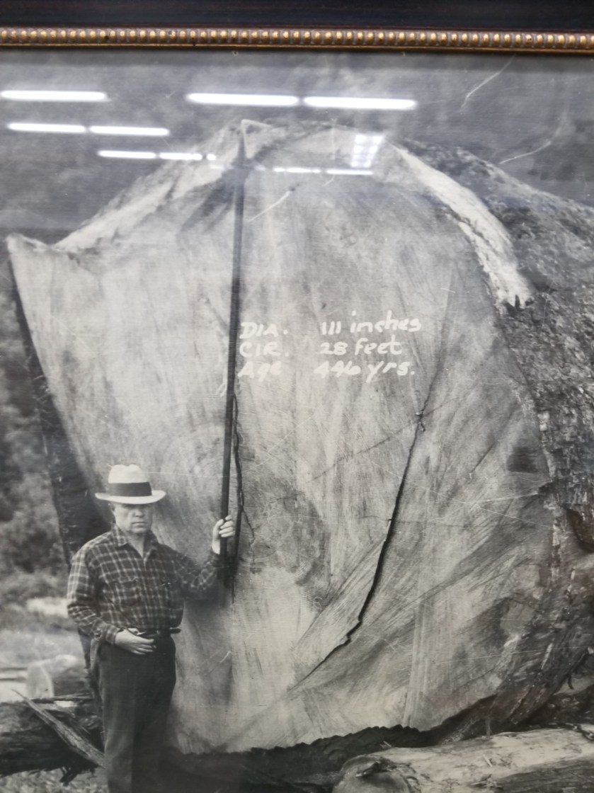
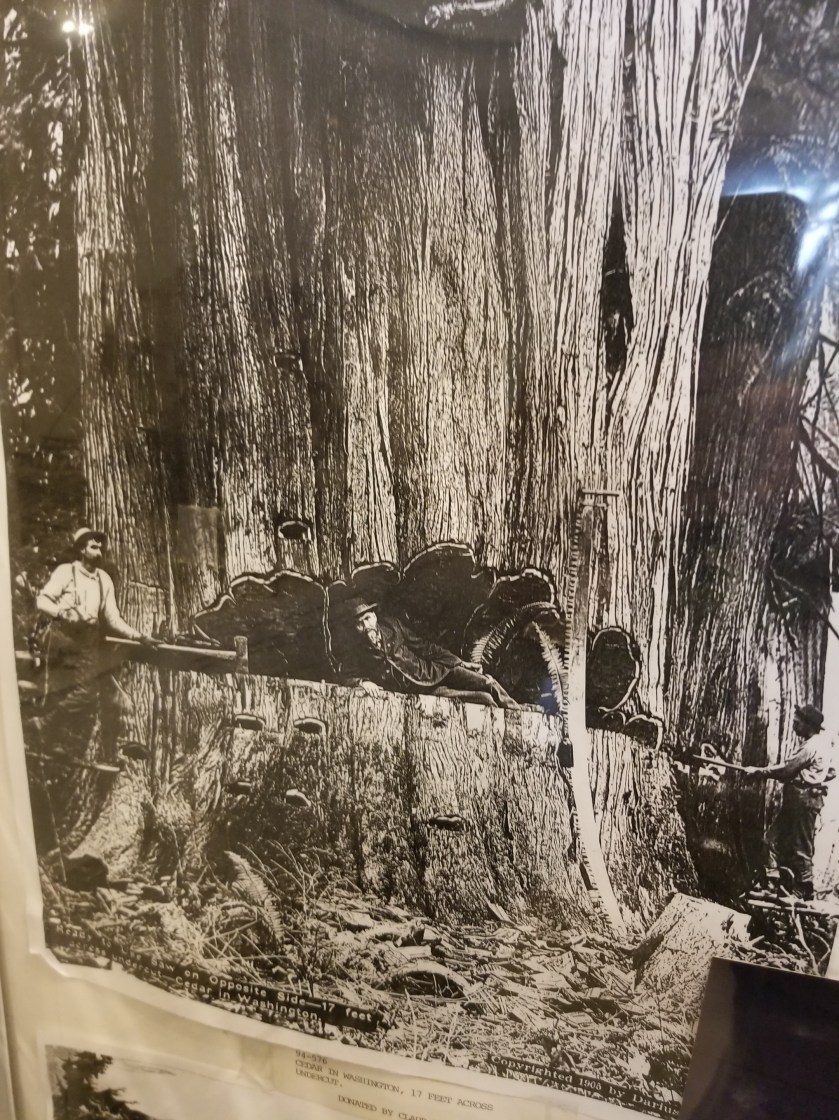
First, they had great photographs of early logging and railroad. There were some huge trees harvested in the Skagit Valley in the early years. Tow transport the logs, railroads were built, sometimes traveling over 130 high trestles.
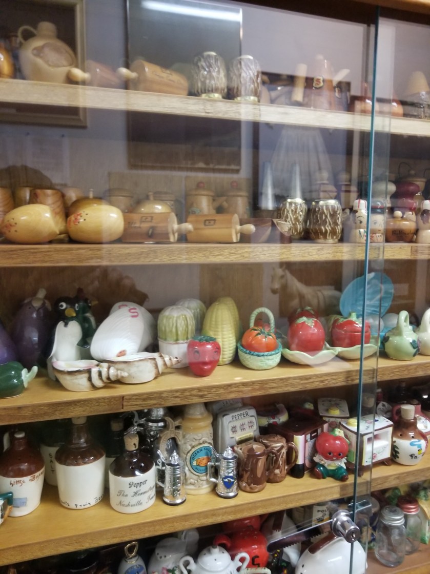
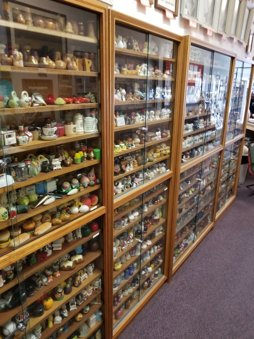
Second, and more endearing, was the 2,334 pairs of salt and pepper shaker collection. Over her lifetime, Ida Mae Quarles collected them. As you can imagine, she was probably the easiest person in the word to buy gifts for. At least early on. She had custom display shelves built. Four of them. She left them to one of her daughters. Again, no surprise, the daughter demurred and donated the entire collection (with a few sentimental favorites withheld) to the museum.
Happy at this unique discovery, I went to the library to attempt to catch up on this blog. With energy being scarce, I had not made many entries. Indeed, I found a pen at some point and just wrote down some bullet points about each day. I made a couple entries, ordered a few supplies, and pushed off before the library closed at 3:00.
My motel was over a mile away, most of the walking to be done along busy Highway 20. I powered up my resolve by getting a burger at Hal’s drive in. Then, I walked, thankful the forecasted rain had not materialized. I was pleased to see I had a full-sized grocery store near the motel and some restaurants.
About a quarter mile from the motel, the skies unloaded. It was a sprinkle at first. I took the clue and popped open my umbrella. As the rain intensified, I did stay dry under the umbrella, but the splash from the cars whipping by next to me soaked me on the one side.
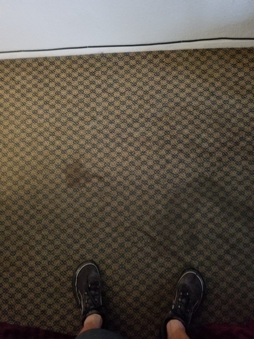
I got to the motel. It was an interesting place. After some fits and starts, I eventually got settled in. The room had a couple interesting stains on the floor, both appearing to be from a human and one almost certainly from blood. The previous tenant was apparently better than the rest of us because they had smoked cigarettes heavily. As an ex-smoker, I am nota crazy zealot, but it was annoying to have that reminder of making a bad choice everyday for 28 years.
I got my new shoes, and ate and bought groceries. I knew tomorrow would be mostly road walking so I bought crappy munching food at the grocery.
Stupidly, I turned on the news before going to sleep. I tried to sleep, but it did not come very easily.
August 10, 2018. From Park Creek Campground to stealth camp in commercial forest above Concrete.
I was the first one up in the campground. The family reunion people must felt at home because they simply let their dogs out to roam. They were pretty well behaved and sniffed their way through my camp.
I had another day of highway walking. My Chief Logistics Officer has informed me of a potential bus route in the small town of Concrete that would get me to Sedro-Woolley where she had reserved a motel and where new shoes awaited me. Tomorrow, Saturday, it only ran twice: early in the morning and late in the afternoon. All I had to do on this day was get close to Concrete and camp so I could pop in to town, eat, and get on the bus.
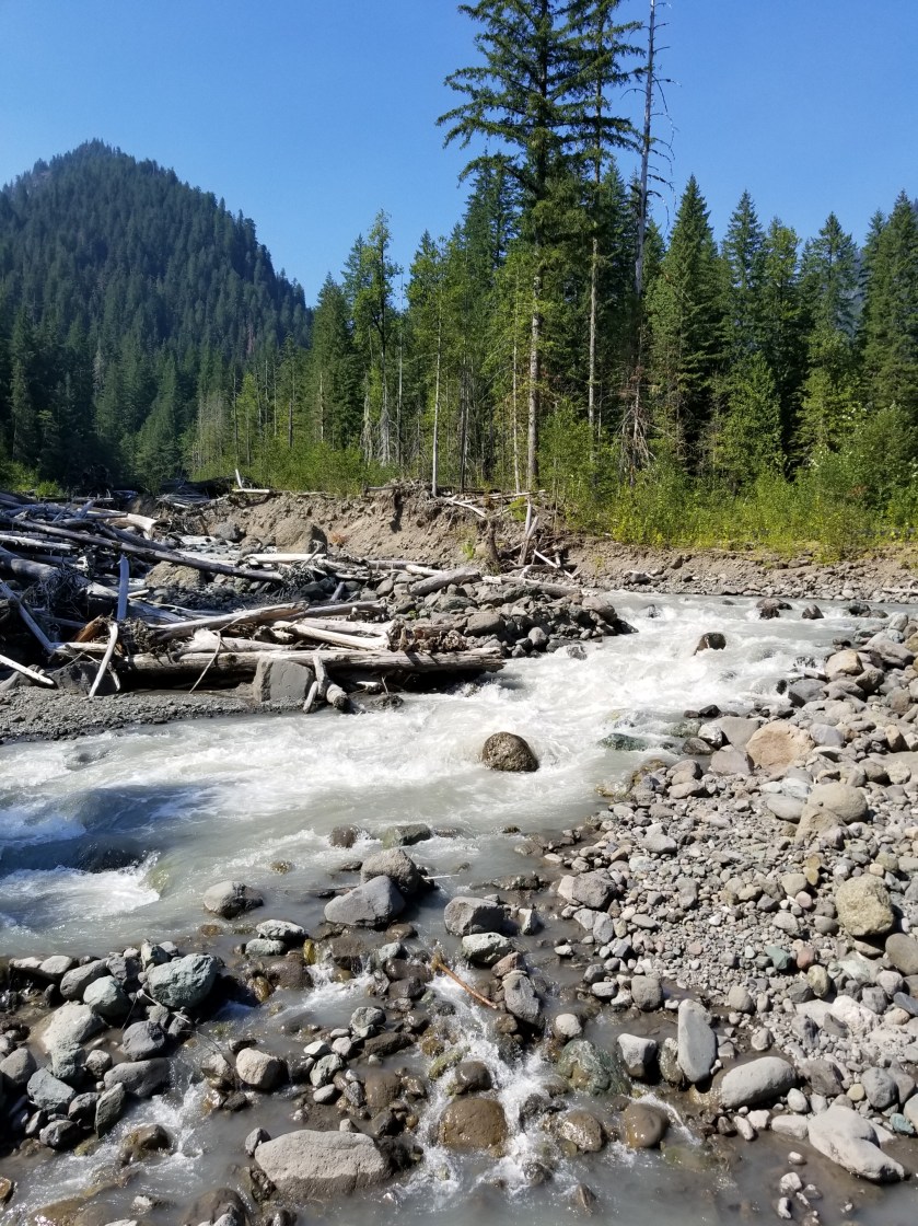
At first the early morning walk was beautiful with no traffic. I did, however, encounter a tragedy. On a bridge with solid concrete walls, hundreds, if not thousands, of tiny toads were trying desperately to get into the water. I don’t know how they got there, but it was hard to catch and rescue them. After 15 minutes, I stopped trying to help and turned my back. Once traffic started, that bridge was going to be unpleasant.
Highway walking is boring. It is repetitive motion, so your feet and legs, which have become accustomed to intense variety, get numbed by the repetition. Mentally, there is not much there other than avoiding being killed. So, I tried listening to an audio book. However, this got to be a hassle because to hear it over the sound of the occasional truck or massive RV, I had to have the volume up too loud.
Late morning I came to a stream that was recommended as a good water source. I walked down and there was a lady sitting on the rocks at the stream’s edge about 20 feet upstream. We exchanged hellos. She had a smaller backpack, more like what a student would use than a backpacker. I went about filtering water. Out of the corner of my eye, I could see she was just sitting there sometimes tossing a rock in the stream. I must’ve been too focused on my water because I looked up and she was walking right near me. She said sorry as she brushed past and up close I could see from her skin and teeth she was leading a pretty tough life. She had vanished by the time I got back up on the road.
I eventually jumped off the busy Baker Lake Road and went on the shoulder-less Burpee Hill Road. Since all of the motels in Concrete had been sold out for weeks, my plan was to sleep up on the bluff overlooking town and then drop down early in the morning. Hopefully, there would be some public land I could camp on.
Early on, my plan seemed bad. All the land appeared to be privately owned. Just before the road began its curvy descent to town, I passed a gate. It was across a road and said “No Cars Allowed.” It did not say no trespassing or have any other warnings. Earlier, along Baker Lake Road, I had seen similar gates and they did have additional prohibitions. Seeing no overt prohibition, I hiked at least a half mile up the gravel road. It was maintained and used, but judging by the foliage growing in the tire tracks, not very often.
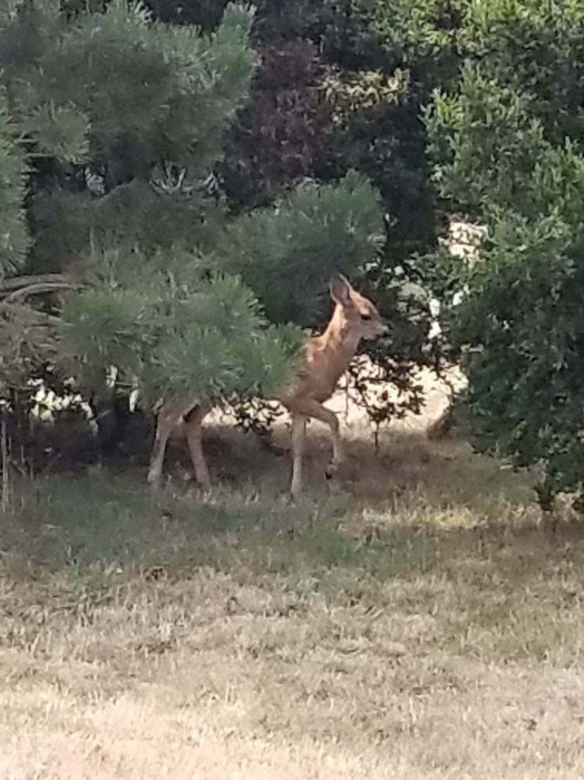
While I waited, a doe and her two fawns snuck out of the woods and foraged before seeing me. You can get a sense of the mosquito level by their twitching.
I waited until dark to pitch my tent. I managed to pitch my tent on what felt like a rock quarry. However, the promise of town food, a bus ride, and new shoes proved a powerful elixir.
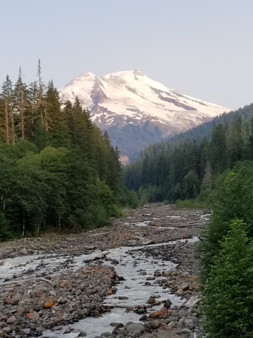
August 9, 2018. Base of Mount Baker to Park Creek Campground
Truly a bizarre night of sleeping. I slept very deeply, but more than once cars whipped by on the nearby gravel road, causing me to start awake, but then immediately fall asleep again.
I got hiking around 5:30. The two-lane highway was reported to be dangerous with narrow shoulders, curves, and tourists watching the views, not the road. Almost immediately the road crossed a spring-fed stream, so I poured out my bad old water and drank a lot of the fresh clean water. The old water from last night had been “enhanced’ by adding some Crystal Light to it. I am now certain the Strawberry Kiwi Rust flavor combination will never work.
There was almost no traffic on the way up. After about an hour, views started appearing through the trees. I passed a ski resort and finally reached a large area of buildings and parking lots. While it was geared for mostly winter visitors, there was a fair amount of activity. As I walked through, I kept my eyes peeled for an outlet. Most of my batteries were low. Fortunately, as I passed the ski patrol building I noticed on the front by the road it had a covered outlet. When I tested it, it was live. So, I took about 45 minutes to charge my phone and “brick” battery.
May need the umbrella…Foxglove grows wild.
My next stop was to get on a trail. This area was designed for people to get out of their cars and hike for a half hour. The trail was clear and clean. It led up to a trail junction that led to a famous overlook called artists point. As I filtered some water near the trail, a couple went by with their two dogs not on leashes.
At the juncture, there was another parking lot that was full. It led to a popular location Lake Ann. I checked the trail register and the usual characters were still two days ahead. Just as I was leaving, another couple walked up with their dog not on a leash.
The trail to Lake Ann was populated and fairly easy. Just when I was going to need to pass through a gaggle of hikers surrounding a stream crossing, my journey veered away to the Swift Creek trail. It was classic PNT. One moment lots of people on a well defined trail, the next walking down a barely discernible path in a meadow.
The map made it look like the trail paralleled the creek and then gradually descended to cross it. At first the map was accurate, but after about an hour, the trail started going uphill. I was concerned and checked my GPS location. I was about 300 feet above where the trail was drawn on the map. However, I had not seen any junctions and I could sometimes see footprints going the same way, so I stuck with it. Eventually the trail did descend, but it sure didn’t match the map.
They look a lot better than they taste.This fella refused to face the camera. Great camouflage, though.
There had been several references to Swift Creek being dangerous to ford. Steep canyons combined with snowmelt can create this situation. When I finally got to the crossing, the creek was good sized, but not intimidating. A twist was that somebody had installed a zip-line that was about 7 feet above two parallel cables that all crossed the stream. Somebody had flung a towel over the top (zip) cable and seemingly crossed (or tried crossing) hanging on to the towel and tightrope walking their way across. No thank you. I just went down stream about 50 feet, found a slight widening in the stream and moved across. It was cold and it was fast, but the water barely reached them hem of my shorts. It took less than a minute. It reminded me of the Grand Enchantment Trail where there was a lot of hysteria about crossing the Rio Grande, but when I did it, it was super easy.
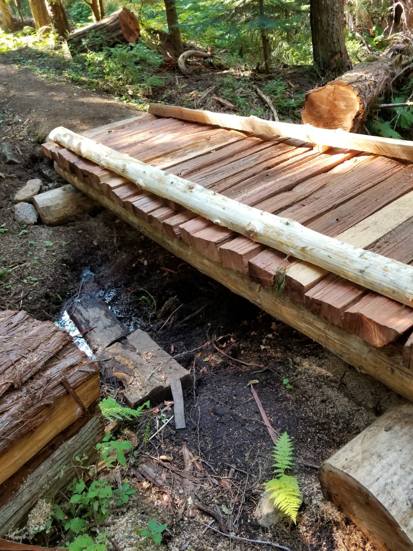
I still had another river crossing ahead. This one was on a creatively made bridge. Apparently each spring local volunteers come out and create the bridge. It was pretty good work.
Notice how silty the water has become from snowmelt.
I skipped the Baker Hot Springs and crunched down the abandoned forest road that was the trail. At the trailhead, there was a car campground. I walked through it and was pleasantly surprised to find a vacant spot. I dropped off my pack and ran down to purchase the camp spot. Walking back, I noticed that the three consecutive spots leading to my spot were occupied by a family. I guess they were going for a compound look. The had cats, dogs, bikes, pickup trucks, RVs, a boat, and an ATV.
After a little light drinking at the site next to mine, they did head off to bed at a reasonable hour. I had pitched my tent near the stream so the white noise of the creek would offset car campground noises.
This family highlighted an economic subset of our country that may not be highly visible to the average person, but is very clear on these backpacking trips. Specifically, there is a class of people that invest heavily in assets that depreciate. I cannot count the number of modest homes I have passed where the yard is covered with a late model pick-up, a boat, ATV, and/or an RV. If it is all new, then there is easily $5,000 to $10,000 of value just wasting away each year. Heaven forbid they bough on credit. I always am curious what these people have in their three digit plans(401 and 529). Obviously there is some pleasure derived, but adding up licenses, insurance, maintenance and these items are a real economic drain.
I discovered I had managed to place my tent on a fine set of tree roots, I was too tried to do anything except scoot around until I was able to lay down in an intuitive yoga position that avoided touching a root but was guaranteed to make me stiff tomorrow.
This tree was determined to grow even though it started life on top of a rock.Among small ferns, a white flower that looks like baby’s breath is quite attractive.
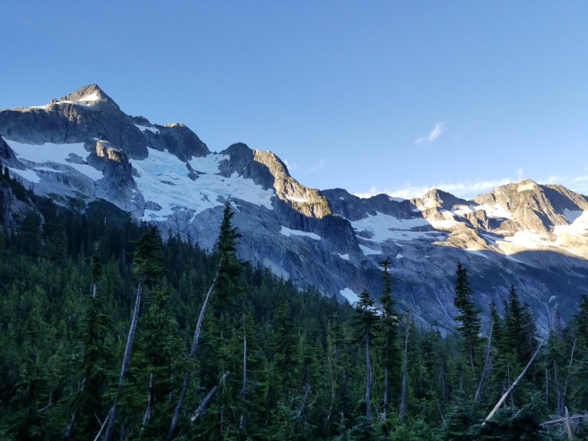
I was the first one up. Got my food and took off downhill. The glaciers on this side of the Pass were bigger. I wish the sun was higher to bring out the beautiful blue of the ice that is at the center of the glaciers.
The air had cleared and I was cruising downhill. I knew I had a long day ahead of me as I needed to get to the base of the Mount Baker highway.
After breakfasting on several spider webs, I stopped and had some trail mix. I was brushing my teeth near a stream and a couple showed up. They were out for few days. Just as they were leaving, a group of five ladies came by. They just said “hi” and passed by.
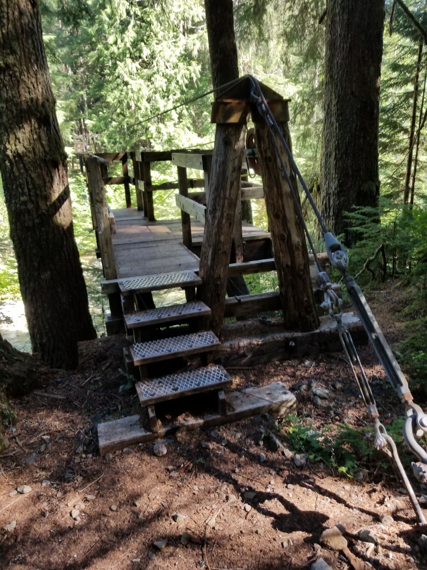
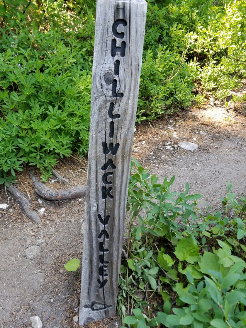
Later, I came to the famous cable car over a river with the improbable name of Chilliwack. The cable car is a two seat basket. You get in and pull yourself across.
I couldn’t figure out how to video the trip across. About halfway across, I did stop and notice how frayed the pulling rope was. Definitely a unique way of crossing a stream.
At the other side a mother with two kids and her dad had differing levels of enthusiasm about the ride ahead. Mom was far less enthusiastic than the little boy.
As the day wore on and I approached a popular trailhead, there were scores of people, all shapes and sizes and ages. One couple I met at the apex of Hennegan Pass. They had full packs and some climbing gear. They knew about the PNT and offered me rides since they lived right near the trail in Alger. Really nice folks.
I continued a long, shadeless grind downhill. For the first time in weeks, I broke out the umbrella for shade. It was wonderful. Not sure why I have such a Mary Poppins complex against using it more often.
I reached the trailhead and began a long walk on a gradually declining gravel road. One car did offer me a ride, but I declined.
I went past a cordoned off area that had a few dozen bee hives right beside the road. Not sure what the bees were pollinating, but I didn’t want another sting and went by swiftly.
The evening was warm and windless. I had a freak event happen. I was just walking along and about 100 feet into the forest, a good-sized dead tree just snapped and fell straight over. Random.
I finally reached a developed forest service campground at the bottom of the climb up the Mount Baker highway. It was called Silver Fir. All the places were taken. I looked at places to stealth camp, but didn’t see anything good. Then, I used their handpump to get water. I filled up my three liter platypus bag, but the water looked a bit off.
I crossed the highway to a lot used by the highway department. It also had some snowshoeing routes for winter. I went down a gravel road and after a quarter mile saw a small clearing where I could fit my tent.
I ate as it darkened and got into my tent. The water I obtained from the campground was so rusty it made me wonder how long it had been since my tetanus shot.
It was one of those nights where I don’t even remember putting my head down before I was fast asleep.
August 7, 2018. From Big Beaver Camp to Whatcom Pass.
I was glad to get moving in the morning. I could smell the smoke in the air and feel the building heat.
Fortunately, most of my morning would be spent gradually heading upstream along Big Beaver Creek.
There were two immediately striking features in the morning. First, the bluish, opaque stream colored by the grit from snowmelt. Second the huge cedars and western hemlock. Massive trunks supported a canopy of branches a hundred feet up.
This environment was good for toads and their offspring. When I first saw the forest floor moving, I thought it large ants.
This skinny guy was hard to see.This one was not so hard to see.
The trees were interesting. Their size meant they truly blocked out sunlight from plants below. It struck me how little life there was. Hardly any songbirds, scarcely a sign of deer or squirrels. Cedars and hemlocks produce tiny cones and consume all light. In poignant contrast, the mosquitoes were large, numerous, and happy to see me.
This cedar had to be 20+ feet in circumference.Quick, who is older?
Due to the absence of wildlife and wind, the cathedral-like forest was hushed, like when you walk into a large empty church. If you stopped, there was an overwhelming sense of space and silence (except for the tinny buzz of mosquitoes).
When light penetrated, it would occasionally reveal an intricate spider web. Try as I might, I cannot get a satisfactory picture of a spider web.
I found a charming stream and got some water that was not silty.
Later, I met a group of two guys and one lady, all young and in a hurry. Selfishly, I was hopeful they had been hiking a while and therefore had cleared all the spiderwebs on the trail. No such luck. Just after I passed the next campground, the webs started again.
A bit later, I met another two-men, one-woman group. They were from South Carolina, up for a friend’s wedding. Fun people.
I climbed over a ridge from Big Beaver Creek and dropped steeply into the next valley with the unimaginative name of Little Beaver Creek. No idea what the would’ve done if there was a medium sized beaver.
Subtly, the flies began to dominate the mosquitoes. Less quick to bite, their size and relentlessness made them more irritating.
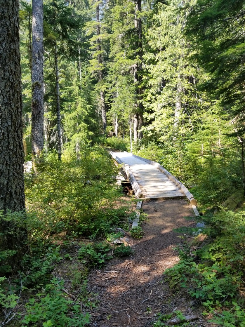
One thing about federal parks or recreation areas: they do bridges right.
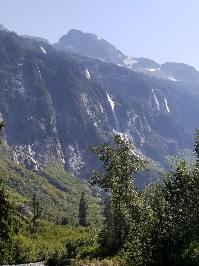
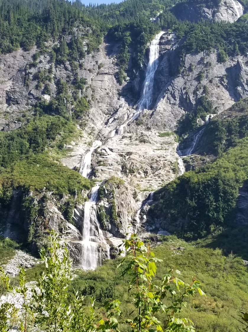
I made my way up the valley. It got high enough that there was snow and glacier up high across the way. With the heat, the melt created numerous waterfalls. Visually, it was mesmerizing.
Whatcom (pronounced watt come) Pass was my reserved campsite. It had a legendary reputation as an intense climb. It lived up to its reputation. Near the top, some of the wood buttressing the slope had dissolved.
The gray timbers were there to shore up the gravel trail above.
The campsite had a reputation as prone to bear visits. As a result, I ate my dinner about a quarter mile away to cut down on odors. There was a boulder field with a lot of pikas who squeaked their annoyance at me.
I was the last to arrive at the reserved campsite, so I got the least attractive campsite. The best tent pad looked straight down the valley. Mine looked north at a boulder field. I hung up my food and got my tent put together.
I heard the Pikas going off. Then I heard a large rock tumble. I looked and at the edge of the boulder field was a good sized black bear pointed uphill (away). don’t know the proper way to size black bears, but he looked like four Labrador Retrievers mushed together. If you’ve suffered through earlier blog posts, you know I am not a fan of bears. I yelled and he moved a bit and looked at me. Finally, I clapped loudly and he scurried uphill and away from the Pass, in to the trees.
My neighbors came over to see about the ruckus. We had a good chat and they all said they had hung their food. As you can imagine, I did not sleep too well, startling awake to the slightest sound. As you can equally imagine, nothing happened. When I reflected on this bear’s behavior, he seemed to just want to go over the pass and avoid humans. The biggest wildlife lesson on this trip is that animals very much use passes and saddles as transportation highways.
July 28th. 2018. Stealth camp to Whistler Canyon Trailhead.
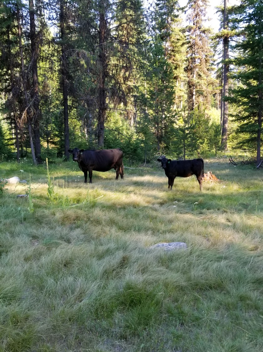
Immediately, I could tell it was going to be a hot day. I cruised downhill through a ranch. Some cattle, instead of running, treat you like a rock star. This herd started coming towards me so I thought they were going to crowd me.
This morning I could choose between a quiet public road for 5 miles or an official quiet public road plus a trail that gained and lost 700 feet over 10 miles. I chose the former.
I met an older lady on her way downhill to a Saturday morning yoga class. She loved living up high in the woods.
Eventually, I came to an area where the road walk and official trail met. For the next ten miles I’d follow a trail a group of local horsemen had developed. Up high, it was hot and sunny. For the first time, I got to the point where I just found a shady spot and took a power nap. I awoke refreshed. Within 100 steps, I looked back to see the PNT hiker from Bonaparte Lake.
We hiked together for the next few hours as the trail descended to the valley where Oroville awaited. He was young and enthusiastic about many things. He was going to hitch in to town. Knowing I had two nights of reservations ahead already, I opted to camp at the trailhead on the edge of town (technically 2 1/2 miles, but to a backpacker that’s an edge).
Though smokey. You could see the valley below.
Nearing the bottom, there was a sign mentioning an alternate trail with a water crossing and then a connection to “W.C.” The main trail was just to connect to “W.C.” While I am not British, I could not figure out why trail signs out here would suddenly reference water closets. Still, I needed water and cut over to the alternate, wishing my fellow hiker good luck. “W.C” stood for Whistler Canyon, the local trail name.
Just a few yards from the main trail, the alternate revealed a gurgling stream. There were a couple teens there trying to make out. I awkwardly blurted out “I’m just getting some water” and went past them upstream 30 feet. As the Dad of daughters, I fought hard to keep from asking the girl if her Dad knew she was up here with this loser.
With enough water to rehydrate and get me through the night, I descended. I was surprised the trailhead was so spacious. I found a place on the fence near an apple orchard. I propped up my backpack and opened my umbrella to create a shady spot in the 96 degree heat.
For amusement, a herd of mountain sheep went up and down the hillside in front of me. The younger ones even came down to eat. However, when the dominant Male returned, they just watched me and even when I got in my tent he would not let any of them come down.
The younger ones came down to feed while adults remained up high.
Once the alpha Male returned, he kept the herd up high looking down on me.
July 25, 2018. From Okanogan Forest camp to Cougar Creek camp. 22 miles
I was not well rested after the rough night. Still, I packed efficiently and even forced myself to eat my breakfast of cold-soaked 10 grain cereal.
It was a beautiful day for hiking along this seldom-used road. I had seen no cars on it yesterday. With this solitude, you would not be surprised that when it came time to perform an important bodily function, I simply took off my pack and went a few yards into the woods to dig my cat-hole and take care of business. Well, as Murphy’s Law would have it, another hiker, heading the opposite direction, comes walking down the road. Nobody for days and this guy walks up on my dump. I tried to recover as quickly as possible, but it was certainly awkward.
We chatted briefly, but I was eager to get on with my life.
Later, as the day got hotter, I took the aptly named Sweat Creek Trail. It was a tough climb on a hot afternoon. Perhaps some steep climbs, I heard the chainsaws of a trail crew. After waiting in the distance for them to see me, I had a good, short visit. It was two adults and three teenage helpers. They were a legitime PNT crew. I expressed my gratitude for all the work they do and showed the younger ones all the scars on my legs from going over blowdowns, etc. Also, I let them know I was a dues paying PNTA member.
Their work is hot and difficult. I whine about carrying a backpack in hot weather, but these folks get up, put on long pants, work boots, hard hats, carry their gear uphill to the worksite, and labor in the sun all day. I thanked them again and let them get back to work.
Part of the work this crew had to remedy was eliminating misleading cattle paths. Generally, cattle are fairly good trail makers, sometimes they riff on their own. What this means is they will very often follow the main human trail, but, when it suits their bovine fancy, they cut a new path. Thus, in many areas a hiker has a very difficult time telling the difference between the human and cow paths.
On my way downhill, I could see the trail crew had a lot of tree and cattle work. As if to prove the point, I encountered a small herd of about three pairs of cows and calves. Always, I stop and talk in a calm manner when I see cattle on the trail. While sometimes they amble off safely, other times, like this one, one bolts and the others follow. You might be surprised how agile these animals at going downhill at speed, jumping over obstacles. I waited a few minutes so they would not feel threatened. I don’t want either a calf or cow to get hurt running.
Unfortunately, I’ve seen this movie before and was not surprised to have the same process repeated. Two more times. In all, they probably ran downhill for a 750 foot elevation loss over a mile. Finally, one of the cows went left off the trail and the calves, who normally choose the trails, chose to follow her.
It was evening by the time I reached the bottom of the trail. The guide book made a vague reference that the trail seemed to go on private property but to veer left. Mild understatement. The trail basically dumps right in to someone’s yard. I didn’t see a dog, but clearly somebody lived in the trailer parked there. I went immediately over to the edge of the yard and moved quickly and quietly away.
Eerily, the occupant(s) had a fascination with skulls and decorated their yard with several plastic skulls and skeletal parts. At age 56, I am just too damned old to be abducted and converted by some cult. Think about it. You never hear about guys like me getting captured and converted, it is always younger people. So, I kicked in to high gear and got the heck out of there.
I came out on a public road. It switched between private property and public land. There were definitely some unique homesteads along the way. Maybe you live in a suburb or a nice urban setting. Indeed, you’ve also probably seen poor, blighted urban areas. However, taking a long walk really draws out a different variation of the American dream. There are rural areas where it is either the start, or fulfillment, of the dream to get a piece of land and park an RV or Camper on it and call that home. Sometimes there is evidence of a more permanent, traditional structure in various stages of completion. I can sort of understand the pride of ownership angle, but most of the situations appear to never convert to permanent housing. Instead a second or a third trailer is added. (I shudder to think what their septic solution looks like.) Pointedly, most of these smaller homesteads were the most prominent displayers of “Private Property” or “Keep Out” with a few specifically mentioning government officials. (Note I have the honor of working with municipal employees in my community and can’t recall any kind of professional that works harder to be fair, judicious, and considerate.)
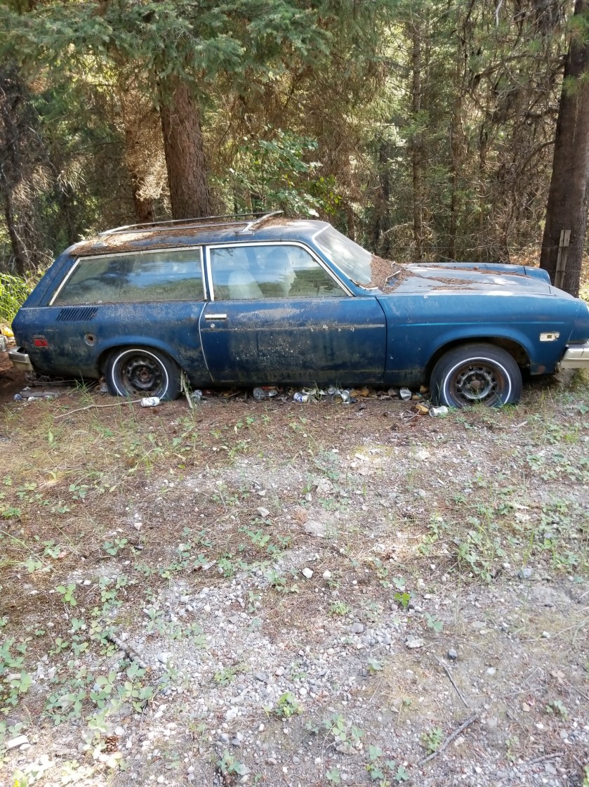
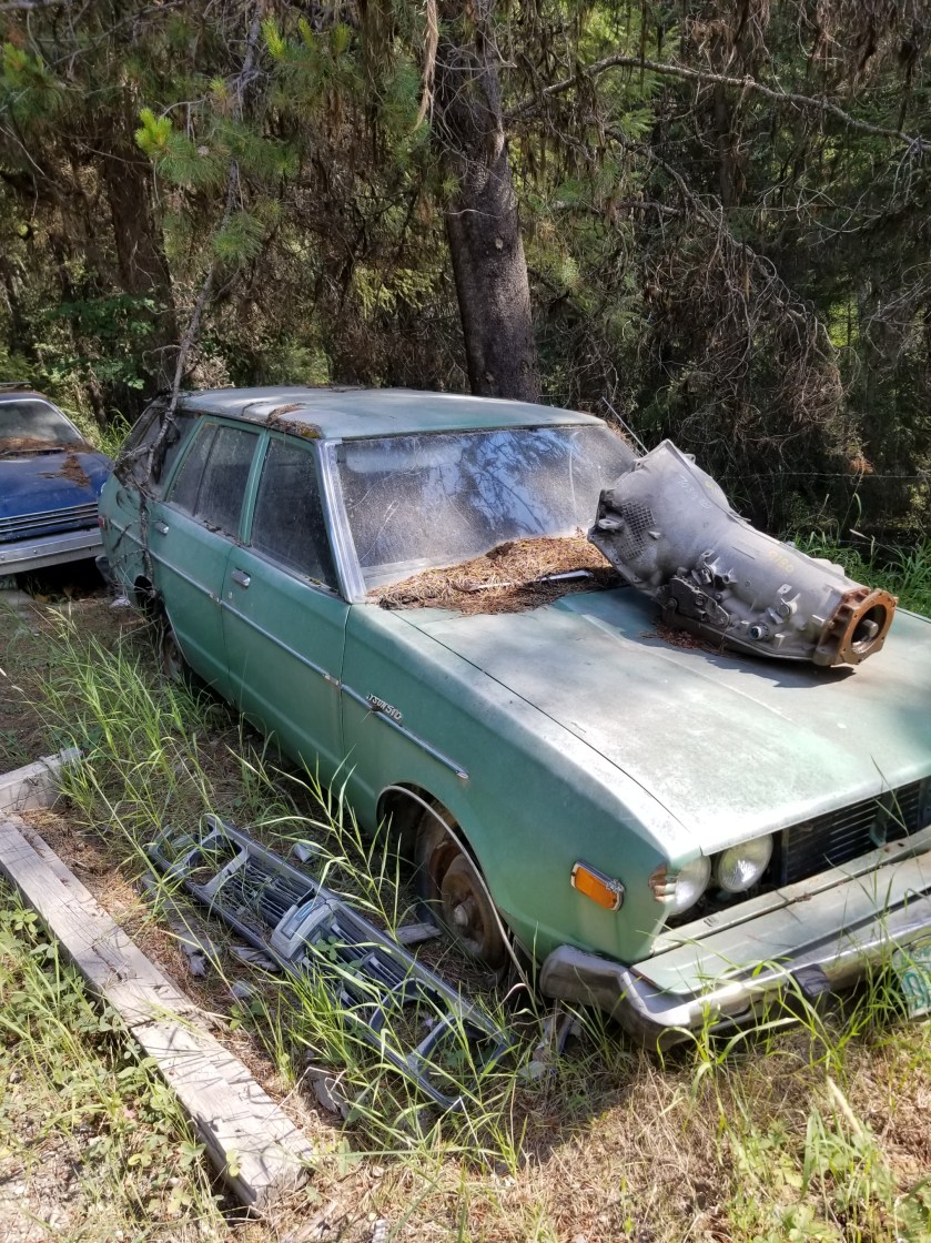
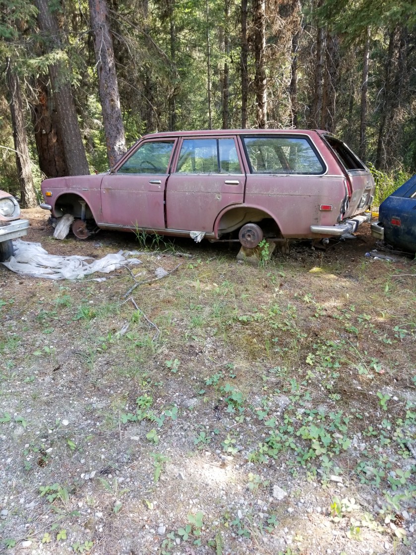
I passed a few properties where they spilled some of their excesses on to the public right of way. I’m not a “car guy” but one place was occupied by one who convinced himself (and perhaps a long suffering wife), that he would hold on to junkers to “part them out.” To nobody’s surprise, the Dodge Aries and various Datsun models did not generate much demand, so these vehicles decorated the road.
Eventually, I found a flat secluded spot on public property down by the creek. It got darker faster in the narrow valley. I ate my dinner while shooing away yellowjackets. I pitched my tent, hydrated some more, and went to bed.
While I initially dropped right off to sleep, in the night I was awakened by a sound. Not one crunching in the woods or brushing against the tent. Eerily, it came from underneath the tent. In the ground, there were subtle digging sounds and then a muffled pig-like snort. Being a guy and having lived in apartments, I naturally reacted by pounding on the ground. That produced silence. For a few hours. I had to repeat this one more time. In the morning, when i packed my tent, I could not see any obvious signs of tunneling or disturbed earth. I’ll never know what it was.
I find it fascinating that spruce trees will “feel” that they are dying and produce these clusters of robust growth, kind of like the opposite of cancer cells. I’m not sure if these anomalous growths are then intended to jumpstart regeneration when the tree falls.Saw this grave marker along the gravel road this morning. Couldn’t tell if it was for a pet or an unpopular relative.