After a zero day in Pioche, I took off for another four days. Pioche is a former mining boom town. They have pivoted to tourism, but feel it is important to post on every business there is no public restroom.
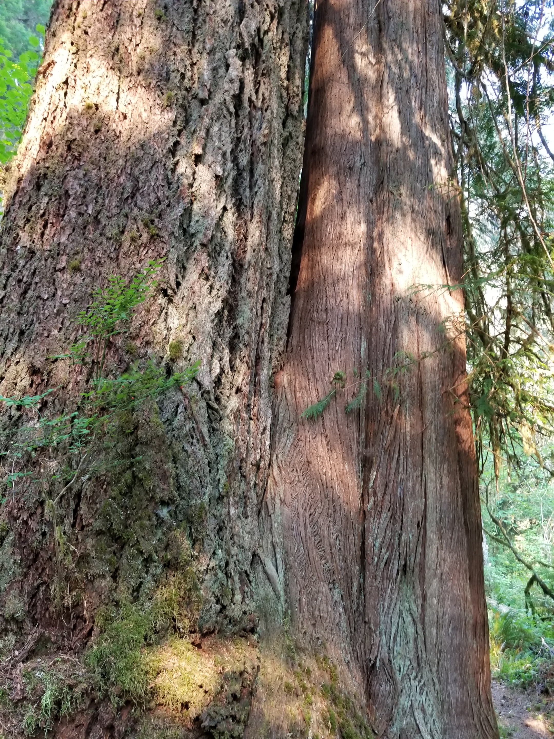
In the early morning climb out, I went past the old mining operation and then down past an electric transmission repair facility. Next, a long basin walk went past an abandoned car and motorcycle. Most of us, at one point in our life, have been so angry at a machine that we wanted to take it out and shoot it. I recall an HP printer clearly. Well, out here people actually shoot their failed gear.
This trail is very difficult in so many ways. Take noise. The silence is all encompassing. When you are in a wide basin with mountains in the distance all around, it is disorienting to have no sound. You stop, strain and maybe pick up an insect or bird. Or take the wind. Most afternoons the wind kicks in. Sometimes it is just shifting breezes. Other times it is powerful gusts lifting sand and dirt to pummel and blast the unlucky hiker. Wind or silence. One or the other, never neither.
Margins are thin. Life is precious and water dear. So far, not a single cattle herd has been seen. Ranchers are reluctant to spend resources on a herd not knowing costs. Water is the thinnest margin. Every natural water resource has multiple paths and a variety of prints. I’ve seen terrible sights. There was a natural spring. It had been fenced off to keep animals out of the source. This year the source was dry. A wild horse’s hoof was twisted in the top two strands of barbed wire, its leg bones pointing down to the rest of the skeleton.
Nellis Air Force Base is south of here and uses the remote area for fighter pilot training. I have heard a few sonic booms. Often I hear the fighters overhead but cannot see them. The pilots are also pushing themselves and their machine to the margin.
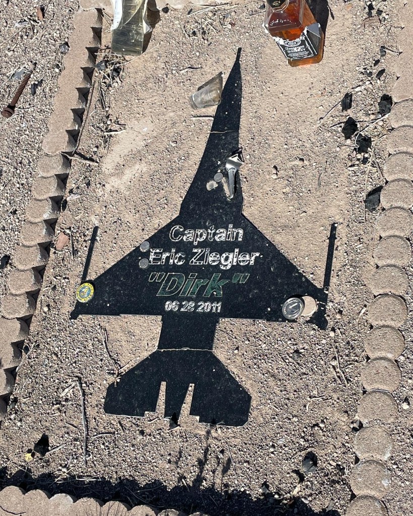
Crossing the basin, my eye caught an upright pole about six feet high. Other than sparse junipers or cacti, nothing grew that high. I angled over to it, about a half mile away. A metal sign on a wooden post proclaimed “Dirk’s Place” and there was a rectangular memorial on the ground. It honored Eric Ziegler “Dirk” and there was a bottle of Jack Daniels with a few sips gone. I paid my respects and moved on.
RIP
A later Google search confirmed my fears. Captain Ziegler, from North Dakota, was on his last battle simulation flight before advancing to the elite U.S. Air Force Weapons school. Investigators say he blacked out in a maneuver, lost control and crashed in the Nevada basin. He went past the margin.
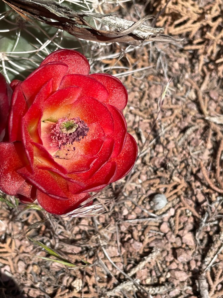
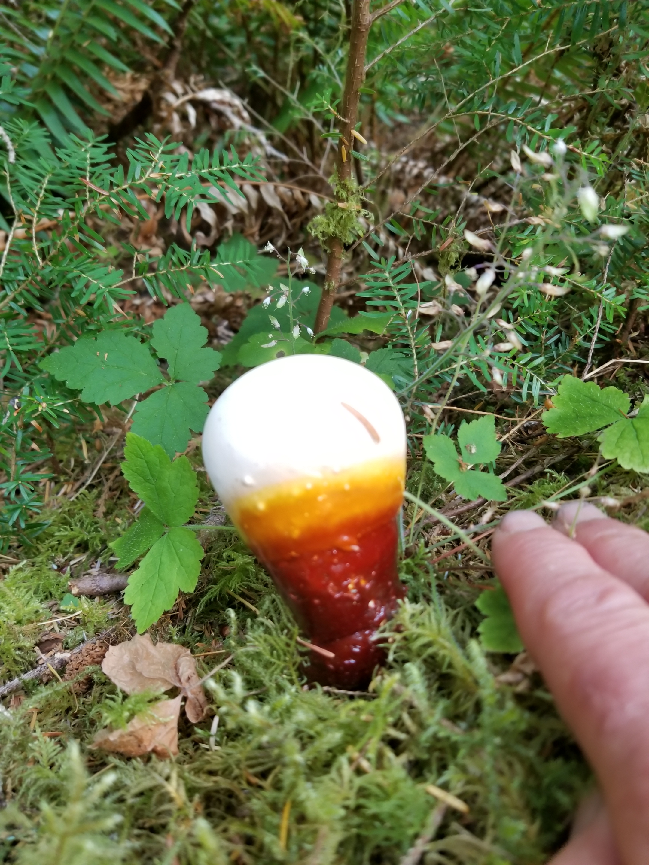
In spite of these challenges, the Great Basin Trail has beauty. I’m here in time to see many different blooms. I’ve also managed to find a nest with a solitary egg.
Cactus bloomLife goes on
I leave tomorrow for a long stretch. It will be 11 days to my next town. I’ll depend on cached food and water. I can’t wait to report back.
Driving down a lonely, gravel road in Nevada, I was excited, nervous, optimistic. Helen, my wife, was dropping me off at a “faint Jeep track” where I would start my Great Basin Trail (GBT) hike. She needed to get down to Las Vegas, return the rental car and fly home. We kissed, hugged and said goodbye for the next two months and she headed to the freeway. I headed into the sagebrush.
Storm clouds loomed in from the west, but they looked mild and I hoped they would miss me. Eastern Nevada seems like a mighty creature reached down and pulled a rake through from south to north. Mountain ranges go along in neat rows and hot dry valleys separate them. I was happy for this valley to receive rain, but I wanted no part of it.
Storm in the valley
As I gained elevation, I left the comfort of just following an old jeep track. As I started to follow geographic features, the flora changed from sagebrush to sparse juniper and pine. The storm briefly caught up to me and gifted me with some light rain and even a few snowflakes.
I arrived at my first water source and it was glorious. Indian Spring is a developed spring flowing with cold clear water. It was the last reliable source for several miles.
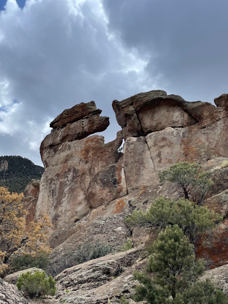
Leaving the spring, the route became very difficult. Scrambling up a rock formation, I tripped and extended my hands to cushion the fall. My phone, with detailed GPS information, bore the brunt and part of the glass cracked.
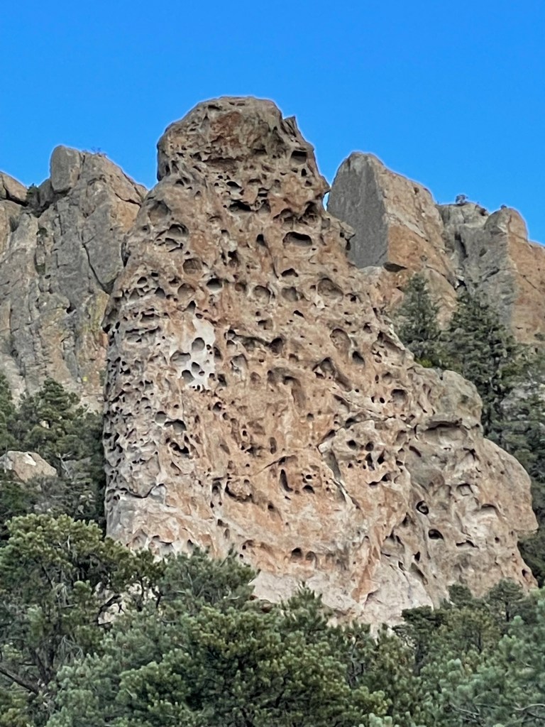
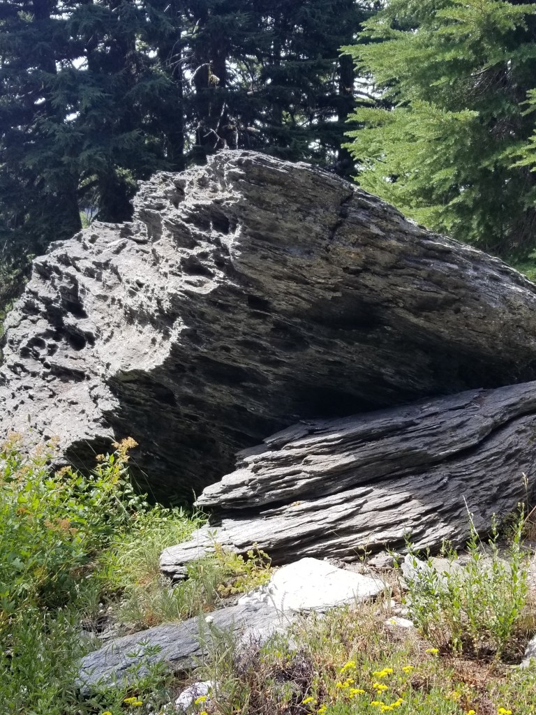
Strange rock formationsDo you see something in this photo?
Next I entered a very steep area where I was to follow game or elk or horse trails. There are three problems with this. First, animals are great pathfinders, but will vary their routes based on changes (tree falls, presence of predators, etc.). Second, in the early season the animals are lower enjoying the spring grass and giving birth. Third, I am 6’4” while deer are three feet from the ground at the shoulder. Thus, even if I get on a horse trail, my shoulders and face are pushing through branches that they miss.
I was making less than one mile per hour. The terrain was getting rougher with rocky cliffs. I fell again. This time slamming down on one of my carbon fiber trekking poles, snapping it. Towards dark, I did an assessment: almost all my water was gone, I was not going to reach my planned campsite, and somewhere along the way, my umbrella had been removed by a branch. Oh, and because I had been using my phone’s GPS mapping all day, my battery was nearing the single digits.
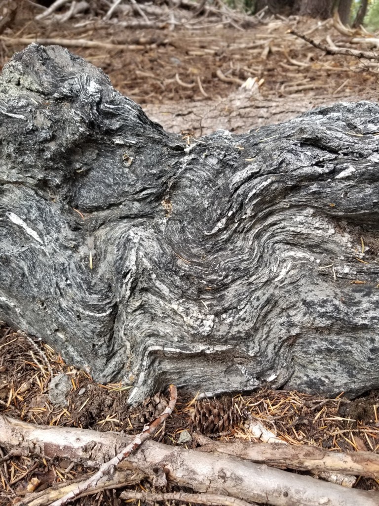
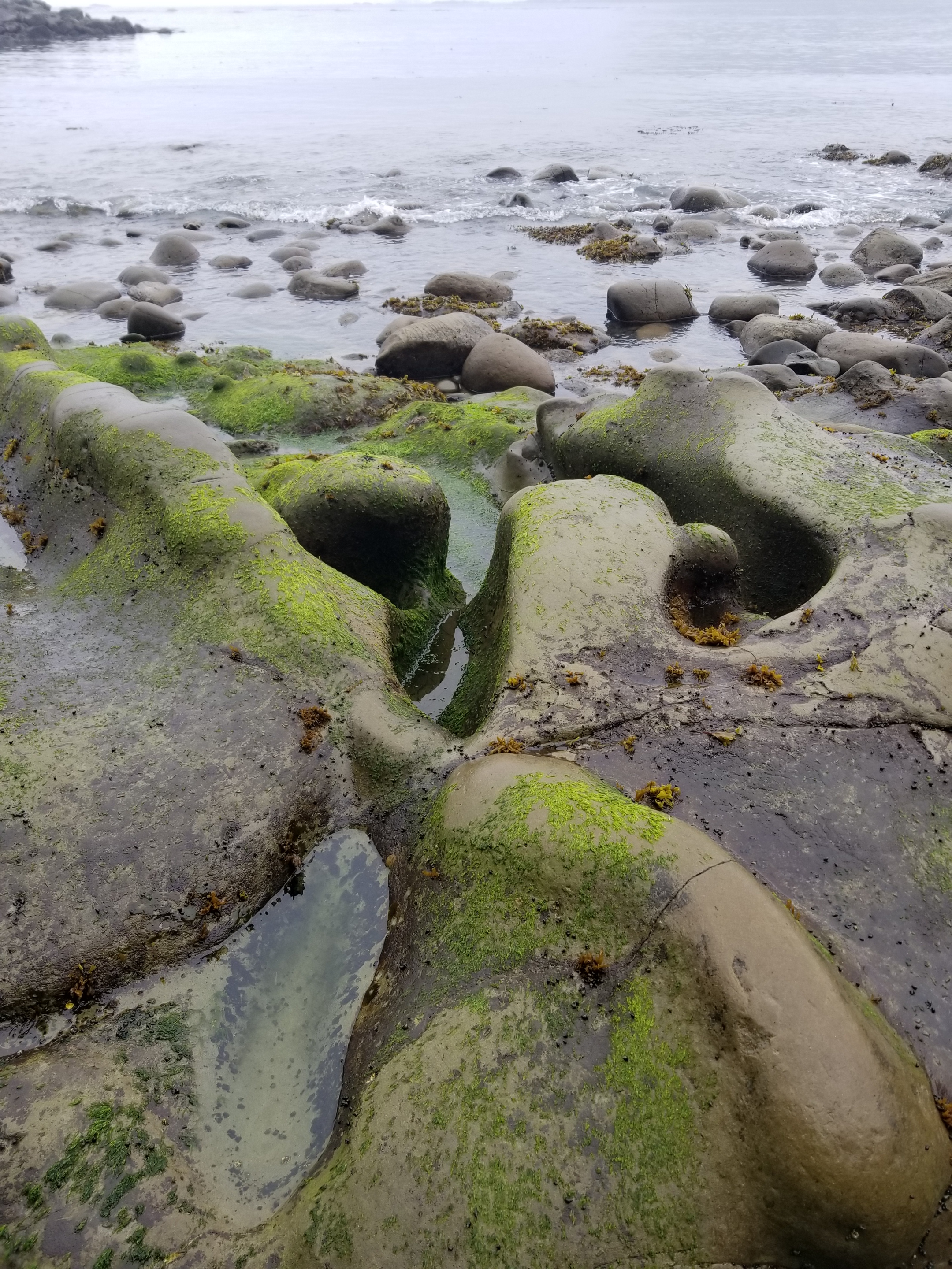
Geologists call this type of rock Swiss Cheese
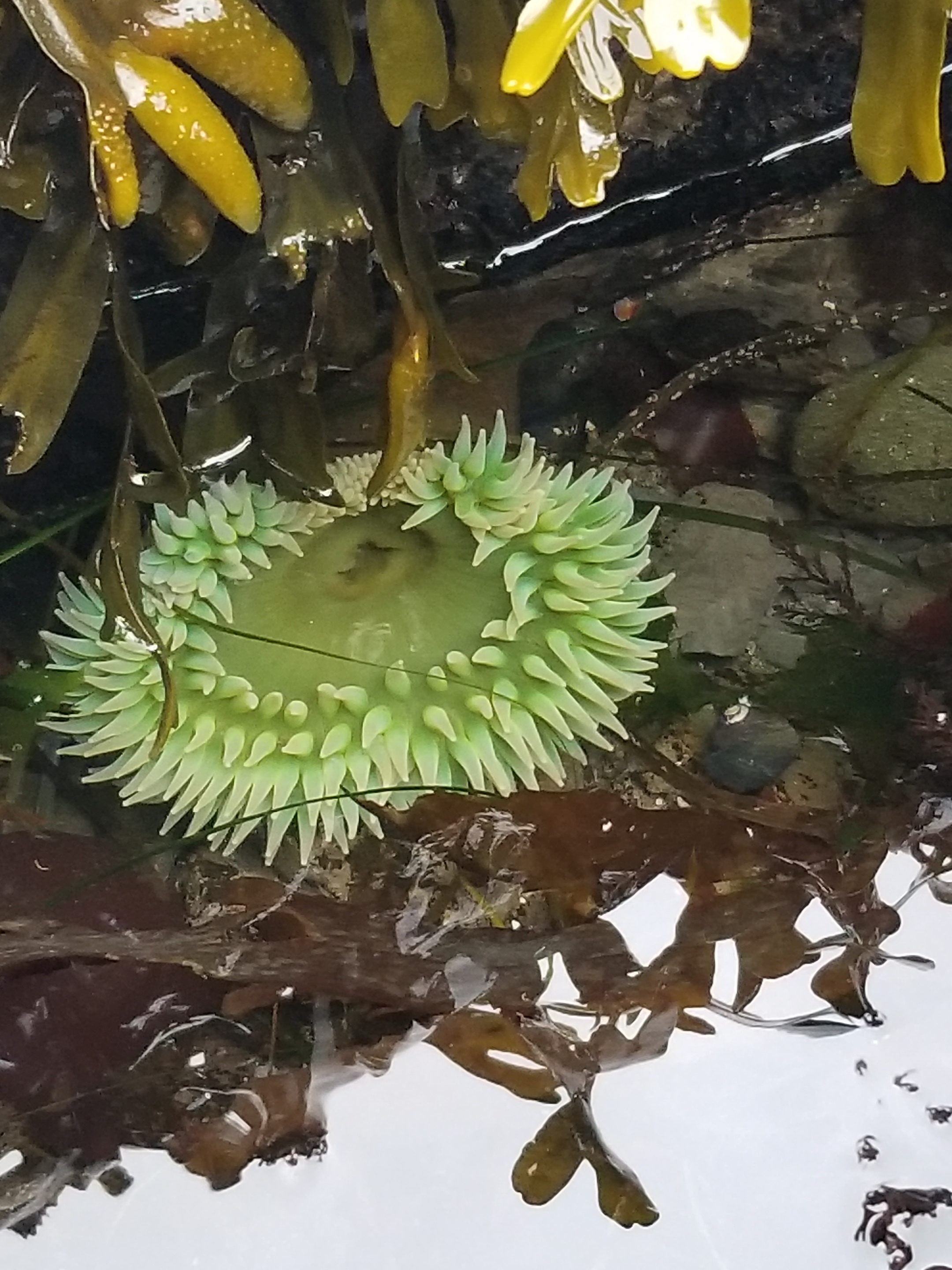
So I pushed toward the nearest possible water source. As it got darker, I made my way up a dried stream bed. By the markings in the stream bed, other creatures had done this already. As the canyon narrowed, I finally found a slit in a rock containing a deep pool. Pushing aside the top layer of green growth i filled my filtering water bottle. I was glad that green is one of my favorite colors because in the fading light I could see a green hue even after filtering. “Wilderness wheatgrass”
The next day was more route finding among trees and shrubs, ending with a nice dirt road walk. I started to appreciate the silence and the smells. Smells from the plants, to be clear. Juniper, sagebrush, mountain mahogany, pine. If there was no wind, it was vast, pure silence occasionally pierced by a jet far overhead.
More rockAbandoned
The third day was brutal. Mostly pushing through mountain mahogany and then, later, weaving through manzanita. I’m not a botanist, so excuse my oversimplified descriptions. Mountain mahogany is a tall shrub with a unique smell, interesting bark, and branches designed to shred clothing, slash arms, and remove hats from passers by. Manzanita is a low growing shrub with waxy green leaves, charming little pink flowers, and numerous thick sharp branches designed to cut shins, grab feet, and hide the ground. I ended up on a high windy ridge dotted with manzanita as night fell. I tucked in next to a burly manzanita that blocked the wind. I cowboy camped under a vibrant starry sky watching satellites ceaselessly perform their orbits.
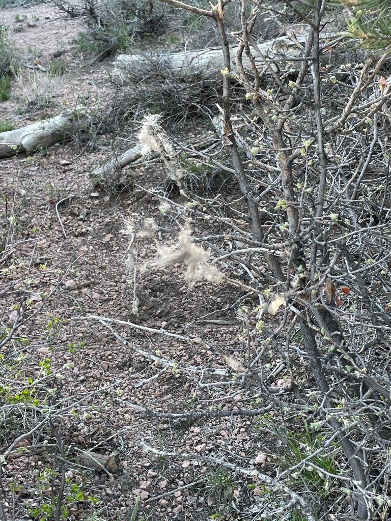
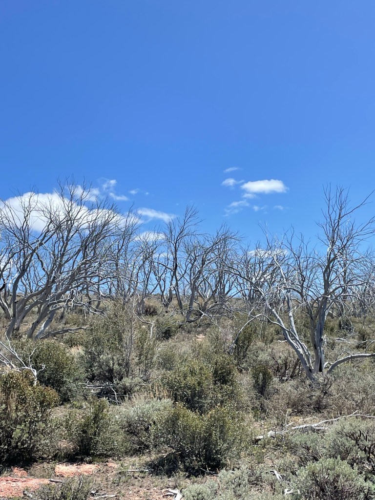
Elk fur snagged by mountain mahogany Remnants of a “forest” fire. Huge views
My fourth day witnessed huge elevation gains. It began with an unexpected surprise. Someone had cleared a six foot wide swath through the thick shrubbery and marked it with cairns. Was it a hunter? And old sheep herders route? A misguided, overzealous Scout troop earning their shrubbery badge? Regardless, I was happy and smiling.
The smile wore off as I looked up and ahead. In the distance, on a barren mountain at 9,200’, stood the radio towers I would climb to pass. The path was dirt road and it was sunny and in the 50s. I knew I had to continue working on my uphill and downhill muscles for the mountains later in my trip.
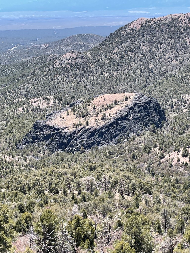
The views from the top were vast and great. I could look back and see where I started. The other direction I could see the tiny reflections of Pioche, my next resupply town. I sipped some of my dwindling water and began a knee-crunching descent. It was sunny, not windy and bereft of interesting things to look at, so I changed into shorts, fired up an audiobook, and set my own personal cruise control. There was, however, an intriguing geological feature. It was a large black, square lava tube that jutted sharply out of the forest floor. The top was almost flat with a miniature forest growing on top.
Having never seen a car all day, I walked in to my last water source, Page Creek Spring, where I would spend my last night before town. It was warm water with many green plant forms. Fortunately as I made my way up one side to find the source, I found a tiny spring releasing clear cold water. It was perfect.
There was an abandoned structure on site. An amalgam of stone, wood, and corrugated steel, I tried to figure out it’s former role. Home, loafing shed, who knows. I again cowboy camped on public land. However this night it was not windy. Very quiet and still except for the one round of coyote howls to each other across the valley .
My final day was a warm 20 mile road walk in to town. Desolate country. Besides one band of wild horses, it was just me, horned toads and lizards and an occasional antelope in the distance. I saw my first car and person since Sunday as I neared Pioche. It is pronounced pee oh shh. Grabbed a sandwich and water, checked into my motel and started my “town” routine.
Wild horses
In summary, it took me one day longer to travel 85 miles. This trail is tough. I have to get better at not using my phone GPS map every five minutes. This trip is going to be far less following a trail and much more forging a route. It is big, windy, lonely and I like it.
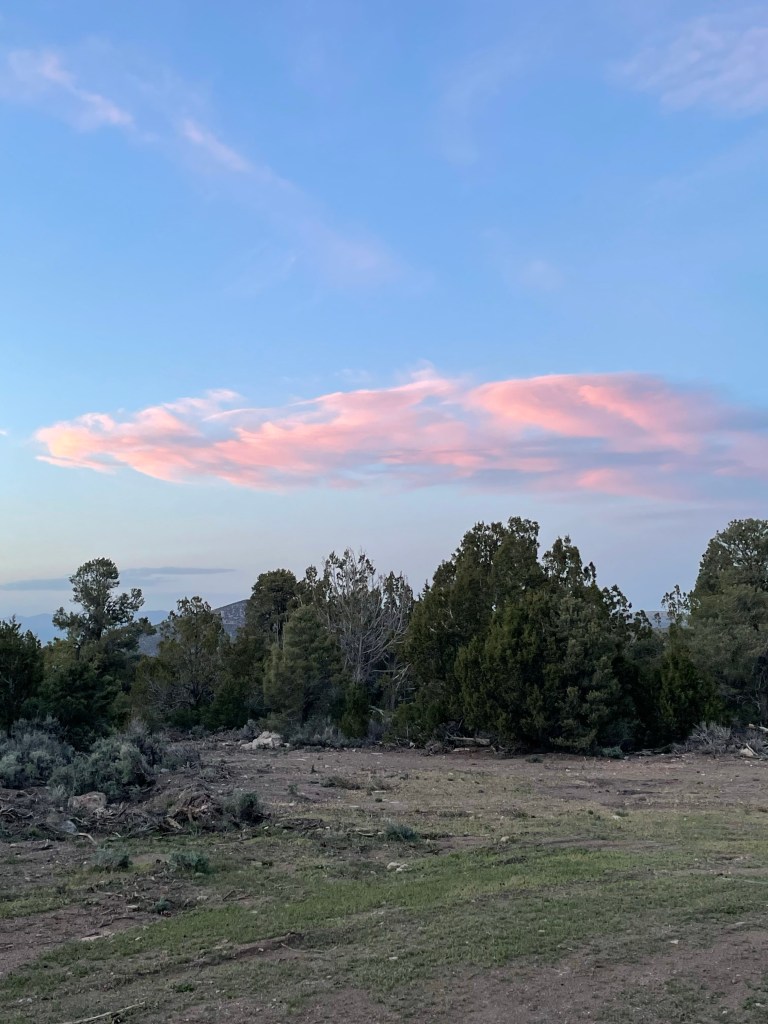
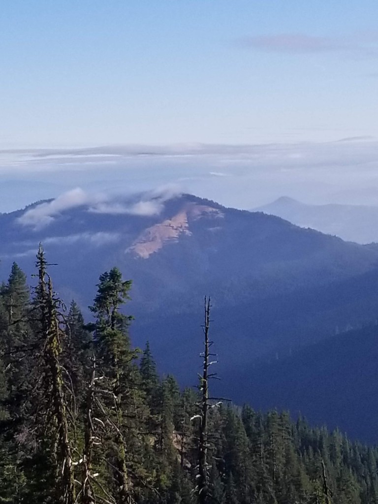
It was a pretty view in the morning. I was up high. There was a ceiling of clouds just above me. Low clouds skittered around the hills below.
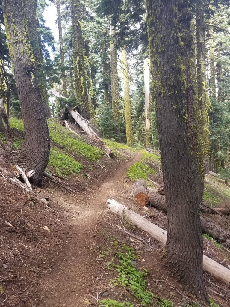
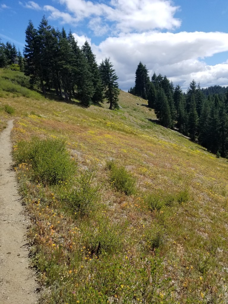
Remaining clouds burning off in the morning sun.Perfect trail
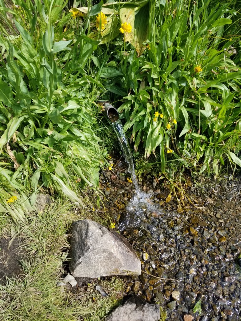
It was a great day of hiking, mostly slight ups and downs along ridges. In the late morning I came up to a wonderful water source: a spring that had been tapped with a pipe.
Spring Water.
A trio of ladies came to the spring as I was filling up. They were retired and had been doing PCT section hikes for years. All at least in their 60s, they were boisterous and energetic and brightened my day.
I was just walking along later in the day when I heard some people getting out of cars and preparing to go on a day hike. I said “Hi” and kept walking. Their energetic Labrador kept running to me and then back to them. I was surprised to stumble on the trail marker noting the state line between Oregon and California. I tried taking some selfies and the day hikers were nice enough to snap a photo. Dutifully I wrote my name in the trail register and continued on, feeling a lot better knowing I had walked from the northern border of Oregon to its southern border.
Water was just a little scarce. I filled at a creek where cattle grazed (not the best) and late in the day settled for a stagnant pond. However, there were some very interesting rocks. They had multiple thin layers. Some of them reminded me of how croissants are made…with layer upon layer of thin dough.
Layered like croissants but much tougher to chew….
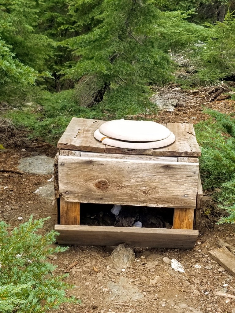
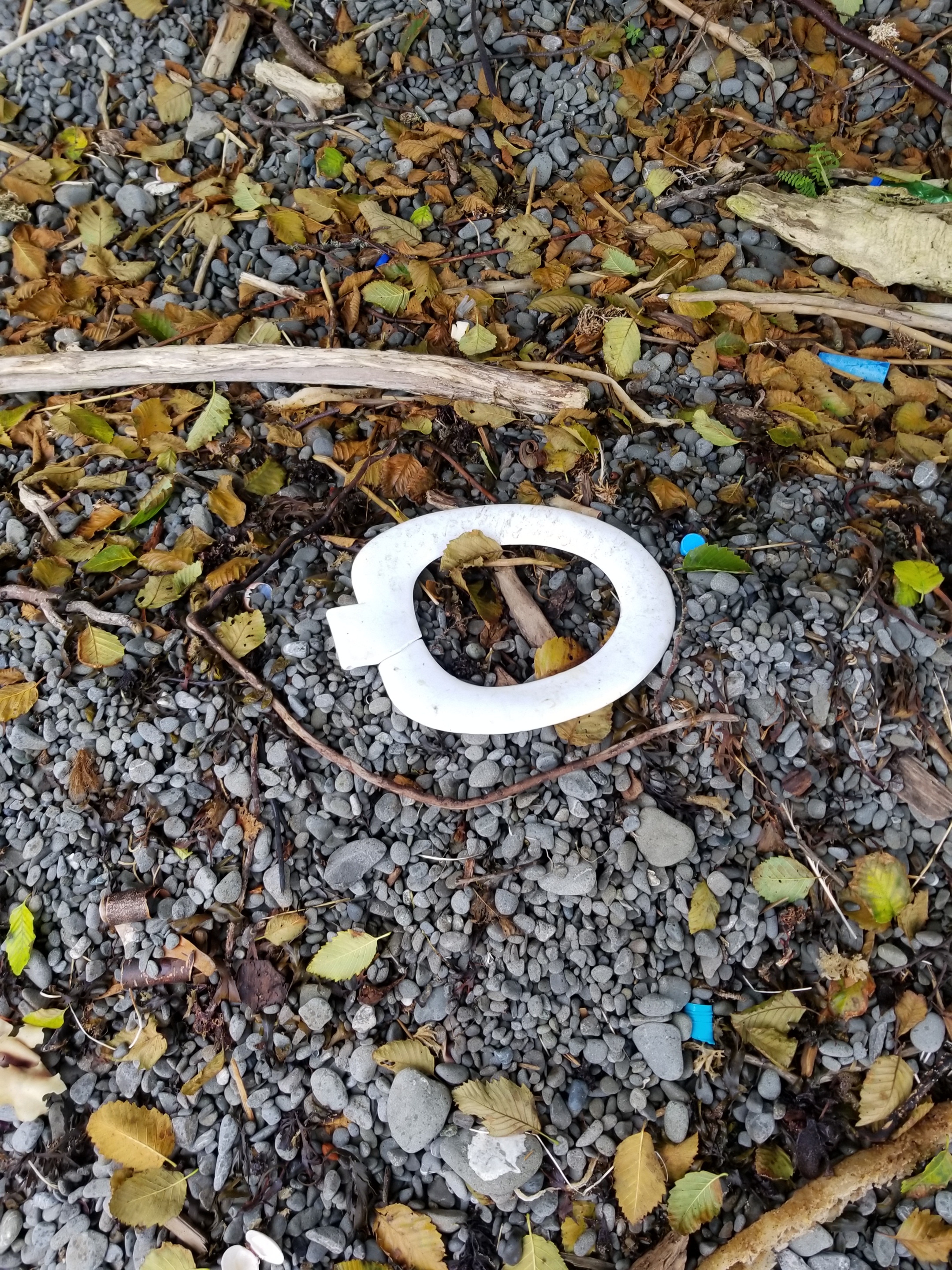
More puzzling was a strange toilet fixture. I had encountered variations of these a few times before on backpacking trips and puzzled on their purpose. They are usually a toilet seat on a wood frame about 12 to 18 inches high. Being a man who cannot rest unless I am able to unravel the mysteries of the universe, I had found that hunters make these and keep them near their hunting camps. In season, they dig a good size hole, place the fixture on top, and then have a functional, open air toilet for several days. At first, I wondered why they left them in the woods. However, when I considered the alternative of explaining to your spouse why you brought it home and your plan to keep it in the garage, the wisdom of just leaving it in the woods made tremendous sense. Sadly, I was dumb enough to go lift the lid. Even more sadly, some people had actually used the fixture and left their product just sitting there.
Leave no trace….
As the sun set, I had some sub-optimal tent-site choices. I ended up setting my tent within five feet of the trail. I always think this looks like a rookie move and didn’t like doing it. However, it was getting late and I knew I wanted to get up early and get going so I could drop down to my next resupply town, the Seiad Valley. My tent barely fit into the spot. I was surprised the temperature was falling so quickly and put on my down puffy and hat. I ended up sleeping in them, too, after setting my alarm for 4:00 am. With no wind, I was certain that if any animal walked along the trail at night that close to my tent, I would have some form of a coronary event.
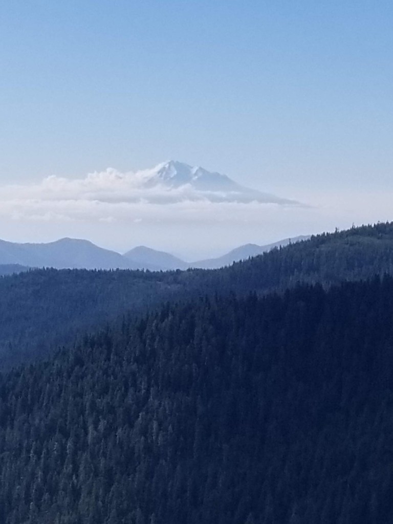
Shasta sometimes seemed to just float in the distance.
I was able to sleep in just a little at the Timbers Motel in downtown Ashland. I drew up my grocery list and also had a plan to hit a local laundromat when it opened at 7.
The laundromat was just a couple blocks away. I walked there and the doors were open. An older guy was in his idling car outside. I need to first clarify that I have perhaps the worst luck ever at laundromats. Something goes wrong every time. So, when the change machine accurately gave me change for my five dollars, I was getting a little smug. Next, to the soap dispensing machine. It looked old and solid, perhaps using metal from decommissioned WWII aircraft. Coins go in, selection made, pull the lever, and nothing. “Here we go….” I muttered to myself as I found the coin return. I was surprised it worked! As a spokesman for the triumph of hope over experience, I tried about 13 times to get the machine to perform the simple transaction: I put in correct coins, it gives me soap. Alas, nothing.
I figured at least getting the dirt loosened would be a small victory. So I ran a load of wash without soap. I considered the downside: without soap, perhaps all I would accomplish would be to loosen dirt and sweat and evenly distribute it over all my clothes so my shirts would smell like my feet and my socks would smell like my arm pit. Sounded good to me. Hell, I still smelled like lavender epsom salt.
An hour later, as I finished folding my clothes from the dryer, the assistant manager walked in. I thought I would be a good citizen and let her know the soap dispenser did not work. Deftly demonstrating how she reached the level of assistant manager by age 32, she said “I have some behind the counter I can sell you.” For a fleeting moment I considered that sprinkling the dry powder on my laundered clothes might have some potential benefit, but I decided against it, thanked her for her problem-solving skills, and went to the grocery store.
I stocked up on the crap that backpackers buy in town: cheese, meat sticks, Fritos, sunflower seeds, and two breakfast burritos. I went back to the motel, ate, packed up and caught a cab back to Callahan’s Lodge.
It was an old lodge. Lodges used to be destinations. Rustic with wood accents, dead animals mounted on walls, rooms and food and alcohol. Historically, Callahan’s was on the outskirts of Ashland and a destination. The original Callahans were instrumental to getting the entire Pacific Crest Trail built. However, it apparently burned down, was rebuilt and sold and was now for sale again. Lodges were fading anyways and the covid pandemic was not helping.
My stay was not the best. At first, the guy at the front desk said my resupply package was not there. He was rushed, so I asked him to please double check when things slowed down. He also informed me that I did not have a reservation. I explained that I thought I did. After several minutes of intense research on his part, he announced that he had solved the mystery and that my reservation was for tomorrow. I tried to gently correct him and explain that was the original plan, but it was changed and that “Cheryl” had spoken with my wife and assured her the reservation was moved to today. He ignored all of that and magnanimously informed me that the room type I reserved for tomorrow was actually available today so I could check in. Since we were bonding, I seized the moment and asked him if I could go to the room where they keep resupply packages and help him look for my package. He hesitated as though I was asking to get into the cash box, but eventually he relented. I found the box in about 31 seconds.
Retreating to the deck for a late lunch, I tried to enjoy the peace and solitude of being given a menu and allowed to read it uninterrupted for 20 minutes. When a perceptive server decided to ask if I wanted to order lunch, I praised her deductive skills and placed an order. After another 20 minutes I was enjoying my burger and chewing the ice which was all the beverage I was going to get. After another brisk 20 minute interlude, I was giving my bill and released. For a moment, my instincts suggested that maybe I should just hold my spot and start ordering dinner.
Later on, I regretted not trustung my instincts. While many people were dining on the patio and trying to handle yellow jackets in various ways (fight versus flee) I sat inside. After 20 minutes, the bartender came across the indoor area and asked me if I was planning on having dinner. I said that I was actually waiting for my connecting flight to London. Eventually everything was sorted out and perhaps trying to atone for any inconvenience, all components of my meal (appetizer, salad, and entree) were all delivered at the same time.
Not sure what will come of Callahan’s. It is great that it is so close to the trail, but with a short cab ride whisking hikers to a greater variety of places, I am not sure it will last long.
Just an explanation. I am actually in Truckee California today about to get back on the trail. I had to skip about a 90 mile section due to fire closures. My blog, unfortunately, still has me in the middle of Oregon in July.
Why? Well, I have three devices that use energy. My smartphone, I believe it is a Samsung 1. This serves as a blog writing tool, camera, and map. I also have a satellite device over which I can transmit text without cell phone service, it tracks me, and, finally, has an SOS function if needed. Lastly, I have an MP3 player on which I have some audio books and which I can sometimes use to pick up random radio stations.
All require electricity, but my battery power has been limited. I can go four days easily. Five days and I have to be careful. Six days, and I have to shut off devices. In my view, the priority is the satellite device (SOS and ability to always text), next is the phone (map & route finding, but no photos), and I don’t use the MP3.
So, besides being wiped out when I reach camp at night, I have had to be parsimonious writing blog entries.
And don’t get me started on WordPress changing their application mid-trip! Now, I have to submit entries via email and can only attach photos at the end without a description.
The good news is that Helen sent me a much more powerful battery. Now, I plan to catch up on blog entries and try to stay current.
Also, I have enabled a link to my Instagram account. It should appear on the right hand side. You can click on the photos and hopefully see the banter I sometimes attach. That tends to be a fairly current snapshot.
I apologize for the gaps. I should catch up and make this feel like timely rather than an old man reminiscing about days gone by. I appreciate your patience.
A long distance hike requires planning. At a minimum, there’s the path and mileage and opportunities to get food and water. For the most popular trails, there has evolved a basic set of GPS locations, topographical maps, and descriptions of communities along the way that might provide food, shelter, resupply packages, or other services.
You first need to decide on a direction. The Triple Crown of U.S. trails (Appalachian, Continental, and Pacific Trails) have historically been followed from south to north. The arguments for this approach include following warmer weather (snow melt) north, starting and finishing earlier, and tradition. Going in a northbound direction is called a “NoBo.” The problem with this approach is that in the case of western trails (PCT and CDT) you are likely to experience two snow challenges in mountains. The first is early on when entering the Sierras or San Juan’s. Remaining winter snow can be a challenge. And if you are not careful towards the northern end, early fall snow in the Cascades or Rockies can be a risk.
A southbound (“SoBo”) trip has some advantages. Satellite imagery and snow sensors tell exactly what starting conditions will be like relative to snowpack. Additionally it is less crowded. The biggest negative is the challenge of getting through the southern end of mountain ranges before winter snows begin.
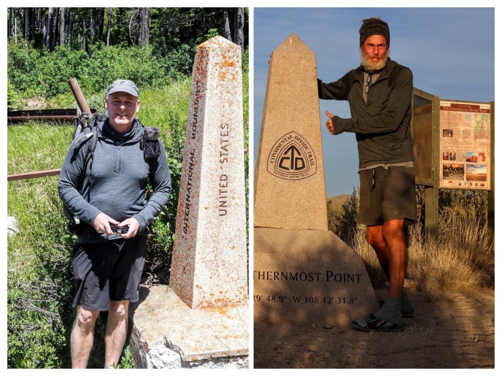
I’m going SoBo on this trip. I have estimated hiking speeds and developed a resupply plan. One goal will be to eat more. On my CDT SoBo, I lost about 50 pounds.
In 2016 I was able to convert my body fat to facial hair.
August 26, 2018. Stealth camp before cedar Creek to stealth camp before Yellow Bank.
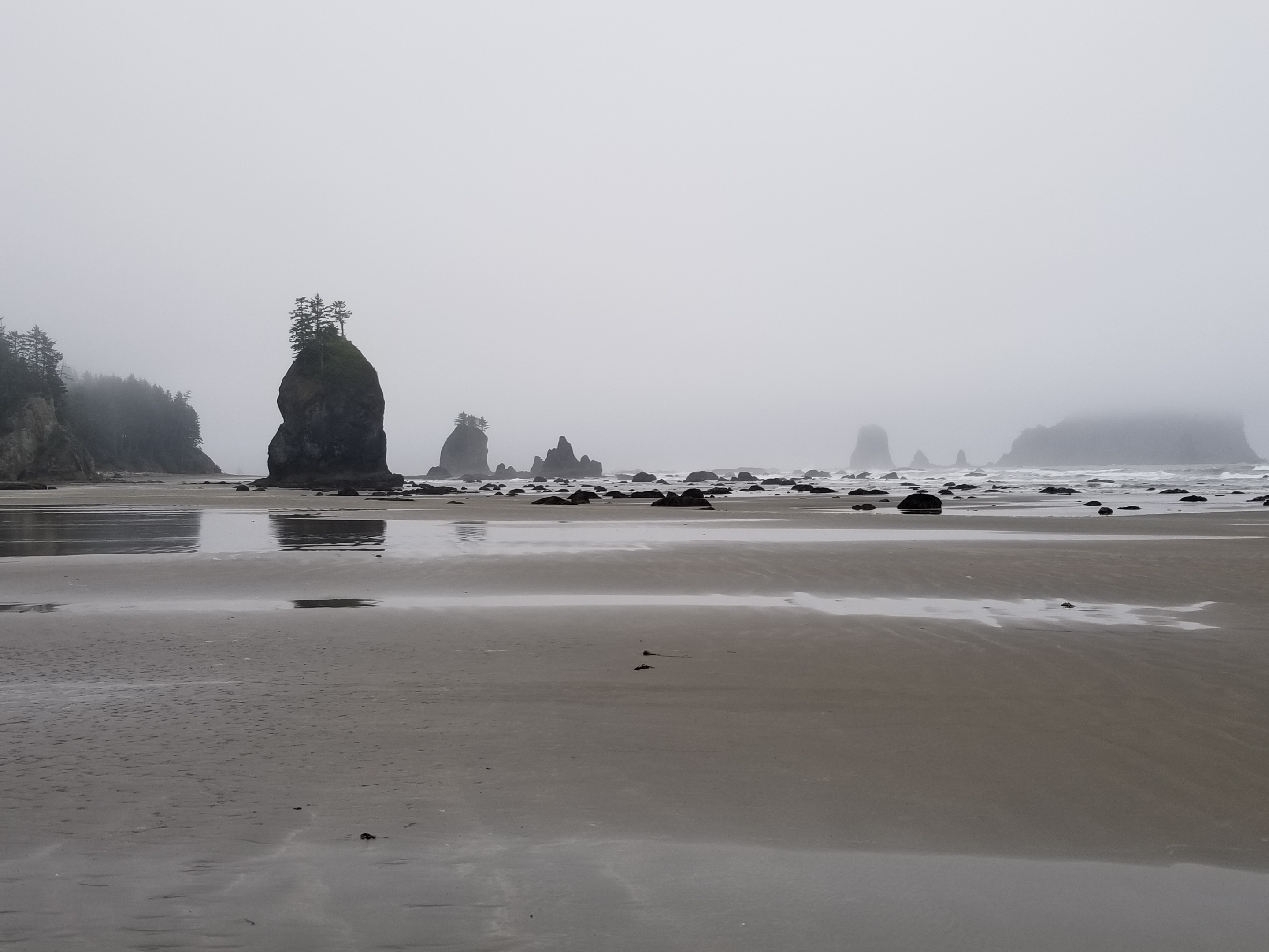
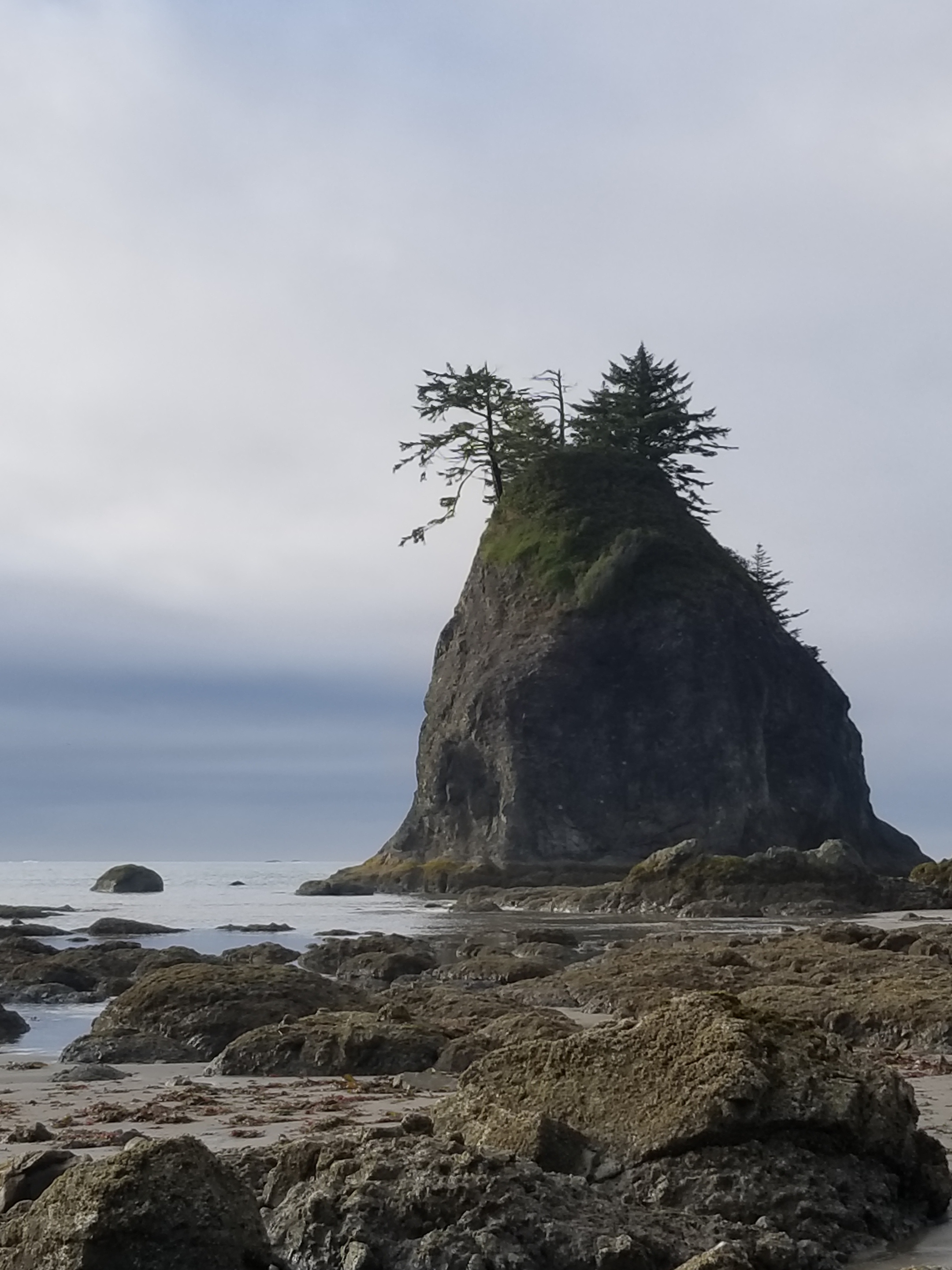
I got up early because low tide was around 7:30. The first part of my morning was easy hiking on firm sand. It was overcast with de minimis drizzle.
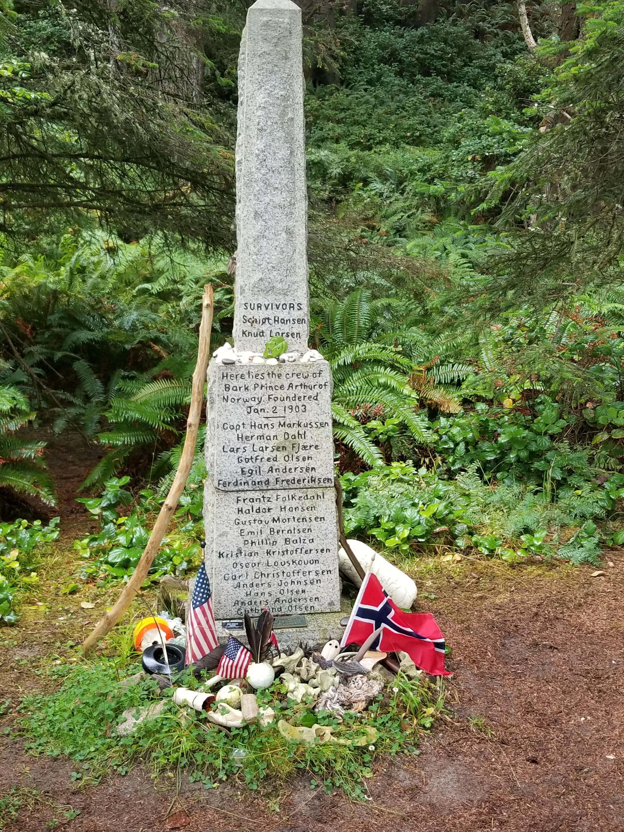
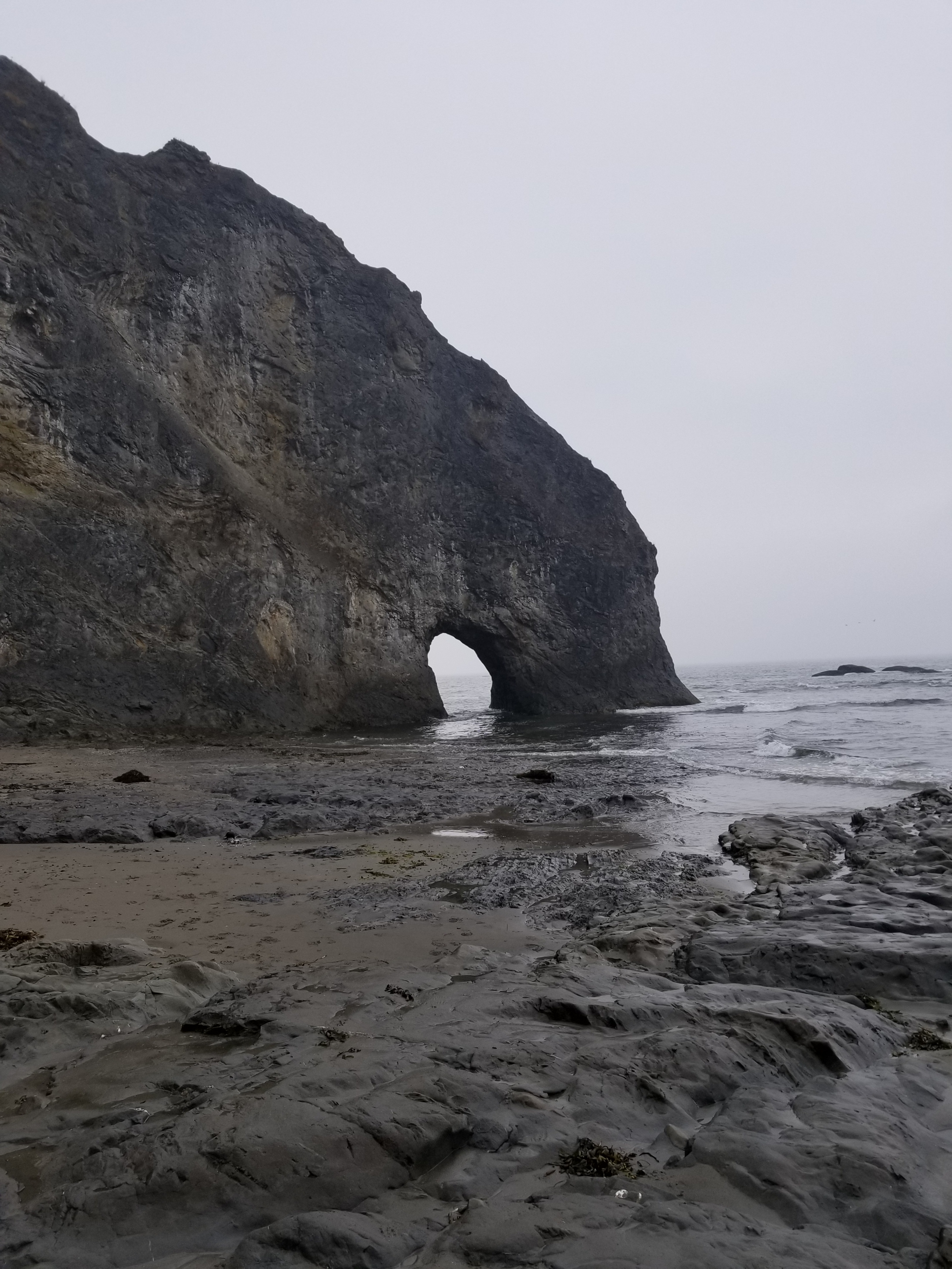
After the easy hiking, I rounded one headland and fortunately hit another lengthy sand beach leading up to the Norwegian Memorial and the adjacent campsite. The Prince Arthur of Norway crashed on the rocks nearby in 1903 and a monument was erected in honor. There were some appropriate mementos at the base of the memorial (flags for the US and Norway) and inappropriate (a shoe insert).
I could’ve stayed at this campsite, but it was still morning and high tide would not happen until after 1:00. However, designated campsites after Norwegian required a reservation. I opted to get close to the first restricted site (Yellow Banks), leaving just six miles of beach before reaching the trail’s end at Cape Alava tomorrow.
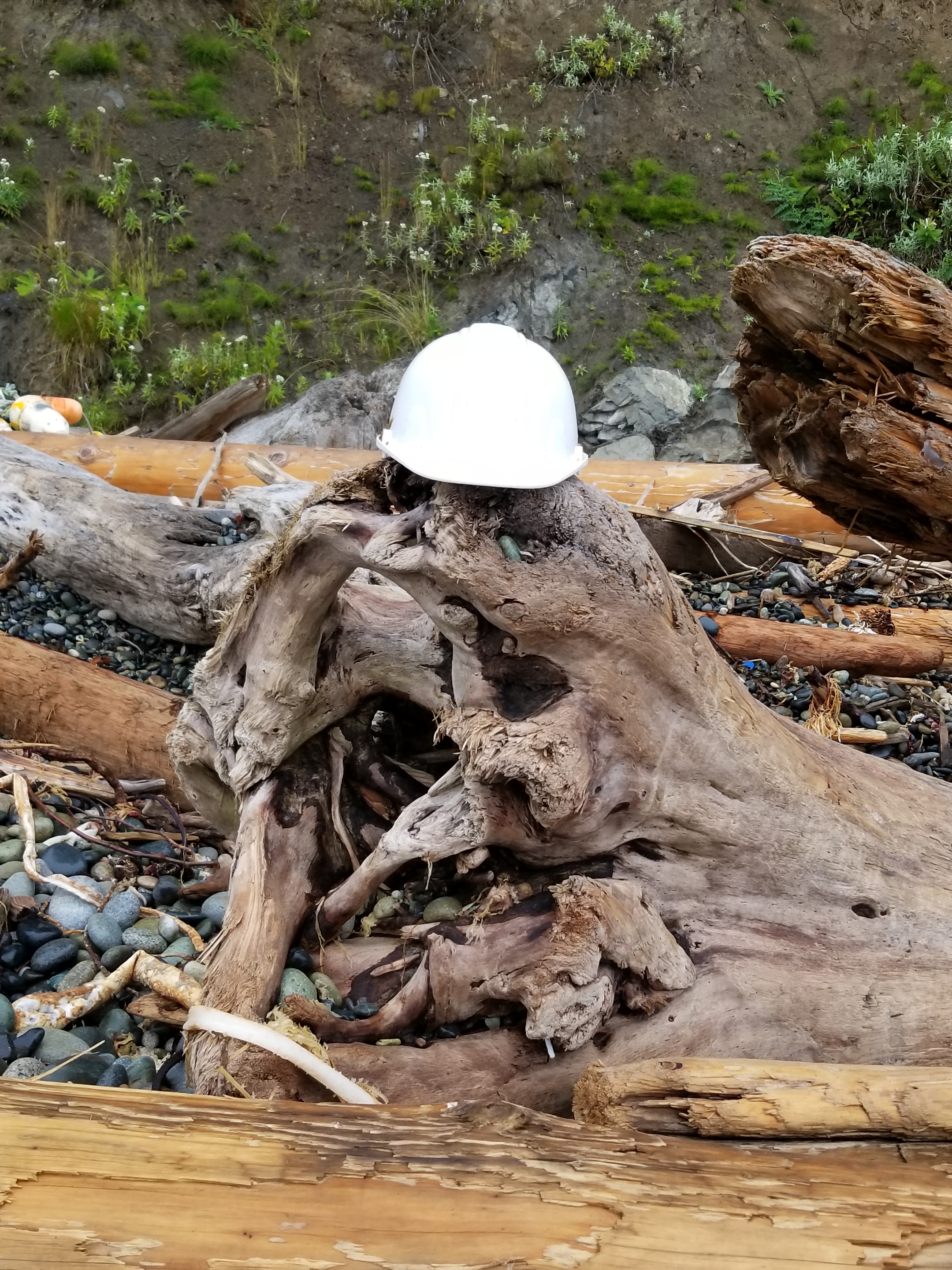
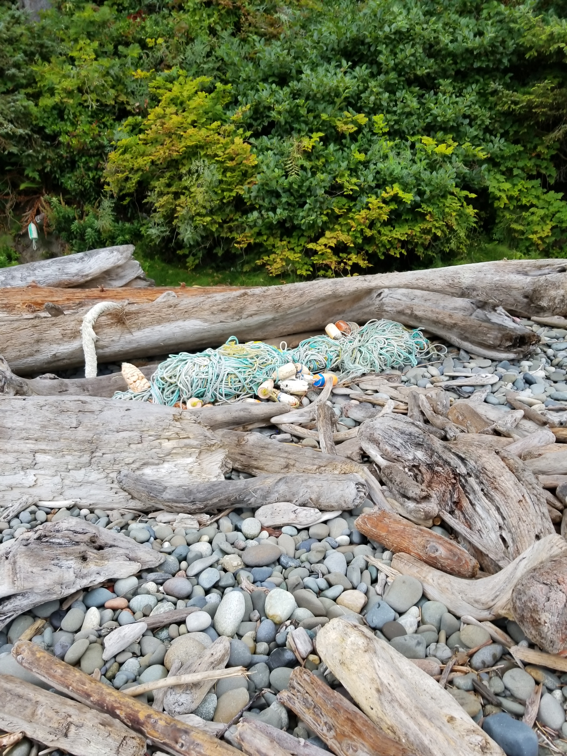
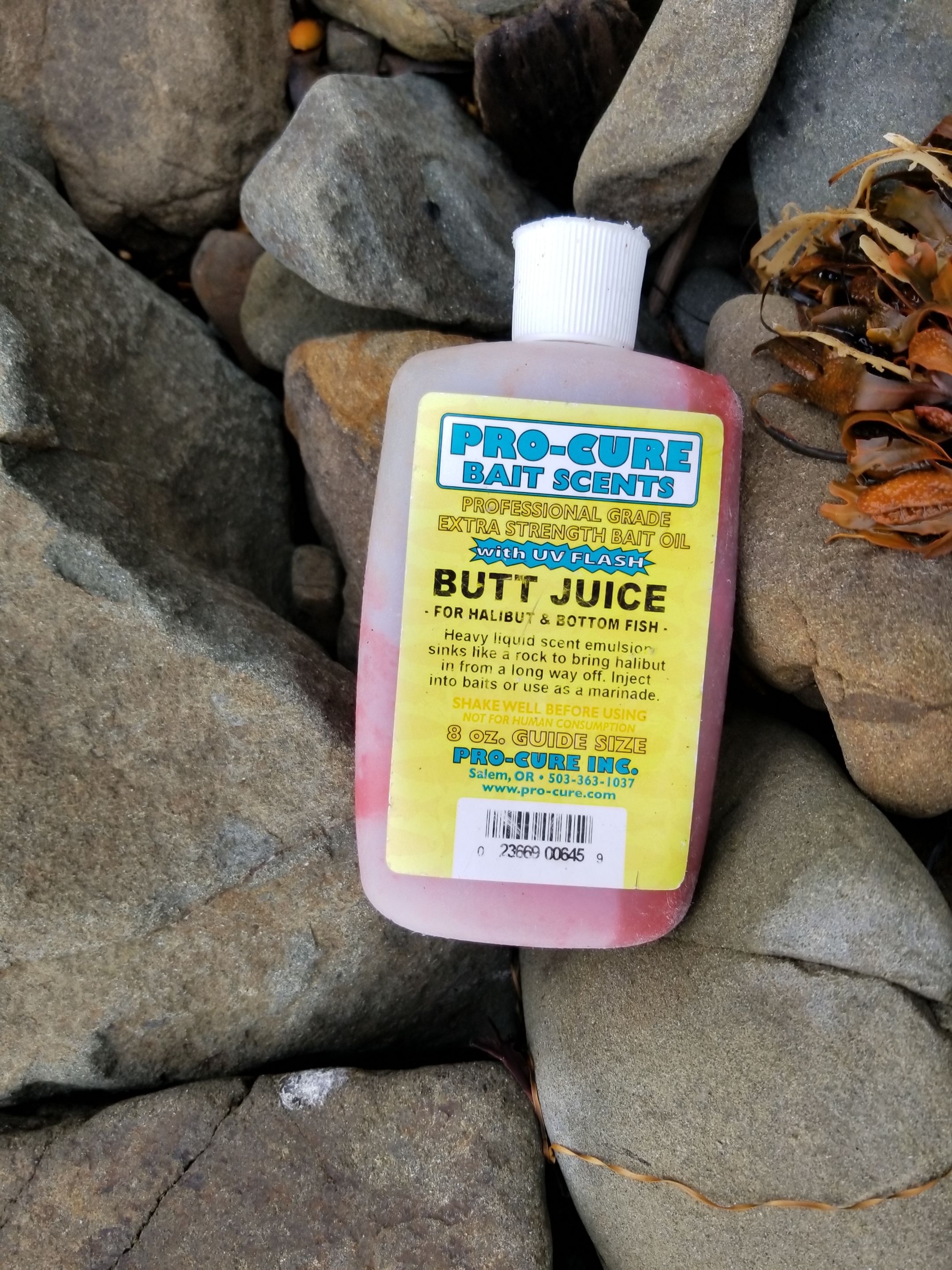
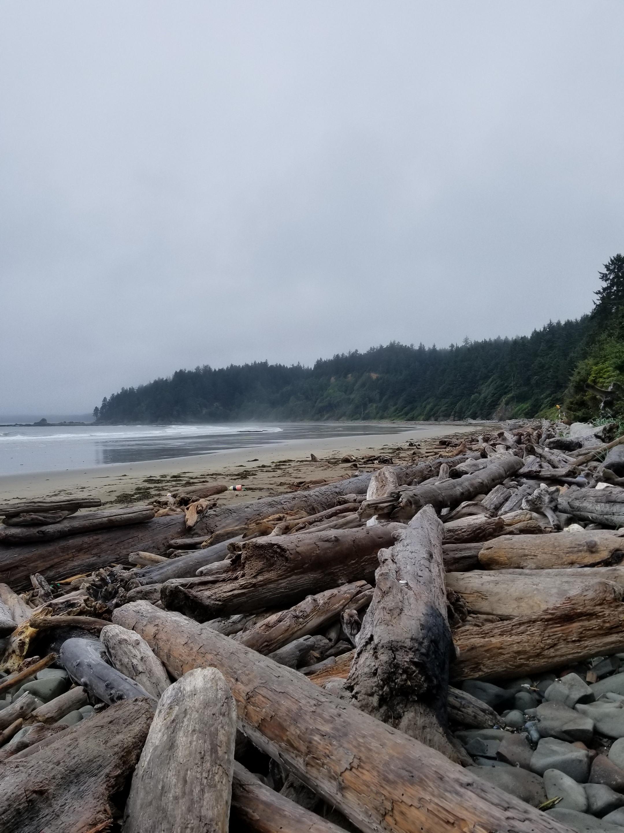
Based on this decision, I had to do some rock scrambling. Along the way I found an amazing variety and volume of waste on the beach. Fishing nets, flotation devices, cable protectors, rusty barrels. The most depressing was the sheer volume of plastic water bottles. Worse, so many of them were half full. Terrible.
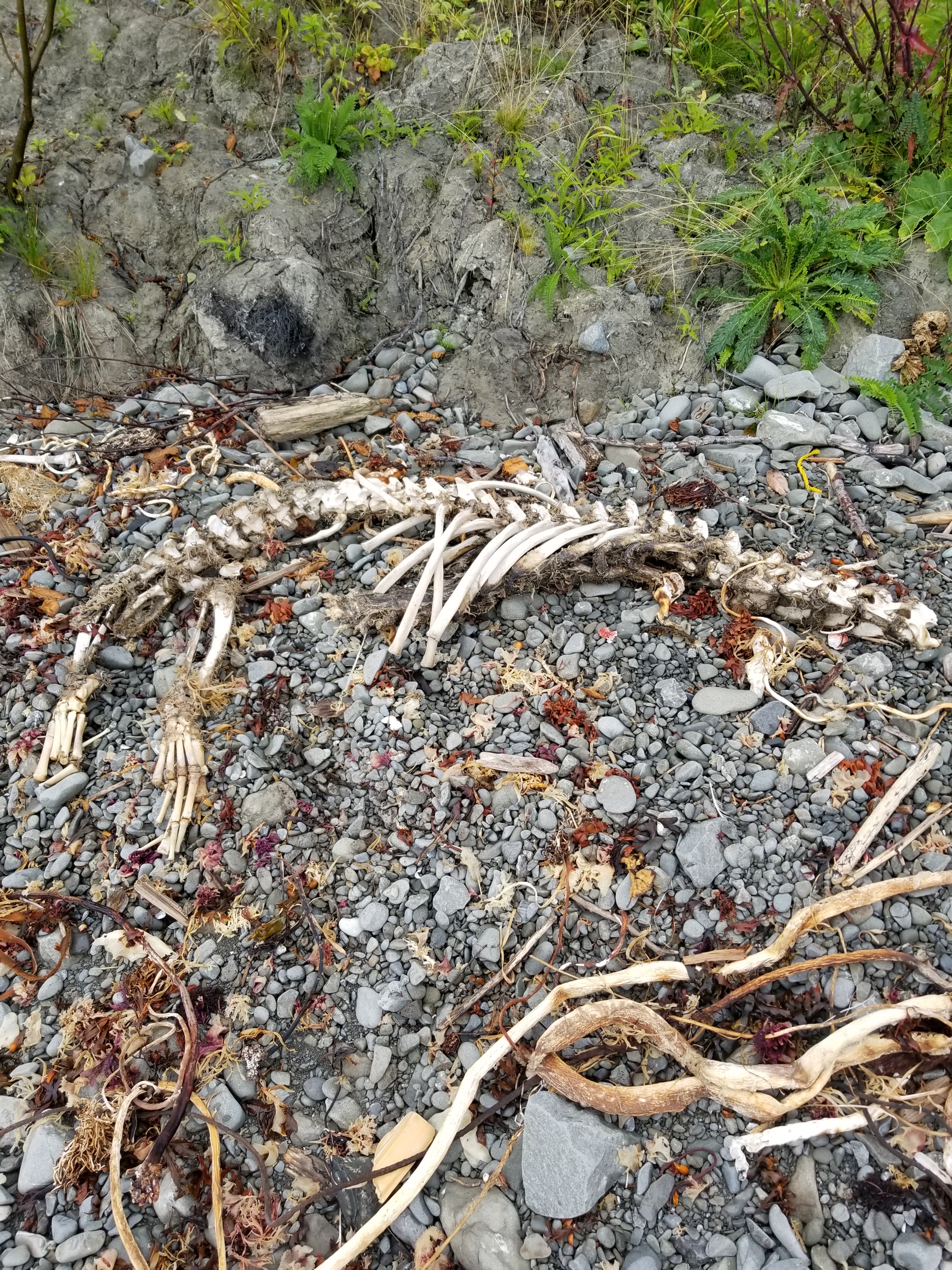
Fortunately, no head was attached.
I was shocked by the large amount of netting that had washed up.
Try as I might, I couldn’t come up with an explanation.
OK. So just once in college I did experiment with Happy Time Assortment.
No comment.
This headless skeleton appeared to from a sea lion.
I found a cove that seemed very remote based on the amount of material washed up. It had little beach and a lot of driftwood. Since high tide would be in soon, I opted to get up high and wait for the tide to recede. I found a good spot and even managed a short nap.
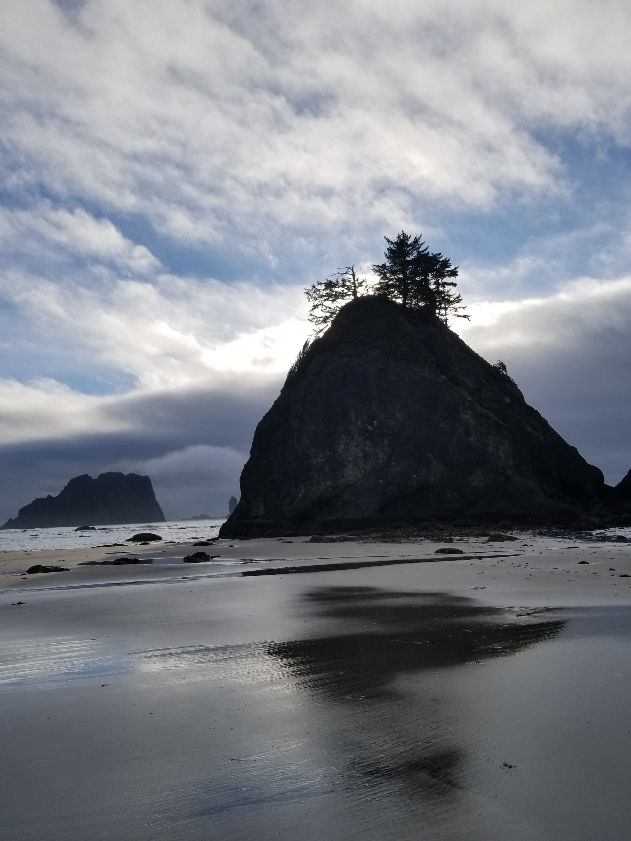
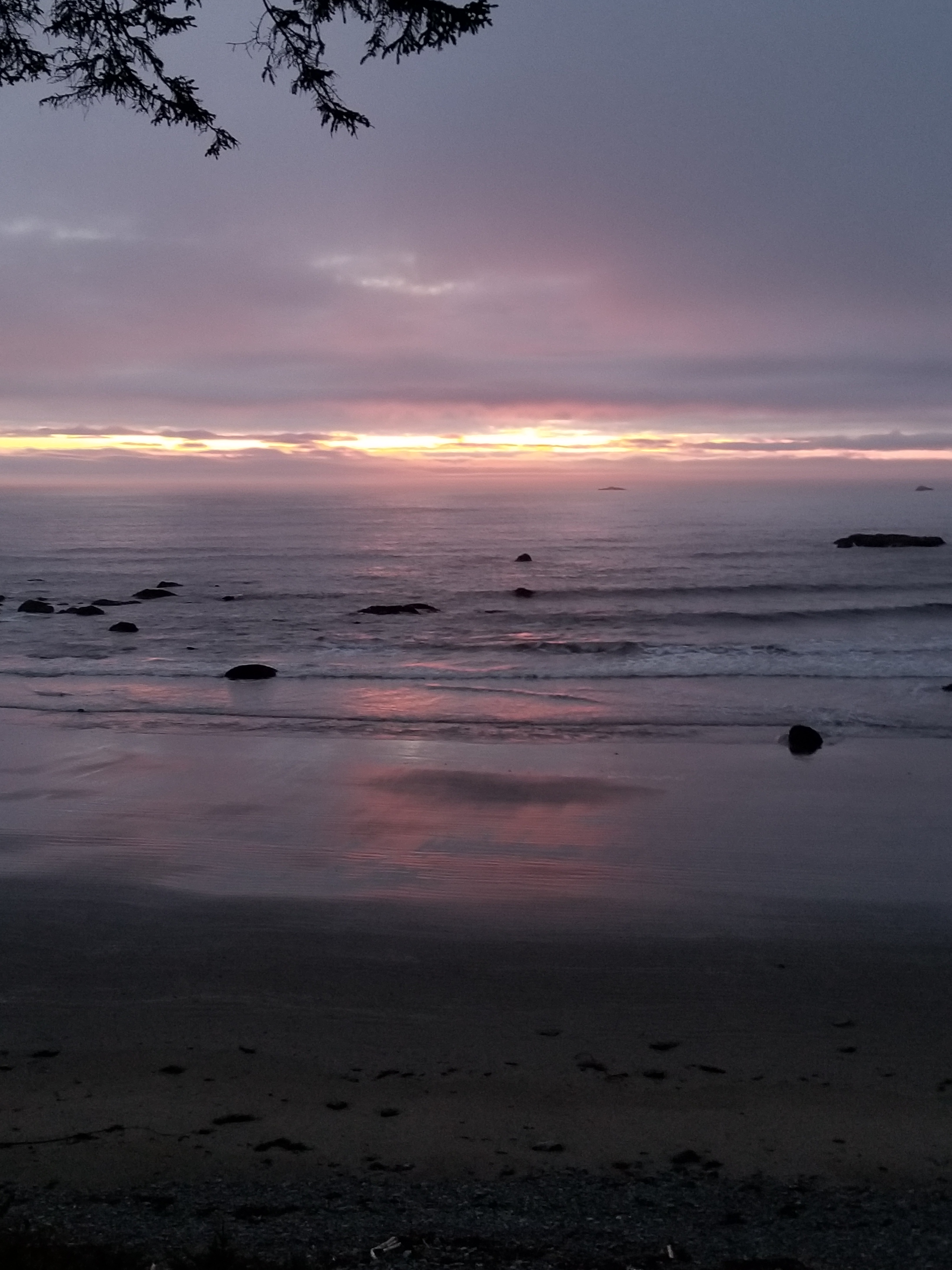
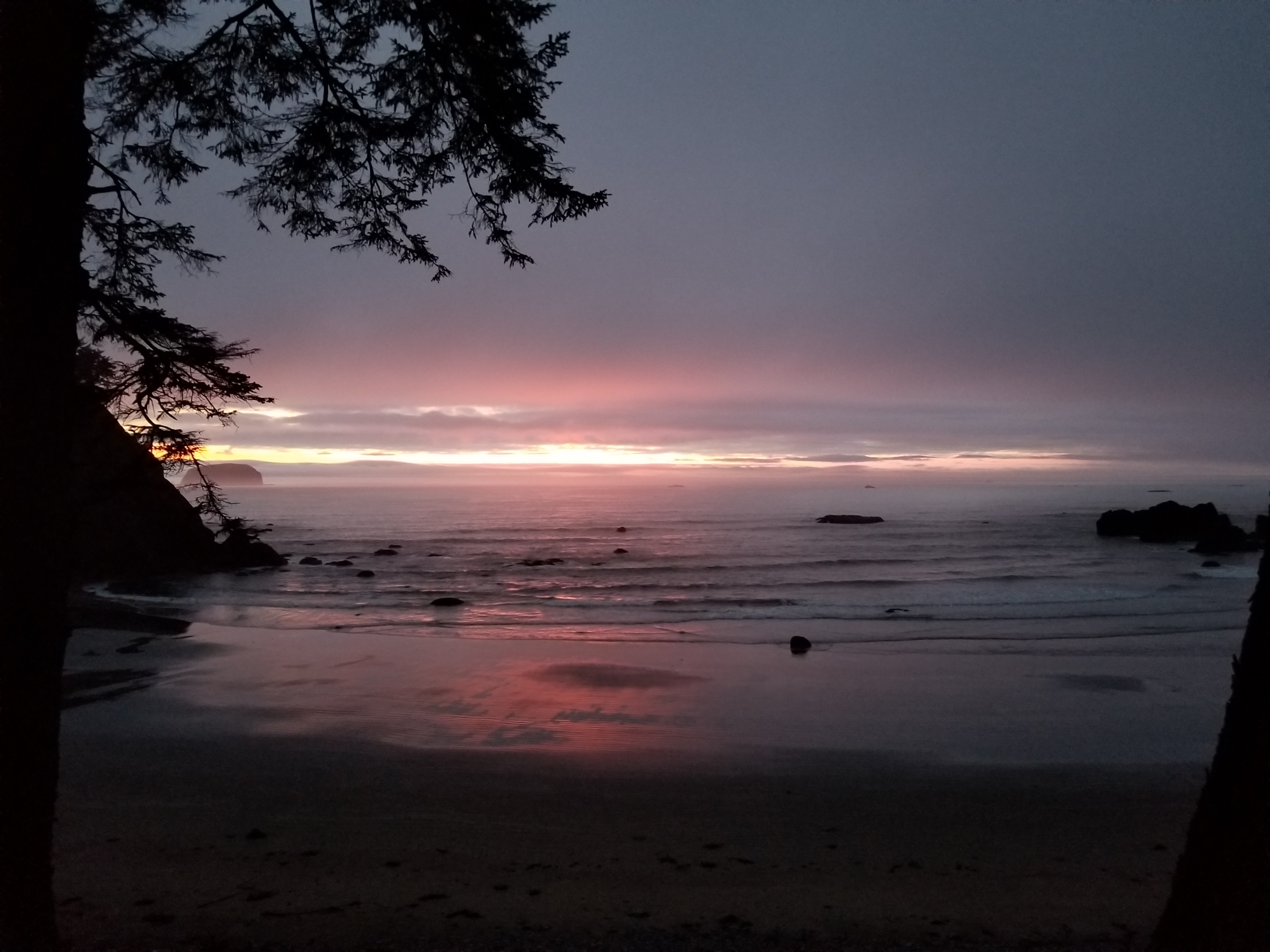
Moving again, I soon approached Yellow Banks. Before it, there was a well-used campsite that I grabbed. I had a late dinner and watched the horizon, hoping for a repeat of last night’s show. Unfortunately, the sky remained gray. As this was my last night, I reflected a bit but did not get sentimental. It was time to finish.
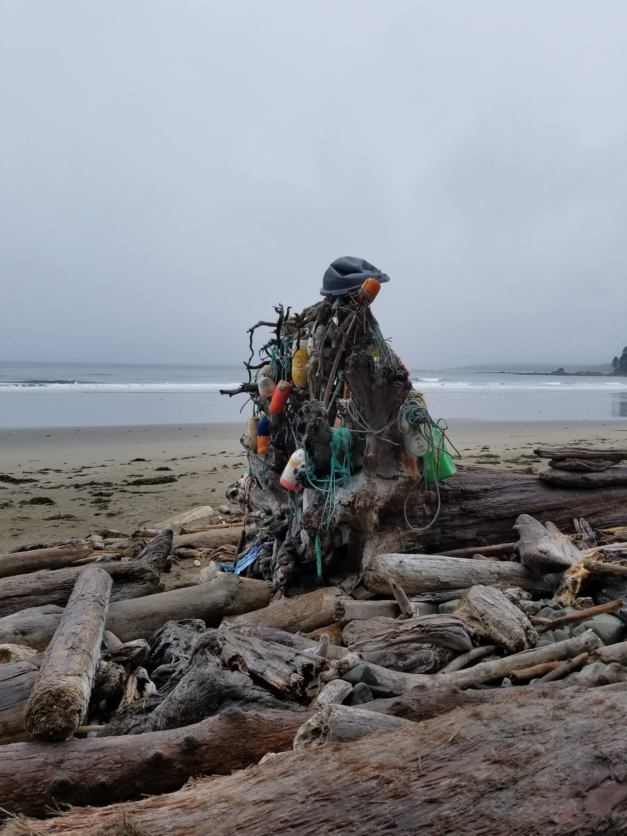
This decoration marked the entrance to my camping spot.
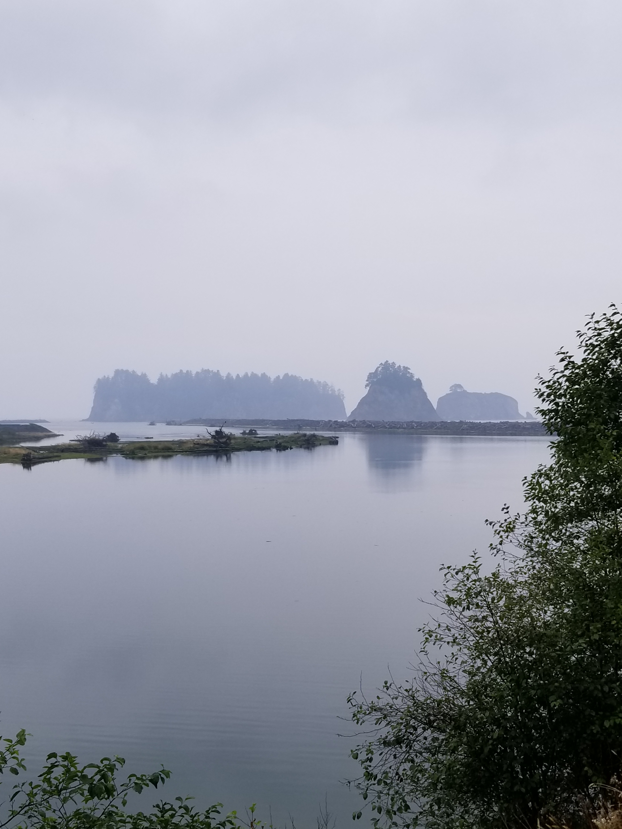
Looking up the cove, I could barely see the Yellow Banks.
August 25, 2018. From Forks to a stealth camp between the Chilean Memorial and Cedar Creek campsites.
I enjoyed my last shower and went to the transit station. I was going to take a local bus over a 6 mile stretch of highway with non-existent shoulders. It would drop me off at a corner gas station from which I would walk five plus miles to ONP and Rialto Beach.
The skies were gray and damp, promising rain. The bus stop at the corner station served breakfast. I couldn’t refuse. The only choice was a breakfast burrito. I grabbed my coffee and sat down to wait while they cooked it.
While checking my maps and tide tables, a backpacker came in and asked if I was doing the PNT. He was doing a short coast hike, but recognized the PNT maps from a few years back. His trail name was Tiger Lily.
The breakfast burrito was simply a frozen one they microwaved. Alas, beggars can’t be choosers, so I ate with gusto. And a hell of a lot of salsa.
I refilled my coffee and wandered out to begin hiking down Mora Road. Almost immediately it started drizzling. I got out my umbrella. I must’ve looked like a sissy backpacker with my umbrella in one hand and my coffee in the other.
Not caring what I looked like, I made steady progress west. At times there was no shoulder. Almost always cars gave me ample room. If I could hear a car approaching from behind and see one coming I just stepped off into the bushes. When I reached the ONP boundary, the speed limit mercifully dropped to 25 mph.
I arrived at Rialto Beach. Despite the drizzle and cold, the parking lot was full. I used the faucet to fill up on fresh water. Like most tourist locations, about 70% of the people stayed within 500 feet of their car, so very quickly I was on uncrowded beach.
This beach was mostly sand with driftwood stacked up past the high tide line. The tide was coming in, so I found a sheltered spot, got out rain gear, and with my umbrella made a dry spot where I tried to nap with limited success.
As the tide turned, I packed up and went north towards Hole-in-the-wall. If you’ve never backpacked on a sandy beach, it primarily consists of trying to find the firmest sand. Soft sand saps energy. On rocks, the name of the game is not putting all your weight on the slippery rocks and plants. Plus, have trekking poles or a stick to help with balance. I didn’t want to break my expensive trekking poles on the last couple days so I just found a sturdy stick.
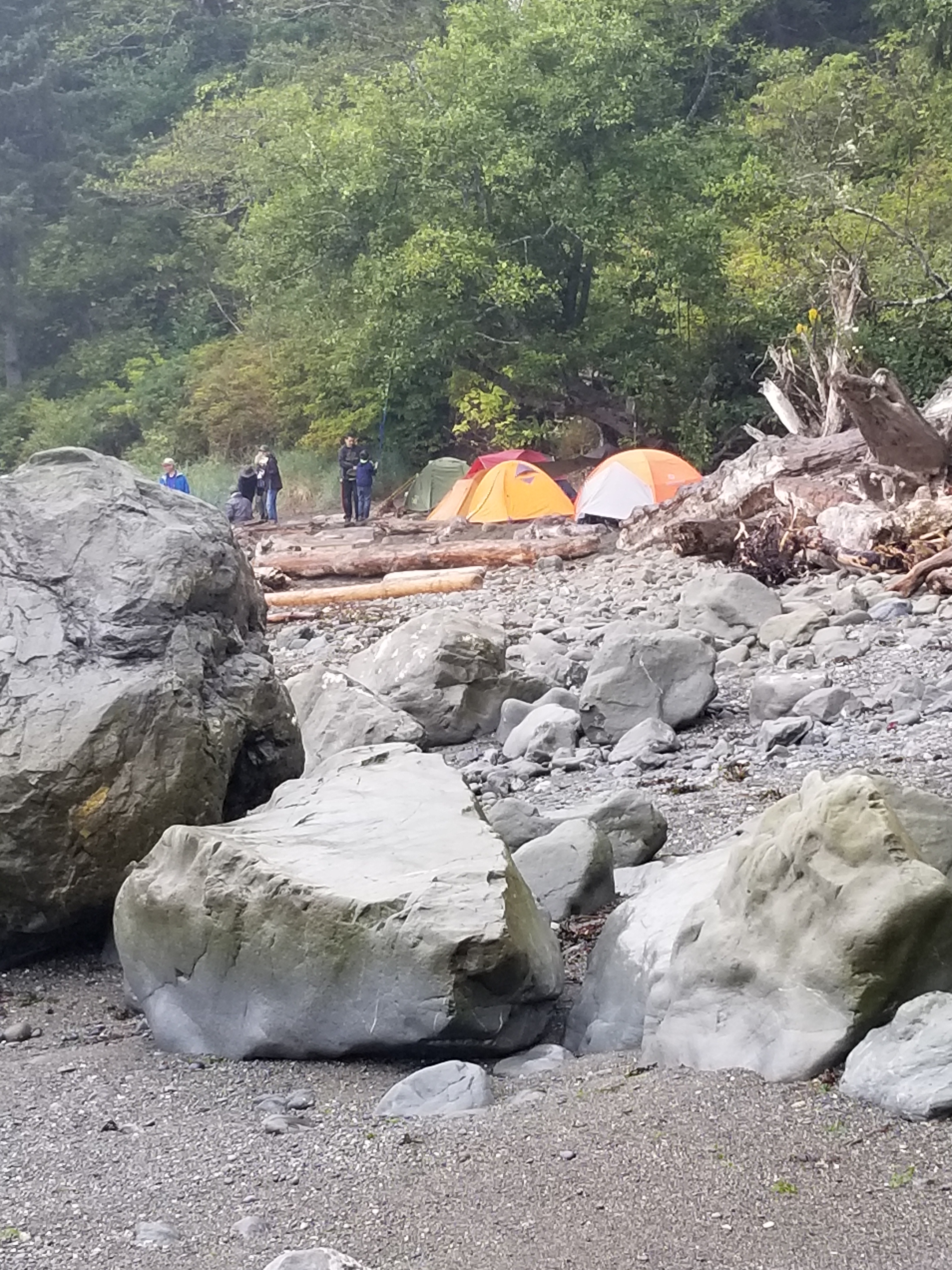
I cleared Hole-in-the-wall easily. I loosely joined three guys hiking north to their campsite, the Chilean Memorial so named for a monument honoring the sailors from a Chilean ship that wrecked off the coast in the 1900s. The guys were from the Seattle area and doing an out-and-back.We navigated some slippery rocks.
At Chilean Memorial there was a dense tent-city. I was glad I wasn’t camping there. Instead, I was aiming for a stream about three miles north.
Coincidentally, I ran in to Tiger Lilly. We talked for about an hour to let the tide drop further to ease hiking around Cape Johnson. He was a Park Ranger, off duty, and had extensive hiking experience.
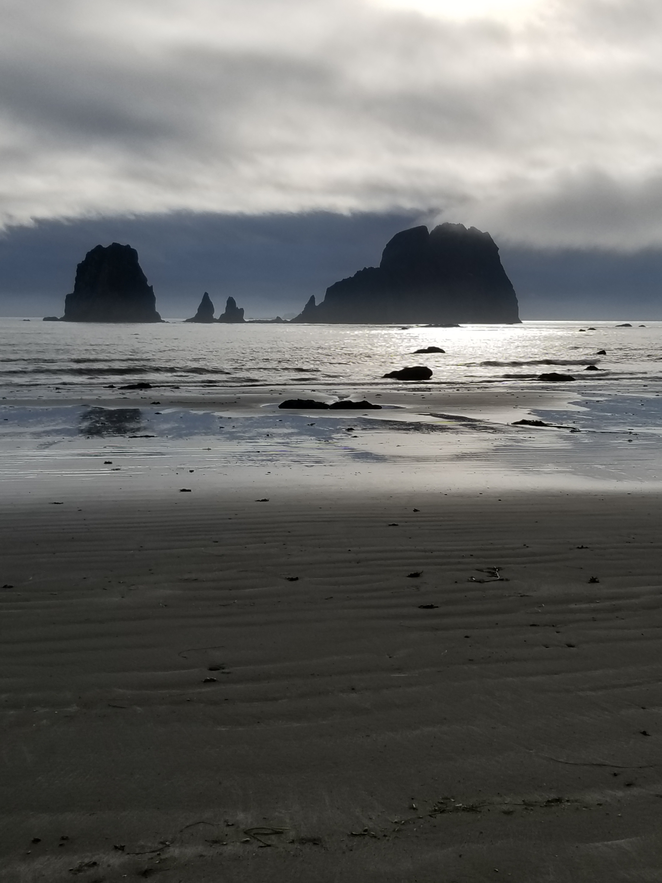
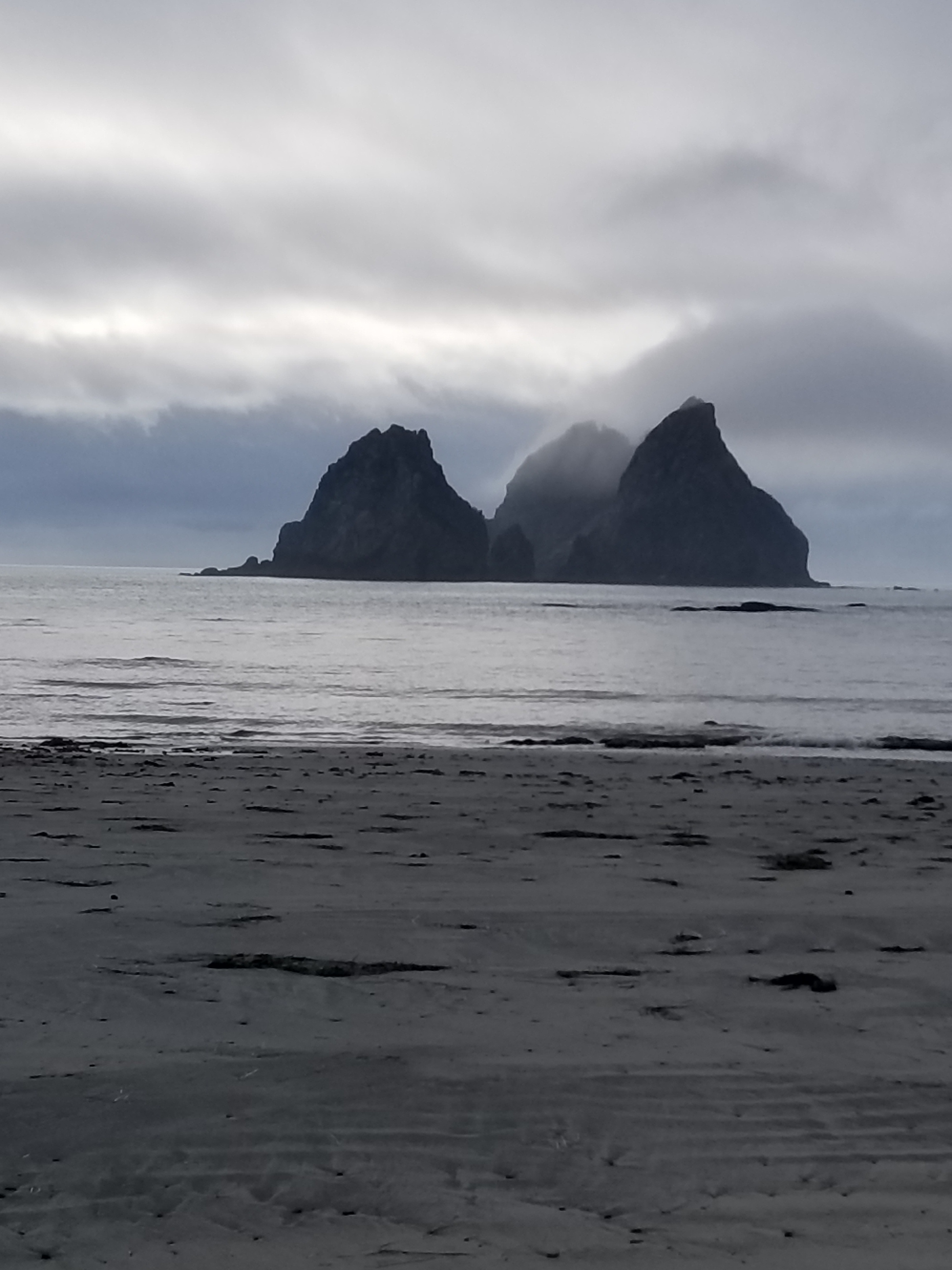
I crossed one headland using the ropes, but most I went around. As the afternoon ground towards evening, the drizzle ended and the sun even poked out. This was especially nice to highlight the various islands near the shore.
Around 7:30 I found a great campsite. It was about 60 feet up a bluff, under a large pine. It even had a fire circle which would’ve been nice.
I enjoyed my next to last dinner watching the tide recede towards the setting sun. To my delight, the sun actually pierced the clouds on the horizon giving me a light show before bed.
I put my bear canister in the bushes a distance away. They say it is not bears so much as raccoons that necessitate the canister precautions. It turned out to be a great day.
As I unfolded myself from my cramped sleeping spot, I was psyched. Today was a town / resupply day. A shower. Food on a plate. Sitting on furniture. Hot water.
I woke up a small herd of cow elks when I started. I was unable to get a good photo as they crashed their way through the thick brush.
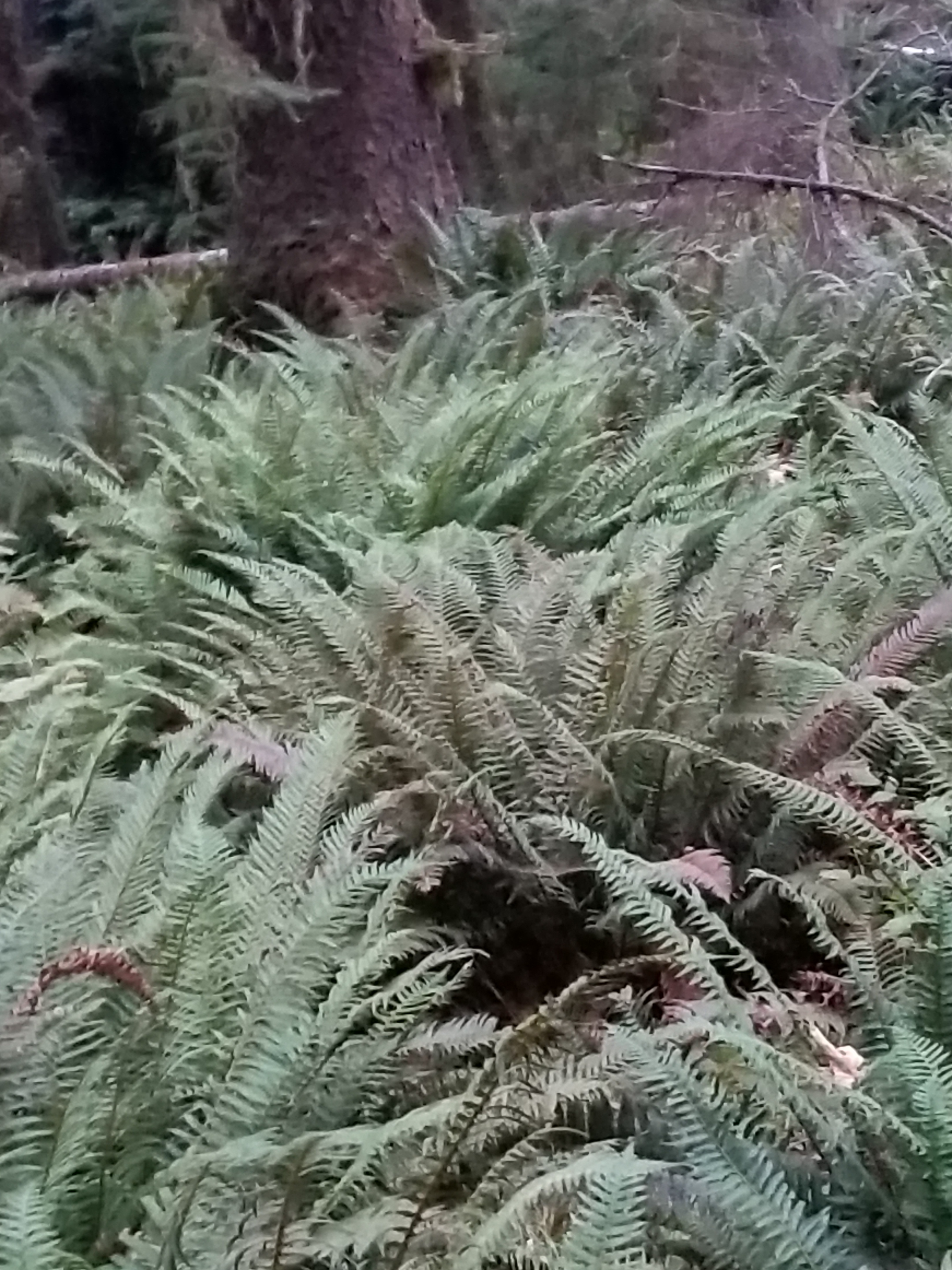
These large ferns dominated the forest floor
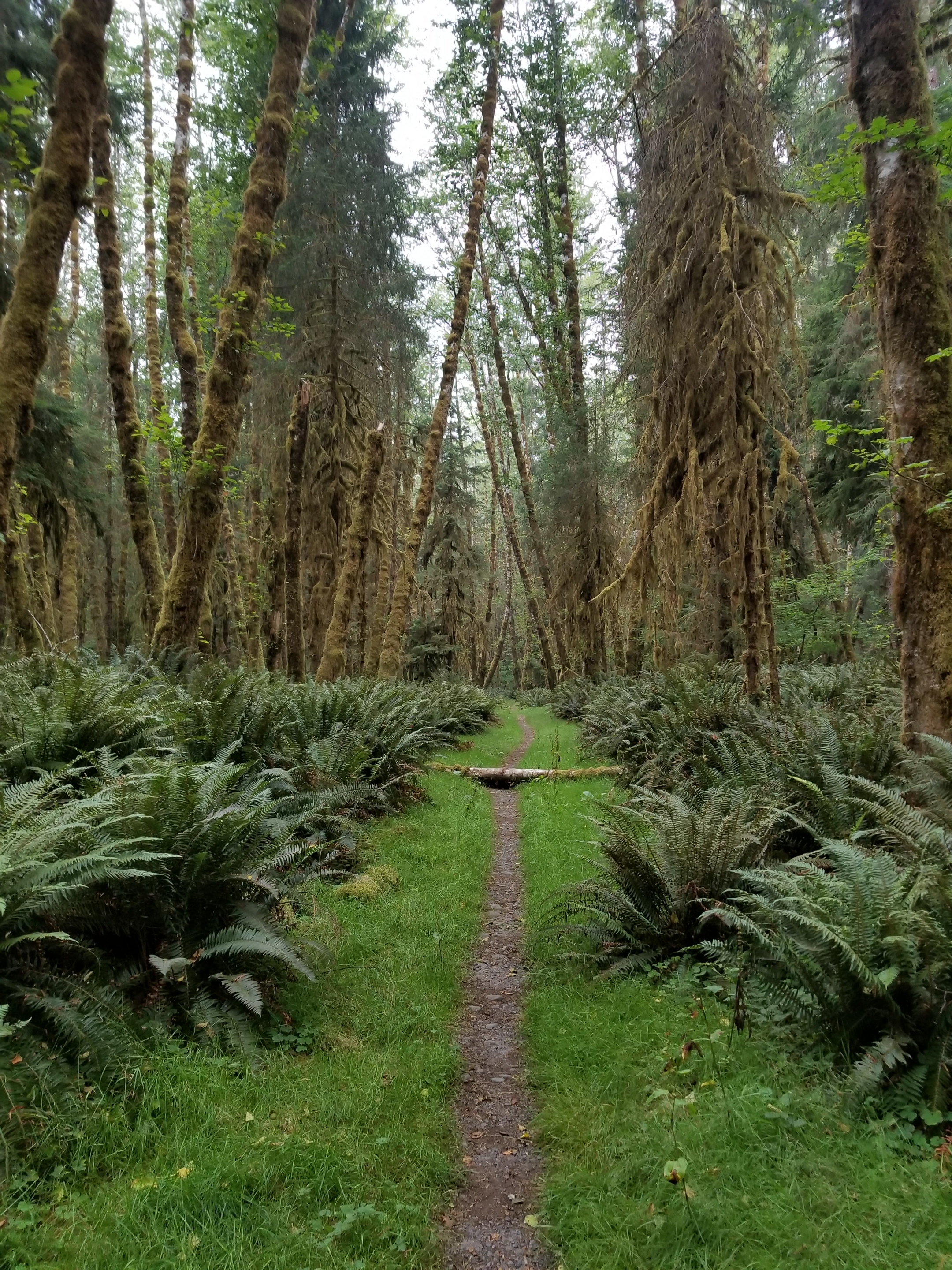
Pretty, nice trail.
The closer I got to the road, the better the trail maintenance. The better the trail maintenance, the faster I went. My morning goal was to reach Bogachiel State Park where I might catch a 10:30 bus to Forks. If I missed that it would be hitching or a paved highway walk.
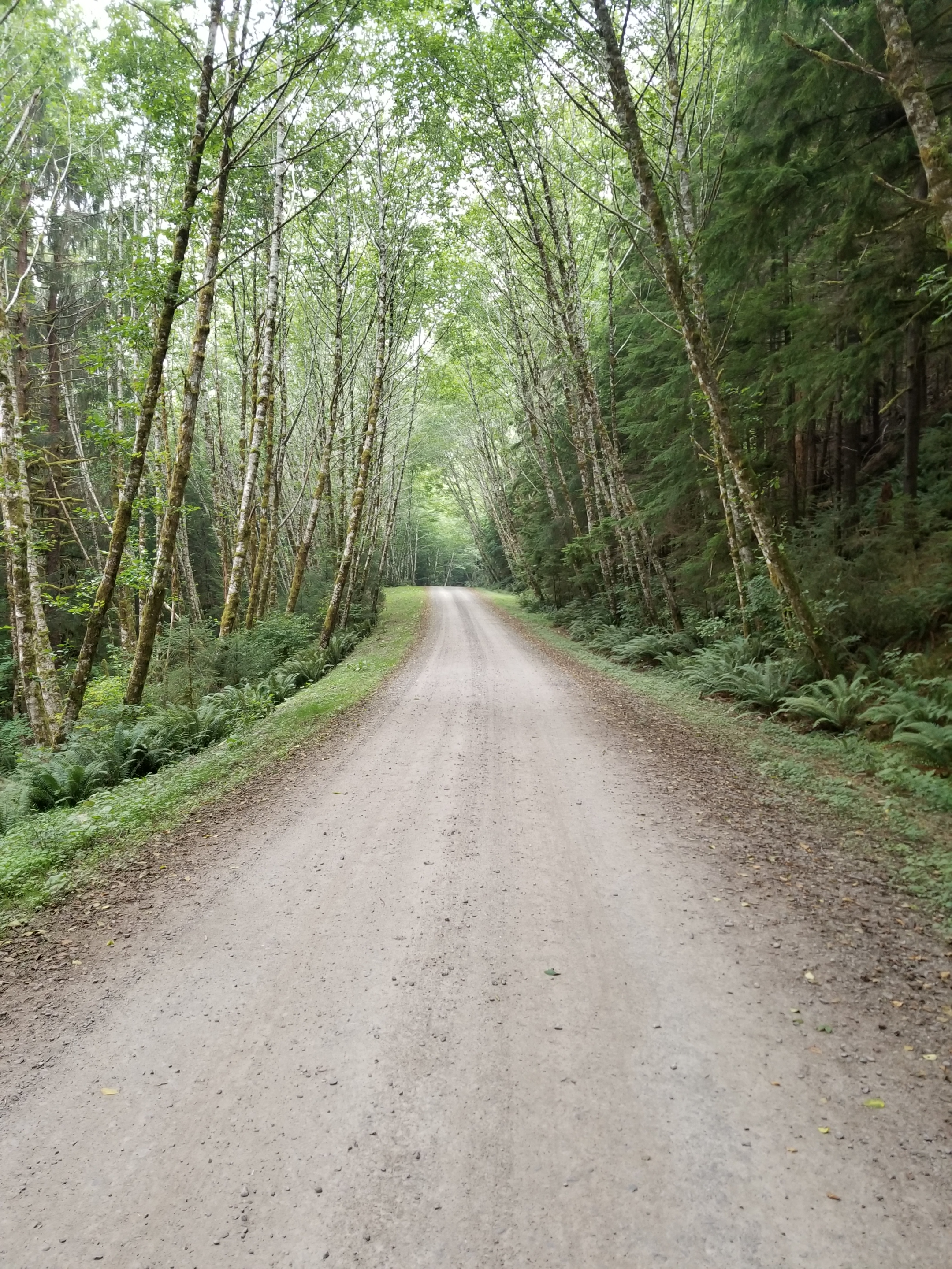
In short order I was off the trail and on to a gravel road. I kicked my speed up another gear. It was overcast and cool, so hiking fast felt good and easy.
If all road walks were like this they would be popular.
Then, I hit the Road Closed sign. I was supposed to take the curiously named Undi Road. It was closed and a new Undi Bypass was indicated. At first I was in denial and tried walking the closed road. However it was truly abandoned and I went back to the bypass. It did not show on any maps, so I had no idea how long it would take. Immediately, however, it was clear it was steep.
I abandoned hope of catching the bus. There were utility crews stringing power lines and the road felt very new. Only a few cars went by. One of them flew by and dusted me big time. It had Minnesota plates. So much for Minnesota nice.
The Bypass ended and I was on blacktop, resolved to hiking into town. Amazingly, a guy who had just come down the Bypass stopped and asked if I wanted a ride. You betcha.
He spent the six miles bitching about local government and the bypass. He was from Hibbing Minnesota. He was a pretty good guy and dropped me off at the wonderfully named Dew Drop Inn.
I couldn’t get in to my room for five hours. So while a shower was out, I managed to get a breakfast and hit the library. Fortunately, I ran in to One Direction just as they were heading out to finish their trip.
Forks is a fading town, losing lumber and holding on to waning tourism related to the Twilight series and sport fishing. I must say the food was bad at every place I ate. Since this was the last resupply town for me, I was disappointed.
I took my final resupply package and got ready for my final leg. It would walk to and then along the coastal portion of ONP, ending at the westernmost point of land for the 48 states. My permit was goofy, so I hatched a plan to spend two (instead of five) nights on the beach. I appreciated the symbolism of starting a hike at the crest of the continental divide and ending at the farthest west point possible. Equally, however, I know how annoying beach walking can get.
I tossed and turned most of the night, perhaps anxious about finishing the PNT.
August 23, 2018. Deer Lake to Bogachiel Campground
Since I camped in a meadow near a lake, it was inevitable my tent was covered with condensation. It was just a little brisk as I gathered the bear canister and packed.
I went out past the toilet. Given the soil composition and number of visitors, the human waste goes into what can only be described as modified coolers. When necessary, a batch of full ones is swapped (via helicopter I presume) with empty ones. The main takeaway for me was to never, ever buy a used cooler.
I started climbing up from Deer Lake via a different trail. It was 6:30, but once I got past the two main camping areas I was pretty assertive with the “Hey bear” mantra. I didn’t want to startle a black bear sleeping on the trail with a huckleberry hangover.
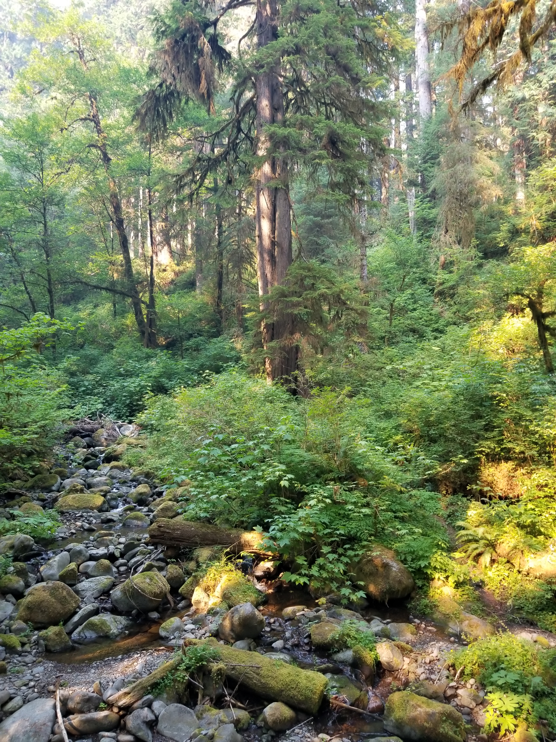
Although the trail was climbing out of the Deer Lake basin, it did so in a gradual manner through pretty country. At the peak, I started walking along a tree covered ridge. It was perfect as far as I was concerned: up high on smooth trail with cool air.
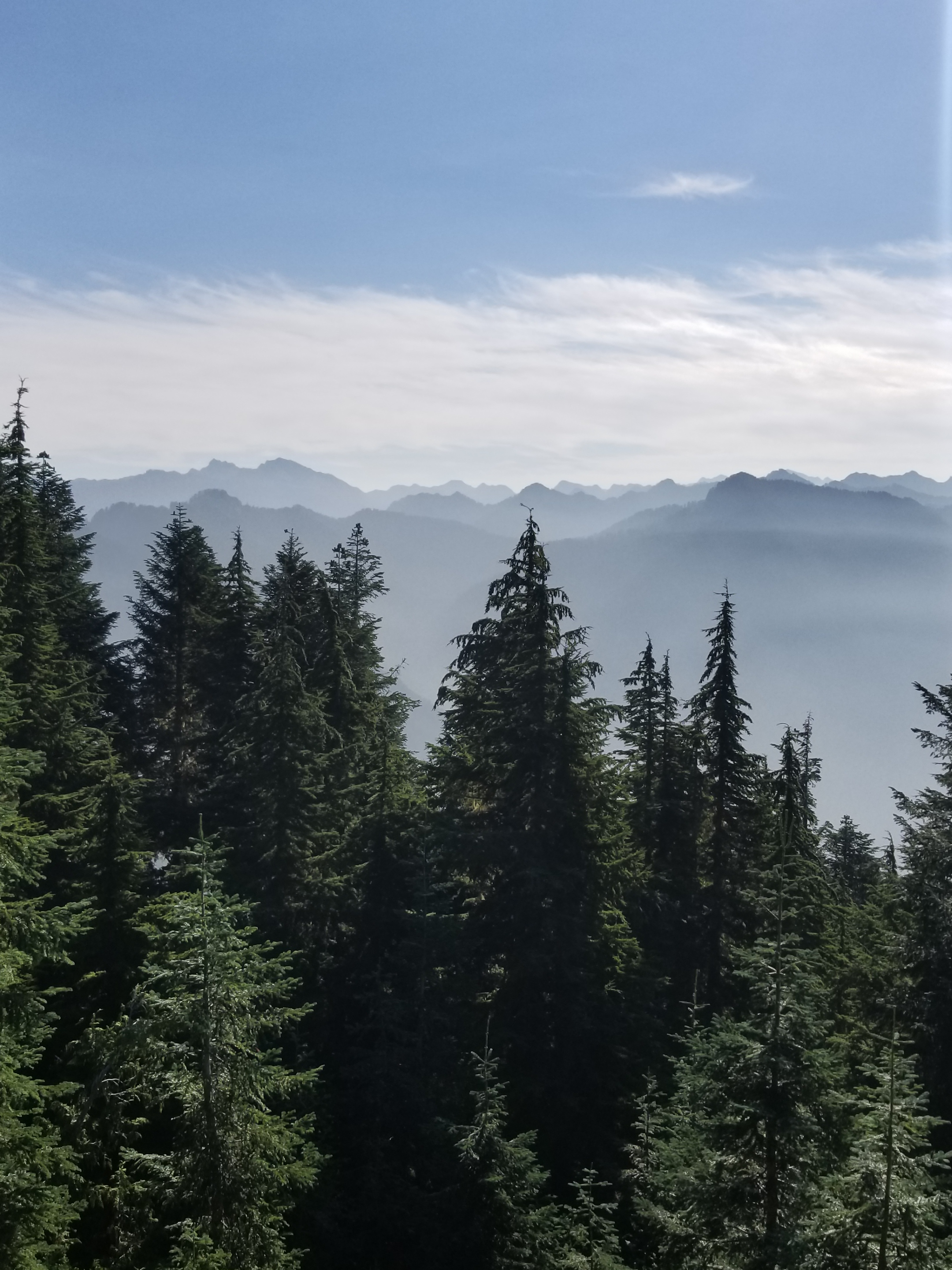
After a few miles, I reached a break in the trees. I was surprised to see that upper level winds had blown away the smoke from some mountain tops given gorgeous views.
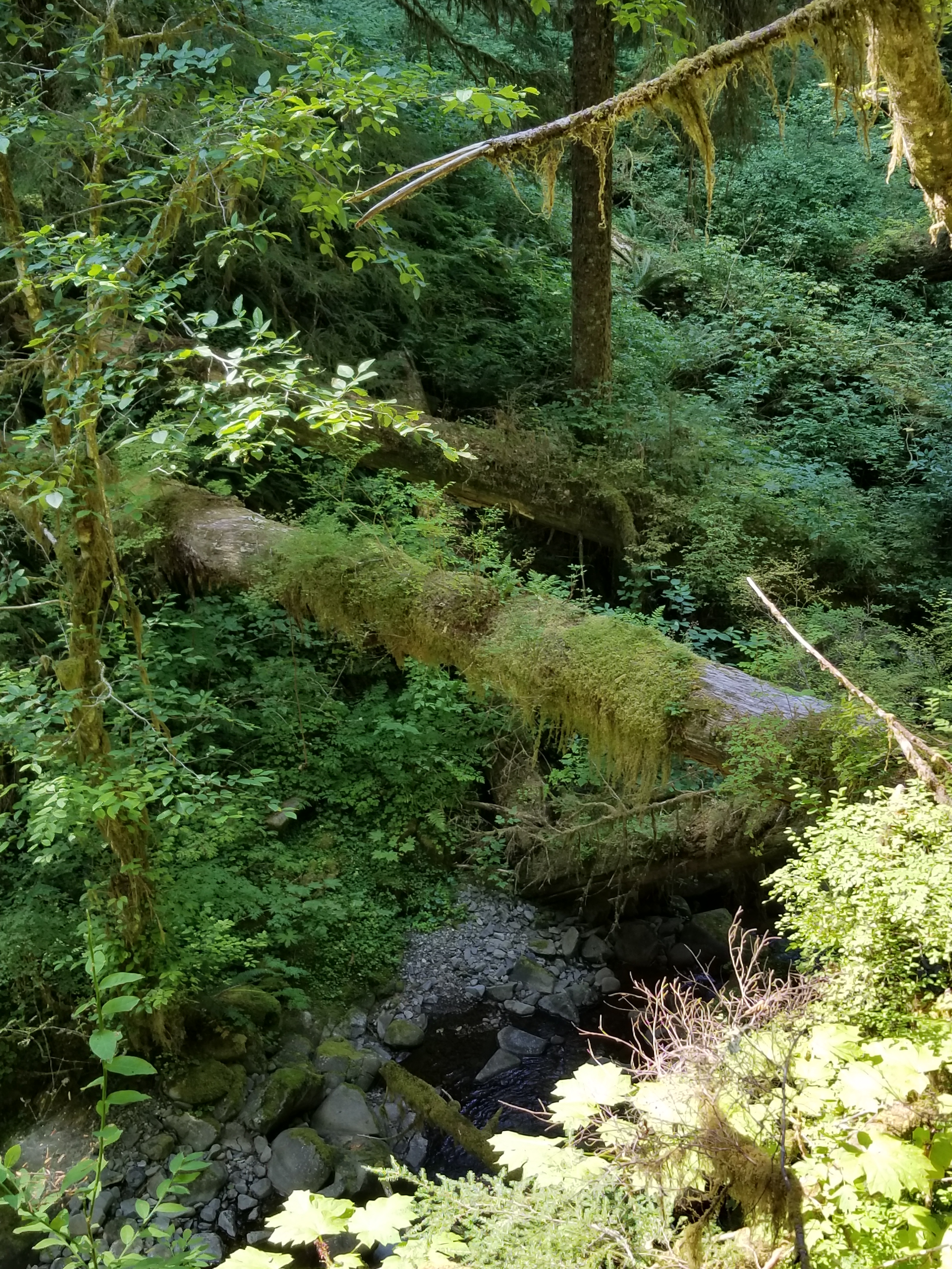
Soon after, the honeymoon was over as the trail descended. The trail turned into a rocky dry creek bed with blow downs. Although the forest was pretty, the condition of the trail detracted from the enjoyment.
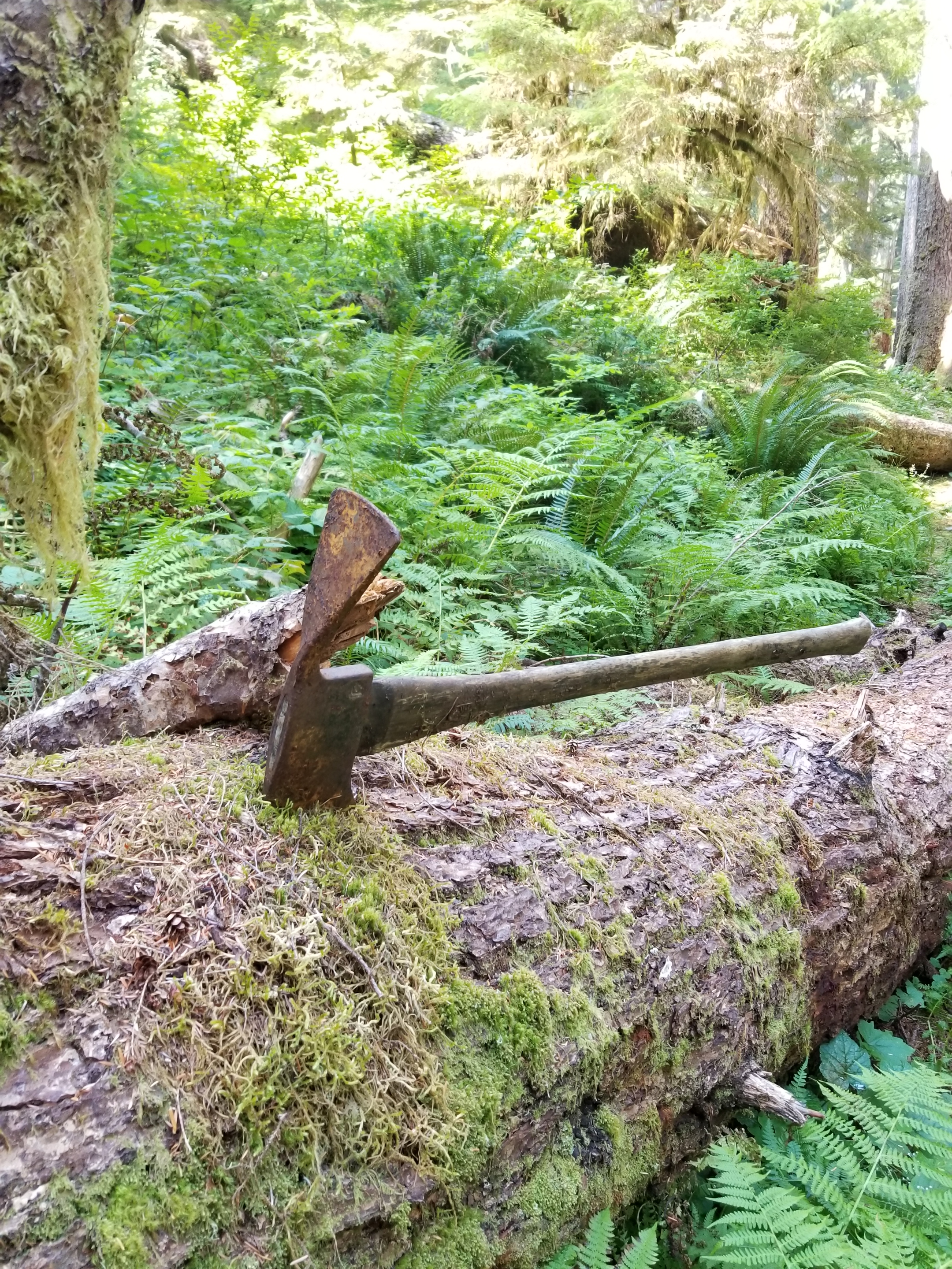
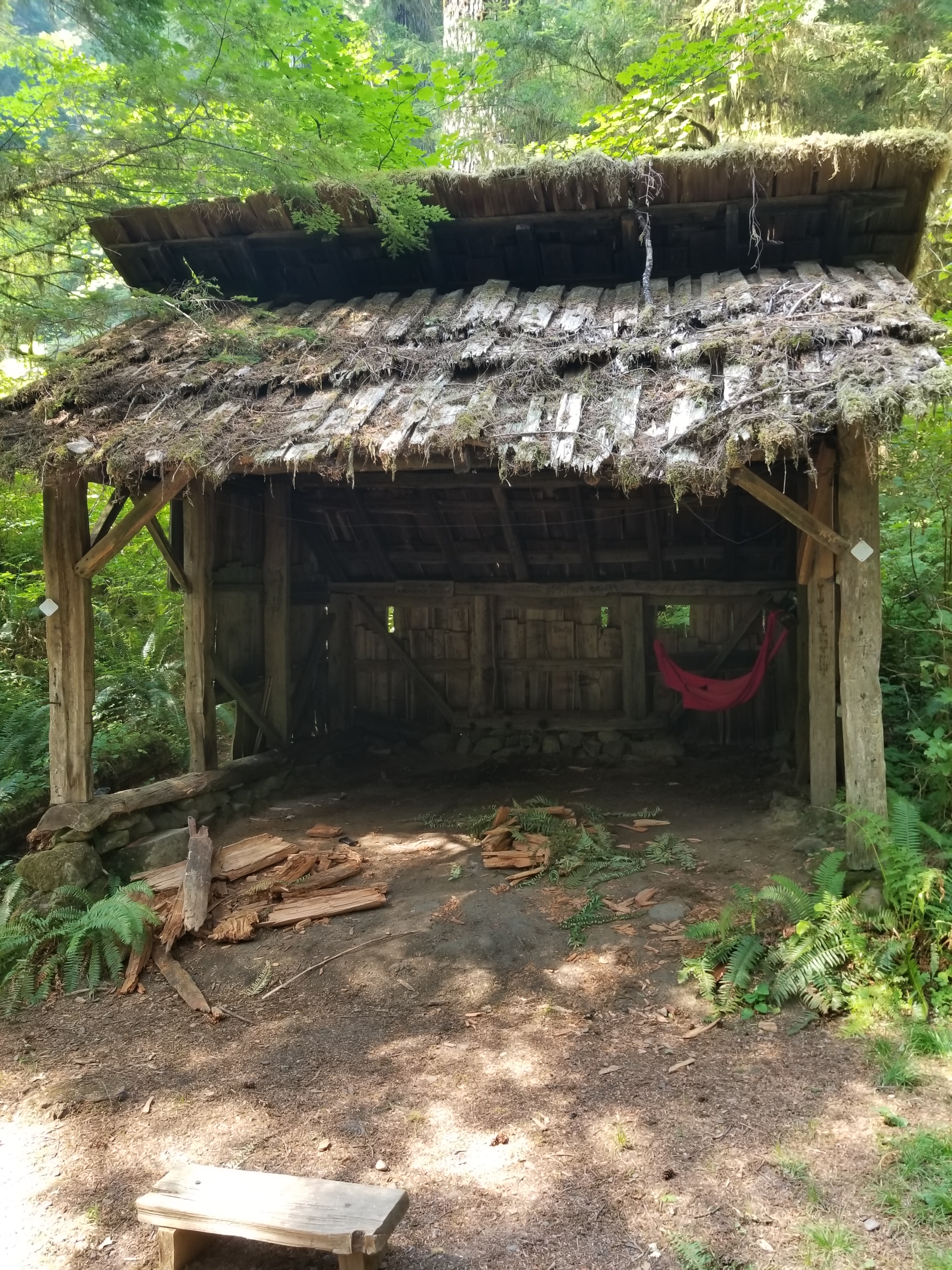
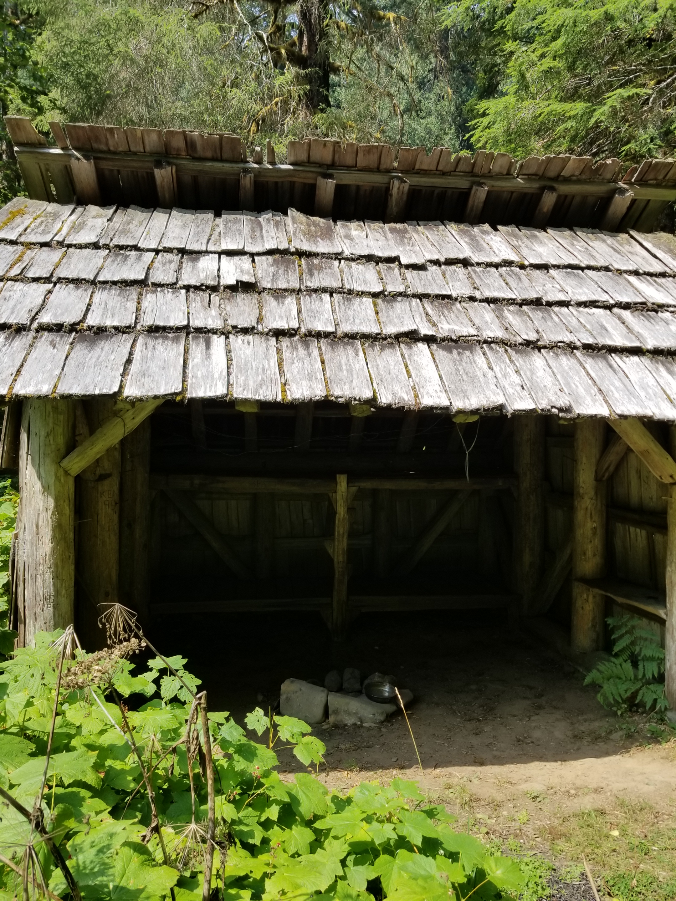
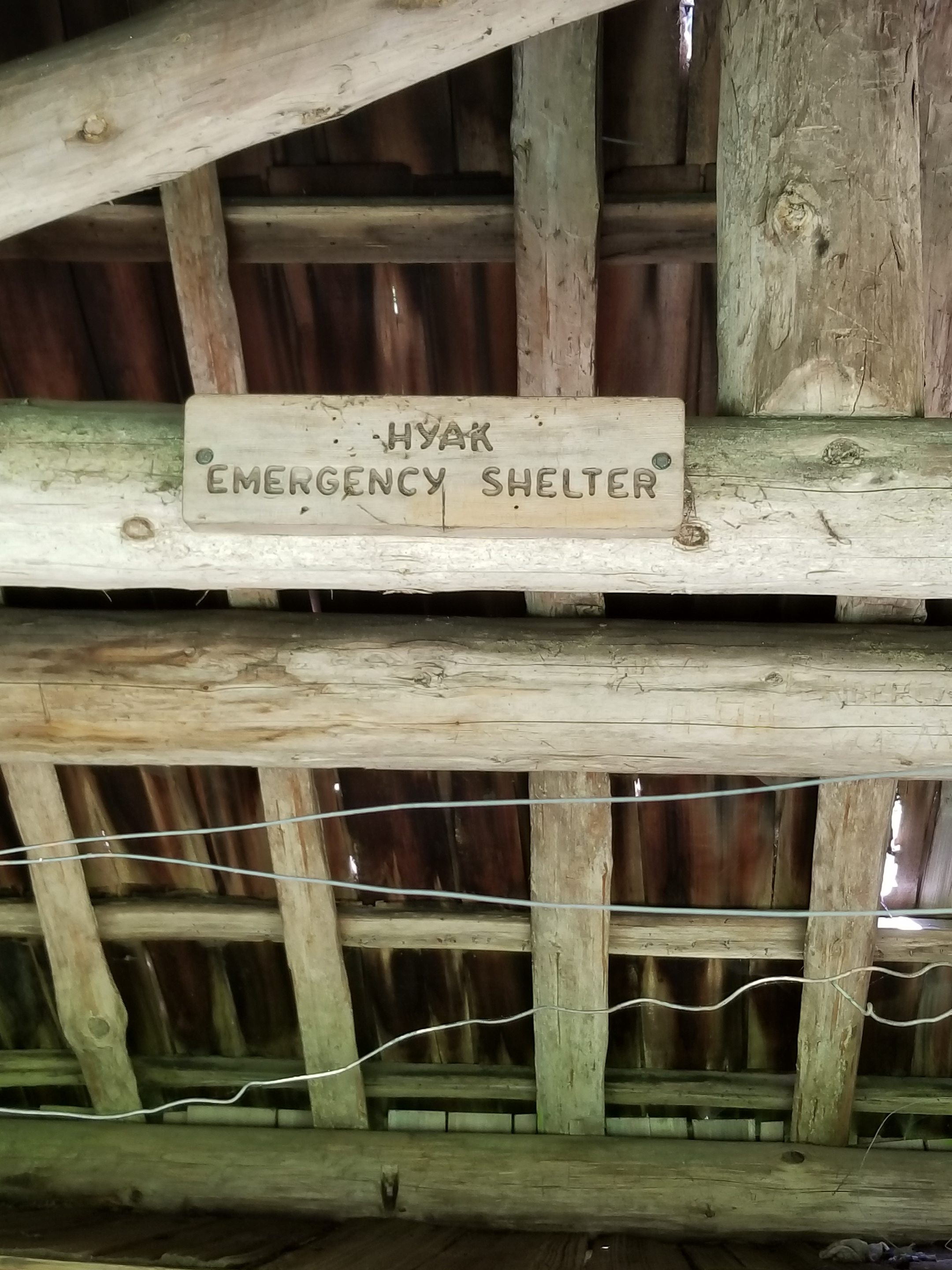
Along this portion of trail, some emergency shelters had been constructed many years ago. I am speculating, but I think they were meant for people unprepared for a snow storm. Essentially, they were three sided lean-tos.
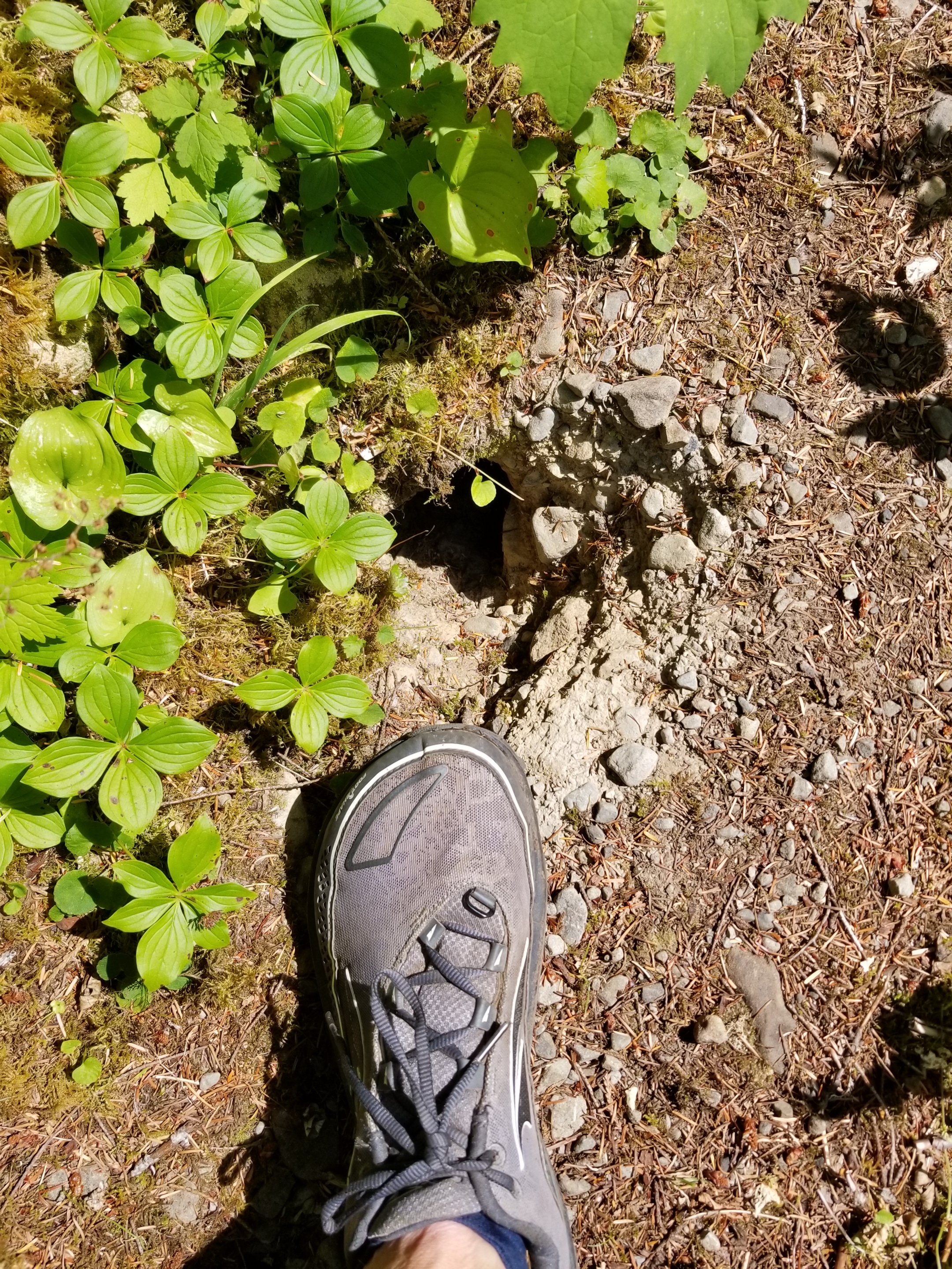
The trail followed the Bogachiel River as it grew in size during its descent. Once the trail and river leveled, portions of the trail were overgrown with plants up to my chest and head. What made it treacherous was the occasional hole dug by a badger (or similar sized creature) that could easily swallow a foot and really mess up an ankle.
I pushed to reach a camp on the map called Bogachiel Camp and Ranger Station. It was a challenge, but I got there. Unfortunately, it was missing just two things: a camp and a ranger station. I walked the area three times and found nothing. Instead, I shoehorned myself into a cramped spot in the dark. It was not ideal, but it was my home for the night.