As I unfolded myself from my cramped sleeping spot, I was psyched. Today was a town / resupply day. A shower. Food on a plate. Sitting on furniture. Hot water.
I woke up a small herd of cow elks when I started. I was unable to get a good photo as they crashed their way through the thick brush.
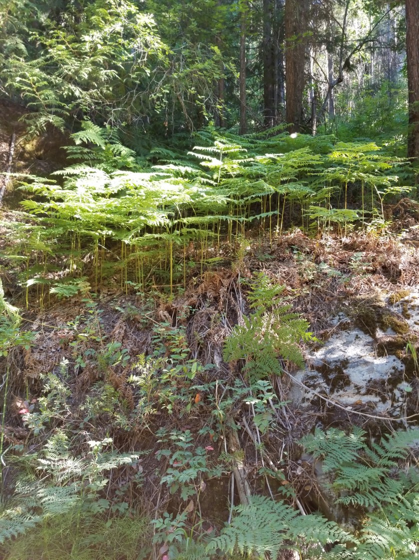
These large ferns dominated the forest floor
Pretty, nice trail.
The closer I got to the road, the better the trail maintenance. The better the trail maintenance, the faster I went. My morning goal was to reach Bogachiel State Park where I might catch a 10:30 bus to Forks. If I missed that it would be hitching or a paved highway walk.
In short order I was off the trail and on to a gravel road. I kicked my speed up another gear. It was overcast and cool, so hiking fast felt good and easy.
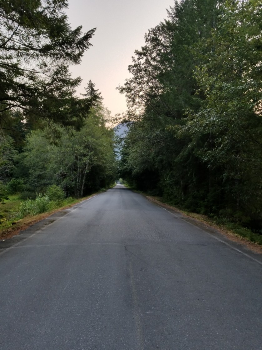
If all road walks were like this they would be popular.
Then, I hit the Road Closed sign. I was supposed to take the curiously named Undi Road. It was closed and a new Undi Bypass was indicated. At first I was in denial and tried walking the closed road. However it was truly abandoned and I went back to the bypass. It did not show on any maps, so I had no idea how long it would take. Immediately, however, it was clear it was steep.
I abandoned hope of catching the bus. There were utility crews stringing power lines and the road felt very new. Only a few cars went by. One of them flew by and dusted me big time. It had Minnesota plates. So much for Minnesota nice.
The Bypass ended and I was on blacktop, resolved to hiking into town. Amazingly, a guy who had just come down the Bypass stopped and asked if I wanted a ride. You betcha.
He spent the six miles bitching about local government and the bypass. He was from Hibbing Minnesota. He was a pretty good guy and dropped me off at the wonderfully named Dew Drop Inn.
I couldn’t get in to my room for five hours. So while a shower was out, I managed to get a breakfast and hit the library. Fortunately, I ran in to One Direction just as they were heading out to finish their trip.
Forks is a fading town, losing lumber and holding on to waning tourism related to the Twilight series and sport fishing. I must say the food was bad at every place I ate. Since this was the last resupply town for me, I was disappointed.
I took my final resupply package and got ready for my final leg. It would walk to and then along the coastal portion of ONP, ending at the westernmost point of land for the 48 states. My permit was goofy, so I hatched a plan to spend two (instead of five) nights on the beach. I appreciated the symbolism of starting a hike at the crest of the continental divide and ending at the farthest west point possible. Equally, however, I know how annoying beach walking can get.
I tossed and turned most of the night, perhaps anxious about finishing the PNT.
(Recap on permits and national parks: To manage the flow of people in the backcountry of National Parks, the National Park Service has a permit system. In the case of Olympic National Park (“ONP”) the system has some loose rules and strict rules depending upon areas. As you might imagine, the more restrictive rules apply to popular and sensitive areas. The less restrictive are more broadly designed to monitor the general direction and volume of hikers. Thankfully, PNT hikers can call and get permits over the phone. I did, but without the benefit of detailed maps in front of me.)
I was ready to go about an hour ahead of schedule. I wandered over to the local bus transit center and got on the 8:00 am #8 bus. It was early, but I was happy to just be on board. It started going the exact opposite direction I expected. I panicked as this was a Saturday and there was only a morning and evening run on the route I wanted from Port Townsend to Discovery Bay. If I was on the wrong bus, it would be a dangerous walk, a sketchy hitch, or a seven hour wait. Fortunately, the driver was just doing a loop through Port Townsend and then came back to the exact place I boarded. From there, we got going.
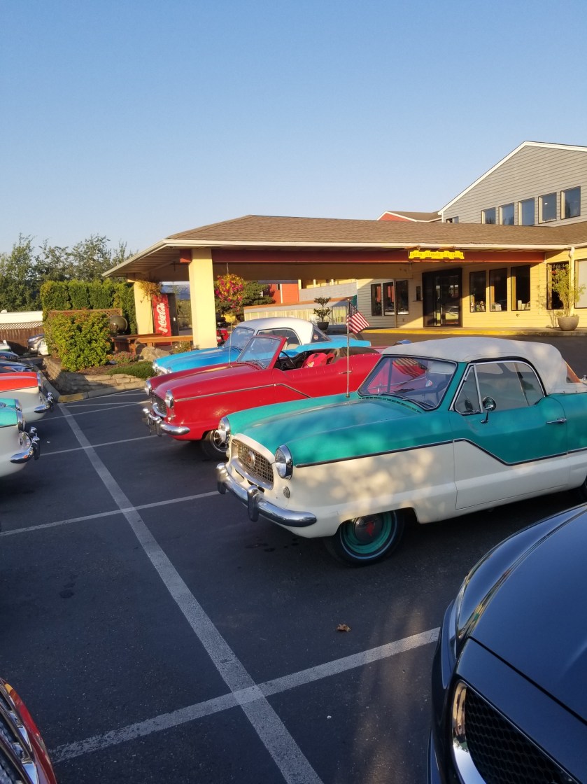
There was a regional Nash Metropolitan car club meeting at my motel. I’m not a car guy, but these were pretty cool. Definitely a cozy fit.
I exited the bus at Discovery Bay. Not knowing the history, I had to guess that somebody came here and discovered there was nothing. Technically, there was a bar and a marijuana dispensary, but that was it.
West Uncas Road was my route. I shouldered my 7 days of food and started walking up. Immediately, I was hit with a “Road Closed Ahead” sign. Undaunted, I trudged on admiring the farmland that had been carved out of the lush forest. The next road sign said the road was closed at Salmon Creek, which was what I had to cross in order to get to the trail head. I thought this was not good, but what choice did I have?
I got to the road closure, and it was simply a bridge being replaced over a (now) small stream. Easily, I walked down the bank, hopped over the trickle, and climbed the other bank: problem solved.
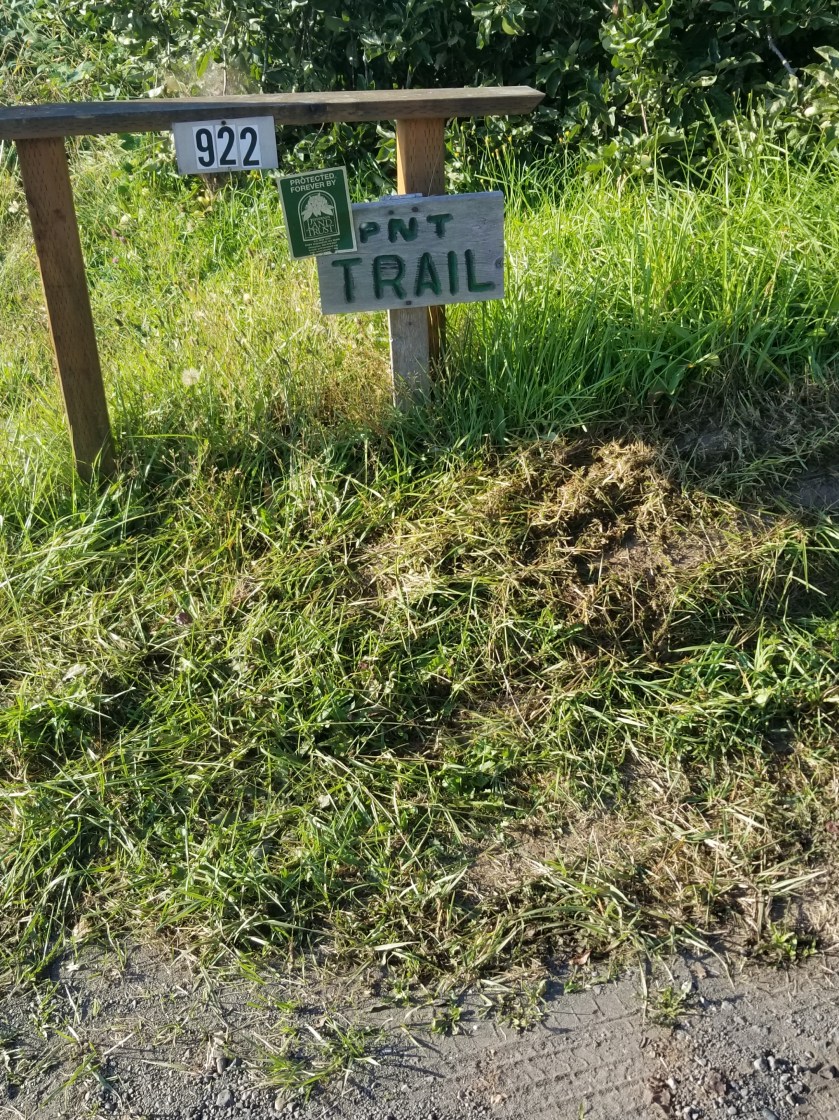
My next challenge was finding the trailhead. The app on my phone said I had passed it. I went back to the driveway of a house and noticed a “PNT Trail” sign attached to their mailbox. However, there were also signs on the driveway saying it was private property and there was “no through traffic.” I walked up the driveway and saw a younger man on the porch. I asked him if this was the way to the PNT. He said he did not know. I asked if it was OK for me to cross the property. He said he wasn’t sure. I was not sure whether he was being difficult or sincere.
I walked further up the driveway and a man yelled out of a second story window “Are you a hiker? I’ll be right down.”
This could be real bad (Hiker Hater) or good (“I love PNT hikers”). It turned out to be good. The man was named Greg and he owned the land, the 120 year old family house having been converted to a rental (i.e., airBandB), thus explaining the guest’s unfamiliarity with the PNT. He was excited about the PNT, explaining the route through his property, his trail angel activities, and an invitation to look at the “cabin” he was building for PNT hikers. He also told me to pick any fruit I wanted off the trees I would pass. He was an interesting and enthusiastic guy and I was very glad I met him.
After crossing his property and the adjoining one, I was on Forest Service land. I was going uphill, but I was not in a hurry. My permit did not have me entering the park until tomorrow, and even then it was a crazy location. As a result, today I just wanted to get close to the park, then tomorrow get right to the edge of the park. The third day, Monday, I would enter the park and stay at my first restricted / reserved campsite per my permit.
Mostly the morning was spent on forest roads. At one point, I walked past a small trail opening, assuming my next turn would be another forest road. After 20 minutes, I checked my phone app and saw I was off course. As I turned around and went back down hill, a guy with a backpack riding a 10 speed road bike passed me, and we said Hi.
Sure enough, the miniature trail opening was in fact the abandoned road I should’ve taken. The bike rider was there too. I shared my map, but he said it didn’t look like the route he was following. However, about 20 minutes later he came up behind me, having decided this was also his route.
We talked for a bit. He lived nearby, wanted to go camping and did not own a car. So, he was riding Forest Service roads to find a campsite. Once we got to a more established road, I urged him to take off and not keep walking. He said his name was Jerome and we wished each other safe travels.
I finally reached a Forest Service campground which I had as a possible stopping point. I walked through the campsite, saw there was no opening, and resigned myself to eating a quick lunch there, getting some water, and moving on. Ironically, with all the smoke in the air and the warm temperatures and fire bans, some people still had some fires burning in their campsites.
As I was packing up, two bicyclists came by and asked me about backpacking. One of them knew a bit about gear and they had several questions including where I was camping that night. I honestly didn’t know and told them.
In the afternoon, I narrowed my camping options down. I decided to go down Gray Wolf trail. This was the old “official” PNT route, but a bridge washout several years ago that had not and would not be repaired resulted in the “official” route changing. More importantly to me, it had water and, from the topographical map, potential flat camping spots. I was surprised at the number of cars at the trail head since this trail ostensibly went about 5 miles, hit an impasse and returned. Oddly, I ran in to the two biking guys. They had some backpacking questions and again asked where I was camping that night. I thought that was kinda weird, so I gave a vague answer. They didn’t look very dangerous, but I never give out specifics to strangers.
The topographical maps were accurate, but the forest was so dense that even flat land was covered with thick foliage. I found a loop trail for Cat Creek and decided to explore that. At a minimum, it would put me closer to water. After a futile half hour, I eventually found a tiny spot where my tent would just fit. It was lumpy, but at this hour, it would have to do. I set up camp and went up the loop trail to get water. Of course, just at the end, there was a perfect, moss moss covered campsite.
I ate my rehydrated meal and marveled at the mossy surrounding, the ground generally three inches deep with living and dead plant matter. Now that I am on the Olympic peninsula, I expected to see more lush forests. My seven day food supply did not all fit in the bear canister. So I hung some and left the rest, especially the more fragrant foods, in the cannister. I did however, find the best use for a bear cannister: as a camp stool.
I have never seen butterfly Bush growing in the wild. This was a clearcutting of forest land and there were several growing.Did I stop to smell it? Yes. Was it amazing? Absolutely.Looking down at the top of an unusual spindly plant.This boulder was probably four feet wide and two feet tall. How it ended up on the stump of a tree long ago is a mystery. I thought it might be like excalibur from King Arthur, but I couldn’t move it….
Another motel continental breakfast got a bit of food and coffee in my system. I left the motel and found a route that would intercept the official PNT right near the coast. I perhaps owe an explanation. There was a state park where I could’ve camped in my tent. It was about another 6 miles. However, with a perfectly good town nearby, I grabbed a motel and a cooked meal.
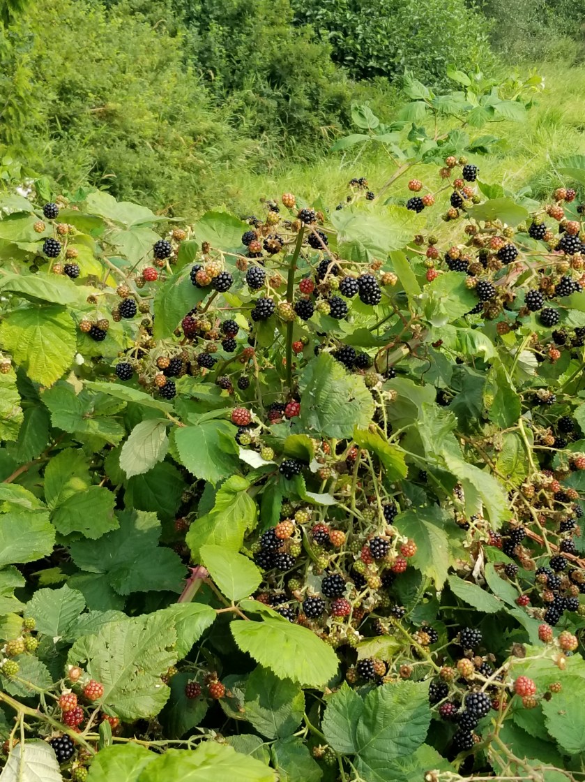
The route I chose did walk me through this military-based town. I went by huge walls of blackberry plants and finally encountered people harvesting these beauties. Back home, I would probably pay $5 for a pint, but out here the plant is a nuisance and it is amazing to see so much ripe fruit just waste away on the vine.
When I reached the beach, the tide was high so I walked the nearby road. It was fairly boring. In another unique PNT moment I was walking along and a car came towards me, looked at me, and slowed down. In about a minute it had turned around and crept up beside me and the lady inside asked if I was a PNT hiker. She was the local trail angel and she and her husband hosted hikers, including the Brits currently.
She offered a lift and encouraged me to stop by. I stuck to the road walking and reflected how nice it is that people are actually keeping an eye out for hikers.
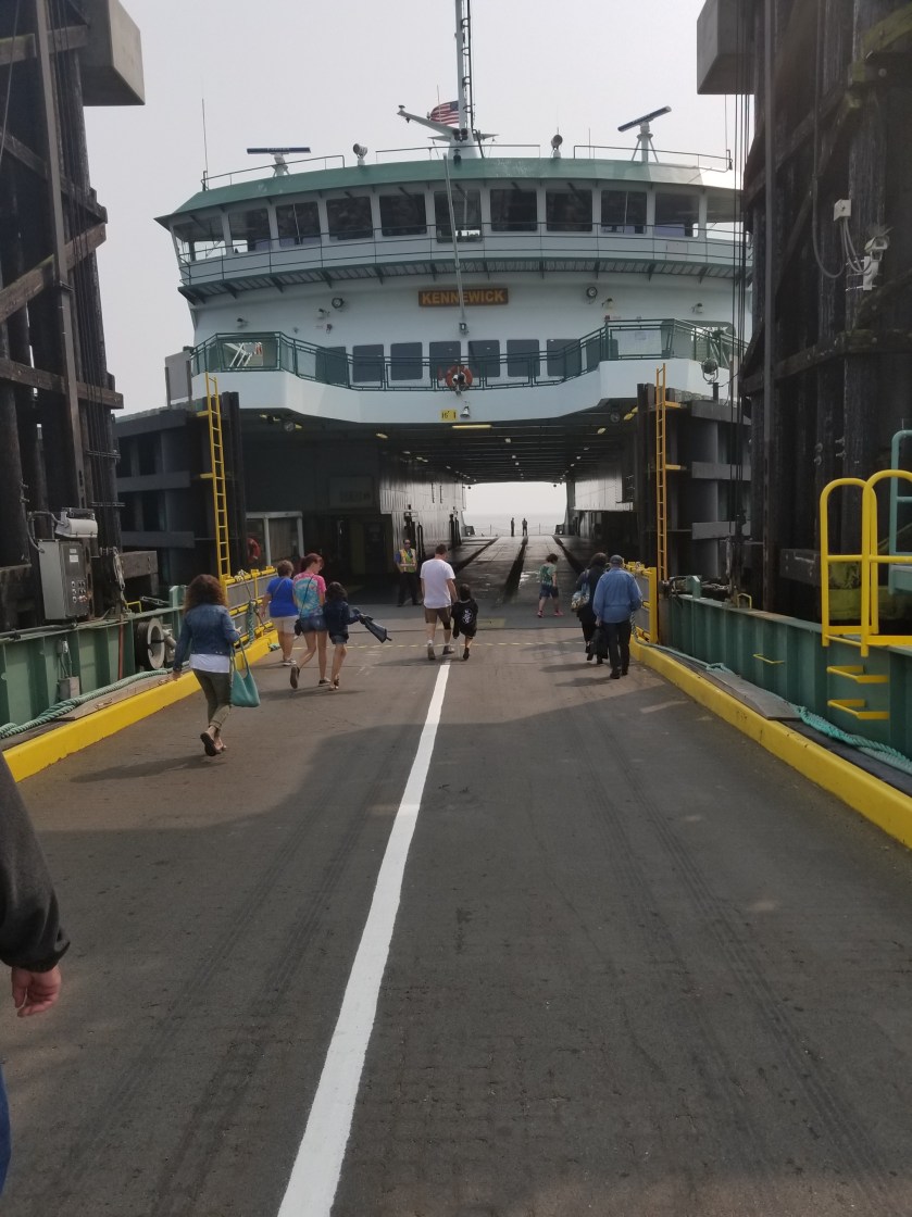
Once again I found myself near the dreaded Highway 20. Fortunately, there was a nice bike path that was parallel and I took that until I could cut over on farm roads towards the ferry. I was walking down a quiet Engle Road and was about two miles from the ferry terminal when a small local transit bus went flying by. It braked hard. It started backing up. I shook my head, indicating I was not looking for the bus, but still it backed-up the road. The driver asked if I was going to the ferry, I said yes and before I could explain that I wanted to walk, he got urgent and said we could just make the next one but I had to hurry. There was another, older couple on the bus. The driver was a little edgy, like he had downed a lot of coffee, but he got us to the terminal just in time.
I kind of like ferry rides. Even though this one is short and despite the smoke in the air, you could still see the outlines of islands. Port Townsend appeared as we docked and I was close to a motel and a zero day.
August 14, 2018 Anacortes Motel to motel in Oak Harbor
I tried sleeping in a little bit, but it just did not work. I showered and took advantage of the continental breakfast. Most of the time the motels offer a continental breakfast and they often include hard-boiled eggs which are a great way to start the day.
My first big task was to get my wilderness permit. PNT hikers can call in and work out a permit with a forest service employee. This is such a relief from having to trudge into a forest service office. I was disadvantaged because my Olympic map was on my phone. I had a pretty clear route planned, but this forest service guy and I had a miscommunication. He started with me going way south, suddenly lurching far north and then doing a 27 mile ridge-hike. I wish I had a full size map in front of me when we talked.
He also had me going from Forks to Mosquito Creek in one day, an almost 30 mile route dependent upon tides. He offered several good pointers, so he was competent. It is just some of the legs of my permit made no sense.
Once that was done, I headed out around 10:00. I mailed the paycheck I had found and went to find the trail. Anacortes has a huge forested park. The trail runs through it. As an urban park, it was mostly well marked and exquisitely maintained. However, the PNT route soon felt like I was playing some Keno board (trail 210 for 1/4 mile to 212 then 248 then 10, etc.)
This owl outside Anacortes was very alert in the daytime.
Eventually it spilled out on to some busy roads with an old time grocery store (Lake Erie Store). Then there was a confusing juncture. As I sat by the side of the road puzzling with my maps, a car pulled up asking if I was a PNT hiker. He was wearing a PCT hat. The gentleman was planning on hiking the PCT next year, but he was excited now. We talked gear for a little bit, his training, and some local information that helped me. His name was Larry and I got the feeling he’ll do just fine on his PCT hike.
An old miner’s tunnel.This log cabin was unique in that the logs were cut in half lengthwise. It reduced the insulating power, but instantly created flat interior walls.
I went on another trail through woods and once again got ejected out on to busy road. I walked along Highway 20 for some time. The scariest part was going over Deception Bridge, which is actually two bridges. The tidal changes are powerful as they get channeled through a small space, creating whirlpools and waves. Looking down to the swirling current 180 feet below, I was feeling a bit queasy. While it was unnerving enough to have the 2 lanes of Highway 20 right there on the bridge next to a narrow pedestrian bridge, I was especially surprised with the number of tourists who were standing in groups on the narrow walkway. I had to sneak by and around and hated looking down from such a height.
After the bridge, the pattern of get-on-a-trail-then-pop-out-on-a-highway repeated. This last time, I noticed a bus stop on a corner with a guy standing there. I went over to see the route and schedule. Sure enough, a bus would some along and drop me off in downtown Oak Harbor. I took the mass transit.
We went past the entrance to the Naval Air base and through most of the town. I got off and had to walk back a bit to get to a motel closer to the trail and food. It all worked out though my hips have really started to hurt from so much pavement walking. For a welcome change, I had greek food for dinner and then watched TV until falling asleep.
August 10, 2018. From Park Creek Campground to stealth camp in commercial forest above Concrete.
I was the first one up in the campground. The family reunion people must felt at home because they simply let their dogs out to roam. They were pretty well behaved and sniffed their way through my camp.
I had another day of highway walking. My Chief Logistics Officer has informed me of a potential bus route in the small town of Concrete that would get me to Sedro-Woolley where she had reserved a motel and where new shoes awaited me. Tomorrow, Saturday, it only ran twice: early in the morning and late in the afternoon. All I had to do on this day was get close to Concrete and camp so I could pop in to town, eat, and get on the bus.
At first the early morning walk was beautiful with no traffic. I did, however, encounter a tragedy. On a bridge with solid concrete walls, hundreds, if not thousands, of tiny toads were trying desperately to get into the water. I don’t know how they got there, but it was hard to catch and rescue them. After 15 minutes, I stopped trying to help and turned my back. Once traffic started, that bridge was going to be unpleasant.
Highway walking is boring. It is repetitive motion, so your feet and legs, which have become accustomed to intense variety, get numbed by the repetition. Mentally, there is not much there other than avoiding being killed. So, I tried listening to an audio book. However, this got to be a hassle because to hear it over the sound of the occasional truck or massive RV, I had to have the volume up too loud.
Late morning I came to a stream that was recommended as a good water source. I walked down and there was a lady sitting on the rocks at the stream’s edge about 20 feet upstream. We exchanged hellos. She had a smaller backpack, more like what a student would use than a backpacker. I went about filtering water. Out of the corner of my eye, I could see she was just sitting there sometimes tossing a rock in the stream. I must’ve been too focused on my water because I looked up and she was walking right near me. She said sorry as she brushed past and up close I could see from her skin and teeth she was leading a pretty tough life. She had vanished by the time I got back up on the road.
I eventually jumped off the busy Baker Lake Road and went on the shoulder-less Burpee Hill Road. Since all of the motels in Concrete had been sold out for weeks, my plan was to sleep up on the bluff overlooking town and then drop down early in the morning. Hopefully, there would be some public land I could camp on.
Early on, my plan seemed bad. All the land appeared to be privately owned. Just before the road began its curvy descent to town, I passed a gate. It was across a road and said “No Cars Allowed.” It did not say no trespassing or have any other warnings. Earlier, along Baker Lake Road, I had seen similar gates and they did have additional prohibitions. Seeing no overt prohibition, I hiked at least a half mile up the gravel road. It was maintained and used, but judging by the foliage growing in the tire tracks, not very often.
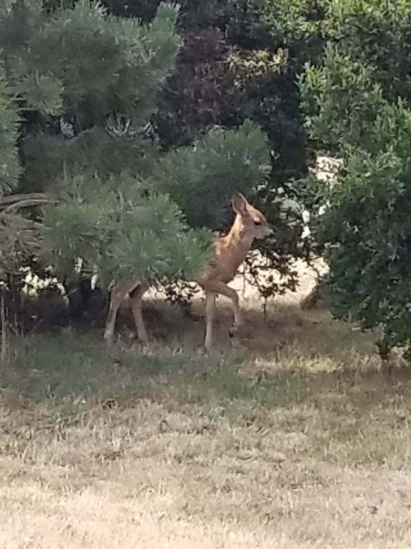
While I waited, a doe and her two fawns snuck out of the woods and foraged before seeing me. You can get a sense of the mosquito level by their twitching.
I waited until dark to pitch my tent. I managed to pitch my tent on what felt like a rock quarry. However, the promise of town food, a bus ride, and new shoes proved a powerful elixir.
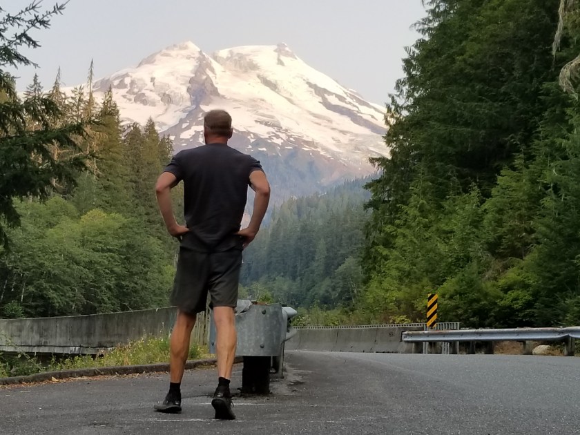
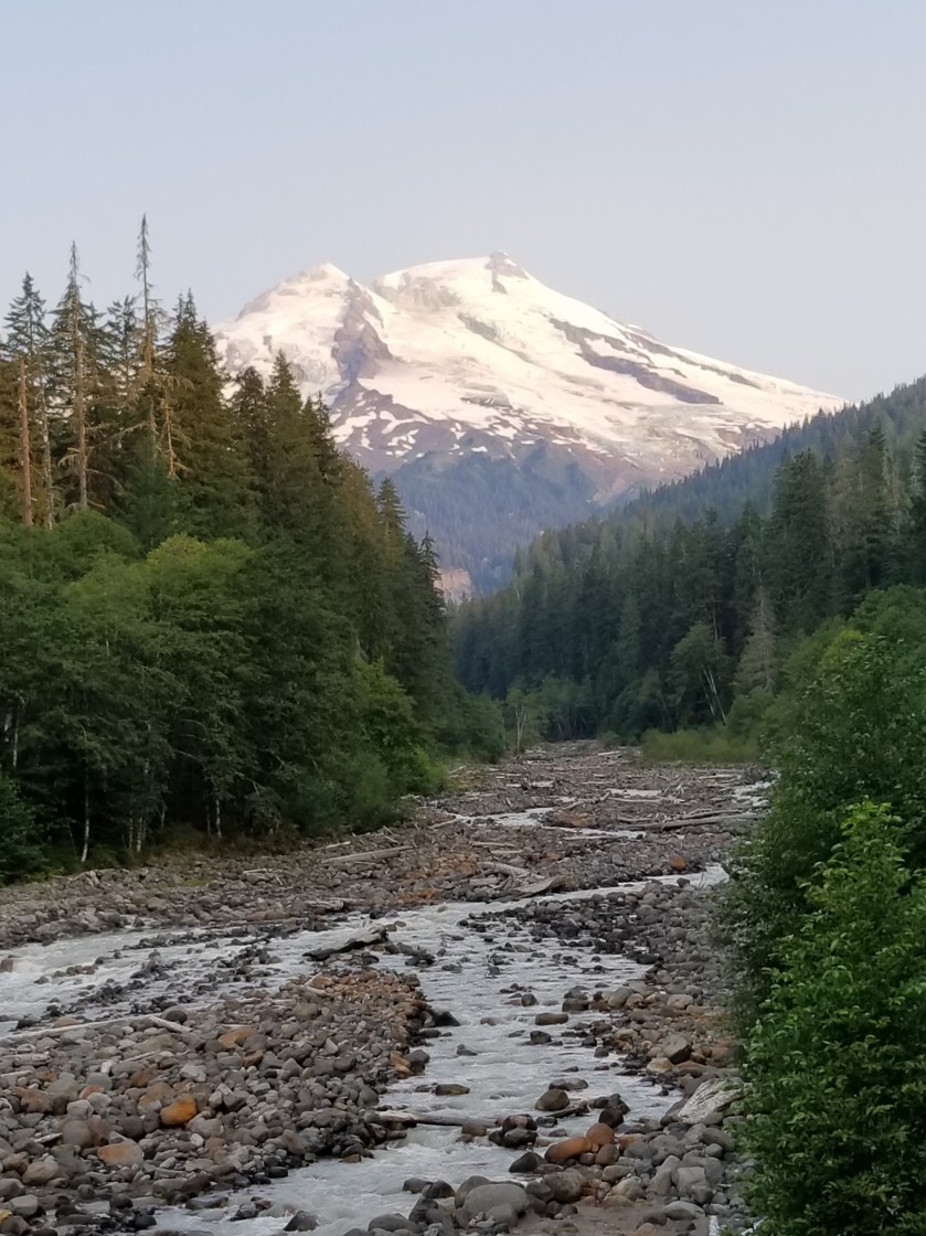
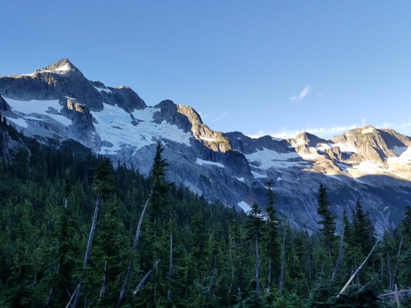
I was the first one up. Got my food and took off downhill. The glaciers on this side of the Pass were bigger. I wish the sun was higher to bring out the beautiful blue of the ice that is at the center of the glaciers.
The air had cleared and I was cruising downhill. I knew I had a long day ahead of me as I needed to get to the base of the Mount Baker highway.
After breakfasting on several spider webs, I stopped and had some trail mix. I was brushing my teeth near a stream and a couple showed up. They were out for few days. Just as they were leaving, a group of five ladies came by. They just said “hi” and passed by.
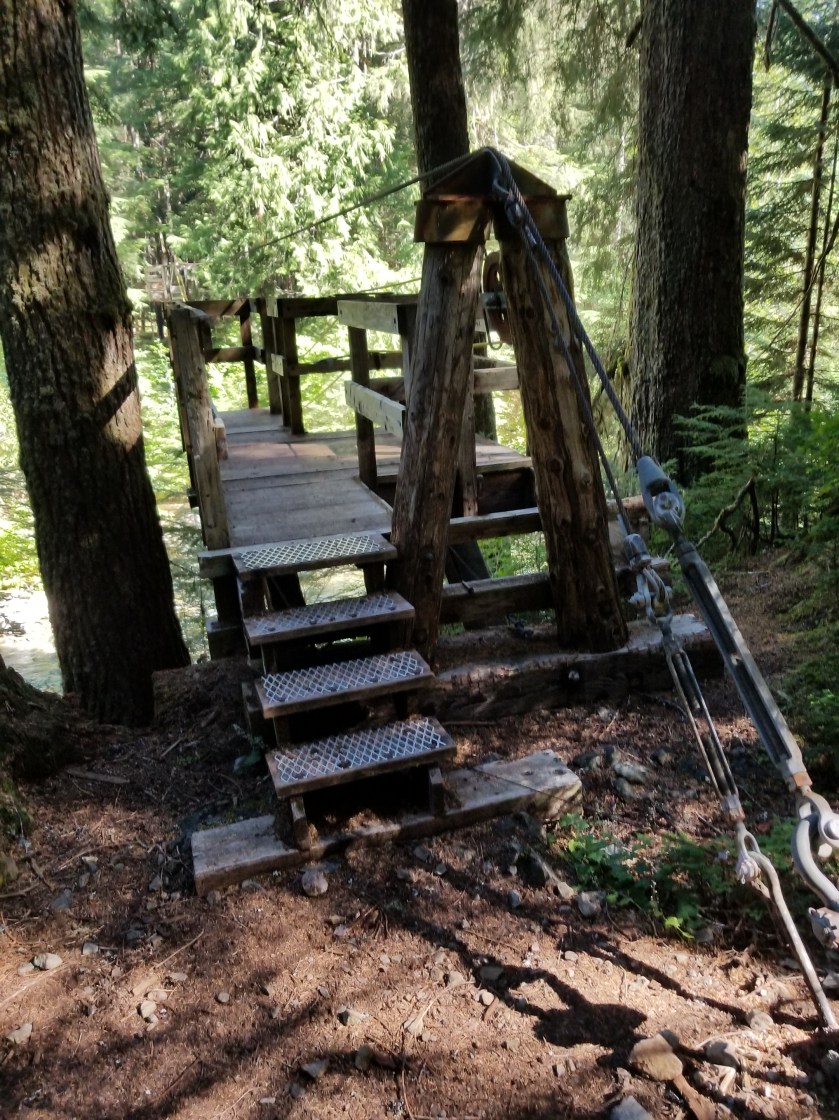
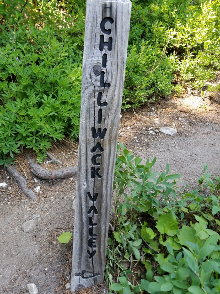
Later, I came to the famous cable car over a river with the improbable name of Chilliwack. The cable car is a two seat basket. You get in and pull yourself across.
I couldn’t figure out how to video the trip across. About halfway across, I did stop and notice how frayed the pulling rope was. Definitely a unique way of crossing a stream.
At the other side a mother with two kids and her dad had differing levels of enthusiasm about the ride ahead. Mom was far less enthusiastic than the little boy.
As the day wore on and I approached a popular trailhead, there were scores of people, all shapes and sizes and ages. One couple I met at the apex of Hennegan Pass. They had full packs and some climbing gear. They knew about the PNT and offered me rides since they lived right near the trail in Alger. Really nice folks.
I continued a long, shadeless grind downhill. For the first time in weeks, I broke out the umbrella for shade. It was wonderful. Not sure why I have such a Mary Poppins complex against using it more often.
I reached the trailhead and began a long walk on a gradually declining gravel road. One car did offer me a ride, but I declined.
I went past a cordoned off area that had a few dozen bee hives right beside the road. Not sure what the bees were pollinating, but I didn’t want another sting and went by swiftly.
The evening was warm and windless. I had a freak event happen. I was just walking along and about 100 feet into the forest, a good-sized dead tree just snapped and fell straight over. Random.
I finally reached a developed forest service campground at the bottom of the climb up the Mount Baker highway. It was called Silver Fir. All the places were taken. I looked at places to stealth camp, but didn’t see anything good. Then, I used their handpump to get water. I filled up my three liter platypus bag, but the water looked a bit off.
I crossed the highway to a lot used by the highway department. It also had some snowshoeing routes for winter. I went down a gravel road and after a quarter mile saw a small clearing where I could fit my tent.
I ate as it darkened and got into my tent. The water I obtained from the campground was so rusty it made me wonder how long it had been since my tetanus shot.
It was one of those nights where I don’t even remember putting my head down before I was fast asleep.
July 28th. 2018. Stealth camp to Whistler Canyon Trailhead.
Immediately, I could tell it was going to be a hot day. I cruised downhill through a ranch. Some cattle, instead of running, treat you like a rock star. This herd started coming towards me so I thought they were going to crowd me.
This morning I could choose between a quiet public road for 5 miles or an official quiet public road plus a trail that gained and lost 700 feet over 10 miles. I chose the former.
I met an older lady on her way downhill to a Saturday morning yoga class. She loved living up high in the woods.
Eventually, I came to an area where the road walk and official trail met. For the next ten miles I’d follow a trail a group of local horsemen had developed. Up high, it was hot and sunny. For the first time, I got to the point where I just found a shady spot and took a power nap. I awoke refreshed. Within 100 steps, I looked back to see the PNT hiker from Bonaparte Lake.
We hiked together for the next few hours as the trail descended to the valley where Oroville awaited. He was young and enthusiastic about many things. He was going to hitch in to town. Knowing I had two nights of reservations ahead already, I opted to camp at the trailhead on the edge of town (technically 2 1/2 miles, but to a backpacker that’s an edge).
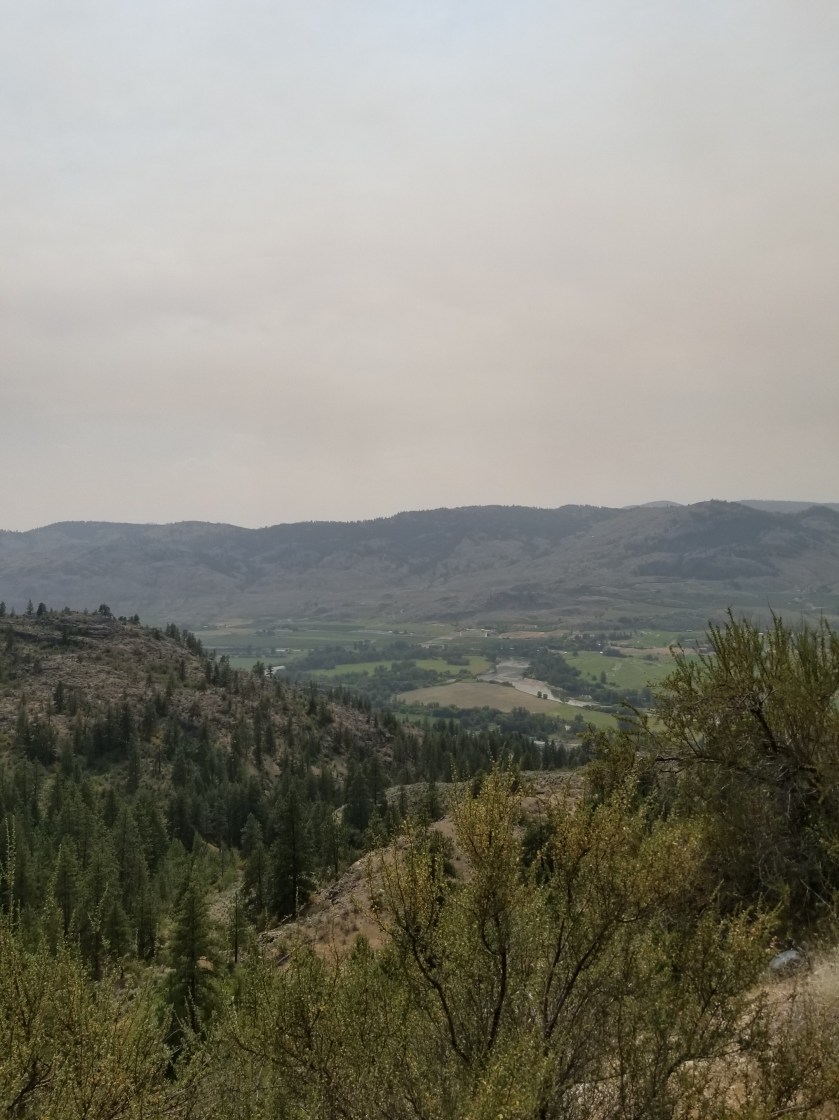
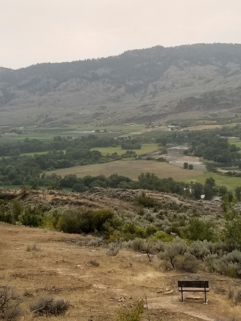
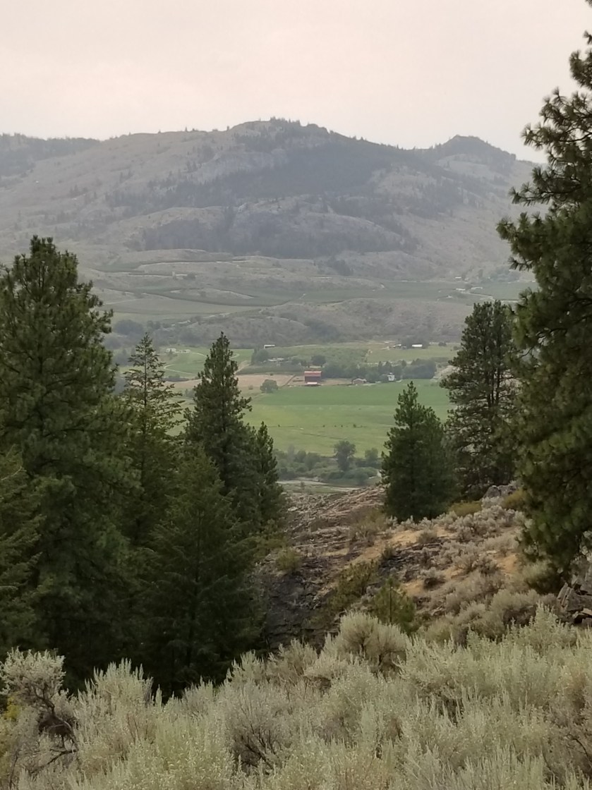
Though smokey. You could see the valley below.
Nearing the bottom, there was a sign mentioning an alternate trail with a water crossing and then a connection to “W.C.” The main trail was just to connect to “W.C.” While I am not British, I could not figure out why trail signs out here would suddenly reference water closets. Still, I needed water and cut over to the alternate, wishing my fellow hiker good luck. “W.C” stood for Whistler Canyon, the local trail name.
Just a few yards from the main trail, the alternate revealed a gurgling stream. There were a couple teens there trying to make out. I awkwardly blurted out “I’m just getting some water” and went past them upstream 30 feet. As the Dad of daughters, I fought hard to keep from asking the girl if her Dad knew she was up here with this loser.
With enough water to rehydrate and get me through the night, I descended. I was surprised the trailhead was so spacious. I found a place on the fence near an apple orchard. I propped up my backpack and opened my umbrella to create a shady spot in the 96 degree heat.
For amusement, a herd of mountain sheep went up and down the hillside in front of me. The younger ones even came down to eat. However, when the dominant Male returned, they just watched me and even when I got in my tent he would not let any of them come down.
The younger ones came down to feed while adults remained up high.
Once the alpha Male returned, he kept the herd up high looking down on me.
July 24, 2018. From Thirteen Mile Mountain to stealth camp on Forest Road before Ogle Creek.
In spite of the strong moonlight, I woke up rested. I broke camp relatively quickly.
It was a brilliant, beautiful morning going slightly up and down on trail through grassy ponderosa forests. Great views.
Later in the morning I was cruising downhill, I went from sunny slope to a sharp shaded corner. That was where the accident happened. For my part, it took me two full steps before I recognized the sound of a rattlesnake. For his part, he waited until I was next to him before rattling as he wound himself up underneath a Bush. We both screwed up. I went back to see him and he had beautiful green markings. The video does not do it justice, but you can understand I did not want to stress the creature or, more to the point, get bit and die all for the sake of a more clear video. This isn’t Mutual of Omaha, people.
Later, I crossed a road with a trailhead. I loved it. There was a description of Thirteen Mile Trail. Best part? The length of the trail. All of my avid blog followers know I love goofy signs. So, both of them can understand my glee over the Thirteen Mile Trail being 16 miles. What do you think happened?
I was too tired to consider how a difficulty rating of difficult worked.
I dropped down an amazing canyon of Thirteen Mile Creek. It had huge 500 foot sheer walls and a churning stream. Suddenly, the stream disappeared. Just as suddenly, it reappeared, apparently choosing to run undergroundfor a quarter mile.
The photo fails to capture how high and sheer the cliffs were.
I next had a 2 mile walk on a highway with no shoulder. The Guidebook said this was the Grand Canyon of Washington. I was not impressed. Plus, there were a couple jerk drivers who clearly could’ve moved over, but chose to hug the lane and almost clip me.
Off the road, I had a dry trail uphill for several miles. It was tough. I had one of my oddest wildlife experiences. Given the amount of time until my next resupply and chance to charge batteries, I have been turning off my phone which is my camera. At a road junction, I was looking at my printed map. A spotted fawn trotted out of the woods. I reached for my phone and turned it on. On a whim, I told the fawn to “calm down.” Unexpectedly, it turned and came right to me. It was panting. It was obviously stressed, but I knew taking my pack off to give it water would spook it. By the time my phone turned on, the fawn was trotting away through the woods. So bizarre.
Late in the day, after passing cattle and timber harvesting, I came to a “V” in the road. A sudden crashing in the bushes uphill made me reach for my phone. I spied some black ears and a scalp. I wasn’t sure if it was a wolf or a black bear. As I was getting my camera ready to video, the bear cub came into the open. “Oh shit”. I hightailed it out of there not waiting a nanosecond to see where momma was.
An eventful day drew to a close when I found a beautiful grassy plateau for my camp. I hung my food far away and went to sleep. Or tried. It turns out I was on a bit of a lump, plus the zipper on my tent failed. So I spent a lot of the night fidgeting to find a comfortable position and waking to a mosquito buzzing my ear.
July 21, 2018. Stealth camp near Kettle River to unnamed saddle in Kettle Mountains.
The night was very still. I heard some coyotes around midnight doing roll call. No problem with the camping.
As I continued down the road to cross the Kettle River, I walked along a quarter mile of the plateau and not a single private property sign was posted. I was relieved.
After crossing the river and highway 395, I was on a gravel road, passing a large piece of private property which had been logged. As best I can tell, the way landowners make a living is to graze cattle on their forest land and then periodically harvest timber. I would imagine lumber shortages and tariffs probably pushed a lot of folks to harvest lumber sooner rather than later.
Today I was feeling a little sluggish on the relentless gradual climb. I tried hydrating more, but it was tough. Plus, there were about six young guys on motor bikes whipping up and down the trail leaving annoying dust clouds. The scenery was nice, though.
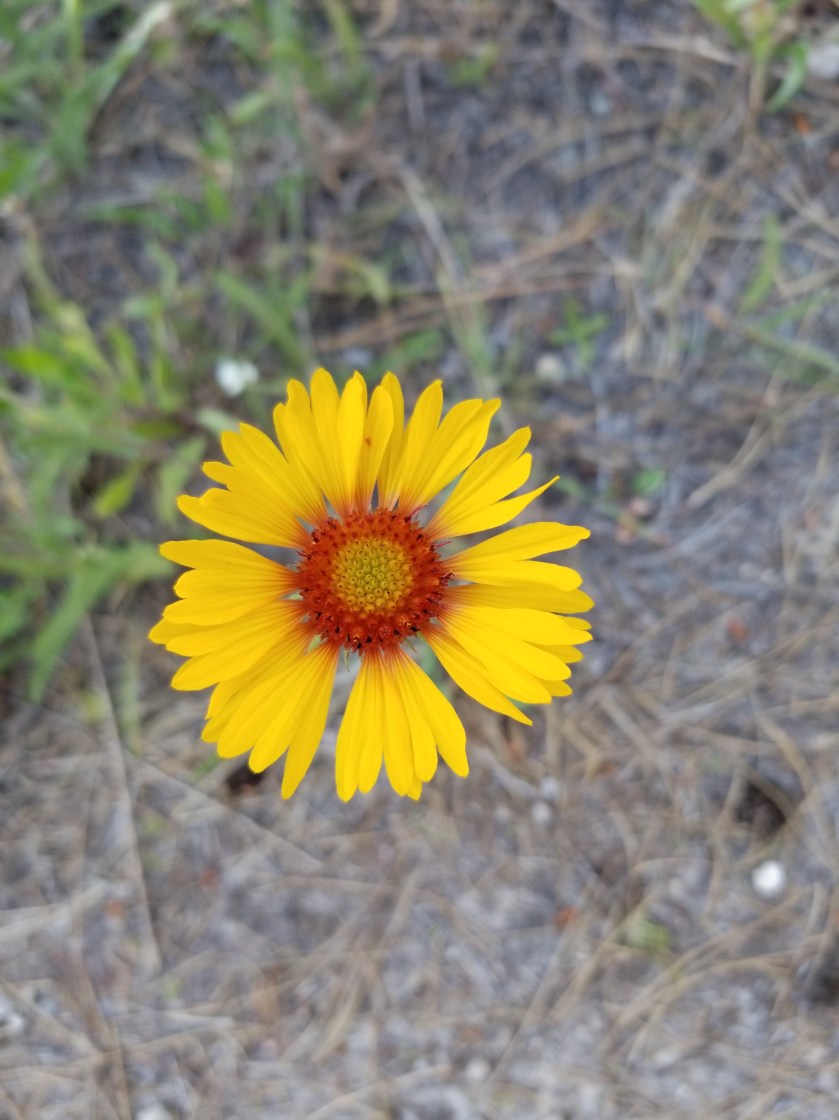
These ferns grabbed a slice of morning light as they grew on top of a boulder.Indian paintbrush (red/orange) and lupine (purple) are attention getters in meadows.
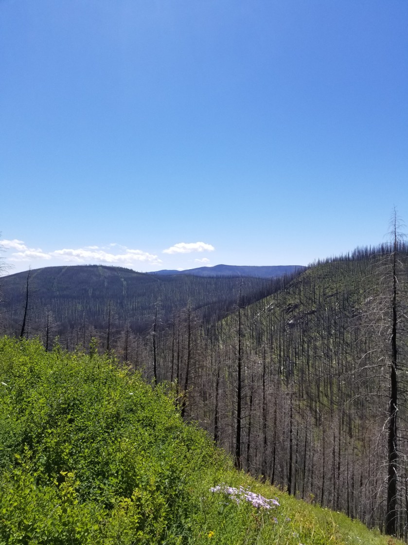
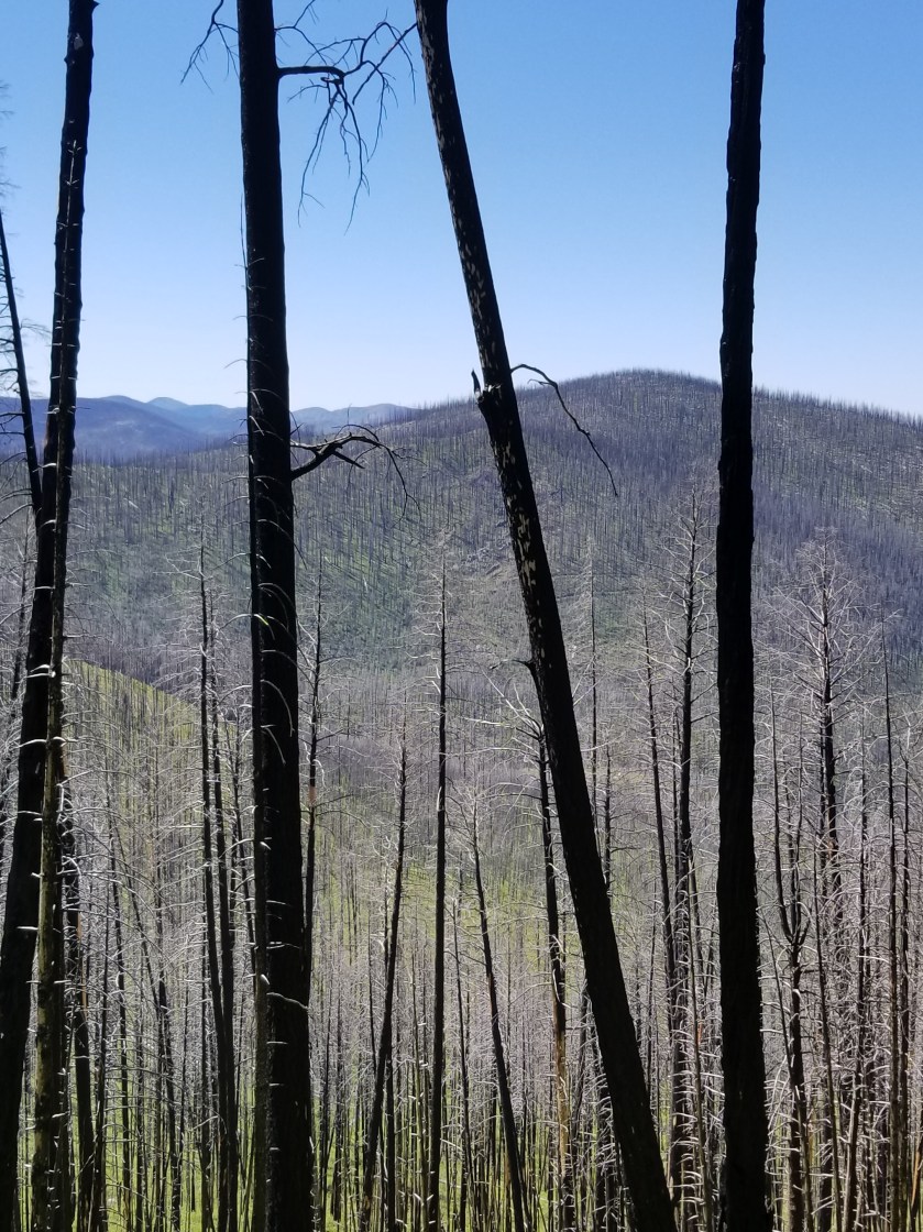
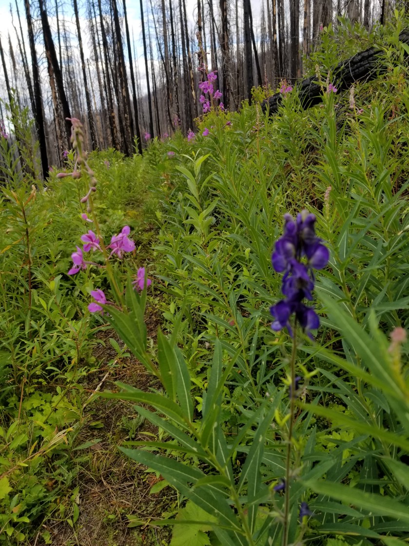
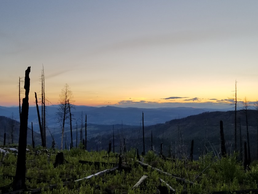
The day changed tremendously when I entered the burn area. In 2015, a massive complex of fires swept over a large swath of this country. I entered an area of standing deadwood, charred fallen logs, fireweed, and lupine. The trail dwindled from a gravel road used to salvage usable burned wood to abandoned forest service roads with multiple blowdowns.
It is such a contrast between the massive carnage of a forest fire and the rapid evolution of plants scrambling to seize the open terrain. Lupine has an explosive takeover strategy. It develops seed pods that twist and then pop open, scattering seeds. The most interesting thing to me was the absence of pine, spruce, and larch seedlings. They must bide their time and rely on their height genetics to overcome the early lead of other plants.
I’ve only seen two sets of footprints. That is, until I got to an intersection with a paved road. Then, a new pair of prints appeared. This was the famous Kettle Crest Trail.
Kettle Crest was a well maintained trail. I could not recall how many days since I had been on a real trail. It was good, but again seemed more like a bike trail than a hike trail.
I was able to get my last water supply and then followed the trail as it switched back and forth uphill. The map showed three turns, but there were at least six.
FireweedSorry for bad focus, but seeing fireweed next to something that looks like a delphinium was an unusual sight.
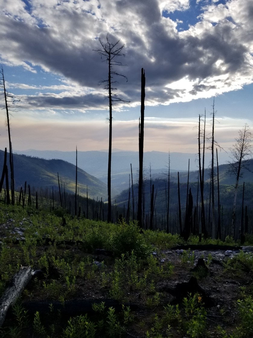
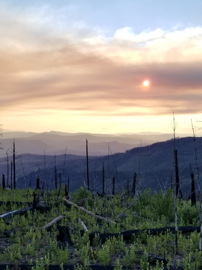
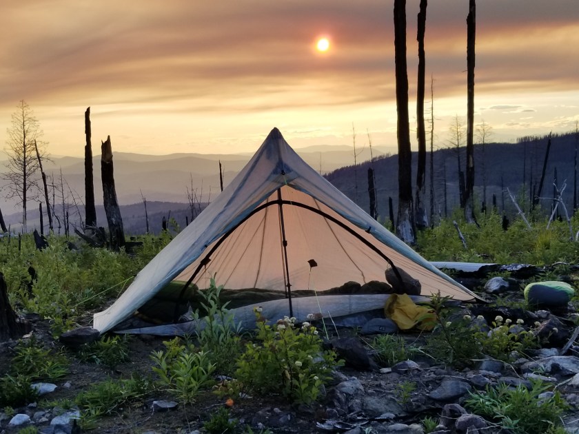
Eventually, I reached the saddle I was shooting for. There was about 45 minutes before sunset. An odd cloud of smoke hung in the air. Plus, for once, it was windy. So, I made camp quickly, avoiding standing dead trees. I pointed the open end of my tent away from the wind. I had to put on my wool hoody plus my down puffy.
View from the saddle. The mountain saddle; I’m not on horseback.Sun behind smoke cloud.
As a shock element, while I was eating my dinner, a mountain bike went whizzing past. Not sure if he saw me, but I hoped he made it to the road before dark.
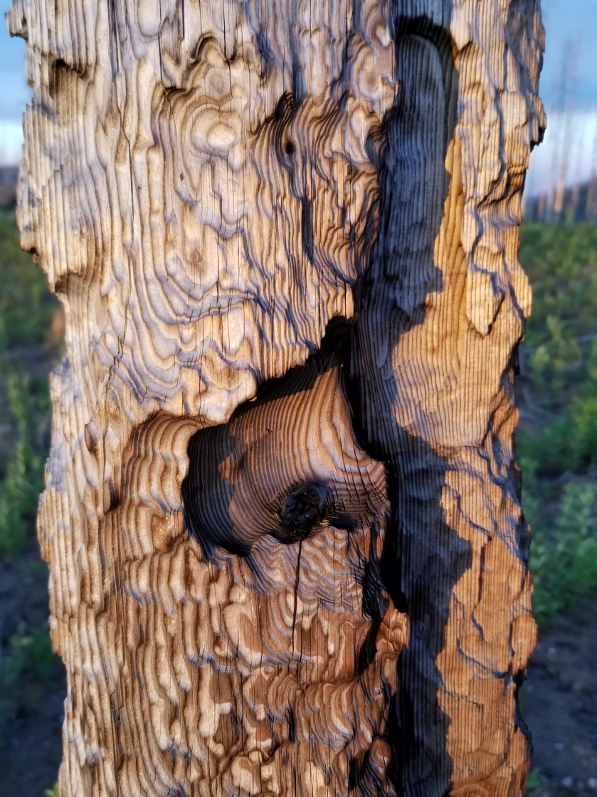
My Zpacks Altaplex tent. The company stopped making them. Too bad because they were great for tall people.First fire, then wind carved this.
It was the first cold night in weeks. I liked it and I liked sleeping up so high. It was a long hard day, but tucking in to a warm sleeping bag was a great reward.