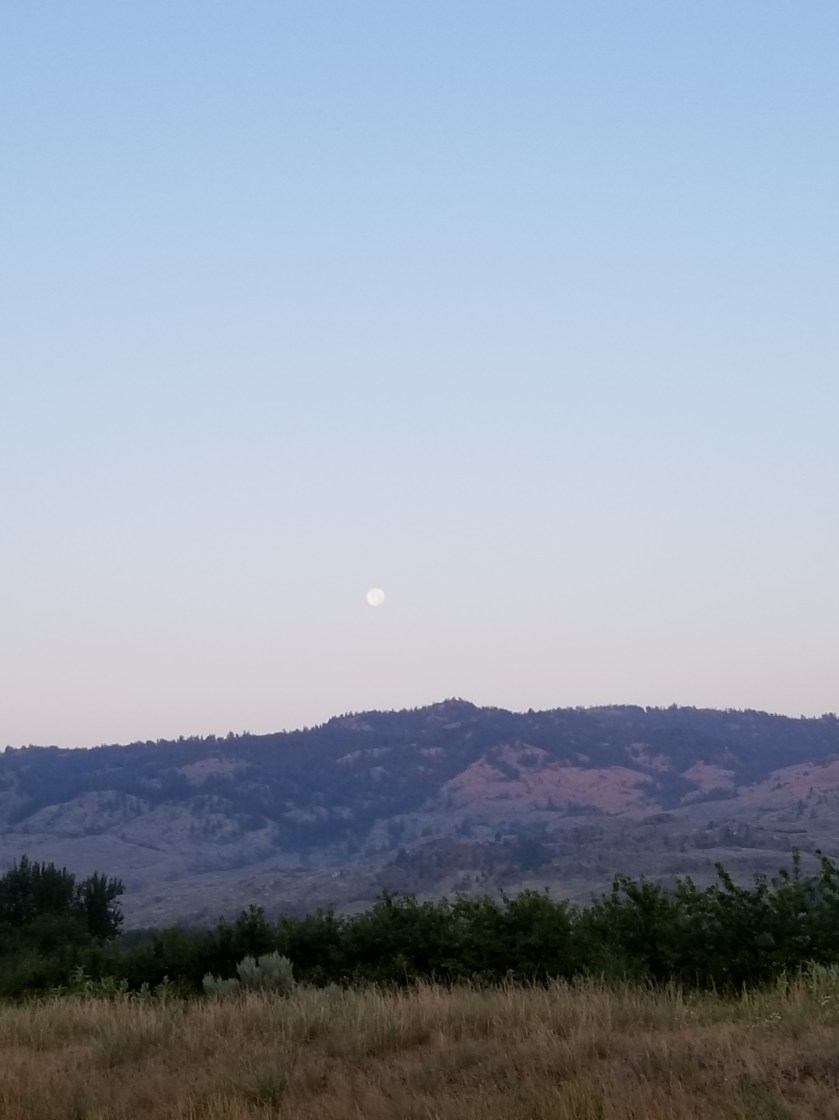
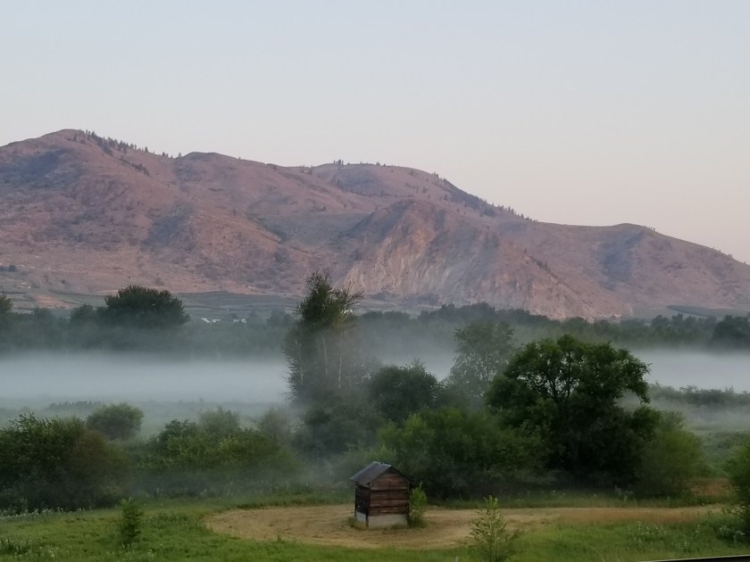
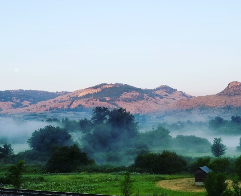
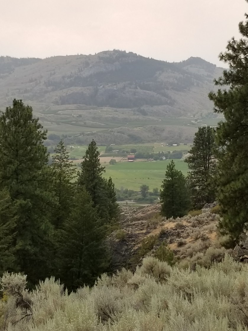
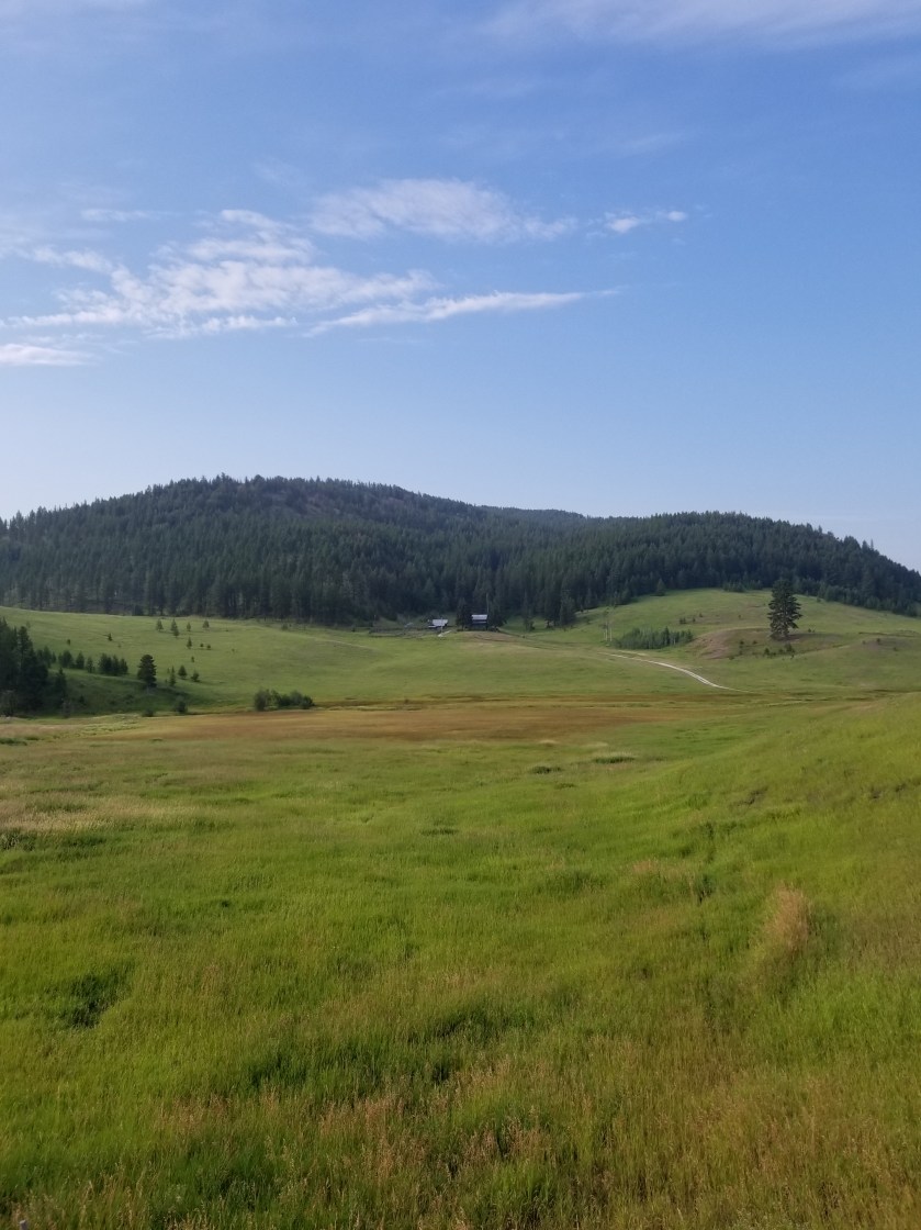
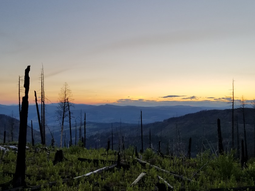
I road walked in to Oroville. Nice fog clung low over the river, the sun slowly rose over the mountains to the east chasing the full moon as it sank over the western hills.
Early morning to Oroville
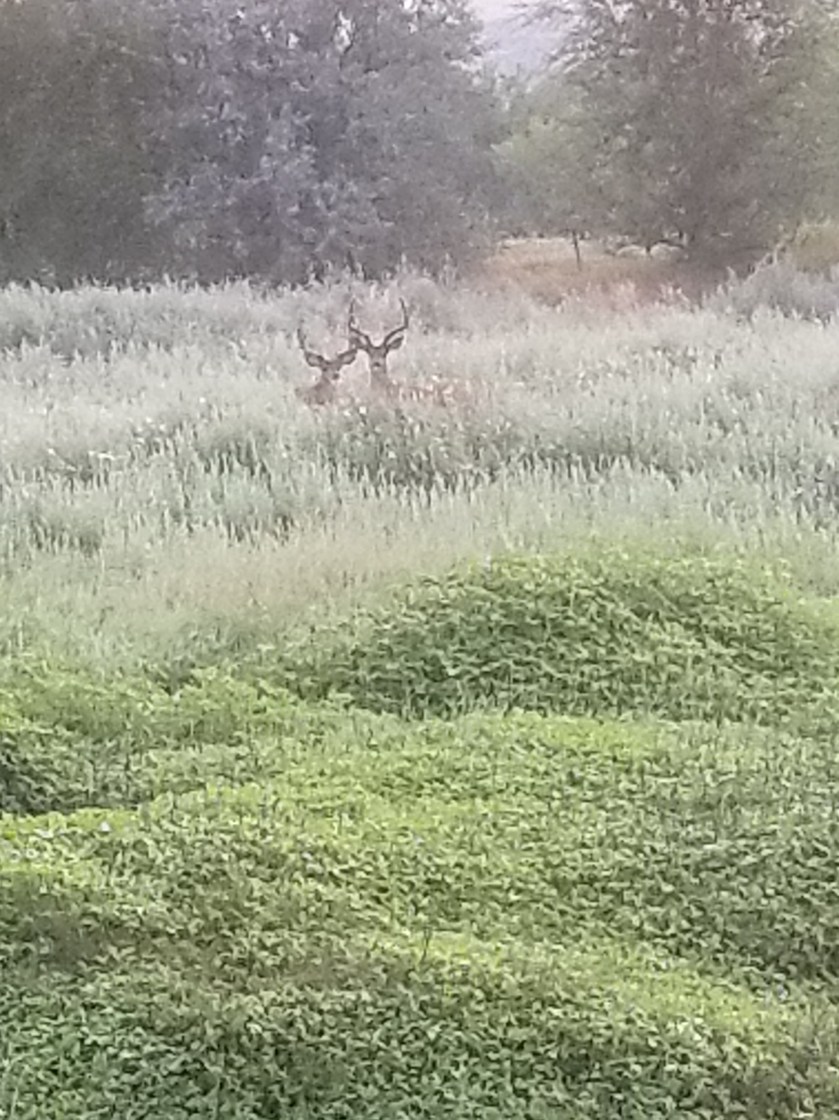
Two bucks were just waking up when I annoyed them.
I love early morning in small towns. I knew the earliest any restaurant opened was 7, so I stopped at an ATM and then went to a gas station for coffee.
I waited outside the restaurant. An older, local gentleman and I chatted about the trail and his town. When they opened, he sat in the middle of a long table with a couple of friends who arrived just at 7:00. Over the next 45 minutes, he held court over about 10 other guys who came and went, including two with sidearms. Another beauty of small towns is the informal network. I’m guessing these guys were mostly bachelors or widowers.
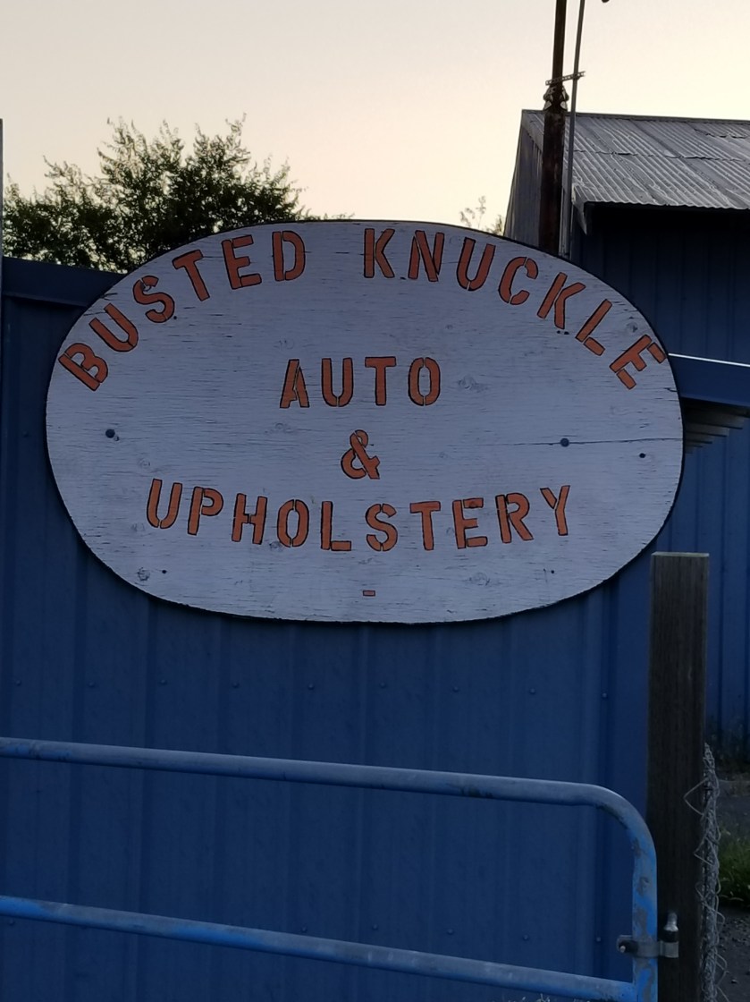
The Camaray Motel is definitely backpacker friendly. They have loaner bikes to get around town, free laundry, and a few other things. Sandy, a whirling dervish of a woman, checked me in very early and got me situated.
My resupply box had a plastic bag around it. Inside was a note explaining the USPS was sorry, but another package spilled a solvent all over mine. But it was okay, in their infinite wisdom. My maps and a few things did reek of fuel, but thankfully none of the food was fouled.
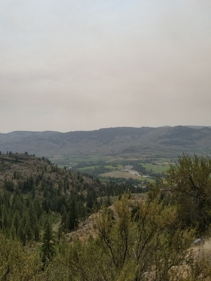
It was hot and smoggy, a little bit of L.A. There was a large fire in Canada. Temperatures hovered around 100 degrees and the valley trapped both heat and smoke.
Oroville is now mostly agricultural. The feeling I got was that this town might make it. Sure, there were the usual shuttered businesses and the five second-hand / collectibles stores, four more than needed. But the businesses that operated were busy. It is less than 10 miles to the Canadian border. Plus, there seemed to be an above average number motorcyclists.
There were two Mexican restaurants in town. The motel recommended the one across the street. It was okay, tasting just like every other Mexican restaurant. Everyone in there was caucasian. Later, when I went to the grocery I passed the other one and it was definitely more of a Hispanic crowd; should’ve gone there.
The first morning I saw Jackson at breakfast. He was heading out after a night at the motel. Later, I met Snowberry. We had dinner at the brew pub in town. It was nice to visit with another backpacker my age. She had an interesting life, has overcome some real challenges, and definitely had an intelligent view on life.
I finished packing and got ready. It was going to be at least seven days in the Pasayten Wilderness, a section I was very much looking forward to.
So I am leaving Oroville. I travel through the Pasayten Wilderness area for seven days. Although tomorrow is supposed to reach 102 here, it should start cooling off.
My next stop is Ross Lake Resort. Google it, as it is quite unique. I can only pickup my resupply package. With luck, I may be able to charge my electronics.
From there, I have another seven days before I reach a town.
The point? I have some serious backpacking ahead with little ability to write or send blog posts. Battery power will be reserved for my satellite communication device.
So, be patient. Assume I am not dead. And hopefully I can post again in a few weeks. Unless I am dead, of course.
Wait up.
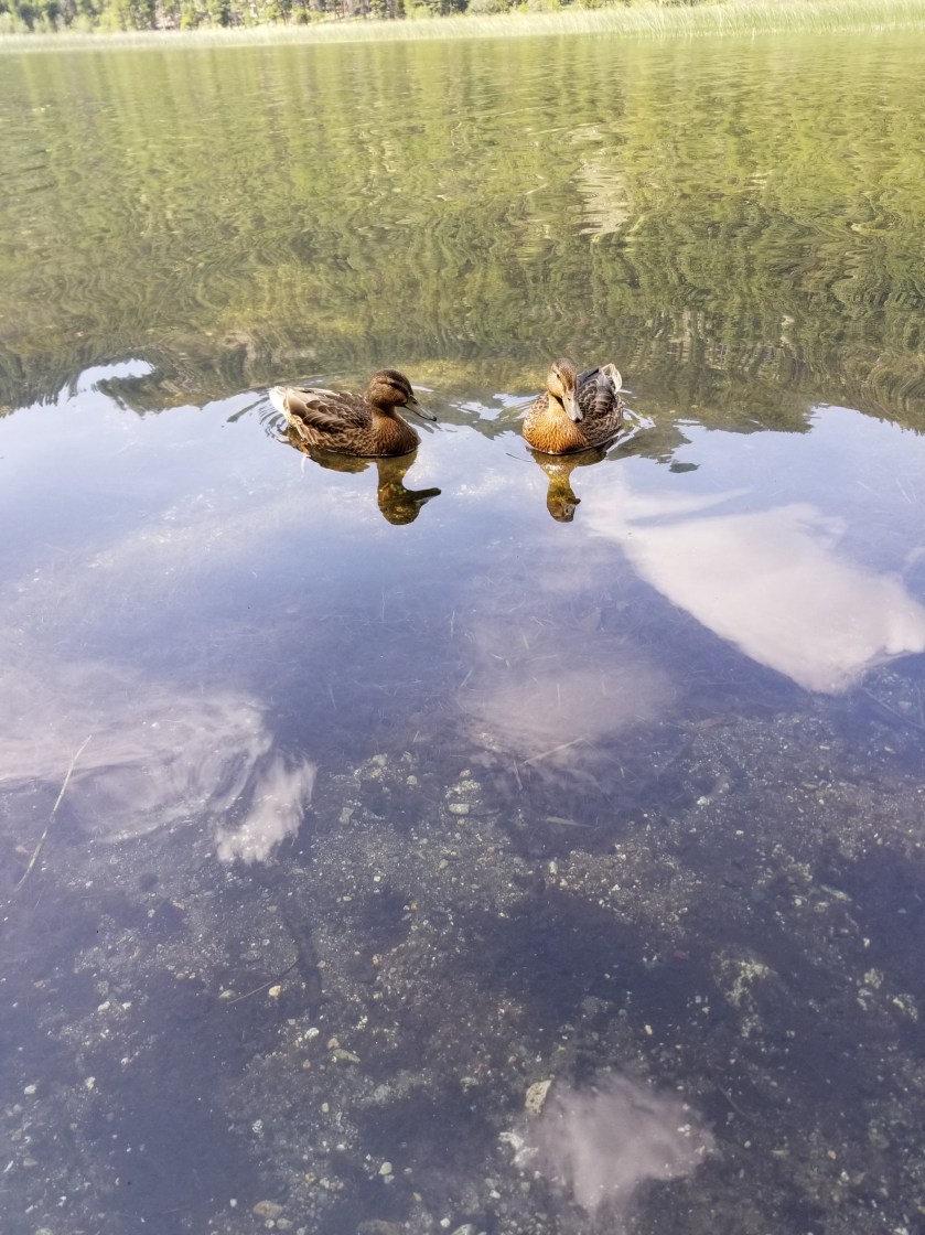
Morning fog on the way to Oroville.Two bucks in the morning dew outside Oroville.
July 28th. 2018. Stealth camp to Whistler Canyon Trailhead.
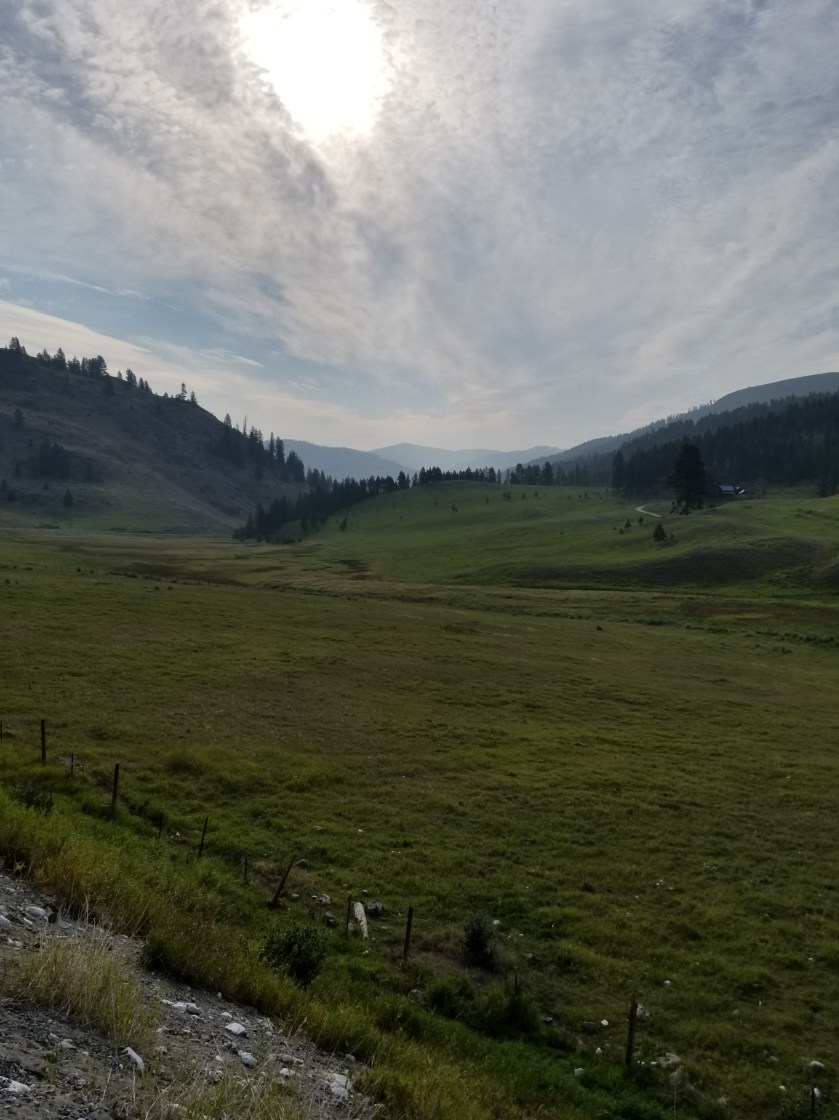
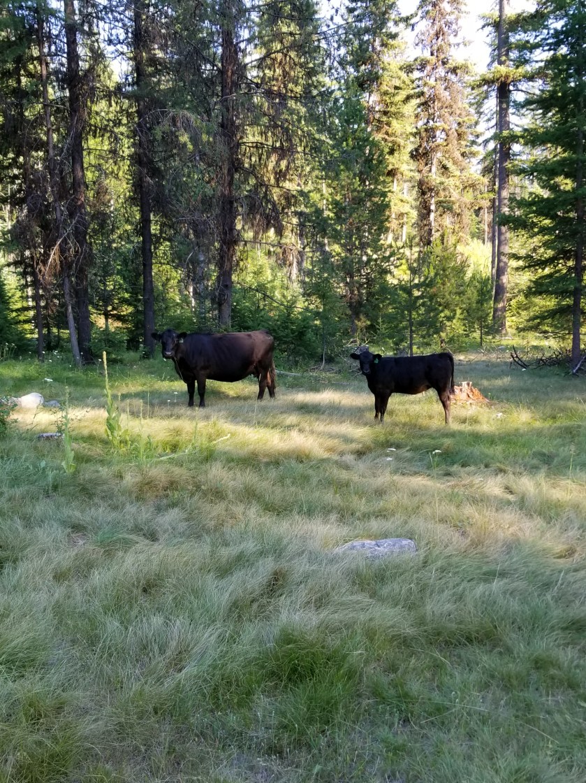
Immediately, I could tell it was going to be a hot day. I cruised downhill through a ranch. Some cattle, instead of running, treat you like a rock star. This herd started coming towards me so I thought they were going to crowd me.
This morning I could choose between a quiet public road for 5 miles or an official quiet public road plus a trail that gained and lost 700 feet over 10 miles. I chose the former.
I met an older lady on her way downhill to a Saturday morning yoga class. She loved living up high in the woods.
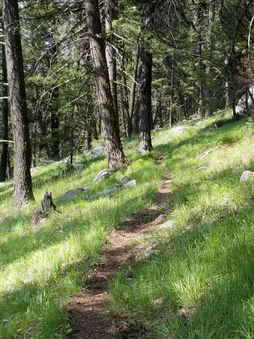
Eventually, I came to an area where the road walk and official trail met. For the next ten miles I’d follow a trail a group of local horsemen had developed. Up high, it was hot and sunny. For the first time, I got to the point where I just found a shady spot and took a power nap. I awoke refreshed. Within 100 steps, I looked back to see the PNT hiker from Bonaparte Lake.
We hiked together for the next few hours as the trail descended to the valley where Oroville awaited. He was young and enthusiastic about many things. He was going to hitch in to town. Knowing I had two nights of reservations ahead already, I opted to camp at the trailhead on the edge of town (technically 2 1/2 miles, but to a backpacker that’s an edge).
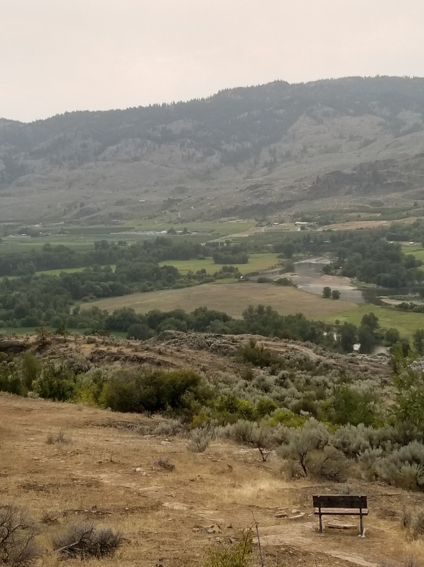
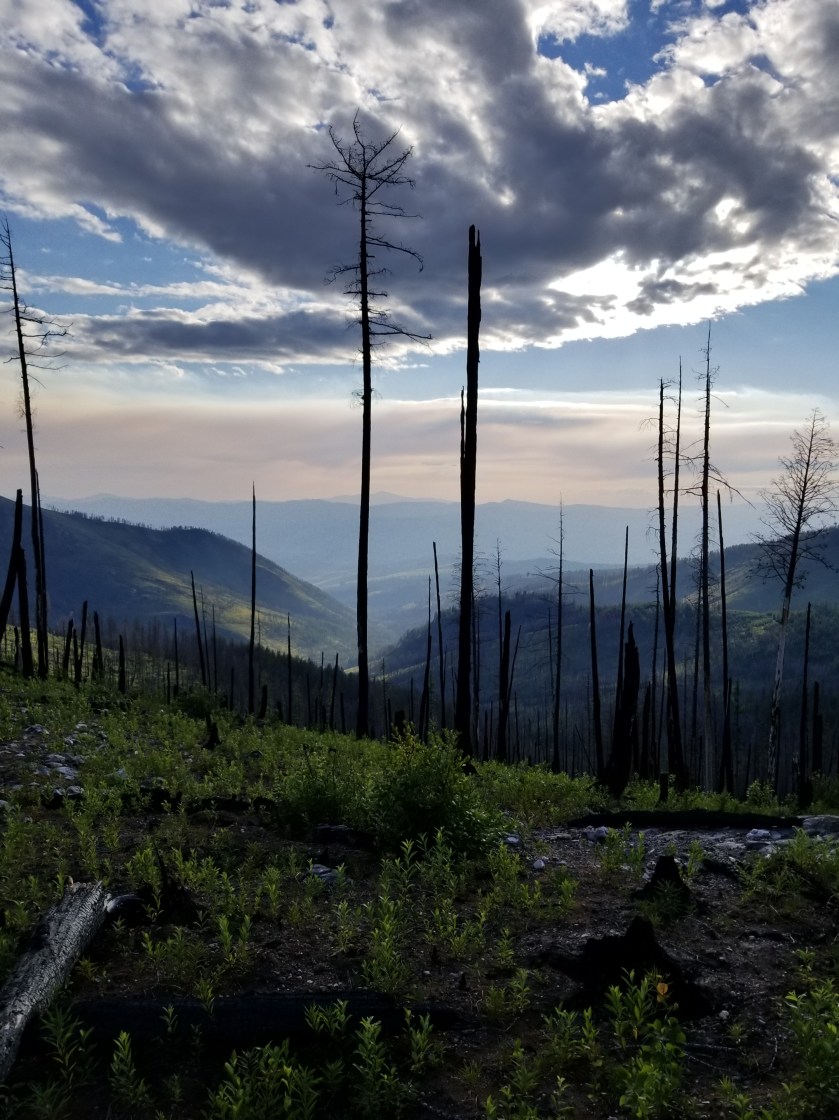
Though smokey. You could see the valley below.
Nearing the bottom, there was a sign mentioning an alternate trail with a water crossing and then a connection to “W.C.” The main trail was just to connect to “W.C.” While I am not British, I could not figure out why trail signs out here would suddenly reference water closets. Still, I needed water and cut over to the alternate, wishing my fellow hiker good luck. “W.C” stood for Whistler Canyon, the local trail name.
Just a few yards from the main trail, the alternate revealed a gurgling stream. There were a couple teens there trying to make out. I awkwardly blurted out “I’m just getting some water” and went past them upstream 30 feet. As the Dad of daughters, I fought hard to keep from asking the girl if her Dad knew she was up here with this loser.
With enough water to rehydrate and get me through the night, I descended. I was surprised the trailhead was so spacious. I found a place on the fence near an apple orchard. I propped up my backpack and opened my umbrella to create a shady spot in the 96 degree heat.
For amusement, a herd of mountain sheep went up and down the hillside in front of me. The younger ones even came down to eat. However, when the dominant Male returned, they just watched me and even when I got in my tent he would not let any of them come down.
The younger ones came down to feed while adults remained up high.
Once the alpha Male returned, he kept the herd up high looking down on me.
July 27, 2018. Bonaparte Lake resort to Stealth camp off trail.
I had reservations in Oroville in two days and planned to take a zero (miles hiked) day there as well. My pack was light and I was in no hurry.
After breakfast at the Resort, they didn’t open until 8:00, I started up Mount Bonaparte. Later, I would need to look up why a tall mountain in central Washington was named for a short French dictator. I was going to go from 3,000 feet above sea level to at least 6,000 feet.
The higher I went, the more I sweated and slowed. At one point, a trail crew had clearly cut and cleared some large logs. Inexplicably, they left a six foot clump of branches in the trail between the cut logs. I thought I should do a good trail deed and move the branches once I got over them. However, halfway across, I felt a sharp pain on my left forearm and looked down to see a hornet stinging me. I smashed it, registered there were a large number of hornets around me, and put Usain Bolt to shame in my sprint away. No wonder the trail crew had not cleared the branches.
On the trail, I am a little bit of a hypochondriac. My first thought was I had not been stung in over 40 years. I wondered how allergic reactions tons to bee stings developed. My backcountry solution was the Nyquil pills (2) I had from my sinus issue had, among much else, anti histamine. After ten minutes, it was clear I was not going to die and u just got on with my day.
The trail offered a choice:split off and take a level contour around the mountain or go up to almost the staffed fire lookout tower and then bomb downhill. I chose the longer 4th of July contour around Mount Bonaparte. I was not in a rush and had no desire to see a lookout.
Although it was still smokey, it was a good choice. On the eastern side of the mountain, the trail was a little scarce, but discernible. However, about halfway around, it was clear a trail crew had just recently cleared blowdowns, but also widened and smoothed the trail. It was impressive. To help you visualize, the trail went from a faint eight inch path through grass to a scraped 24 inch clear trail.
I went past one supposedly “reliable” water source that was non-existent. I was concerned. No need as this 4th of July trail crossed several small, cold beautiful streams. Here’s a video of one of them that seemed almost like a screen saver.
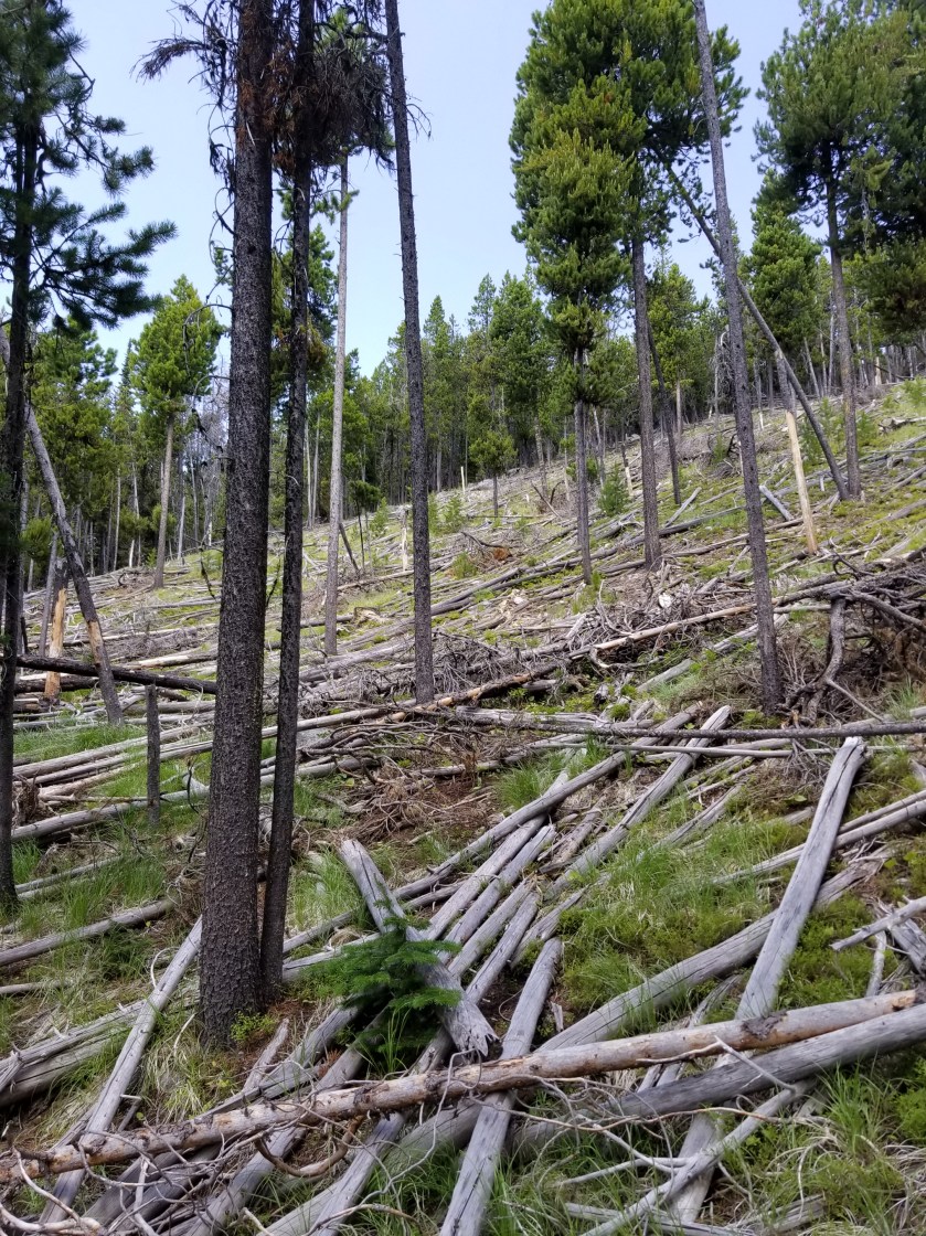
To be honest, there were some sections of zombie forest. Tons of dead trees across the ground and hundreds of standing dead trees. It is hard to maintain a trail in a zombie forest and not much fun to hike on it.
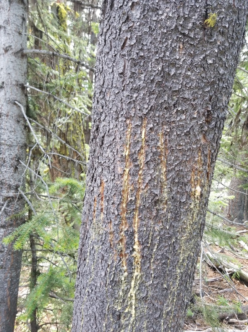
I found what I think was a boundary tree. To my untrained eye, it seemed like an animal about the size of a cougar had scratched a tree about six feet high to mark its territory.
I spooked a large moose. It did not have antlers, was powerful in the shoulders, and moved with strength and grace through blowdowns. Of course, after 100 feet it stopped and turned around and looked at me.
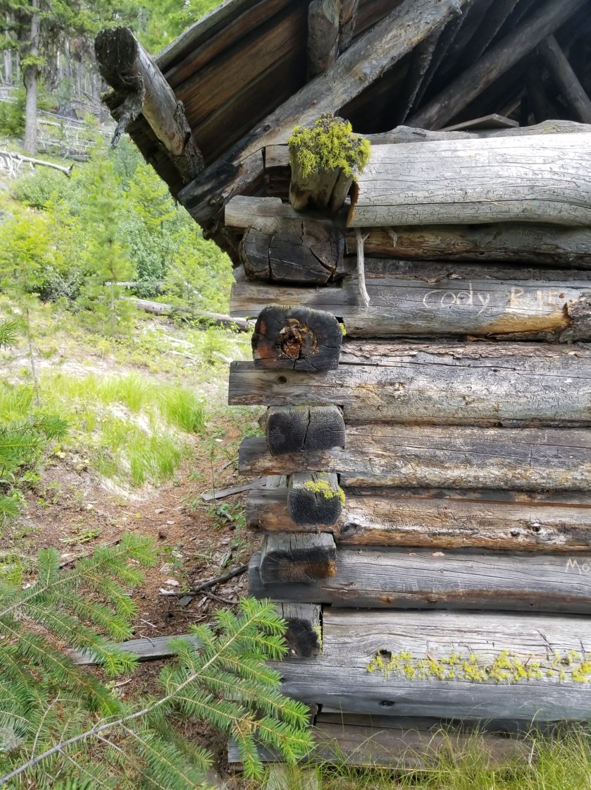
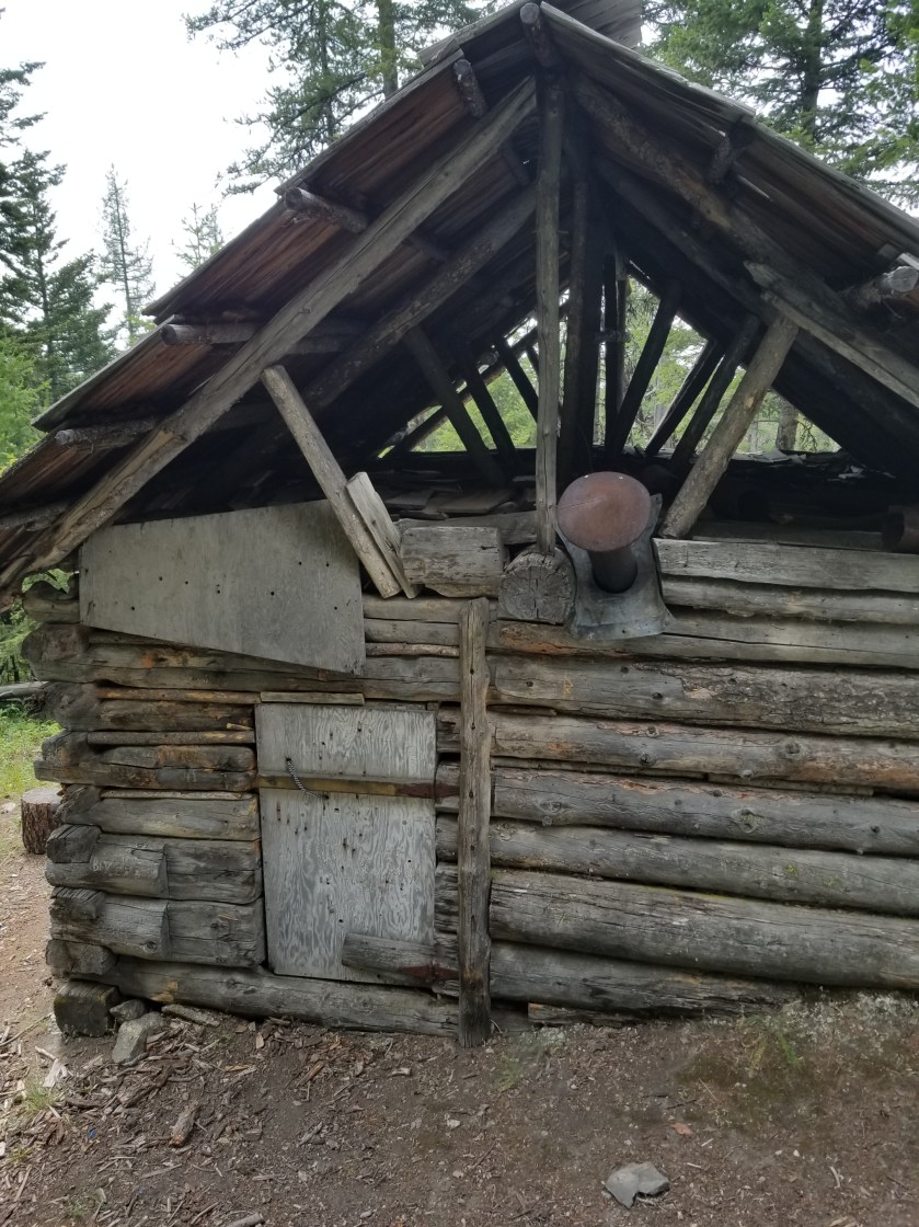
Next I came to an old cabin that was actually serviceable. The roof was whole, the door snug and there was a sturdy bunk and functioning stove inside. It was called the Riggow cabin and it was amazing how it lucked and did not burn in the fires that have swept up this mountain over the years.
I descended down to cattle area. Cows grazed freely and messed up the water sources. Before leaving the national forest, I decided to camp on public land. I crossed a water source and chose a campsite where trees had fallen across the cow trails thinking this was a dead end for them.
I filtered all the water I would need from the source, setup my tent, and ate. Later I walked back to the trail junction to see if the other hiker made it through. He had and must’ve taken the shooter steeper route.
Going back to my tent, I ran in to a cow standing in the water source. She looked me in the eye and just crapped right in the water. Immediately, I vowed to have steak in Oroville.
A small herd of cows kept wanting to walk by my tent. Even into the night I had to get out and shoo them away
A loud group of coyotes announced nightfall and I enjoyed a small steady breeze blowing down the mountain, making for a cool evening of sleeping after a long hot day of hiking.
July 26, 2018. Cougar Creek to Bonaparte Lake Resort.
Leaving behind my subterranean mystery, I scooted down the gravel road with a skip in my step. See, I was going to be at a restaurant in just a few hours.
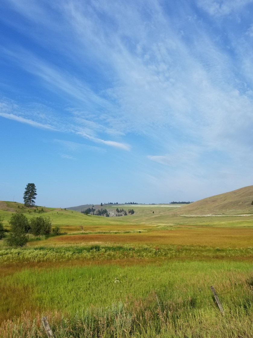
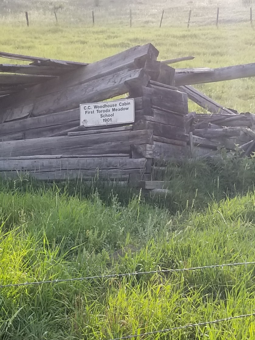
Out of the forested Cougar Creek valley I climbed to higher grassland country. There was a gorgeous old ranch there.
A
Also, the remnants of an old school.
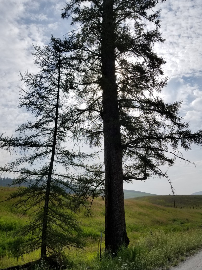
Leaving the grassland I passed the largest larch tree I have seen on this trip. It had to be 80 feet tall.
Eventually I entered a forested area where the mosquitoes were vicious. For the first time in weeks, I stopped hiking to put on repellant.
The PNT official route was supposed to veer off this empty road and angle towards the resort on an abandoned road. I chose to stay on a perfectly good unabandoned road that went straight to the resort.
They had my resupply package. On an impulse, I purchased a tent site for the night. I had a designated spot with a picnic table and access to restrooms and a warm shower.
I ate a huge breakfast, showered and then lazily soaked my legs in the lake. No fish died.
Since leaving Northport, there have been two types of military aircraft on a daily basis. First, there are fighter jets that sometimes have exercises. I recall watching a couple of very aggressive moves on one day where a low flying jet flew through a valley and then went quickly up to intercept a plane coming towards me.
Second, there must be some stealth bombers practicing. You can clearly hear the plane. But when you look up and follow the sound and project forward, you don’t see a plane. A commercial aircraft is easy to spot this way on a clear day. Even if there are no contrails, the plane is easy to see. Only once was I able to see a bomber. It was late and the sun was low in the horizon and somehow the sunlight illuminated the underside so I could see it for about ten seconds.
I mention this because I was lazily soaking my legs in Bonaparte Lake when I heard one of the fighter jets. It sounded like it was approaching. The sound got louder until the jet roared overhead only 100 or 200 feet above. It was fast, loud, and such a contrast to the idyllic lake.
Under the category of “No way!” I went over to the resort restaurant for dinner at 6:00. I walk in and there’s a big sign saying “closed.” I asked the server why. She said the cook sliced his finger badly and had to go for stitches. In remote locations like this, there is no backup. One thing I’ve learned backpacking is to not react emotionally, instead just honestly stating my situation. “I’m staying here tonight. I am backpacking and only have two dinners to get me 50 miles to Oroville. I was counting on a meal here. Do you have any ideas on what I should do?” The server said she was not allowed to cook, but there were some veggies for a salad. I said that was perfect. She ended up making a delicious salad with ham and avocado to boot.
A PNT backpacker came in. They gave him the bad news about the kitchen. They served him a beer and he bought a bag of Doritos. I walked out with him, asking him questions about the trail. Since I was clean shaven, I’m sure he thought I was just a pesky old guy.
I went back to my tent site. While it was ideal for much of the day, unfortunately the RV closest to my tent site turned out to be the host location for some large family reunion. A whole family of RVers! They were mostly older, so many headed off to bed at 8 or 9. The hardcore drinkers, of course, stayed on and got much louder but made even less sense. To my relief, they shut themselves down at 10:00 sharp with “good nights” shouted to each other five feet apart.
I slept ok and felt pretty good having eaten, showered, and rested.
July 25, 2018. From Okanogan Forest camp to Cougar Creek camp. 22 miles
I was not well rested after the rough night. Still, I packed efficiently and even forced myself to eat my breakfast of cold-soaked 10 grain cereal.
It was a beautiful day for hiking along this seldom-used road. I had seen no cars on it yesterday. With this solitude, you would not be surprised that when it came time to perform an important bodily function, I simply took off my pack and went a few yards into the woods to dig my cat-hole and take care of business. Well, as Murphy’s Law would have it, another hiker, heading the opposite direction, comes walking down the road. Nobody for days and this guy walks up on my dump. I tried to recover as quickly as possible, but it was certainly awkward.
We chatted briefly, but I was eager to get on with my life.
Later, as the day got hotter, I took the aptly named Sweat Creek Trail. It was a tough climb on a hot afternoon. Perhaps some steep climbs, I heard the chainsaws of a trail crew. After waiting in the distance for them to see me, I had a good, short visit. It was two adults and three teenage helpers. They were a legitime PNT crew. I expressed my gratitude for all the work they do and showed the younger ones all the scars on my legs from going over blowdowns, etc. Also, I let them know I was a dues paying PNTA member.
Their work is hot and difficult. I whine about carrying a backpack in hot weather, but these folks get up, put on long pants, work boots, hard hats, carry their gear uphill to the worksite, and labor in the sun all day. I thanked them again and let them get back to work.
Part of the work this crew had to remedy was eliminating misleading cattle paths. Generally, cattle are fairly good trail makers, sometimes they riff on their own. What this means is they will very often follow the main human trail, but, when it suits their bovine fancy, they cut a new path. Thus, in many areas a hiker has a very difficult time telling the difference between the human and cow paths.
On my way downhill, I could see the trail crew had a lot of tree and cattle work. As if to prove the point, I encountered a small herd of about three pairs of cows and calves. Always, I stop and talk in a calm manner when I see cattle on the trail. While sometimes they amble off safely, other times, like this one, one bolts and the others follow. You might be surprised how agile these animals at going downhill at speed, jumping over obstacles. I waited a few minutes so they would not feel threatened. I don’t want either a calf or cow to get hurt running.
Unfortunately, I’ve seen this movie before and was not surprised to have the same process repeated. Two more times. In all, they probably ran downhill for a 750 foot elevation loss over a mile. Finally, one of the cows went left off the trail and the calves, who normally choose the trails, chose to follow her.
It was evening by the time I reached the bottom of the trail. The guide book made a vague reference that the trail seemed to go on private property but to veer left. Mild understatement. The trail basically dumps right in to someone’s yard. I didn’t see a dog, but clearly somebody lived in the trailer parked there. I went immediately over to the edge of the yard and moved quickly and quietly away.
Eerily, the occupant(s) had a fascination with skulls and decorated their yard with several plastic skulls and skeletal parts. At age 56, I am just too damned old to be abducted and converted by some cult. Think about it. You never hear about guys like me getting captured and converted, it is always younger people. So, I kicked in to high gear and got the heck out of there.
I came out on a public road. It switched between private property and public land. There were definitely some unique homesteads along the way. Maybe you live in a suburb or a nice urban setting. Indeed, you’ve also probably seen poor, blighted urban areas. However, taking a long walk really draws out a different variation of the American dream. There are rural areas where it is either the start, or fulfillment, of the dream to get a piece of land and park an RV or Camper on it and call that home. Sometimes there is evidence of a more permanent, traditional structure in various stages of completion. I can sort of understand the pride of ownership angle, but most of the situations appear to never convert to permanent housing. Instead a second or a third trailer is added. (I shudder to think what their septic solution looks like.) Pointedly, most of these smaller homesteads were the most prominent displayers of “Private Property” or “Keep Out” with a few specifically mentioning government officials. (Note I have the honor of working with municipal employees in my community and can’t recall any kind of professional that works harder to be fair, judicious, and considerate.)
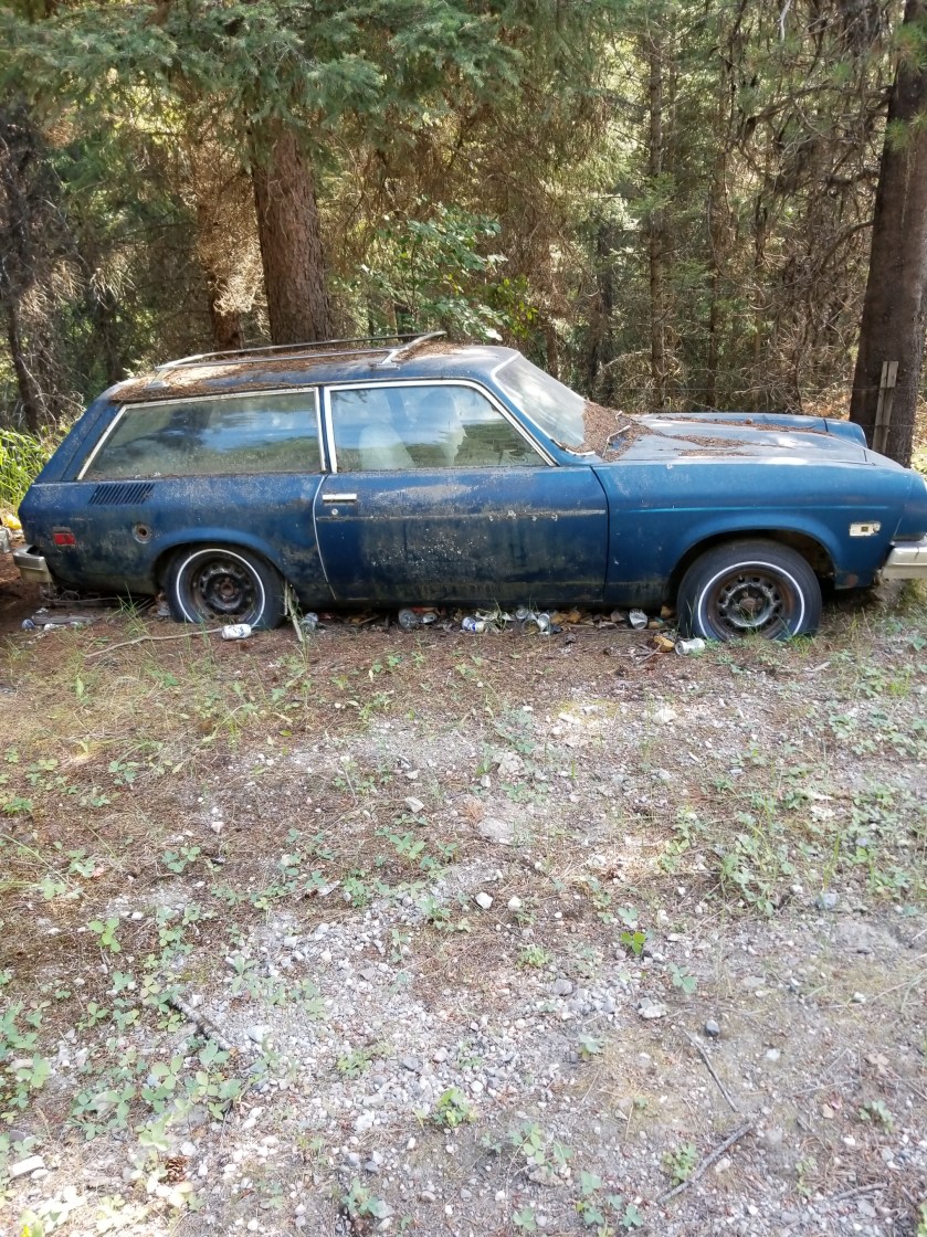
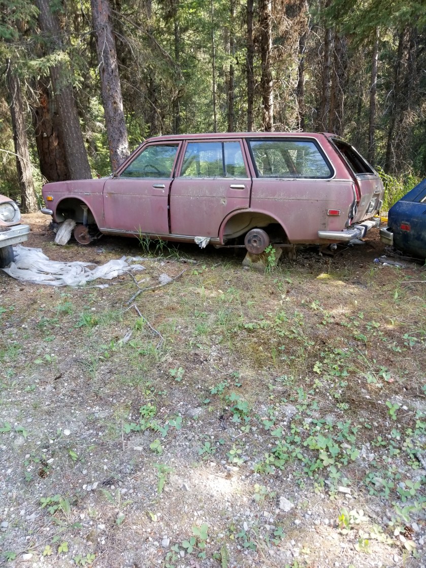
I passed a few properties where they spilled some of their excesses on to the public right of way. I’m not a “car guy” but one place was occupied by one who convinced himself (and perhaps a long suffering wife), that he would hold on to junkers to “part them out.” To nobody’s surprise, the Dodge Aries and various Datsun models did not generate much demand, so these vehicles decorated the road.
Eventually, I found a flat secluded spot on public property down by the creek. It got darker faster in the narrow valley. I ate my dinner while shooing away yellowjackets. I pitched my tent, hydrated some more, and went to bed.
While I initially dropped right off to sleep, in the night I was awakened by a sound. Not one crunching in the woods or brushing against the tent. Eerily, it came from underneath the tent. In the ground, there were subtle digging sounds and then a muffled pig-like snort. Being a guy and having lived in apartments, I naturally reacted by pounding on the ground. That produced silence. For a few hours. I had to repeat this one more time. In the morning, when i packed my tent, I could not see any obvious signs of tunneling or disturbed earth. I’ll never know what it was.
I find it fascinating that spruce trees will “feel” that they are dying and produce these clusters of robust growth, kind of like the opposite of cancer cells. I’m not sure if these anomalous growths are then intended to jumpstart regeneration when the tree falls.Saw this grave marker along the gravel road this morning. Couldn’t tell if it was for a pet or an unpopular relative.
July 24, 2018. From Thirteen Mile Mountain to stealth camp on Forest Road before Ogle Creek.
In spite of the strong moonlight, I woke up rested. I broke camp relatively quickly.
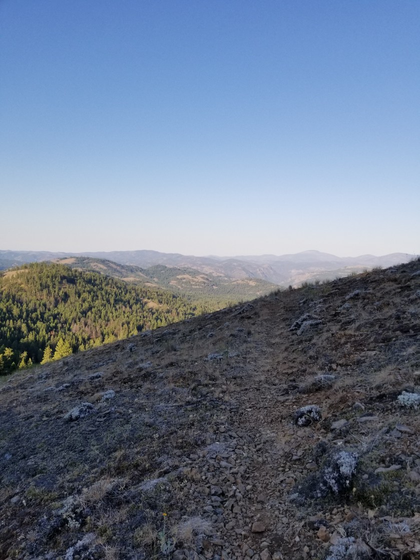
It was a brilliant, beautiful morning going slightly up and down on trail through grassy ponderosa forests. Great views.
Later in the morning I was cruising downhill, I went from sunny slope to a sharp shaded corner. That was where the accident happened. For my part, it took me two full steps before I recognized the sound of a rattlesnake. For his part, he waited until I was next to him before rattling as he wound himself up underneath a Bush. We both screwed up. I went back to see him and he had beautiful green markings. The video does not do it justice, but you can understand I did not want to stress the creature or, more to the point, get bit and die all for the sake of a more clear video. This isn’t Mutual of Omaha, people.
Later, I crossed a road with a trailhead. I loved it. There was a description of Thirteen Mile Trail. Best part? The length of the trail. All of my avid blog followers know I love goofy signs. So, both of them can understand my glee over the Thirteen Mile Trail being 16 miles. What do you think happened?
I was too tired to consider how a difficulty rating of difficult worked.
I dropped down an amazing canyon of Thirteen Mile Creek. It had huge 500 foot sheer walls and a churning stream. Suddenly, the stream disappeared. Just as suddenly, it reappeared, apparently choosing to run undergroundfor a quarter mile.
The photo fails to capture how high and sheer the cliffs were.
I next had a 2 mile walk on a highway with no shoulder. The Guidebook said this was the Grand Canyon of Washington. I was not impressed. Plus, there were a couple jerk drivers who clearly could’ve moved over, but chose to hug the lane and almost clip me.
Off the road, I had a dry trail uphill for several miles. It was tough. I had one of my oddest wildlife experiences. Given the amount of time until my next resupply and chance to charge batteries, I have been turning off my phone which is my camera. At a road junction, I was looking at my printed map. A spotted fawn trotted out of the woods. I reached for my phone and turned it on. On a whim, I told the fawn to “calm down.” Unexpectedly, it turned and came right to me. It was panting. It was obviously stressed, but I knew taking my pack off to give it water would spook it. By the time my phone turned on, the fawn was trotting away through the woods. So bizarre.
Late in the day, after passing cattle and timber harvesting, I came to a “V” in the road. A sudden crashing in the bushes uphill made me reach for my phone. I spied some black ears and a scalp. I wasn’t sure if it was a wolf or a black bear. As I was getting my camera ready to video, the bear cub came into the open. “Oh shit”. I hightailed it out of there not waiting a nanosecond to see where momma was.
An eventful day drew to a close when I found a beautiful grassy plateau for my camp. I hung my food far away and went to sleep. Or tried. It turns out I was on a bit of a lump, plus the zipper on my tent failed. So I spent a lot of the night fidgeting to find a comfortable position and waking to a mosquito buzzing my ear.
July 21, 2018. Stealth camp near Kettle River to unnamed saddle in Kettle Mountains.
The night was very still. I heard some coyotes around midnight doing roll call. No problem with the camping.
As I continued down the road to cross the Kettle River, I walked along a quarter mile of the plateau and not a single private property sign was posted. I was relieved.
After crossing the river and highway 395, I was on a gravel road, passing a large piece of private property which had been logged. As best I can tell, the way landowners make a living is to graze cattle on their forest land and then periodically harvest timber. I would imagine lumber shortages and tariffs probably pushed a lot of folks to harvest lumber sooner rather than later.
Today I was feeling a little sluggish on the relentless gradual climb. I tried hydrating more, but it was tough. Plus, there were about six young guys on motor bikes whipping up and down the trail leaving annoying dust clouds. The scenery was nice, though.
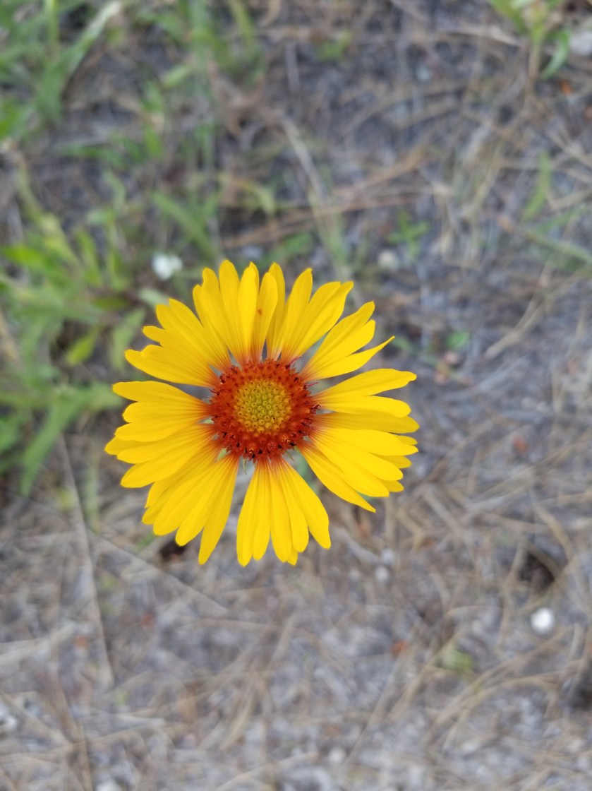
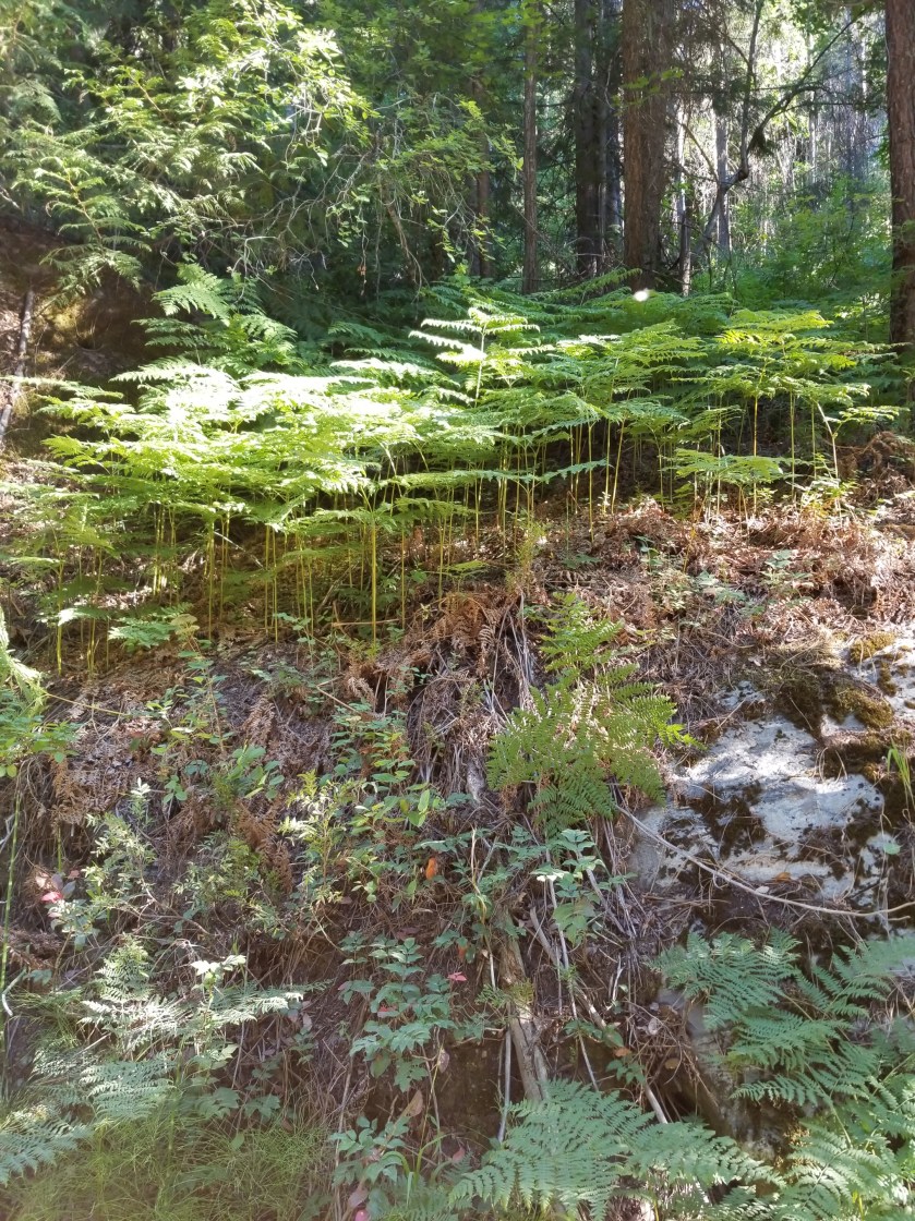
These ferns grabbed a slice of morning light as they grew on top of a boulder.Indian paintbrush (red/orange) and lupine (purple) are attention getters in meadows.
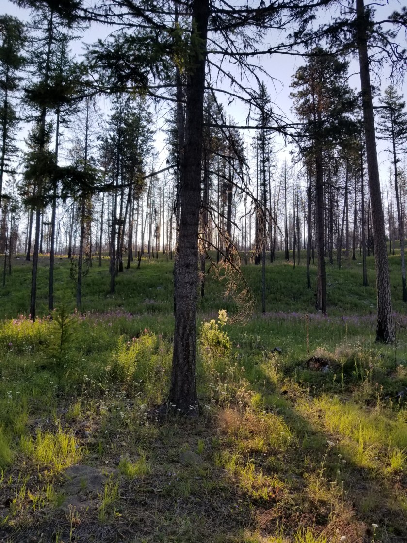
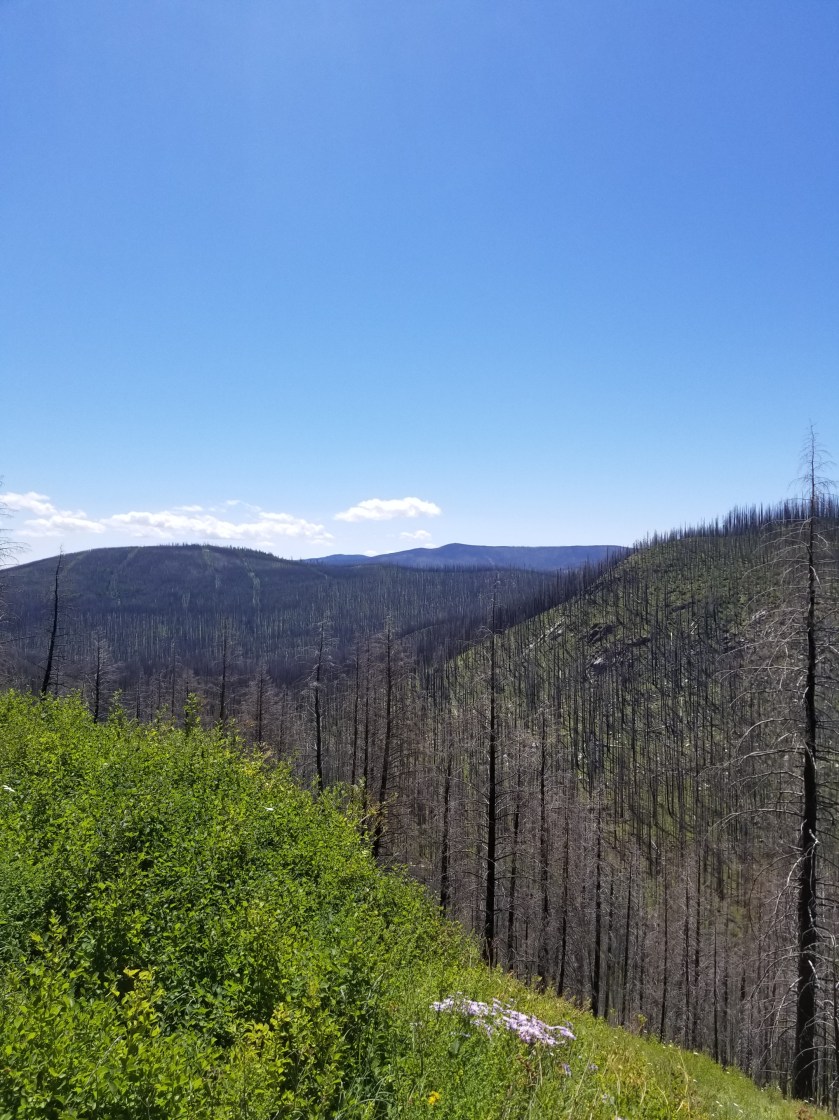
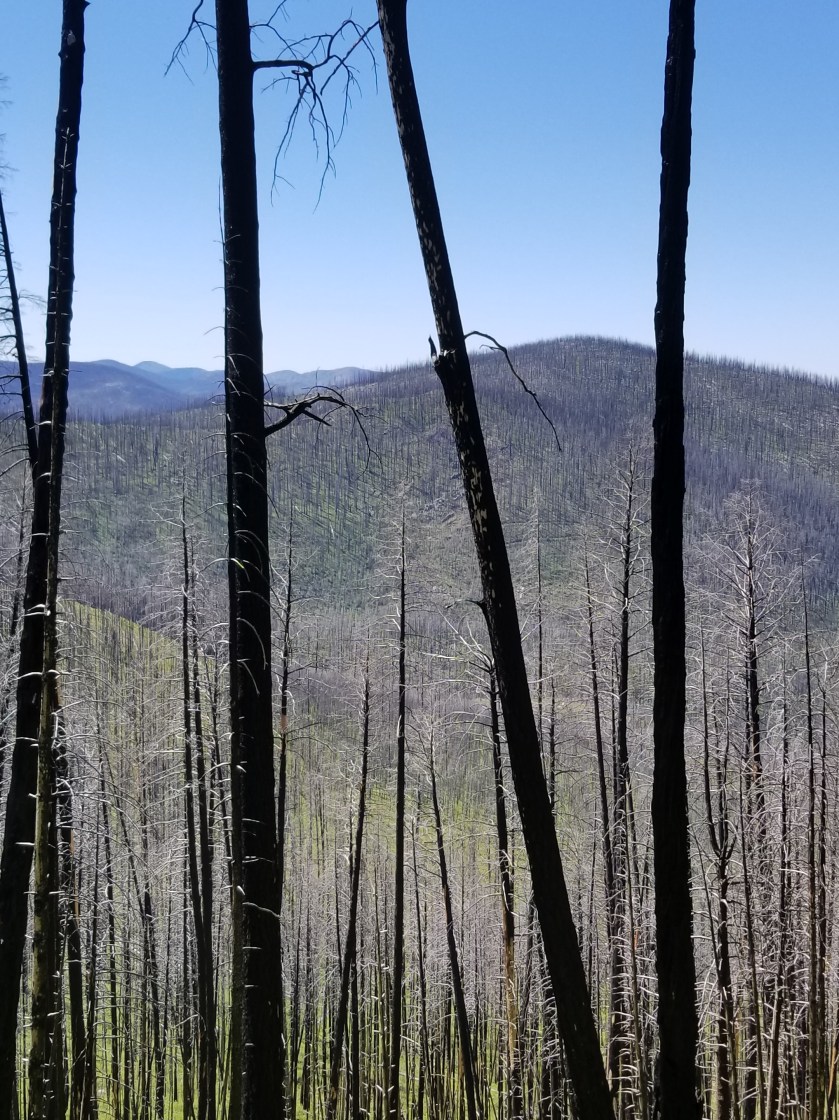
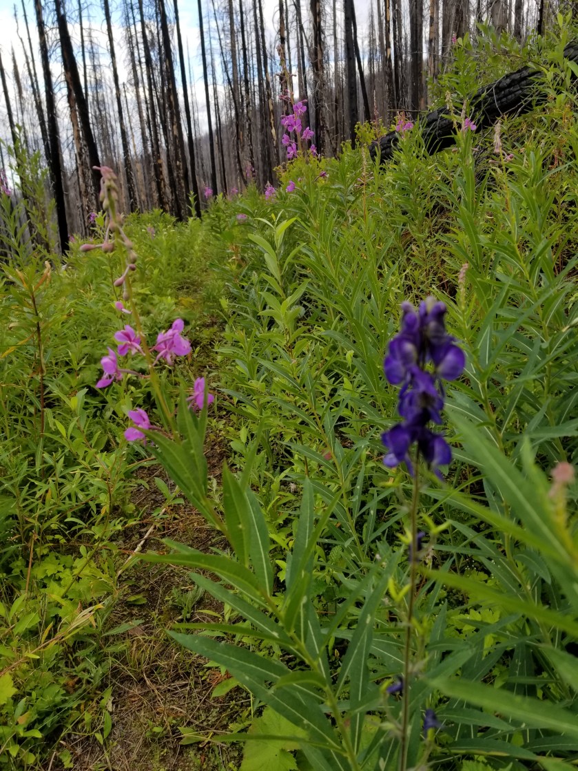
The day changed tremendously when I entered the burn area. In 2015, a massive complex of fires swept over a large swath of this country. I entered an area of standing deadwood, charred fallen logs, fireweed, and lupine. The trail dwindled from a gravel road used to salvage usable burned wood to abandoned forest service roads with multiple blowdowns.
It is such a contrast between the massive carnage of a forest fire and the rapid evolution of plants scrambling to seize the open terrain. Lupine has an explosive takeover strategy. It develops seed pods that twist and then pop open, scattering seeds. The most interesting thing to me was the absence of pine, spruce, and larch seedlings. They must bide their time and rely on their height genetics to overcome the early lead of other plants.
I’ve only seen two sets of footprints. That is, until I got to an intersection with a paved road. Then, a new pair of prints appeared. This was the famous Kettle Crest Trail.
Kettle Crest was a well maintained trail. I could not recall how many days since I had been on a real trail. It was good, but again seemed more like a bike trail than a hike trail.
I was able to get my last water supply and then followed the trail as it switched back and forth uphill. The map showed three turns, but there were at least six.
FireweedSorry for bad focus, but seeing fireweed next to something that looks like a delphinium was an unusual sight.
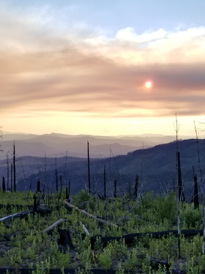
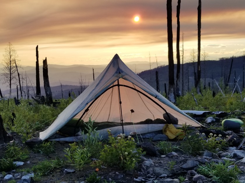
Eventually, I reached the saddle I was shooting for. There was about 45 minutes before sunset. An odd cloud of smoke hung in the air. Plus, for once, it was windy. So, I made camp quickly, avoiding standing dead trees. I pointed the open end of my tent away from the wind. I had to put on my wool hoody plus my down puffy.
View from the saddle. The mountain saddle; I’m not on horseback.Sun behind smoke cloud.
As a shock element, while I was eating my dinner, a mountain bike went whizzing past. Not sure if he saw me, but I hoped he made it to the road before dark.
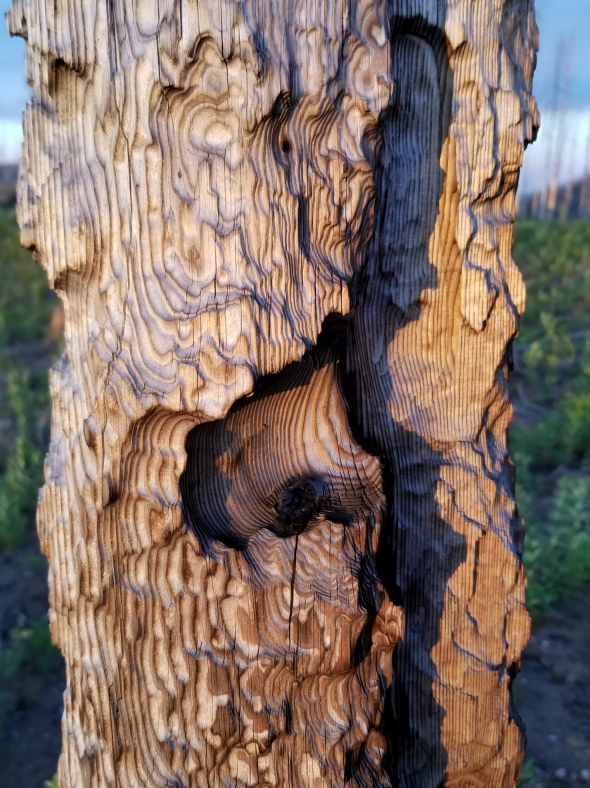
My Zpacks Altaplex tent. The company stopped making them. Too bad because they were great for tall people.First fire, then wind carved this.
It was the first cold night in weeks. I liked it and I liked sleeping up so high. It was a long hard day, but tucking in to a warm sleeping bag was a great reward.
July 20, 2018. Northport to stealth camp near the Kettle River. 24 miles
I woke up early and packed. I hadn’t mentioned this previously, but this was a big resupply. I would not get supplies again for 130 miles at Bonaparte Lake Resort. Averaging 20 miles a day meant six days. I usually bring about two and a half pounds of food per day. So, I would be leaving town with 18 pounds of food plus my regular, base weight.
Trying to carbo load, I ordered huevos rancheros with two extra eggs. I then ordered dessert: strawberry rhubarb crisp. With ice cream. The Mustang Grill was a great place. They were fast, organized, the food was good. Indeed, for the first half hour, about every five minutes a different bachelor rancher or farmer came in and got “the usual.”
The first part of today’s travel was to cross the Columbia River. Unlike prior bridges, there was no pedestrian walkway. Instead, there was a narrow catwalk with a low barrier between me and the vehicles and a waist high railing over the river.
As I started across, I noticed it was proudly built in 1947. At first, I steadied myself and took tiny steps. Twice, cars came by and the bridge didn’t rattle. Too much.
About halfway across, I was taking adult-sized steps. I looked ahead and saw my second worst fear: a logging truck barreling towards me. My worst fear? Another one coming from behind.
Here comes the log truck….
Suddenly, huevos rancheros seemed very, very stupid. I almost dropped to all fours, but then realized I wanted to plummet to my death with dignity. So I stood and waited as the truck got closer. The bridge was shaking pretty good as the driver waved passing by me. As the sound of the truck faded, so the grinding and popping of the bridge faded. From that point, I fairly sprinted to the end. What a great start.
Looking back at the bridge.
After a short pavement walk, I started on gravel roads again, then dirt. Early on, I walked up Sheep Creek road. Every once in a while there were cuts between the forest road and the creek. On many, it was clearly just families tucked in for camping. On a few, however, it seemed like this was home for some people. Kind of depressing.
Later I walked through areas the forest service had sold for logging. It looks rough at first, but modern logging is so much better than the old clear-cutting ways. Now, they mark a section and within it designate mature healthy trees to protect. Waste is piled. Yes, it looks logged, but it is not a barren wasteland.
It looks rough, but at least some healthy mature trees remain.
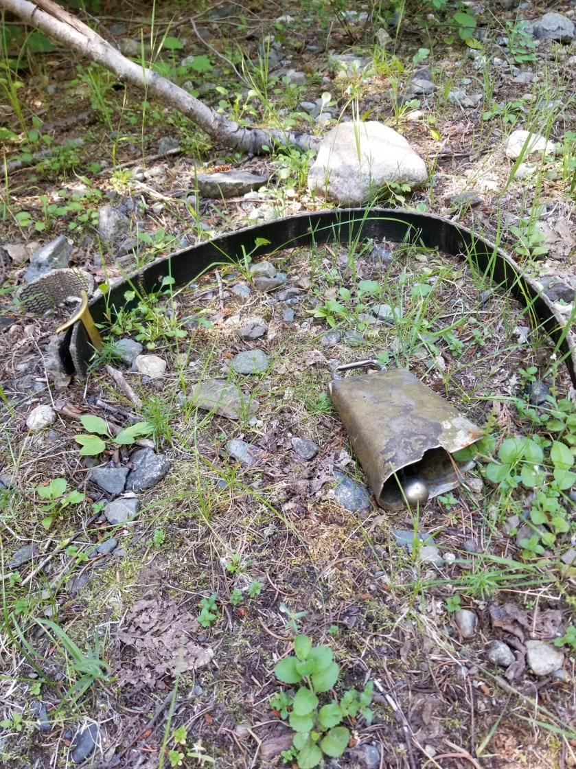
Along the way I found a cow bell and collar. Clearly signs that some happy cow had broken free from that noisey bell.
Also, a matchbox car was so out of place.
Not meant for forest roads.
I saw a small snake in the road.
Later, I found an entire ant colony moving across the road. Each was carrying an egg.
I was at my 20 mile goal, but there was some daylight left. I opted to skip the public campground at Pierre Lake because it was a one mile walk in the wrong direction. Instead, I thought I could find water and public land before my next big river crossing, the Kettle River.
At first, there were just a few large ranches. However, as I went down the road toward the river, the no trespassing signs increased and there was no water. I went past a volunteer fire department and seriously considered stealth camping behind it. Around 7:30, I found a small creek on my side of a barbed wire fence. It probably had some type of ag runoff, but at least it would be wet. I drank a filtered liter and filtered two more to go.
I was getting pretty desperate. I hate trespassing. At my final road juncture, I saw a plateau above a slope. I walked up 200 feet and down 200 feet. No signs were posted. Most importantly, it looked like it had been logged several years ago, reminiscent of the public lands.
I hiked up the slope and came out on a beautiful plateau with widely spaced mature ponderosa pines. Carefully, I scanned for any signs or buildings or roads. None. I ate my dinner quietly. As it got dark, I set up my tent, sort of confident I was on public land. Laying down, I had visions of guard dogs barking at my tent as a trespasser, but the fatigue of a 24 mile day overwhelmed everything.
July 19, 2018. Silver Creek campground to Northport.
Not much to report on this day. Originally, I planned on stealth camping a few miles before the town of Newport, and the next morning go in for breakfast, pick up my General Delivery package at the Post Office, and be on my way. I did not think I could reach Northport before the Post Office closed. Ideally, I would camp overlooking the Columbia River.
The overarching theme for this day would be sun and asphalt. I packed up and left before Indigo and Snowberry were ready. While I started on a forest service gravel road, after three miles it took a right turn on to a paved county road. There was an older gentleman sweating at some yard chore at the junction. We exchanged greetings and I was on my way to 15 miles of asphalt.
In previous years, the PNT to Northport was shorter and mostly trail. However, a landowner decided they no longer wanted to provide access. Now, the PNT walks about 12 miles on pavement. I do not know the details, but it seems absurd.
After approaching the Canadian border, I turned south and began walking south parallel to the Columbia River. When visible, it broke the monotony. Between the road and the river, an abandoned railroad track gave rusty testimony to an earlier time of economic prosperity.
There seems to be something on the track.
One guy stopped and offered a ride. Locals in pick ups and truckers waved and gave me a wide berth when there was no shoulder. Surprisingly, Canadians always seemed to cut it close when passing.
As I checked my pace, I realized I could probably get to my package before the Post Office closed. It was now stinking hot. I was sweating pretty good. At one point, a Border Patrol officer stopped. By his questions it seemed to be a combination of investigation (where did you sleep last night? Where are you headed) and welfare check (do you have enough water).
The bridge over the Columbia at Northport.
I pressed and got to town in time. There was a simple cottage with a vacancy so I grabbed it. On my way from the post office to the cottage, I was hailed by Snowberry. They had stopped at the intersection of the gravel and paved roads and asked the man working in his yard if he would give them a ride to Northport. He did.
The cottage had a/c, so I took a shower and lowered my body temperature. Later, I had a two entree dinner and drank what seemed like a gallon of water.
I was glad I got to town and the cottage. Tomorrow, I would wait until the other restaurant in town opened for breakfast. Until then, sleep.