I was up early, showered, and packed. I couldn’t wait to get back on the trail. Eventually, we got to the trail around 8:30. I downed a liter of water. A younger couple rode up with Sam and I. I let them take the lead.
Why is it never “cream puff canyon?”
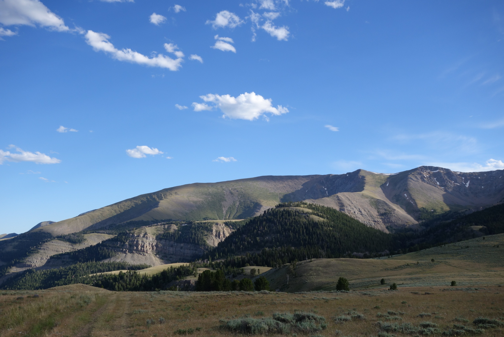
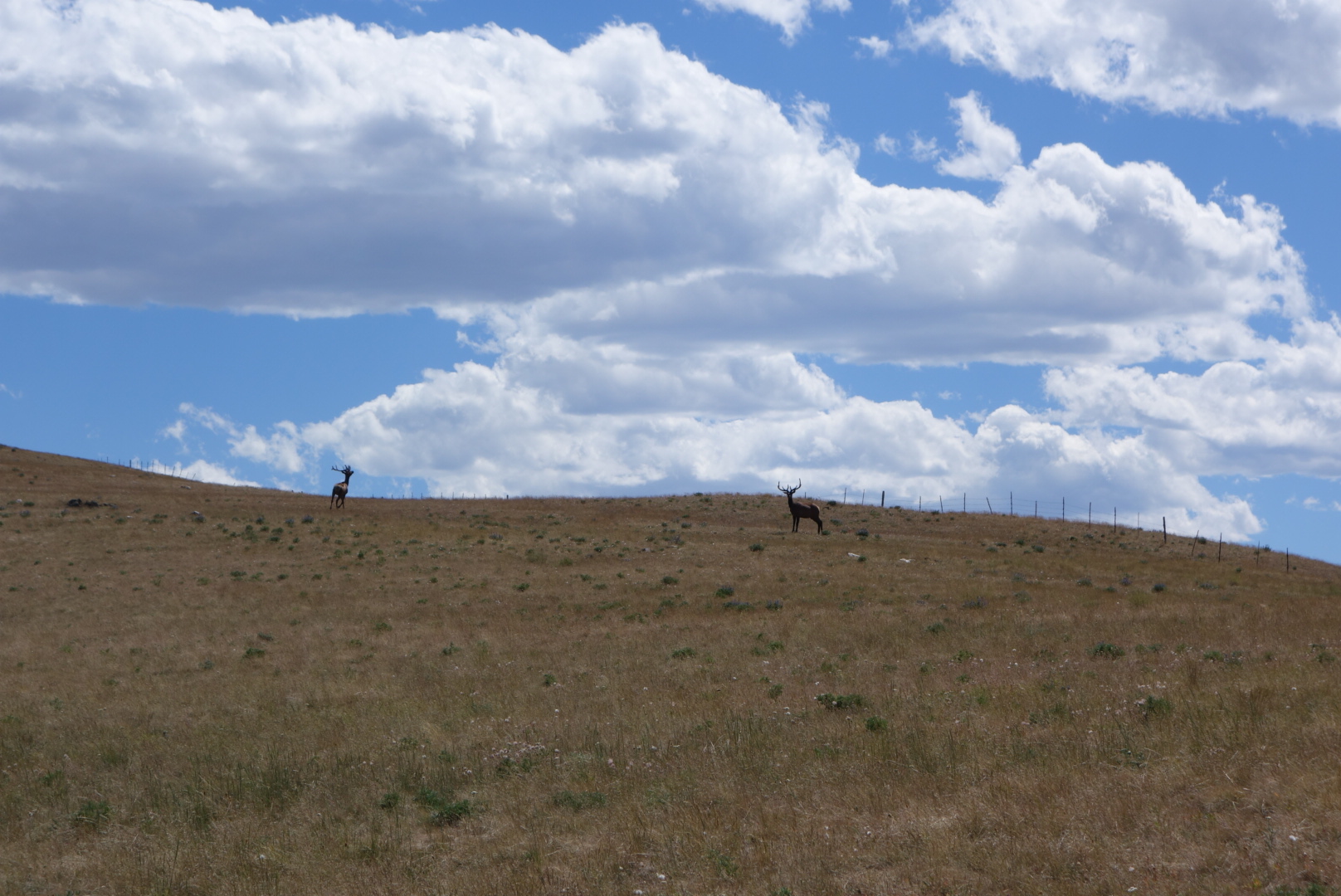
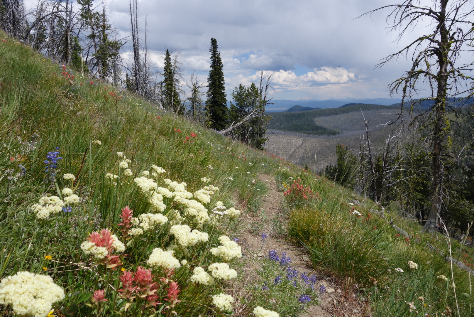
It was a fairly steady climb in open country. I like this country, but one has to be cautious about water. Eventually, the breeze kicked in. That cooled things off. At one point, I came over a hill-top and saw two elk in the distance. As I focused on them, it turned out they were both bulls. Their antlers were big, but not huge. They were grazing, facing in to the wind. I thought for sure they would see me approach and bolt. However, I kept getting closer and closer. When I was within 100 yards, one of them spotted me. They pranced around a bit and then bolted. I could not get good still photos, but I captured some nice video.
There are two young bull elk in the distance.
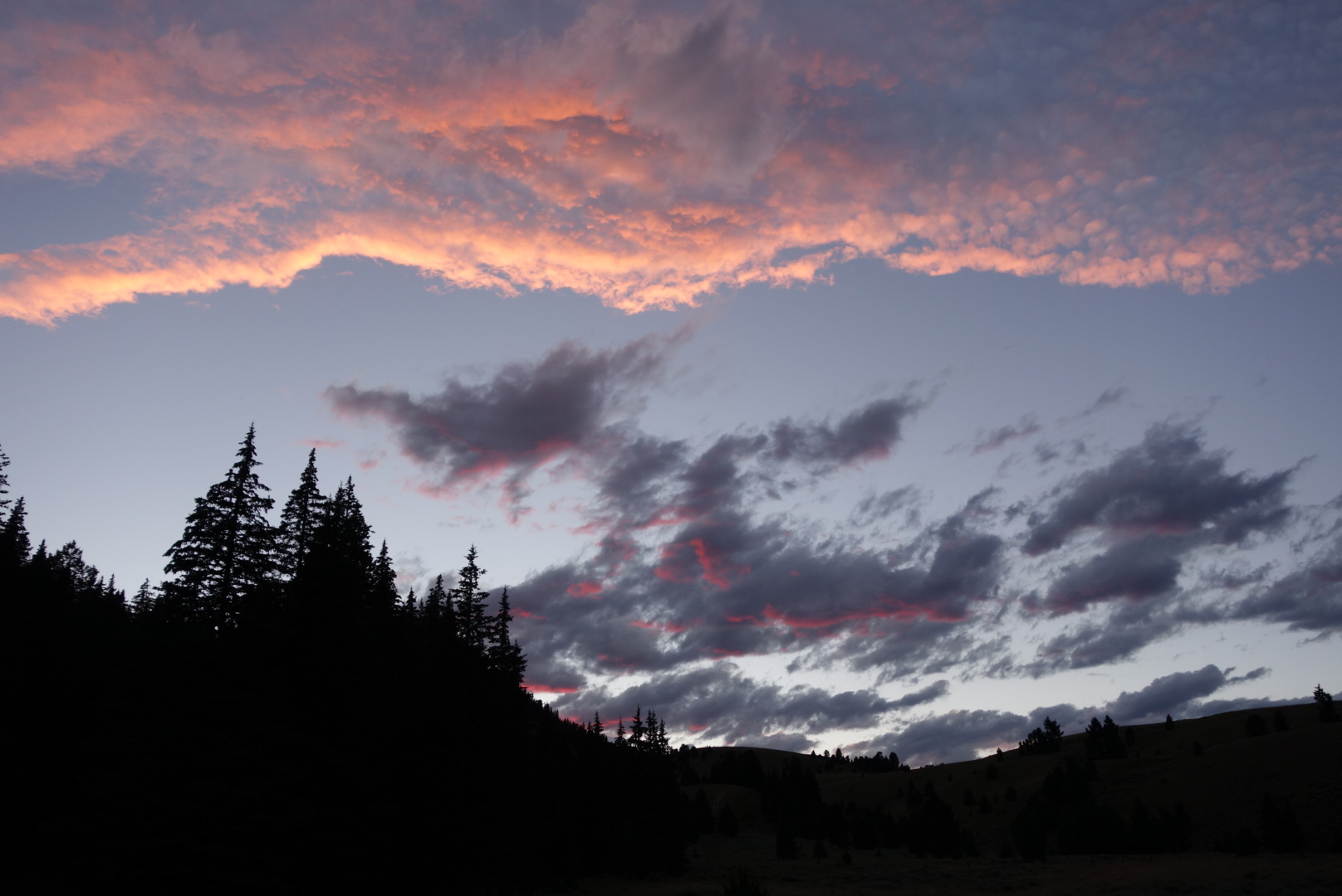
It was getting late, but I thought I still had enough energy to make my stretch goal of Morrison Lake. That would be 26 miles. I went for it. Around 8:15 I stumbled to the lake. I found a campsite far away from the water. I did not want to be near animal paths, especially bears. It was a gorgeous sunset that I almost missed. Plus, there was a full moon rising soon after sunset, but I could not figure out the adjustments to capture good photos.
Today was one of those days that would normally be considered frustrating, but you learn to accept the nature of backpacking and just accept.
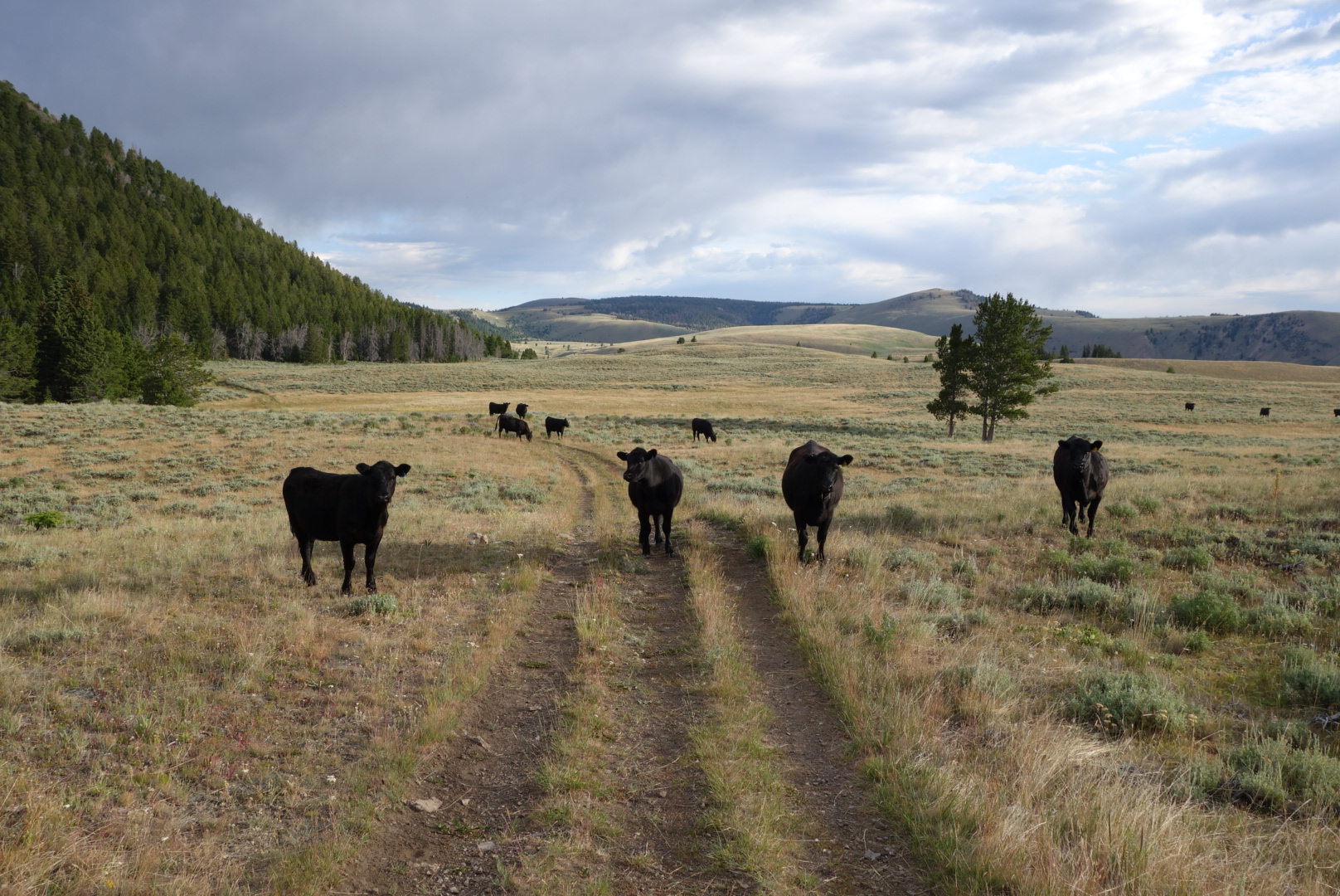
First, I started walking through some cattle herds. Some were skittish, but others seemed to think I was there to open a gate to let them into greener pastures. A group started following me, which felt weird.
Stalkers. Probably follow my blog.Later the trail became less well marked. One of the mixed blessings of the Continental Divide is that there are several alternates. On trails where only CDT hikers use the trail, alternates dilute traffic and therefore the tread is less visible. For me, open meadows/ fields are my undoing. Fortunately, today these open areas were hilltops, so even though there might not be specific tread to follow, a distant post with a CDT sign on it was good enough for navigation.
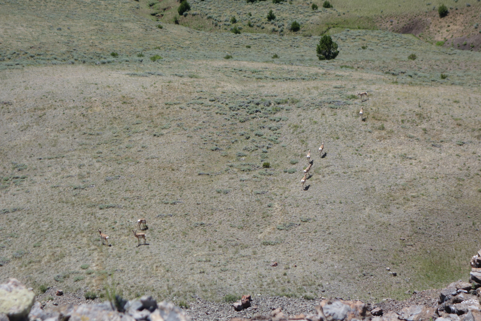
I finally got close to a herd of antelope. I came to a cliff and looked down to see a decent sized herd. Normally, they scan the horizon so diligently you cannot get close. I guess they don’t look up.
Antelope below.
Later, still, I came to Cottonwood Mountain. Again, one map set encourages hikers to climb up and over the mountain. The official trail went down a canyon then around the mountain. Being old-fashioned, I went down the canyon. The trail was non-existent and the posts very far apart. Long story short, I turned downstream when I should’ve turned upstream. I ended up off trail (note I never officially declare myself “lost”) for about three hours. That would normally be frustrating, but it gave me a good chance to appreciate the game trails. These are the routes the animals make and follow. Some are very good tread and find very efficient routes. The elk ones are great because they are big enough for a human to walk on. I did see several female elk and saw one bull grazing on a hillside.
Eventually I got back on track. I had to walk through a big herd of cattle which led to a pseudo stampede. I always try to be calm and move slowly, but once one cow freaks, very often the rest do.
I came down through sage brush to a beautiful creek called Tendoy. The flies and mosquitos had been bad all day. I was ready to call it a night. I found a wooded campsite on a little hill away from the creek and set up camp. I did meet two men on horseback that had been scouting elk for the hunting season ahead. As I thought back on the day, I had hiked about 26 miles, but only about 21 were on the trail.
I woke up to a pretty nice day, but a few warm gusts of wind up from the valley indicated it might get warm. Soon, the other hikers (Kimchee, Moonbeam and Wash Pot) passed me. I enjoyed hiking with the latter two for awhile. We got separated in, you guessed it, a meadow. Stupid me followed a sign that said CDT, but the route had changed.
While bushwhacking to get back on trail, I ran across a large moose antler. I am told people pay good money for these. However, it was heavy and I was not going to carry it. It was impressive to realize that moose grow these, carry them, and then shed them.
The forest in the morning was very impressive. It was one where some huge old trees had been logged in the past 20 or so years. However, the loggers had left other large trees. So the forest had the feel of openness, had the gravity of big trees, and would be able to provide large valuable trees in the near future. Compared to clear cutting, this made so much more sense.
One of the southbound hikers ahead of us had sent Wash Pot a message saying we were entering a 10 + mile stretch with no water. We had to fill up at Aldus Lake and the next water would not be until a later lake. I caught up to them at Aldus Lake, dutifully filtered 4 liters of water, and started hiking. Every time I passed a creek or spring, I wondered whether this person knew that it was legal to get water from sources other than lakes. By late afternoon there was about a five mile stretch with no water, but carrying unnecessary water is annoying.
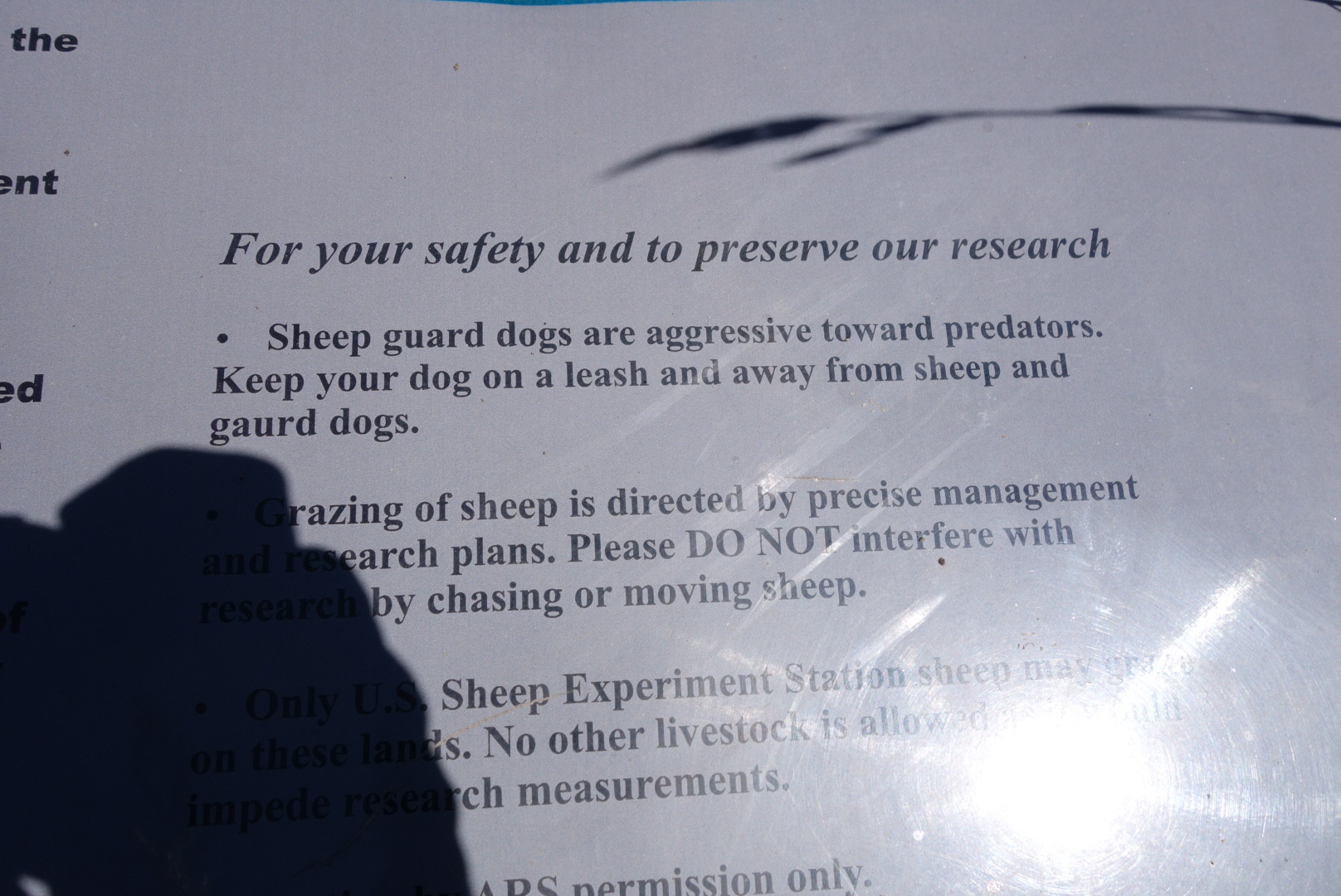
We had been going in and out of the US Department of Agriculture Experimental Sheep Station. There was a sign explaining roughly what was going on. It is intending to improve the stock and also see what plants the sheep eat. During the two day walk through the area, it seemed to me the most successful experiment they conducted was to make the sheep invisible. Never saw a one. (Of the several signs explaining Experimental Sheep Station activities, they all misspelled “gaurd dogs.”)
There was a long series of climbs to finish the day. What great views. Water, of course was scarce on these ridges, but the views made up for it. I passed two sets of northbounders, they looked pretty ragged.
The mosquitoes really amped up late in the day. It finally got to the point where I stopped and broke out the DEET spray. Normally, I can tough it out until camp and then put on my wind shirt and rain pants. At last, I came to the trail juncture where water was alleged to come from a spring. I was glad to see three of the four speedy hikers had set up camp in a cluster of trees and also that the spring flowed fast and cool out of the side of the mountain.
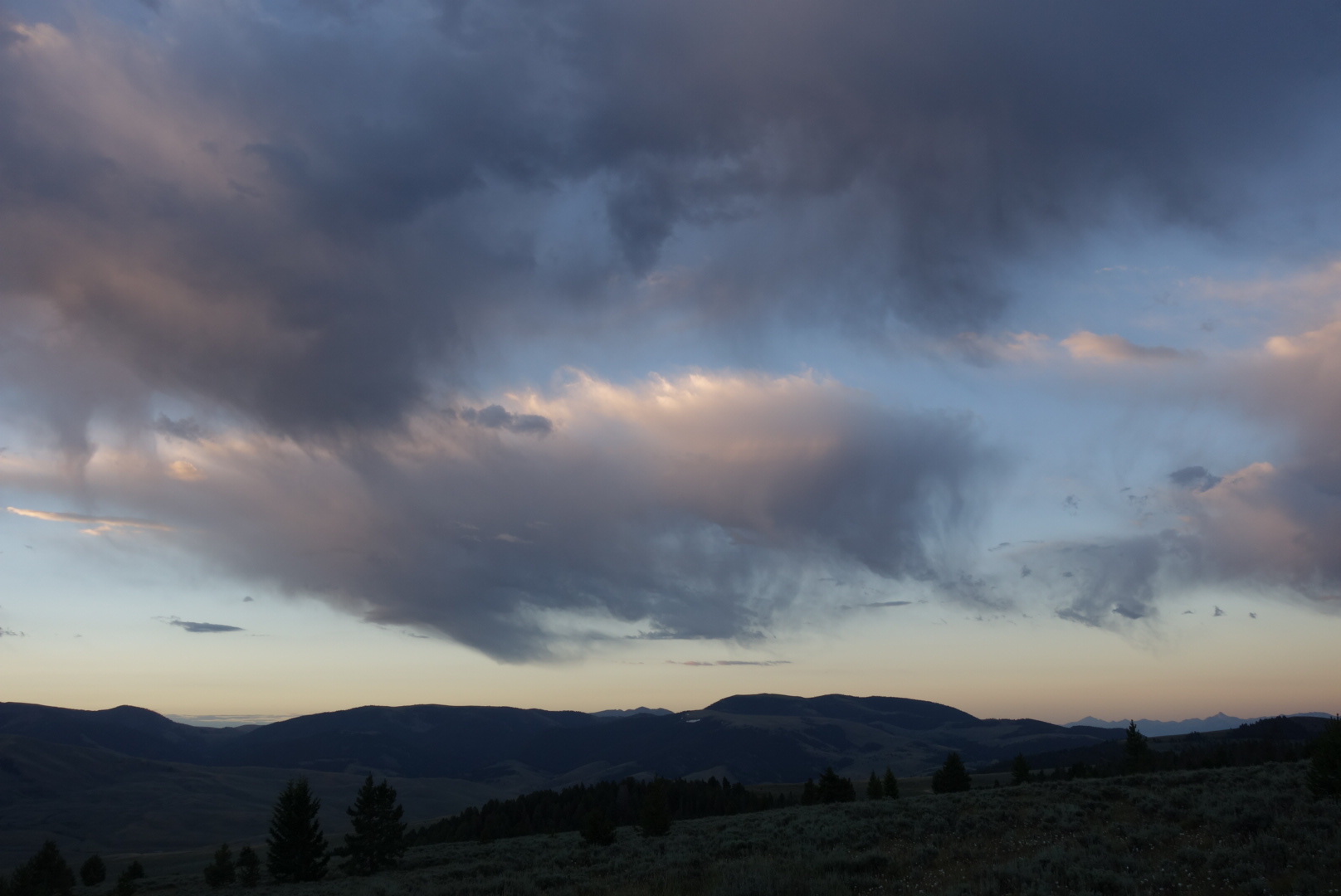
I set up camp as it grew dark. There were thunderheads on the horizon, but clear skies overhead. It was not clear if we would stay clear or deal with lightning on the Divide.
After dark, a bull elk started practicing his call. He needed the practice because it sounded awful.
It was stormy all night. On both sides of the ridge, thunderstorms were raining down on the valleys below. Up top, it got very windy. My Zpacks Altaplex tent did a pretty good job shedding the wind. The tent stake holding the one support pole came up around 11:00, so I fixed that and re-tightened everything. I did not sleep well because of the wind, but I was extremely grateful the lightning had stayed away and that my tent performed well.
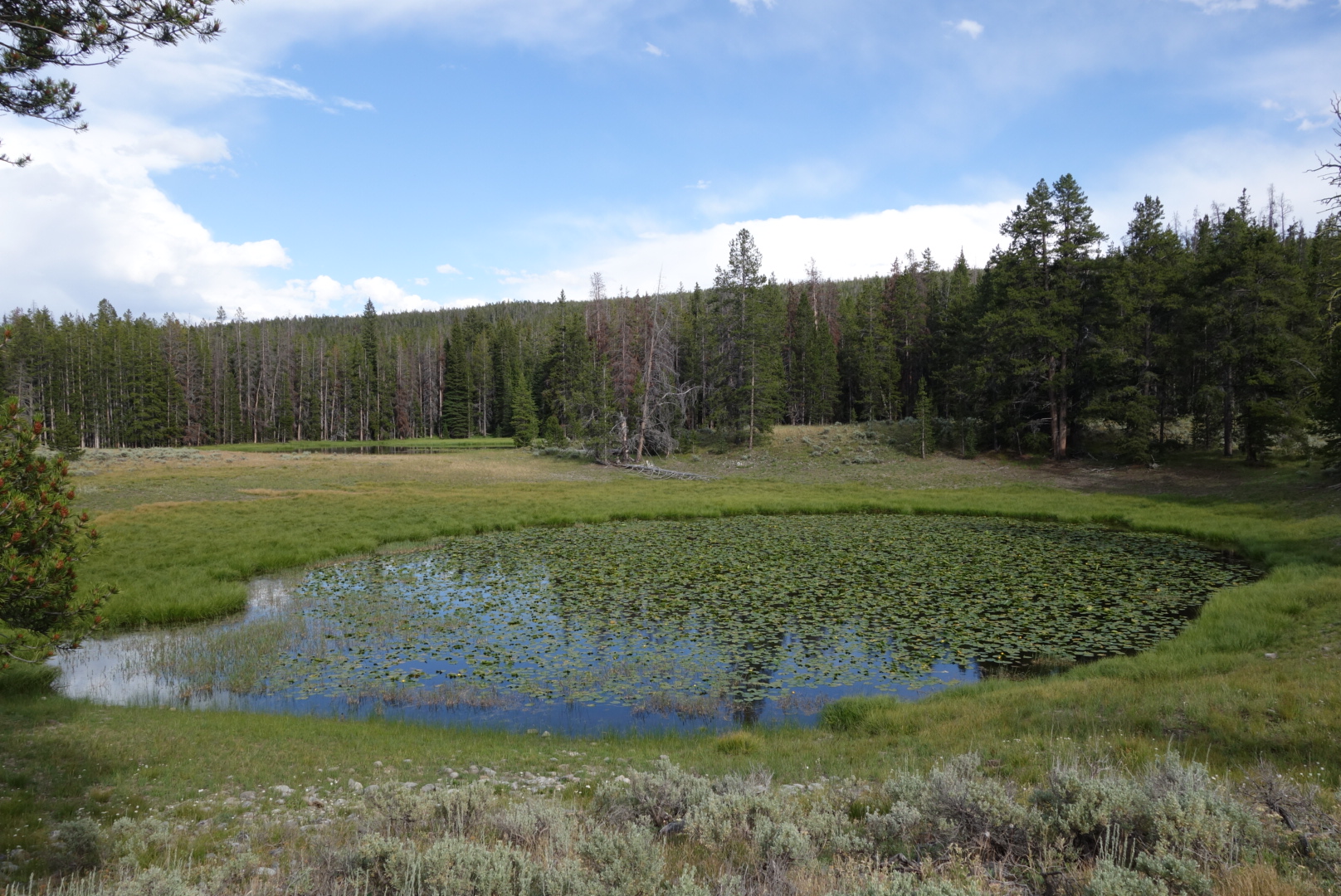
I was groggy and broke camp a little slow. I saw the last of the others going over the first ridge. I knew I would not see them again. I actually hiked really well. At a trail juncture, I stuck with the official route and visited Lillian Lake. It could easily have been called Maggie’s Mud Puddle. The plus side was a beautiful spring less than a mile later. Perhaps it seems odd, but I love springs. The idea that cold, pure water just gushes up out of the earth is astounding. This one had great volume and created a green ribbon of vegetation as it made a short trip to Hell Roaring Creek.
Eventually, I made my way down to Red Rock Pass. I met a Continental Divide biker on the dirt road. In response to his question, I explained I was a southbound CDT hiker. He asked me what route I was following. I showed him the trail I was getting on. He asked “You know that is going north?” That is the beauty of this trail. To go south you go north. (The reason it goes north is to get around Henry’s Lake.)
It was a hot afternoon with a gradual ascent through cattle grazing areas. It occurred to me that I was doing pretty well. I stopped and got my maps out. It seemed that there was good news and bad news. The good news was that I could reach West Yellowstone a day early and add a zero day. The bad news was that my Yellowstone permit was off.
Helen performed a miracle and got me a motel and a ride into town. This was in spite of it being a weekend in a National Park. I was so happy. It sure made hiking a lot easier knowing a zero day was ahead.
It was hot, dry hiking in the afternoon. The water sources were not listed as confident. Plus, there were no “great” camping spots. I crossed the main highway and started up the trail. After crossing many dry creek beds, I came across one gushing water. That was great. Two mountain bikers came by.
At last I crossed a pretty good stream. I would follow it up to its headwaters the next day. It was a steep valley, so campsites were not easy. I eventually found a place. After I was set up, I noticed nearby there was a pile of deer fur. No bones, just fur. Hmm?
I was so tired from the hike and the windy night before, I eagerly crawled in to my sleeping bag and fell asleep right away.
Today’s main features would be two steep climbs, tempered by switch backs. The first was from the creek I was on up to one pass. Later, there would be another getting me to the peak where I could see tons of lakes and forests.
A switchback is tricky. Too gradual and there is too much energy wasted going horizontally with little elevation gain. Too steep and energy is wasted going uphill but having to stop and catch your breath.
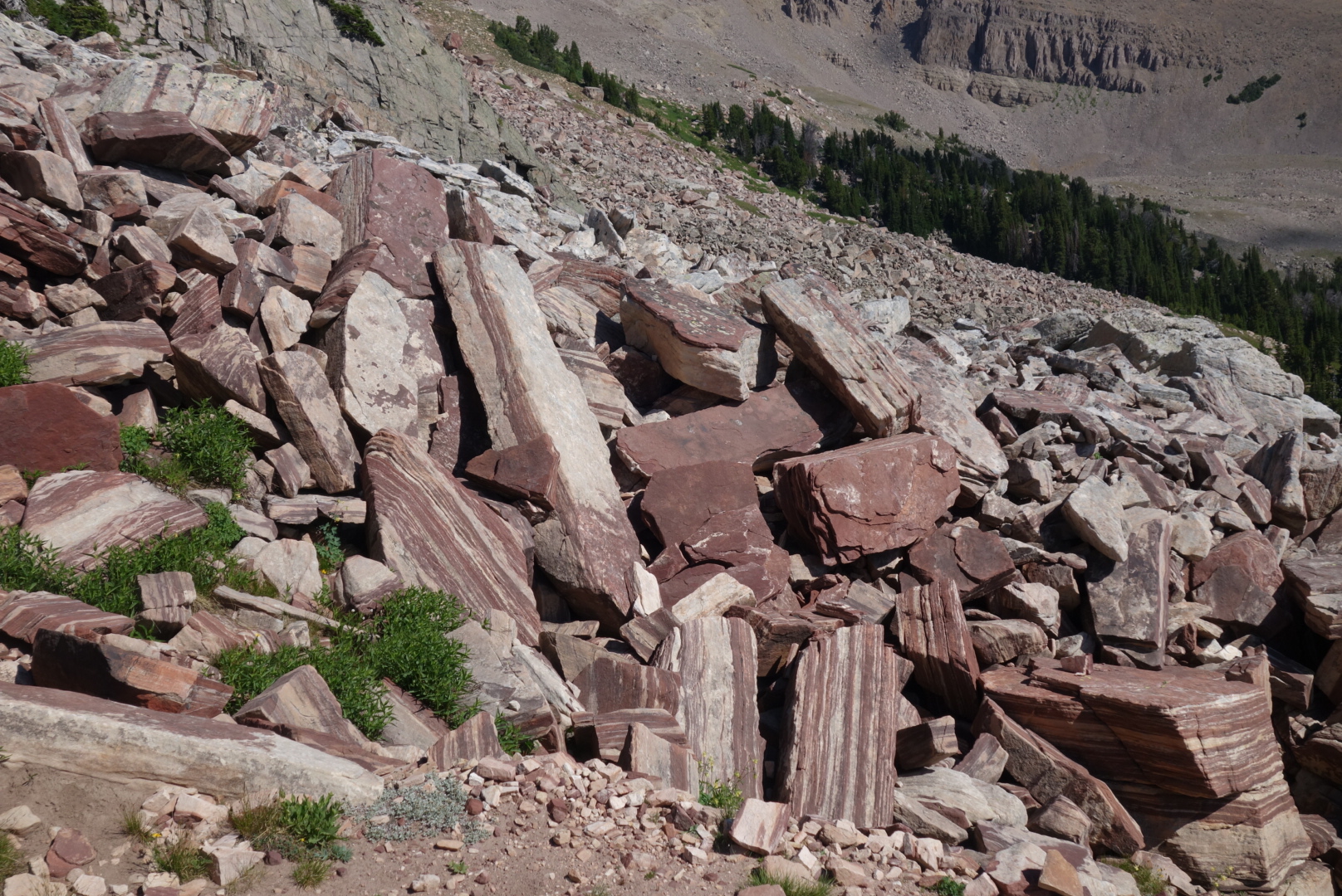
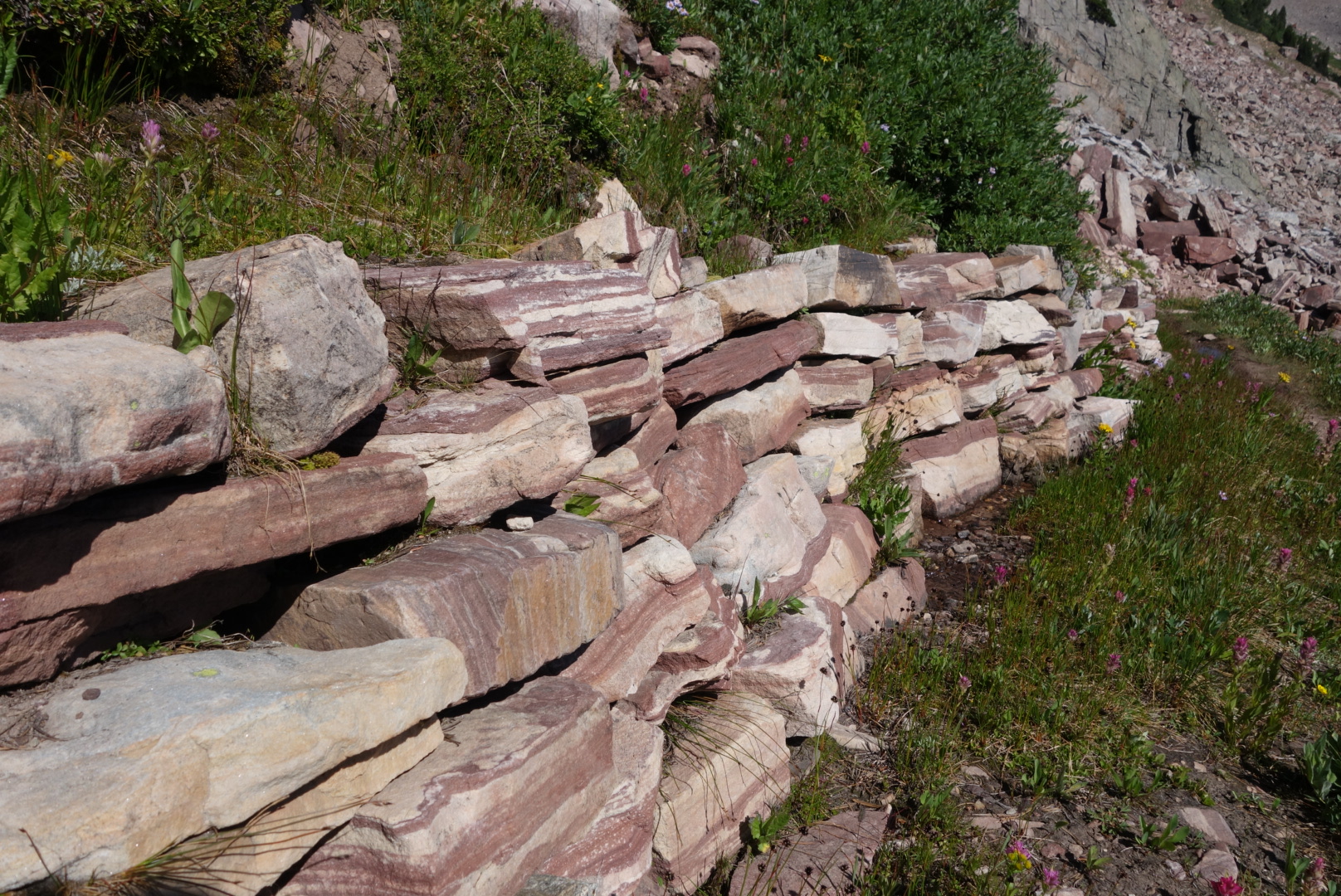
The first switchback was a little too long, but it was a great way to start the day. There were some stones that were layered in red and white. It seemed like a great color and pattern for stone countertops.
This combination of colors in rock was catchy and not seen anywhere else on the trail. Almost like a peppermint and white chocolate candy.
I descended into grassy meadows with spots of forests. Several spring creeks appeared and provided delicious water.
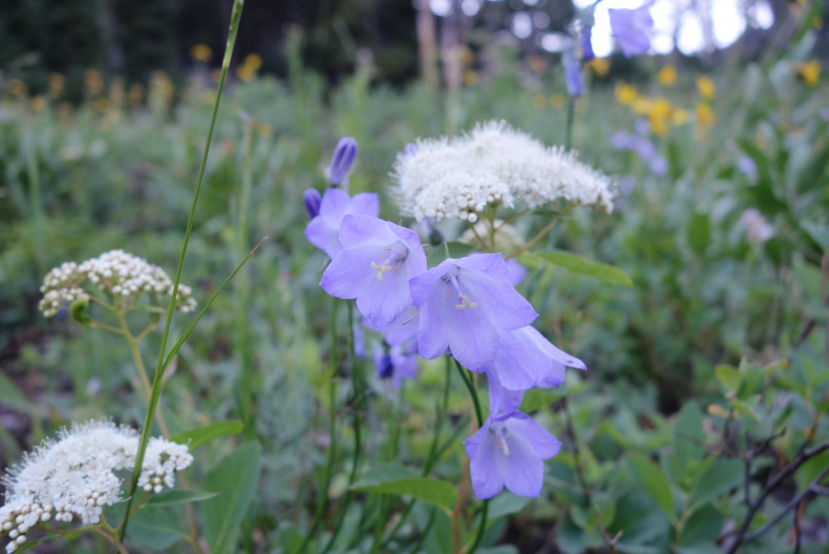
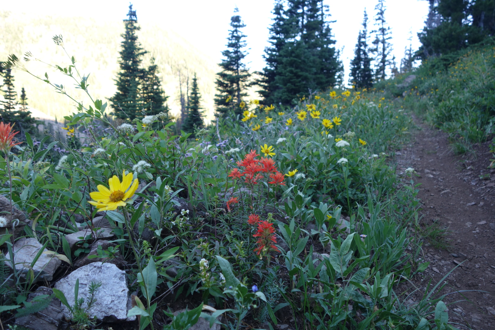
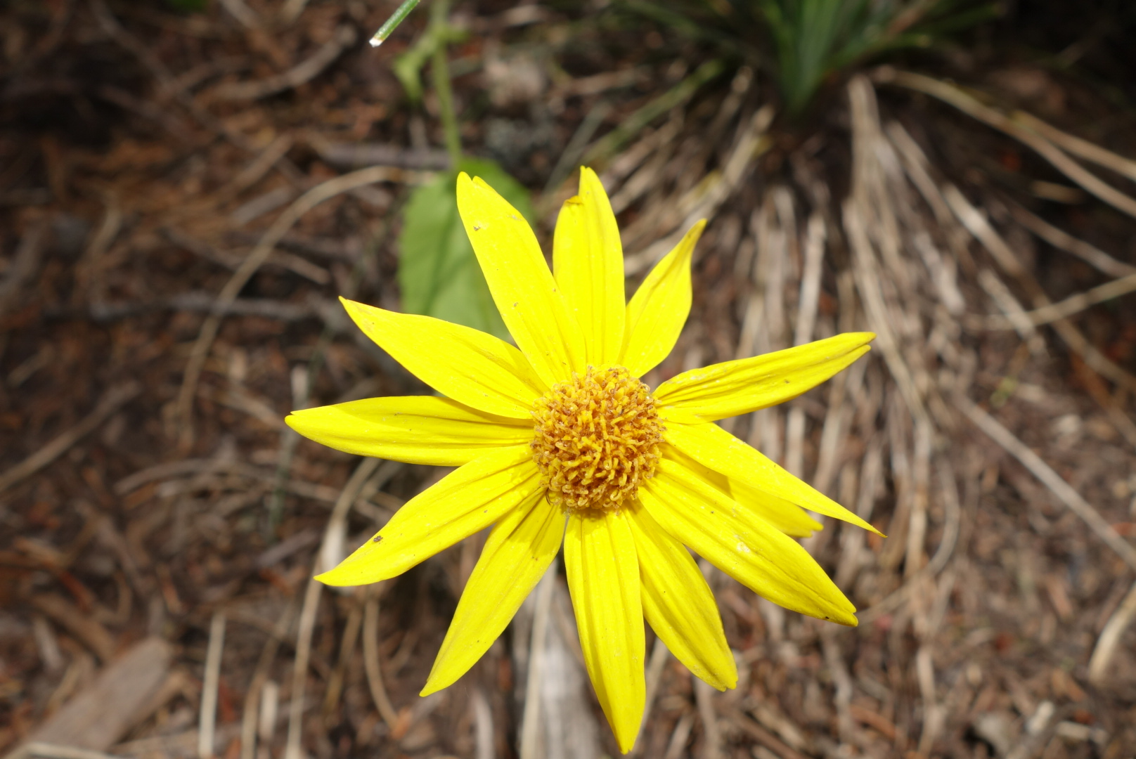
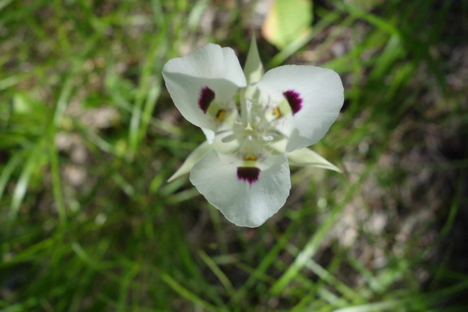
The flowers made the long switchback more enjoyable.
As I was starting the second switchback, I met two mountain bikers. They were the same two from yesterday. We visited for a bit. They seemed intrigued with hiking the CDT. I cannot imagine mountain biking this trail.
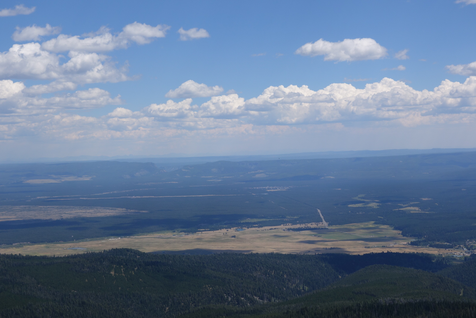
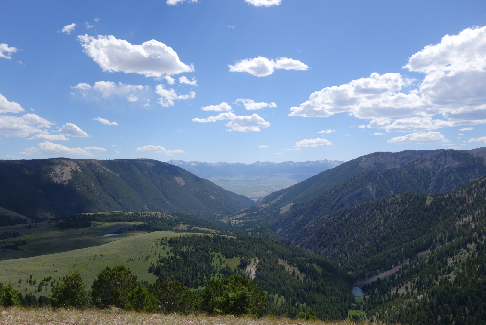
After the second switchback, which was just perfect, I reached some amazing views. Lakes, forest, West Yellowstone, the notch in the caldera where the highway enters the park.
Looking down at West Yellowstone
The hike down wasn’t that great after the initial views. I reached the Targee Pass but could not get a Verizon signal. Eventually I got a signal and reached the motel. About 2 hours after reaching the Pass I was cleaned up and getting dinner number 1.
West Yellowstone is a major tourist town and it was quite overwhelming after having largely been by myself for a while.
While I was waiting, 3 times cars stopped, people got out, and photos were taken. I offered once to take a family picture, but I was declined in favor of a selfie stick.
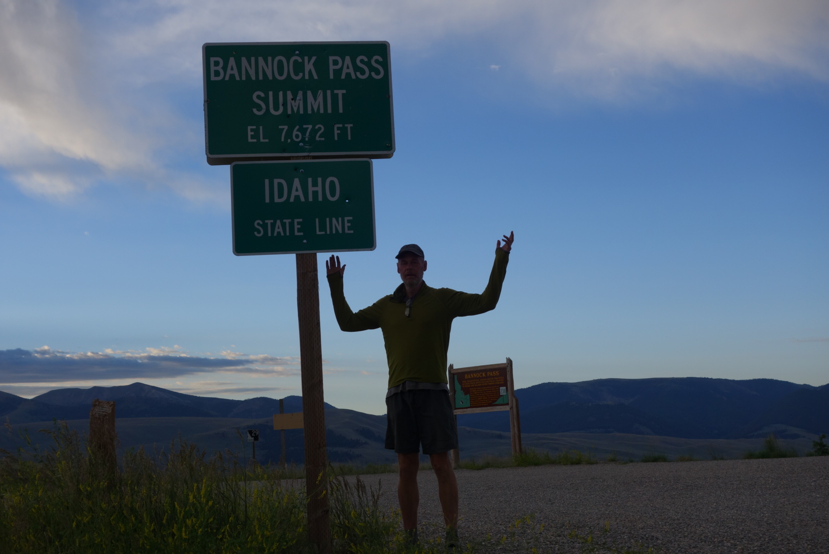
I was wiped out from the night and got to the desolate Bannock PassPass over an hour before my scheduled pick up.
No Internet or cell signal. I started to update blog posts since I would soon be near power. However, in the warm morning sun, I dozed off. I awoke to a large bull elk moving rapidly uphill through the cattle field. The steers were making noise, but it was unclear whether they were cheers or jeers as the elk easily jumped the barbed wire fence forming the prison around the cattle.
Town was great. I had a huge breakfast, took a nap, and had a huge dinner. The only restaurant in town was interesting. I ordered an omelet and the deep fried french toast. After about 10 minutes the cook/ waitress asked me if I wanted eggs. I said definitely and to put them in the omelet.
When I had Internet access, I did some research and found that deep fried french toast is only legal because of state fairs. Without the audacity of state fair food, it would be too dangerous. It was four sizzling crispy slabs of French toast, each dotted with a tablespoon of butter. That I ate it plus the omelet and the hash browns was fairly impressive and disgusting at once.
I resupplied, napped and had dinner. At dinner, I was more conservative. There were a few other hikers in town. I made arrangements with the motel owner (Sam) for a ride back to the trail in the morning.
Leadore is a nice hiker town. It is dry and in a big valley devoted to ranching. I’m not sure a car based traveler would relish it as much as a hiker
Crossed the 45th parallel. Half way to the equator. Actually, Baker Park where I did some of my training for this hike is on the 45 th parallel.
There were some horific climbs in the morning after Lemhi Pass. By the way, this Pass has historic significance for the Lewis and Clark voyage. Sacajawea led the party to a spring here as well as the passage over the Continental Divide. I filled up on the same delicious spring water that quenched the thirst of the legendary explorers. Then, I washed my socks in the stream.
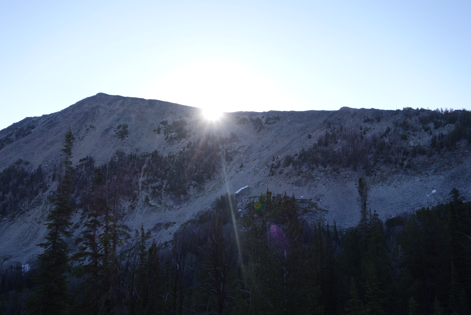
Sunrise just hitting the valley below
Today I pushed to get close to my next town: Leadore (pronounced “led or”). I like this pattern of getting into town for breakfast, lunch and dinner and then breakfast again the next day on my way out of town.
After the initial morning climbs, the trail spent a considerable amount of time on treeless ridges affording amazing views. Although it started to get hot, the breeze picked up as an off set. At one exposed steep climb in the late afternoon, the wind had to be near 30 miles an hour and it felt like it helped push me up the hill.
I really liked how the elements lined up in this view.
After crossing Grizzly Hill, I had about 2 hours more daylight. The terrain went to a hodgepodge of forest and open sagebrush meadows. I tried calling the local motel to confirm a 9 am pickup, but no cell service.
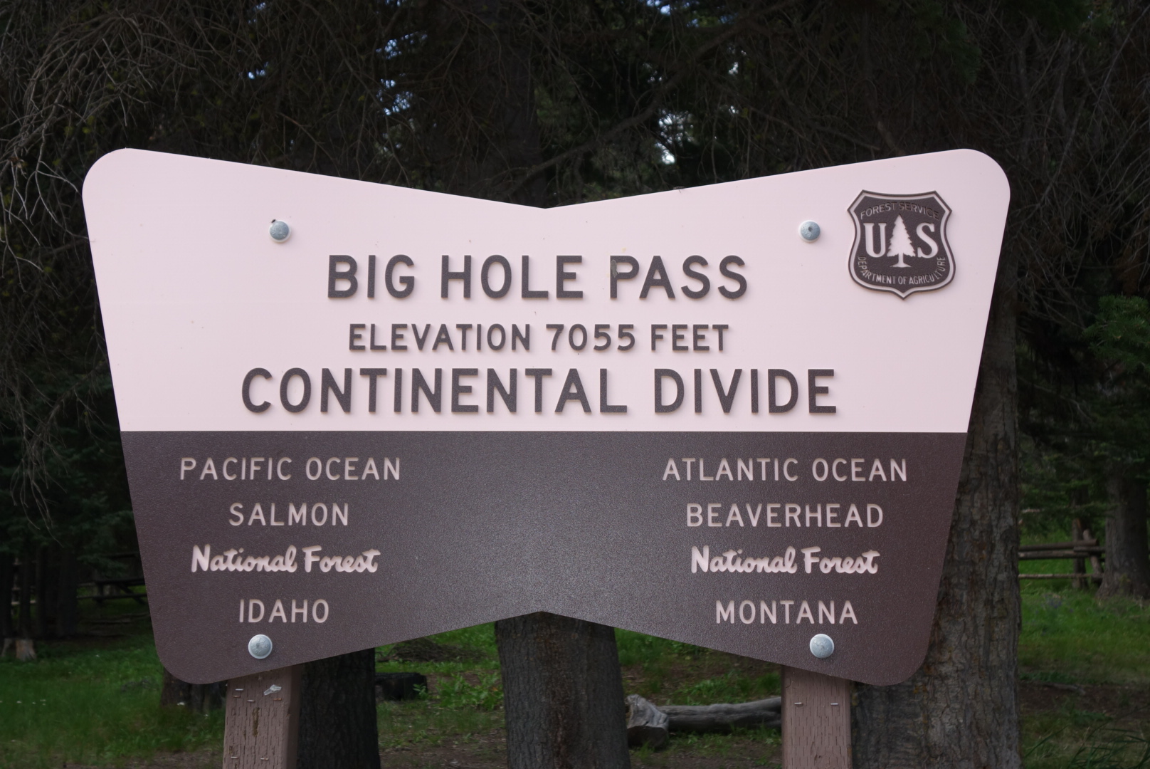
With about 45 minutes of light left, I looked for a place to camp. I had 2 liters of water, so all I needed was level ground. After a few places that had problems, I found a decent spot. There was a slight 20 foot hill to the west. To the east, after 25 feet of some young and old trees, there was a sagebrush meadow. About 30 feet to the south was the trail and more woods. Finally, to the north, was one large old pine and a few smaller trees. Since I was on the Montana / Idaho border, there was a fence running along the edge in a northeastern direction. At its northwest end, the fence was about 40 feet away; about 60 feet away in th northeast.
I pitched my tent in the center with a flat area and a southeast view to catch a little early sun. The alarm on my watch needs a little boost most mornings. I boiled water for my dinner, ate, and got ready for bed.
My ritual is to brush teeth and then get in the tent. I bring my phone, camera, headlamp and satellite device. In addition I bring maps, a liter of water, my bear spray, my medical kit (for wounds, pain relief), and stuff sack of clothes for a pillow. I take off my shoes, socks, and gaiters and leave them outside the tent. Then, I get into my sleeping bag. I check my route for tomorrow, write down today’s achievements, and send satellite text to Helen.
There were about 10 minutes of post-sunset light left and a slight breeze from the west. It would be dark for about 2 hours before the full moon rose. I was putting away my maps, pleased with a short three miles tomorrow before a ride in to town.
Outside, by the large pine to the north, there was an animal moving. Wild and domestic animals always make trails along fences. I figured it was a deer so I banged on the side of my tent to startle the critter away. The tent fabric is cuben fiber. It sounds a little bit like wrapping paper. Usually a quick whack creates enough noise to spook anything.
This time was different. After 10 seconds, the branch crunching resumed. And it sounded like it was coming towards me. I was able to peek through the ventilation screen that runs around the edge of my tent. It was a cinnamon colored bear looking at the tent from about 25 feet away. Crap.
I grabbed my bear spray, slipped on my shoes and stood up. I immediately yelled “Go bear!” I figured the presence of a human in a bear hunting area shouting loudly should send it scampering. I was wrong. What it did was send the second cub scurrying up the large pine to the north. Out of the corner of my eye I could see it scamper up about 30 feet, outlined against the fading light. I saw the first one outlined a little lower.
Oh shit. The mother bear was unimpressed. She stood her ground. My quick read was:
large, cinnamon-fur colored barrel with arms, legs, head, and teeth
250 pounds.
Not a grizzly
Sow with cubs
She scooted backwards a few feet. I yelled again. She made a sound that resembled a muffled “woof” and then charged me. I instinctively yelled “no” (please note my voice did not crack) and let out a shot of bear spray.
As fate would have it, this was a “bluff” charge to see if I would run. She pulled up at about 20 feet away. The spray only went about 15 feet, dispersed on the slight breeze from the west, so she didn’t get a taste.
Round one was a draw. She backed up slightly, making muttering sounds. She walked by the tree where her cubs perched silently. I did not look at them, keeping my eyes locked on the sow. I didn’t care what any stupid video said, I was maintaining eye contact.
She circled around to the east. I had to kneel to keep sight of her through the trees. I hoped she would see the large open meadow and call her cubs and scamper to bear freedom.
I was wrong. She circled until she was due east and had a clear line of sight to me. I had kept up a steady barrage of “No!” and “Go bear!” all the way. I had also grabbed my headlamp as I was just about out of light.
Her muttering turned to the muffled woof and she charged me again. I again yelled and sprayed. Like last time, she pulled up and the spray didn’t quite reach her. I hoped what was left of the western breeze may have carried some to her, but she seemed unfazed.
I was wondering how this was going to end. She circled back with her strange, quiet murmuring. I thought about leaving, but I thought she would destroy all my stuff and I had several troubling questions: where exactly would I go? when would I return? if her bluff charges are to create a flee reaction, won’t she charge me with relish as I retreat?
I decided to stay. She returned to her original position about 30 feet away, slightly uphill towards the northwest. I flipped on my headlamp. I decided to throw stones. Between clutching the bear spray and being under stress, most 3rd grade girls throw better than I did at that moment.
I was very unclear how this stand off was going to end. She was not interested in the wide open east. She sensed I was neither going to flee nor attack. After yelling loudly for 15 minutes, nobody was around to come help. Also, the fence was much more of an obstacle to her than I would’ve thought.
Just as I was pondering this, she went over to the old pine, made some strange vocalizations, scratched the tree, and her cubs came down. In the dark, I heard the first come down quietly and the second one not so quietly. Suddenly they were crunching up the short hill along the fence.
Just as I was about to breathe a sigh of relief, they unexpectedly decided to walk south across the top of the hill. This made me nervous because her cubs were now more vulnerable, she could charge straight downhill, and it was dark.
As if on cue, one of the cubs climbed a tree. The mother was talking, but the voice was different. After a few tense minutes in which I could not tell what was happening, I heard the treed cub start talking. Neither had made a sound when first treed. My guess was one cub had overreacted, climbed a tree, and the mother was making tracks away when the treed cub cried out “wait up.” Quickly, there was some quieter crunching from the tree and then silence.
At that point, I found myself shaking. For one hour, I sat under a pine tree wrapped in my sleeping bag armed with bear spray and being hypersensitive to any and all sounds. Later, after the full moon came out, I tried to sleep in the tent (with my shoes on), but had limited success.
I had two high passes today, one major ascent, and otherwise mostly waterless walking atop the Continental Divide. It was tough, glorious and just what I had hoped for from the CDT.
Today I thought about how Amercan place names came about. Early on, it seems like people in New England looked backwards. They named towns after the land they left: New York, New Hampshire, Georgetown.
By the time Americans reached the midwest, they used more aspirational or idyllic names: Hope, Oak Park, Eden Prairie.
However, when it came to the “real west” it seems people got very literal. Silver City, South Pass, Boulder.
I kinda like the western way. For example, Anaconda was originally going to be named Copperopolis, reflecting it’s mineral heritage (until they learned another town had used the name).
Places are more vivid when they are called Cowbone Lake, Dead Horse Lake or Deadman’s Pass.
Sorry for the strange tangent, but it would not leave my mind today after I looked down the headwaters of Bloody Dick Creek.
I did sleep pretty well. I knew I had some high passes to clear, but fotunately they occurred mostly in the morning.
I startled a small elk herd early on. They went crashing down a steep slope. I always marvel at their agility.
The footprints of the faster hikers were helpful. Above treeline the trail is sometimes difficult as there is little soil on which a tread can develop. Near the top of the tallest pass, there was some remaining snow to navigate (in my case, navigate means avoid).
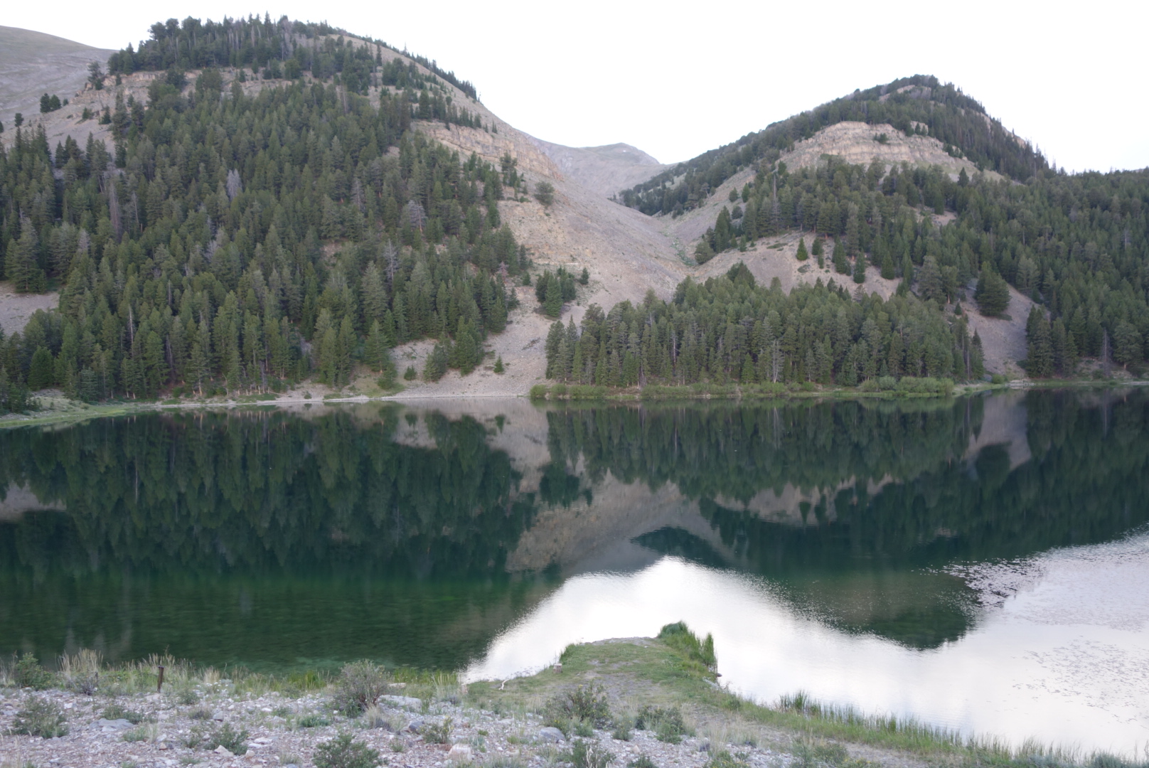
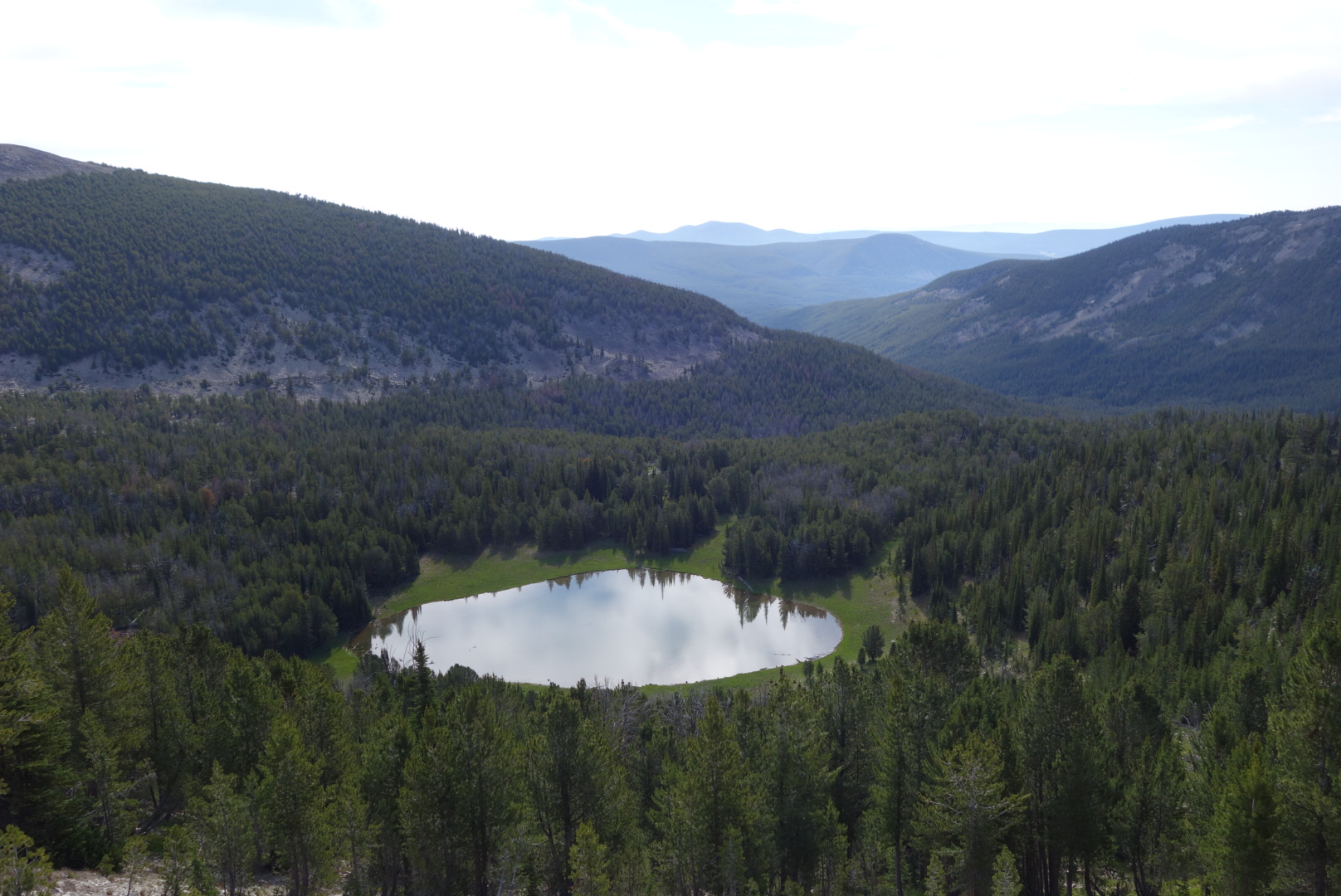
The reward for the effort was some stunning views. Not just mountains but beautiful lakes, too. Looked like good fishing.
Trail on the left, brook in the middle, mountain in the background
Later, I did, in fact, pass by some day hikers heading up to fish the alpine lakes. I like to see normal folks using trails for enjoyment.
I was doing pretty well on time. That is, until I came to a 1,000 climb. On both map sets, the trail up from Miner Creek was a set of tight squiggles indicating short,steep switchbacks. Probably a half mile in length. As a backpacker you look at a map like that and think: it will be a struggle, but over quickly.
The trail turned out to have long, sweeping switchbacks. It was as if Cecil B. Demille had been commissioned to design languid, epic switchbacks for a movie set. In short, there must’ve been a mile and half of never-ending-trail to get to the top.
Another section of maps also understated miles. So, by the time I was ready to camp, I was about two miles short of my goal. Such is life. I ended up stealth camping off trail and was able to see an almost-full moon move across the sky.
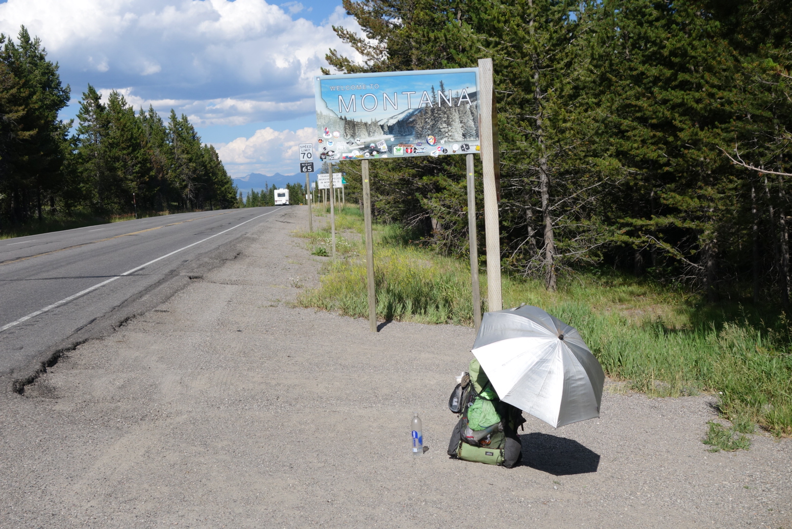
It felt good to be cleaned up. I was all set and went to the restaurant to get a breakfast burrito to go. Nancy made a delicious one and I went over to the highway to hitch.
Two and a half hours later, I finally got a ride. I am doomed for hitchiking. Humans are very good at quickly asessing situations and categorizing. When they see a middle aged man with a white beard, the immediate thought: at this age, why cant he get his own transportation? Must be homeless or broke. Or on parole.
The guy who eventually gave me a ride was on vacation, trying to catch cutthroat trout in seldom fished streams. Small world: he had been in commercial real estate and was familiar with the company I worked for in Houston.
I started hiking around 10. It was mostly thick, young trees. I noticed something brown and large ahead on my right. It was moving towards the trail. I froze. An elk or moose. I slowly reached for my camera. It was a bull elk. He heard me unsnap my camera case. We both stood still. Eventually, he continued on toward the trail. I was able to start the movie function on my camera, but it wasn’t zoomed in enough. He did poke through the trees, took about 2 seconds to recognize me, and bolted.
The rest of the day was spent feeding the mosquitos and flies. Poor things.
I ended up doing about 18 miles and managed to end up camping at a ridge line which meant a nice breeze. One other through hiker came through and camped but I didn’t catch his name.
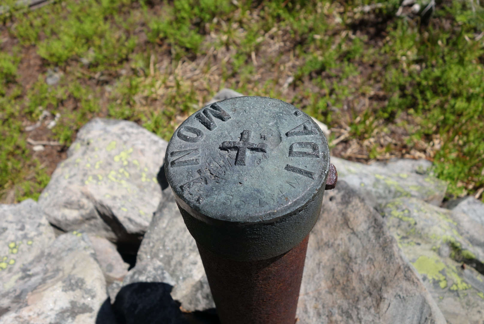
Judging from the the number of these, Idaho and Montana don’t entirely trust each other.And if you must know, I did not pee here.