I woke up smelling smoke. This was not good. One of my irrational fears is a forest fire and massively confused hiking. I had no internet access. Via satellite text, Helen was able to let me know there were no fires on trail. There was one fire to the southwest and that was probably just blowing smoke my way.
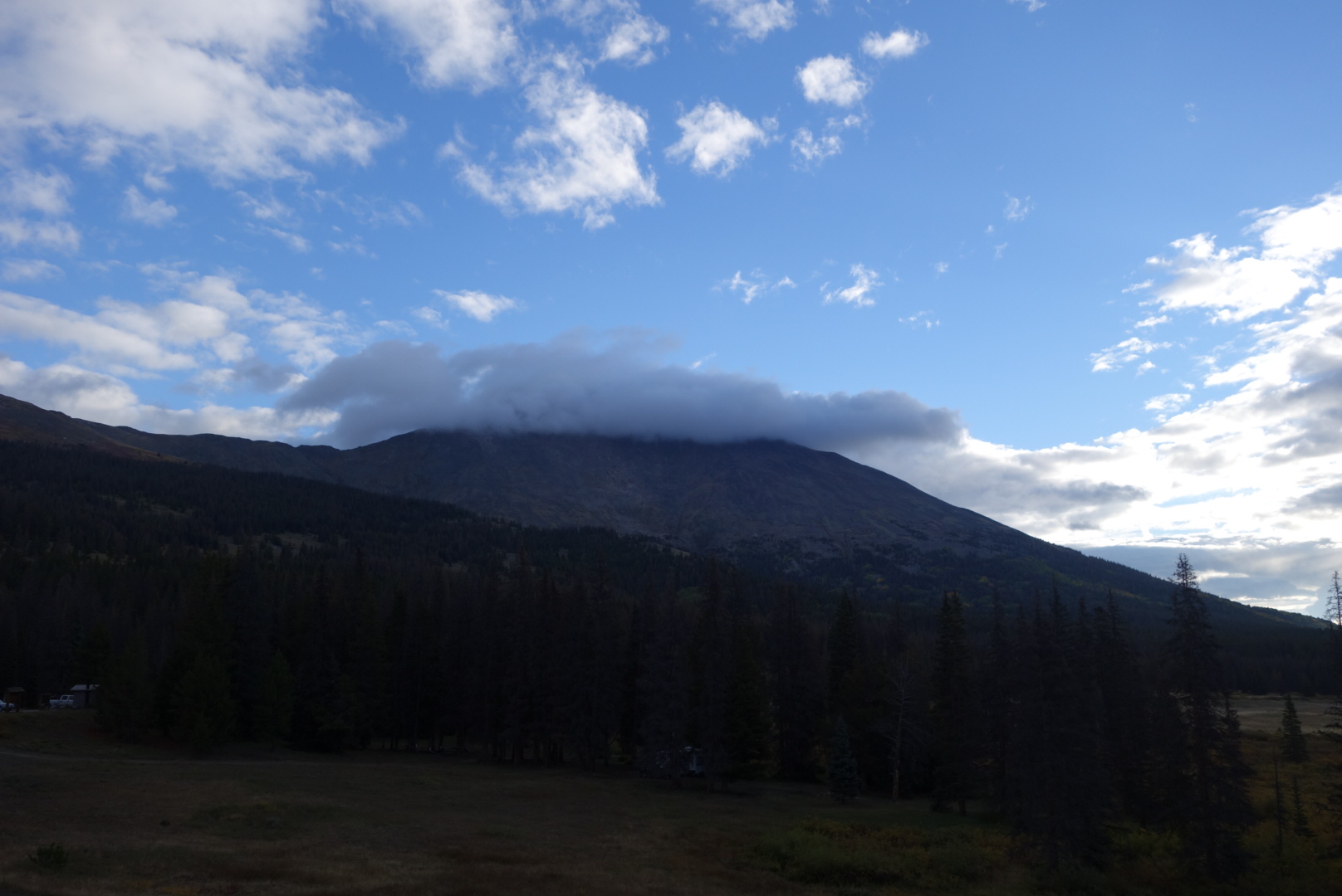
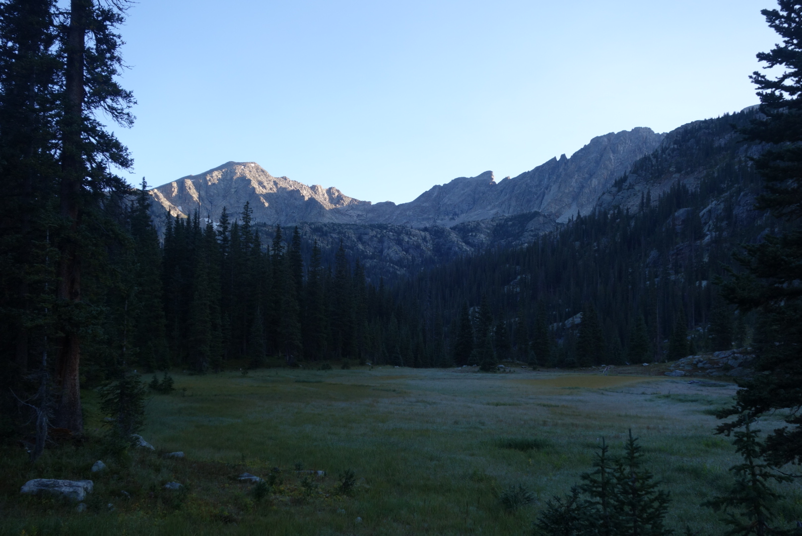
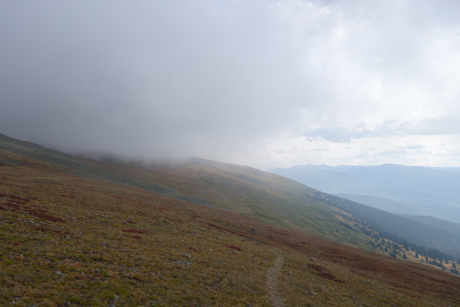
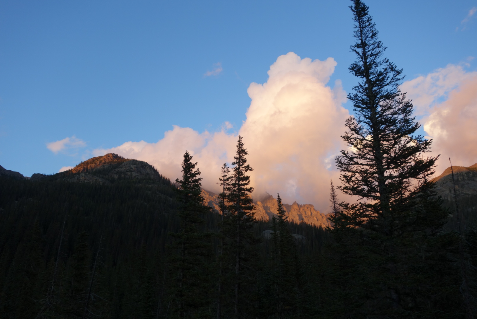
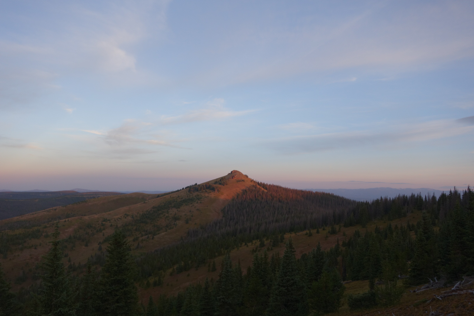
A cloud over the ridge above my campWalking along the trail through woods, I turned off my headlamp once I could see the trail. I came across a bow hunter in full camo. I am sorry, but I still get a wee bit uncomfortable around a grown man in camo with weapons. Still, he was a nice guy and had a good hike ahead of him before he reached his designated elk hunting area.
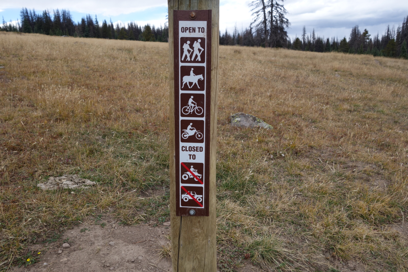
The trail became annoying. Annoying because of rocks. Everybody complements the Colorado Trail Association about their great trail. However, for a good stretch of it, motorcycles are allowed. I suspect it is the US Forest Service that makes these decisions. I can’t fathom the thought process…
Motorcycles + hikers
“OK. We need to decide on who can use single path trails and who can use two-track trails. Any Ideas?”
“Yeah. Let’s have hikers and horses use single track. Anything with wheels goes on two-track.”
“No, no. Lets put mountain bikes and motorcycles on the single track. They all use only a single path.”
“But won’t motorcycles and bikes startle horses? Don’t they move at a much higher rate than foot or hoof traffic?”
“Naw. Don’t worry about it.”
“In the winter, should we also put cross country skiers and snowmobiles on the same paths?”
Can you imagine if these folks also did traffic in Manhattan? Applying the same mindset, they would have all cars, trucks, cabs, and buses go on the streets, while pedestrians, bikes, and motorcycles would share the sidewalks.
Sorry for the tangent, but it is just a wrong way to divide natural resources.
Later in the day, Wash Pot caught up to me. It was great to see him again. He looked fit and relaxed after some down time in Colorado with friends and family. He was hiking with a lady from Virginia whose trail name was Corbett. Anyhow, we talked and hiked for while. However, I cannot do both, so I let them cruise on ahead.
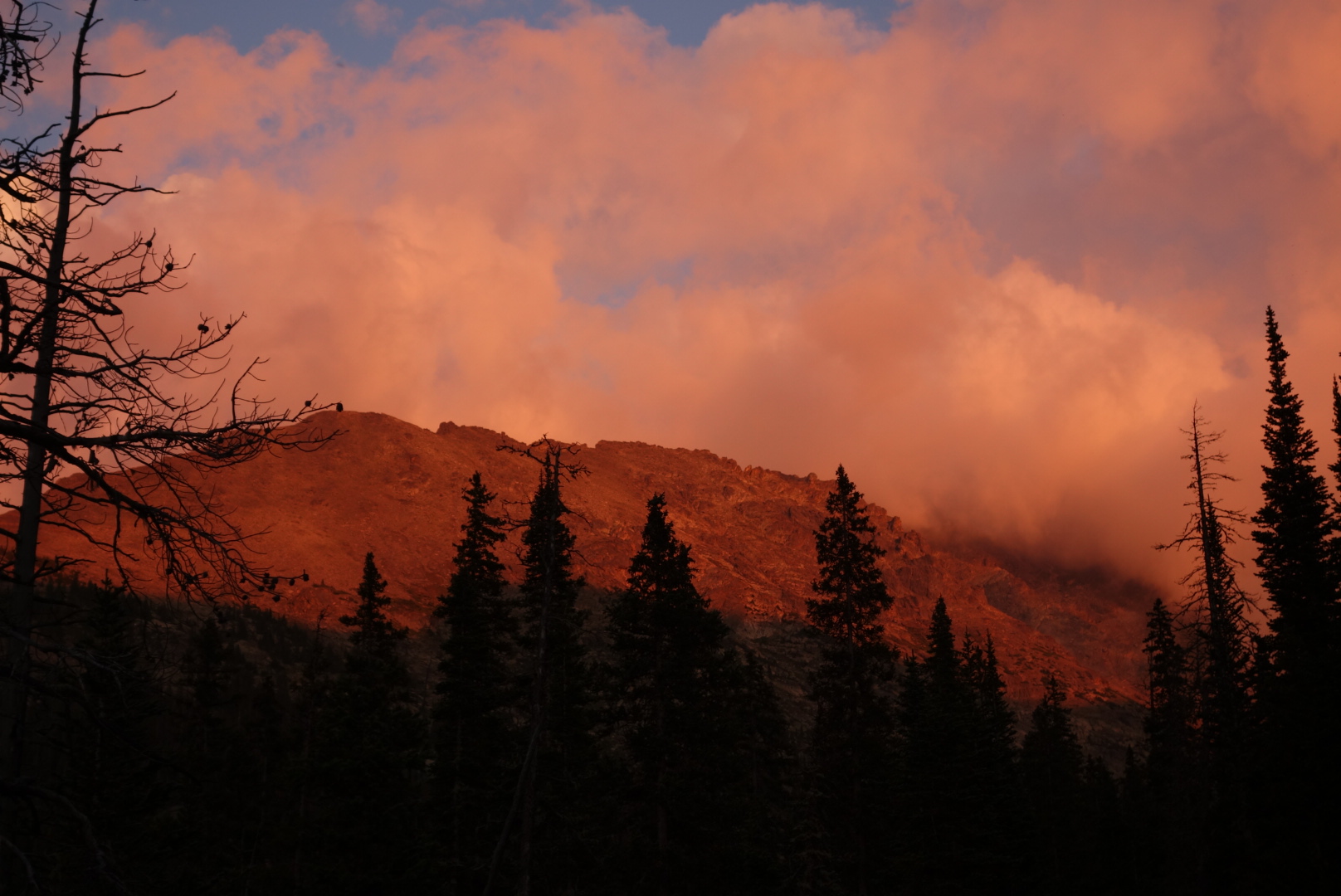
I tucked in to a level area somewhere between Long Branch Baldy and Middle Baldy and just got my tent set up when the skies let loose. In the vestibule of my tent, I propped my umbrella and had a cold dinner before heading off to bed. It cleared up later that night. Oddly, I heard grouse get startled in the middle of the night by something nearby. Probably a coyote, but it was an eye opener to suddenly have a grouse’s wings thumping at 2:00 am.
I knew today was going to be tough. Second days are always tough, but I could hear Dan tossing and turning all night in his tent. It may not seem like much, but between the wind, other sounds, and novelty of sleeping in a bag on a thin mattress on uneven ground is a difficult adjustment.
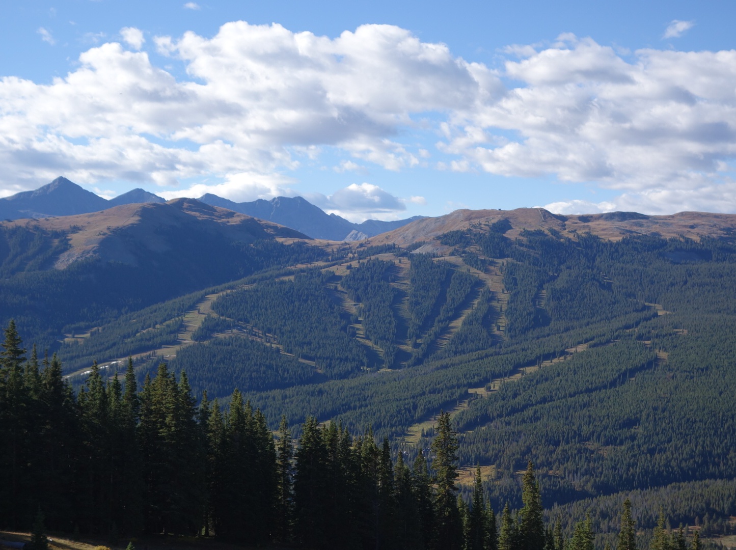
We cleared our first pass (Uneva, appx 12,000′) early and then dropped down into the Copper Mountain ski area. Dan had a tough time with the downhill. Individuals react differently to downhill. I kind of like it, but several hikers hate it worse than uphill. In addition to the obvious knee stress, there is potential slipping.
Dan made the first peak of the day no problem
We grabbed a meal and I bought a new headlamp since I had manged to lose mine. Refueled, we climbed. Then we climbed some more. In fact, Copper Mountain was about 9,800 feet above sea level and we ended the day at Searles Pass around 12,500 feet.
I got a little ahead of Dan and tried to find a good campsite, but pretty much everything was exposed. It was interesting to see a herd of domestic sheep and how they behaved near the pass. There was a shepherd I could see. What a life.
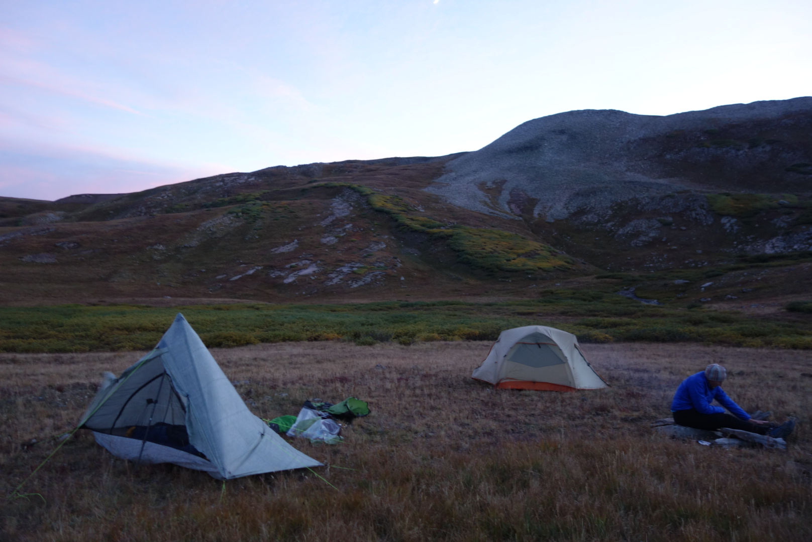
I managed to build a little fire with scraps of wood. We went to bed right after eating. I hoped Dan would sleep better his second night. It was fairly windy all night, so I was often disturbed by my own tent flapping.
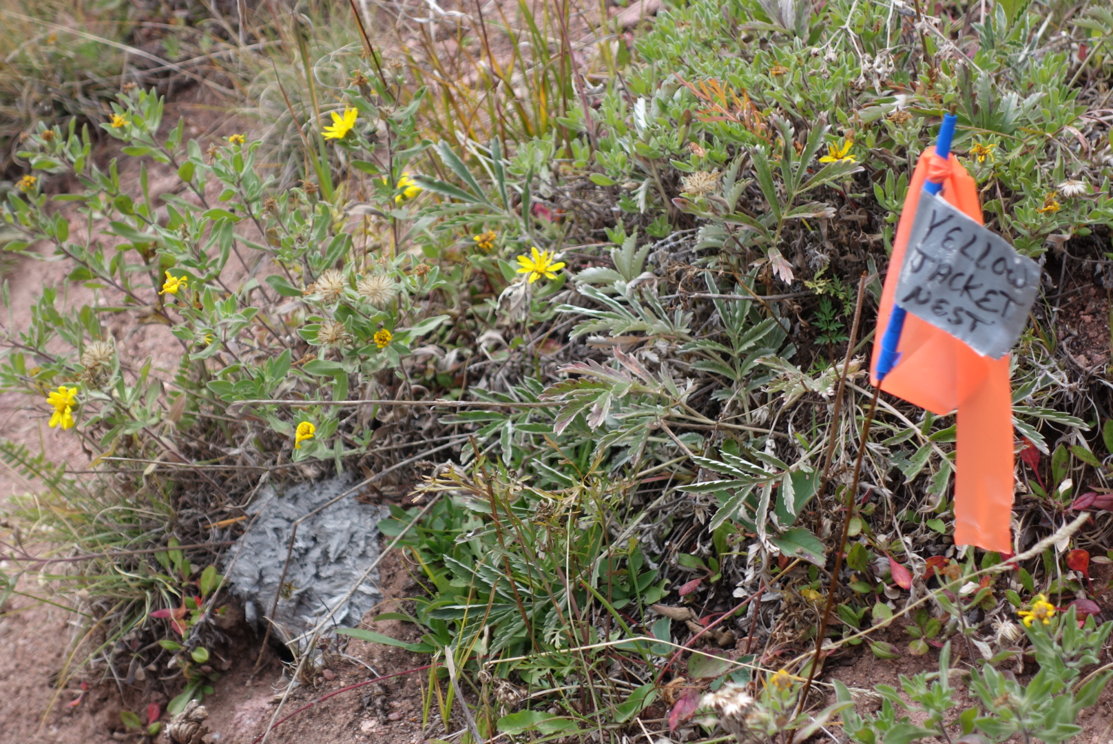
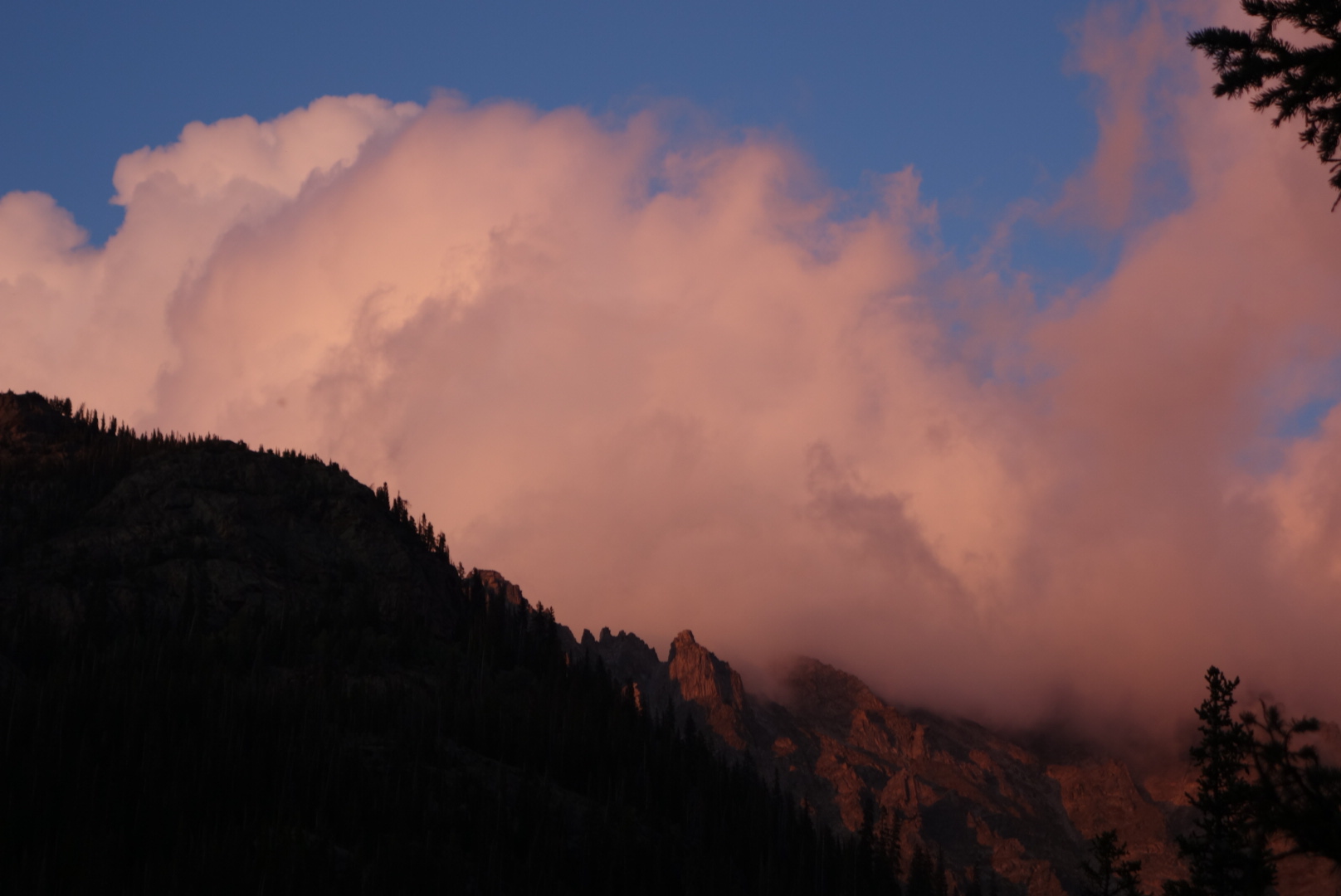
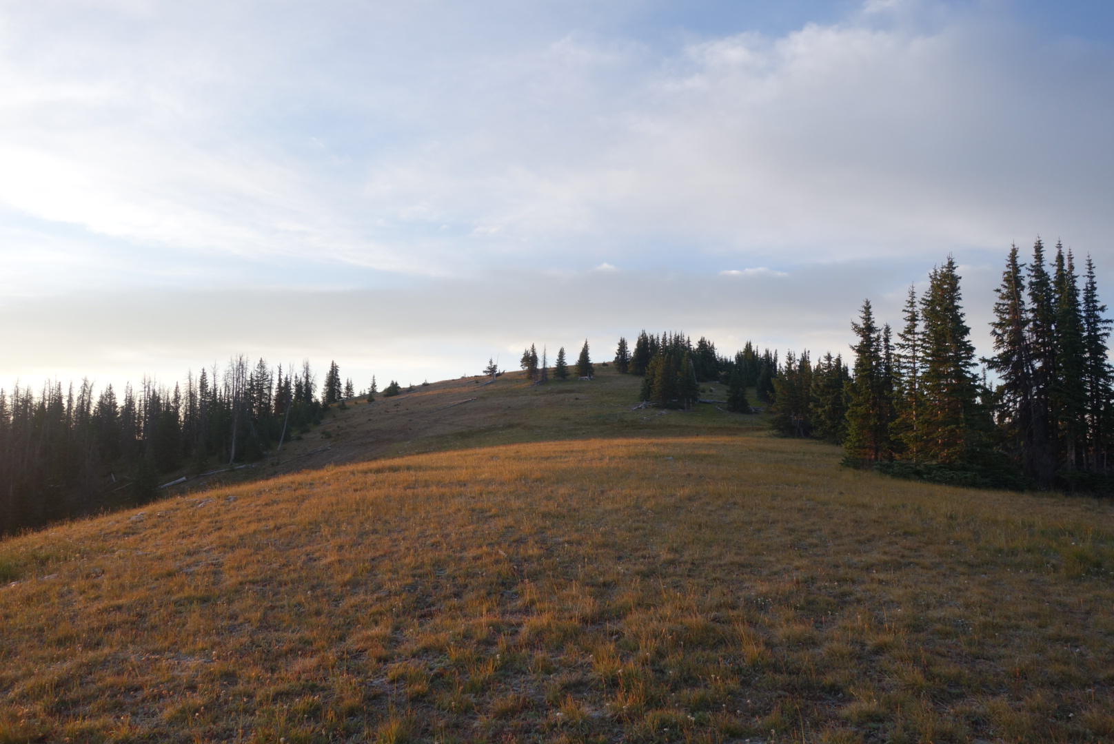
This Colorado Trail even labels insect nests….Our windy campsite
What a change a day makes. The morning was crisp, quiet and I knew it would be a great morning. With my headlamp on, I clumped my way over to the trail. In the process I came within 10 feet of stepping on some car campers sleeping under a tarp. Oops.
The creepy car from last night was on the road. My guess was the person needed to sleep in their car for some reason.
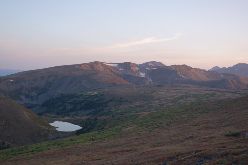
There was not clear tread. Mostly the first hours of the day were spent walking between trail posts every 400 feet or so. It was high country. Winter Park ski resort came and went in the distance on the west side, while sheer cliffs revealed snow-fed lakes almost directly below on the east.
Sunrise over an unnamed lake
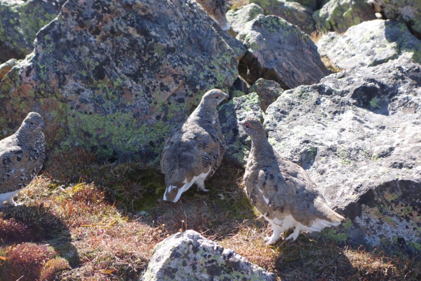
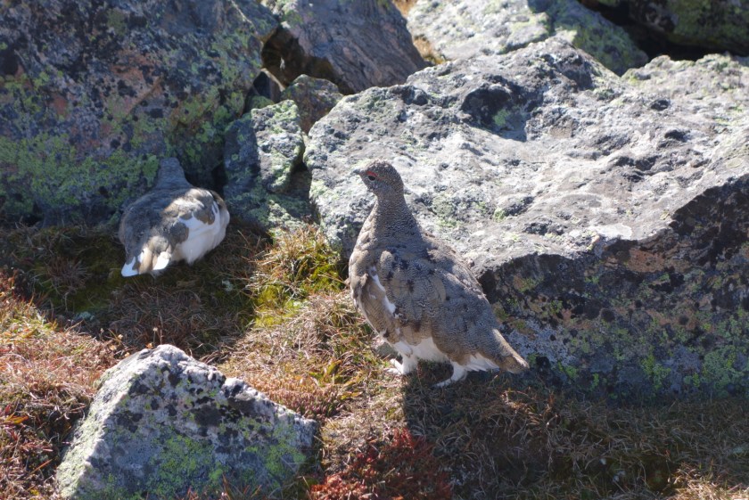
Around 10:00, I started the climb up James Peak. At 13,300 feet above sea level it would my highest climb so far. Incredibly, I passed a couple on the way up. I also nearly stepped on a group of ptarmigan that were on the trail.
I also reflected on my friend James (I know him as Jim) for whom this peak was portentously named. Actually, I have no idea of the name source. Anyhow, Jim and I met in college and were great friends. One of the smartest and funniest people I would meet in my life. He was the best man at my wedding. We had done two backpacking trips together: once in Oregon during college and then once again in Minnesota when I moved back there. In between, life had come along. Moving, careers, kids, etc. Because he’s such a dedicated attorney and husband, I had not been able to lure him into all or a portion of this trip. It would’ve been great to climb this peak with him. I also reflected that, on an actuarial basis, we probably have less future years to hang out than the years passed since college. As motivation, I promised myself if I made it to the top I would do my best to drag Jim out somewhere on a consistent basis to do smart, dumb, or even inert things. Life is short and getting shorter.
Ptarmigan were almost directly on the trail. They were not impressed by me.The leg feathers are a pretty smart evolution for this climate.
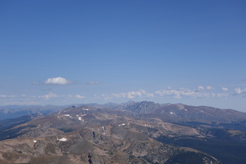
I did reach the top. It was amazing to see all the surrounding mountains. Besides the couple I passed, there were two other people up top. Later, I passed them on the way down and we visited briefly. One was a dentist and the other was a retired gentleman named Kent who still climbed 14ers. Very inspiring to meet him out here climbing peaks that truly challenged me.
One view from atop James Peak
I followed the trail down. Perhaps because of private property concerns, the trail seemed to take an elongated trip back down to the forest, across the Fall River and then come back up again. Although the trail seemed to only get use by CDT hikers, there was some impressive engineering on some of trail walls.
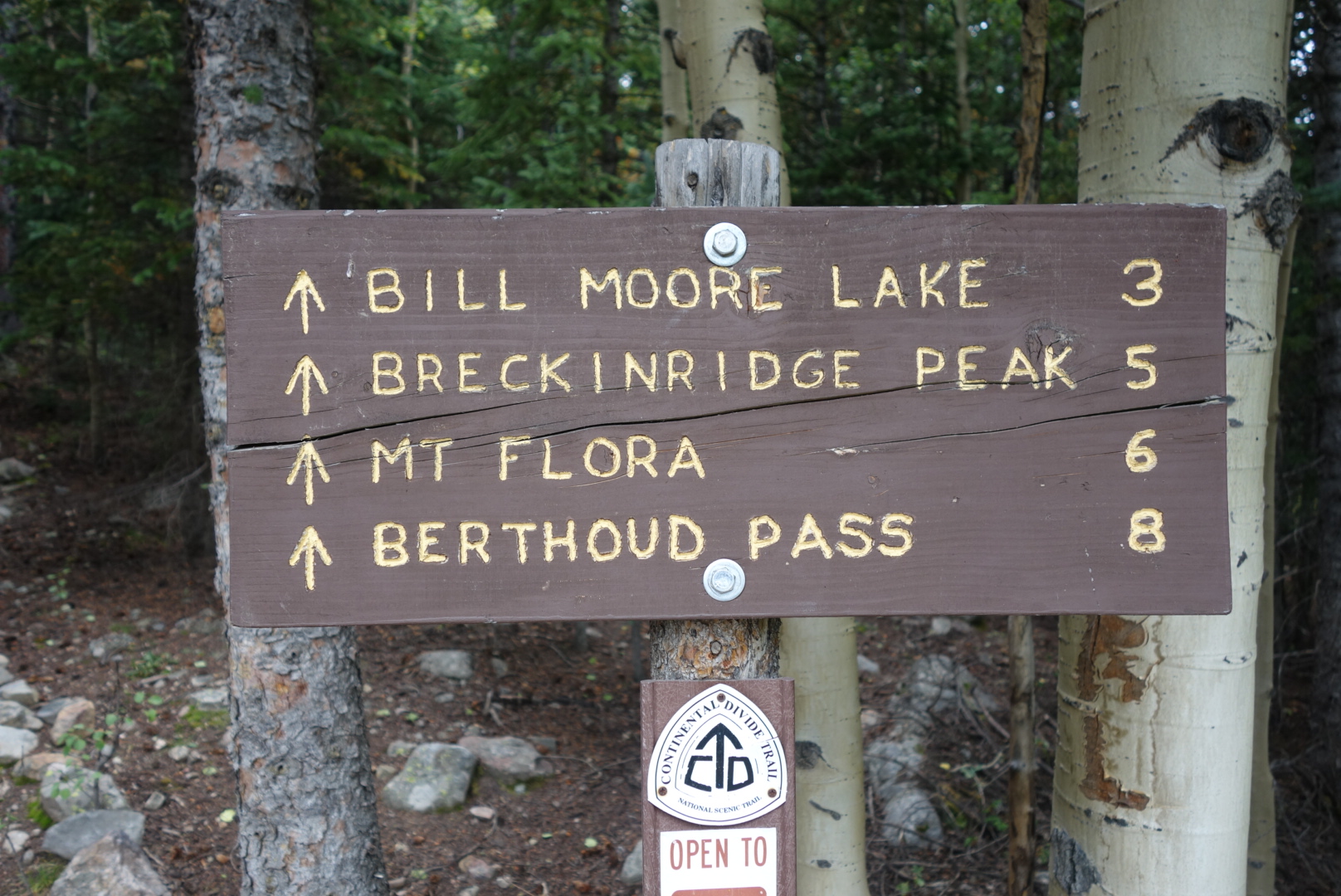
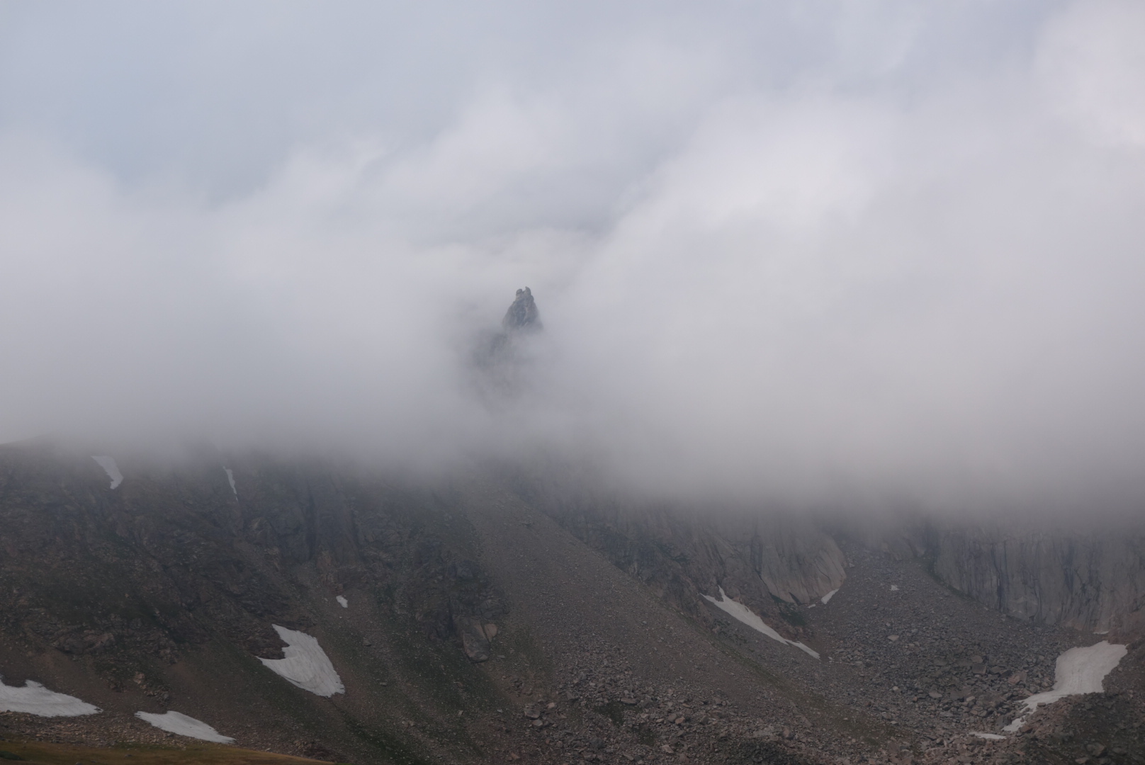
This is about the point in my Colorado blog entries where I mention the skies darkening. Sure enough, as I reached Bill Moore Lake(11,300) the rain started. My challenge was that I needed to get over Breckenridge Peak (12,900) and Mount Flora (13,100) to reach my goal of Berthoud Pass in five miles. I filled up on water, ate a Snickers bar, and set out.
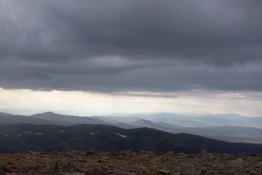
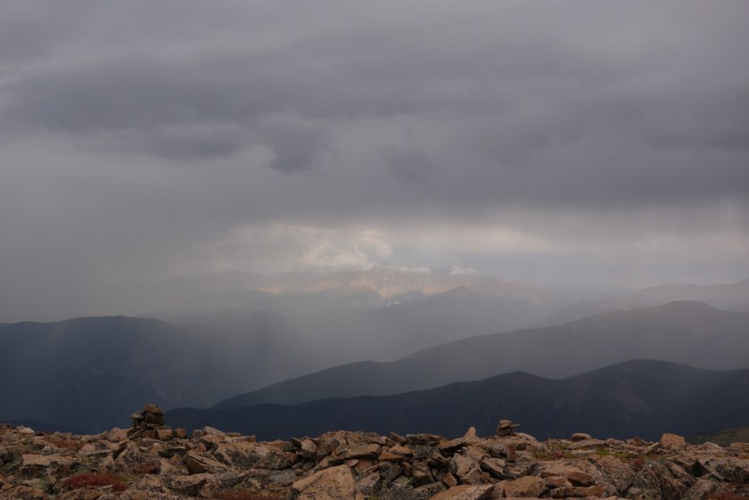
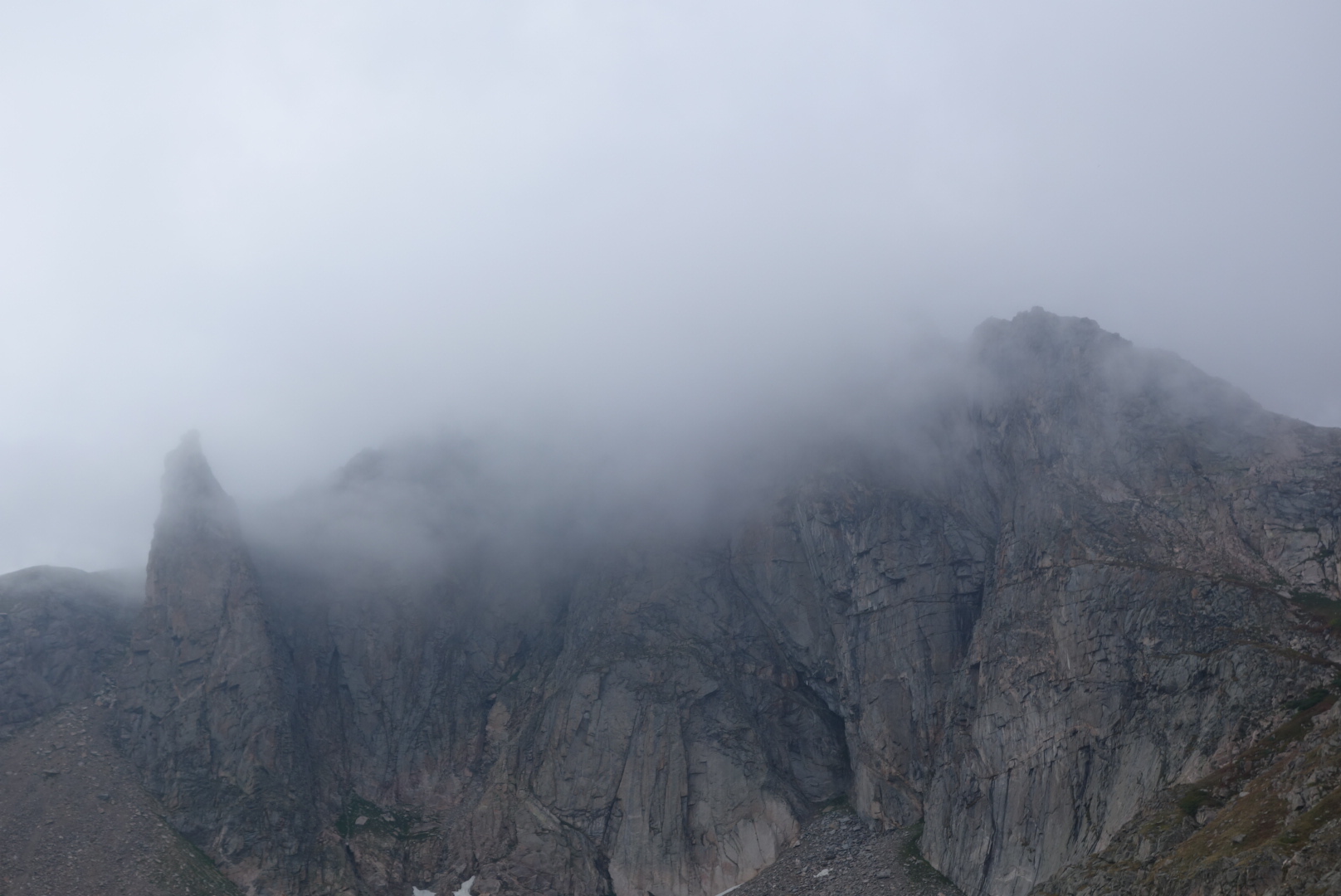
Initially, it was just drizzle. About halfway up Breckenridge Peak, the thunder started rumbling in from the south. By the time I topped out, the clouds overhead were a very nasty shade of dark grey and the lightning to the south was visible. I could turn around or go for it. I went for it. Struggling to keep a steady pace, I cleared the saddle and began climbing up Mount Flora. Out of breath, I reached the top, found the register, made a quick entry, and left.
These clouds were getting darker as I moved quickly towards Mount Flora.Through a break in the clouds and rain, you could see across to other mountains
Almost immediately, the skies opened up with cold rain and wind. I had on all my waterproof gear and my umbrella but I was still getting drenched. Nevertheless, I did count my blessings:the lightning did stay to the south.
As I approached the abandoned ski resort of Berthoud Pass, the rain stopped. A highway ran through the pass. I found a stealth campsite away from the road and the rest area. I knew all my stuff would still be wet in the morning, but there was nothing I could do about it and instead reflected on how lucky I was to have beaten Thor. This day.
It was close to freezing in the morning. The trail climbed through a few meadows near lakes and a place called Coyote Park. The almost freezing grass and shrubs bathed my feet in ice water.
The view? Gorgeous. The grass? Cold, wet.
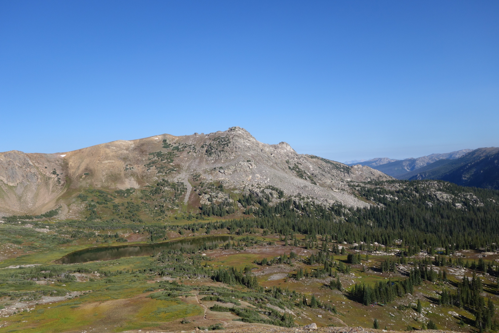
The trail reached Caribou Lake at the foot of Arapaho Pass. The climb up to the 11,900 foot pass was steep and I could look back down and see a group of young hikers, probably boy scouts, breaking camp.
Caribou Lake on the left
I reached the pass and did what all through hikers do: checked for a cell signal. The sun was out so I warmed up and checked in. I thought I was going crazy because I kept hearing voices.
When I started hiking again, I found the source of my craziness. It was a group of about 10 day hikers just reaching the Pass from the other direction. They were kind of standoffish, so I just kept walking. In rapid order, I met a day hiker with his (unleashed) dog and a trail runner.
The lady trail runner confirmed my suspicion: I was near a popular trail head. I took a break and studied my maps more closely. The shorter mileage was only for a first segment. When I added in the second segment, I had chosen a route that was five miles longer than the official trail. What an idiot.
I ran in to all sizes and shapes of people as I descended. It was a nice day and I enjoyed the descent. I enjoyed it so much I missed my turn. What an idiot. After climbing back uphill for about a half mile, I was back on the correct trail to Diamond Lake.
I was finally chugging along. There were the customary clouds gathering in the distance, but I was keeping a good pace. Then, the trail began going straight up over a mountain when the map showed it skirting all the way around. I retraced my steps, looking for a blown turn. I bushwhacked looking for the old rail. After an hour, I gave up and resigned myself to the fact the old trail had been rerouted and I was on an unmapped path. What an idiot.
Eventually, after a couple correct guesses at trail junctions, I was back on my misguided long-cut. The goal was to rejoin the official (and shorter) CDT just after Devil’s Thumb Pass. Now I could see the pass and also the big snow fields I feared I might have to climb late in the day.
Snow field below Devil’s Thumb Pass. I saw three hikers up there.Not expecting to meet anybody out here, I was surprised to meet a young woman hiking the other direction. She confirmed I would not have to walk over snow fields and that there was a good water source ahead. She had an interest in backpacking and asked a lot of intelligent questions.
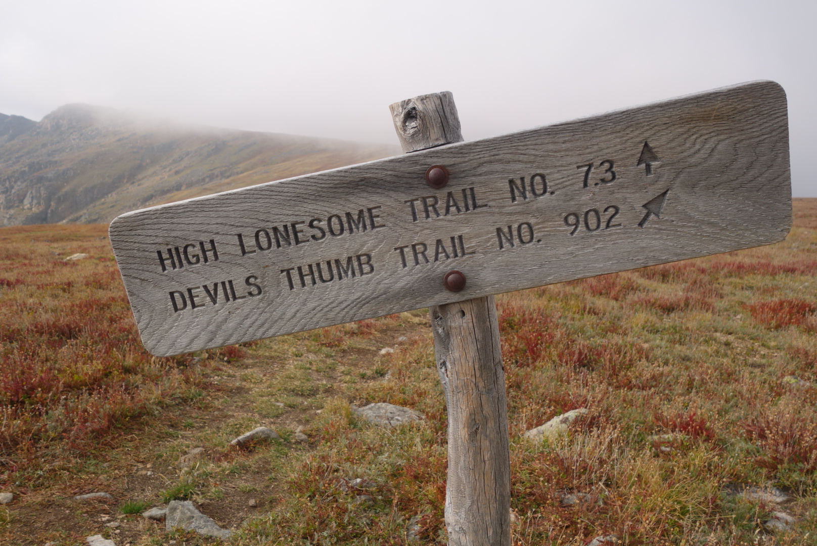
By now you can predict at least one thing. As I began my climb up to the ridge, it began to drizzle and the wind swirled in the steep canyons. After I made it the top, it was very eerie. The clouds were being blown up out of the canyon and then swept out over the more moderate side I was now on. Also, I loved the name of the trail: High Lonesome Trail.
As the sun set, the wind, wet, and dark forced me to seek shelter within a cluster of dwarf spruce just before Rollins Pass. It was challenging to set up the tent in the dark and wind. Also there was a car that turn on its headlights, then creep along for awhile and then stop, only to repeat the action in 15 minutes. Kinda weird.
I fell asleep to the wind slapping the tent. By small measures it tapered off. By 2:00, when I got out of the tent to pee, i was treated to a beautiful display of stars sparkling in silent, cold air from horizon to horizon. I guess getting older and having to get up in the middle of the night can have its advantages.
In the dark, I left the hostel and walked down through a sleeping Grand Lakes. No restaurants were open and the town was very quiet.
The trail winds through town, then residential areas, eventually reaching a lakeside trail. It was a nice sunrise. The houses were across the lake and the trail ran through a natural area with several osprey nests.
The lakes are man made, so I came to my first dam. I ate a little, took off some layers, and headed south. In a narrow section of a bay, I came across a couple who were in a sailboat. I think they were just waking up. Their quiet scene was in contrast to the campsite near the Twin Creek Ranger station that featured two pontoons, a jet ski, a large canvas tent and generator.
After the ranger station, the trail climbed atop a bluff. The maps warned of many blowdowns and there were. A slow uphill climb over fallen trees is not ideal. I just imagined it as an obstacle course instead of a trail and it seemed to go a little faster.
I met a husband and wife section hiking. Their names were, I think, pot and lid, presumably referring to the cooking product.
To my great surprise, I ran into Adam and Denali. I walked right past them as they took a break overlooking the lake below. They were the enjoyable young couple I had hiked with in Montana before Butte. We caught up a little. They were going northbound from Chama, NM. So, there was still a chance i would see them again when they later returned to New Mexico and finished their trip to the border with Mexico. They are a positive, fun young couple and I always enjoy being around them.
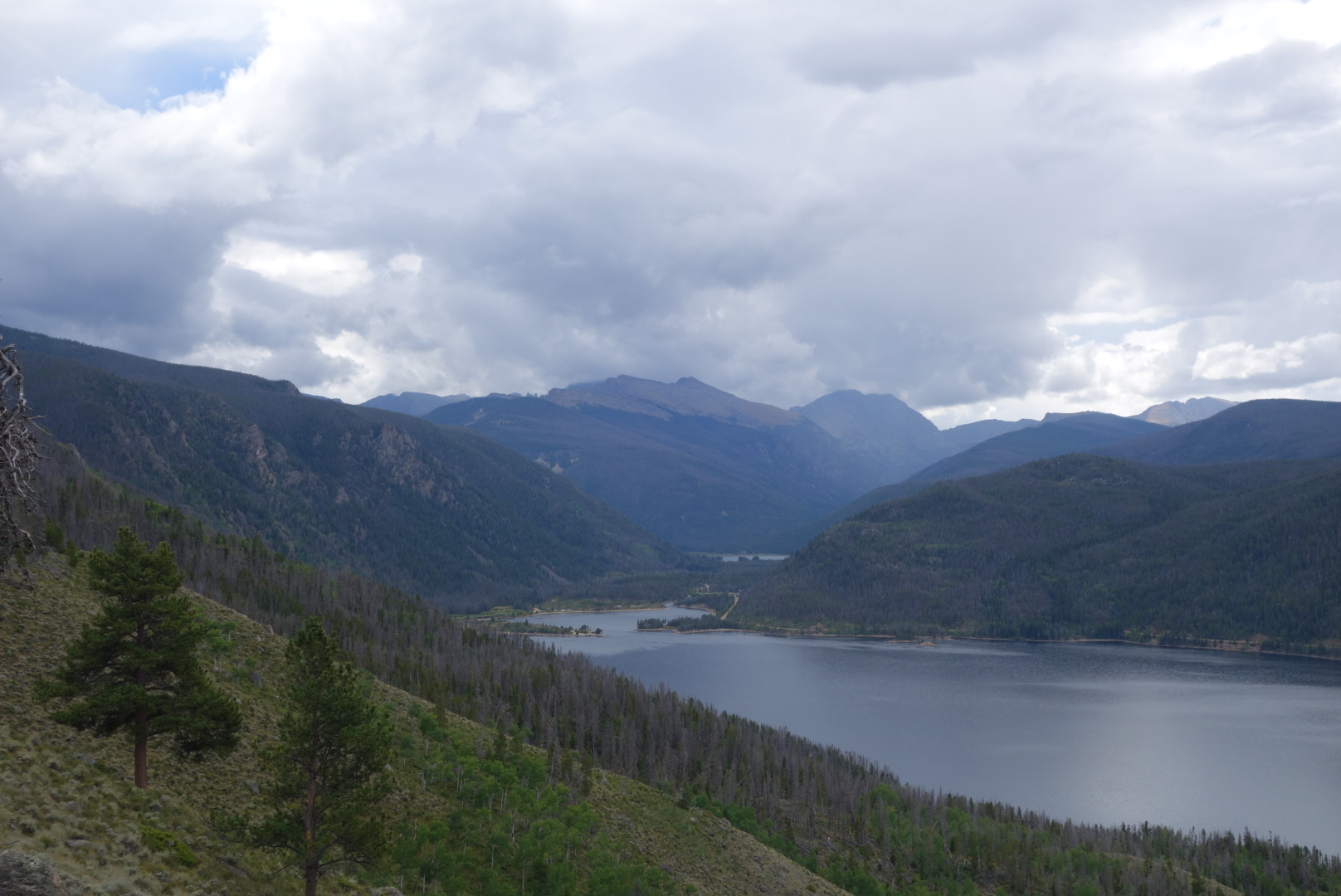
Continuing south, the trail eventually descends to the head of Lake Granby at Arapaho Bay. There was a large campground there. About 100 yards before reaching the campground, on the trail was something I had not seen in awhile: a large pile of bear scat.
I ate lunch at the campground. Looking up the valley there were dark storm clouds. The wind was sharp. I put back on everything I had taken off earlier. Also, the helicopter that I had heard and seen earlier flew by much closer this time.
I trudged up a gravel road to Monarch Lake. This was the last man-made reservoir before I climbed into mountains. There were a ton of cars at the end of the road, including a horse trailer with Iowa plates. I met a search and rescue guy. He had a team out who helped a guy who was having trouble breathing. The helicopter had been for him. Where, but for the grace of God, go I.
Surprisingly, there were few people on the CDT portion. I came across an abandoned steam engine that was probably used to build the dam. Also, I saw a lady trail running.
I came to a fork. I looked at my Ley maps which are annotated. My tired eyes saw the words “no permit required” and 8 miles versus 12, so I decided on the spot to take the alternate route up Arapaho Creek.
The storm I had seen earlier had been through. Everything was soaked, so inevitably my feet got soaked. I climbed from 8,300 feet to about 10,000 feet. Although the terrain was rough I found a flattish spot where I could look up at the peaks. As the sun set, it was cool to watch the clouds. They were trying to reach over the mountain tops to come down into my valley, but they could not. So I was under clear skies while the other side of the mountains were cloudy. After sunset, the show continued as I could see flashes. The lightning was far enough off to have no sound yet bright enough to have a light show. I had made a small fire and it was amazing to watch this show play out from my tiny campsite.
A zero day means one where no miles are hiked. I extended my stay at the hostel for a day, got my resupply, said goodbye to Qtip, and then looked at th loop hike around Rocky Mountain National Park.
The trail starts about 500 feet from the hostel. It is about 25 miles. It was 10:00. With no backpack, I thought I could go about 3 mph and be back before dark. So, on my day off from backpacking, I went on a long hike.
I just brought my down puffy and rain jacket. I drank a bunch of water before leaving; it’s better in you than on you is my motto.
Initially the trail was mostly level. Without trying, I cruised past the day hikers. It was nice to see families out enjoying the scenery. I did see a few backpackers coming down.
After 5 miles the trail started to climb. I enjoyed not having weight on my back, but I was not that much faster.
As I encountered backpackers going the way I had come from, I asked them if they were looking forward to finishing. It surprised me how many were planning to stop before the end. Soon, it became clear that most were doing the loop in 3 days. At first I was a little stunned by the short daily distances, but when I thought about the altitude, the desire for sightseeing, and earlier trips I’d taken, it made sense. Not all backpacking trips needed to be about big miles.
Disappointed is the best description of how I felt about myself once I got to around 11,000 feet. Instead of cruising easily and lightly uphill, I had to stop often to catch my breath. The benefit, however, was the scenery. The trail fairly quickly gets above treeline for some impressive views back down the valley. Plus, once you get to the highest elevations, around 12,000 feet above sea level, it is roughly a plateau which presents several different views.
One of the views, unfortunately, was dark clouds developing. I had my puffy on already due to the temperature. I now hoped to be able to descend before the storm hit.
I came across a tall young guy with a fancy camera and tripod. We walked downhill together for a brief period. He was from Long Island and had spent a year visiting national parks and taking photos. He slept in his car and thought he was about through with his project.
Somehow I pulled ahead. I had about four miles to go until the end. It was 6:00, so I figured I would be finishing in the dark. The rain came. So, too, did a strong wind. I was in an area where the pine bark beetle had destroyed a lot of trees. These trees were either standing up dead or tipped over, caught on a nearby tree. As the wind gusted, the trees groaned and popped. Then, some started toppling with loud crashes.
My strong preference was to not be crushed by a falling tree. Unfortunately, there was very little I could control; if a tree was going to fall there was nothing I could do. So, I increased my pace, vowed that this was not the way I was going to die, and hiked as fast as I could to the hostel.
Cold, wet, hungry and alive, I made it to the hostel. I put on warm, dry clothes and headed into town for a hot meal. Later, I packed up knowing I would leave early.
All in all, the Rocky Mountain National Park loop was a great day hike. Although not as dramatic as Glacier, it still affords great views and I am glad I walked 25 miles on my day off.
The morning was spent hopscotching a trail open to motorcycles. Some trails are quite popular with motorcycle enthusiasts and they have two results. First is a convex tire repeatedly ridden over dirt creates a deeply rutted concave trail which the human foot is not meant to walk upon. Second is to churn up all kinds of rocks making each step an adventure.
Nevertheless, the trail followed a small stream, Trout Creek, uphill until the headwaters were passed. Then, a serious uphill climb.
I came to the turn for official trail and it looked sketchy. In some places on the CDT there is a vicious cycle of low usage leading to low maintenance leading to low usage, etc. Instead, I took an alternate up the Illinois River. At first it was a gravel road with grazing cattle and then a fairly decent trail.
As per usual in my case, clouds thickened and drizzle started. In case I have not elaborated on it before, there are a few hassles with rain and backpacking. First, you want to avoid stopping and taking off your backpack. Next, if you haven’t guessed right, your weather gear (insulation and water resistance are the two main ones) is probaby buried in your pack. Lastly, it is putting on and adjusting your clothing and regaining the momentum of the trail.
Thus, my umbrella was not enough for the increasingly stronger drizzle and slowly dropping temperatures. I added insulation and my rain pants and forged up to Bowen Pass, 11,475 feet, where my alternate rejoined the official CDT.
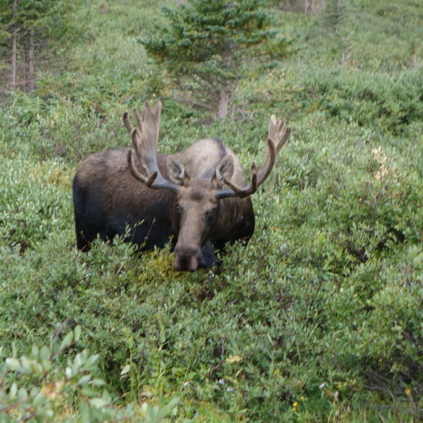
The pass was above treeline. As I descended into the valley I spotted a bull moose feeding in a clump of shrubs. This was all the more interesting because I could plainly see where the trail went directly through those same shrubs, not 15 feet from the bull. As I went down another set of switchbacks, I saw there was another moose, without antlers, also feeding in the same island of vegetation.
This didn’t bode well as a bull with a cow might get defensive. Several people on the trail had said moose were more dangerous than bears. Still, I believed that all previous moose I encountered ran when they saw a human. Thus, I hoped to approach the moose and get some good video as it saw me and ran off.
The angle of the trail relative to the shrubbery, plus the wind direction, let me get close to the feeding bull. Further away, I could not see the other moose. When I could see the antlers, I pulled out the camera, started the video function, and stood up straight hoping to get a clear focus before the bull ran off in fear of me, the mighty apex predator. Well, 20 feet away the bull was extremely unimpressed by me. He continued eating. It was strange to have eye contact with a large, wild animal.
He was not the least bit intimidated.
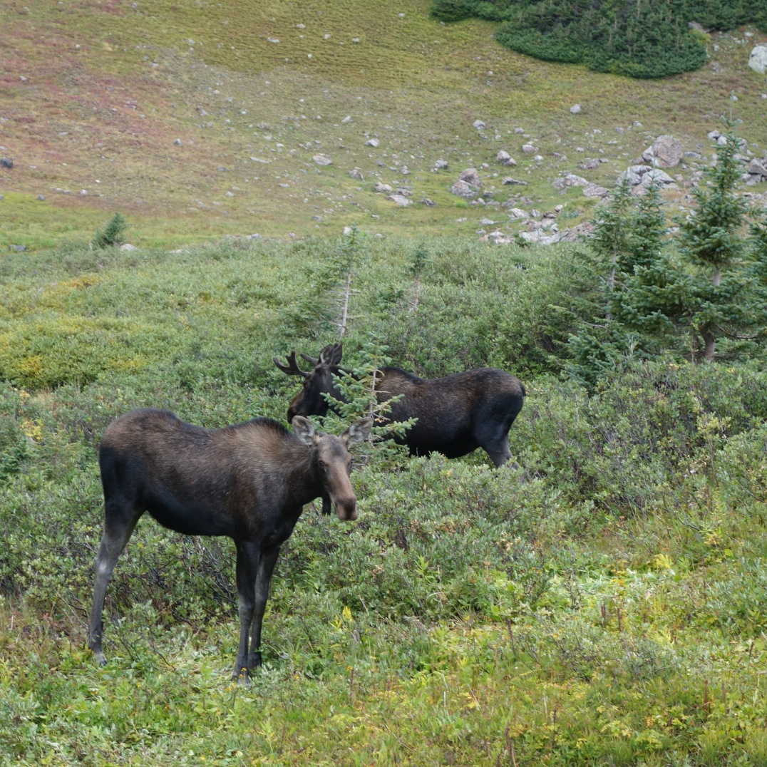
I tried to quickly determine if this was good or bad. He could charge forward in about 10 steps and deliver some hurt. I, on the other hand, was pretty much confined to a thin trail chopped through thick shrubbery. I decided this was bad and kept talking and walking. Much to my relief, he stayed put as I passed. Much, much more to my surprise were the three other moose that suddenly stood up 15 feet away to see what was going on.
These young guys popped up to see me.
“This is not good.” I am not sure why saying this out loud was helpful, but I did it anyways. Although I now had five moose all looking at me, I was slightly relieved to note these three were young males, only one with a small set of antlers.I could tell they were torn between staying or fleeing. I was definitely into fleeing.
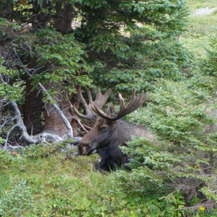
As I edged past, I was amazed to see the biggest bull lounging on the ground. This guy was big, even laying down. I had thought moose were solitary creatures, but now l had six moose all in one place.
This guy was big, even laying down
The big guy laying down gave me a look that clearly conveyed “Don’t make me stand up!” I had to get a picture so I took the chance of a few snaps. He looked pretty mad now. An inventory of quickly accessible defensive weapons available to me only came up with an umbrella.
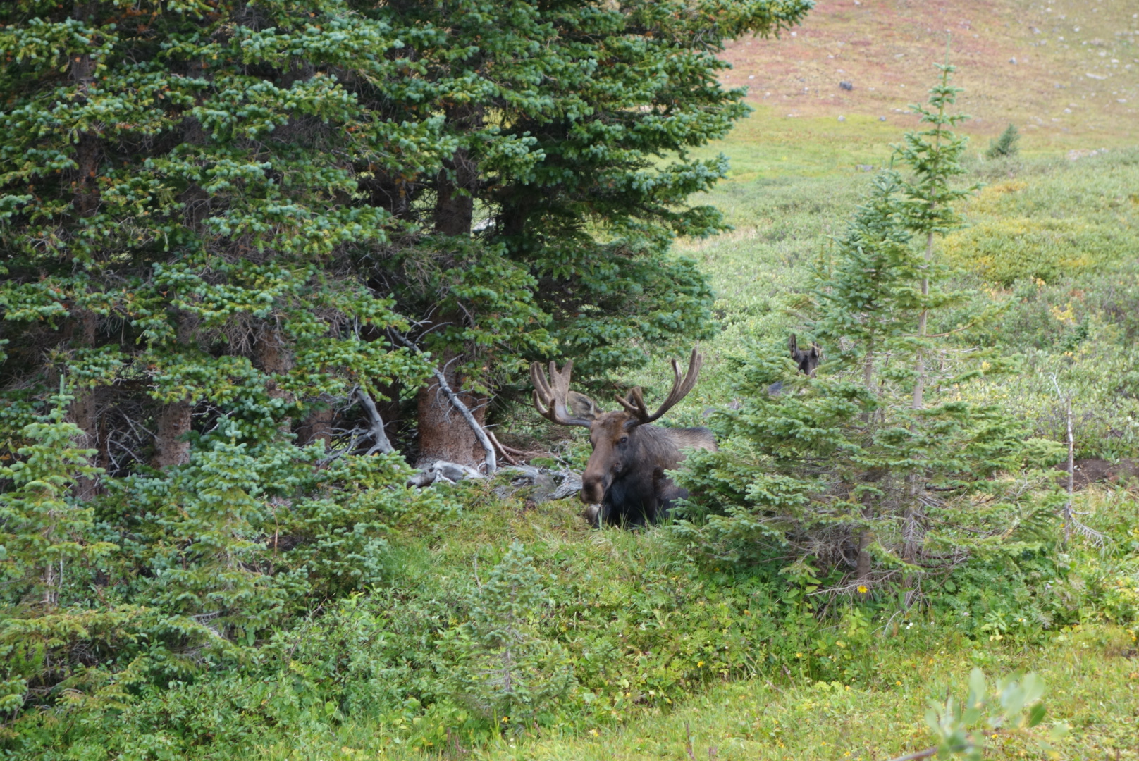
Talking and walking smoothly, I did slide by and finally I started to shake a little. I had just walked past over a literal ton of bull moose. Wow.
Although a memorable experience, I had to focus on the rain which had increased in intensity. Since the trail followed a creek downhill, the hiking was fast. After several miles, I ran into three young ladies out for a day hike. They mentioned they worked at the Shadow Cliff Hostel in Grand Lakes, which is where my resupply package awaited. I originally planned on one more night in the woods. However, after chatting with them, I guessed that I could push all the way to the hostel. Once again, Helen came through and got me a room for the night.
I high tailed it down the trail. For the most part, the trail was now indistinguishable from a creek. I reached the highway. I could walk the highway to town or follow the official CDT. I chose the latter and regretted it. Sweeping curves that just ended up back at the highway.
As the rain stopped, I eventually walked into town. I ate some dinner at a restaurant. The waitress was impressed that I wolfed down two entrees, a full rack of ribs plus a chicken burrito.
Through the dark town, I made my way to Shadow Cliff. I met Qtip there which was great. I grabbed my sheets, made my bed, and went to sleep.
Another zero day. Decided to make the most of it. Caught up some blog entries in the morning after motel’s continental breakfast.
Went to strip mall and got much needed haircut. Felt so much better.
Got some groceries to take out of town in addition to resupply.
I had a hamburger plus bowl of chili for lunch. Took a power nap back at motel. The highly recommended Italian restaurant was too far for dinner, so I settled for another hamburger, this time from an Irish pub. I ordered a sub from the sandwich shop next door to bring on the trail.
Also, given my luck with hitchiking, I ordered a cab to take me to the pass.
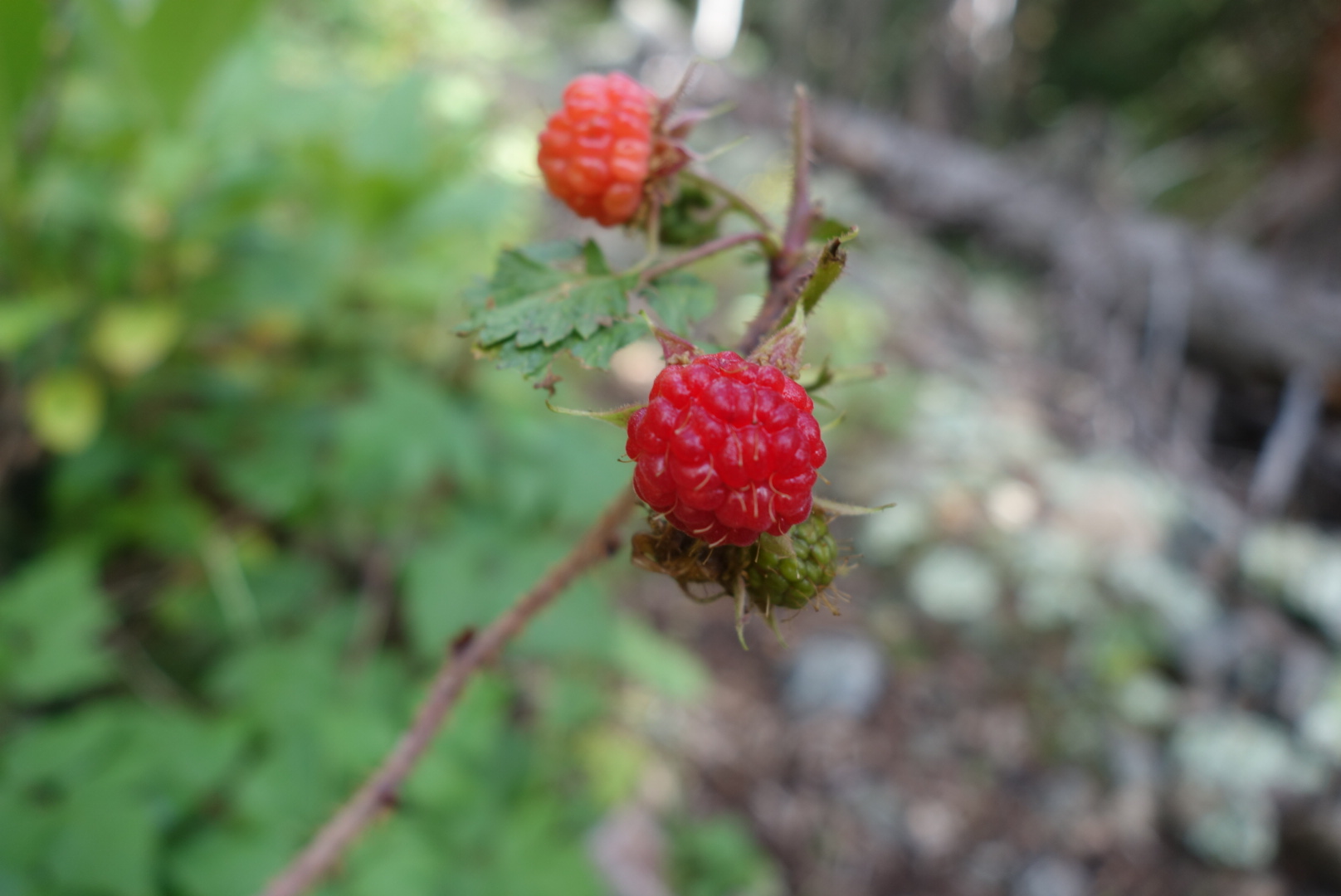
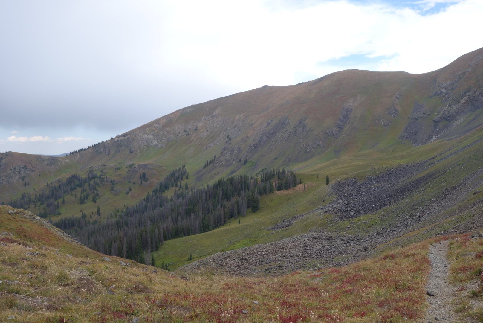
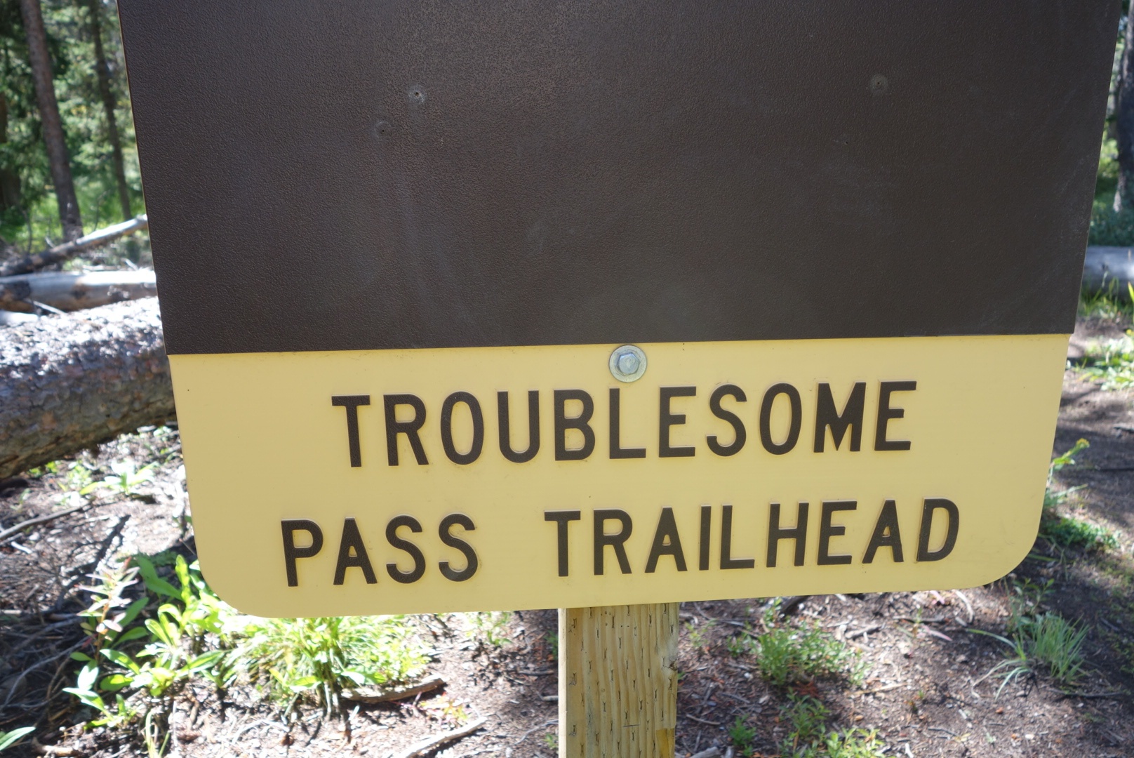
Got to traipse along some high, narrow ridges today. Great names like Poison Ridge and Troublesome Pass. I went around Haystack Mountain instead of over. I wanted to save my strength for Parkview Mountain this afternoon. I found some ripe raspberries along the way, which was a sweet surprise.
Parkview Mountain rises to 12,300 feet above sea level. The approach was above treeline with amazing views. One of the views was of clouds thickening in both color and size. The last half mile came down to me counting 50 steps and then letting my pulse calm down. Man, I truly wish I had not smoked for 27 years.
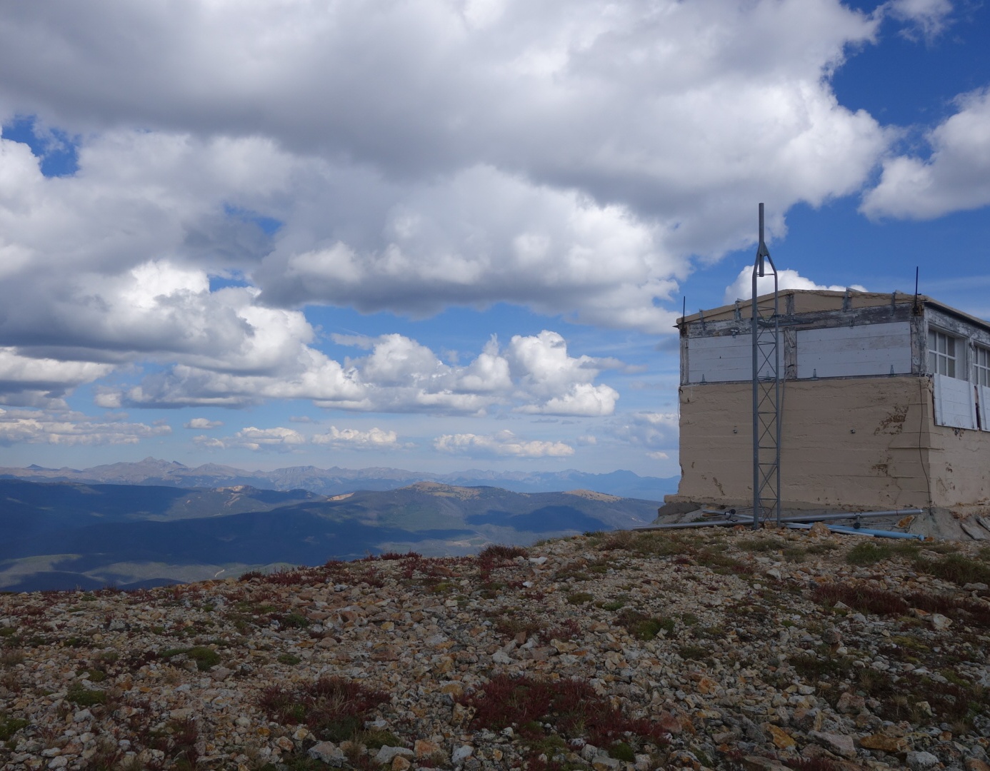
Eventually, I did reach the top. There is an emergency shelter there in case of lightning. Massive amounts of rodent feces and graffiti were the two dominant interior design themes.
Shelter on ParviewThe only thing as bad as a long climb is a long descent. I came down 1200 feet in a half mile. More gradually, a forest service road swept downhill in switchbacks.
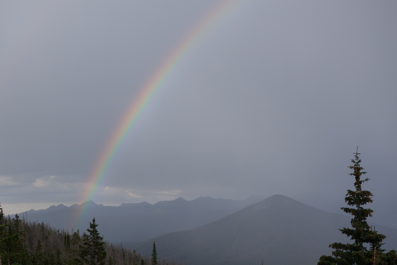
Maybe it was the downpour that finally occurred, but I missed my turn. Rather than climbing back up or bushwacking, I chose to follow the forest service road as it swept back and forth downhill. I made a last stop for water when I dumped out onto a two lane highway.
Nice rainbow to lead the way.
I had about a mile walk uphill on the highway until I reached Willow Creek Pass where the trail crossed. It was almost dark enough for a headlamp. There was hardly any traffic. As I neared the Pass, a little old lady in a Subaru stopped. She rolled down the driver’s window, her chin barely above the door, and asked if I needed help. What a sweet, fearless lady.
I ended up putting my tent up in the dark on a wet piece of what I thought was level ground. This guaranteed a night of discomfort and fidgeting with the tangential benefit of a wet tent to carry tomorrow.
Did not sleep well. The rain stopped and the skies cleared, but I tossed and turned. I slept in until 6:00 thinking there was no need to rush to the highway for early morning hitchiking.
Almost immediately I ran into Sweet Baby James and Moon Light Lady. I followed them to the highway and the three of us tried to hitch in to Steamboat Springs. My streak continued and we had to wait 90 minutes.
The family that picked us up had seen us and turned around. They were in a van towing a camper. They were a young couple from Michigan and had their three young kids plus a dog. SBJ, MLL, and I climbed on to the front bench seat with our backpacks on our laps.
The driver kept turning back to ask me questions about the trail and SBJ/MLL were talking to the kids. As the driver barreled down the highway, I learned the vehicle had over 200,000 miles on it and several parts had to be replaced soon. His wife was serene during all of this.
At last we descended into Steamboat Springs. They needed to visit Walmart and we agreed to split up there. I had dug out my wallet and pulled out some gas money. We went our separate ways in the parking lot and I made a beeline for a burrito joint.
Before I ordered, I checked my pockets. Panic. No wallet. I retraced my steps to the van. Sure enough I could see my wallet on the floor as their dog barked at me. Normally, I would’ve tried the van door. However, when you look and smell like I do at this point, people are immediaately suspicious. So, I sat and waited for an hour. My paranoia was that I would go into Walmart to find them and they would come out and leave me with no ID or credit cards or cash.
It all worked out. I got to my motel, ate too much, and did laundry. I did have the best meal on the trail at a place called the Ore House.