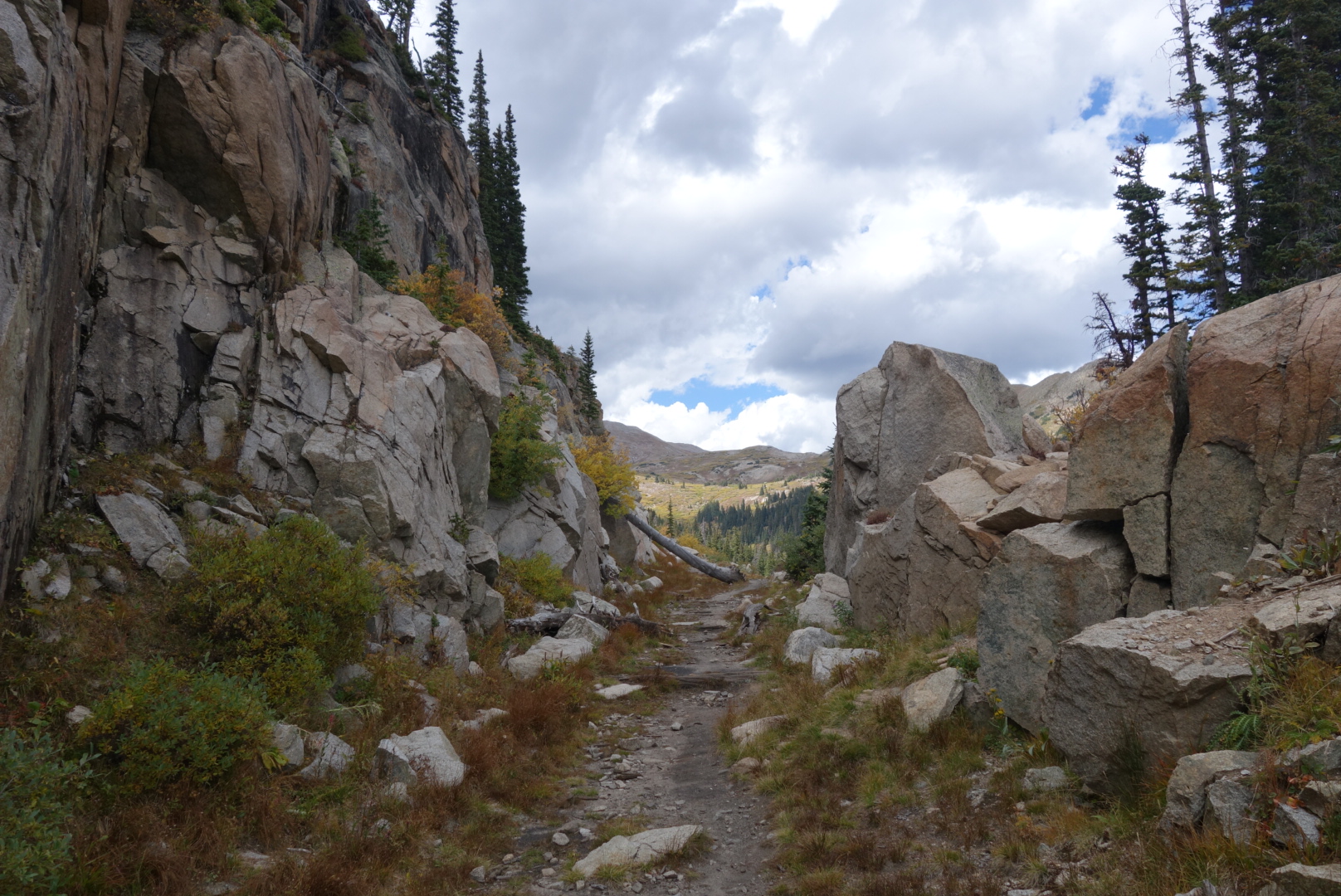
Another day of high ridge hiking. Some interesting rock formations and lakes in the morning as well.
I did have a couple interesting wildlife encounters. The first one was approaching the top of a pass. Usually a rock pile, called a cairn, is at the top of a pass. Many times it will have an informational post sticking out of it. In this case, I saw a crooked stick at the peak. That was odd. Then I realized it was an antler. Sure enough, as I approached, a cow elk stood up. Once she saw me, the surprise was over and they ran down the hill and half way up the ther side of the valley.
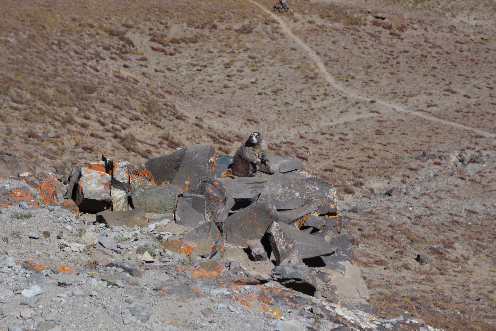
The other encounter involved marmots. I came across a rocky area and there were a couple marmots in photgenic locations. One was on a boulder that jutted out. he was mildly interested in me. He gave a half-hearted alarm warning of my presence. I guess word was getting around I was pretty harmless. Although feeling just a little slighted by the lack of terror I instilled, I climbed on and then all hell broke loose. I thought they finally realized I was an apex predator and all the marmots stepped up their warning cries. However, as I got to the end of a switch back, I was able to see the red fox that caused all the excitement. Once I got over the crest, I saw the fox’s partner, its brilliant coat stark against the drab fall grasses.
Me? Not impressed. Fox? Marmot Def Con 4.
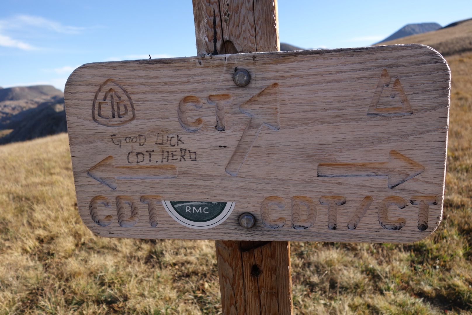
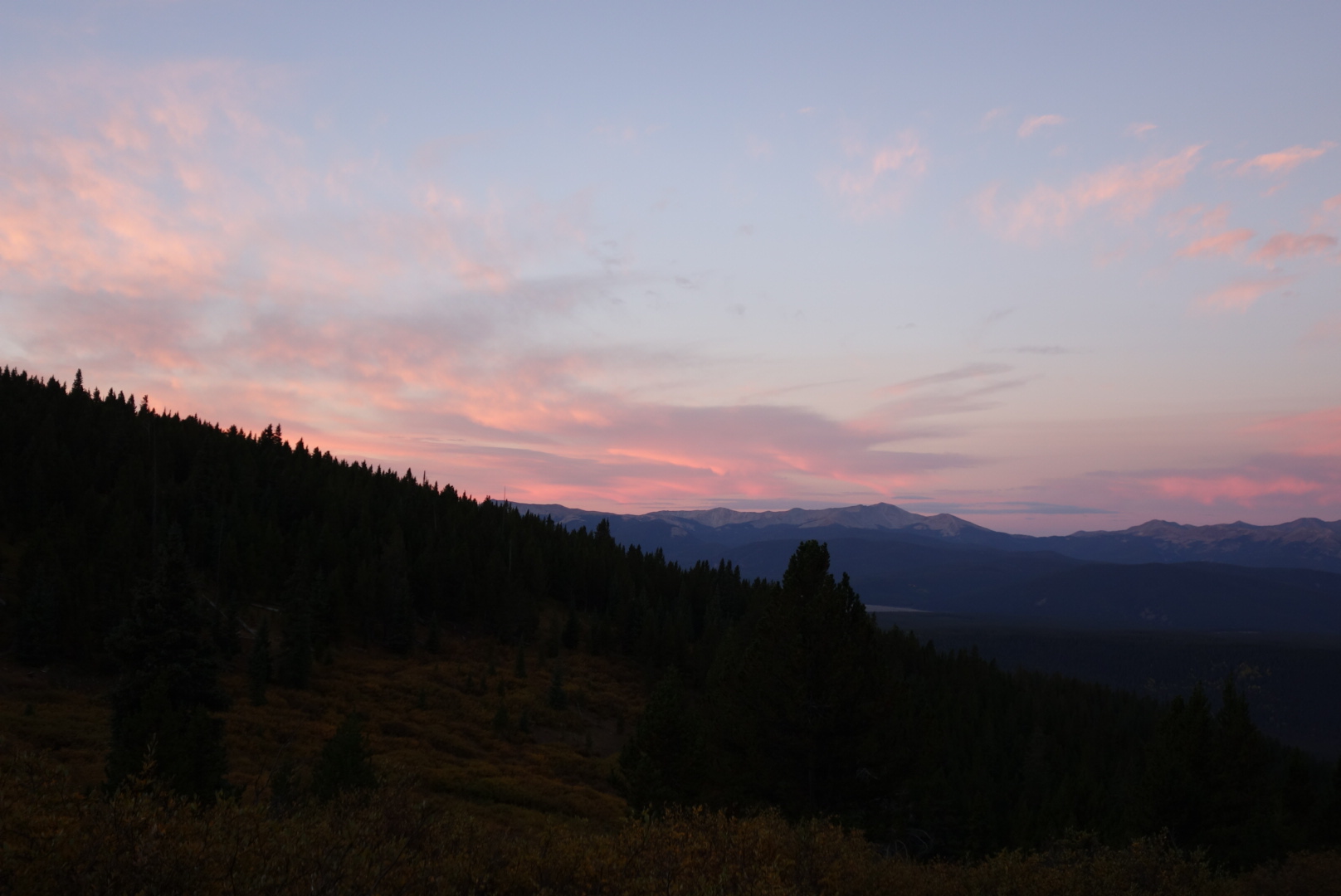
Late in the afternoon, the Colorado Trail and the CDT split. I then entered the Weminuche Wilderness area. As it got dark, I was able to achieve my goal of a high elevation campsite that was flat and had some wind shelter. This was probably one of my top five spots all trip and I slept quite well.
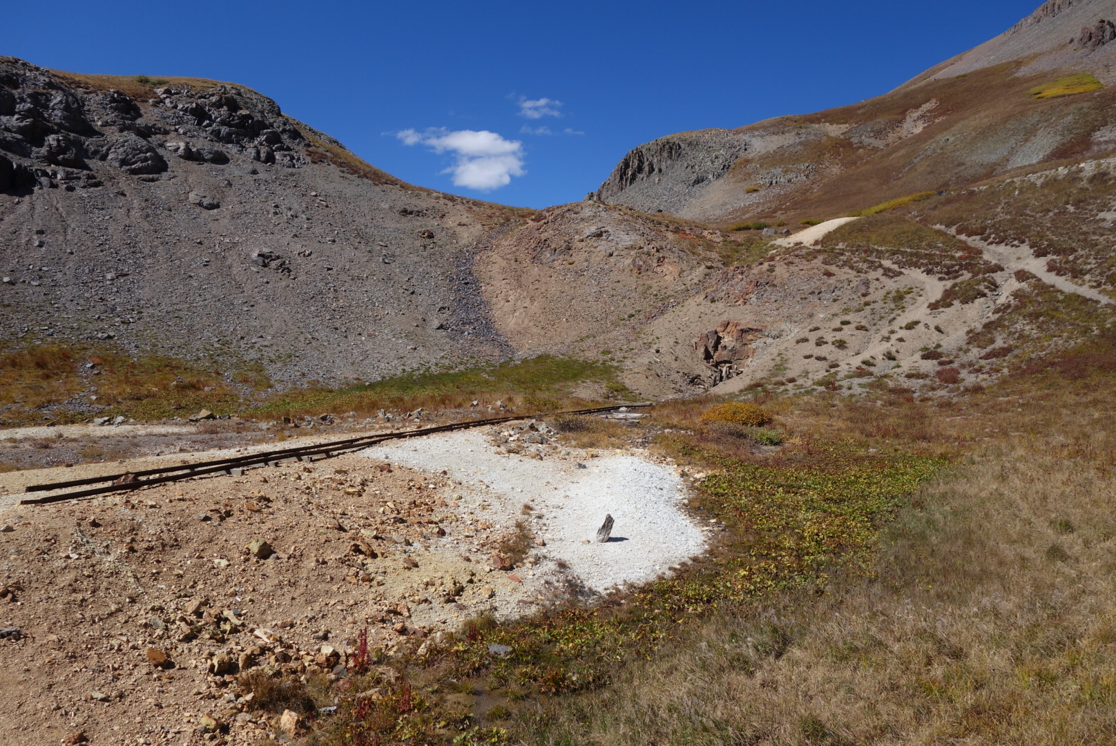
Headwaters of the Rio Grande. Not impressive but at least you can drink it
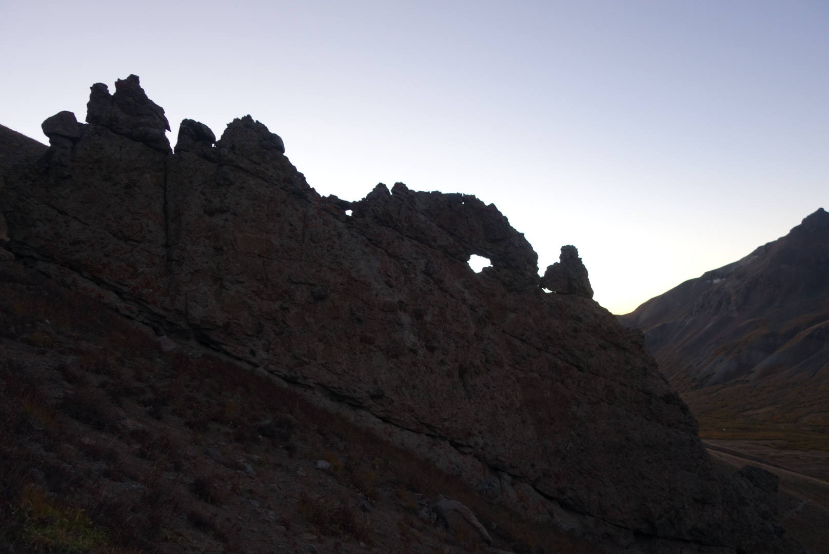
Morning light through hole in the rock
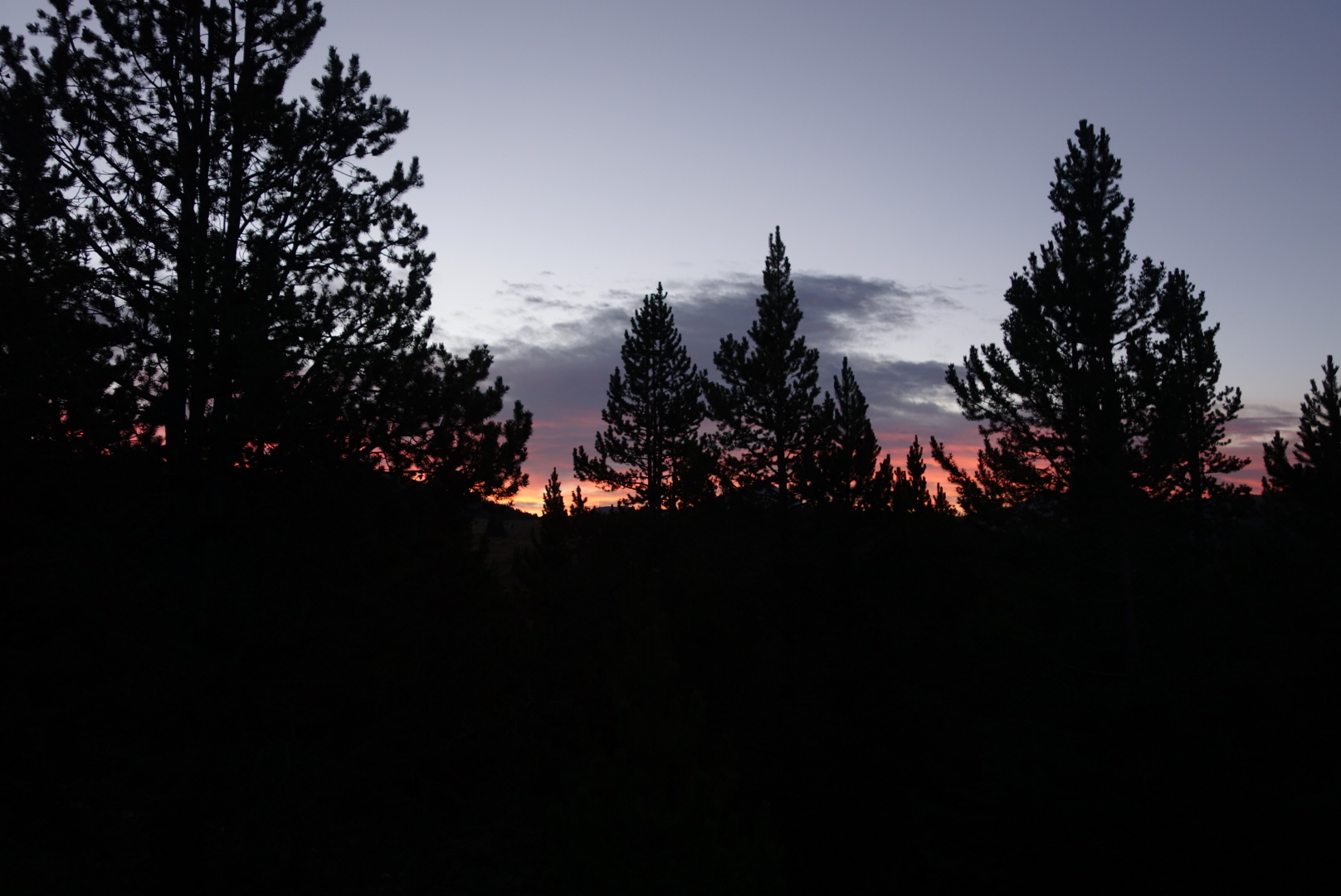
Morning reflection
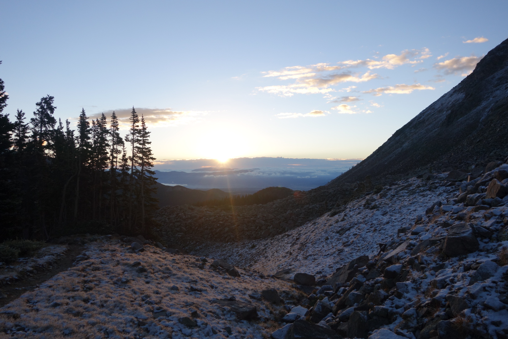
Morning reflection off small lakeThe CDT and the CT split
Butch dropped me off at Spring Creek Pass. After exchanging well wishes I set off. It was a jeep trail going uphill at first. I met a husband wife elk hunting couple and they were quitting for the season with no luck.
After a steady climb up, the trail went in to the terrain I love: high ridges above tree line. On the way, the trail passes a yurt made mostly for winter campers but CDT hikers can use it to.
Wide grassy areas with pine, spruce, and aspens.
Can you believe some people hike this trail northbound in June and miss this?
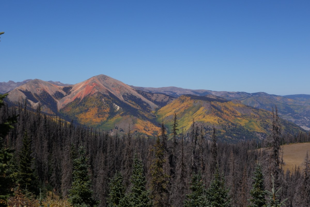
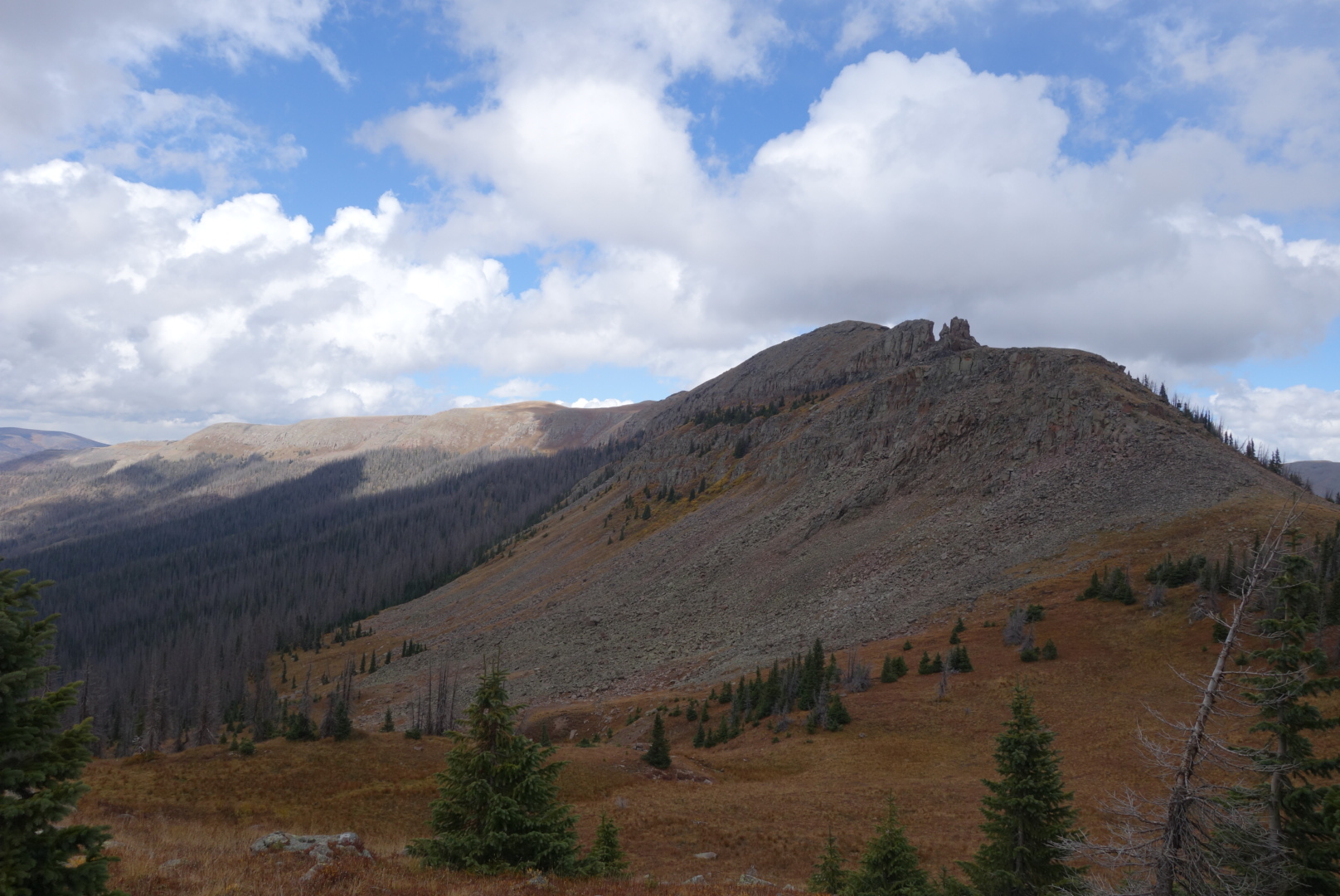
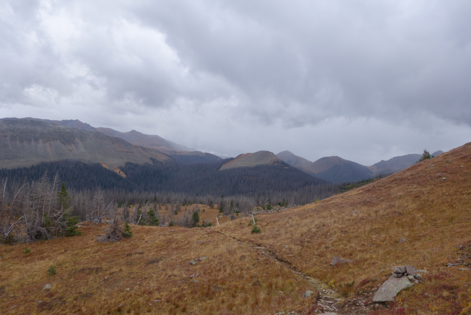
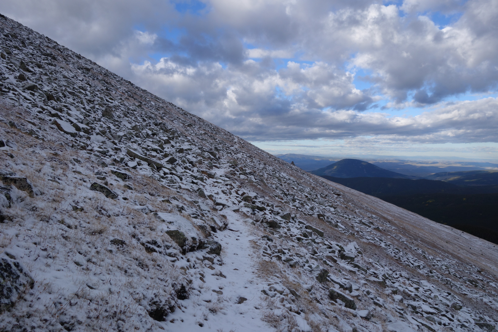
Once up on the ridges, I felt like I could not stop taking pictures. Looking down into valleys with aspens and pines and bright blue skies with just a few puffy white clouds. This was perfect hiking.
The trail wound it’s way higher.Sorry, I just took many photos in this section.
The winds have been strong and that’s why my hair is thinning. I am not balding.
Late in the day, the trail came down through some ATV trails and an old mining area. I ran across some folks on their ATVs and side-by-sides. One guy was gener0uos and encouraging. I had another conversation with a guy who asked me where I was going. I said Pagosa Springs. I was following the trail and heading west. He looked at me and said “You need to go that way” and pointed south southeast. It was a classic driver/ hiker conversation. He was legitimately concerned I was lost and going the wrong way. I was legitimately concerned he spent too much time in his ATV and should walk more.
I camped on a hillock I found alongside Lost Trail Creek. What a reassuring name. I had a small fire and a warm meal. The moon would barely appear in this canyon, but the quiet creek below made a sweet background sound to help fall asleep.
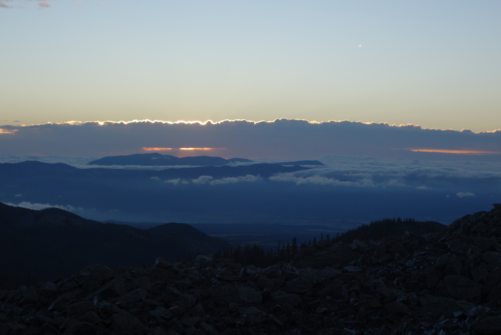
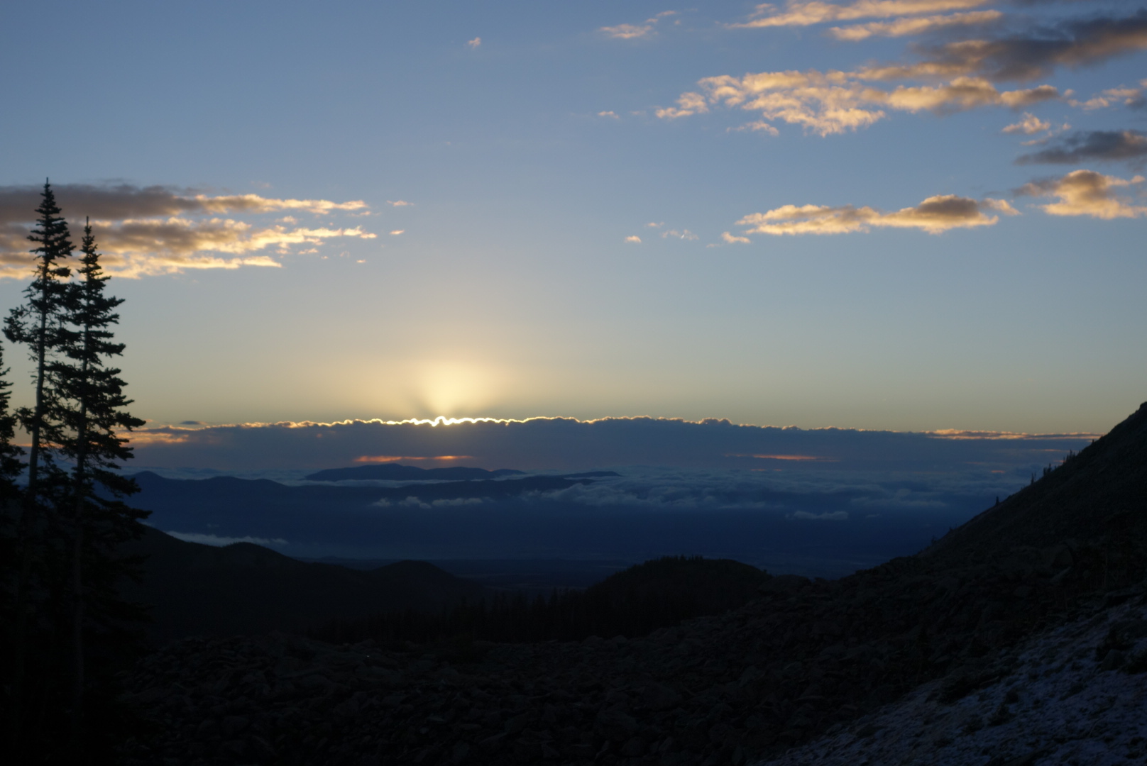
I was up and hiking by 5 a.m. Between the moonlight and my headlamp, the trail was easy to see. Within an hour I reached Snow Mesa, about 2 miles of rolling grass lands. The hiking was easy in the morning. To the west the almost-full moon was going down. Behind me to the east the Sun was starting to rise. For a while I had a great experience with a full moon lighting the direction I was heading and the rising sun casting a shadow from behind me and Illuminating the Western mountains.
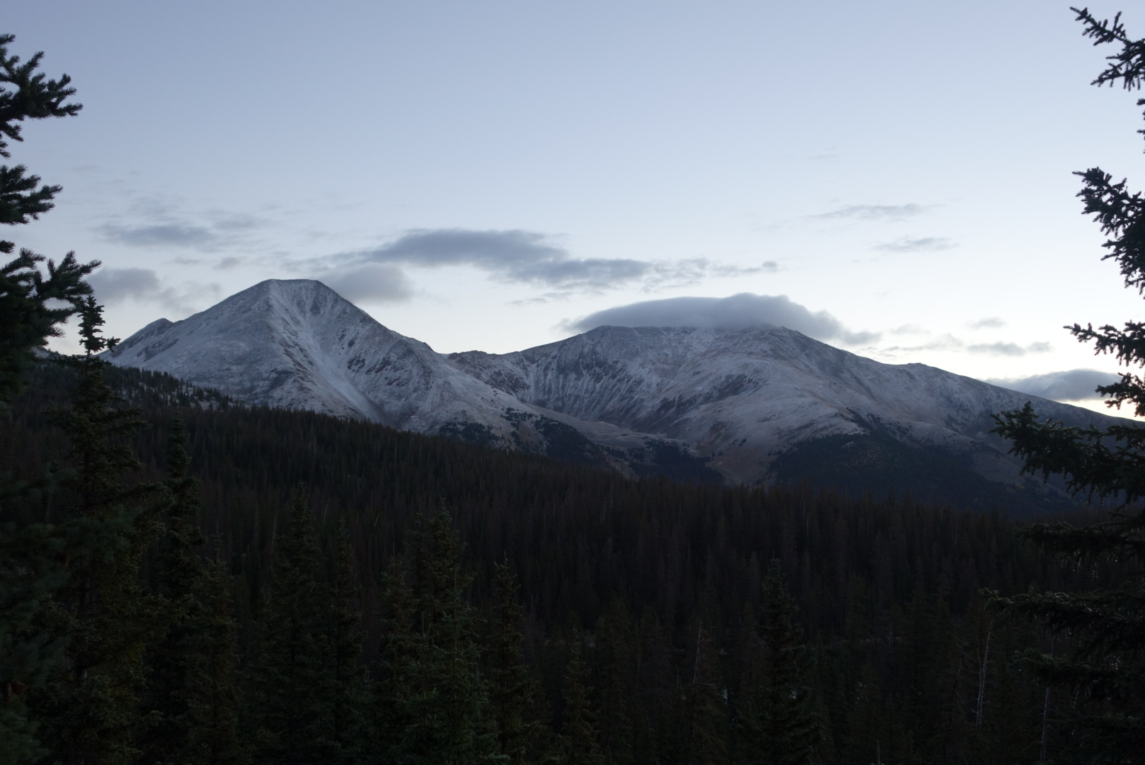
Snow Mesa is somewhat featureless. Most of the morning I was walking towards the moon.I tried to get artsy here but it failed. The sun was rising behind me. The faint trail leads to a trail post in the middle of the photo.These mountains were to the northwest.To the west south west, these were the mountains I would climb in the week ahead.
I wanted to make sure that I would be at Spring Creek Pass to get my ride into Lake City. I had a little bit of extra time and I got to the pass about an hour ahead of time and waited for the the ride into the town.
At 10 o’clock Butch showed up and drove me into town. We had a good conversation. He is from the Houston area and comes up to Lake City every summer.
I immediately sought out breakfast at the only restaurant serving at that time. I ordered the hungry man breakfast plus a couple sides. It filled up the full table in the booth I was sitting in.
After breakfast,I checked into my motel and got my resupply package, did some grocery shopping, and then I went to the Ravens Rest hostel. I met the owner and I gave him money for a room in case Emily showed up.
Then I did my usual napping and then eating a lunch and then eating a dinner and packing up and getting ready to return to the trail. Lake City is very pretty. There was a Wine Festival going on. I liked the town. It had a good feel to it. The only bad experience was at Poker Alice pizza.I went in and ordered and the manager took my $20 and held it up to the light and scriticized it to make sure it wasn’t counterfeit. He made quite a production out of this. The irony was that the $20 bill was from the town’s ATM. At first I didn’t think anything of it. After all $20 is a big loss to a small business. However as subsequent customers ordered, he did not perform the same detailed scrutiny of their cash and so I realized that he only did it to me because I was a scruffy looking dude. The pizza sucked.
Lake City seems like a nice town and a great resupply I went to bed early and plan to meet butch at 8 o’clock for a ride back to the trail
I stayed in Pagosa Springs. It is an interesting town, but not too hiker-friendly. It is basically like a barbell. At one end is a concentration of businesses near the springs and some restaurants and motels. There is a 2 mile highway stretch and then another concentration of new, generic stores and motels.
I ended up walking from the spring end where I was staying to Walmart in the new area. It is not fun walking along a highway. On the way back, a car passed and came to a rapid halt in front of me. Out of the front passenger side, a guy asked if I needed a ride. I said no thanks as I was pretty close to my motel. He asked if I was a through hiker. I thought I must smell pretty bad if a passenger in a moving car can smell me. His trail name was Let it Be and he had hiked the CDT and said I just looked like a through hiker. Even though it was a busy highway, we had a good, brief conversation. What a great guy.
There were some good restaurants. The fish tacos at Kip’s were great. The hamburgers at Riff Raff were good. Indeed, at the Riff Raff you can order a lamb, yak, or bison burger. Oddly, I have had a trail craving for fried chicken and I was able to get some in town.
It felt good to dry out and eat too much. Still, I found myself getting antsy to return to the trail.
Helen texted me the weather forecast for my area. A high wind advisory and rain tapering off later in the day. Yeah. Right.
Instead of hunkering down, I did my usual: I started hiking my way out.
Once I got to the ridge, the wind got serious. My guess was a steady 30 mph with gusts to 60 or 70. I have been through a couple hurricanes so I have a sense of wind speed. So walking on the ridges became an arsenic-or-hemlock choice. I could lean into the wind rushing up the slope and hope it didn’t pause, or I could stand up straight and hope the gusts weren’t strong enough to push me over the steep edge.
I trudged along leaning against the wind and taking wide steps. My hips hurt from the odd walking. It was like robot walking with the wide stance.
My hands were numb again. There were times when the wind was so strong that the only thing I could do was turn my back to the wind, point my butt at it, and squat by bending my knees. I know it is sophomoric, but I couldn’t help but think that I have broken a lot of wind in my life, yet this was the first time my rear was a wind breaker.
By afternoon the wind had died down. The rain had tapered off. Unfortunately it tapered off to ice and then to snow. I looked at my maps and figured I could push and make it to Wolf Creek Pass where the highway to Pagosa Springs passed by. It was not that the snow was bad. It was more a desire to get truly warm after last night and today. In fact, the snowfall was kind of nice, maybe an inch an hour. Helen came through again and was able to get me a motel room for that night, but I had to get there on my own.
I figured the sympathy hitch would work. An old guy at a pass with a backpack in the snow. Wouldn’t you stop? Anyhow, it worked. A cool guy named Connor stopped after only 15 minutes. He sold Salomon shoes and by the end of the ride, he had convinced me of two styles I should try.
I got to the motel, ate a huge dinner and took a hot shower. I never fully regained feeling in the the tips of my fingers, but am sure it will come back soon.
[Note: I don’t have any photos. My fingers were so numb I couldn’t unsnap my camera case and push buttons. I think I have one video later in the day and will post later if possible. ]
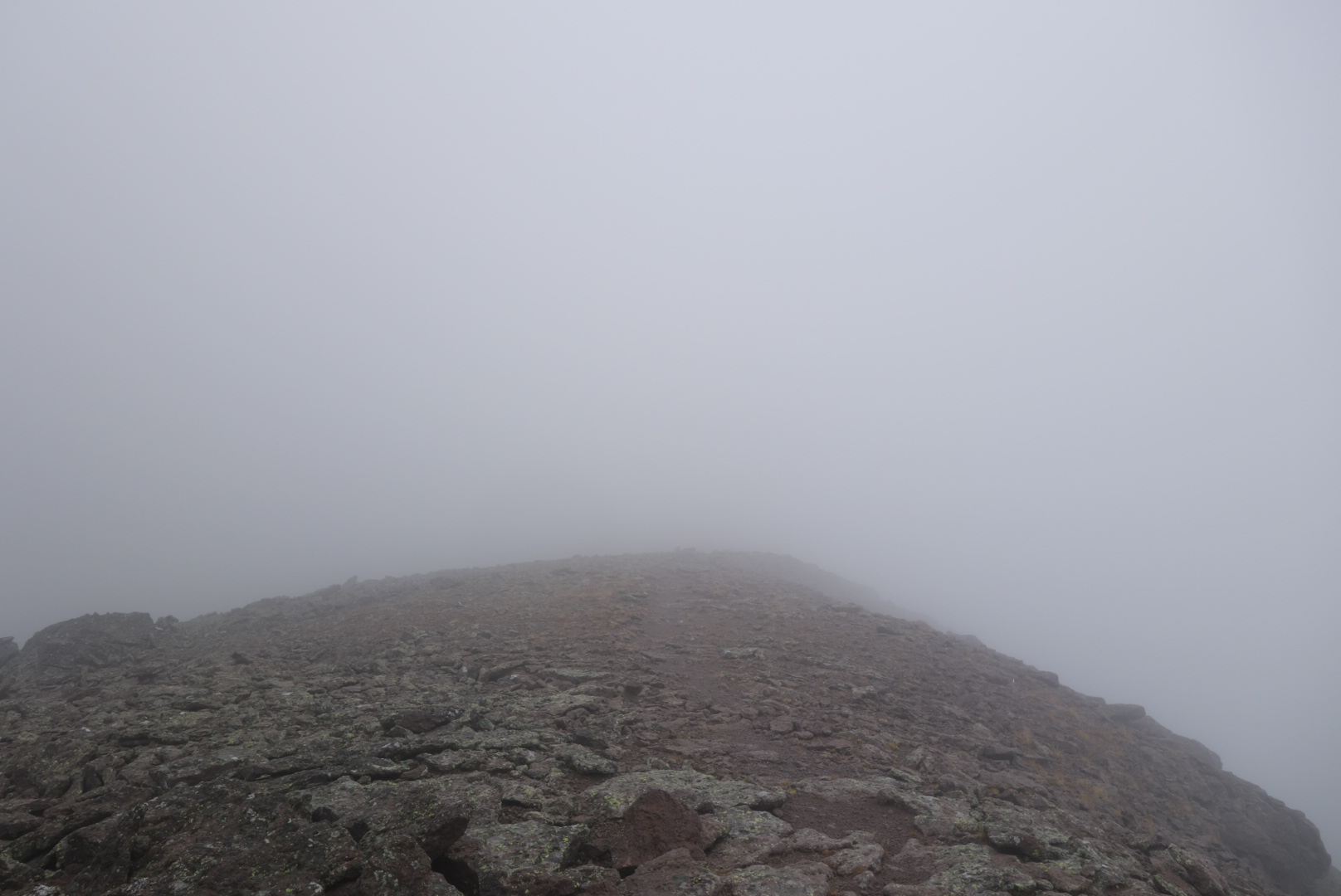
In the morning, the weather was no better. It was misting and windy. I was basically walking in a cloud. I would guess the winds gusted to 30 mph.
My morning weather in four easy photos. 1) started out a little drizzly2) on the ridge, the clouds descended, rain increased, visibility reduced.3) winds even stronger (steady wind from the right) & visibility dropped to 20 feet
4) hat is a cairn in front of me. Visibility about 10 feet, wind about 30 mph, and stinging mist. Thank goodness this wasn’t snow.
I later came down out of the clouds. The trail went down to the Piedra River. I managed to follow the horse-men’s trail, not the hiker’s. It started raining consistently for an hour as I reconnected to the hiking trail via the Turkey Creek trail.
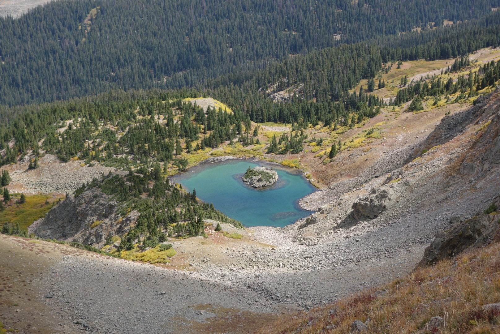
As I reached the top of the valley, I came across a beautiful little spring-fed lake. The crystal clear water was gorgeous.
I did not know it at the time, but these clouds would later turn ferocious.
I climbed up one side canyon and stopped to get my last water before I went above tree line. I heard thunder and saw a clump of clouds. To me, it seemed like a passing cloud. I wanted to make miles. I wanted to camp high. I had been through bad weather all day, what was a little thunder cloud to me? I decided to go up.
Just as I was in the transition zone between trees and no trees, there is a stretch where there are clumps of short spruce. they are spaced kind of far apart. Kind of small pioneer forest outposts above treeline. As it became clear the thundercloud was coming straight t for me, I looked for a clump where I could duck or crawl in for some temporary protection from the rain plus I would no longer be the tallest thing around. So, I pushed aside some branches, popped open my umbrella, and pulled my knees up to my chin while the cloud passed.
It did not pass. It stayed. Or it was a lot longer than I suspected. Regardless, after 45 minutes of huddling underneath my umbrella and getting colder and wetter, I knew I needed to do something. This had all the makings of hypothermia.
I broke some branches and found an awkward configuration for my tent. I tried setting it up, but two forces were working against me. The first was the wind that was gusting up the mountain. The second was the decreasing dexterity of my fingers. The gloves were soaked. I struggled to grab the lines and stakes. After taking about twice as long as normal, my tent was up. I gathered large rocks and put them on top of each tent stake to hold them in the ground.
I tucked inside the tent. The wind had picked up. The lightning was still going, and the rain was relentless. I got my sleeping bag unfurled. From my clothing sack I took out every piece of dry clothing. I stripped off everything I had on. The hardest were the wet socks. They clung to my feet. My fingers were useless. And I was shivering like crazy. Eventually I wriggled 0ut of them, put on my dry clothes and buried myself in the sleeping bag.
By now, I was shivering uncontrollably. I pulled the bag around my head. Through the bag I could see the lightning flash. One one thousand, two one thousand. Boom. The next one was closer. I told myself I was not going to die this kind of death: shivering cold and struck by lightning.
Somehow, I dozed off and woke up around six. I was no longer shivering, but my hands and feet were a bit numb. I struggled to eat with clumsy hands. The lightning had stopped, but the wind had picked up. I hoped the hope of all hopes my cuben fiber tent would stand up to the beating by the wind.
I ended up dozing off between wind gusts. Many times during the night I found myself pushing on the side of the tent, a counter-force to the wind. I was not sure what I would do if some of the stakes came up. I was sure I was going to make it through the night, just not with a lot of sleep.
It was kind of eerie hiking with just a headlamp through a closed-in forest. It was very cold and my breath created little clouds which the light penetrated and then I penetrated. When I came out of the woods to a small meadow, the grass crunched underfoot. I was near Hunt Lake. I kept turning around to watch the sunrise. It was so cool. There was a blanket of low clouds covering the land below. Then, some mountain peaks poked through. Lastly, there were clumps of clouds higher up. All in all it created a three level sight. My weakness as a photographer really showed at this time.
I kept climbing higher and I began to get into snow. Between the time I left my campsite at Boss Lake Reservoir at 11,200′ and reached the apex of the trail at Bald Mountain at 12,500′, I had gone from cold to winter. hiking above treeline in the snow was slow because the rocks are slick. It was maybe 3″ deep, so I was only worried about falling, not sliding down the side of the mountain. Still, I couldn’t help think of the headlines if I did my end here: “Balding Hiker killed on Bald Mountain” or “Bald Mountain Claims One of Its Own”.
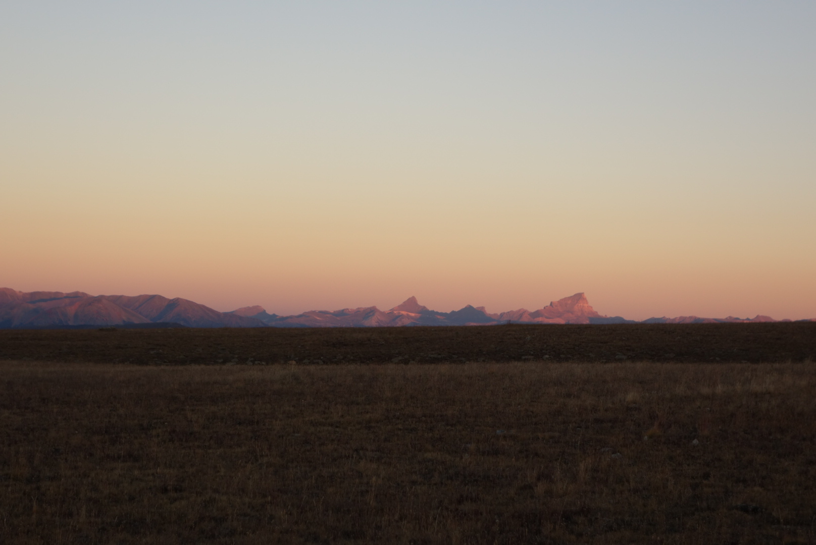
More concerning was a glance south. My first glimpse at the San Juans. If you have the misfortune to have read previous posts, you know the San Juans are the big deal for Southbound hikers: get through before winter snows. As I looked south, it was clear they had received a lot more than my 3″ of snow. Better get moving.
I did make fairly good time. The trail went along a ridge line and as the sun rose, the snow left. There was even an interpretive display in the middle of nowhere. Later, the tril went through the Monarch ski area. Strange to think in 90 days this would be flooded with people.
I made it to the Monarch Crest Gift Shop around noon. This place is on the trail, holds packages for hikers, and has both packaged and some “fresh” food. When I visit a place like this I generally try to make a purchase and also charge electronics. I did both. Of course, I did not do anything until I looked sharp with a new pair of shoes.
Hiker Tip: At the Monarch Crest Store, lower your expectations for food. With the exception of chili, ice cream, and fudge (not a trio to be messed with, by the way), everything is prepared as follows: remove prepared item from fridge, microwave, serve to customer. As a result, both my egg sandwich and my hot dog had weird textures. However, the chili dog was an upgrade.
I ran into Sampson there. No, not the strong man. Trail name. He started Nobo this spring, hit snow, broke his leg and rehabbed. Now, he was chunk hiking his way north again. He still had a noticeable hitch in his giddy up in my opinion. He was waiting for his resupply package to arrive, so we chatted for awhile. Nice guy and I hope he finishes the trail in good health.
With junk like fudge, elk jerky, and Fritos, at 3:00 I left the store at the same time as Sampson. Almost immediately, it started snowing. I signed the register and was surprised to see a couple names of people who were far back previously.
The weather cleared and the trail provided some great views. It was nice to walk up high and switch between forests and open spaces. I found some water late in the day. Above treeline, I found a level campsite behind a clump of spruce. The wind settled down after the sunset and I had a great evening after munching on junk food and watching the moon rise over the ridge above me.
Today would be a day of many climbs. I wanted to get close to my resupply at Monarch Pass. To do so would require a long day.
In the morning I went over one ridge and came across a high bowl in the canyon. I saw something I had never seen before. A herd of deer were standing in one of the shallow ponds common in these high meadows. A few were wrestling each other. It was cool to watch them play, but eventually they got serious and wandered off.
Next I climbed down a steep descent to the North Fork of Chalk Creek. It is tough on a hiker’s psyche to go downhill and look across the valley knowing you will have to climb all that distance back up. Also annoying to me was that it appeared somebody had ridden a motorcycle up and down this trail when that was not allowed.
Once I had climbed back up, I was in valleys that formed the headwaters of Wildcat Gulch. I met a hunter. He was in camo clothing. He and I commiserated on the absence of elk in this area. He said his buddy with an elk tag was still out there somewhere.
Curiously, the trail crosses a historical anomaly. There is an abandoned alpine railroad tunnel. It connected Denver and Gunnison, was in operation between 1882 and 1910, and was a narrow gauge track. I am guessing it was not a huge financial success, especially since it ran alongside Mount Poor (I cannot make this stuff up). The tunnel, reasonably, is today sealed shut, but the rail bed provides a gradual descent for a few miles.
The old railroad bed carved through rock
Next came a still active mining area called Hancock. It always amazes me there are people who hold on to stakes and are weekend miners. Hope springs eternal. A bad by product, in my mind, is dicey water. I saw a few creeklets coming out of mines that were an other-worldly color and they fed in to the main stream.
This was the resident ham in Hancock. Liked having his picture taken.
Hiking uphill the temperature dropped and the skies darkened. Near the head of the valley is Hancock Lake. I met a couple Colorado Trail (CT) hikers. They were in good spirits and that boutyed me for my third climb of the day, Chalk Creek Pass.
This ptarmigan was very talkative for some reason
Just as I crested and checked for a cell signal, thunder boomed from the direction I was going. Undaunted, I went down. I ran into another CT hiker. He was struggling a bit, so I gave him as much encouragement as I could.
As the evening wore on, I followed more new silly trail. It was new, marked CDT trail. However, it was another one of those sweeping, swooshing trails that felt like a slalom course. What was silly about it was that it often crossed a straight forest service road. Oh well.
At the bottom, there was a bridge that was being repaired. Despite signs indicating there was no bridge, there was patently a bridge across the creek. Granted, it was not highly engineered, but for somebody this long on the CDT, a log and a stick are good enough.
Lastly, I pushed to get up to Boss Lake Reservoir. It was up high and had views.
Given the various roots and rocks that I slept on, it was not too difficult to pop up and get going. I was cold, but when I got to my first valley with a creek, it got real cold as I filtered water. There was frost everywhere. To make things a little better, it was shaping up to be a beautiful sunrise. Rich, puffy clouds across the horizon. Unfortunately, I could not get out of the forest to get a clear shot and instead had to settle with a view west across the valley.
Eventually, after a choppy hike down another Gulch (Prospector, this time) I came to Texas Creek. It seemed a fairly popular tread, but during a weekday after school has started, I didn’t see any people.
Next up was Cottonwood Pass. Although a challenging uphill climb, there were parts with some old trees. They somehow make it feel like an adventure. Maybe its their size, but it makes me feel like I am hiking in a forest rather than through one.
Above treeline, I went through expanses of alpine willow. It is a tough shrub. While it no doubt serves ecological purposes, in this section it appears to live only to scratch backpackers and to let its fluffy seedlings fly away.
Near Cottonwood Pass, I met a fresh looking day hiker coming down the trail with his dog on a leash (thank you). I stopped and asked him where he was coming from as he was the first person I had seen today. He said”The parking lot.” I felt like a dork. I reviewed my maps and this time noticed a paved road that accesses the pass.
Sure enough, I crested the pass and saw the cars and the people. As I navigated my way around them, I felt a little out of place. I was still in shorts and my merino wool hoody was my warmth. I watched a few of them get 0ut of their cars and attempt to climb Cottonwood Mountain, but most would give up after a little while as the thin air took its toll.
There is a saying in backpacking which seems a little too mystical for my tastes. “The trail provides.” However, in this case, it was true. I had been struggling with how to get a pair of gloves. Ones from home would be too bulky. I needed a pair I could hike in, provide a little warmth, but allow flexibility to grasp gear. About a third of the way up Cottonwood Mountain, just beside the trail, was a pair of Mountain Hardwear gloves, Men’s XL. Perfect. No snot marks from wiping noses or blood from crimes. I rejoiced. However, I did pause for 15 minutes to see if somebody came looking for them. None did, so I trudged on.
Looking down at Cottonwood Pass from Cottonwood Mountain
There ensued some beautiful ridge line hiking with great views. Unfortunately, the wind got stronger and colder, so I put on some more layers. To give you a sense of this hiking, it means you are above all meaningful plant life. The trail is usually rocky or gravel. It can go over peaks or parallel around them from pass to pass. If there are alpine lakes, you can look down into them, getting a great glimpse of their blue or green depths. It is glorious. At least, if you are dressed for it. I was now, with my trail gloves.
Lost Lake. I found it.
I met a couple weekend hikers who were about my age. I was chatting with one. we noticed a younger hiker coming towards us. The weekend hiker asked me if the approaching hiker was a CDT hiker. I noticed the shorts, super light wind shirt, and absence of hip belt for his backpack and pronounced him a CDT hiker. He didn’t stay to talk. He was interested in catching another hiker that I had seen disappear in the distance. He was a younger guy and seemed to be that cohort of hikers who want to see who is fastest.
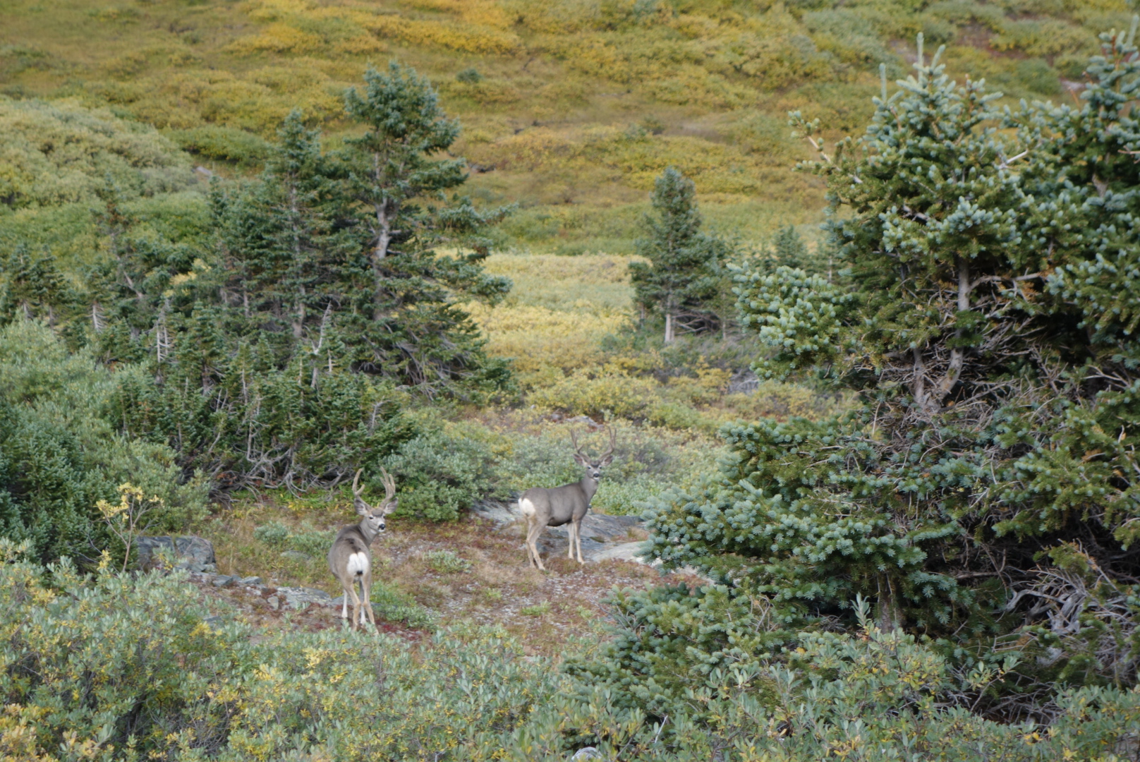
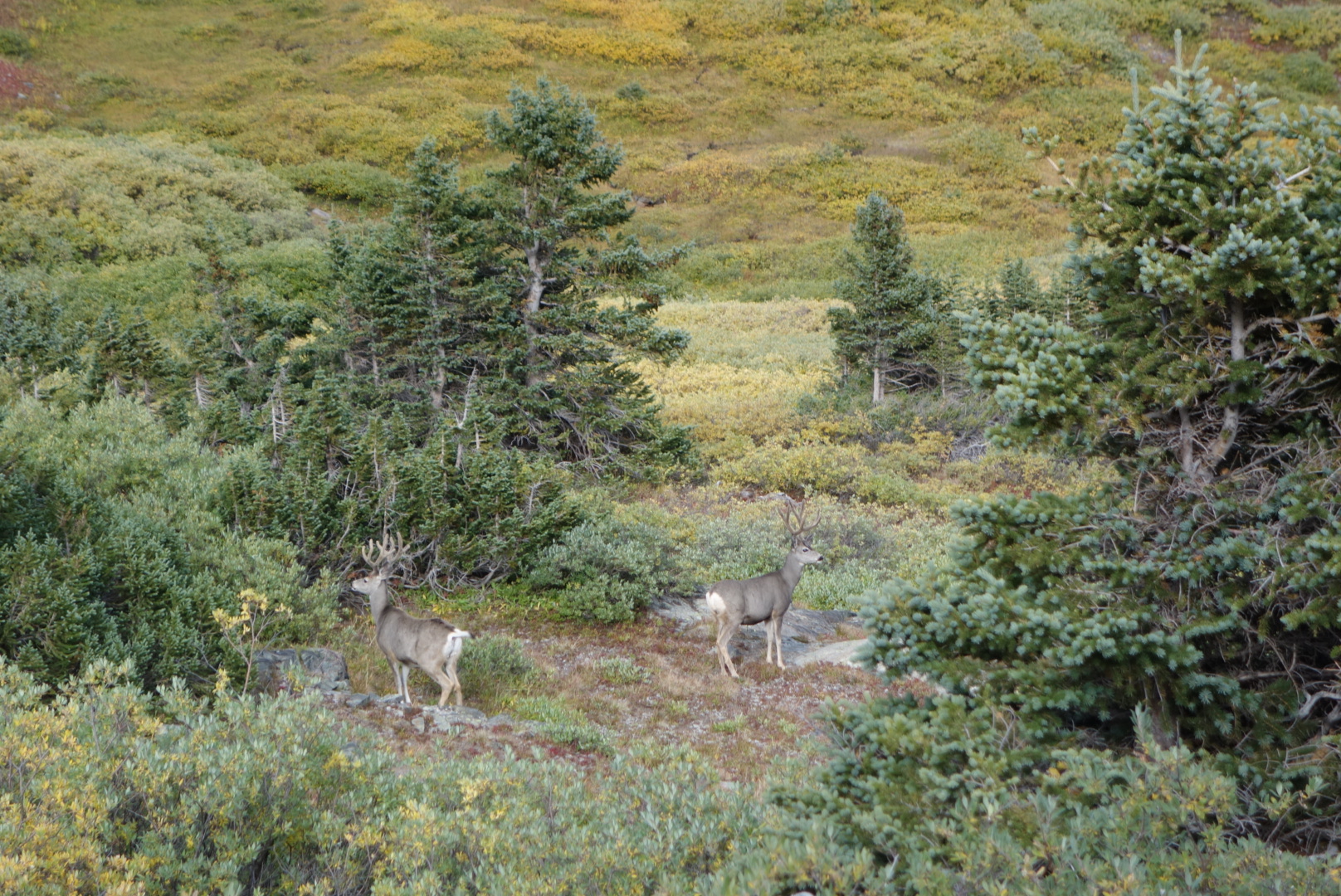
Once I got on the other side of the ridge, the wind died down. I came down into a box canyon. I came across two buck mule deer. One was a little nervous, but the other could not care in the least.
I could’ve hit ’em with rocksNice antlers on these guys
Since I was going to be above tree line, I knew finding a rock-free campsite would be my main challenge. I started my search earlier and found a spot just before Emma Burr Mountain. (on a side note, the obvious attempt to honor Ms. Burr is wasted. On the topographical maps I had, her last name appears with a grid line through it at the precise point over the r’s thus showing the 13,000+ mountain as “Emma Butt”).
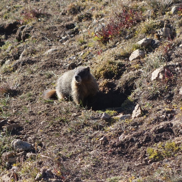
I set up camp in the cold, fading light. I was surrounded by pikas who lived among the rocks and boulders that came off Emma. Were they nocturnal, I wondered.
The highlight came when I looked up the cliffs. A mother mountain goat and her kid were feeding. These creatures are so graceful. It was fun to see the mother effortlessly jump from ledge to ledge to get to better grazing. Sometimes the kid could follow, other times it had to work its way around. What a great way to close the day.
That night, it was windy at first, then rain, then ice and then silence. Mountains have their own weather.
We both got up and going early. I liked how Dan got going in the morning. It matched my style. Some people like to sleep in or linger over a cup of coffee. Dan, fortunately, liked to get down to business.
Met solo southbound Colorado Trail hiker. In the small world category, he also was on Ski Patrol and knew Wash Pot. We hiked with him for ahile, but then he shot ahead.
From the blog entries, I may give the impression everything is either uphill or downhill. Not true, we came across an area with some beautiful mountain lakes. We ate lunch at a small one just west of Galena Lake.
I cannot recall whether Dan was looking at something or vomiting.After all the rain, mushrooms came out in style. My phone is on top to give scale. No, I did not eat any.
Unfortunately, there was a huge descent ahead. It was a drop of 1,500 feet to the trailhead near Turquoise Lake. We agreed that the bottom may be a good spot to call it a day.
At the very bottom, we managed to make a stealth campsite and have a good sized fire. We agreed that we would hike solo over the next two days. I needed to get going on my itinerary if I was to avoid snow in southern Colorado. Dan was cool with this. Plus, I took a lot of comfort seeing how strong he was with backpacking skills.
We celebrated as best we could. I ate two dinners: my last and one of Dan’s extras. The night was perfect and I cowboy camped so I could get going quickly in the morning. Plus, Dan got his trail name: T-bone. Not an inconsequential achievement.