I left with my new, bright headlamp. For the first half hour I was cruising, but I could not believe how cold it was. Surely, I struck an odd figure walking down the road with a headlamp and my hands tucked under my armpits.
I was supposed to follow a trail off the road. Could not find it. I bushwhacked in the direction I should be going. Eventually, I crossed a path. It didn’t look exactly right, more like a horse trail. I followed it in the cold for ten minutes, but gave up when it went the wrong way.
Eventually, I got on track. This time the trail was marked by wooden posts with paint on top. The trail goes by a closed museum and then cross country along a fence line. Later, it climbed a forest service road and the temperature also warmed.
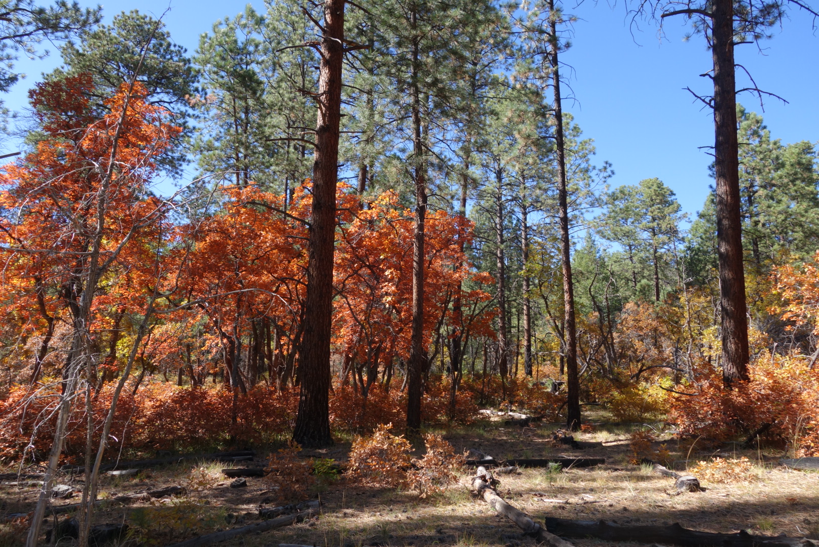
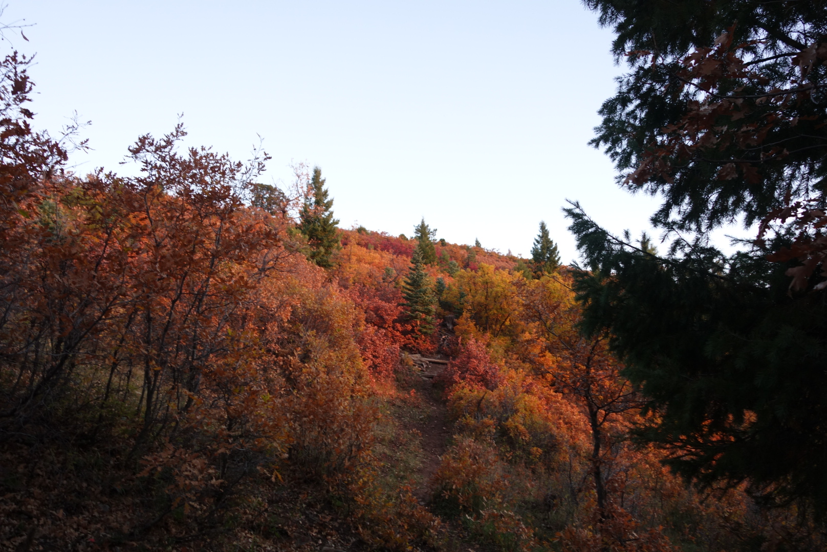
Colorful oaks under the ponderosa’s canopy
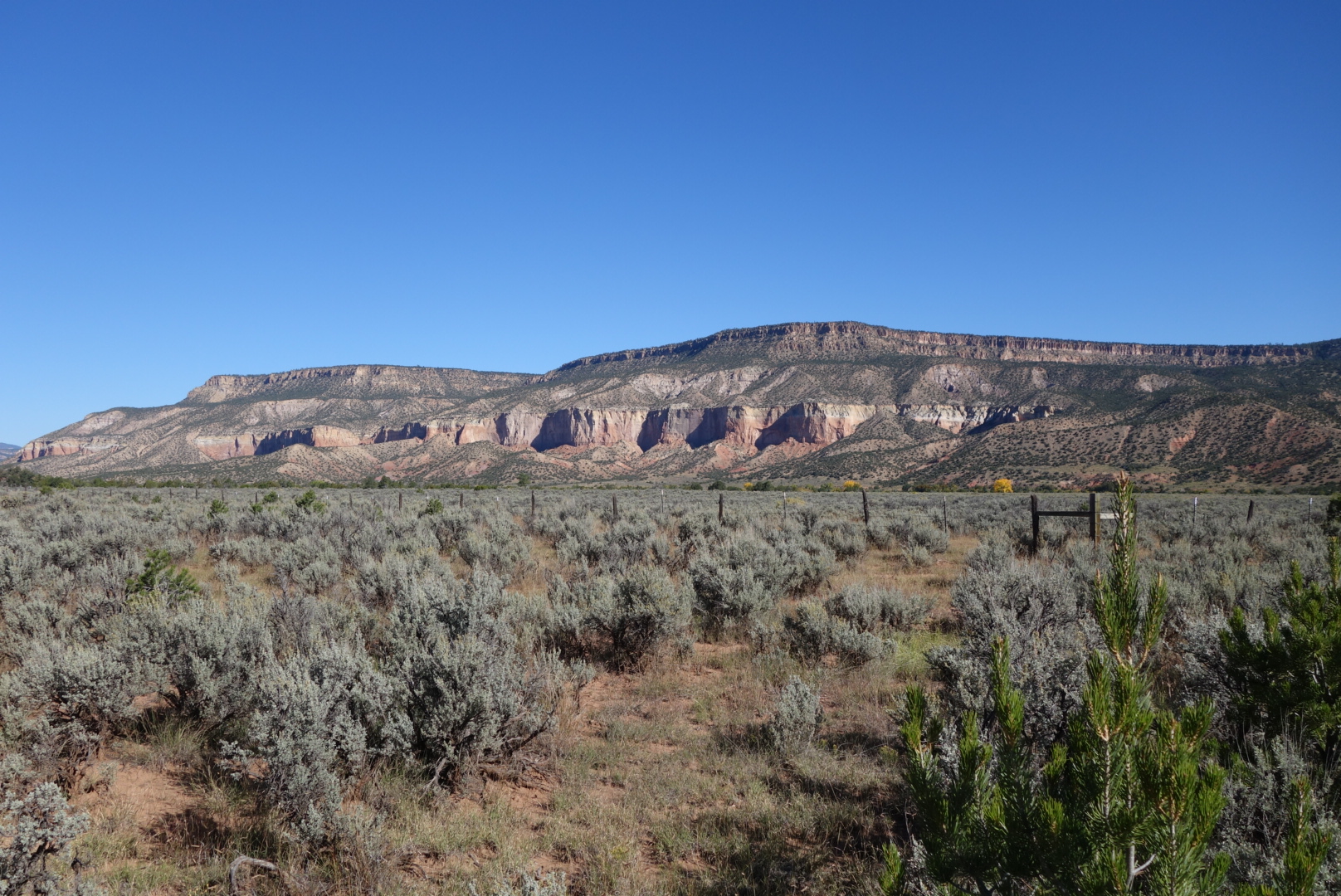
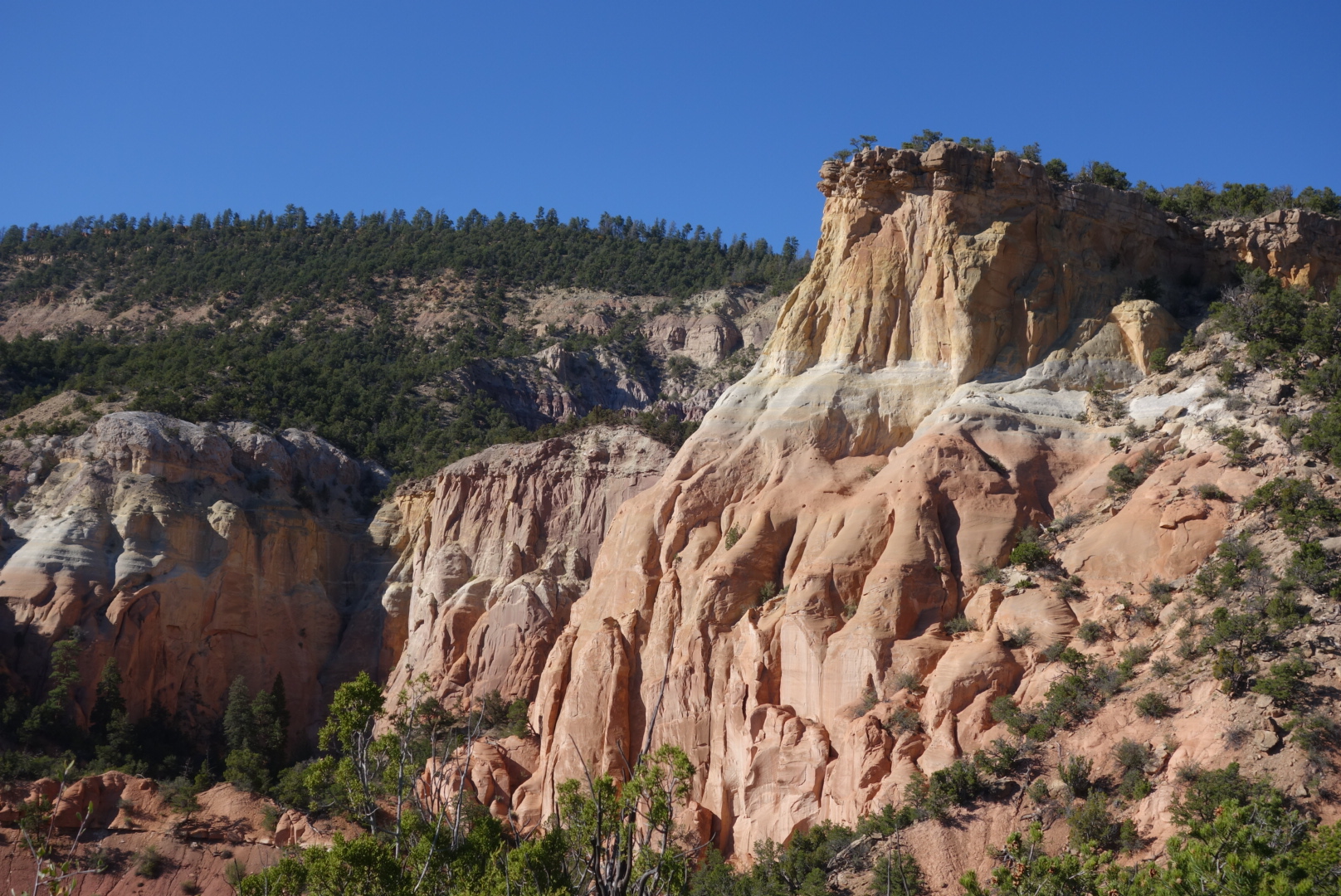
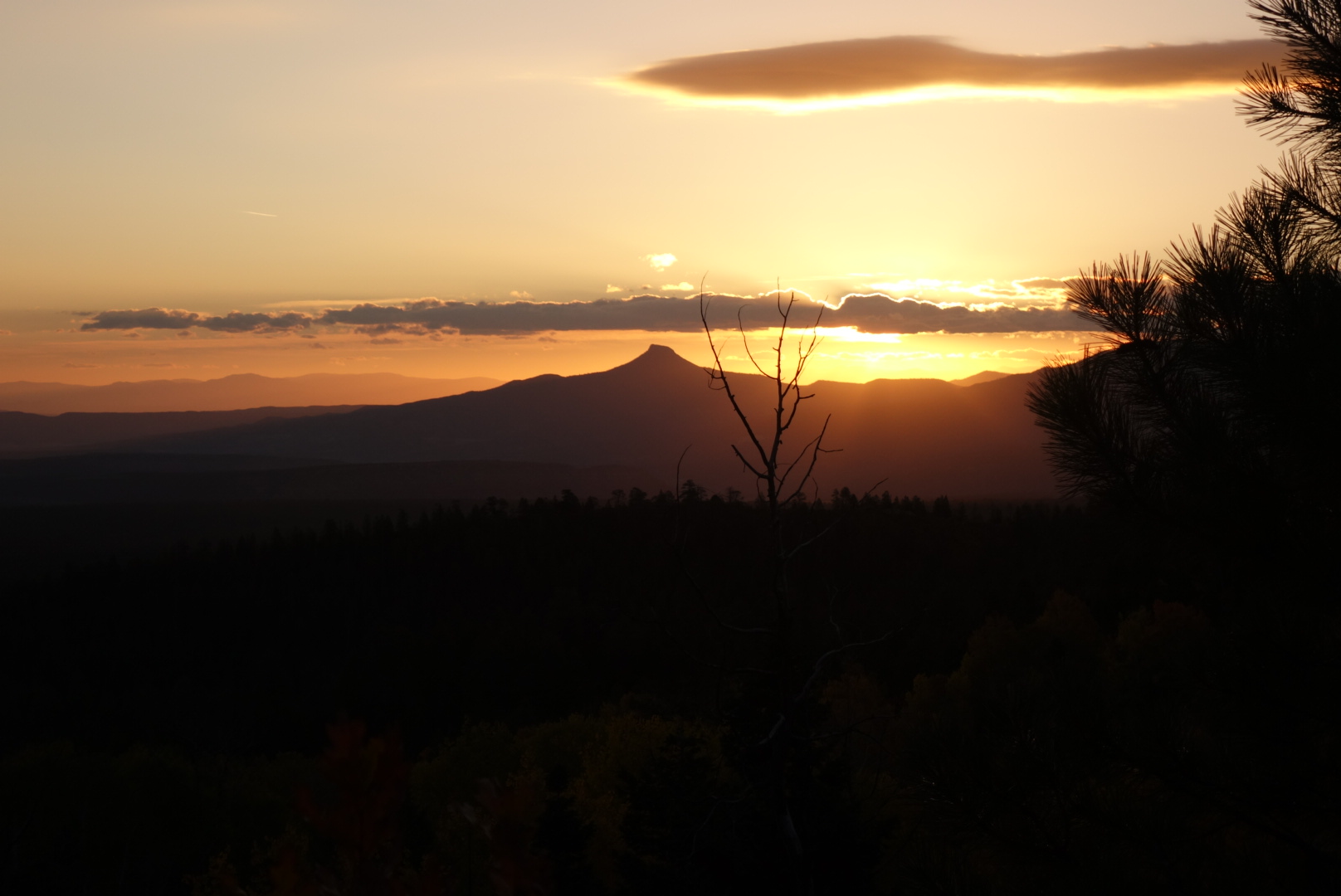
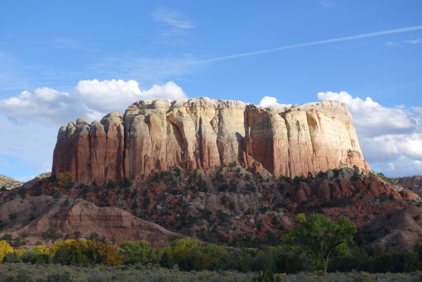
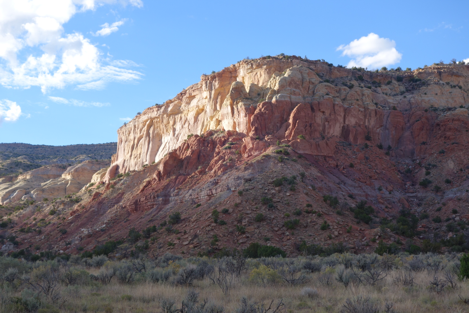
Later in the day, some sandstone cliffs
After following a small stream uphill, the trail veered off for some gentle climbs. Late in the day, the trail came down and paralleled a forest service road (not my favorite). Across the road, there was a cow path and a small herd was moving single file in the same direction as me. The game was on. Let’s make sure we all understand I was carrying a backpack, it was unfamiliar territory, and my trail took turns. So, the fact the cows hiked faster than me over a half hour period should NOT be a surpirse. Frankly, I think they cheated.
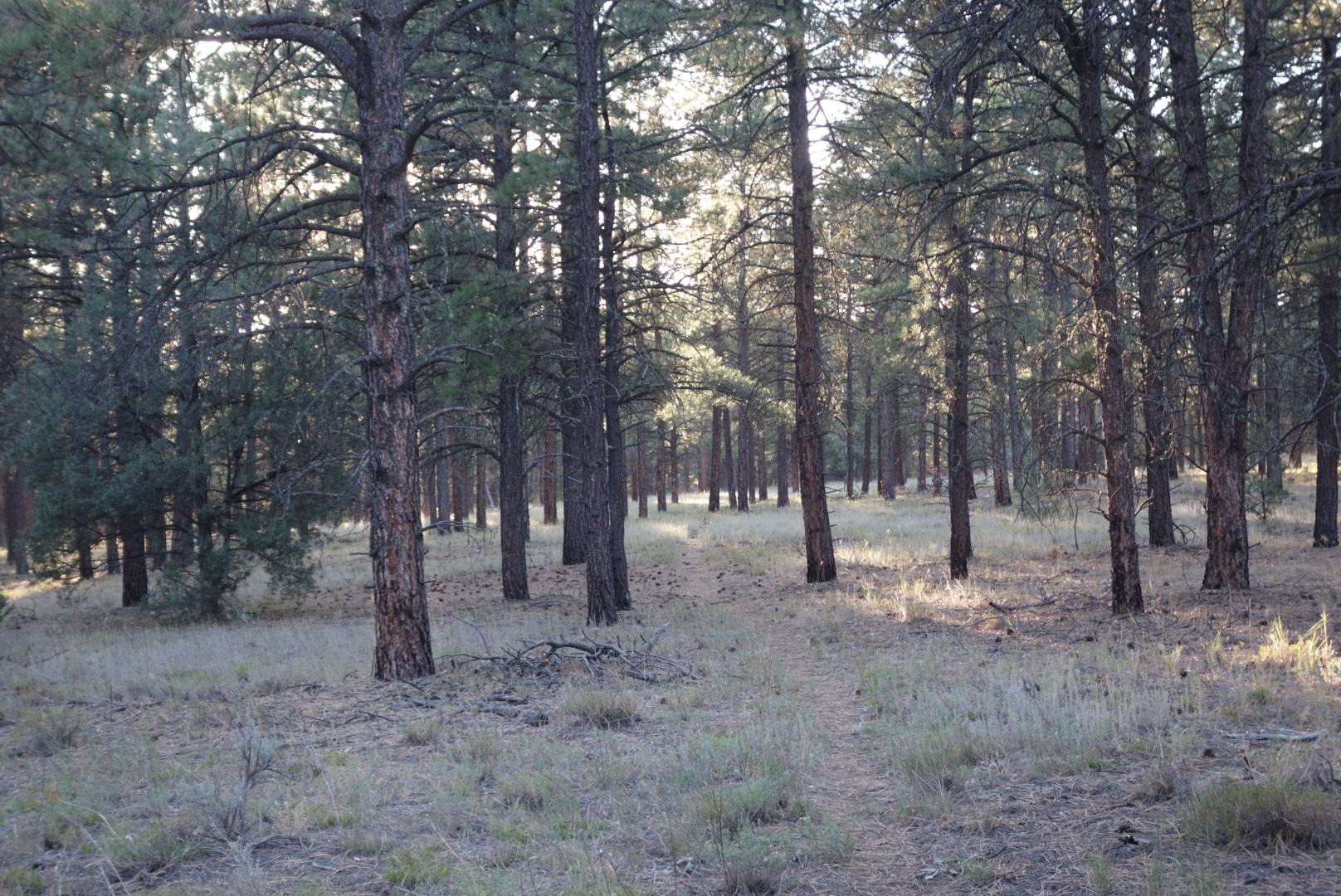
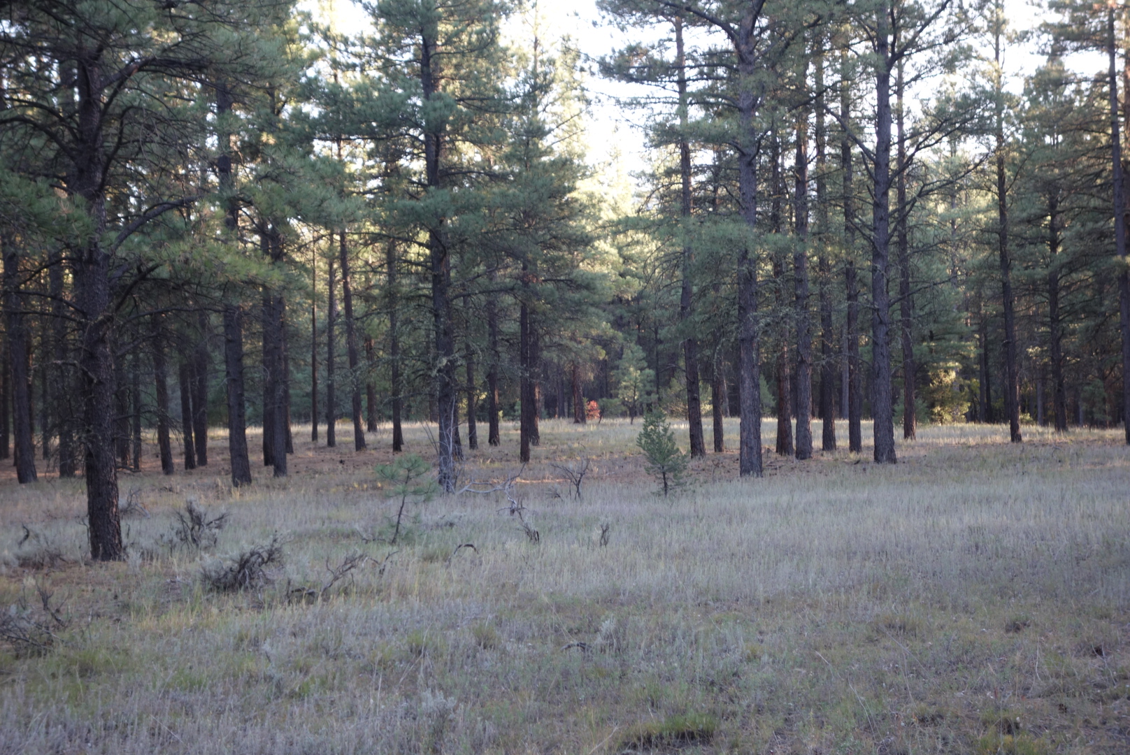
In the evening, the trail wove through level, open forest
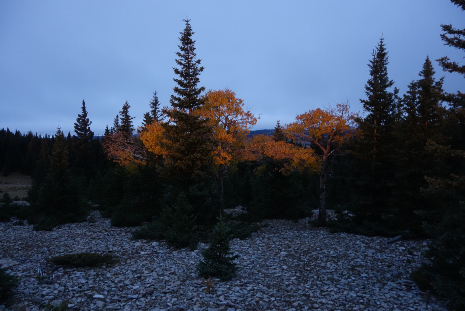
A solitary bit of fall color
After crossing highway 92, the trail followed rolling ponderosa forests uphill. I eventually found a flat spot just before the route steepened. I cowboy camped. Around 9:00 I was woken by some branches snapping about 50 feet awauy. I turned on my headlamp and had about 40 glowing eyes looking back at me. It was a cow herd. Later still, there must’ve been two coyote packs fighting over territory because it was a pretty extensive period of growls and barks. Not the sounds of a hunt. Still, I managed to sleep.
I cruised along in the morning. I was a little surprised to see a headlamp behind me, but it was SBJ and MLL. They easily passed me as they are great hill climbers. The morning would be spent going up an old trail.
The trail was uphill but not as bad as I had feared. It eventually topped out in the San Pedro Peaks wilderness area. It was mostly flat and had several meadows and grassy flats they called parks, for good reason. I did encounter two pairs of other hikers. Complete opposites. The first was two guys. “Hi” was the substance of our communication. The second was two ladies. The lady was very familiar with the CDT.
Descending, the trail rapidly went from alpine, to pine, to mixed deciduous/pine to, finally, shrubs. The descent was along a stream that caught the sunlight and had colorful leaves floating in the pools. Why does anybody hike this trail northbound?
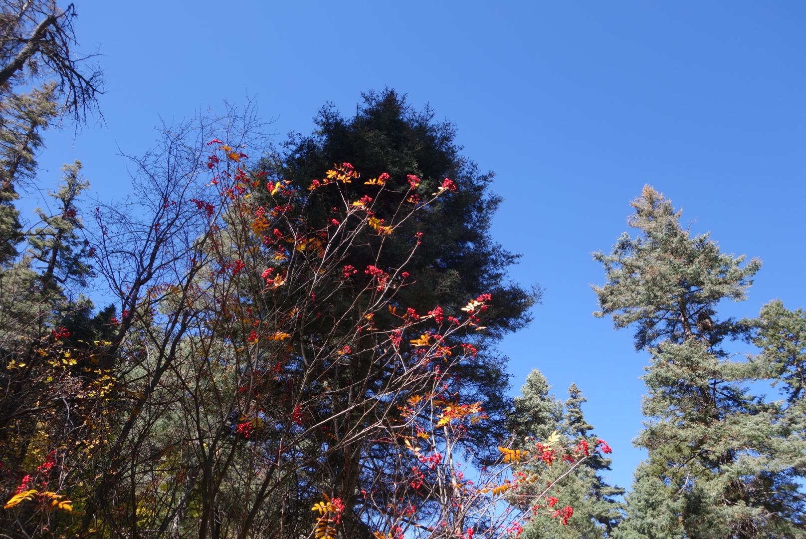
Red berries missed by the birds.
SBJ, MLL, and I road walked in to Cuba, New Mexico. I stopped at the Frontier Motel where I would find my resupply and my old Granite Gear backpack. Cuba was a typical fading New Mexico town along a highway. It had some great points. El Bruno’s was a great restaurant. The Frontier Motel was pretty good, with an almost brand new bathroom and the manager (Rosemary) was great.
After visiting the two museums on site, I checked for my packages. They only had one: the filter. That was the most important one, but I wanted the headlamp,too.
Later, I found Sweet Baby James and Moon Light Lady (SBJ and MLL). They were just swinging by top pick up a package. The Ranch gave them a bit of run around saying they had to rent a campsite in order to do laundry or purchase a shower. I let them use my room’s shower. They stayed for lunch and left later in the day.
After asking twice more, I went in and talked to a volunteer around 6:00. He found my second package right away. It had also been delivered around noon. I guess its about asking the right people.
I packed up and got ready for an early AM departure.
I tried to sleep in and get some rest, but I am conditioned to get up and get going. However, I was extra grateful I had made it into town as there was a huge downpour about 2:00 in the morning.
I walked around the facility and was impressed. It can host up to 400 people and tends to cater to small groups interested in archeology, painting, writing, photography, religion, etc. Ghost Ranch, incidentally, has been used in many movies, notably The Magnificent Seven, 3:10 to Yuma, The Missing, and City Slickers.
When I was there, painting, writing, and archeology groups were there. The painting group would take up stations around the campus and try to paint landscapes, much like Georgia O’Keefe. I amused myself by going up to them and saying things like “That’s good. You should take lessons!” or “You really did well with the number 5 color.” No, I didn’t.
Basically, I did town chores and caught up on some blog entries. It is a lot of work to keep a blog going from the trail. After a tough day on the trail, the last thing I feel like doing is write a blog entry. And then screw around with photos, formatting, and posting. However, whenever I feel that updating my blog is difficult, I think how awfully painful it must be to read it.
Well, you know about my headlamp issues, so I won’t rehash them. The general frustration is that daylight is precious. Days are getting shorter and they get shorter as I head south. I need to get miles in if I want to complete the trail this month. Hiking in the morning fits my personality and helps solve this loss of daylight.
This morning presented a new challenge. Either at my last water source or climbing over the blowdowns, I lost a key part of my water purification system. This was bad. You simply cannot hike through cattle-happy New Mexico without a water filter. I was able to reach Helen and she performed a few Sunday miracles and arranged to get a headlamp and water filter sent to me via overnight at Ghost Ranch (my next destination).
Even though it is elk season here in New Mexico, I still enjoy walking quietly in the morning and coming upon a herd or a single bull. I came across a few bulls in the morning and they couldn’t figure me out. I slowly reached for my camera, but they seem to be able to detect the sound of a camera case snap with great clarity.
I saw a few bull elk just after this section of trail.
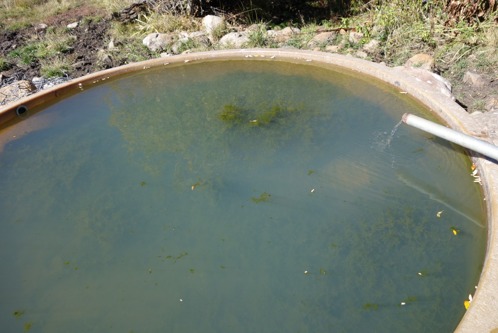
“The trail will provide.” So goes the saying. Well, in mid morning, I came across a cattle tank where the rancher had elevated the pipe containing incoming ground water. The tank and pipe were accessible to the public in this case; usually ranchers fence it off. I was so relieved to find fresh groundwater and tanked up for a full day, about 3 liters.
May not look like much to you, but that piped water was a beauty to me.
It was forest in the morning and then switched to mesa. I find that I can hike fairly fast on mesa, mainly because it is flat. Also, I was mad at myself for losing my filter and I find I hike faster when I am mad. The upshot was that when I sat down for a snack at 1:00, I realized I might be able to make Ghost Ranch tonight instead of tomorrow. If you have followed this blog… Ok if anybody had followed this blog, they would know the reward of town food is motivating to me.
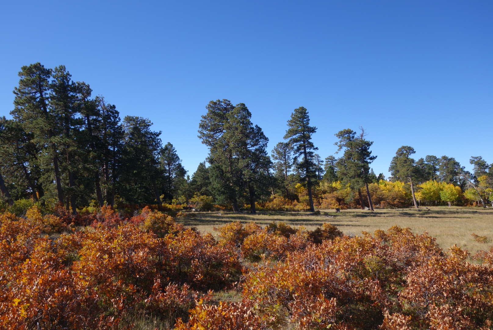
The hills mellowed out in this section.I dubbed this the Eileen forest. Due to the prevailing wind the ponderosa’s all grew slanted to the left.
I cranked up the hiking a notch and followed the alternate that went directly in to Ghost Ranch. Ghost Ranch is famous for Georgia O’Keefe and her landscapes. It is a Presbyterian retreat center open to all. Through-hikers can stop by and enjoy the all you can eat (AYCE) meals.
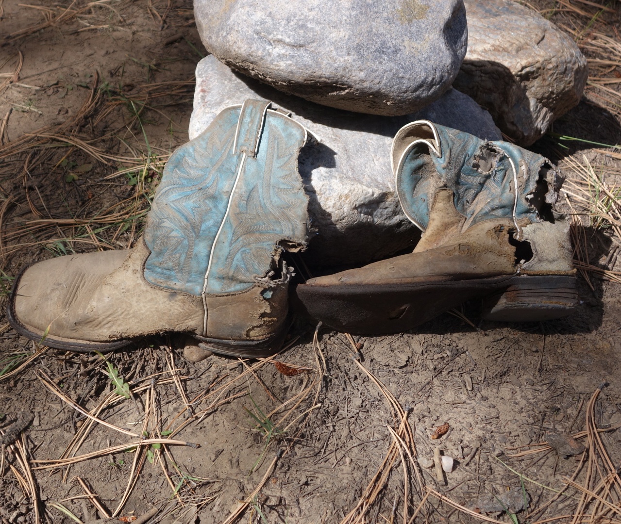
It’s amazing what you find….
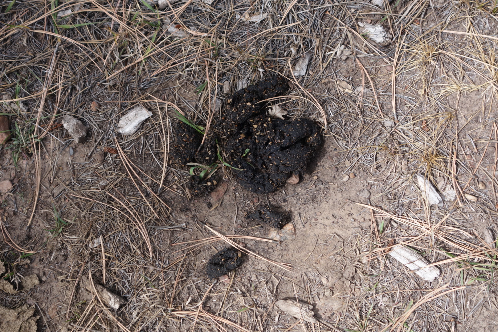
The alternate to Ghost Ranch follows a gently sloping mesa and then descends sharply into a desert canyon. While I was on the mesa, I encounterd a larghe lump in the trail that created a lump in my throat: bear scat. On closer examination (yes, I did), it appeared to be heavily tilted towards acorns. Perhaps these black bears are related to the Glacier Park grizzly and tend to be vegetarian.
Acorn compote
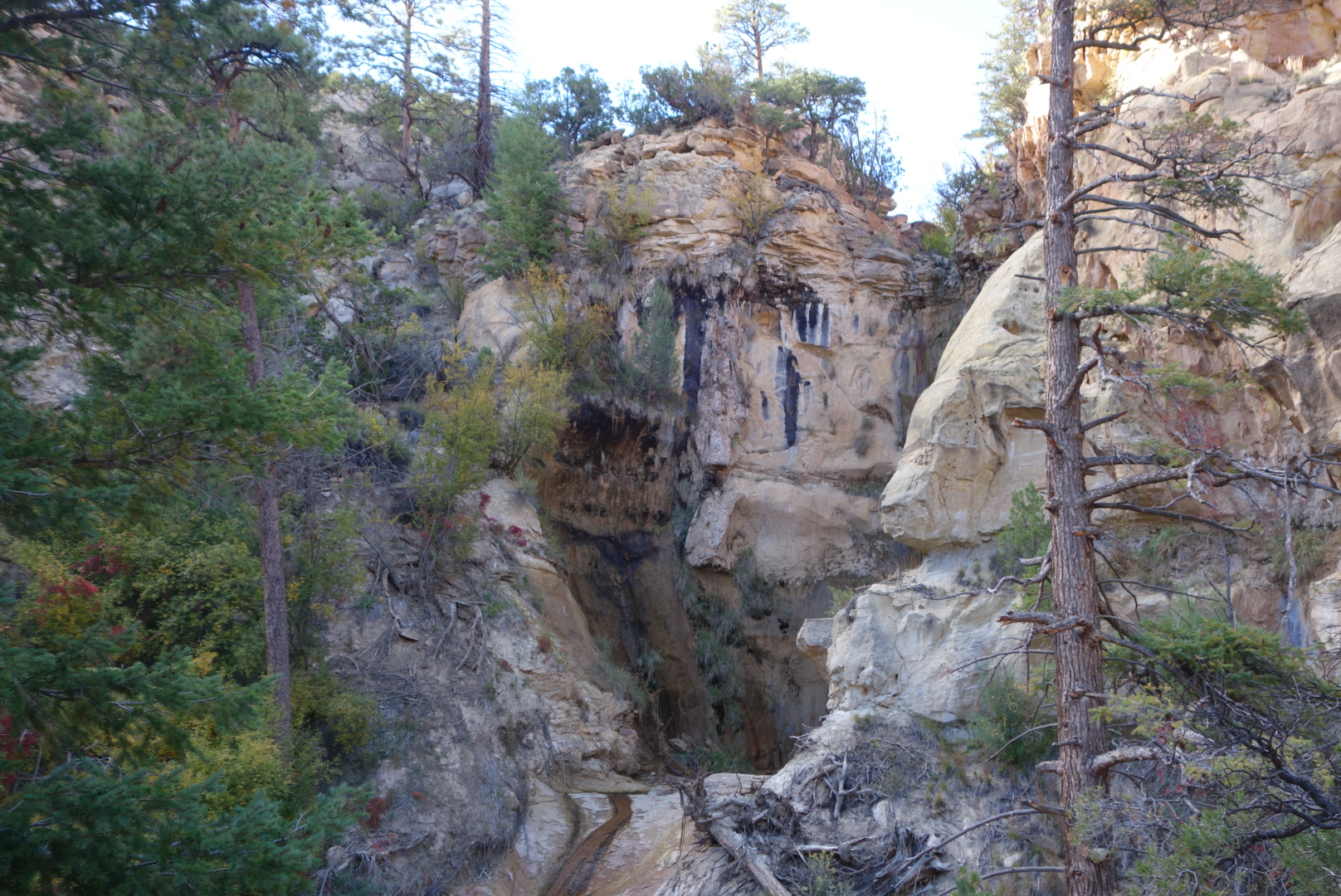
As I dropped down off the mesa, the trail was challenging. However, the change in the ecosystem was awesome. Within a mere quarter mile the land turned to desert with prickly pear, cholla cactus, and sandy soil. There was a small stream at the bottom of the canyon. I was in cruise control and went by some day hikers. As if scripted, right after passing them, I slipped on a tiny rock in a tiny stream and fell on my butt. The mighty through-hiker shows ’em how we do it. More seriously, my replacement Zpacks pack started making weird squeaking sounds…similar to those the last time when the original one failed in the field. I decided to have my old pack sent to Cuba, NM and not risk having the Zpacks fail on me in the desert.
I recovered from my fall from grace and made it to the registration. Got a room (campsites are available) and was ion time for the AYCE dinner. In full disclosure, I did offer to buy two dinners knowing I would eat a lot. They said it was fine and they were used to hikers. While the food was not the best (think college food service), it was plentiful. I ate thoroughly and was glad for the fresh veggies.
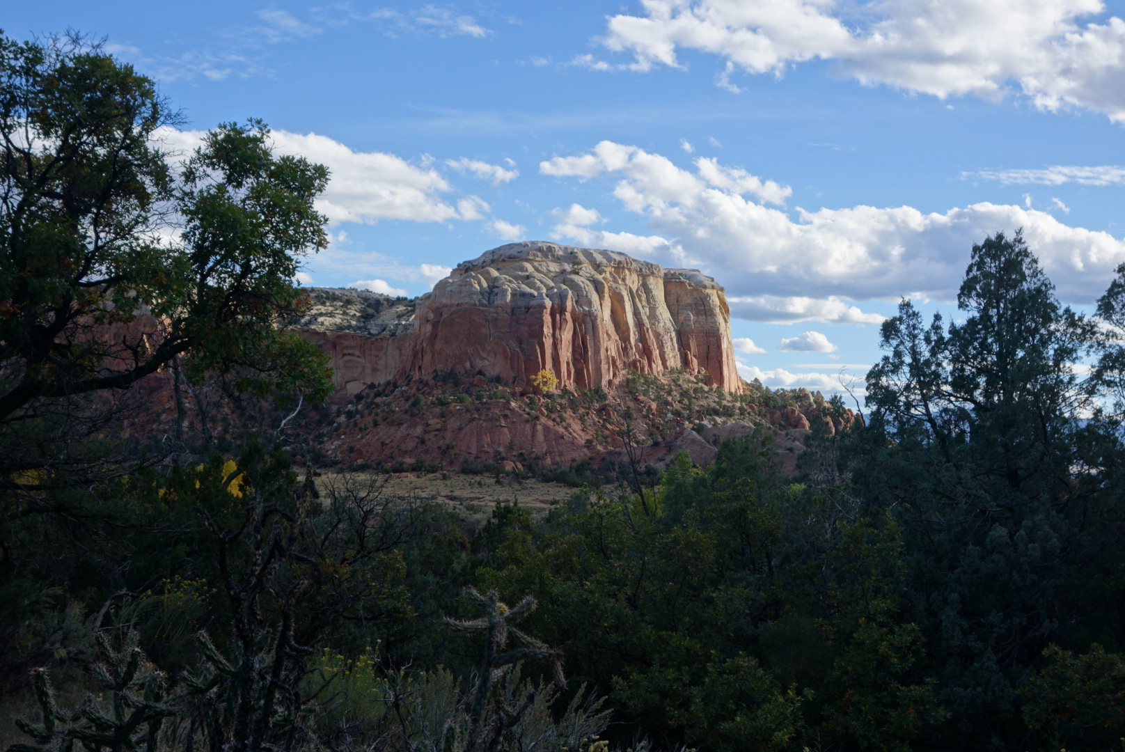
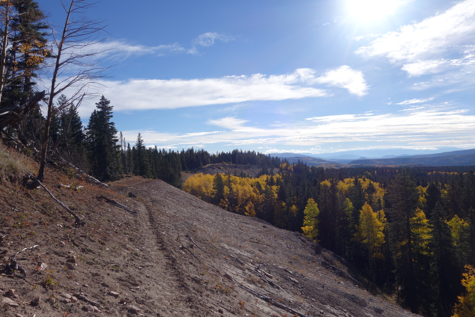
Descending to Ghost RanchI can see why people come here
I tried to get going early. For some reason I woke up at 3:30 and stayed awake. There was some creature breaking branches deep in the dark, motionless forest which did not help. Unfortunately, my dang headlamp was stuck on an even lower setting so hiking in the dark was out. So, I packed up and huddled around my gear until just a little dawn showed through.
The headlamp I have is from Black Diamond. It came with an instruction sheet that unfolded into a sheet of paper large enough to sail a boat. I would not be surprised if it offered instructions in Esperanto. It can strobe, glow red, lock itself, and have high beams and low beams like a car. All these functions are achieved through a series of taps and holds, like Morse code, via a button on top. The first thing any real man will do is throw away an instruction sheet bigger than 8 1/2 x 11, especially if it has Esperanto. In the field, the lamp unilaterally decides its base level. If it is high beam, great. If not, and you haven’t memorized the code of taps and holds, you are screwed. I was screwed. Even doing the old computer reboot by removing the batteries did not seem to work.
Once able to move, I made great time. It was fantastic hiking for most of the day. It was high forest of mixed deciduous and conifer. There were plenty of elk. I went around the Vallecitos Ranch which is a wilderness retreat center focusing on mindfulness.
Later in the day, I got my final water supply before moving away from water. The trail then went on a weird tangent. Somebody had posted a sign about a reroute due to dangerous trail conditions. It said to follow the flagging for an alternate. The problem was there was no flagging. Regardless, I eventually got synced back up. The trail went through an aspen forest blow down. There were a few hairy workarounds.
As with most things, it eventually cleared up. I was in high meadow territory. I climbed to the crest where a forest service road crossed and I found a grove of young aspen. I was able to cowboy camp. There were some hunters across the valley, but they were pretty mellow.
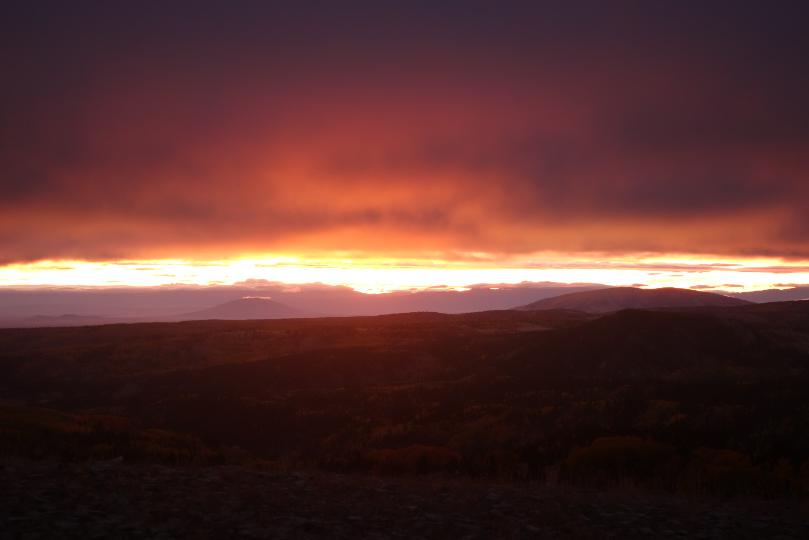
I woke up and walked slowly along the ridge. My headlamp, for some reason, only goes on the low setting, so I had to walk slowly. I passed the Brazos Ridge Overlook as the sun came up. It was a beautiful sunrise but then the clouds rolled in and I was walking in a cloud in the morning. I came across five gallons of water left by a trail angel, but all the water was gone. (In trail jargon, a trail angel is a person who does good deeds for hikers. It can range from leaving water or snacks to providing transportation or lodging.)
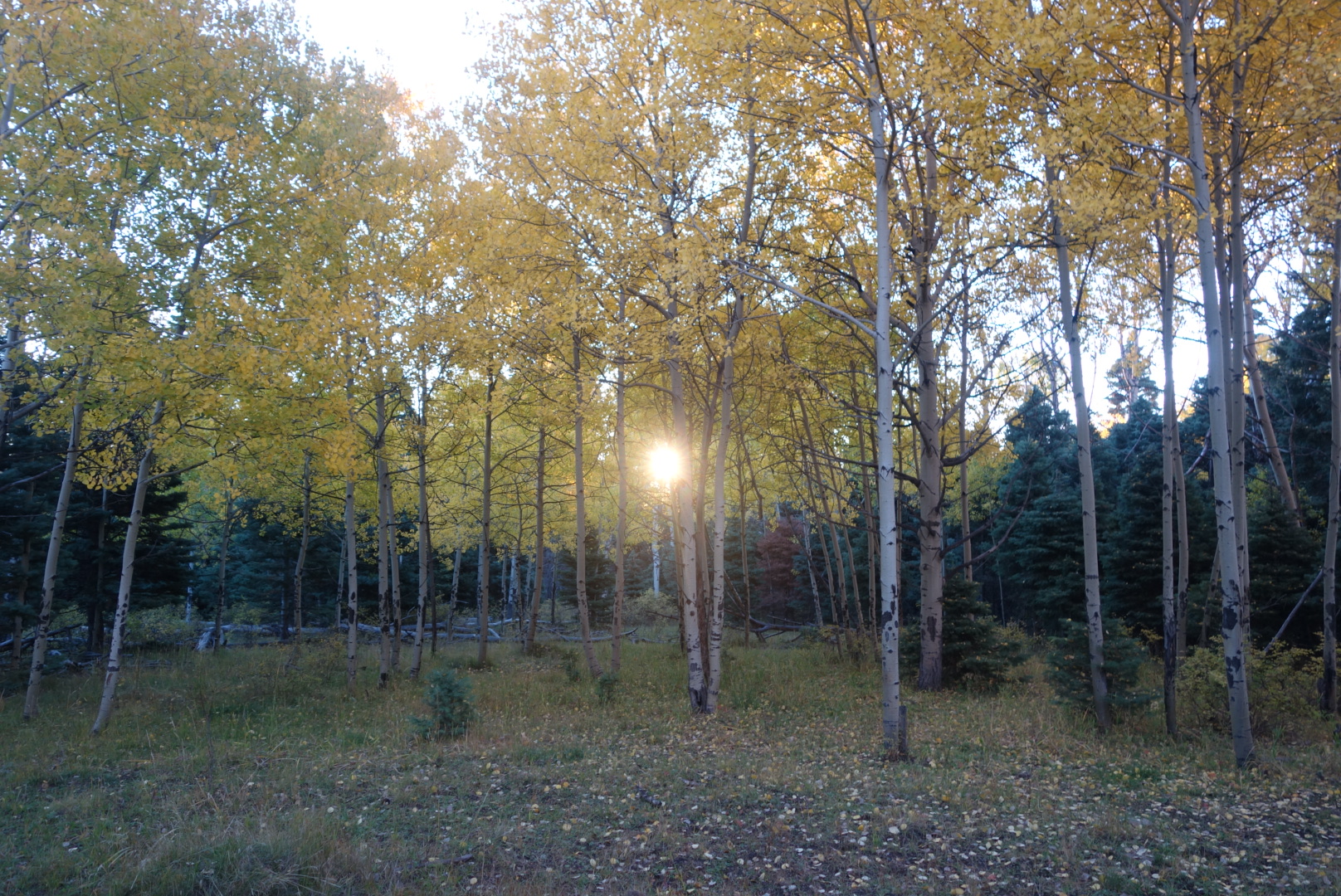
Sunrise catching the aspens
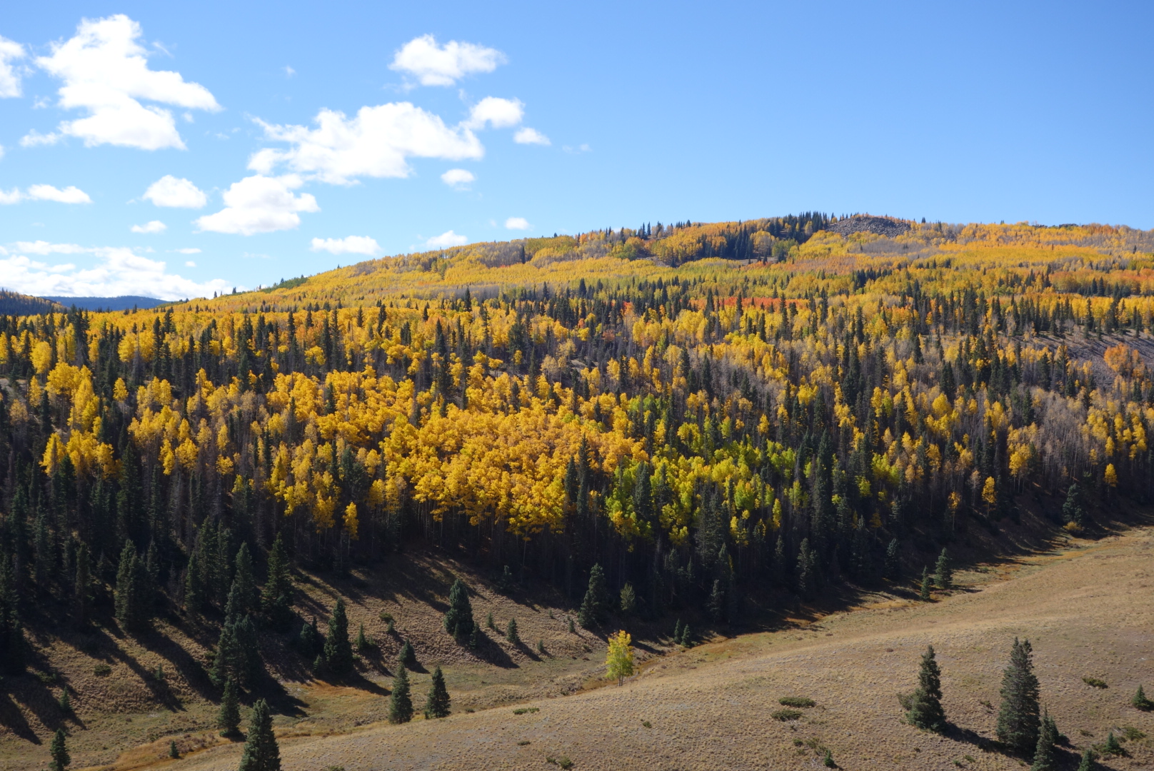
Later on, the sun broke through and I had a beautiful view of all the aspens changing color. It was a great day for hiking. Temperature in the 60’s and very few clouds. Although it was dry, I did manage to find enough water to quench my thirst. The first water source, unfortunately, was Laguntas Campground where a hiker who had finished the CDT was later found dead.
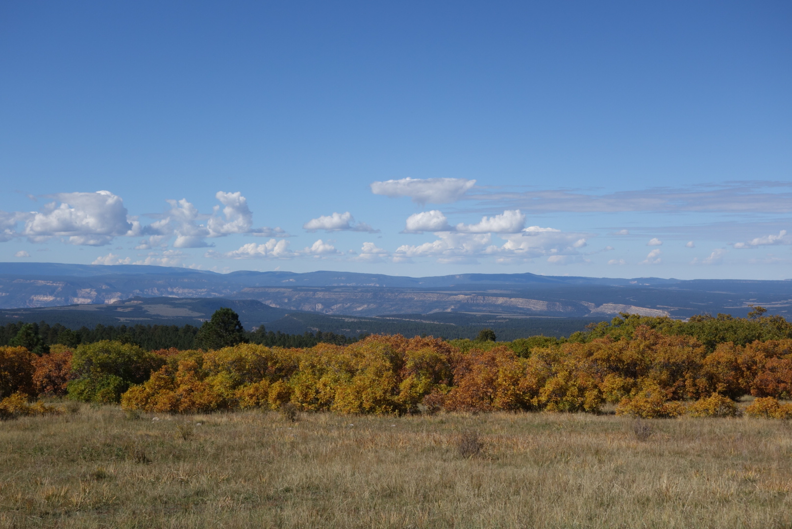
One highlight was walking along the ridge overlooking the Rio San Antonto. There were golden aspens that crept up to the base of the trail along the edge of the mesa. then, across the valley were more patches of pines and aspens. Glorious.
Great view on a great day.
Hope this panorama shows up on the blog
Later in the afternoon, I was expecting to get water from a reliable source called Spring Tank. However, the dead cow at the edge was a clear sign this water was not for me.
It was my 27th wedding anniversary today. My age is 54. For those of you who are not good at math, that means that half of my life has been spent married to Helen and the other half was before marrying her. I thought that if I had not met and married Helen, I would probably be eating bad food, have poor personal hygiene, and be sleeping on the ground. Come to think of it, that is what I’m doing now.
It was a great day. The Taos Trail Angels (Tom, Ron, and Tony?) had left some delicious treats just before Hopewell Lake. Then, when I got to the campground at the lake and found the water had been turned off for the winter, a nice family let me take 2 liters from their igloo cooler.
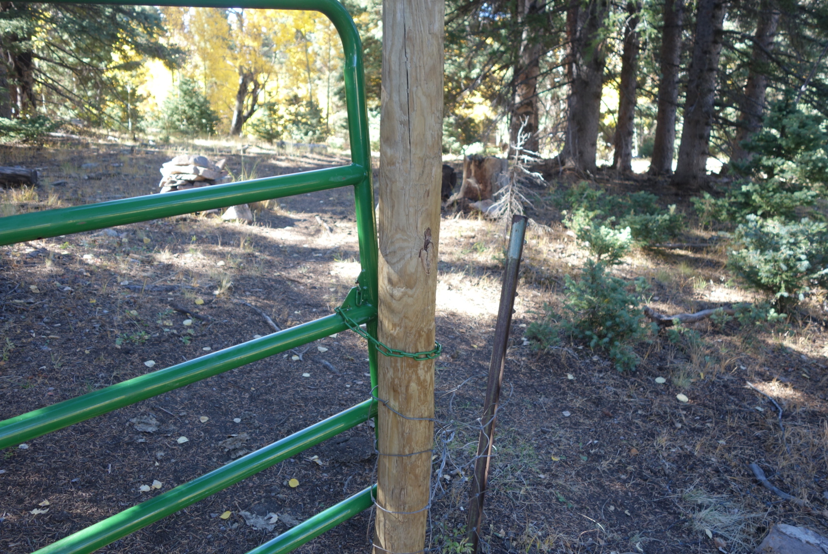
Confession : I actually unlocked, went through, and then locked the gate. Only then did my keen observation skills detect that the barbed wire fence was missing and I could’ve simply hiked around the gate.
I hiked in the dark a little further. I set up a cowboy camp. Earlier in the day I had seen the dust from a cattle roundup. Most of the outfits here are cow – calf. This means the rancher keeps cows and then raises their calf’s to a certain age before selling them off. Let me tell you there is no more mournful sound than a herd of cows calling out for their calfs which have been taken away. Eventually, and perhaps sadly, I grew accustomed to their calls and fell asleep.
The trail again wound through mesa today. Early on there was a not-so-good hiking moment. It was still dark. The narrative said to turn at the “white rocks” which is hard to do with an LED light. Anyhow, I dropped down the hill where the GPS said, but failed to find the trail. Instead, I ended up following an elk trail. Eventually I came out to the trail. I turned around and saw a perfectly good, clear trail up over the top of the mountain I had just wasted 45 minutes circumnavigating. Not sure what the map makers were thinking.
The rest of the morning was neither exciting nor boring. There were some nice views down into valleys where the elks bugled and the aspens fluttered their yellow leaves.
Right around noon, I approached the Cumbres Pass. This is where a vintage railroad still runs. I was fortunate enough to get there just a few moments before the train arrived. Some hikers take the train to or from Chama, New Mexico because it stops right here at the pass.
Later, I passed unceremoniously into New Mexico from Colorado.
I wanted to sleep up high again given the clear weather. That meant pushing through a cattle operation. I wanted to sleep on top of Brazos Ridge. Most of the identified streams were fouled. This was frustrating as I was low on water.
Up high, I did find a spring that ran into a small grove of trees and fizzled out there. Unfortunately, the cows had found this too. Although the “stream” was no more than 30 feet long and there were no obvious “pies” in it, it still tasted like cow turd. I cannot explain it. Also, I cannot explain how I know what cow turd tastes like even though I have never eaten one.
I had the pleasure of following newish trail once up on the Brazos Ridge. While it was rocky, it was clear. I tucked in behind a grove of spruce and found a nice flat spot on which I pitched my tent.
There were a lot of miles today. First was to get up high, over 12,000. I crossed several small streams. I also found a few pairs of eyes in the dark that caught my headlamp.
After that, I was walking along some rolling ridge tops. There was a mild change in topography. I was no longer either an up or down. Instead, I was now getting on to mesas. At least I think of them as mesas. For the life of me, I am not sure I could tell you when a butte ends a mesa begins and then a plateau takes over.
The water sources were mostly snow melt ponds and therefore not super appealing. I took just what I needed. Late in the day, I dropped down to Dipping Lakes and tanked up on water. My goal was to sleep high on the mesa.
The climb up was tough but rewarding. I could see the sun dropping to the west and the valley below had aspens. I ended up getting to the southern tip of the mesa. The only notation on the maps was “Flat 12,187.” It was too exposed of a campsite for me, so I dropped down to a flatter saddle and quickly made camp. Along the way, I came across a sign that warned northbound travelers the 813 trail, the number for the CDT in southern Colorado, was a “dangerous trail.” Great. I suspect (or at least hope) the faded sign referred to lightning, not just a general rule.
Once again, the mountains got big. I know this sounds redundant. But now the peaks were getting up to 13 and 14 thousand feet. Fortunately, I was feeling a little better about altitude and the hiking was more enjoyment and less exertion.
I went around Montezuma and Summit Peaks. There was just enough snow on Summit Peak to make it look like a pastry on which somebody had sprinkled powdered sugar.
I ended up sleeping in a canyon near a small stream, the North Fork Conejos River. Coyotes serenaded me against the soft sounds of the creek. The wind would gently gust over my face as I cowboy camped under a moonless sky.