A Walk Through Time

October 13th

My hip belt arrived. It was delivered to a different motel with a completely different name, but what is life without a little mystery?

I put on the new belt and was off around 11:00. My route would take me along old Route 66 through Grants, then through some sparse neighborhoods,  up through a historic canyon, then south through a quiet canyon.

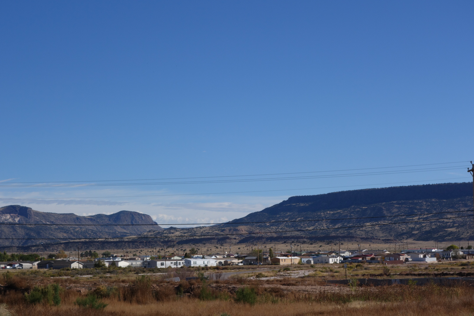
A new interstate goes around Grants.  However,  Grants most recently grew along Route 66.  As a result, traffic bypasses Grants and the town is dying, or at least resizing.

Walking along the old Route is like walking through a business cemetery. Car dealers, small automotive repair shops, small grocery and appliance stores all shuttered. It made me realize how much cars have changed just in my life tinme.  It used to be cars broke down all the time and people always sought an honest mechanic.  Now, the car dealers have tied up warranties and service, the niche shops grab standard services (think Jiffy Lube), and big boxes grab chunks of business (I buy my tires at Costco).  However, the fact is that cars are also so much better now.  Growing up, I can remember knowing which cars were bad based on how often they were stranded on the highway.

The only thriving businesses in Grants, besides the prisons, are payday loans and fast food joints.  I hope the town survives.

In case you are wondering about my physical well being, I received some objective feedback.   In the middle of town, there is a park and at one there is an old building where the homeless and/or drunk people gather.  When I walked past, I received a heart-warming welcome.  I looked like one of their own and they were waving me over.  Yes, I belong.

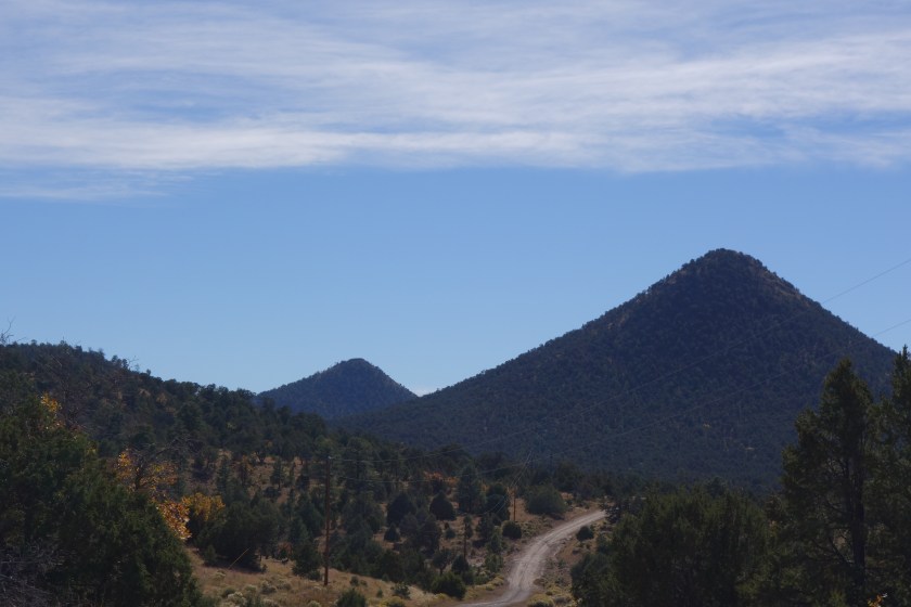
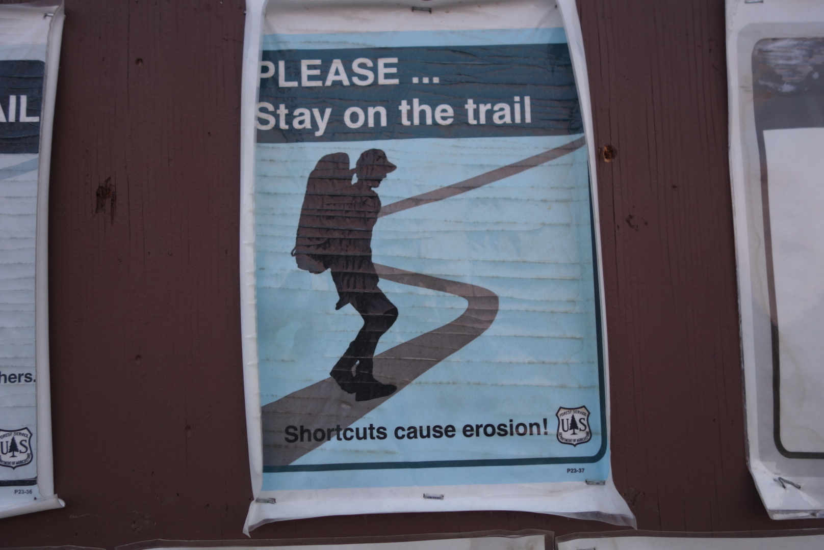
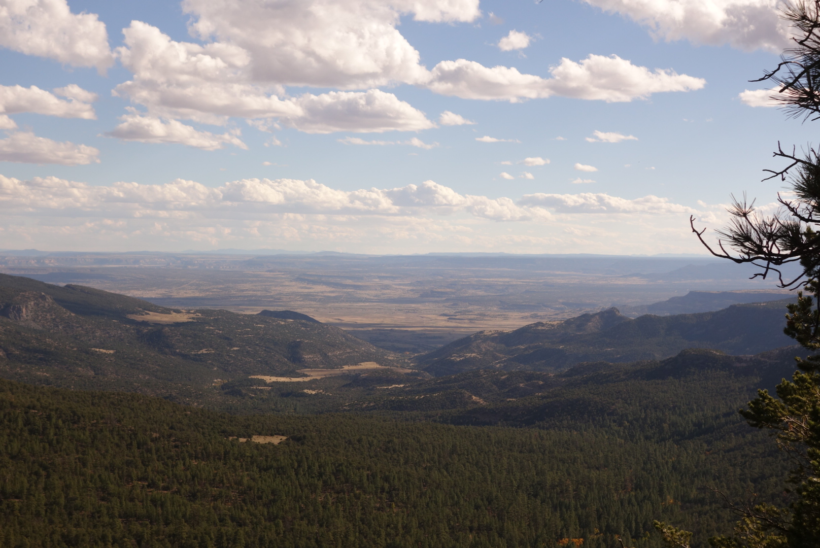
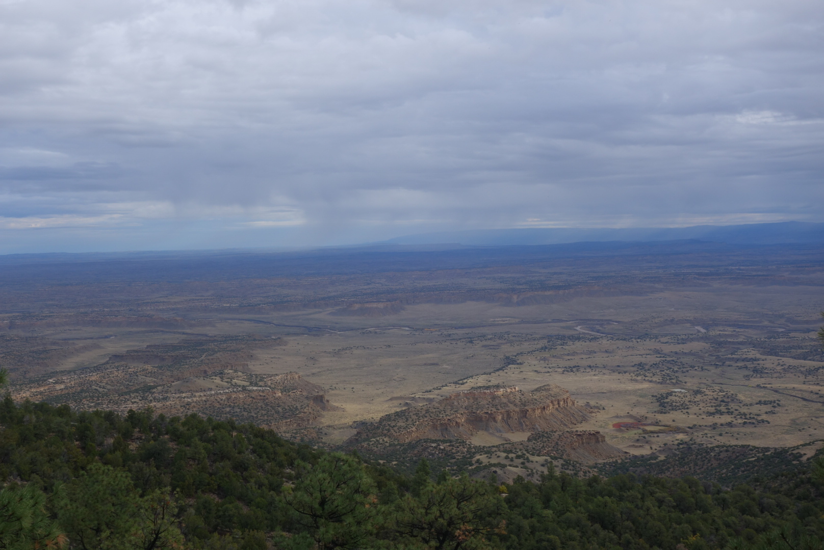
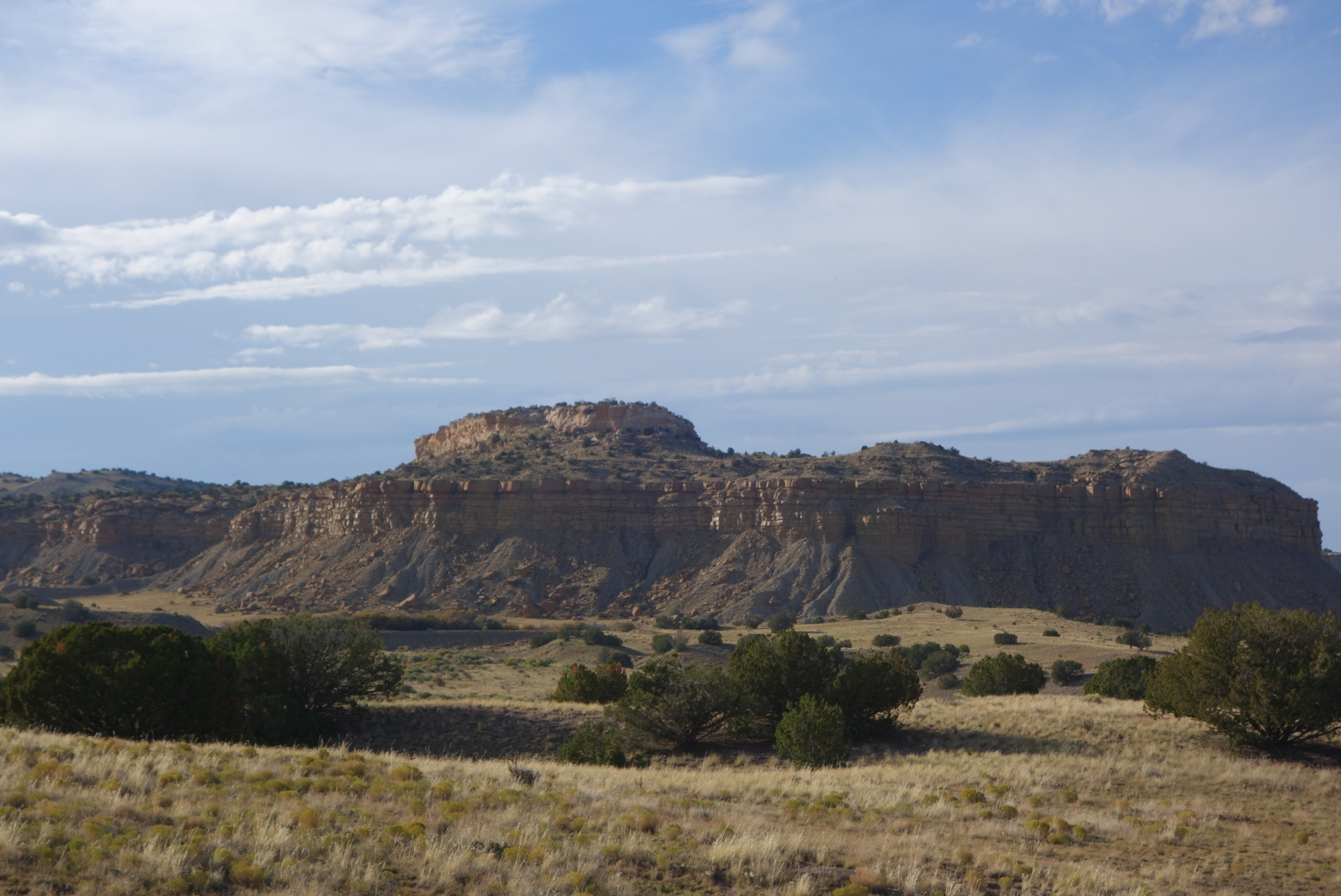
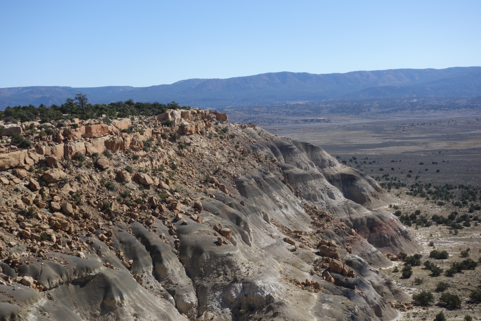
I finally exited Grants, crossed over the interstate, and worked my way up to the Zuni Canyon.  An auto tour had been implemented to help drivers see the role this canyon played in transporting lumber from the local mountains down to sawmills in Albuquerque.

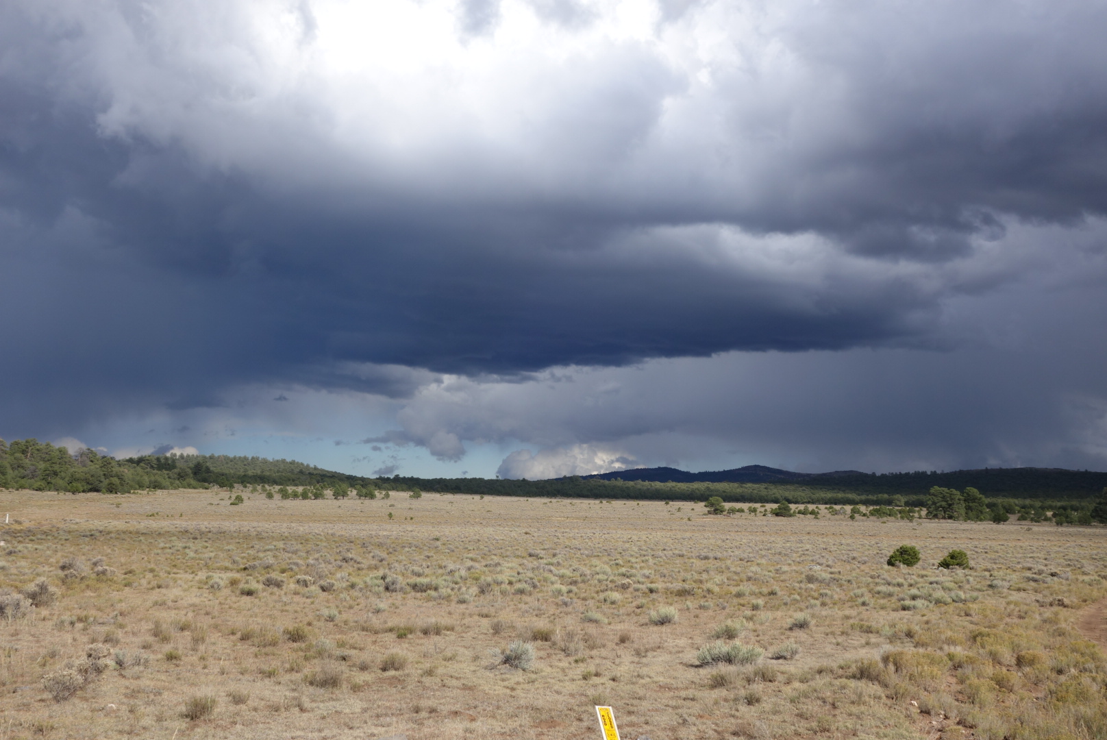
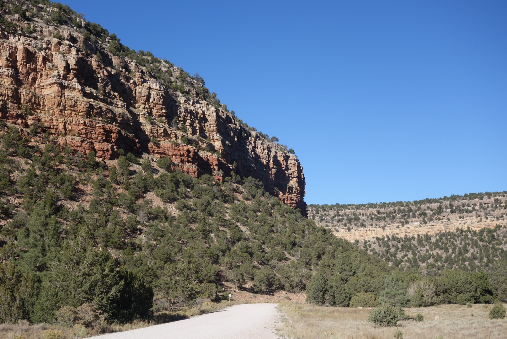
It was a hot day and the road, once it left neighborhoods, turned to gravel. Dusty gravel.  If you every drive a dusty road, slow down for people walking.   I concluded there is a special section in hell for drivers who don’t.  They prefer to fling gravel and maintain a dust cloud reminiscent of the plume from an erupting volcano.

Entering the canyon. Note the gravel road.
The gouge in the cliff was where logs were lowered from the mesa to the railroad

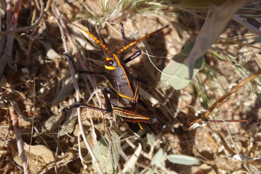
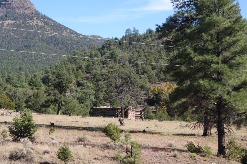
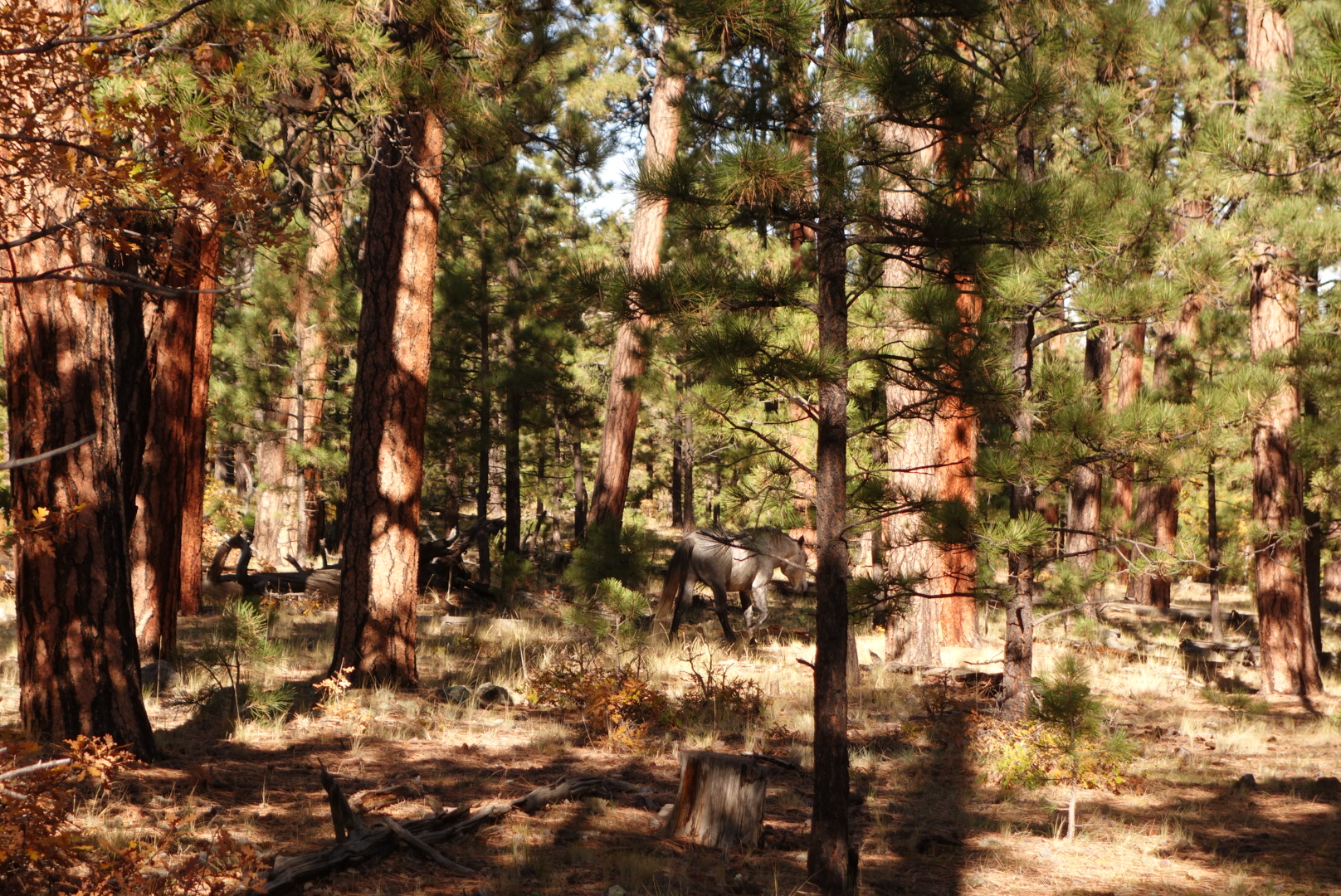
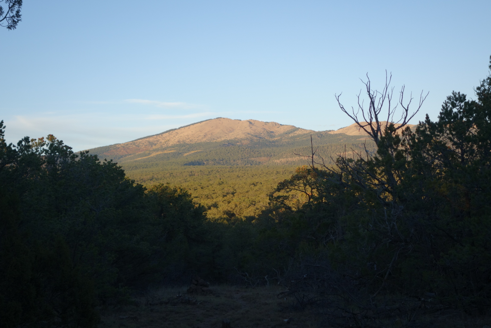
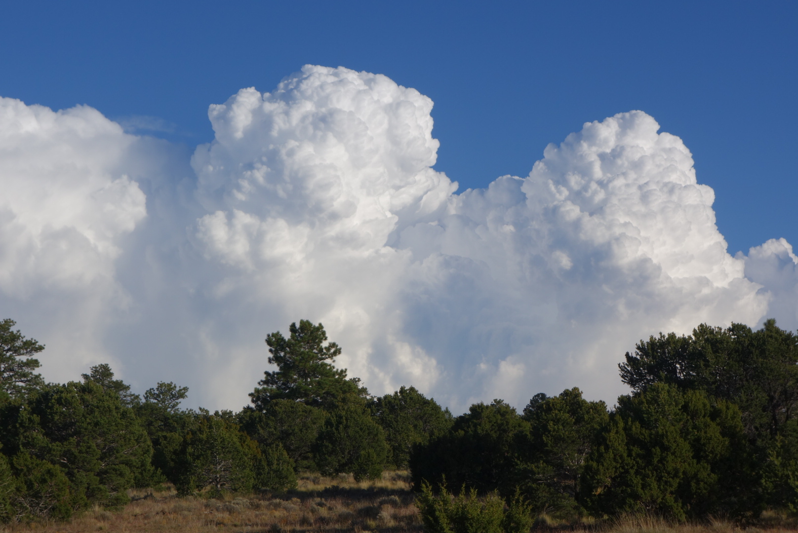
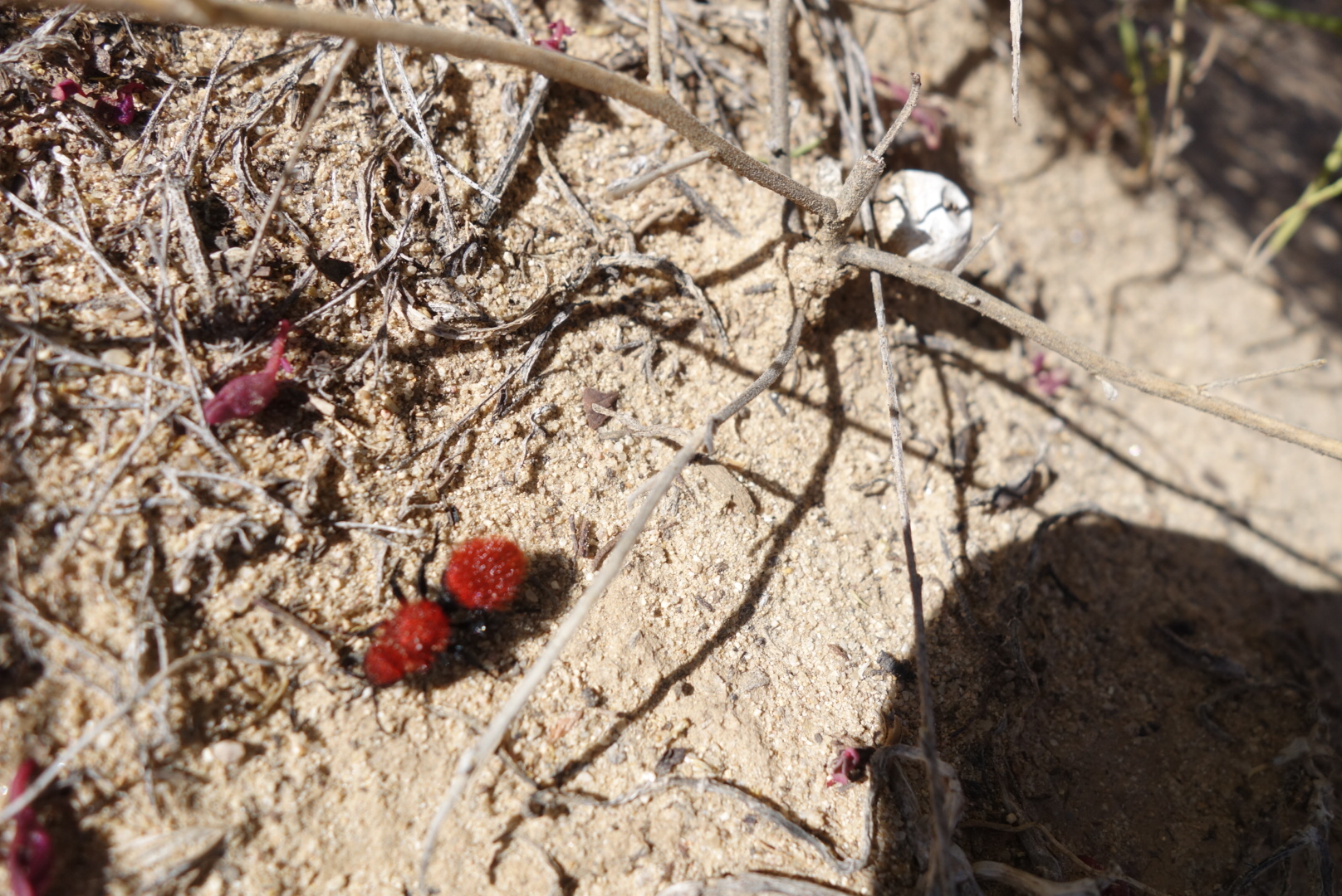
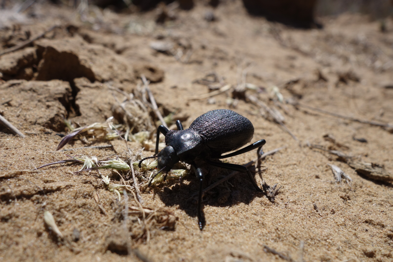
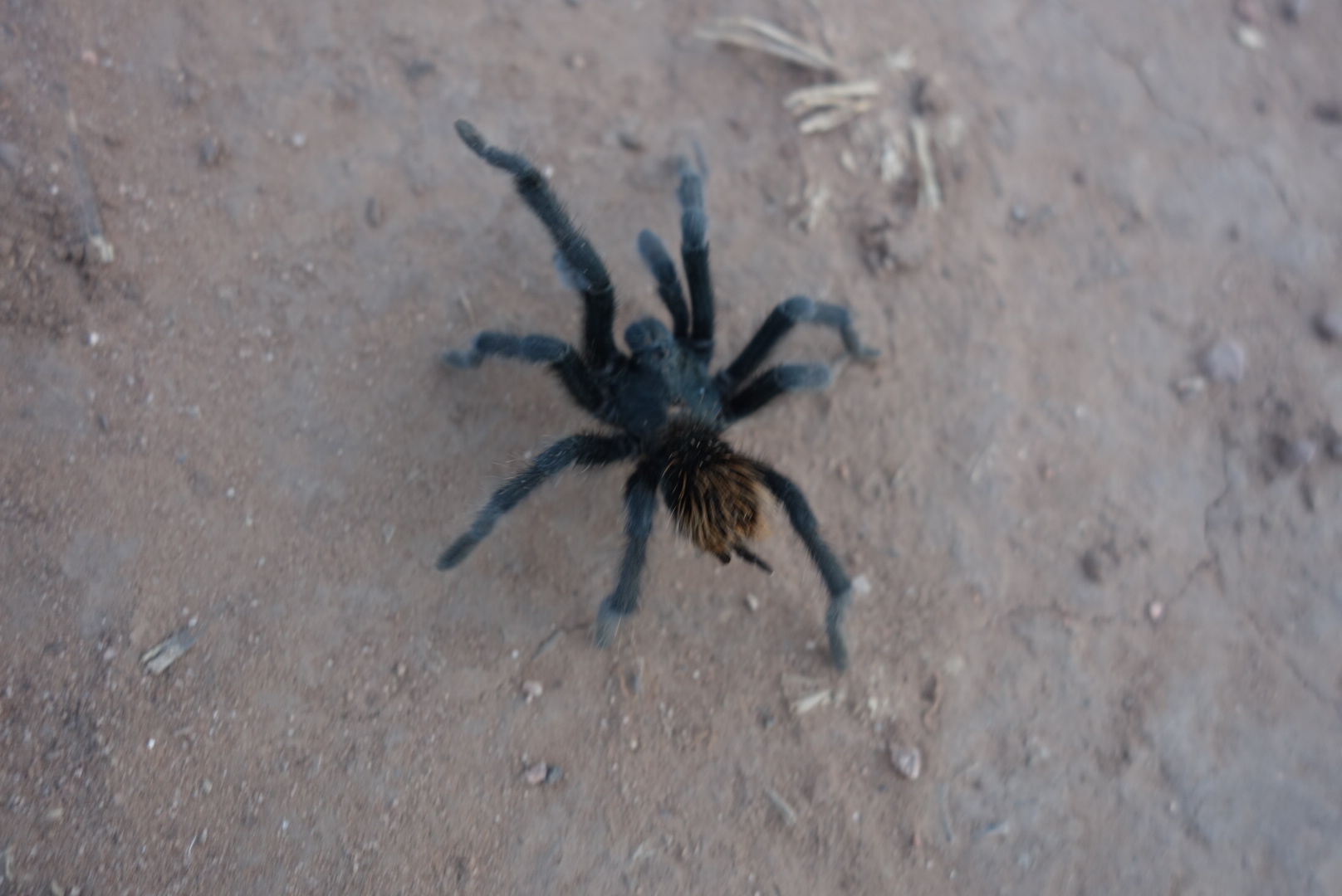
Around 3:00, I finally peeled off the gravel round to a less traveled road.  It rolled gently through ponderosa pines.  It was quiet and cool.   I saw my first tarantula.  It was very cool to see although not quite as big as I had imagined.

So cool. Maybe 2 inches long. I was surprised how furry it was.
Another look.

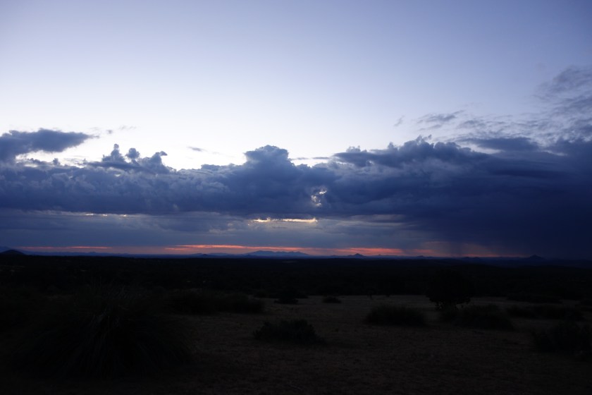
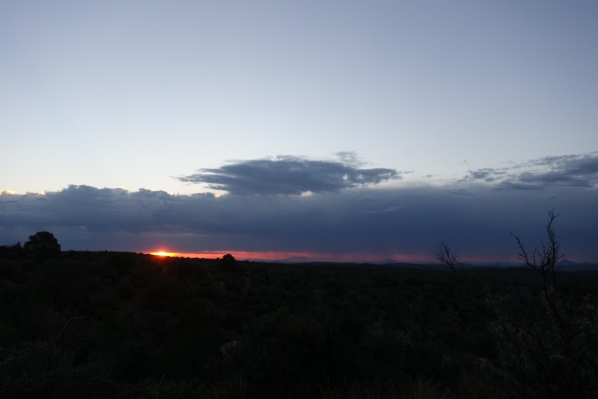
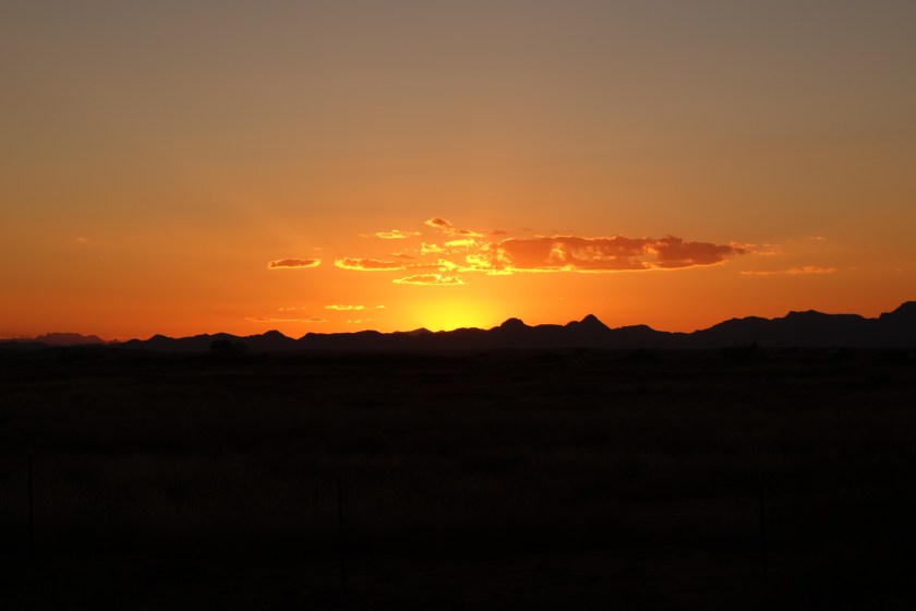
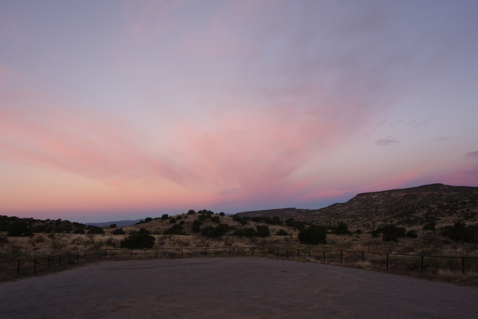
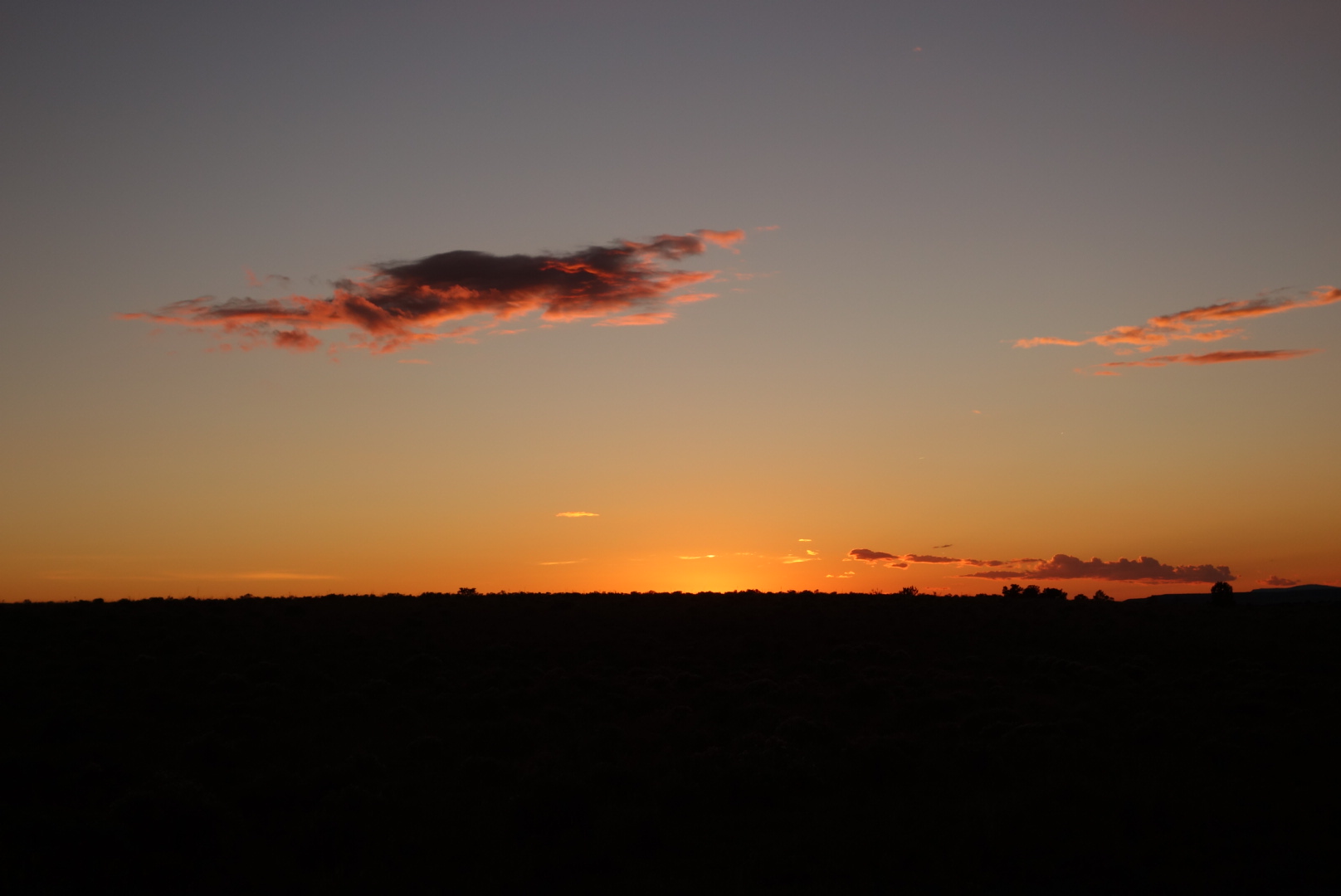
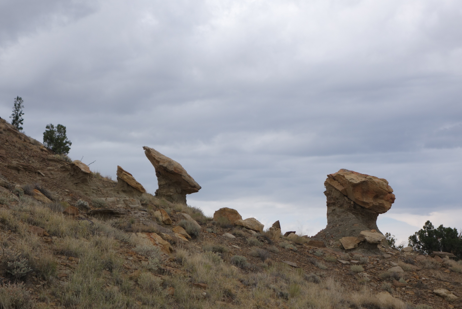
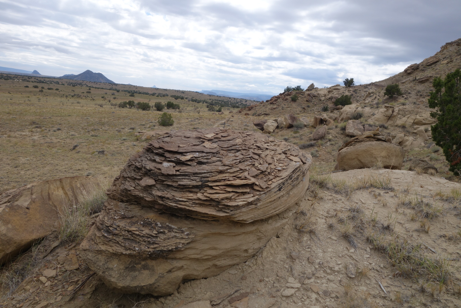
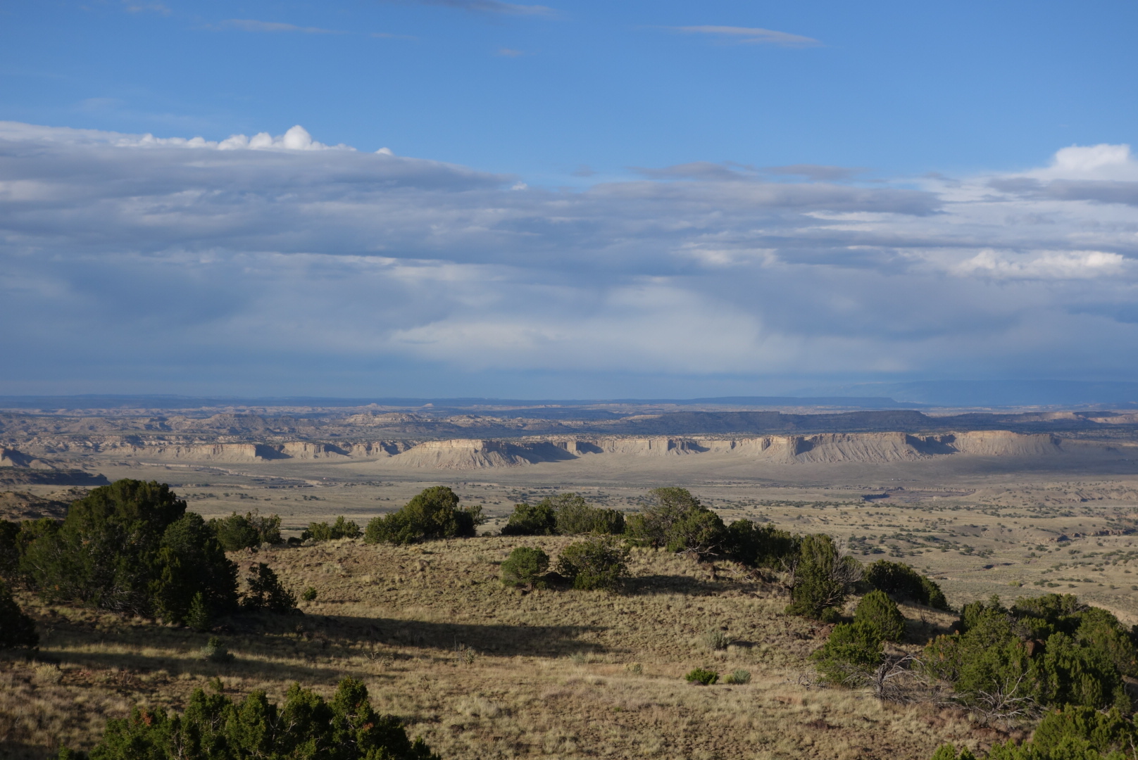
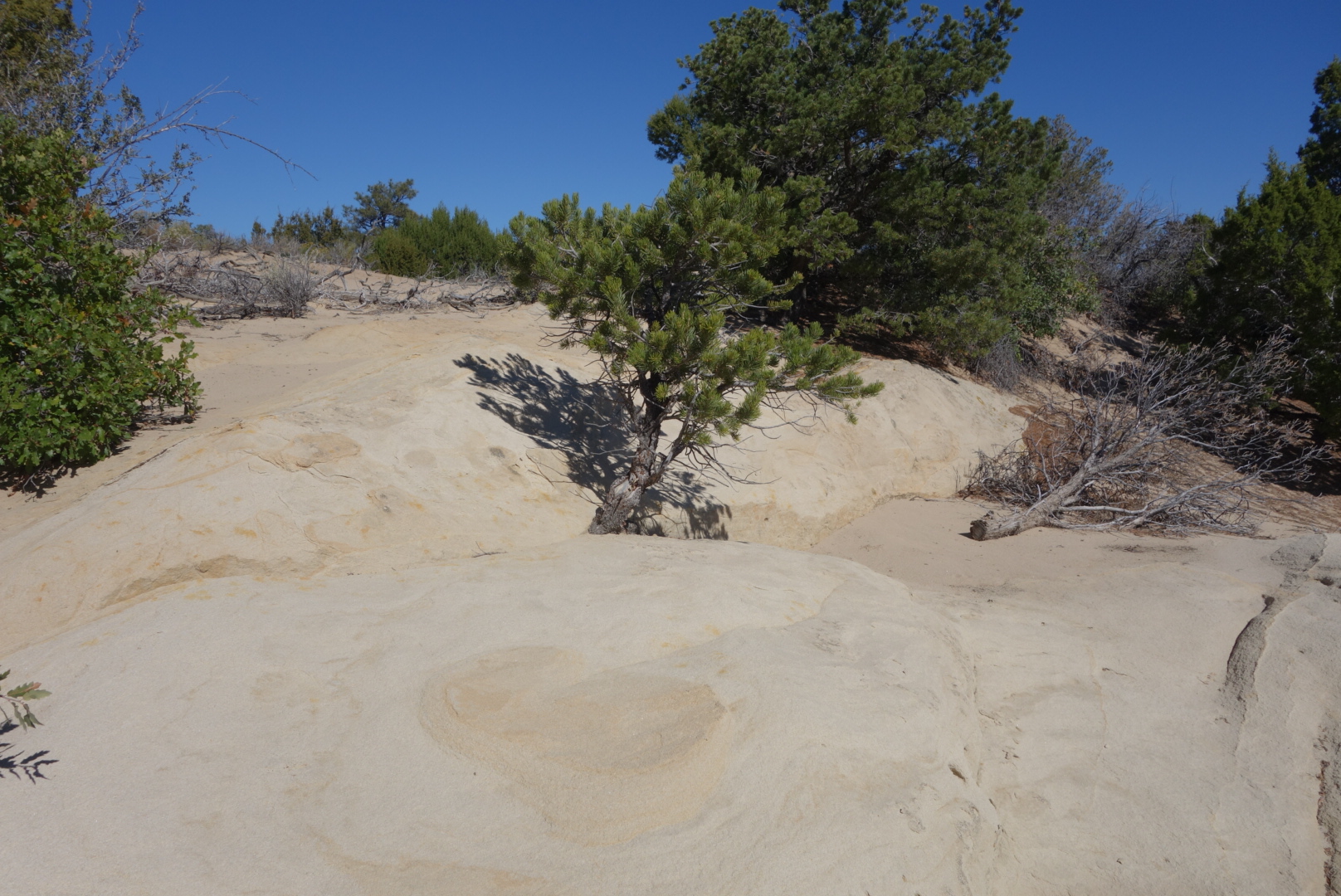
I easily found a side canyon where I set up my tent as the night was coming on and the temperature was falling.  What a beautiful part of the country.

Death March to Lordsburg

October 25th

I had reviewed the maps and determined that I could make one good push and get to Lordsburg in a day.  My plan had been to get within about 10 miles and cruise in on a third day of hiking.  However, I needed to figure out some logistics and thought I should just get in to town.

The early part of the day was mostly scrub oaks, pines, and Junipers.  The trail went up and down a few hills, through some cattle operations, and eventually crested just above an abandoned mine.  From there, I could make out Lordsburg in the distance.  The best part of the morning hike was smelling the desert after the rain.  It is not that organic, musty smell of a forest after a rain, but a sharper, more metallic smell.  I liked it. Plus, the storm had moved to the east and the sunrise highlighted the remnants of last night’s excitement.

dsc06455
the remnants of last night’s storm.  You might be able to make out where the rain is coming down on the horizon.
dsc06460
Sorry, but I do tend to overdo it with sunrise pictures.
dsc06461
In the words of Beyonce, I woke up like this.  You may be surprised to learn that often I dressed myself in the dark and did not have any mirror.  Honest.

For your edification, hiking trails in the desert present their own challenges.  If there is little tread, it is very easy to mistake a small gully for the trail.  Especially after a rain.  And plants in the desert have this unspoken law where they do not grow up next to each other.  They usually leave space.  Determining whether you are looking at open natural space or a trail can be tricky at times.  I probably took about 20 wrong turns during the day, but am experienced enough at this point to know quickly I am off course.

I passed one solar well that had great water and I filled up my two liter Platypus bladder and also my one liter bottle. (In case you don’t know platypus is a brand and a bladder is flexible plastic bag for liquids….I am not using the small internal organ of an Australian egg laying mammal.)  This well pulled the water right from the ground through a spigot.  Later, I came across a second solar well, but the water was terrible.  It was sulfuric smelling and tasted rotten.  This one filled a large tank and the tank then drained down to a lower, accessible tank. As I was leaving, I figured out the large tank had no top so whatever insects or creatures that lived (or died) in the large tank were invisible.   I ended up pouring that water out.

In the late afternoon sun the trail dropped to slightly level ground, it was a grueling walk of at least 8 miles across open terrain.  The Continental Divide Trail Coalition had placed 8 x 10 white signs on six foot metal posts as markers for hikers across the tread-less land.  Inexplicably, they only had signs that faced one way and most were positioned to help north bound hikers. Since the signs are posted about 100 to 200 yards apart, it took a pretty sharp eye to spot the next sign.  On top of this, in the fall, the native grasses produce seeds.  One grass in particular produces a seed that is dagger like.  It went through the fabric of my trail running shoes, my wool socks, and lodged in my skin.  After stopping a couple times to remove the offenders from my shoes, socks, and skin, I did the manly thing.  I put duct tape over the exposed fabric part of my shoes.  This did the trick.

dsc06522
Really, I made these modifications myself.  No professionals were involved.

An odd thing that happened involved grasshoppers.  All of a sudden, the size of the grasshoppers doubled.  These southern New Mexico insects were huge and colorful.  I tried to get some up close photos, but my shadow quite often spooked them.

dsc06470
This one was about three inches long

dsc06467


I ended up walking in to Lordsburg at night.  On my left side, cars and trucks whizzed by on the highway.  On my right, various size dogs would bark and lunge out of darkened front porches.  I finally wandered through the city and found my motel and the McDonald’s next door.  As I approached the McDonalds, a homeless guy was out front.  He was going to hit me up for money, but as I got closer, he looked me over, shook his head slightly, and went to the other entrance.  After I ordered, the homeless guy came in with a man who bought him dinner.  Apparently, I look so bad the homeless people won’t ask me for money.  While I waited, I looked down and noticed the duct tape on my shoes and realized I am a through hiker.

dsc06473
Sunset viewed from highway 90 walking towards Lordsburg
dsc06475
Sunsets are so cool.  They morph in shape and color.  


On the Dry Road Again

October 17th

I packed.  Lucky and I went to the Gathering Place for breakfast.  We discovered another way to tell CDT hikers: smashed smart phone screens.  It was a dead heat between which one looked worst.  His had more shards, but my screen’s damage spanned a much larger distance.

We ate, got our resupply packages from the post office, and went back to the Toaster House.  I repacked and left.  Lucky was going to stay for a while.  The odd fellow was outside again with a roaring fire, unresponsive to any hello or good-bye.

By 10:30 I was sweating.  I retrieved some trail angel water from an animal shelter.  It was hot, dry walking along roads without much traffic.  The terrain gradually evolved from scrub pines and oaks to Ponderosa and taller trees.  I saw a few old abandoned log cabins.   I also came across an ironic place.  So much of the land is marked with barbed wire and No Trespassing signage.  Very law-and-order.  I came to a place in the country the owner had decided to name the “Robber’s Roost.”  This shrine to the rebellious and unlawful  was, of course, surrounded with barbed wire and Private Property, No Trespassing signs.

dsc06326.jpg

dsc06333
It is pronounced Maine Gas.  If not, I don’t exactly know what old Tuffy is up to.
dsc06324
Another example of the New Mexico welcome mat.

In the afternoon I came to a water source.  The local landowner kept an electric pump near the road where hikers could turn on the pump and get fresh ground water.  It was great and cold and I filled up my stomach and my bottles.

dsc06330
An abandoned log cabin
dsc06327
Ponderosa forests on the conical hills

Late in the day, the road took me high into a ponderosa public forest, out of the private  lands.  Sometimes, the transition is not immediate and there are patches of private land.  I came across an interesting one.  It must’ve had 3o vehicles in various states of repair.  There was initially an old bloodhound chained up and he announced my approach.  Repeatedly.  Later, around car 22, a huge mastiff mix came running towards me with a deep, intimidating bark.  We eyed each other, but when I walked past and broke eye contact, he came at me.  I reached for my manly umbrella and turned towards  the dog and yelled “No!”  I couldn’t believe it.  It worked.  He got a little hurt look in his eyes and stopped short.

I met the owners of this menagerie of cars.  Nice beer drinking guy.  Told me some good places to camp.  He didn’t offer me a beer though.

At last, I reached a crest.  A series of utility poles ran up the ridge line.  Many times these are a good place to look for camping sites because the utility company will trim trees away crating open spots.  I found a great clearing among some pinons and oaks.  As I was putting up my tent, I found bear scat with a ton of acorns in it.   Great.  What is it with bears on this trip?  It was old and I figured they are smart enough to know when an area is exhausted, so I didn’t do anything different except hang my food far away.

I did have a small fire using some of the great firewood.  Sometimes it is nice and relaxing to have a fire before bed and I enjoyed this one until about 9:30 before putting it out.

Pie Town, The Toaster House, and Lucky: a Day in the Life on the CDT

October 16th.

I got cruising early, making sure not to wake my hosts.  The moon was full and bright.  In fact, as I went down York Ranch Road, I would turn off my headlamp and just walk by the light of the moon.

Not too many interesting things to see.  I came across a bunch of  cattle penned up awaiting the arrival of the truck that would whisk them off to the feedlot and the grocery stores.  Weird to think about your food this way.

I also refined my deeply religious thoughts concerning hell and gravel roads.  Yes, I still believe there is a section in hell for people who speed past pedestrians on gravel roads.  However, I developed a more sophisticated profile of its inhabitants.  If they drove Denalis or new Suburbans, they were in hell because they NEVER slowed dlown.  Also, if they were younger, they were in hell.  (One sub-theme on this trip is how fast young people want to be… or how slow older folks want things to be)  The most dangerous incident was a teenage girl with sunglasses and loud music coming towards me.  She was driving a dually (4 tires on the rear axle) and the extra wide mirrors.  She must’ve been going 60 and did not move over at all, her mirrors coming within inches of my shoulder.  I hope I don’t see her in her little section.

If you’ve slogged through previous blog entries, you know that if I am heading in to town for resupply, I am a force to be reckoned with on the trail.  I was making about 3 1/2 miles per hour.  Perhaps even more motivating was the town name: Pie Town.
Pie Town is a random stop on the road.  The idea was to set up a couple restaurants that sell pie and get people to stop.  It worked.  Not a big town, but a few restaurants and a lot of pie.

I ate my first lunch with two entrees and pie at the Gathering Place.  It was Sunday so my Post Office package would have to wait.  I went to stay at an unusual place called the Toaster House. It is open to any and all, free of charge.  The name comes from the abandoned toasters serving as decorations on the front gate.  There is hot water in the shower, running cold water from the taps, and two outhouses (including a two-seater, perhaps a tip-of-the-hat to the Romans).  There are about 6 beds, a fridge and a stove.  I met Tim, a Continental Divide biker from Seattle.  There was another strange fellow there who didn’t talk and Tim warned me he was unstable.  That dude stayed outside the whole time building and maintaining a substantial fire.

An easy way to identify toaster house….
Toaster House

I napped and headed out for Lunch 2.  Great conversation with the owners who run the Pie Town Cafe, open 4 days a week between 11 and 4.  I was just finishing my pie when in walks Lucky Strike.  It was great to see him.  The trail had treated him well.  Its like we had the opposite reactions to the trail:  he was looking stronger, better, and younger while I was looking older, thinner, and haggard.

We spent the evening  catching up on trail talk.  John and Anzie Thomas came to visit for a spell.  Later,  Tim the biker came out and we talked for some time.  Eventually, well past hiker midnight, we called it a night.

I did not sleep so well.  The odd fellow would walk around in the dark, making the floors creak.  Then he would put on a headlamp and walk around outside.  Finally, around 3:30 he decided it was high time for a bath and spent an hour splashing around in the bathtub that was adjacent to my room.  I did sleep off and on, but it was strange to be in this house.

Pain in the Neck

October 12th

I got up and was ready to head out.  My neck still hurt.  However, when I put on my pack, a sharp pain shot through my shoulder.  I walked around for a little, but this was not going to work.

I extended my stay at the motel and tried resting (and of course, eating).  Helen was able to find a smaller hip belt for my pack which is getting overnighted to me tomorrow.

I am frustrated being this far and having a stupid injury.  However, I would hate to be in the middle of the desert and be immobilized by pain.  So, I am taking a zero and hope to walk out of town tomorrow morning sometime.

I texted Qtip.  Based on trail registers, the man was flying down the trail.  I  assumed he was done. He texted back saying he was laid up with shin split’s in Silver City. That must be really tough for him.

Grants

October 11th

I cruised early on the easy-to-follow trail on the mesa.  I enjoyed the hike.

When I reached the mesa edge, I had a two mile trail down the side.  It was rocky trail and I stumbled a few times.  My neck/shoulder hurt pretty bad.  Part of the reason may be my clothing bag is my pillow and it is pretty thin now that I am out of the mountains.  Also, my old/new Granite Gear Crown VC belt barely holds on the hips and therefore most of the pack’s weight is borne on my shoulders.  Whatever, it got more painful as the morning progressed.

Sunrise


At the base of the downhill trail, there is a bulletin board.  It has one sign that bugs the crap out of me.  It is common to see signs that tell hikers to not cut switchbacks so we don’t damage the woods.  Also, there will be signs telling hikers to stay on the trail.  It galls me that I am told to not get off the trail because of the harm I can unleash, but the same organization leases out forest land to huge herds of cattle that destroy trails, meadows, and water sources.  I can’t believe that my stepping off trail causes as much damage as a 600 pound steer that produces a turd every 15 minutes.

But cattle are free to roam….?

I road walked into town.  My fantasy of easy-over eggs was fulfilled at a local restaurant.  I walked along the old Route 66 to the motel strip which had a Walmart.  I checked in and did my chores.

Sign near the correctional facility

There is an Asian AYCE buffet right nearby.  It was not as bad as I feared.  Yes, the food was a little greasy, but there were some very good choices as well.


Grants in the foreground and the mesa I was on is on the right.
I packed up and went to bed early in the hopes of a good night’s sleep.  I was planning on walking through town in the morning to take the alternate route.


Mount Taylor

October 10th

Today I had a decision about whether to go over or around Mount Taylor.  The Ley maps are unabashedly for going over the summit.  It is a fairly dry straightforward climb up and over.  The official trail circumnavigates around the north side of Mount Taylor with less up and down, a longer distance plus one reliable water source.  Mt. Taylor reaches a peak of 11,300 feet above sea level.  Also, it marks the southern end of the traditional Navajo nation.

I ended up walking around.  I wanted the comfort of water along the way and, at this point, being on top of an 11,000′ mountain is not that impressive to me.

The trail was actually pretty nice.  It turns out the Mount Taylor 50k Trail Run uses both the official and alternate trails….it was run just the previous weekend.  There was interesting elevation gains, a good water source, and the tread was distinct.  Glad I took it.

Pretty nice trail

Many areas had a nice mix of aspens and pine


I found a gray mare walking through the woods on the eastern side.  She was neither afraid nor excited to see me.  (Later on I stopped at the Forest Service office and asked whether there was a horse reported missing.   He said there are wild horses all over and not worry about it.)

Bad photo, but the mare is in the shadow in the center of the photo

A local couple in their side-by-side stopped and we had a great discussion.  They both work at the correctional facility and this was their day off.  The man grew up in the area and knew it like the back of his hand.  They offered me water and food.  They even let me know their address if I needed anything.  I wish I was as generous as this couple.

A view south, where I am headed, from the mesa.

Mt . Taylor

Late in the day, I found a black irrigation  hose.  Ranchers out here use them to transport water from a spring to a cattle tank.  They can go for miles.  This one had a leak about a half mile down hill.  I was glad to have the exrta water “just in case.”

Go away bear

There have been a ton of pine nuts on the trail.  Considering how much I pay for these in the grocery store, I should’ve dumped my food and collected the pine nuts.  Later in the day, I heard pickup trucks and “thunking” sounds.  It sounded like somebody hitting a tree with a baseball bat.  I finally ran across the source: people out collecting pine nuts.  From the way one guy acted, I am not sure this was  an up-and-up  operation.  I ended up camping across a meadow from their base camp.

Pine nuts


Another Cloudy Day in the Desert 

October 9th

I got going and found that the rain had cleared the trail of all footprints, freshened everything up, and generally made the day pleasant.  I climbed up on to the big mesa, Chavito Mesa.  Great views and great hiking with a good mix of wide open areas and pine trees.

Looking back down from the top of the mesa.
So mesas will often have these open grassy areas with clumps of pines.
A burned forest on the mesa.
Pine nuts in the cone. There are very cool gray squirrels here with tufted ears that are hard for me to photograph.

Late morning I reached a reliable spring called Ojo de los Indios.  I hiked down and got some piped spring water.  I almost passed it up assuming the rain would fill up the “tanks.”  Glad I did not.

There was one long, straight stretch where the hiking was a little dull.  My new (old) backpack was not feeling too comfortable and the sun was warming things up.  The straight forest service road turned in to a miles long mud pit in the afternoon.  The forest service had been grading the road.  With this soil, adding rainwater made for a sticky, sloppy walk.  Hiking is not fun when your feet get heavier and slicker.

A long, straight muddy road is not a backpacker’s ideal route.

I did run across a couple interesting things:

some black bear paw prints that went right down the middle of the road for awhile. 

When will I be free of these beasts?
a guy who looked like he was preparing some type of bait for hunting.  I’m not sure sure what is legal and illegal in New Mexico, but he was surprised and did not seem happy to see me.

I saw a micro storm develop and roll over the top of me.  It amounted to nothing, but in the distance I could see it morphing in to a huge thunderhead.

This little micro storm developed quickly but also passed by me swiftly with very little rain or lightning.
Later on, all the little storms gathered on the other side of the mesa.

At dark, I ended up just setting up a stealth camp in the sagebrush.  The moon was bright and the night on my side of the mesa was great.  However, when I looked east, towards Grants, that huge thunderhead was still rumbling.  I was lucky to have missed that storm.

My sunset to the west.
The thunderstorm hovered on the other side (east ) of the mesa.
Sunset hitting the top of the thunderstorm.


More Desert Rain

October 8th

The desert trail was marked so well with cairns that the pre-dawn walking was easy.  The first part of the morning I walked around a few big hills called Cerros.  And, reminiscent of Montana and Wyoming, I walked around Deadman Peaks. 


The rocks are so interesting to me.  Several times I have come close to falling because I am looking at rocks.  It is also a little bit like aspens further north; I stop and take photos almost too often.

Gotta love the pillars.

This particular hillside had many interesting formations.

Unlike other rocks, this type erodes through chipping from the top.

This boulder was hollowed out.

I came down off the mesa and walked in some open terrain.  There were a few abandoned windmills as well as some active “tanks.”  Down here a tank is usually where soil has been used to seal off a canyon to retain water for livestock.  The water is invariably nasty.

There was a spigot that provided some well water.  It took me a little time  to figure it out, but I tanked up 2 liters with fresh groundwater.  Soon thereafter, a cache of water was supplied by the Trujillo family.  They had left some apples, too.  I took an apple and drank a half liter.  It was overcast, so I was not losing too much fluid.


There was still more open country hiking in store.  It was nice weather.  If the temperature was in the 90s, this would be a tougher section to hike.  I came to my last water cache and drank a liter and left with 2 liters.  There was a spring (Ojo Frio) coming up, but why walk away from a certain source for an iffy one?


Cabezon in the morning.

Cabezon from evening. It’s symmetrical shape served as a reference point all day. (Storm clouds in background. )

If you are philosophical, you might consider water caches left by trail angels.  On the one hand, the provide potable water in an arid area where heat and dehydration related illnesses are a legitimate threat.  On the other hand, they also present a bit of a moral hazard. Hikers unsuited for desert trail might assume the cached supplies will be there and charge forward. But if the source is not there, that hiker can be in dire straits.  I think sobo CDT hikers who went through the Basin are probably adept at arid travel by this point.

I crossed an almost-dry Chico Arroyo.  An Arroyo is a canyon formed by flood water.  Down here, water does not get absorbed easily so it tends to run off and the run off ends up in an arroyo.  This one had a few trickles and puddles left.  More importantly, the flat bottom was dry.  The combination of desert sand and soil can make these river beds into wet cement or quick sand.  I could see a cow had recently crossed with some difficulty.  I guessed that my lower weight and flatter foot would work to my advantage and it did.  I crossed without getting stuck.

I climbed a large mesa, about twice the height of what I had been going over the last two days,  I got about halfway up and saw a relatively flat spot at 6:00 pm.  Rather than push for the top, I camped.  To me, there were still enough mare’s tails in the sky to suggest setting the tent up.  One other twist about desert backpacking is that sweeping the tensite for prickly items is extremely important.  I found the site  was level but lumpy, so it was not perfect.

Looking back, the mesas from earlier in the day seemed trivial.

This was a mesa on a mesa.

Later that night, rain and wind swept in.  My guess was rain between 9:00 and midnight.  That’s a pretty substantive rain for this part of the country.  Between the lumps and wind, I had a spotty night’s sleep.


Leaving Cuba

October 7th

Up early, I walked through a quiet Cuba.  I stopped at McDonald’s to get a breakfast on the road.  The day was to start with a walk along a highway, although it was not a heavily traveled road.

Despite the chill, I enjoyed the road walk.  In fact, I enjoyed it so much I walked an extra mile past my turn off.  Shame on me.  I checked for and did not see any private property or No Trespassing signs.  Seeing none, I set my sights due south and bushwhacked to intercept the trail.

The trail was amazingly well marked.  Unlike last section where it was blue paint on trees, posts, or rocks, this section was white paint on wooden posts or cairns. I thought because of my missed turn I would find myself behind SBJ and MLL.  I did not see their footprints.  I could see a few others that looked to be a day or two old.

These fuzzy / furry insects are very interesting but hard to photograph.
She was laying eggs. She walked through an ant colony and they left her alone.

Eventually the trail wound over to the edge of the Mesa Portales.  It was a pleasant diversion to walk along and be able to look out.  The only bad news were some developing thunderheads.

The trail drops off the mesa to some flat terrain.  Some trail angels had left a supply of fresh water just before Jones Canyon.  This time, there was plenty left.  I took a liter and drank a liter.  The next water stop was Jones Canyon which was a cool old spring with some abandoned stone structure nearby.

This pine was growing straight out of the rock.
You can see this tree is uprooted on the right, but is still living in the center of the photo. Gotta be tough to live here.
Looking back at part of the mesa.

I gradually climbed the La Ventana Mesa.  I looked back and saw a pretty bad thunderstorm in the direction of Cuba.  I hope my fellow southbounders were out of town before that hit.  As it got dark, I found a place in the junipers where I could cowboy camp up high.  It was a good spot, but I was reminded of one of the real negatives of desert hiking:  the sand.

Some of the rock on top of the mesa has developed this tortoise shell pattern.
This was interesting to me. We’re the pebbles blasted in to the larger rock or pushed in?

Desert sand is not like beach sand.  It is finer and sneakier.  It sticks to you and gets into places you don’t want.  For backpackers, this means the fine gritty sand gets in your sleep system, perhaps your food and water, too.