My plan had always included a zero day in Lordsburg. My thinking was that I would need to coordinate travel for the trip home.
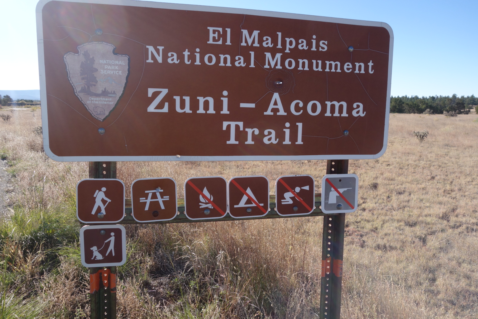
Another example of how the CDT is a muddled trail is the three possible ending points on the US border with Mexico. People can finish with a choice of two road walks or the official end which is a hike to a monument on the border and then arranging for transportation over a very rough dirt road via a designated shuttle service (or a friend with a car they are willing to trash). Neither of the road walks had appealed to me, so I planned on backpacking to the monument.
I made arrangements to be picked up the morning of October 31st. That would give me a little over four solid days of hiking. The shuttle driver lived in Silver City, so I arranged to go there because I could rent a car in that town, then drive to Arizona to see my mother, and then fly home. Flights were booked. Rental cars were arranged. Border Patrol was contacted to let them know I would be walking to the border.
Other than travel, I did usual town stuff. Lordsburg is another town in hard times. They have a street called Motel Drive. Until I-10 was built, traffic ran along this route and there were motels and restaurants and other businesses. However, now it is pretty desolate. Locals recommended a cafe called Ramona’s which was about one and a half miles down Motel Drive. It was a depressing walk, but the food was very good.
While in the small local grocer, I ran into another CDT hiker. His name was Simplesole and he had just finished the day before. It was reassuring to hear that the water sources along the way had a good supply.
I really hoped to get a good night’s sleep on my last town day on the trail, but it didn’t happen. I guess I was just anxious to get going.
Walked out of Silver City early in the morning. 13 mile highway walk carrying a lot of water. This was becoming an unpleasant refrain. A few miles out of town there is a famous CDT sight: The driveway lined with old toilets. Not sure what point the resident is trying to make, but it is a unique idea.
Sunrise as I was walking out of Silver CityVery unique driveway decorations on the road walk south of Silver City.
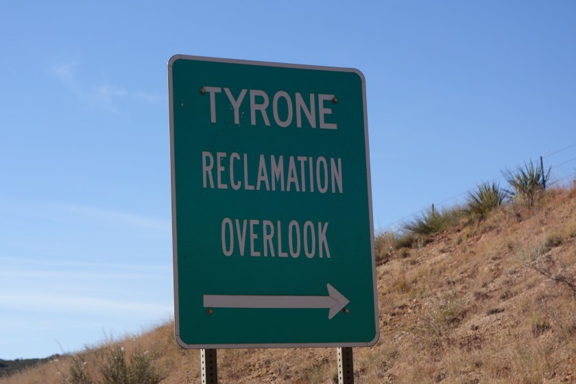
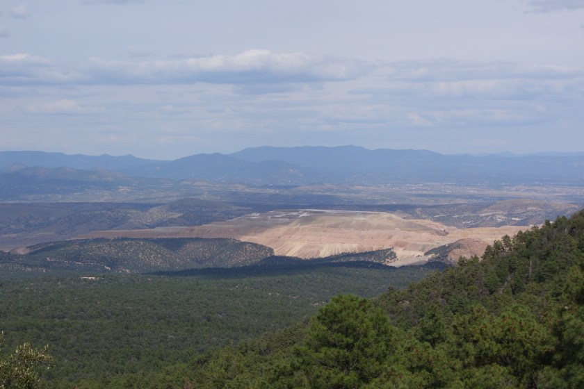
I passed an old copper mine. There was an explanatory visitor site explaining how the mine was being reclaimed. There were lots of words and pictures, but to my untrained eye, it looked like they just smoothed the sides, put on some topsoil, and threw down some seeds to see what might grow. Surely, it will all work out.
Can you resist taking a look at a reclamation site? I have a soft part in my heart for them.The reclamation site was even more beautiful from up high.
Americans have a hard time with mining. Almost universally, we dislike the environmental and visual impacts. Nobody finds a copper strip mine appealing. However, none of us seem to be willing to give up electrical devices. Heck, we can’t even agree to get rid of the penny (although I know modern ones are mostly zinc).
Later, around midday, I left roads and entered forest. A couple times, I encountered two or three isolated cattle. I am never sure if they escaped the round up and are going to try to survive over winter or if the rancher leasing the land will come back and get these stragglers.
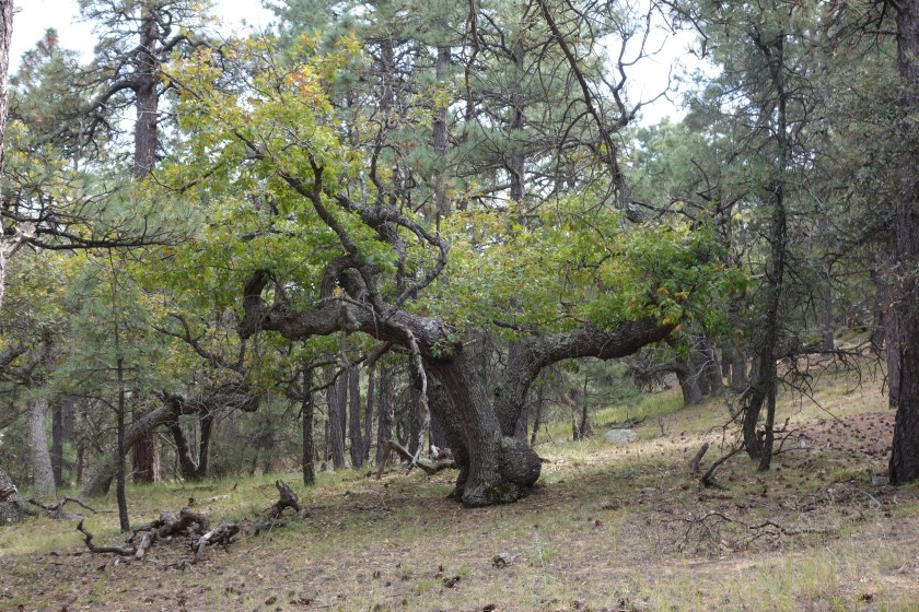
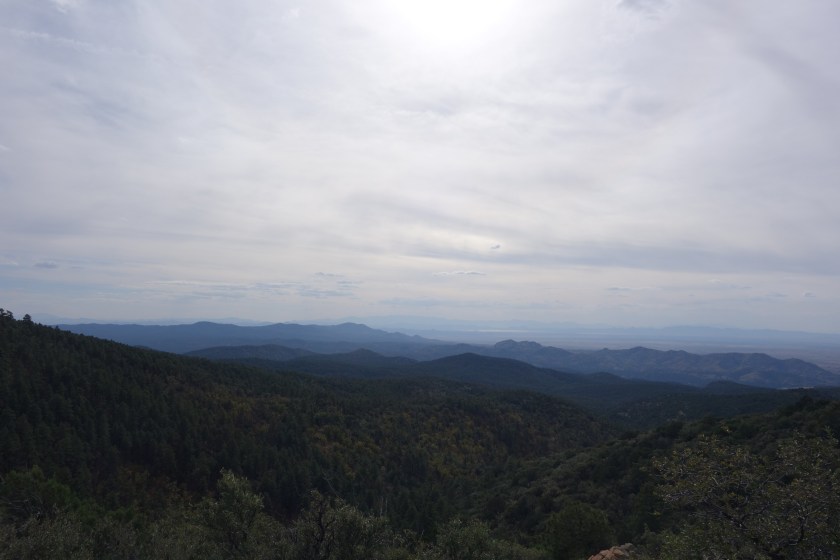
I reached the top of Burro Peak in the early afternoon. There were some nice views and a few great old trees. I believe I even saw the Hatchet Mountains which are right near the end of the CDT. It was a good moment. I thought back to June when I was in Montana and could look back and still see the mountains of Glacier National Park. Maybe I would finish this thing.
This gnarled old oak tree near the top of Burro Mountain was very cool. I am sure wood workers would love to get their hands on that burl.Looking south from Old Burro. It was getting cloudy……
There was one natural spring, Mud Spring, that had good, plentiful water despite the fact the protective coverings and fencing had been destroyed. Later still, when the trail approached a road, a trail angel had left some water for CDT hikers.
I noticed a large bank of clouds to the west and concluded the night would come a little quicker than normal and the sunset would not be too pretty. So, I found a hill top, pitched the tent, and ate dinner by a small fire.
Sure enough, the large cloud bank turned out to be a storm. Desert storms are powerful. My tent was flapping oddly. Eventually I went out to find some of the stakes had wriggled loose from the rocky, sandy soil. To my surprise, there was even a half hour of fairly heavy rain around 2:00 and some lightning. Thank goodness I wasn’t cowboy camping.
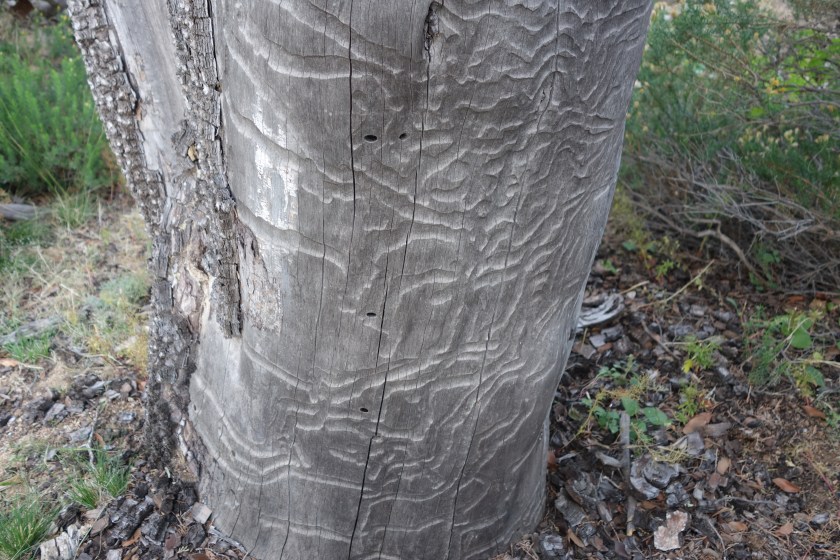
This tree was still alive (barely) despite having lost bark after being eaten by beetles.
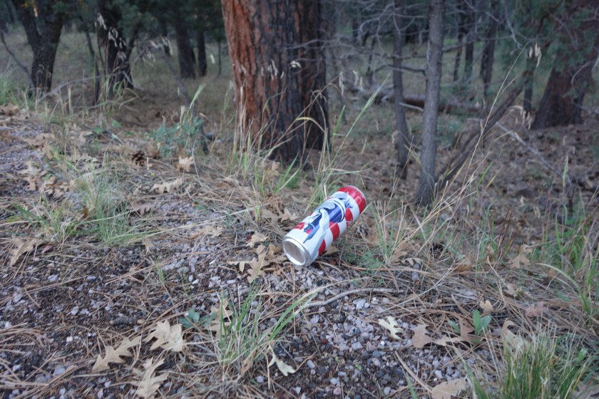
I resumed my road walk along state highway 15. The lack of traffic was nice and the road actually went through some nice forests. Of course, being New Mexico, nice forests also includes beer cans and bottles every ten feet along the road.
‘Merica. Budweiser’s attempt to position their brand as America’s beer can backfire horribly. I don’t think littering this great country with cans and bottles is what America is all about.
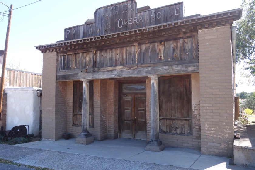
I was able to walk through Pinos Altos, an old town where a Hearst family church was located. I believe they first made their money in mining before media. Otherwise, it was a long hot road walk down into Silver City.
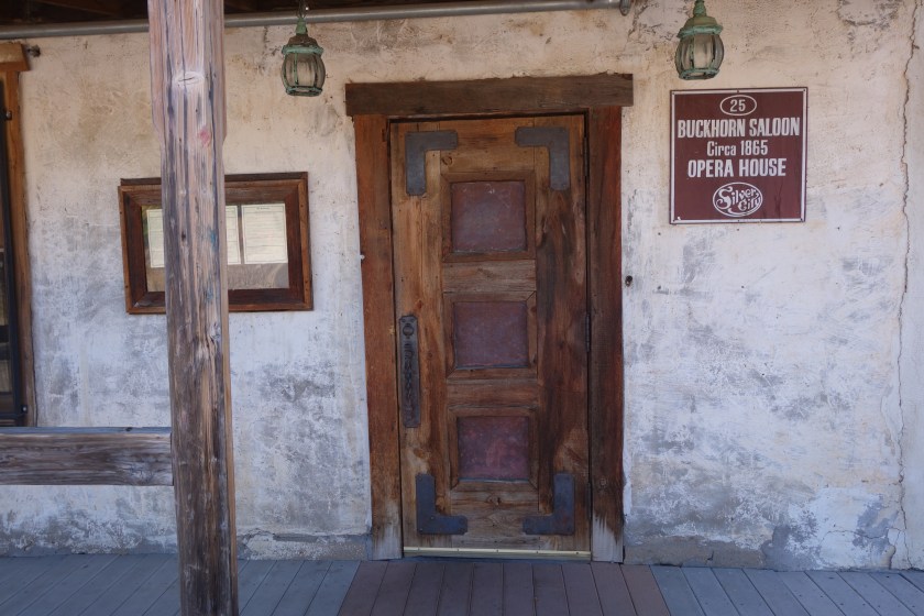
The front of the opera house. No phantoms found.The saloon was next door to the opera house, of course. I loved the door and it may have been the original.
Like other towns, it was facing some economic struggles. You could see the town was fighting back, trying to find uses for old abandoned buildings and touting their history. I liked the spirit of the town, but would not buy real estate there.
The Palace Hotel was where I stayed. It is an historic hotel the owners have resuscitated. They are giving it a good try, but some of the stuff was just not working out (like the shower) and they could not afford to retrofit air conditioning, so it must be a tough place to stay in the summer. Still it was cool to see how old hotels were laid out.
* * *
The long road walk gave me time to think about New Mexico. I realize I am not yet done. Also, I have only been through certain sections of the state on this trip and the one last year. Still, I felt comfortable drawing some conclusions. The overarching theme is bipolar.
I don’t mean the clinical sense of rapid mood swings. But just a real different polarity in their actions or sentiments.
For example, the people are generally the friendliest. They almost always wave, are willing to stop and visit, and are quite welcoming. But they just can’t help but string barbed wire around their property and post No Trespassing signs.
It is such a beautiful state, too. Many roads providing easy access to gorgeous forests. But the response seems to be to enhance the natural beauty with the sparkle and flash of beer cans and bottles. There are places where there is a beer can or bottle every ten feet. Maybe that is why they wave when you see them… to keep their throwing arm in shape.
I have had a few conversations where the New Mexican tried to guide the conversation to how “those boys up in Oregon have a point” regarding a distrust of the government and fear it will take from the private residents. The Oregon boys are the Arizona guys who took over a wildlife refuge for a while. Nobody has been specific about what they fear the federal government will take. To me, an admittedly poor student of history, it strikes me as ironic that they are sitting on land the federal government took from Navajos and Mexicans and gave to US citizens a couple hundred years ago. So, on the one hand, the federal government has clearly seized land in the past. But on the other hand, today’s residents are benefiting from that taking.
Lastly, the volume of Trump supporters is loud in the sections I have toured. Without access to data, I am nevertheless pretty sure New Mexico must be one of those states where the federal government pumps in way more money than it extracts. There is the forest service, BLM, Border Patrol, military bases, Los Alamos Laboratory and then all the state institutions. I would imagine a traditional republican platform about less federal government might be bad news for these folks, but they sure seem to be in favor of Trump. To me, especially with the cattle ranchers, they might want to think more about Hillary. After all, early in her legal career she showed some remarkable skill trading cattle futures.
In summary, while I love New Mexico and almost all of the people I have met, it does have a few rough edges that make me want to be more likely a visitor than a resident.
Home on the way to Silver City. It was an adobe home that had burned and was stuck in the ambivalent state of being uninhabitable but not torn down.
Eager to get past this section and resupply, I cruised early. For a while I must’ve been following a skunk. His odor was there on the trail for several hundred feet. I was thankful I have not had a skunk visit me at night.
Eventually, the trail joined a more commonly used route that took visitors from the popular Gila Cliff Dwelling National Monument over to the Middle Fork of the Gila. I encountered some day hikers. One was a group of ladies ranging from their 50s to 70s and they were making good time. Very inspiring, especially since this section of trail trail is quite rocky.
Once down to the paved road, I made great time. I saw some animals crossing the road up ahead. As I drew near, it was clear they were javelinas. Most just bolted, barely visible in the high grass. However, a few stopped to watch me and I took some pictures. I could see they were gorging on some type of wild watermelon or gourd that grew alongside the road.
Javelinas are not photogenic to begin with, but this guy would not strike a better pose.He had his snout up in the air here. He was lucky to not catch a whiff of me.
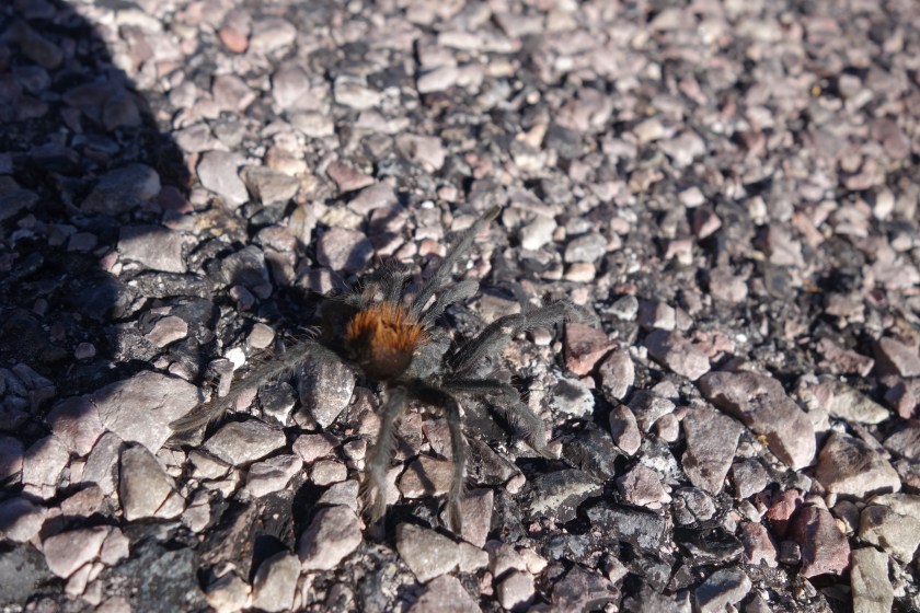
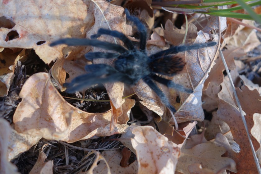
Later, I found a couple different tarantulas. It was interesting to see how they reacted once they sensed my presence. Apparently they do not like their picture taken. They raise up their front legs and make themselves look much bigger. The ones in this area had a section of their body which was a soft brown color.
This one was crossing the road. It got annoyed with me taking pictures and raised its furry rear end and front legs up in the air.Later on, I found this one on some leaves.
I eventually reached Doc Campbell’s trading post. It is an eclectic collection of foods, books, “local” artwork and sundries. The guy who runs it wore a denim shirt and camo pants. He was fairly grumpy and not particularly glad to see me, a customer. I retrieved my box and got some junk food. He charges hikers $3.00 per box to hold them. However, he wanted me to pay cash so neither of us would pay sales tax as this was a service as opposed to the sale of goods. He was tight with a nickel. Also, very strict about other matters such as what to do with my empty resupply box and the correct way to microwave a burrito (70 seconds on high with the wrapper torn just so). He had a huge Trump for President banner proudly displayed in his store. For a guy whose business was so dependent on a federally subsidized park and visitor center as the sole point of the traffic on his road, it struck me as a little odd he was so pro-Trump. But, I have not followed the presidential race too much and perhaps Trump is different.
I resupplied, charged my electronics, and got some water. On the spot, I decided to road walk to Silver City rather than go back to to hike the Gila (combined Middle and West Forks now) for another 20 miles. I don’t know if it is the fact I am 4 months into the trip, but the charm of more river crossings failed to work on me. I’d rather walk along a state highway.
In fact, it was not that bad from a traffic perspective. The only thing on the first section was the Gila Cliff Dwellings and visitation was probably down this time of year. Aside from traffic, the first five miles were tough because I started around 1:00 on a hot day and it was all uphill. I complain about backpacking hills being steep sometimes, but at least they get it over with quickly. This road rose steadily for five miles.
I came across an interesting contrast. There was one roadside informational display. The Forest Service had spent some money to create informational signs explaining that forest fires were a good thing, critical to maintaining the health of the ponderosa forest. Suppressing fires let the under story plants grow, choking out native species. Moreover, animals, I was assured, could escape fires and were thus not likely to be harmed. In short, the various kiosks convinced me fires were a necessary thing.
However, there are many many Forest Service signs, some just a mile down the road, admonishing against fires, warning that fires kill, and to be extra diligent. So, I was a little confused. If fires are so good, why all the warning signs? I guess that lightning creates healthy organic fires and people create unhealthy fires.
I found in the Handbook there was a tavern / inn down the road where I might purchase a meal and get a room. I picked up my pace hoping to reach it before dark. On the lightly traveled road, I was averaging about four miles per hour. When I got there, it was closed for the season.
Disappointed, I made my way uphill. I was also disappointed to see that I was once again in private property. However, one of my maps indicated there was public land once I reached the top of the hill. As the sun set, I did reach the top of the hill, the barbed wire stopped, and I saw forest service signage. I pulled in to a short forest service road that appeared to have been camped in before. I was breaking one of my cardinal rules: never camp by a road or campground on a Friday or Saturday night. But it was dark and there had been little traffic on highway 15.
After I pitched my tent, I was surprised to see I was getting attacked by mosquitoes. They were the first I had seen since Wyoming. I just shooed them away.
As I started to fall asleep, somewhere in the distance a dog started barking. And kept barking. Continuously. It was one of those annoying sounds that I should’ve been able to ignore, but once I heard it I could not unhear it. Eventually I dozed off, but every time I woke up it was still barking. Neighbors must have the patience of Job.
To prove my rule, about 3:00 in the morning, I heard some young women cackling about 20 feet from my tent. They were from a car that had pulled over so they could pee. Given their speech and the time, I suspect they shut whatever bar down and were driving home and decided to relieve themselves. Upon finishing their task, they sat in their car and idled for another 15 minutes. I was tempted to walk up to the side and stick my big furry homeless man face in their window on this deserted road, but I figured New Mexico is a gun friendly state and they were ripped.
Finally, they drove off. The dog stopped barking. I slept really well from 3:30 to 4:30.
What a brutal morning. I could not bring myself to get up and get going. It did in fact freeze along the river. I was glad I brought my water filter into the tent to prevent it from freezing and cracking. But that was the only thing to be glad about.
I got dressed slowly. I put my wet sock underneath me to try to at least warm them up a bit. I breathed warm air into my frozen shoes to create some flexibility before wedging my foot in them. In short, I stalled. However, eventually, I did the deed and slid on my wet, nearly frozen socks. I then wiggled and stomped them into my mostly thawed shoes. Finally, the shoelaces were wrangled into position, and I was up and going.
The thought of that first river crossing was almost too much to bear. I decided that terrorist suspects would fear putting on wet, frozen socks and shoes every morning until they revealed their secrets. I think we’d get some fast answers.
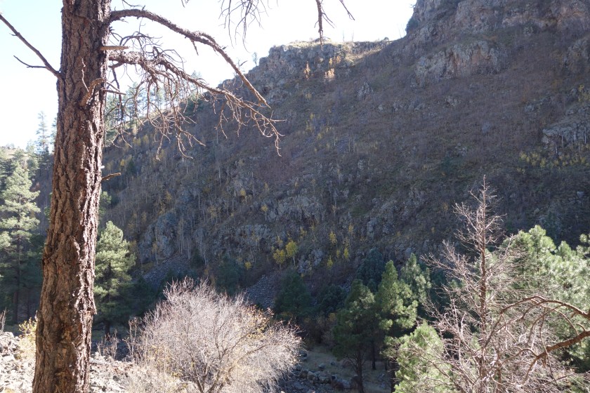
Walking along the Middle Fork of the Gila River was ok. Many backpackers consider it a highlight. The steep walls are interesting. There are often caves formed on the cliff and other times the sheer walls go straight up. Down below, along the river, there are sometime wide areas with intereting plants.
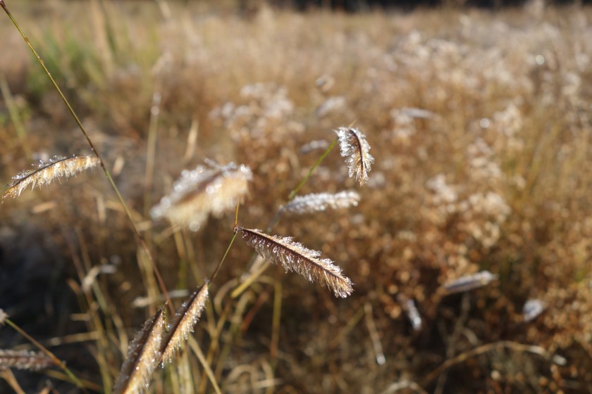
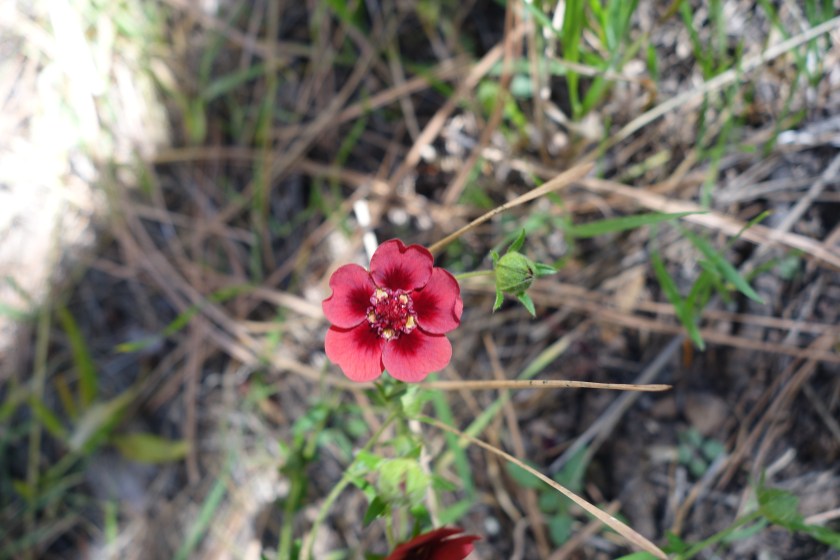
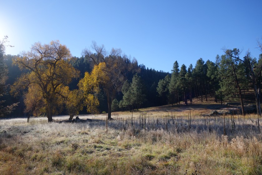
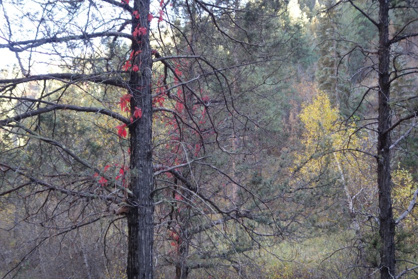
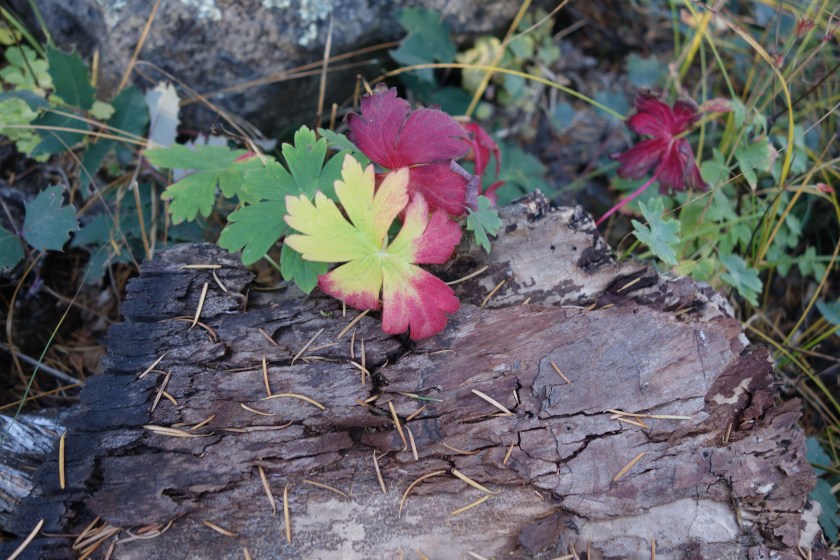
The dew had frozen on the grass in the valley. There were few flowers, but this one jumped out with its red color.There were some meadows. In the still morning air, the yellow leaves of this tree drifted down onto the frozen grass.
There are piles of debris 10 feet high 30 feet from the current stream bed, silent testimony to the power of the river when it rages. When you see those news stories about flash floods in the southwest, imagine all the water being forced through a narrow canyon. Just the sound must be intimidating. There is wildlife here as well. I surprised 4 mule deer that were wading in the river.
But the river can be tough. Due to its flooding, there is no trail. crossing a river can be tricky with the slippery rocks below the surface. Plus, sand gets in your shoes, silently creating friction within your wet shoes. There are some backpackers who report crossing the river 200 times in their hike. Me? I was ready to bail by noon. It just seemed unnecessarily tedious for the repetition of canyon walls. In fact, almost 18 months ago to the day I bailed out of the West Fork of the Gila River when I hiked the Grand Enchantment Trail and grew tired of the tedium.
The canyon walls had interesting caves. Here, the water had bored through the wall creating a portal to the trees growing behind it.Trees grow on the sheer cliff face. It is hard to see, but there is a 50 or 60 foot ponderosa growing out of a rock just to the right of the center.
The climb out of the river canyon was on a seldom used trail that seemed to evaporate at times. Still, I was able to follow it to reach the mesa between the West and Middle Forks. From there, I knew where I was. And it was beautiful. I was surprised to find some small creeks flowing. I also came across the footprints of SBJ and MLL. Apparently they grew sick of the canyon even sooner than me. Near sunset, I lost their trail. I think they either tried to bushwhack or cut out to camp for the night. As I neared a small lake called the Woodland, I saw a beautiful bull elk. I scared it off as there were hunters in the area.
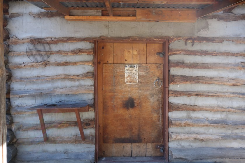
The door to Prior Cabin, a backwoods cabin for the forest rangers.
Eventually, I settled on a ridge top and had a nice little fire with a view of total darkness in all directions. I know it seems silly, but in this day and age, I find a lot of joy being able to look for miles in all directions and not see a single man-made light.
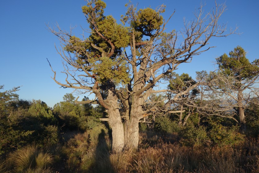
On top of the mesa, there are ancient pines and junipers. Many have dead portions, but they still manage to live somehow. This one had a trunk that must’ve been ten feet in circumference.
Another morning where I subconsciously do not want to get up and somehow push my watch deep into my sleeping quilt so I cannot hear the alarm. I must be killing the battery doing this. Still, I am up and going in the dark with the moon almost straight overhead. Within the first 200 feet on the road, I startle a small group of cattle. I think I came up on them so fast and the headlamp blinded them because they just stood and stared.
The grassy area was vast. Probably 2 miles wide and 1 1/2 miles long. I was following a road that went almost the full length. I turned off the headlamp and enjoyed the moonlight walk in the brisk air. On my right, I woke up a small herd of cattle, perhaps 30 total. The fastest ones got up at the sound of my approach. They chose their bravests and smartest leader and formed a herd to escape the terrible danger I presented. She was a good choice for a leader. Vocal, to give directions and encouragement. Strong, to sustain a stampede as long as necessary. Observant, able to keep an eye on the threat. Unfortunately, she was still just a cow. So she led a stampeded in the dark of about 15 cows and calfs. They ran parallel to me for at lest 15 minutes. Not perpendicular and away. Not diagonally and away. And, no, not the opposite direction and away. Instead, she led them on a half mile run right next to the danger source. This domesticated stupidity was only topped by the second half of the herd, about 100 feet behind the first half, which had a clear view of me and the folly of the lead group, but instead chose to follow the herd rather than simply stop and be free from danger. I just stopped and waited for 15 minutes while the herd wandered away.
I climbed steadily after that and again entered high ponderosa forest. It was all road walking. I pulled my standard road walk stunt and missed a turn adding an unnecessary 1 1/2 miles each way detour.
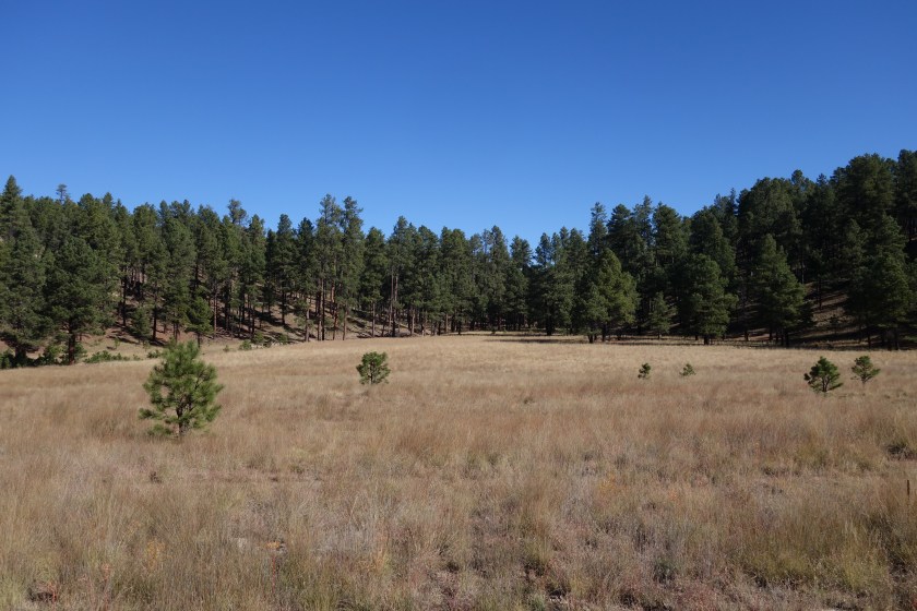
The land then turned to pure seasonal grassland. Since this was not the season, it was a scratchy brown carpet of dried grass for miles. Eventually the trail drops into a canyon and follows that providing some interest.
Eventually, I reach Snow Lake. It is a man made dam with a good sized lake. To me, the good news was the campground that had well water. I had a great break there and drank tons of water even though I knew I would soon be dropping down to the Gila (pronounced hee lah) River. The only bad part was the name of the campground: dipping vat. Nowadays, it seems innocuous, but I believe the term is used to describe a water body into which a ton of chemicals were added and the herds driven through to combat infestations. Mmm, enjoyed that water.
I went past the dam and dropped down into the canyon. It was about 4:00 and I knew night would come early, these are steep river canyons and the Gila is famous as a home to people for thousands of years. After about an hour I realized I should let Helen know my satellite device will not work in canyons this steep. I was right. My messages did not go through, no matter how wide the canyon.
I crossed the river about 5 times. It was obvious that earlier in the year a significant rainfall had occurred. All plants within 5 feet of either side was still bent over. The only tread I could see was a pair of horse hoof prints. I got twisted around a couple time, but the great thing about rivers is that getting back on track is pretty easy.
I finally found a wide flat spot elevated from the river. The river was about 10 to 15 feet wide and mostly shin deep. Still, I like to sleep up and away to avoid the sound and the cold valley draft. I camped next to an abandoned fence and I think the area may have burned. I built a small fire that night and was impressed with how long the old juniper fence posts burned. It was like oak. There was no point trying to dry my shoes and socks over the small fire. I know two things from experience: 1) they are more likely to burn than dry over a fire and 2) tomorrow they will get wet again.
So, I took my shriveled white feet and got in to my tent and went to sleep a little later than normal. I was not looking forward to cold wet shoes in the morning.
I got up and going, eager to climb the mountain first thing in the morning. I loved the trail in this area. Even in the dark, it was a beautiful climb. I wanted to be high when the sun rose as those are the prettiest photographs. However, it looked like it would be cloudless and therefore less visual interest.
There was a choice of taking an alternate which was shorter and in a valley or the official trail which was up high and longer. Also, the comment was the official trail was “wicked” in some parts. While there was one old section where no tread or cairns existed, enough tree notches were around to navigate. The rest of the official trail was gorgeous. It was graded well, stayed in trees, but offered vast views. I am so glad I did not take the short cut up the valley.
A pleasant surprise came in the form of a small seasonal creek. This area was hit with a storm a few days before and this one stream was still trickling out some groundwater.
The trail entered more arid, desert-like terrain. I did see a bobcat for the second time in my life. Coincidentally, the only other time I have seen one was about 18 months before and 100 miles southeast.
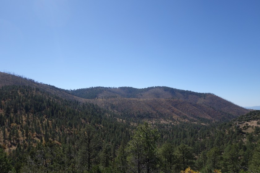
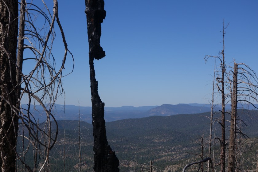
This tree was picked out.mountains in the background were burned except at the top
A skeleton of a tree in the burned area.
Later, I had a steep climb through a burned forest. That hot climb through a tough territory was rewarded with a long slow descent through a vibrant pine forest on the other side. Even an unreliable water source (Dutchman Spring) was full of water. As a result, my afternoon and evening was spent walking slowly downhill through an older ponderosa pine forest. I saw two cars in 6 hours. I also ran into a northbound section hiker named Arizona Chap.
The quiet road was surrounded mostly by ponderosa, but there were sometimes oaks to provide fall colors.
I camped at the edge of the forest. Out here, the ponderosa gives way to pine, juniper and scrub oaks before turning to grasslands. As the grass grew more dominant and the light more scarce, I went off the road and found a modest sized juniper with flat, smooth ground underneath. I made camp and listened to the cows and coyotes down in the grass. The moon was coming up later and later, so I went to sleep in the dark. It did not feel like it would freeze, but I still brought the water filter into the tent just in case it did.
I got going a little later. Much to my surprise, it wasn’t insanely cold, just mildly cold. As I was packing, a few vehicles went by. Hunters on their way to their posts.
Within about 25 minutes I was chugging up a slope. I heard an elk call ahead. I walked more quietly. Using my headlamp to pick out and avoid any sticks. On my right I see three faces turn to look at me. To my credit, I kept all noises, liquids, and solids inside my body. My first thought was leprechauns, but it was just some young guys squatting down to hunt hunt the small valley below. We exchanged whispered information and I was on my way. Turns out they were the ones who made the elk sound.
I climbed up Mangas mountain. It afforded some nice views looking south. I did not go up to the lookout. I believe they are no longer staffed by this time of year.
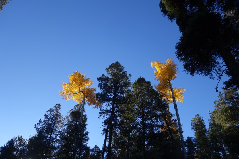
A few aspen break up the pine forest and provide color on Mangas Mountain
It was a fairly dull day after that. I walked down in to some valleys and was on forest roads. I did have one guy on an ATV come by while I was taking a break on a log. I was off trail a little bit and he did not see me. I was curious to see a large bag of some type of feed in the back of his ATV. An hour later, he came back and the feed bag was empty. Yea sportsmanship!
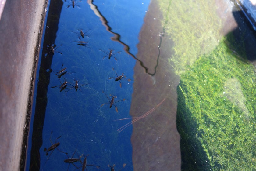
Late in the day I came to a large metal tank with an attached solar pump. However, since the cattle were gone, the pump was not working. The owner had locked it. I looked in the tank and it was quite the little ecosystem. Down on the side, there was a small trough which had clear water and some green aquatic plant, clearly the lesser of two evils. The water was actually cool and tasted OK after filtering.
Water + vegetables + animal protein = Backpacker’s DelightNo worries, my filter kept out most of the bugs.
I put water in my dehydrated meal. For the first time all trip, the bag leaked. Of course, it would be coconut curry that leaked. So, the outside back pocket of my backpack now smelled like a Thai restaurant and I was now carrying a bag of rehydrating food in one hand as I hiked in the twilight.
I was heading up a ridge and heard elk bugling. It sounded real this time. Sure enough, I could see the bull ahead of me in the thin trees. As I got closer, I got my camera out and got the video ready. I honestly convinced myself that I was going to capture dramatic elk footage with the camera in my right hand and a dripping bag of coconut curry in the left. Surprisingly, I got pretty close, I came around a corner and found the bull and a cow in flagrante. It doesn’t matter whether it was me or the curry, but they noticed me and took off.
Ended up cowboy camping on a bed of ponderosa pine needles on a small ridge. It was a little breezy, but a fine spot nonetheless.
Well, it was not the cars that kept me awake. Bull elk apparently are partial to the National Park Service. All night I heard from across the road the various grunts, bellows, and bugles that are the ruminant equivalent of a Barry White medley. The fact this must work does not speak highly of elk cows. Perhaps the almost full moon added a little extra zest to their passion, but I was glad for my alarm to go off at 4:30.
Have I mentioned that New Mexico is freakin’ cold? Again, I had everything on and was cold. I was first walking down the highway and then cut over to a dirt road that went up Sand Canyon, another well-named geographical feature.
My first water source was supposed to be a solar well. Since this was pre-dawn the pump would not be working and, besides, I could not find it in the dark. I later also skipped a one mile side trip to a wind mill rumored to have good water.
I passed many hunters camped along the road. The few I spoke with all said there were signs of elk but they could not find them. I wanted to explain where the bags under my eyes came from, but chose not to. After all, if the fact something kept me awake at night was reason enough for me to send hunters with guns to kill it, many dogs and car alarms would be gone by now.
I climbed steadily upward. I met my last two elk hunters as I neared the peak for the day. We were on a dirt road. They asked what my route was. I told them I would follow this road, cut north, and then descend a canyon on the opposite side. They were well intentioned and twice warned me this road dead-ended just ahead. I thanked them and went along. I grabbed water from a “tank” which was an earthen dam that collected muddy run-off. I would filter it as a last resort.
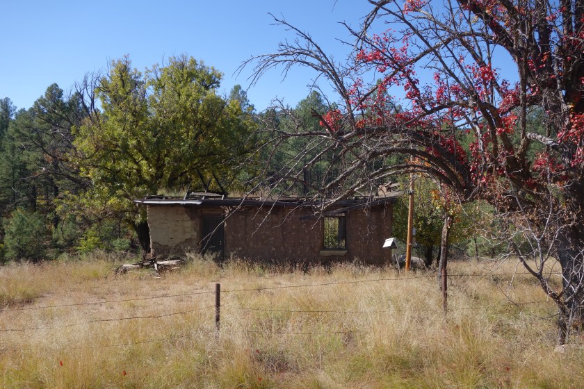
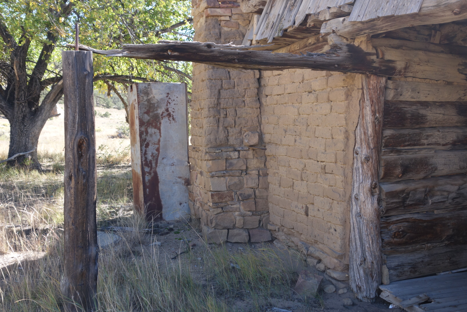
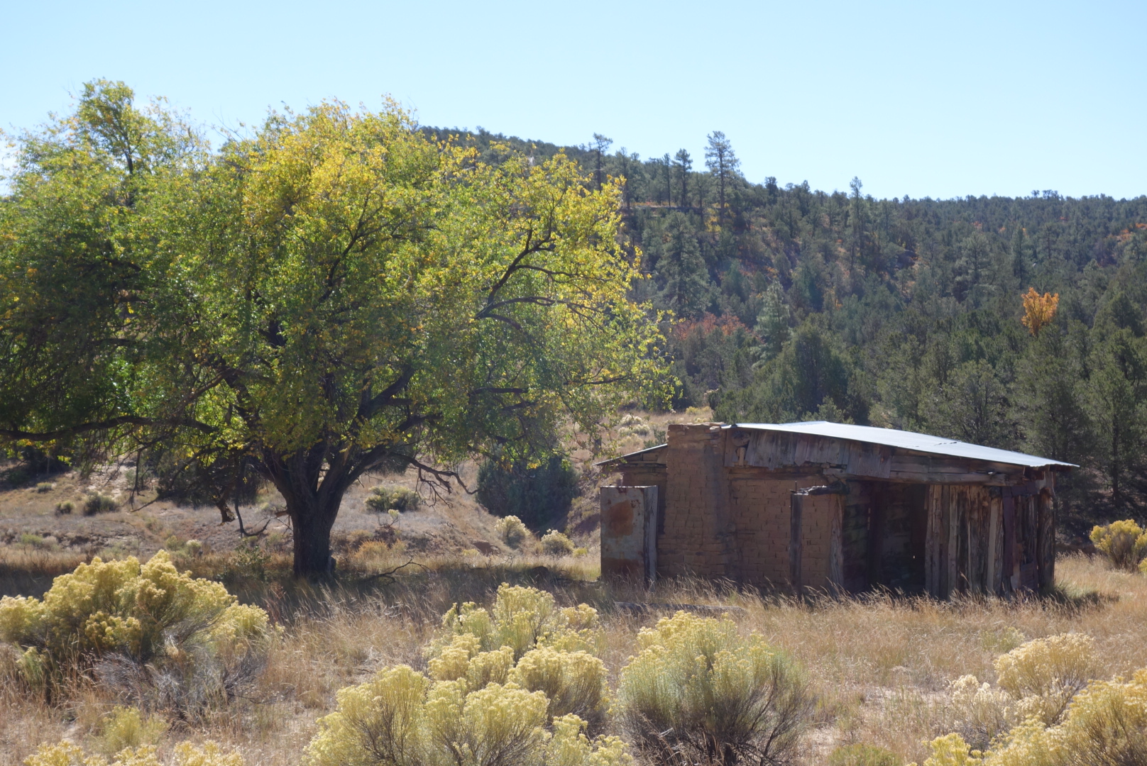
The hike down Armijo canyon went fast. The temperature waremed quickly. I came to a vary old cabin and dry spring. Allegedly, the original building dated from the 1200 and various occupants had added bits over time.
Some of the masonry was reported to be quite old.
The old cabin
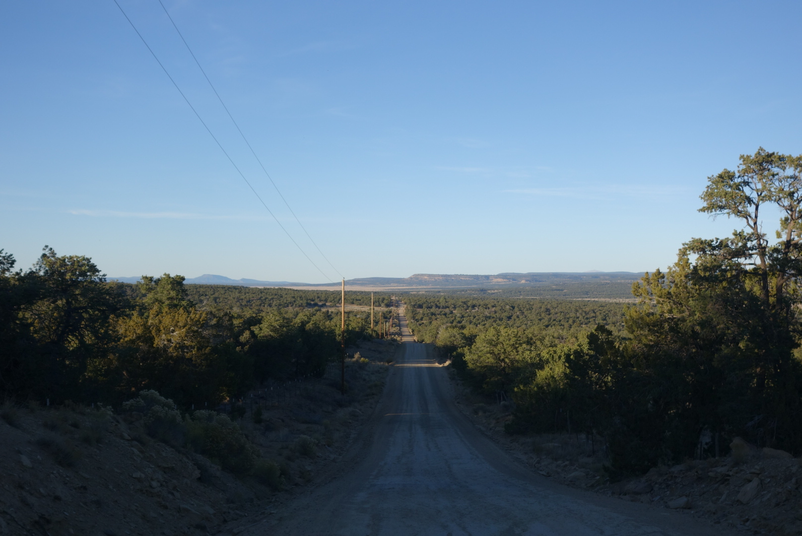
Finally, the canyon drops out into a broad canyon where ranching is the only activity. In fact, there is only one ranch, the York Ranch. ( Later I learned it is 180,000 acreas and was recently sold for $11million). The gravel road that would be my home for the next 24 hours was the York Ranch Road. Yup, York Ranch is the boss out here.
Looking back down York Ranch Road from a crest
I was down to my brown tank water. About every 20 minutes a vehicle would go by. I would shake my water botttle at the approaching vehicle, a sign I needed water. Nobody stopped. I gave up. At this point I was approaching a reliable solar well. It was big and beautiful. A solar pump poured water into a huge metal tank that must’ve been 20,000 gallons. when it came out of the pipe, the water was cold and delicious, coming up (I later learned) from 900 feet below.
As I got back on the road hydrated and lugging 5 liters (10 lbs) of water, the first car that came by stopped and asked if I needed anything like water or food. In fact, three more cars did that. Two drivers said there was another hiker behind me on the same road.
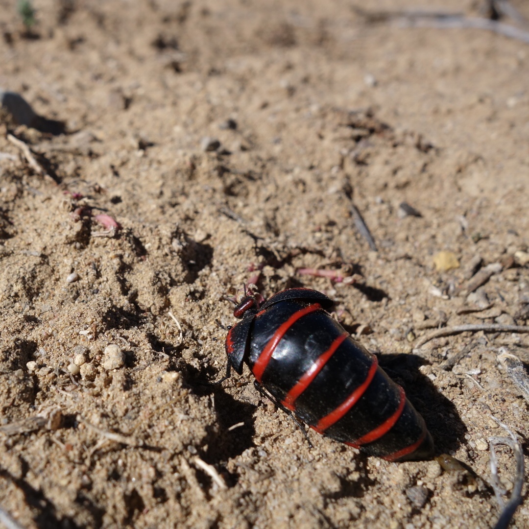
This odd bug was near the water tank. Its head is so tiny in relation to its body.
I made good time on the road, but as it got darker, it was clear that I was not finding any public land. On each side of the road, the familiar New Mexico hospitality signs of barbed wire plus “No Trespassing” greeted me for miles. Finally, around 6:00 I reached the Thomas Mountain Ranch which has a sign out front encouraqging hikers and bikers to come in for water. I came in and hoped I could find a patch of land to camp on.
The grounds were a collection of welded water tanks, a few idle recreational vehicles, and a large metal shed/ hangar. I was there during supper time, so I cautiously looked for a place to camp. Out of the hangar pops John Thomas. He insisted I come in. I met his wife Anzie. Over the next three and a half hours I would learn about their life preaching, working as a metal fabricator,, service in the Korean war, and political beliefs.
He was 84 and she was a bit younger. Both were sharp and entertaining. They lived full and intersting lives. They bought a little piece of retirment land and it turned out the Continental Divide Trail went right by their front door. They loved helping out the hikers and bikers with water and a place to sleep. They kept a scrap book. For every hiker there was a page and a number and a note. (I was number 261, I think.) The first entries were some college students from Minnesota that stopped and asked for water in 1999.
I was offered a defunct RV to sleep in. It had a bed and sofa. I slept on the sofa and left early the next day. In contrast to the cold, no trespassing, and barbed wire, I was glad to end my day in the warmth of the Thomas Ranch, their hand-welded fire box, and a warm family.
Well, New Mexico continues to be one of the coldest states on this trip. I bundled up with everything I had and moved along in the dark. I knew there were a couple good water sources ahead, but I also knew I would be going through a very dry area called “The Badlands” a name which must’ve gotten published without first running through the chamber of commerce.
Looking down the valley before crossing over to El Malpais
My second water source was a windmill tank. There was a slight breeze in the valley and therefore the windmill was pumping out fresh water from the ground. I filled my bottle and my 3 liter platypus bladder. My hands were very cold after that, but the sun was about to crest the hill and then, I knew, things would be very different.
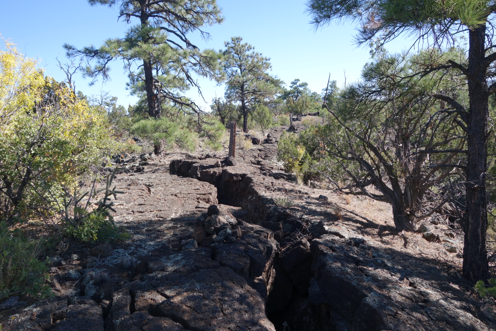
I came to the highway and crossed it to reach the parking lot for the national monument known as El Malpais. Nobody there and surprisingly little signage. When all you have to offer is sharp rocks, no water, little shade, and hard-to-follow trails, it is no surprise that the public does not come streaming in. I did see an interesting symbol/sign. Perhaps I have been on the trail a long time and apparently crawling on your knees with a headlamp is a new trend, but not allowed in El Malpais.
Not sure what is going on in the next to last symbol on the right. Whatever it is, you can’t do it here.
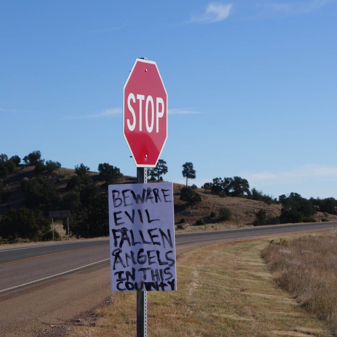
Also, there was a handwritten poster attached to the stop sign. On top of worrying about water and tarantulas, apparently I now had to watch out for fallen angels. Unfortunately I was out of range and could not google an image so I would know what to look for…
Thanks for the head’s up.
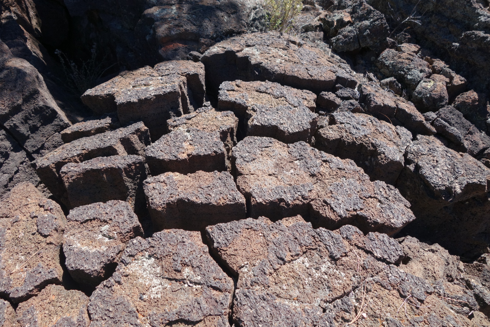
The badlands were not so bad. Volcanic rock is very grabby and so I stumbled a bit more. However, I grew to like the patterns the dried lava made and seeing some of the holes where it had spewed out millions of years ago. There was also a surprising amount of plant and bird life there. Later on, I met a hunter who explained that the remains of a father and daughter were recently found after going missing for six years in the Badlands. I could see how one could get truned around if there was not a lot of wilderness experience.
Dried, cracked lava.More plant life here than I expected.
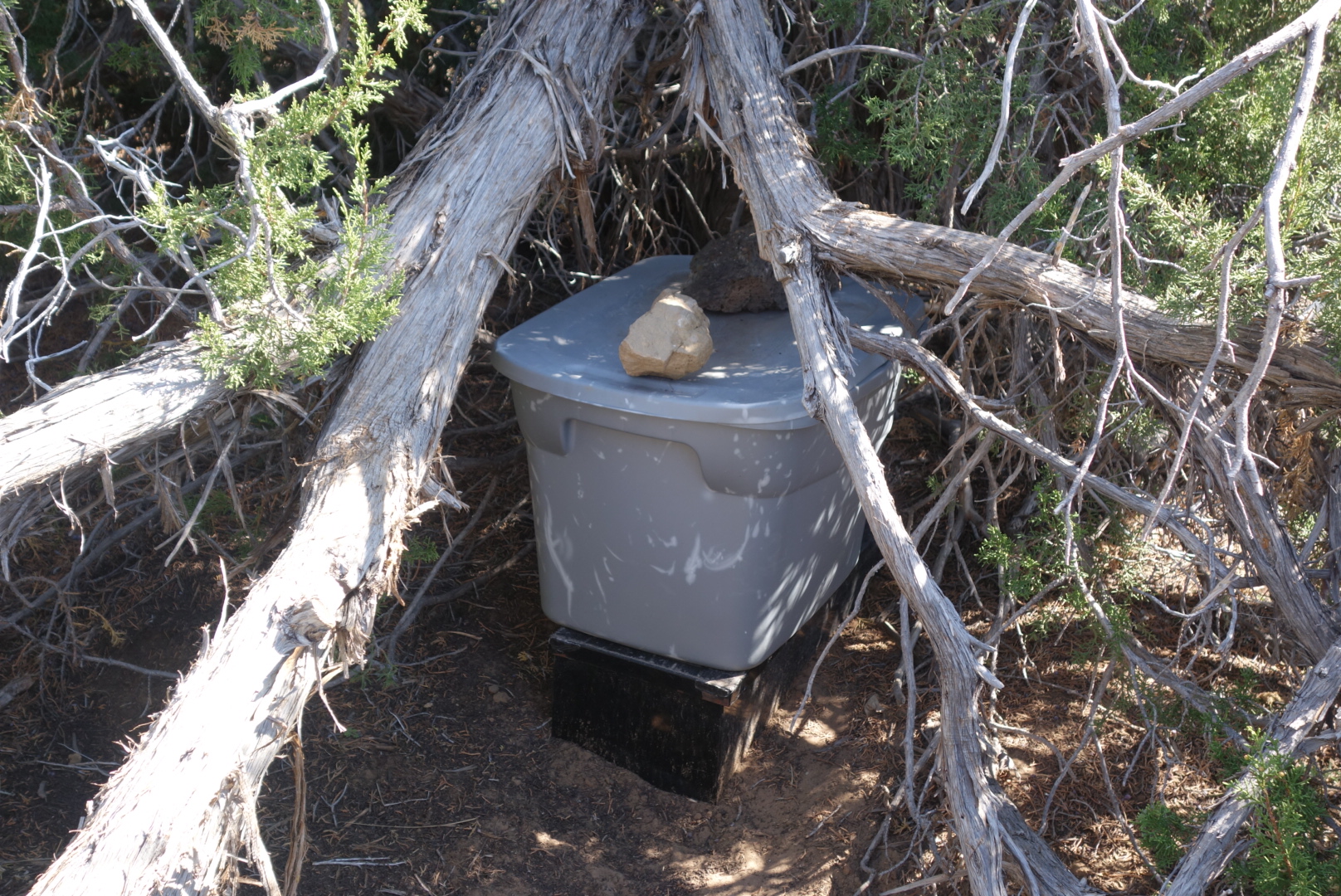
When I emerged from El Malpais, I found a lovely water cache maintained by the Mumms, a local family. The water was in a cooler tucked under a thick juniper. It was still cold from the night. I drank over a liter and restocked my water supply. What struck me as odd was that my predecessors would take a bottle, drain it, and then put it back in the cooler. For people who live and breath small spaces, why none of them crushed the empties and put the cap on to save space was amazing. I spent several minutes reducing the size of the empty bottles and then set out on a long highway walk.
Yes! Water cache!
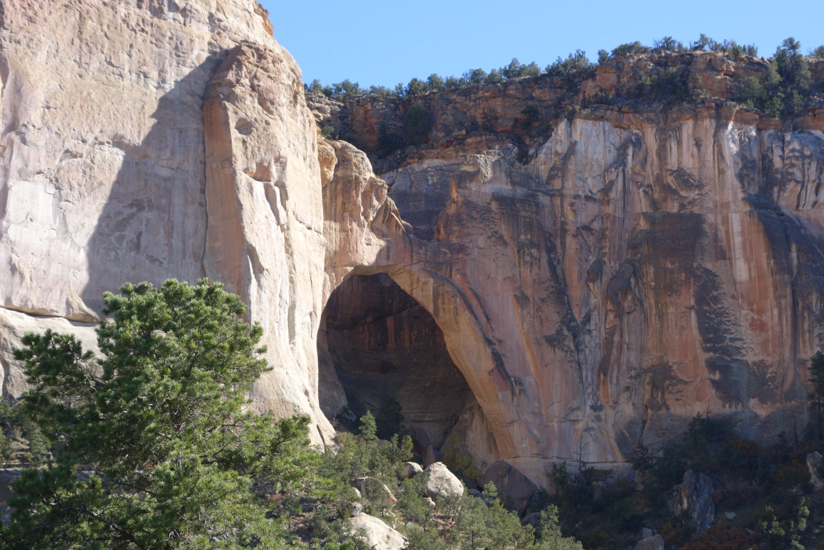
It was a long hot road walk along 117. I did go past the La Venatana arch. One route recommendation was to scramble up the hill beside the arch and walk along the mesa parallel to the highway. Why I would climb up to a thorny mesa to bushwhack my way above a highway was an unanswerable question. It promised a good view of the badlands, which struck me as both ironic and unappealing. Instead, I trudged along the narrow shoulder for 6 hours.
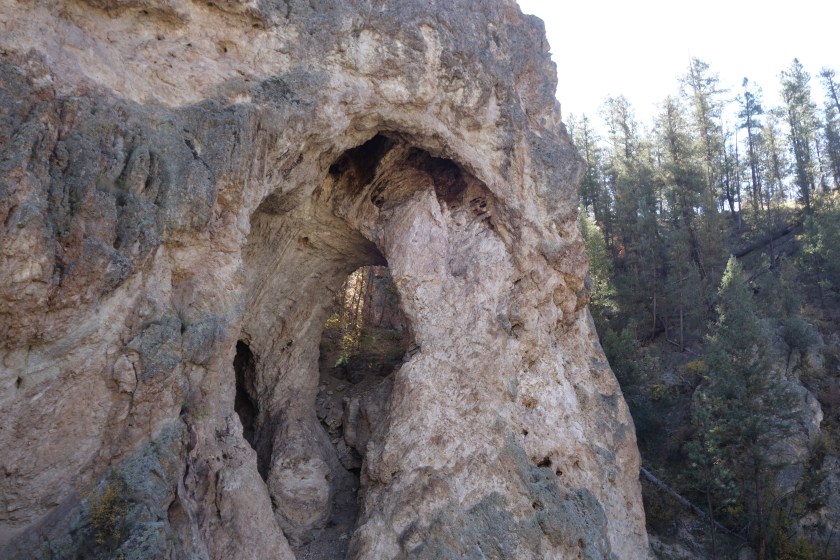
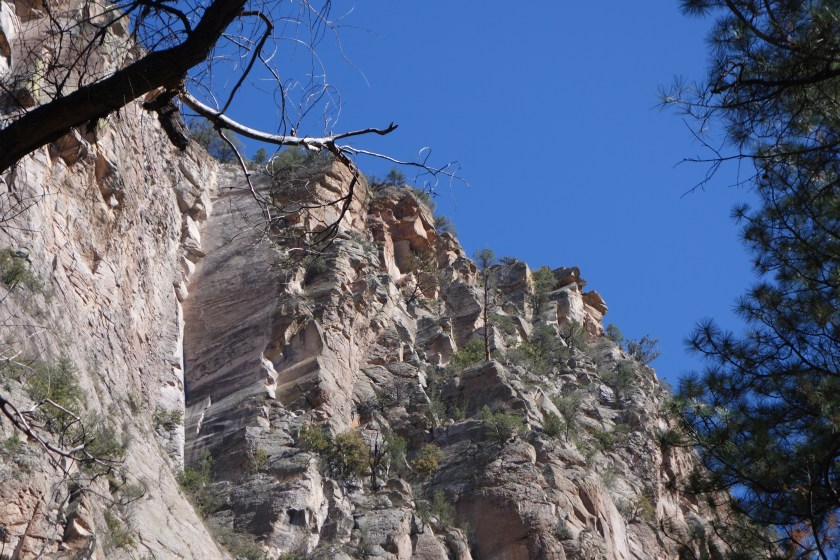
The Ventana arch. It was impressive up close. Just needed a McDonald’s underneath. ..Some interesting rock formations above the highway
For many miles this highway had robust barbed wire fences on both sides. On the east, every 150 feet was a placard indicating the land was owned by the National Park Service. On the west side, every 150 feet was a placard indicating the land was owned by the Forest Service. How many dollars were spent documenting and defending these boundaries was mind-numbing. I wondered, as I often do on long slow walks, whether there was some sort of unknown controversy where the Forest Service is squatting on Park service land (or vice versa) and we just aren’t aware of this terrible conflict.
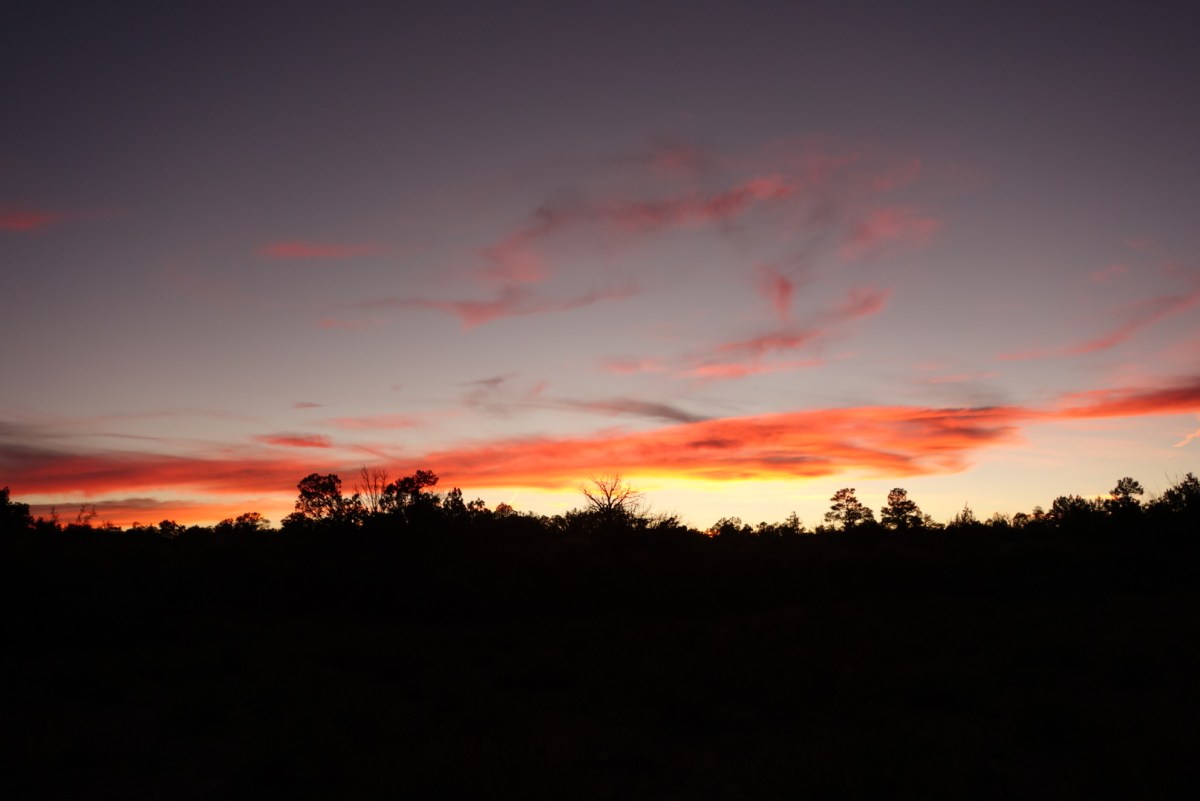
Towards sunset, the Forest Service won the eeny meeny and I hopped their fence. I went over grazing land and got next to some hills. The cattle were gone, but I surprised a few elk cows. Another lovely New Mexico sunset and moon rise helped soften the fact I was camping near a highway. I fell asleep before the 9:00 coyote cacophony.