Stoney Indian Pass

June 28, 2018

(Apologies but my blog vendor, WordPress, has deployed a brilliant business strategy of preventing customers from loading photos remotely. I’ll try to keep Instagram updated with photos. )

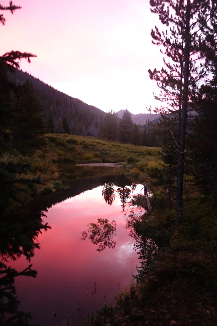
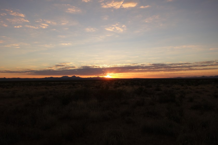
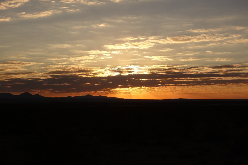
The wind at Coseley Lake died down during the night, offering a gorgeous mountain-reflected-in-the-lake view.

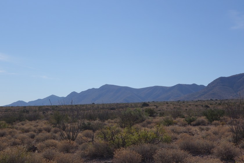
We broke camp and started what we knew was going to be a tough day: about 2,200 feet over Stoney Indian Pass.

At first, the trail climbed gently with a lush understory. The weather turned a little overcast, but that actually makes for good hiking. We ran in to a trail crew that had been doing trail maintenance. This was welcome news. Over winter, trees get blown down or avalanches and landslides knock trees across the trail. They are a pain to get around. Thus, we were fortunate to have them clear our way.

We started gaining elevation and encountering waterfalls. Above one we could look down and across the stream and see a huge reddish brown grizzly grazing.

At a higher level, we climbed into a bowl shaped area that had twin waterfalls feeding a crystalline pond.

Climbing still further, the temperature dropped and blotches of snow appeared. We climbed past still another waterfall and just above it we had to cross the ice fed stream. I hike in mesh trail runners and keep them on for stream crossings. Plus, I use a hiking pole to cross facing upstream so I am basically moving a triangle across. I sure as hell don’t link arms. Ingrid wanted to keep her boots and shoes dry and cross barefoot. Reluctantly, I let her do that. I remembeted that Q-tip did that on the CDT. Knowing that in such cold water your feet hurt after 7 seconds and start numbing after 10, I crossed right behind her, downstream. There were definitely some nervous Dad moments as I watched her struggle the last few feet as her feet (and mine) grew numb and had trouble finding the next step with the waterfall only about 20 feet downstream.

We were now entering areas where the snow fields covered almost one third of the trail. It started drizzling and we donned rain gear. Finally, after a rigorous set of switchbacks and a good sized snow field, we reached Stoney Indian Pass.

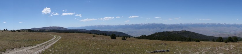
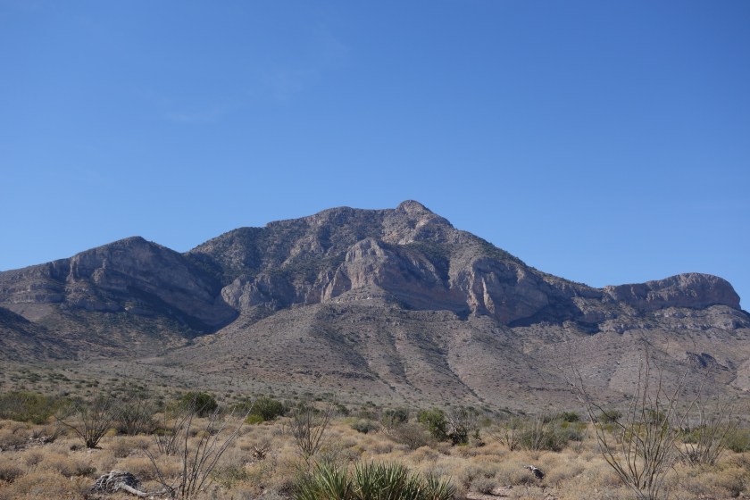
The views were amazing. As the clouds thickened, they began enveloping the uppermost peaks. The rest of what was visible was gray stone with snow accents. Several hundred feet down from us was Stoney Indian Lake. Clear parts were blue, but a portion was covered with ice and obvious avalanche debris. This was going to be a steep descent on a north-facing wall. Rhonda and David had given us some tobacco and explained a humble ceremony which Ingrid and I performed.

As we started going down, I insisted Ingrid take my ice axe. I broke out my hiking poles. At the top, almost the entire trail was under a steep snow bank. We could barely discern the trail, cobbling together melted snippets and the vague footprints of a couple people who went before us a day or so earlier.

More unnerving than the waterfall, I was seriously concerned about Ingrid slipping and sliding down hill into a tree or rock. So, we eventually came up with a plan to bushwhack our way through the areas barren of snow and intercept the trail further down. After a nerve wracking hour, we eventually found a flatter portion of the trail. About 50 feet before reaching the lake, we did our best shoe skiing down the last slope which was fun and a release from the tension.

After the lake, we crashed down several hundred feet and a good six miles to Kootenai campsite. We were both tired. We opted for an early dinner. Even though campfires were permitted at this site, we both chose to just go to bed. For those of you who know I am a bit of an insomniac, seeing me go to bed by 8:30 would shock you.

Beside a lake with a gentle breeze and a thick, lush forest behind, it was no surprise I fell into a deep sleep right away. Until the sticks started breaking somewhere in the woods.

Day One

June 27, 2018

{NOTE My blog vendor, WordPress, is not allowing me to load photos remotely. I will try Instagram as a way to provide visual interest to the dry, crusty written word in my blog. Will add photos here later. Sorry.}

Yesterday, we made it to Many Glacier ranger station. We hoped to get a permit that matched the online reservation we made months ago. The challenge was that we requested a route over two passes and this was a heavy snow year. The ranger was hesitant to give us our route. However, we finally won her over with our microspikes, ice axes, and experience, plus a full-on charm offensive. I’m sure it was the microspikes.

We had to watch the bear video that also covers other hazards. The Park Service recommends that people ford rivers by linking arms and walking perpendicular to the current. Admittedly I am an amateur, but this seems absolutely daft. First, if the current is strong enough to knock one over, wouldn’t the rest fall like dominoes? Second, if my arms were linked to yours and I fell in, no matter how much I loved you, my fingernails would be two inches deep in your flesh, sealing your fate to mine.

Anyway, they gave us a permit for a route which they said was “not recommended.” I was very tempted to ask whether the ever recommended routes they did not permit.

We were able to check in to our motel early, drop our packs, and take a 10 mile hike. We took a popular out-and-back trip to Iceberg Lake. All shapes and ages and sizes were on the trail, almost all happy. Except for the parents of young kids who were stomping down the trail grumpy with grumpy kids.

As billed, Iceberg Lake had an iceberg. Also, there was that guy. You know, the one who understands that the park rules and several signs saying No Dogs applies to everyone else, not him.

The next day we were picked up by the shuttle taxi. It was very interesting to meet David and Rhonda. They live on the Blackfeet Reservation. They started the shuttle service to transport folks around the Glacier area. In addition to educating us about their culture, challenges on the Reservation, and their business. I was most impressed with how they have adopted four children in their community from parents unable to properly care due to drug or alcohol problems. I felt small next to them. They know full well that each of these kids are prone to the same problems as their birth parents, but Rhonda and David opened their hearts and home to give hope.

Around 11:00 we reached the Canadian border at Chief Mountain. We took the obligatory border photo and then started hiking.

The meadows were full of flowers and the forest was a lush green. We spent the first hour descending to the Belly River. Once there, we encountered several hikers and enjoyed the snow capped peaks. Just before we broke off the main trail we ran into the ranger who issued us our permit. She was hiking off-duty and was helping an on-duty ranger with an injured hiker. She checked our permit. Thorough.

We climbed up out of the valley and reached our destination after eight miles. It was Coseley Lake. As the park name suggests, most lakes here are long and narrow since they fill glacier carved valleys. About 150 feet across from our campsite rose a massive stone mountain. Behind behind us, another. While beautiful, the effect was a bit of a wind tunnel.

To manage bear vs backpacker issues, you must camp in designated campsites and each site has a separate food preparation and storage area. During dinner we met a young couple from Missouri on their second backpacking trip and a local, experienced mother-daughter team. It was great dinner conversation but we turned in early.

All in all, a great first day. Ingrid was a natural at finding the right route. The weather was perfect. A good start.

And So It Begins

June 26, 2018

So we are beginning! I am very fortunate to be hiking the Pacific Northwest Trail. Even more of a blessing is that I’m being joined at the start by my daughter, Ingrid. She is joining me for the start through Glacier National Park.

About the Pacific Northwest Trail

There are three famous National Scenic Trails. The Appalachian Trail (AT), Pacific Crest Trail (PCT), and Continental Divide Trail (CDT) make up the famous Triple Crown of long distance hiking in the US. They are approximately 2,200, 2,600, and 2,800 miles long heading in a north/south direction. While also a designated National Scenic Trail, the Pacific Northwest Trail (PNT) is far less traveled and not as well known.

I was attracted to the PNT for several reasons. First it is an east west trail. A hiker going west starts in Glacier National Park and goes across northern Montana, Idaho’s panhandle, northern Washington, across Puget Sound (on a ferry…I’m not swimming across), and lastly it crosses the Olympic peninsula with a final beach walk to the westernmost point of the continental 48 states. It goes through three National Parks and covers some of the most remote mountain ranges around.

The second attraction is its distance: approximately 1,200 miles. Roughly half the distance of the Triple Crown trails, the PNT is long enough to be an immersive experience, but not so long that people forget you and your kids start referring to you by your first name instead of Dad.

Lastly, as a less traveled trail, I like the notion of an uncrowded adventure. Although the westerly direction I am taking is the most popular, I’d be surprised if there were more than 150 people doing it this year. As a frame of reference around 6,000 people hike the AT each year.

Expected Challenges

Hopefully my wife won’t read this section. She is a worrier.

There are a few challenges to this route that go beyond the regular ones I faced on the CDT.

First, this is a young, evolving route. Between fires and trail closures, the route changes. There is an “official” trail, but even the “official” maps recommend alternatives. And those alternatives can change. The challenge is not only getting lost, but finding new trails not quite as described.

Second, forest fires are a bigger risk on this trip. Southbound on the CDT I avoided most fire dangers. July and August through Idaho, Montana, and Washington is just asking to come across a forest fire. In case you are wondering what happens, the Forest Service shuts down areas likely to be in the path of a named fire. To their credit, they try to work with trail organizations like the Pacific Northwest Trail Association (PNTA) to identify alternative routes.

Third, beach hiking. I know it sounds simple but some areas of the trail are covered at high tide so I need to know my tide charts and avoid being in certain areas at the wrong time. Plus, given my propensity for falling, slick oceans rocks are a new hazard. And hiking on sand is just painfully slow.

Rewards

Foremost, backpacking with Ingrid will be great. Starting anything in Glacier is amazing. Walking through truly wild areas of the Pacific northwest will be interesting. I have read that the Pasayten Wilderness is some of the most beautiful country in the 48 states. Walking through a legitimate rain forest via the Olympic peninsula is another highlight. Plus, my Dad is planning on driving out to meet Ingrid and I when we finish our hike through Glacier.

Blog

I am an irregular blogger. Sometimes it is a lack of cell service. Honestly, there are times when I just crash at the end of the day. Not surprising to those who know me, many times I have nothing to say. So don’t expect pithy daily notes from the trail. However, I will try to provide reasonable updates to my loyal blog readers. As all five of them can tell you, I do stay in touch.

Preparations

Going on a long backpacking trip is not something done on a whim. I prepare physically, work hard on logistics, and try to minimize the impact on my family.

Physical preparation

This time I have combined trail running with strength training. Unfortunately, where I live trail running in the winter is problematic. As a result I spent much of this winter and spring on a treadmill. I use the local gym where I do my other exercises.

Running on a treadmill is better than nothing. But it does not replicate outdoor motion such as uneven footing and variable steps. I also used the stair master.

I love my local gym. It is a smallish branch of a franchise. The owner and manager make an effort to provide a good facility. The other members are great. Almost everybody is there to stay healthy and enjoy themselves. Yes, we have the occasional visit from the stereotypes of gym royalty (Lord Gruntsabunch and Sir Dropsalot), but it is the kind of place where you feel good training and develop respect for those members who work out regularly even though you know it is not always easy.

I managed to participate in three races. I had done all of them previously. This year I was markedly slower in all, especially the 25ks. Hopefully this does not portend slow hiking.

As an aside, I kinda like trail running. I am definitely not a natural runner. It is hard and smoking for 27 years didn’t help. Yet running on trails makes it fun. First, there is the concentration of finding where I should take my next step. It is like a video game. Failure to do it right can (and, in my case, will always) lead to a fall. Second, running on a trail is relaxing, especially when the weather is perfect in autumn. Third, it really encourages exploration of outdoor spaces in your community.

Logistics

Planning takes some effort. I mail myself resupply packages to be picked up along the way. To be clear, I plan and prepare the packages, but am totally dependent upon my wife to send them timely.

So, I get topographical maps, a spreadsheet, and a guide book. I estimate how fast or slow I might go in an area and then estimate where I might add stop. Uphill, downhill, road walking, and bushwhacking are the main considerations.

Once I have a daily plan, then I develop a resupply plan. A traditional resupply plan would use Post Offices and the handy priority mail boxes. You ship a box to yourself General Delivery and pick it up when you come to town. When possible, I modify this approach by sending packages to motels along the way. This helps avoid the frustration of walking into a small town Friday evening and having to wait until Monday for the post office to open.

I prepare my own meals in advance. I go stoveless which means my meals are slowly rehydrated. I can’t afford freeze dried meals (financially or nutritionally). Conversely I cant stomach resupplying out of gas stations and living off top ramen. As a result, I spend some time dehydrating meals and packaging them.

Time Away

It is hard on a family when one member wants to wander around for months at a time. If you have kids, there is the weight of missing milestones or events. Household responsibilities that were shared get heaped on the one at home. Plus, there is that nagging fear that if my wife realizes she can live without me for three months, well, then maybe she can go a lot longer. I am assuming that when I stop receiving supply packages the gig is up.

It should be worth it

All of the above may sound a touch whiney, but I don’t intend that. I want to be starting a trip physically confident with a plan for travel and support. It takes time and effort. Yet it allows me to spend my hiking time enjoying the hike versus worrying about details.

Mind the Gap


I was never good at good-byes and keeping in touch.  As a result, I’ve lost some good friends  and probably lowered the quality of my life.  It also explains why it should not be a surprise I stopped writing this blog the day I finished the Continental Divide Trail (CDT).

Very soon I will take another backpacking trip.  To bridge the gap between one trail ending and another beginning I wanted to provide a brief reflection on the CDT.


I ended up walking about 2,700 miles.   It took me 4 ½ months.  I lost 50 pounds, 49 of which I really needed to lose. I swear I lost about a half inch of height.  I grew a beard, lost some hair, acquired two scars I still have, and my right pinky knuckle will always be smashed and crooked.  It took me about 6 months to regain complete touch in my fingertips. Clearly, this was a great trip.

In spite of that list of physical things, I still have flashbacks.  There is no specific trigger, but sometimes an image will just pop up in my mind.  It is usually a view from up high or a beautiful sunset or a hell of a storm.  But it is vivid and real and feels like a micro-vacation.  I’m not sure how long these flashbacks will continue.  I hope forever.

This slideshow requires JavaScript.

This slideshow requires JavaScript.

The CDT is a tough trail.  In the hiking community the catch phrase associated with the trail is “embrace the brutality”.  That’s a bit of hyperbole.  I think it comes from people who have had the luxury of following a well-marked, established trail with trail signage every 200 feet.  The CDT is like a youngster, still maturing and filling out and finding its way.

I am so glad I went southbound.  Once the trail was clear enough to start south from the border with Canada, my only specific weather risk was to get through Colorado before heavy snows might force me off.  Northbounders face two snow risks:  lingering snow in southern Colorado and early snow in Glacier National Park.  Plus, the thunderstorm risks in Colorado challenge northbounders.  Lastly, Montana burns every August.

Surprisingly, the people I met were an incredible piece of the trip.  Almost all other backpackers were friendly and helpful.  Strangers in towns or drivers picking up hitch hikers were generally curious, helpful, and engendered in me a sense of pay-it-forward.   I know there were a few jerks along the way and there is this annoying sub-culture in backpacking to be fast or to have done a lot of miles.   But I must work hard to pull those memories forward.

What about the animals?   I still get goose bumps when I recall startling bull elk with huge antlers and watching them crash through the forest.  Moose, marmots, mice, mountain goats.  Cattle herds that would either stampede away or, sometimes, give the star treatment and follow like a pack of groupies.  Bears.  If you read the blog, you know I had an unpleasant situation with a black bear and her cubs outside Leadore, Idaho.   I still remember that.  I replay what I should’ve done different and what I did right.  I have no desire to be close to a bear again.  I don’t hate them, but I think they are too unpredictable to be near.  Still, I am very grateful I was able to see so many animals in their natural habitat.


I learned a few lessons I wanted to jot down so I don’t forget them:

  • Do not roll-the-dice to get through one more pass during a lightning storm.
  • Down mittens are excellent around the house, but not so much outdoors.
  • My go-to medical technology is duct tape.
  • There is no prize money for finishing the trail the fastest. I am not the fastest.  Or fast.
  • Do not hike with somebody who is carrying emotional baggage, it will weigh you down.
  • Always let the tallest hiker go first in the morning, they will clear all the spider webs.
TKnTB77ACI810vF_q5DZ-S3x2UTgCZqr6LmwN4SUsR3g34dnTPbiwGe6J8DX6ZSY-BxULbQipKhDEZWylPVRnbIv41LX3kjy7OBVEZA1gOWhRzYFVII-jEe3ESK4-iZ691UPG-tNUtnfIs3Q7Xk5LTlCyjpabvGc3k-ZEo9u24-CIj1Ca0i9sY1tuO
Thanks, Q-Tip


Xy5B_ZoosBRrM7uypdcip4q9FsX_N7rkTd8qUfiv2uaxJj56qJ59YPd-NsbrsP-xzqcI9h1wjh2MsinAtp3TcDTamVZGx4t4pPGVYLcS6P1wjApbXlZWxihsJpJBeROyflK6VHi0imST0NDpy9s6hOmW7HBhbHCDVroJt42p_hU8XZKdLgfKF85eSVFPG4_5GDl7XHqHn-5rvWzjlI6QkS2SyoriRuVyb1Ck2h9QtBPiTebYUvq4ypfkkdk4cFZ0YrQ1IF0xVzRoHT6oAnHcT6IfMziW07On2Spkxkw7atf4lBnpIzSyuuw4LfCRi00vMTUd5Hi2sLWoMRF5DpyEjIThr3nH-OQftPkiS_PIC7SrsobZF8U6iwmLiyBA_RmCV1tOB8xh1fOka1aSAadTzGLO6eN4tMXMqNecpUEXKdMvhZ1-kXsjCZvPDYBW8zS0tJ3fB6bFhLnCHGiRjIBjVu07x6Bks9XX6MEo076Q5uwIwIqMbDlkIN-FB1m4Y4zuR7D9ORhRuHDL7MAt8GDAq5rr83fWa8zRI2LHY0q0_EDJF0xUx6FhtLni2kWUStYi7pO8fCP9-BczcmuKl3doReeSAfoK7HKdMY8fbQS8GQ-tlXaQz-uc-i7CMX3e3vXe6xBOPCsmg2lHDngppXlGE2_Lgwgw8bAcZOjifiQdGWfj9BeoWkJ70EbMUIRh-y8LsZLTHmMTbpLF5OVzaVoAY20EPZA-YtZLRneHY3H_

The End of the Trail

October 31st

I slept better than I thought I would.  I feared I would constantly wake up, but I didn’t.  For the first time in a long time, I got up immediately when the alarm on my watch went off.

I was packing steadily in the dark. Backpackers have a routine of what items go where in their pack.  As I was reflexively putting mine in order, it occurred to me it does not matter.  I won’t pack or unpack again  for the trail.

I noticed back up the trail a faint light.  It was a headlamp.  I figured it was probably another southbounder heading to the finish.  But, this close to the border, I did not want to wait around and find out it was something else.  I covered my lamp, finished packing and took off at a pretty good pace.  When I felt like there was some distance, I turned my head lamp back on.

Not to be graphic, but nature called.  This would be my last crap on the trail.  Trust me, I dd not get sentimental.  I was not going to miss the ritual of digging, doing, covering, and then sanitizing hands.

dsc06562
Here comes the sun

The trail came to a large cattle tank.  I went over to check it and it had some good water, but I still had two liters from the last cache.  At this point, the trail left the gravel road and the final section was real trail.  There was some faint tread. However, the direction was east and the rising sun made sign spotting difficult.

dsc06563
A trail marker outlined by the dawn

I managed to come across a lonely cow.  At first she called out to me hoping I was the herd.  But she realized I was a human and charged off a short distance.  Last cattle encounter of the trail.  Not going to miss them, either.

Eventually the sun rose enough that I could see the outline of the posts and signs.  At this point I started getting a little excited and quickened my pace.  My rational mind said it was stupid to hurry since it was only 7:15 and the shuttle out would not come until 10:00. My emotions, however, were urging me to get this over with.

Then, I caught the outline of the monument marking the end.  I could see it had an informational board and some type of canopy.  I walked a little bit faster.  I was walking as fast as I could without running.

I made it to the monument.  It was not an excessively emotional moment for me.  I was happy.  I was proud that I had accomplished what I had set out to do. It felt good.

dsc06564
there it is….

I sent a satellite text to a couple people, put my foot through the fence to touch Mexico (before the Unity Wall is built), and then did what modest, contemplative, thoughtful people like me do:  took some selfies.

dsc06573
My daughter calls my combination of grey colors “groutfits”. 
dsc06580
The trail is not to scale on this map

About 45 minutes later I saw two figures coming down the trail.  The headlamp I saw did belong to CDT hikers.  As they got closer, I could see it was Sweet Baby James and Moon Light Lady.  It was good to see people I had hiked with off and on finish at the same time.  They were jubilant and much more emotional than I had been.  I think the sense of shared accomplishment for couples must be huge.

They did have an exciting story about waking up at night to some noise outside their tent.  Four guys dropped their huge backpacks and ran when SBJ shined his headlamp on them.  He immediately recognized the situation as drug smuggling.  He and MLL packed up as quickly as possible and bushwhacked up high and spent a sleepless night on a rock outcrop. They tried to report the encounter to the Border Patrol and the CDTC, but nobody was particularly responsive.

I took a few pics of them and also of our shuttle driver when he arrived. None of us had been able to find champagne in Lordsburg, but they toasted each other with miniature bottles of Jack Daniels.

dsc06581
Sweet Baby James and Moon Light Lady enjoy a selfie of their toast
dsc06585
Juan and I


The shuttle driver, Juan, showed up ahead of schedule.  He was dropping off a CDT Section hiker.  We happily got in his vehicle and began the rough road out.  Until it hits pavement after an hour, the ride can be quite exciting.  A Chevy 4 door with Texas plates was abandoned with a crushed oil pan, serving as a silent testimony to the wisdom of a high clearance 4 wheel drive vehicle  as the preferred way to travel.

As we were on the road, we drove by a solar well and stock tank.  I craned my neck, trying to see if the tank held water.  Then it hit me.  I did not need to check all possible water sources.  I was done.

^          ^          ^          ^          ^

I suspect some people take these long backpacking trips searching for something or trying to leave something.  Cheryl Strayed tried to use backpacking as a transformational tool in her book/ movie.  However, while I enjoy the time to think through things, I never expect any big epiphanies.

Nevertheless, I think I did end up learning one lesson on this trip and it is consistent with the blog name.  Initially, I found myself wanting to go fast.  I wanted to keep pace with the younger backpackers and post big miles.  It seemed to me I had always been competitive, wanting to be the alpha male.  Wanted to be good at basketball in high school, working my way up the corporate ladder quickly, retiring before age fifty.  In Montana when I had a leg infection, it infuriated me to have a bunch of other southbounders passing me as I limped along.  I was going nuts when I had to rest for a few days in town while the medicine went to work.

But somewhere in Colorado, I realized I was not going to keep up with the faster hikers.  And that was OK.  I concluded that when you are young you want to live life fast.  But as you come to grips with the fact your physical body has peaked, you don’t want life to go so fast.  You want life to go well.  When I focused on the hike and not the speed, I truly began to enjoy backpacking over the hill.

^          ^          ^          ^          ^

Thank you for following along.  I don’t understand WordPress  statistics, but it looks like well over ten people have read this blog and that’s not even counting my Mom, but I have a sneaking suspicion she just looked at the pictures.  Your indulgence for poor writing is very much appreciated.  For example, I pride myself on a unique style of writing where I changed tense often and will use incomplete sentences. To keep the reader guessing.

Also, blogging from the trail is difficult and I was  not up to the task.  In addition to the obvious challenge of being beat every night, there are others.  For example, not using up all your battery or lacking connectivity.  I do not offer this as an excuse, but I hope it puts the long periods of silence on this blog into perspective

I may  post another entry like “Advice to Future CDT Hikers” (and perhaps a gear review) at a later date.  Those are pretty nerdy topics so a non-backpacker won’t be interested. However, I may  very well conclude that those topics are like checking out water sources and not something I need to do any more.


Sincerely,

Kevin or “Wait Up”


My Last Full Day on the CDT

October 30th

No critters visited me in the night.  The javelinas use the arroyos as a highway system.  I was afraid they might smell my camp and come up and visit, but they left me lone.  The landscape is gradually getting harsher and I think animals must have a very challenging time here.  However, I remember reading about a group of big horn sheep that still survive in the Big Hatchet Mountains.  I can’t imagine the in-breeding that must occur in these isolated animal communities.

dsc06539

To help the sheep, the BLM has designated much of the area as a Wilderness Study Area (WSA).  At face value, that is good.  However, the implication for the trail is that no improvements can be made which disturb the surface so metal posts with white signs are not allowed.  Instead, the trail markers change to short wooden posts held upright with rock cairns. Incredibly, cattle grazing is an allowed use in a WSA and cattle love to scratch their itches on these posts.  As a result, the posts are often toppled and invisible.    Thus the trail is more challenging in this section.

Early on I found the highway 81 water cache and stocked up.  It felt like it was going to be a hot day. The Big Hatchet Mountains are, not surprisingly bigger than the little Hatchet Mountains.  They project a stark image.  There are a few canyons that cut through and allegedly Geronimo knew this area and would use the mountains to dodge pursuers.

dsc06541

I got tired of trying to follow the trail.   I could see the canyon I needed to reach and had had enough of the close calls with the cactus, ocotillo, and other sharp items.  I moved east to flatter ground and just navigated towards Sheridan Canyon.

dsc06542
I made a quick stop at the CDT acupuncture clinic.  (Its okay if you admire the very attractive footwear that I stylized myself using duct tape.)
dsc06543
They look worse than they are.  You can just pluck them out.
dsc06544
This little cactus looks like a puff ball, but is nothing of the sort.

Around 3:30, I reached Sheridan Canyon. this is a gap  where the trail cuts through and goes around the last of the mountain range before reaching the border between the USA and Mexico.  Also, it is the last water cache.  I took some time to hydrate at the cache.  The water was a little warm as the brown metal cache was pretty exposed to the sun all day.  I didn’t care, it was wet.  While reading the register (geez, north bounders write a lot) I heard an ATV approach.  I sat perfectly still as it rode by.  No idea what the rider was doing, but he didn’t see me and I was fine with that.

I walked up through the canyon in a westerly direction.  At its peak it switches south again.  The trail drops down into an arroyo.  Given the force of the flash floods, any signage gets washed out, so one is always wondering when to climb up out of the arroyo.  At this point, the novelty of the CDT is expected but still not appreciated.

There were a last set of small hills I had selected as a goal. After eventually switching from arroyo walking to gravel road, I made pretty good time.  Just as I reached the hills, I found a clear patch and made camp.  A stray steer called out to me from the hill, I suppose hoping I was the rest of the herd.  Hearing no response, he quieted down quickly.

As a good-bye gift, the CDT gave me a nice sunset show.  I will miss always being able to watch sunsets.  I think  a society that forced everybody to stop what they were doing to watch the sunrise and sunset every day might be a pretty good place to live.

dsc06547
Last sunset on the trail
dsc06551
In person, it was impressive to see the whole horizon change color
dsc06554
Good Night CDT

Hatchet Mountains

October 29th

The hunters and I were out and about around the same time.  One group was in a truck and another group was on ATVs.  I don’t hunt, but I would imagine the sound and dust from a vehicle approaching on a gravel road must spook game for at least an hour.  On the trail, I don’t have to worry about that.

At daybreak, I did have to worry about finding the white signs.  The morning section of trail went east.  Finding a white sign was impossible for a brief period because I was having to look directly at the sun.  However, by this point in the journey, you just head to where you think the sign ought to be and just keep your eyes open.    It works for the white signs.

dsc06514
That moment just before the rays hit you directly.
dsc06515
The sun looked cool shining through the eastern clouds

At one point the trail walks along a sandy stream bed.  All of the large black beetles I have been seeing are suddenly flying.  It must be part of a mating ritual / getting ready for winter.  Whatever the cause, it is a little creepy to walk into the areas where they congregate and take flight.  They are loud, clumsy fliers and they do mass together a bit. I had not seen this behavior before (and I would not see it the rest of the trail).

The rest of this day’s hike went south along the eastern side of the Little Hatchet Mountains. There was some mining activity.  In fact, one spot had an open old shaft and nearby signs of recent digging.  Due to cave ins near the opening, I was too chicken to peer over the edge.  I did drop a rock down and it took a second or two to hit bottom.

dsc06527
This old shaft went straight down.  I wanted to look down, but the rotten wood and signs of mini cave-ins brought out the chicken in me.

Later, I came across a rusted old pan and then a CDT icon: the bike.  There is a ten speed bike that has been on the trail for awhile.  Some parts are rusted, the tires have no air but they look relatively new.  Some hikers ride it for a bit and I imagine it is evver so slowly moving northbound.   Perhaps one class of north bounders will deliberately start moving the bike to the border with Canada.

dsc06531
The famous CDT bike.
dsc06524
I’m not sure of the reason why somebody brought this into the middle of the desert, but it obviously didn’t pan out.

I stocked up at a cattle pond.  A large metal tank was being supplied by a well.  From the top of the tank, a hose was draining the excess into the cattle pond.  I grabbed the hose and retrieved a couple liters of water.  I knew I would hit a stocked water cache in the morning, so I didn’t need too much.

I ended up camping about 300 yards from the trail near an arroyo.  I had a great view of the Big Hatchet Mountains.  They would be my last mountains on the trail and I would pass beside and through them tomorrow. Also, there was a road off to the east where a rare car would speed along.  I built my drug-smuggler “I’m here” fire and enjoyed an unhurried dinner.

dsc06537
The north end of the Big Hatchet Mountains catching the last of the sunset.


Nobody in Sight

October 28th

For the past week, temperatures in the boot heel have been about 10 degrees Fahrenheit above normal.  It is close to warm when I start hiking each morning.  During the afternoon it gets a bit toasty.  I can imagine average weather must be perfect for hiking.

The sunrise was pretty nice.  Most of the day would be spent walking to a white sign. pausing to find the next, and walking there.  There is little visible wildlife in the daylight.  I have sometimes heard and seen cranes.  Once they were resting on the ground somewhere.  However, a couple other times I have seen them circling higher and making their croaking sound to each other.  They sound like sand hill cranes, but this seems too far south and west.

dsc06487

dsc06502

I also saw a few horned lizards and jack rabbits.  I was finally able to get pictures of both.  Desert animals have to be quick and they are hard to photograph.

dsc06497

DSC06509.JPG


Fortunately, I came across my first stocked water cache around 8:00 in the morning.  The water was still a bit cool from the night.   Although there were stocked water caches, I still always looked at potential water sources.  Most were empty, some had stagnant water, while a few were drinkable.  With the exception of pumping wells, the water is usually warm.  Adding Gatorade or propel or other flavors to warm water still just results in warm flavored water.

dsc06505

I didn’t see anybody this day.  I was following a few set of hiker’s footprints, but there seemed to be very little activity.  Later in the day I entered some small hills called the Coyote Hills.  There seemed to be some fresh signs of cattle.  Nearing a water tank at the top of a hill, I found a small herd.  They were pretty smart because this water tank was overflowing, creating a small desert stream that ran for about 50 feet before drying up.   They all huddled together and watched me as I rinsed off some of the desert dust and cooled off.

dsc06508

I spotted a hunter’s game camera near the tank.  Maybe the hunter had figured out how to keep the pump open creating the mini stream and attracting animals.  Anyhow, I tried to trigger it with goofy pictures of me, but couldn’t get it to fire.


Walking down a rough dirt road, I came across the hunter’s camp.    Nobody was home.   I admired all the “luxuries” while I walked past:  a propane grill, huge cooler, clear plastic storage bins for organizing different items.  In just a few days, I would be returning to the world where luxuries abounded.


I pushed on for a couple more miles, passing an earthen tank that must’ve existed for years since the surrounding vegetation was lush for the desert.  I didn’t want to camp near that place since it attracted animals and hunters.  Fortunately, the trail soon split off the road, so I followed the white signs and found a spot not too far from the trail.

The head and tail lights of trucks were vaguely discernible on the horizon.  Like last night, I made a small fire.  Somehow,  I feel better with a fire as a signal to others out in the desert that I am here.  The creosote bush  and occasional mesquite are not the best sources of firewood, but they put off a nice smoke.

^        ^        ^       ^     ^

As the trip winds down, I have been getting reflective.  On this day I came up with a list of things I have lost or will leave behind.

  • Sunglasses:  I usually don’t wear them, but every time I go on a backpacking trip I buy a pair.  Every trip I lose them within a week.  Somewhere in Glacier National Park is a nice pair of polarized sunglasses.
  • A grey Ibex hoodie. Lost near Lewis and Clark Pass in Montana.  If you found tis, and want to return it, let me know.  If you want to keep it, rest assured that my leprosy has been responding well to treatments and yours will likely be manageable.
  • A desire to see bears in the wild.
  • A Point Six wool sock.  Wyoming has the distinct honor of holding a sock that went several miles.  You’ll know its mine when you smell it before you see it.  Despite attempts at washing, most of my socks would develop a unique odor with balanced hints of sweat, cow dung, and road kill.   This loss confirmed that missing socks is not a phenomena limited to sock drawers.
  • A fear of asking strangers for help.  Whether it was Janie in Montana, a driver in Colorado, or the Thomases in New Mexico,  I learned that asking for help when I really needed it is okay.  In spite of what we see on the news, most Americans have a reflex to help a person in need.  Conversely, if you genuinely need help, asking for it is not shameful.
  • A lot of fat, a little muscle.  When I started, I was a lot bigger.  Now I look like a thin, vagrant Santa.   I had worked out daily prior to this trip, so being lean now means I have lost fat and muscle.  While it might be reasonable to assume that long distance backpackers might end up looking like a kangaroo or T-rex with scrawny arms and strong legs, my observation is that they just get lean all over.


Beginning of the End

October 27th

While I might’ve been able to push and finish in 3 days, the rental car agency was not open until Monday so I felt I had the opportunity to travel with no time pressure hanging over me.

I grabbed a breakfast at Kranberry’s restaurant.  This was a middle of the road diner with a few southwest accents.  After leaving the restaurant, the town disappears quickly. There is a side road that leads to an abandoned mining town called Shakespeare.   Just before reaching the town cemetery, the trail appears off the road and a CDT hiker immediately starts following white signs atop metal posts.  For some reason, this first section of trail seemed to be through the broken glass capital of New Mexico.

dsc06476
Just out of Lordsburg, there is a road to an abandoned town.  To go or not to go, that is the question.

The terrain was rolling desert hills.  Oddly, there were fenced off areas about 100 feet square.  The only thing I could guess was old mining operations where they did not want hikers or, more importantly, cattle falling though on this BLM land.  The only other interesting thing heading out of town was a lone individual standing on a hill.  I assumed he was border patrol because he kept looking around.

dsc06483
Abandoned old bulldozer.
dsc06482
A pack rat had made a home in the drivers seat.  The age of the various dials almost act like tree rings dating this machine.

Six liters of water is 12 pounds.  After a couple hours I began to purposefully drink water to lighten my load.   When I reached the first water cache, I downed a liter of carried water and replaced half of it.  The water caches in this area are stocked fairly regularly, but I always play it safe with water and carry enough for at least 18 hours.  There was a register/log book.  It was interesting to see the northbound entries.  Many were eager to get to town and there were some lengthy entries.  In contrast, the more current entries were from southbounders that were very brief.  I have a rough theory that journal entry length is inverse to miles traveled.

DSC06484.JPG
Pyramid Peak.  It had one lone tree growing on top, barely visible in this fine photograph which lacks both perspective and detail.

Towards dusk started looking for campsites.  In the desert, it takes a surprisingly long time to find places to camp.  One pictures sparse vegetation and sand, but the reality is many prickly plants and sharp rocks.  I ended up finding a clear, sandy area in a field of dried grass.  It was at the base of a small hill and overlooked I-10 on the horizon.  I ended up collecting enough sticks to have a small fire before calling it a night. It was an interesting contrast between the fire’s yellow light, the moonless sky above with innumerable stars, and the steady, silent movement of truck lights out on the interstate.


Around 11:30, I thought I heard something in the grass near my tent. I yelled “Go!” and about 30 or 40 hooves scampered off.  It was javelinas.  I got out to make sure they hadn’t gnawed on my backpack.  While out there, I heard a set of heavier hoofs and some sharp exhaling coming from the hill.  Although my headlamp was not strong enough to spot it on the hill, I knew it was an antelope.  I breathed out loudly through my mouth.  This was met with a loud breath from the dark.  I breathed loudly again and was met with a breath from the dark.  I am sure this could’ve gone on for hours, but I crawled back in my tent (mostly) confident that nobody has ever been trampled inside their tent by an antelope.