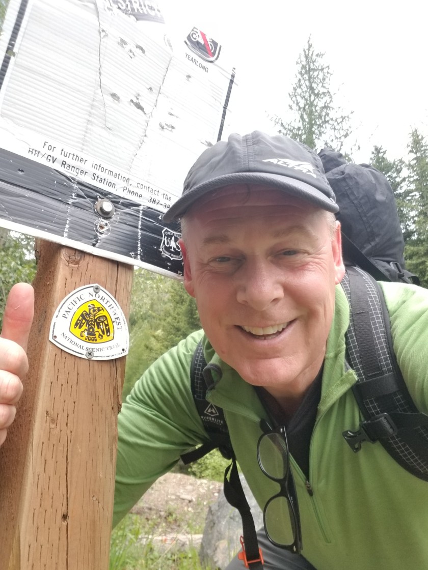
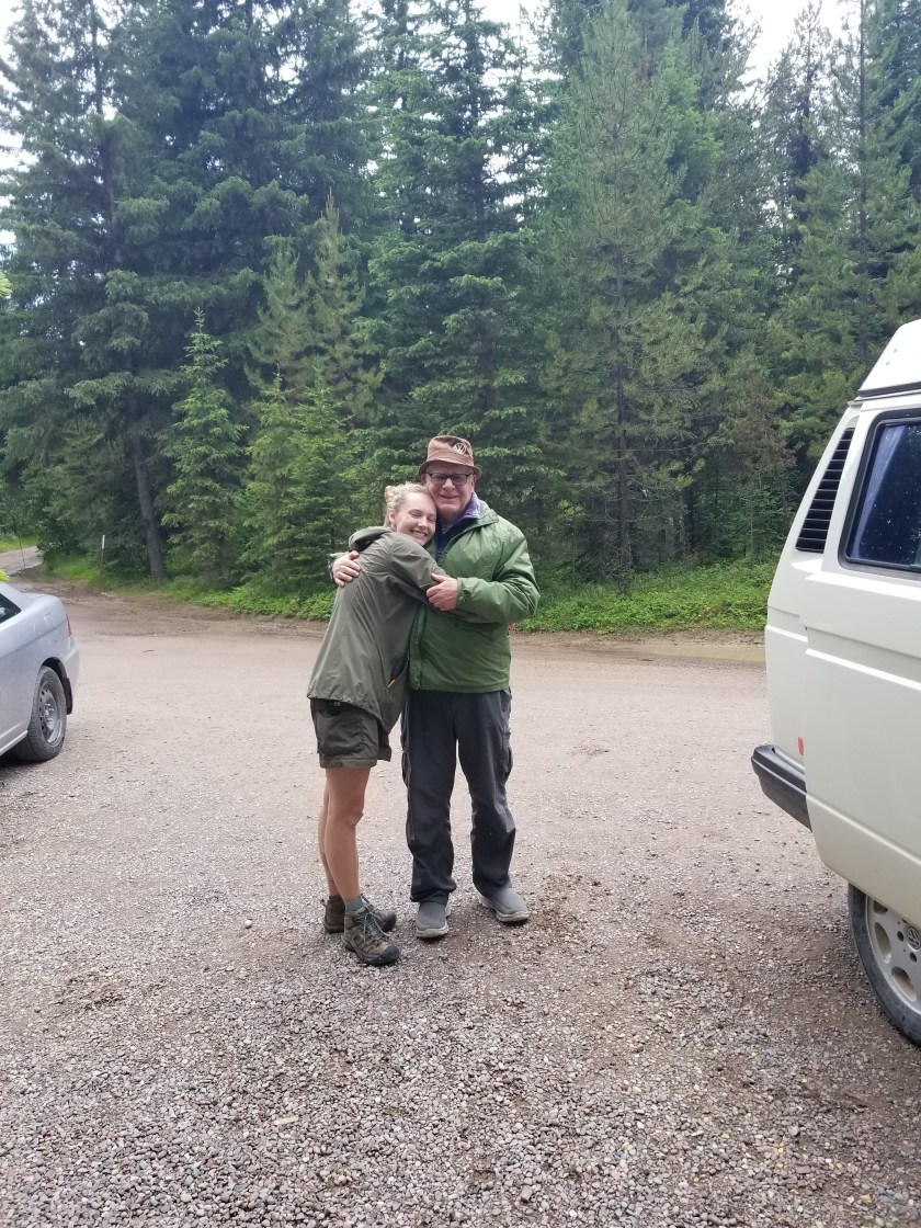
July 9, 2018. Midge Creek 20 miles to a crappy spot on a hill.

It sprinkled during the night. The weather has been strange that way; sprinkling just enough to remind me I am sleeping in a tent, but not enough to dampen the ground. The critters had left my stuff alone.

I started up the trail and there was a nice big set of bear tracks. Grizzly, based on the pads and claws. Great. Another climb spent huffing out “Hey Bear.” The good news was this bear was quite lazy. It was clear a trail crew had been on the trail(fresh sawdust), but quit after awhile (blow-downs and few footprints). Well, this bear didn’t like blow-downs and the prints disappeared.

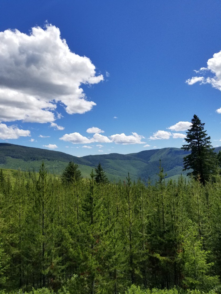
The morning was glorious and I enjoyed reaching my first vista up high. I was following the trail, but was bothered that it stayed higher, longer than my phone based app suggested. I pulled out the phone and sure enough it said I was almost a quarter mile off. I put down my pack and walked back slowly, looking for the junction I must’ve missed. I couldn’t find it so I walked back, put on my pack, and sure enough the trail took a sharp turn in the direction the app suggested. Annoyed at the delay, I was nonetheless happy to get rolling again.

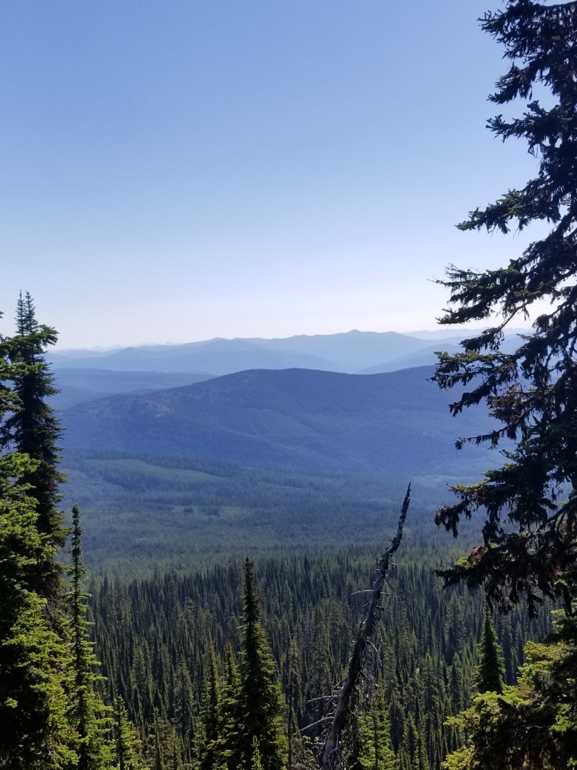
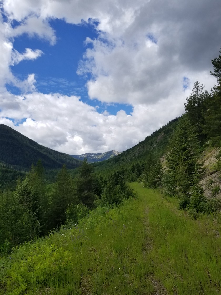
After modest ups and downs through sparse forest with rich green grass, the trail cut across the face of a steep mountain face. Unlike Mount PUD, this time the trail went across a mountain instead of over it. It was sketchy at times, but it was a welcome change to be hiking in the open with views above and below.

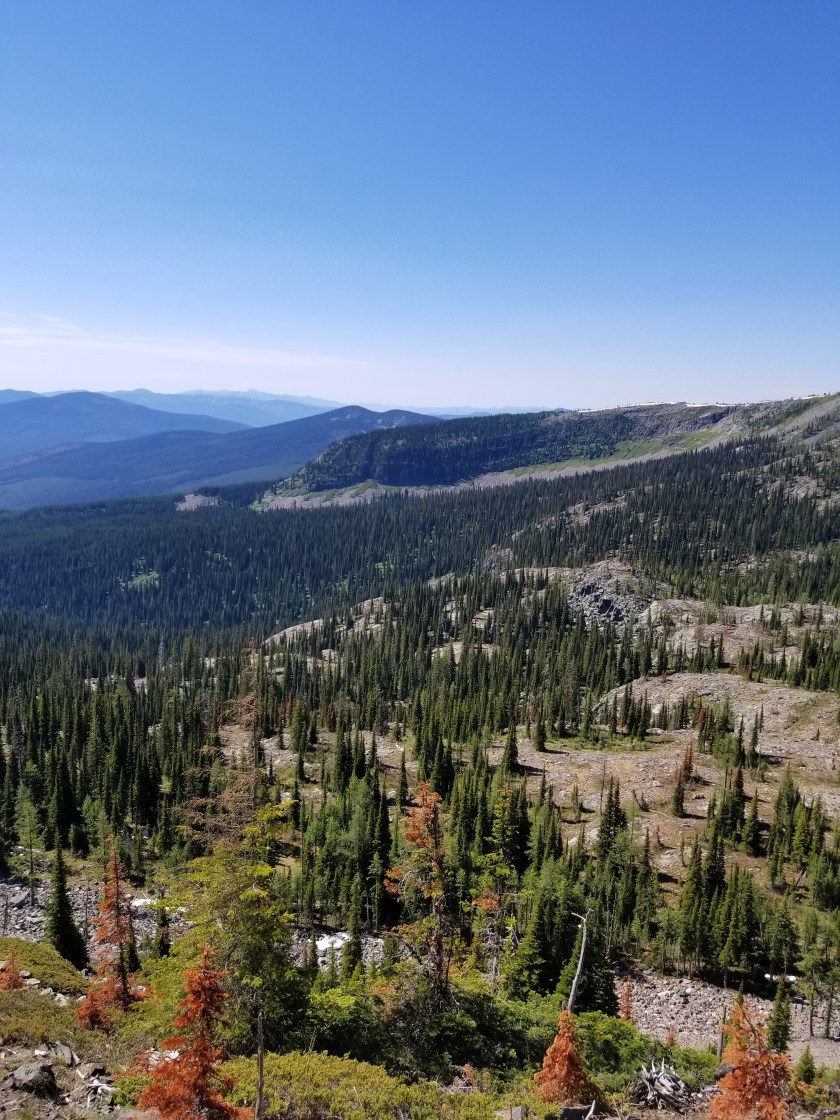
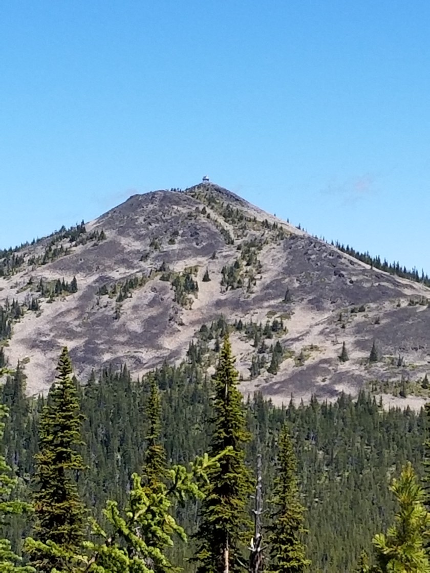
Around 11, the traverse stopped and a short climb was in order to get to the pass below Rock Candy Mountain. I thought I heard voices, but then I thought I was hearing things. At the pass, I was able to get a few bars on my phone. I was hiking faster than I had expected and was toying with pushing real hard today and tomorrow and getting to my next town (Bonners Ferry) a day early. This required coordinating a ride and a motel. I started exploring this while sitting in the middle of the trail.

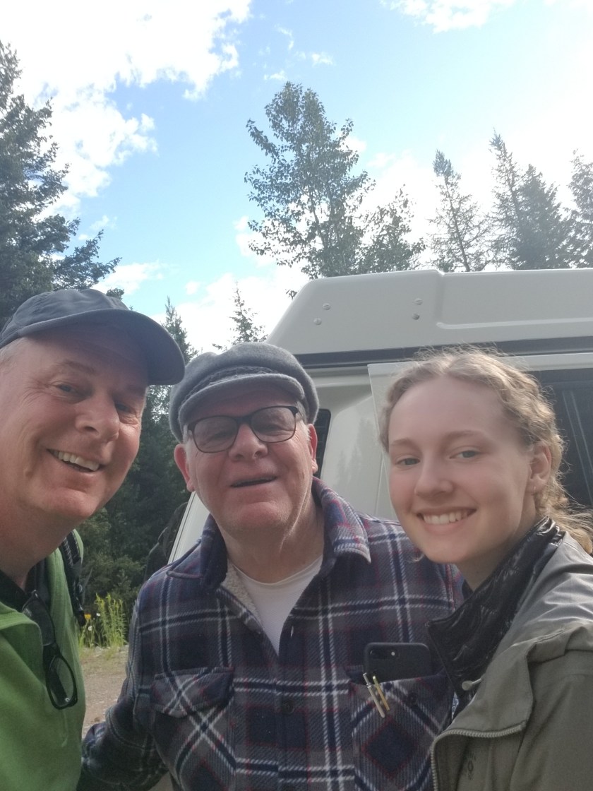
Lo and behold, I had heard voices. Three hikers approached, also doing the PNT. They were youngish and all from London. We exchanged some trail chat, they went to the top of the mountain for lunch and I packed up to continue.

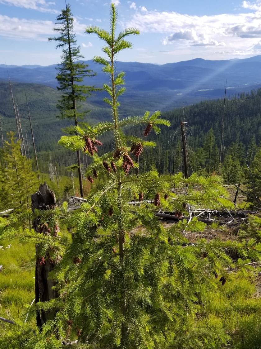
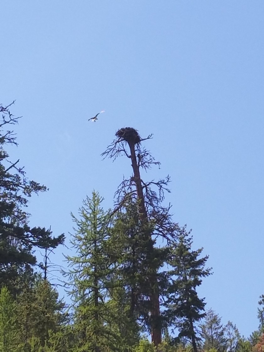
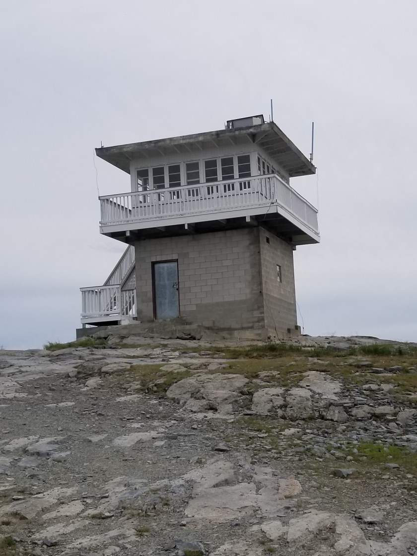
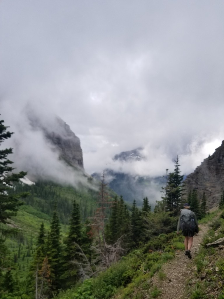
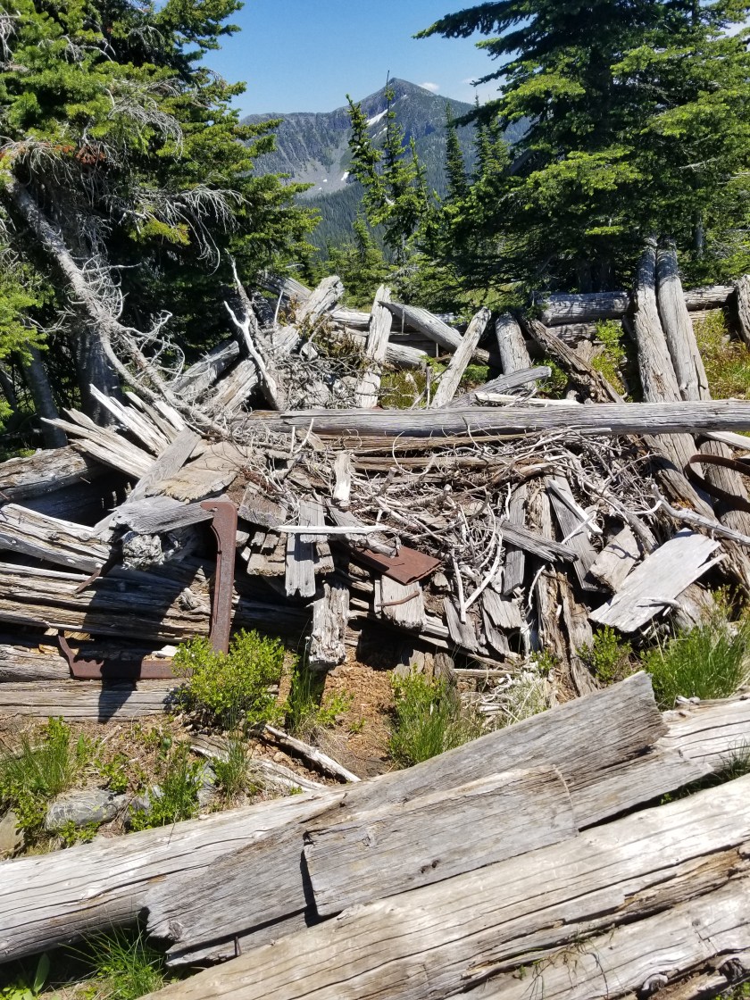
The trail was mostly gentle ups and downs for a few miles. I was in a kind of zone until I was forced to climb up Canuck Peak. Atop there was an abandoned, dilapidated cabin.

With the few faint bars I could get, I checked in on my early arrival and it was not going to happen. That was OK. I was feeling sluggish and by this point I did not think I could make two 25 mile days in a row.

I was almost out of water, on another knee crunching descent, and my feet were protesting. Then, another pointless climb, but at least this time it led to water.

I was so thirsty and I tanked up as best I could. I even added some sport drink stuff to one of the half-liter bottles I drank. Plus, I started hydrating my dinner since it was 4:00. I spilled about one-third of it. I tried to clean up my spill, but left some hoping that a creature might enjoy some couscous with spinach spices.

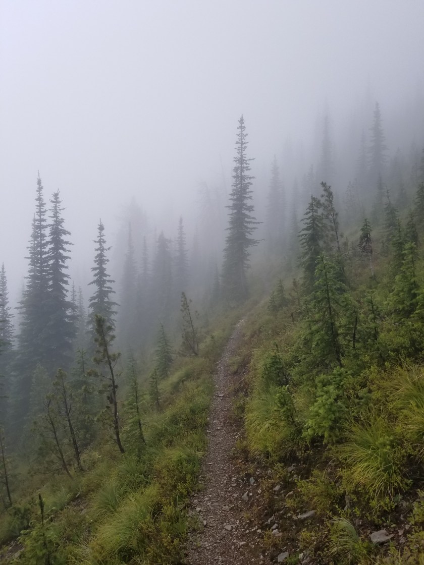
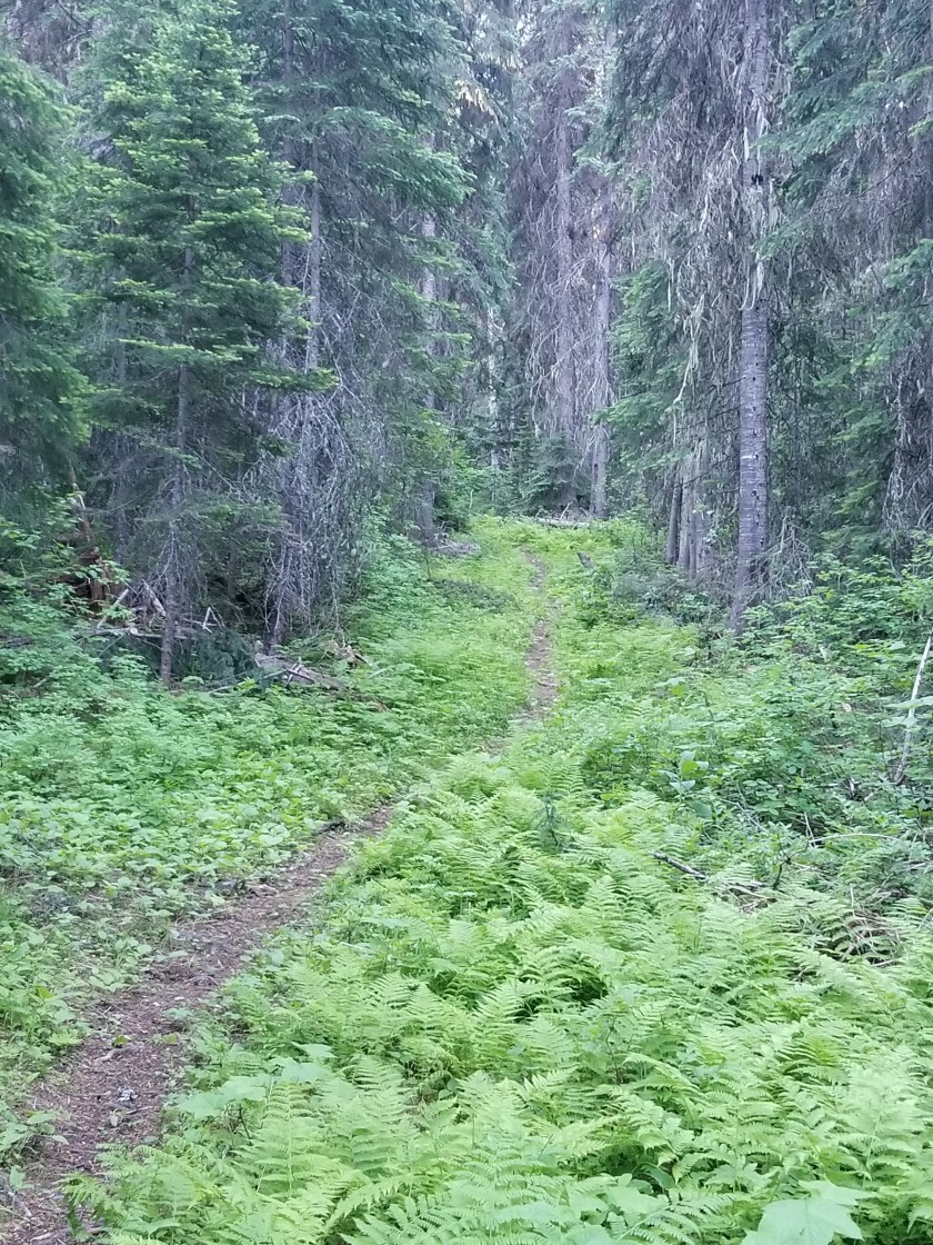
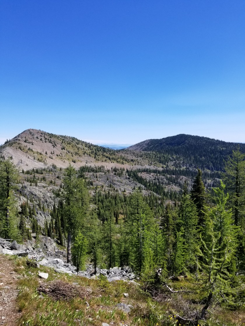
Trudging on, I was set to walk along what looked like beautiful trail according to the map. It was called the Ruby Ridge trail. It was mostly beautiful. Often clear vistas, the trail was mostly level, contouring along around 5500 feet.

I did have one scare. I heard some distinct groaning or grunting ahead. I yelled “Hey Bear” loudly a few times and listened. Again I heard the low growl. I moved to the right where there was a clearing. Looking for a bear, I was surprised to see only a grouse. It was a male grouse and he was definitely strutting his stuff. It may not show in the video, but he did make the low sound.

Not sure why I was so sluggish, I started to gradually go down hill. I had entered a portion of the trail where motorcycles could use the trail. This made it wider and less steep. By 8:00, I realized I would not be able to reach the valley floor where there was a suggested campsite.

I came to my last water source, stocked up, and then began a search for a campsite. My challenges were two-fold. First, the terrain was very steep with virtually no flat spots. Second, the understory was shrubs and any flat space would be covered with huckleberry shrubs, wild roses, and other plants.

Plodding downhill, I finally spied a slight rise among all the downhill slopes. I got on top and figured my tent would just fit. So, I set about pushing away sticks, stones, and pine cones. I had to pull up some shrubs and break branches on others, so I was not the most environmentally sensitive camper. I pitched my tent and found out why this aberrant rise was there: it was a large boulder. In one place long enough, it eventually accumulated enough dirt and then plants grew. My tent stakes, however, would not go in to the boulder no matter how hard I tried (or how hard I cussed). Settling for tents stakes wimpily pushed into the thin topsoil, I had pitched the most ugly tent in American backpacking history. A small rain or a slight wind would surely cause collapse. Heaven forbid I should sneeze.

I crawled in my tent, laid down, and felt every sharp shrub I was not able to uproot. I thought my sleeping pad would pop. Squirming around for 15 minutes, I finally found a position where there were no sticks or stones and neither my face or feet were jammed in to the tent. Given the day and my mood, this was good enough and I conked out.

Mount PUD

July 7, 2018

Stealth camp on road to stealth camp near stream.

There is an acronym attributed to hiking the Appalachian Trail: PUD which stands for Pointless Up and Down. Obviously, backpacking through mountains includes a fair amount of going up and down, but today on the Pacific Northwest Trail it went from neccessary to PUD.

The mountain range I am in is called the the Purcells. They all max out around roughly 7,000 feet above sea level and most have rivers between them. They cover the northwestern part of Montana and the eastern part of Idaho’s panhandle. They are not as steep as the mountains between Polebridge and Eureka. This means they are slightly more amenable to forestry. Therefore, a lot of the hiking is through forest that:

  1. could be harvested,
  2. was harvested (30 years ago) or
  3. a burn area.

By far, the “could be harvested” is the most compelling to hike through. Huge trees block out almost all undergrowth with the forest floor mostly old pine needles. This duff almost feels like walking on those really thick shag carpets from 1970s (younger readers use your imagination or Google). It is eerily quiet. And big trees produce big pine cones.

The “was harvested” is okay. It feels like a working forest. While clear cutting was the old method, the newer approach is to leave a few mature trees and let nature runs its course. Impenetrable understory of alder and huckleberries and young conifers battle for space. Except for the conifers, the shrubs top out at five feet, roughly. Unless opened by a landslide or natural meadow, the general feeling is of the understory pushing in. It is very clear why there are so many animal tracks on the trails; these are the only really viable way to get around. Except for moose. There is a lot of moose scat in these woods.

The “previously burned” areas offer some harsh contrasts. Nature abhors a vacuum, so dense stands of young pine and larch grow. On rocky slopes, grasses and flowers make a land grab. The shrubs take what they can. Hiking through these forest offers more vistas, but they can feel a bit claustrophobic walking between dense walls of thousands of tall skinny 15 foot trees.

All of this is backdrop to today. I started in a harvested area. Mostly shaded, the early morning climb was perfect. Except for the mosquitoes who were fast and relentless. (I don’t use bug sprays or headnets when hiking. The chemicals are too harsh and the headnet feels like walking around in shady cheesecloth. At camp, it’s a different story.)

I got up to the first mountaintop and the next several hours were a rolling climb along a ridgeline with ok views. The “highlight” was a climb nearly to the top of Mount Henry which had a lookout tower.

From there it was a kneecap crushing descent from 7,000 to 3,500 feet over 4 miles. It was about 3:30 when I bottomed out at Fish Lakes and stocked up with water. A campsite was available, but the directory noted “rodent problems.” Regardless whether it is eating, sleeping or traveling, my hard and fast rule is to avoid anything with a rodent problem. So, I began a long steady climb up a mountain, in all a seven mile trip gaining 3,000 feet and losing (you’ll never guess… ) 3,000 feet. I was going for Mt. PUD.

About a half hour in to the switchbacks, I saw a trail sign to a forest road. The number seemed familiar. I looked at my map and that road went along the south and west side of the mountain which was where my current trail would connect. Should I stay on the official footpath or take an unknown shortcut? I chose to stay on my current route over what was to become Mount PUD.

Slowly ascending switchbacks through an area that had previously burned, I was in a walled off corridor of conifers for a long time. The trail was losing visibility when it popped out to a grassy area higher up. I got the feeling this trail had not been maintained in the last two years.

While it was nice to be able to have a view, the barely visible trail through knocked down trees suddenly changed gradient. Previously, I had to stop every five minutes from the exertion. Now, the trail designers suddenly must’ve identified a new target market. However, they chose toddlers and seniors as the target. Watching the sun creep lower while making no uphill progress was infuriating.

Eventually I was mostly above tree line. Trails are difficult to see on hard surfaces. Heavily traveled trails will have small stacks of rocks called cairns. Unfortunately, this trail was so forlorn it was hard to tell what was a cairn and what were two random rocks. I was generally able to patch together the trail and reached the zenith where I was to cut through a rock canyon and finally begin my descent.

This rock canyon was v-shaped. As such, all trees that fell on the sides rolled to the bottom. It was blowdown central. Tired, knees aching, light fading and now I have to parkour my way through this.

When I came out the other side of the canyon, my shorts had a new breathing panel where one least expects such a thing. Down to one pair of town shorts.

I surprised many grouse today. Some have no chicks, some have hatched chicks, and some have flying hatched chicks. If you aren’t familiar with grouse, they are primarily land based birds, taking flight just to avoid danger. Agrouse chick flying is the cutest thing in the world, reminiscent of a piglet flying.

The sun was just sliding behind the western mountains. As I was starting to feel some relief, the trail now headed east. Crabby, I cussed the trail designer who created a route to the Pacific Ocean that goes east.

At least it was through ancient forests. It took some stress off these old legs bounding down on a blanket of needles, many years old and many inches thick. The canopy blocked a big chunk of the fading light. I had to get down to a creek at the bottom. Not only for water, but also a flat place to camp.

Around 9:00 I found a relatively open space and cleared a spot. I did not feel hungry, but forced myself to eat. Right after brushing my teeth, I went straight to my tent. Once inside and away from the mosquitoes, I thought I would just drop to sleep. Instead, I listened. There was nothing. The soft ground absorbed any sounds that made it through the silent canopy above. Sometimes I have difficulty sleeping when it is so quiet because even the littlest sound from far away is magnified. Fortunately, a bird somewhere started its evening song and that’s all I needed to fall deeply asleep, ending my adventure on Mount PUD.

Feeling Overthehill

July 6, 2018. Eureka, MT to stealth camp near Boulder Creek.

Last night in the motel, I was presented with an interesting scenario. On one side a young family checked in. At first the baby was giggling, but eventually got fussy and cried. I have been in their shoes. On the other side, an older couple checked in and they were hard of hearing and thus spoke loud and had the television cranked. I will be in their shoes soon enough.

I walked out of town early, about 6:30. I was loaded with 6 days of food plus water. Watching a town wake up is always interesting. At the last gas station before leaving. I grabbed s cup of coffee.

For a small, tourist town, Eureka had a gem of a hiking / biking trail. It was well maintained and several miles long following the Tobacco River, then, roughly the shore of Lake Koocanusa. I saw two bald eagles along the river.

All good things must come to an end and so I eventually cut over to the freeway. A hot 11 mile walk as RVs, logging trucks, and motorcycles whipped by. Thankfully, I had my MP3 player so I listened to an audiobook most of the way.

It was a pretty boring hike. I was walking along Lake Koocanusa which has a pretty blue undertone. The name is a mashup of Kootenai county. Canada and USA. It is a river dammed several years ago and it stretches 40 miles crossing the US /Canadian border

I did rile up an osprey in her nest. She initially took flight and circled me and her nest. Eventually she settled came to roost down and settled down to her chicks.

I crossed the steel bridge to get to the other side. Thankfully, there was a pedestrian walkway. As I age, I am increasingly nervous about heights. About halfway across the winds started making a weird sound rushing through the railing bars making a bizarre sound. The rest of the way I closely hugged the inside railing.


There was an interesting “shrine” a bit further on the western side. It was unclear whether the honoree died at that spot or was simply honored there. Homage was in the form of beers, bullets, and quarters. Atop was a tasmanian devil in a dress. I’m not sure how I’ll be remembered when I’m gone, but this would not be my first choice.

Finally, I reached the base of Mount Webb. On a hot, dry afternoon it was a 3,300 foot climb in a few short miles. It was an exposed ascent. I had brought 2 and 1/2 liters of water, but it was soon evident this was not enough.

I eventually reached the old lookout station. It too could be rented, but was not occupied. I walked around the catwalk. It was windy. I think staying overnight could be absolutely beautiful with panoramic sunrises and sunsets or a sheer trip through hall in a windy lightning storm.

All of my water was gone. It was 7:00. I still had over a mile until the next water source. Of course, the trail I was on was the Thirsty Mountain Trail.

After I guzzled down a liter of water, I filled my two liter container and then tried to find a place for the night. The forest was a mix of tall, older trees with very little room in the understory and it was steep.

Finally, I found an area that had been trampled by cattle when grazing had been allowed. There were cow pies, but they were at least two or three years old. In a hurry, I put up my tent and ate my dinner. The mosquitoes here were numerous but dumb.

I climbed into bed about 9:30 and almost fell asleep instantly. Later, I was awaken by on and off sprinkles even though there were stars clearly visible.

I was pleased I had managed to crank out a 26 mile day, but my feet and legs were protesting.

A Blue Theme

July 3, 2018. Bluesky Trailhead to Bluebird Lake.

I slept great, there was very little new rain, and I was ready to start a new day. After all, today I was going to climb over Mount Wam.

To start my day, I hiked up two different gravel roads. During the almost five miles, I was only passed by Forest Service and Conservation Corps vehicles. All heading up, hopefully to clear trail for me.

Once again, the damp clouds hung low and periodically dropped rain. On trail, the path was slightly overgrown with huckleberries or, alternately, alders, either of which was glad to drop their accumulated rain onto my shoes.

Last night I had camped at 4,500 elevation. I took a slight break at 6,400 feet to get water and prepare for the steep climb up to Mount Wam. Although I have not seen much wildlife, I was able find two different types of bird nests. Both make their nests on the ground and are very good at camouflage.

This nest was from a sparrow-like bird.
This nest was from a plover or sandpiper-like bird.

Like any normal person, I wondered where the name Mount Wam came from. I googled it previously to no avail. By no avail, I mean I couldn’t find anything on the first page of search results. I couldn’t recall a famous Wam, surely a memorable name. As I climbed the steep trail to the 7,000 elevation, I imagined the name came from a Batman comic fan who dreamed of a Mt. Blam and Mt. Pow. Or, it was meant to be an acronym such as What A Mountain or Wait A Minute or Wasted All Memory.

All this helped pass the struggle up. At the top, there is a restored fire lookout with stunning views that can be reserved for overnight stays. It is quite a hard reservation to get, apparently. However, as I struggled to see 30 feet into the clouds surrounding me, I felt bad for the person who hiked 5 miles up hill to a reservation in this weather.

On the way down away from the peak, I came across two guys on the trail. They were a little older than me. I asked if they had reservations and, fortunately, they did not, just out for an overnight trip. They were flabbergasted when I told them I had started in Glacier National Park. They were good guys and I was glad to see a couple buddies taking on a tough trail in tough conditions.

The rest of the trail was going to stay above 6,500 feet. The intermittent rain plus increasing snow on the ground plus blowdowns every hundred feet made the second half of the day a real struggle.

The trail is safely protected with snow.

By late afternoon, about 75% of the trail was under snow. The rythmn was:

  • Step up on to snow bank
  • Take two steps
  • Slip if steep
  • Sink in to knee
  • Repeat until end
  • Walk on visible trail for six feet
  • Start over

By 5:00, I was exhausted. My quads were aching. I could not feel my toes. Rain was intensifying. My original plan was a 23 mile day to set me up for a shorter walk to town the next day. I had to give that up. I was soaked and getting cranky, warning signs.

Oh sure, sun in the valley!

I made it to Bluebird Lake. A truly beautiful campsite in better weather. A grassy meadow looks over a small crystal lake at the foot of a huge wall spiked with rugged pine trees at the top.

Bluebird Lake

At first I gathered dry firewood with the intent of building a huge fire to dry out. The drizzle, unfortunately, turned to a heavy downpour. I pitched my tent, put all my necessities in it, and then huddled under a big old spruce tree eating my not-fully-hydrated dinner. Still in downpour, I hung up my food bag and splashed in to my tent.

I was very cold and soaked. My down puffy had gotten wet and both my merino wool layers, too. I only had one thin change of dry clothes. I made the change and then struggled for the next 30 minutes to warm up inside my down quilt and stop the shuddering.

In hindsight, I was a dummy for only bringing a wind shirt versus a full-fledged breathable rain jacket. The wind shirt blocks wind and light drizzle, but eventually soaks through in heavy rain. My brilliant plan was to use my umbrella for heavier rains. But I needed both hands free to catch myself on the snow and thus no umbrella. On top of this, the wind shirt traps body perspiration, essentially soaking from within. Lesson learned.

I fell asleep before darkness as the rain turned to drizzle then to nothing. It was a hard fought 18 miles.

A Zero Day in Eureka

July 5, 2018. Eureka, MT to Eureka, MT.

I slept well. Sometimes when I drop elevation and sleep indoors I freak out a bit. Not this time.

This won’t be a lenghy post.

Eureka is a long town spread out over a few miles straddling a north-south highway. A few miles north is Canada. Thankfully, our border is tight there and we are keeping out those Canadians who want to sneak into our country to mow our lawns, pick our produce, and steal jobs in meat packing plants.

Besides pickup trucks there are tourists. My legs protested but I walked a half mile to the post office to pick up my resupply package. Then, since the library didn’t open until 11:00, I found an out of the way local burger joint that was fantastic. A double bacon burger at 10:30 is good living. I walked the full three miles of Eureka, including the residential section.

At the library, I took care of some financial stuff and updated some blog things. Then, about 50 six-year olds invaded and it was time to go.

Montanans seem to be look- you-in-the-eye, hard-working people. There are a lot of NRA stickers, but people are friendly. A weird vibe of “I’ll talk to you but reserve the right to shoot you.”

Eureka is not a pretty town. But the Tobacco Valley in which it sits is very pretty. I hope to come back again. In a car. Or better, a pickup.

Tomorrow, I walk along the highway and cross Lake Koocanusa (42 miles long between beautiful Montana and Canada). My next town is Bonner’s Ferry Idaho in six (slow) or seven (fast) days.

Thanks for traveling along.

Everything Changes

July 4, 2018. Bluebird Lake to Eureka, MT.

I was stuffed up in the morning. I feared a cold. I have not been sick in years, so this was a little concerning. But today was a special day in two ways: it was the Fourth of July and it was a town day!

I knew that I only had one major climb early on and the rest was literally downhill. Although overcast, the air did not feel like rain. I’m not going to lie; putting on sodden socks, wet shoes, and yesterday’s dank hiking clothes was miserable.

About 100 yards from camp, the trail had been cleared of blowdowns. The unmistakable sight and smell of sawdust told the story. Even better, the early climb did produce body heat that dried out my shirt and hoody.

When I reached the apex, I looked east and was delighted to see Glacier’s peaks, even though the tops were cloud covered. Better yet, looking west to my destination I could see clearing skies.

Snow along the ridgeline almost points directly to Glacier’s peaks in the distance.

The trail clearing magic ended the minute I turned at the next junction. Blowdowns, slippery rocks, and copious amounts of stored rain marked the descent. It was an old mining area and there was abandoned, rusted equipment as well as sealed-off shafts.

At the bottom of the hill, the trail merged on to an old mining road. This generally trended down over the next eight miles. It was transformational. First, the skies began to clear. Then, the blowdowns and trail obstacles stopped. Finally, the forest opened up with a high canopy and just grass on the ground, affording glimpses to the valley and reservoir below. Towards the bottom I stopped by a brook to change into my cleanest clothes (a very low bar) and wash up. I was startled by a couple out for a walk. Perhaps they were startled by the odd looking man cleaning himself up in the woods.

If you look closely, you can see a line reflecting the US / Canadian border where the next peace wall will be built, paid for by the Mexican government.

There was a long road walk at the bottom. First among smallish 10 or 20 acre homesteads, later large ranch and haying operations. I scared up a couple bull elk, their antlers just forming, covered in a brown fuzz. Also, a few deer ran away on the open grassland.

This hayfield was so beautiful, climbing up to the forest edge.
I couldn’t zoom in on this deer at the very top of the hill watching me.

My feet had been hurting from constant downhill walking. Now, walking on pavement was making things worse. I reached the highway for the last three miles into town and my motel. At first, there was no shoulder meaning I had to step down and away as cars approached on the two lane highway. Trucks made a special sound as they barreled by.

I walked past a golf course. There were a few stray balls en route and I grabbed a newish one. My back and hip have been sore, so the thought of rolling a golf ball into tight muscles and tendons brought a smile to my face.

At last, I reached my motel in the northern part of Eureka. It was a small town version of a conglomerate: an Exxon station with a Subway restaurant with a motel with a real estate agent. So, while I was paying for my motel room, a chunky tourist was waiting to pay for his pork rinds and 20 gallons of unleaded while in the other line somebody was buying a meatball sub or closing in an escrow. I didn’t care. I walked into my room and turned on the shower. While taking off my shoes, I noticed the left one had a nasty stain. I couldn’t remember what I stepped in. When I took my sock off, I discovered I had bled quite a bit from a cut.

That shower felt so good. I felt like I washed away the cold, the rain, the ash from the burned forest, and the sweat. A burger, some minor medical procedures and this dude was, ironically, a happy camper.

Not the Finest Day

July 2, 2018. Blue Sky Creek junction with Forest Road 114

I woke up feeling pretty good. I packed quickly and noted the weather was slightly more sunny than cloudy. Today would be up along the ridgetops. These kind of hiking days are love / hate. If the weather is clear, they are lovely with views to the horizon. Stormy and you hate almost every minute.

The snow mounds were limited at first. Limited to trees and northern areas. Indeed, the views were pretty good. Once I came to my first ridge, I could see the trail going up the next ridge in the distance.

I could see the trail climbing the mountain ahead.

On a whim, I turned on my phone and got reception. It is very random how connectivity appears on one mountain and not another. I did the only reasonable thing I could and that was check social media.

I started cruising along the ridges. From the footprints, it looked like two people were about three or four days ahead. That was a relief from a route-finding perspective. The snow became almost continuous on the ridge.

After about 30 minutes, the footprints were overlapped by a more recent traveler: a bear. It was cool to see how the bear used the trail, even following on switchbacks. I presumed it was not stalking the others and it did not seem fresh, so I was not worried.

Another traveler joins the trail.
Although the snow melt made it bigger, here is a comparison to my size 13 shoes.

It started drizzling. The views disappeared. I stopped for a snack and had a hail storm roll over. The hail turned to graupel then snow. I entered an area that had burned the prior year. It felt eerie. The ground was charrred and skeletons stood, half burned, large charcoal logs. The white snow contrasting with the black reminder of what must’ve been a hellacious fire

The weather gets bad over the burned out forest.
It was eerie, almost like walking through a graveyard.

I stopped just short of the top of Mt. Locke, 7,200′. The wind really picked up, driving the snow almost horizontally. I made a sarcastic video about the elements and wondering why more people don’t go backpacking. Within 20 seconds of finishing, a massive lightning strike hit nearby. “Holy Mary Mother of Jesus” ( I’m paraphrasing). I knew this was very bad and I had to get down.

I sprinted the 50 feet to the summit, following a clear trail. However, the trail stopped at a sheer dropoff. There were the obvious remains of a former lookout tower, two sheer sides, and the slope I came up. I was stumped and a little panicky. “Where the f*** is the trail?” Please understand that at that moment I am the tallest living thing around and I am carrying two carbon fiber hiking poles in a backpack with small aluminum stays.

I whipped out my map, but it didn’t help. I ran down the trail, resolving to take my chances in the charred landscape I had just come through. However, out of the corner of my left eye, I caught a small flat spot on the blackened ground. I looked and sure enough it was the trail leading away from the top.

My mind kept up the refrain “This isn’t good. I’ve got to get lower.” For my age, I did a pretty good job running down the foot-wide path. However, the trail was only about 30 feet below the descending ridgeline. In short, while I was losing elevation, I was still relatively exposed to the high point. Soon, I saw a sequence of trees along side the trail. I set my sights on the shortest one. First, I stashed my hiking poles. Next, I dumped my backpack. Then, at last, I assumed the position near the short tree. Supposedly, you should squat down as this creates the least amount of body for a lightning bolt to transit. (Not to be cynical, but I did try to imagine how much chipper I might be if lightning only traversed a three foot squatted me versus a six foot standing me.)

Unfortunately, another bolt struck. It was close. Deafening. It made the air smell weird. You know that thing where you are supposed to count “One Mississippi ” to gauge how far away the bolt struck? Well, this was at “O”.

Considering my age, the fact I was squatting, and the proximity of the strike, I was proud that the only thing to come out of me involuntarily were some swear words.

Hoping that the electrical component would move on, I decided to wait 20 minutes. No more lightening occurred and the storm’s fury eased noticeably. I grabbed my poles, backpack, and pep-stepped down the trail, eventually reaching a junction that would pull me off the ridgeline. Ironically, I was now on the Bluesky Trail.

Leaving the stormy ridgeline to join the Bluesky Trail. Note the Pacific Northwest Trail marker below the trail sign melted in the heat of last year’s fire.

The next two hours were spent descending a steep trail in a slow persistent drizzle. I stopped to put on my rain pants and noticed how scarred and blackened my legs were from climbing over charcoaled trees in the burn area. I also realized I had lost my glasses in my panicked run.

After the steep trail and clambering over blow downs, I came to an abandoned road that was now the trail. Oddly, about 5 miles from the parking lot at the start of this trail, I came across an abandoned wheelbarrow.

Pushing a wheelbarrow five miles uphill was a feat of strength and futility for some soul.

Those last miles were wet and slow, but around 6:00 I reached the parking lot, came back up the trail a bit, and set up a soggy campsite in a meadow. Almost 11 hours to cover a lousy 19 miles, but I was glad to be alive.

Going Solo

July 1, 2018. West Glacier, MT.

We were to meet for breakfast. Ing would get on Amtrak back to the twin cities and my Dad would drop me off at the trail. Amtrak notified us of a massive delay (four hours). So we ate breakfast, then Dad & Ingrid took me to the trail.

We said goodbye on a Forest Service road. I was glad Grandpa and Ing got some bonus time together, but a little sad to be on my own.

Again, the clouds hung low as I walked for a few hours on a gravel road. The mosquitoes were fast. Usually I can out-walk them, but these guys ingeniously drafted me and got the back of my legs pretty good. Eventually, it started drizzling so the little buggers disappeared and I popped open my umbrella.

Amazingly, I saw another backpacker. I caught up to her. Originally from Israel, she has lived several places and hiked some long trails, like the Colorado Trail, which overlaps part of the CDT.

The road eventually turned into an abandoned forest service road. I saw my first official PNT trail marker. Alders and huckleberries grew in from the sides. It was a great way to use an old road. The Forest Service cant afford to maintain all their roads. I read somewhere they were the equivalent of the largest construction in the world.

While this trail was good for me, it was also a highway for bears. Indeed, on one section it seemed like a rest area. Needless to say, there was a lot of “Hey bears” from me along the narrow parts.

It switched to a real trail as I got higher. I stopped at the transition point. Two guys and a pack mule came by, said Hi and went on another trail. A real good cowboy chat that was.

Alders pushed in from the sides as the abandoned road turned to trail.

I descended the narrow trail across and down a steep slope. At the road at the bottom, I still felt strong so I went past the Red Meadow camp and pushed on.

Looking across the valley before Red Meadow
Looking down the valley before Red Meadow Camp

I missed my last creek water supply and settled for a snow melt pond just before I went on a trail again. I immediately encountered snow patches on the trail. Snow patches are a big hassle. You step up on them and, depending on the temperature and consistency, walk across, slide, or sink in to a deep hole. In short, it is slow.

Knowing the trail would soon climb a ridgeline and stay there, I found a flat, snowfree place to camp. I built a little fire to take the damp off the 20 mile day and went to sleep early.

Out the Other Side

June 30, 2018

We were ready on time. There is a rhythm to breaking camp in the morning. Even after just a few days, it becomes comforting. Also, I noticed the lightness from having consumed three days worth of food.

Today we would climb 900 feet through Brown Pass and then descend over 2,000 feet, ending with a six mile hike alongside Bowman Lake. I was leery of another icy pass, but it turned out to be snow free. Before dropping over, we took one last look east into Glacier.

The steep descent was made more challenging by fallen trees across the trail, a reminder of how severe the weather can get over the winter. Ingrid was a natural for choosing from a) under b) over or c) around.

Eventually, we heard chainsaws. Then, we saw the crew. They were working on a huge 3 tree collapse across the trail. I sent Ing down and around to get the chainsaw worker’s attention. Never, ever surprise someone operating a chainsaw.

I took the high route above where a massive tree’s roots had been pulled from the ground. It was about 8 feet of loose rock sharply down to the trail. I took two steps, then both my feet flew out and I landed flat on my backpack on the trail right in front of the trail crew supervisor. He complemented me on my grand entrance.

It drizzled off and on as the gray clouds clung to the mountainsides. We were making good time. In reality, I could not keep up with Ingrid. I think she felt sorry for me and every 30 minutes would stop and wait for me, ostensibly to check the map on my phone.

We had made plans to meet my Dad at the campground at the foot of Bowman Lake. That, combined with the prospect of cooked food, a shower, and a bed was exceedingly motivational. Almost exactly on time, we found him and he was happy to see his granddaughter.

After a snack, we headed first to Polebridge Mercantile for some baked goods and then on to West Glacier for dinner and a motel near the Amtrak stop.

For me, this his has been an incredible trip. Usually, I schlump along and take photos to communicate to others what I saw. However, on this trip I was able to share the experience with my daughter. I hope she enjoyed it enough that one day she will take her son or daughter to watch waterfalls and mountain lakes. Plus, being able to end the trip meeting up with my Dad, who tried to instill an appreciation of nature in me, was an extra blessing.

Lake Francis

June 29, 2018

Sorry, WordPress is still not letting me embed pics.

We never figured out what exactly was breaking sticks in the woods. There were several “Hey Bears” and fruitless probes of the darkness with headlamps. We bantered back and forth for an hour before falling deeply asleep.

It was supposed to be a fairly mild day with manageable elevation and just under 10 miles. We started out in the waist deep foliage filling the floor of an old forest. We saw a few deer who were totally unafraid of us.

As we approached Waterton Lake, I caught the Border Patrol cameras so we made some comedy sketches for them.

Waterton Lake is long and lies in both Canada and the U.S. there is a popular resort on the lake in Canada and people can take ferry ride to the southern end of the lake and go through customs. We chatted with Border Patrol (they hadn’t seen our sketches) as well as the Park Rangers. One of the rangers was from near our home.

After some border photos, we began the gradual climb to our campsite at Francis Lake. A trail crew had been ahead of us. In addition to the beautiful, rich scent of the forest, we would occasionally pass some freshly sawn lumber.

It started drizzling just as we picked our tentsite at Francis Lake. Undaunted we walked down to the shore. Absolutely stunning. About 150 feet across an almost turquoise lake rose a massive wall with a waterfall that must’ve been 200 feet high. We just sat on the beach and watched as the rain gave way to sun, revealing the shifting mist clouds high up the waterfall, catching and releasing the sunlight. This park is so astounding. I was so happy to have Ingrid there. I don’t push backpacking on anybody, but sometimes I feel like a nutjob describing some natural beauty. This time I was allowed to share the beauty in person and forever.

We ate dinner and went to bed early as the rain returned. We were both tired from the night before and knew we needed to start early for the long day ahead.