No Fitch

July 18, 2018. Metaline Falls to Silver Creek campground.

I slept awfully in the hot stuffy room. The restaurant opened at 7:00 and I was there. So, too was Indigo. I ordered while she skyped with her family. Her hiking companion, Snowberry, joined us. They were going to have somebody pick them up later and drive them for a good chunk of today’s trail.

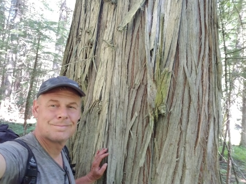
I had a big breakfast, said my goodbyes, paid my bill and was off. I swung by The Rock House for a last look.

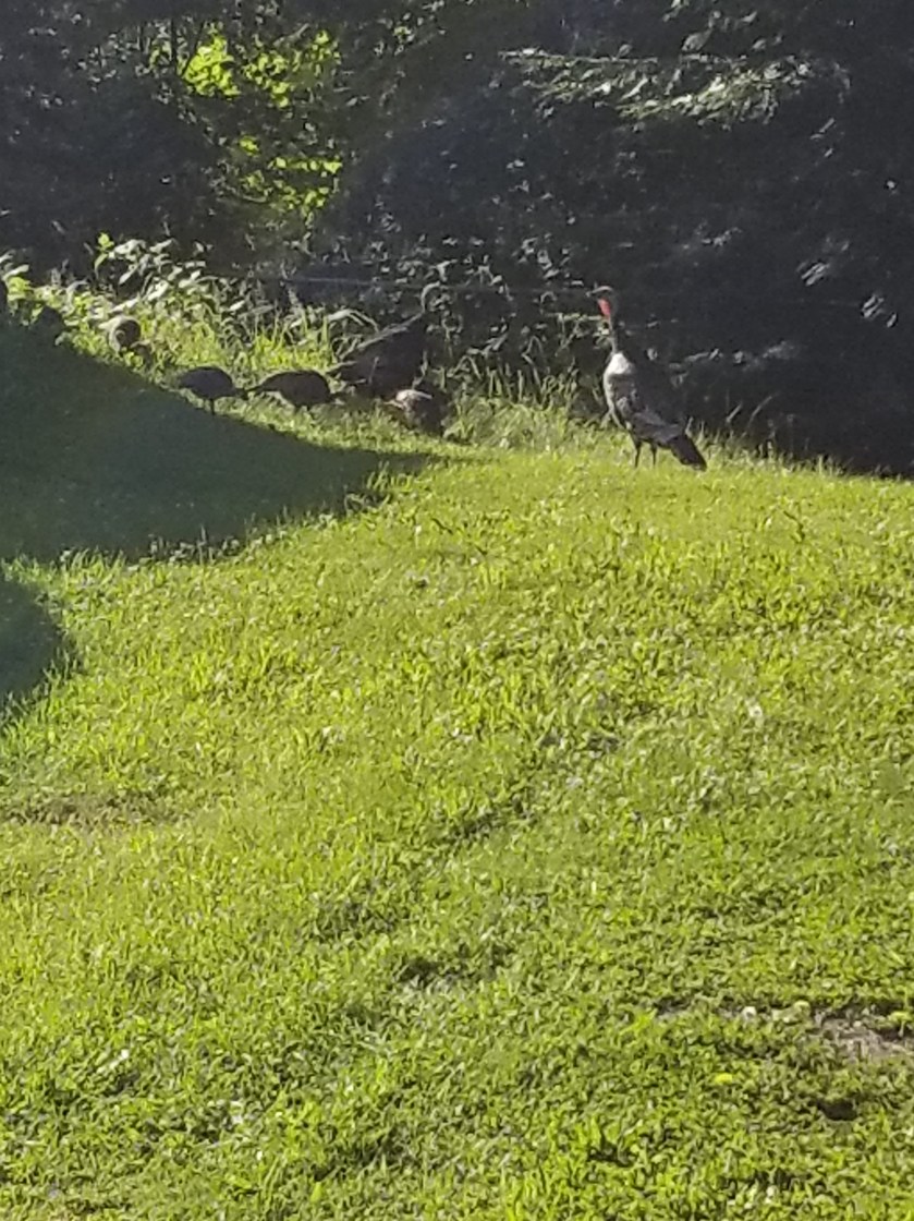
Today’s mission was to leave Metaline Falls at 2,100 feet above sea level, ascend Abercrombie mountain around 7,100 feet and then climb down to Silver Creek campground at 3,100 feet. Five miles of pavement walking awaited. Even though it was morning, there some steep, sweaty climbs. I did see some wild turkeys on the way.

Instead of mosquitoes, it seemed today’s pest was going to be gnats. As an adult, I still cannot tell you anything about gnats. It seems they exist solely to fly around you, waiting to be inhaled or to land in your eyes or ears. Perhaps they are nature’s Ear, Nose and Throat specialists.

By 11, I was on gravel forest service road. I passed one lady collecting huckleberries and two forest service vehicles. Other than that, it was a boring eight mile hike up a gravel road.

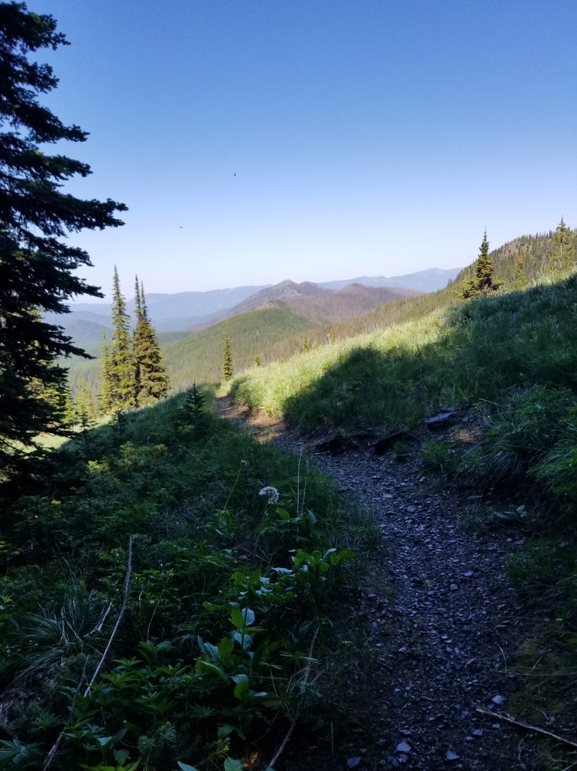
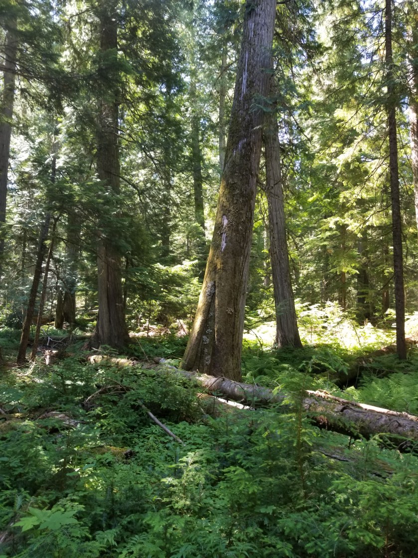
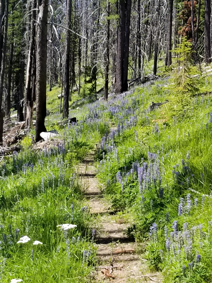
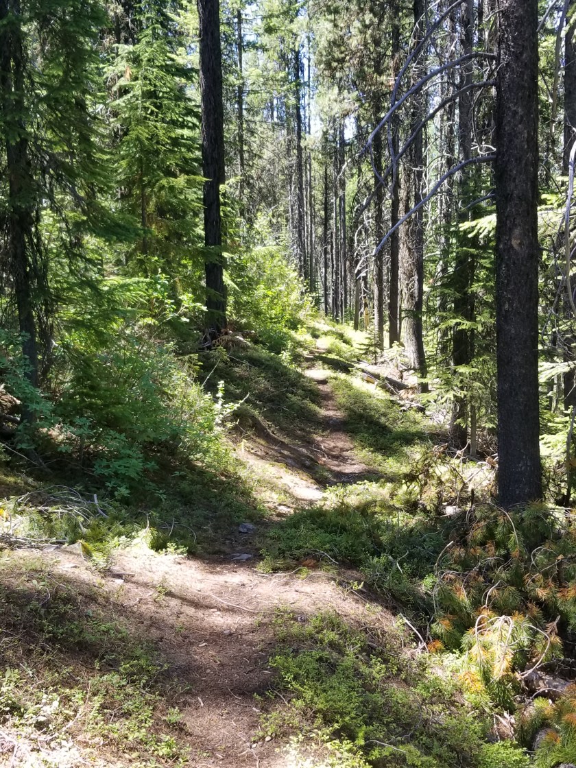
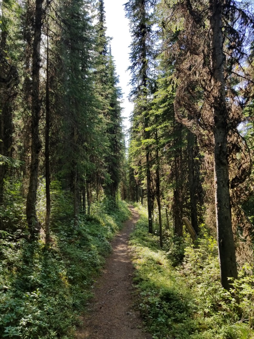
Finally, I switched to trail. I was actually feeling pretty good. Nearing the top there were long switchbacks and I was able to go all the way before pausing at the turn.

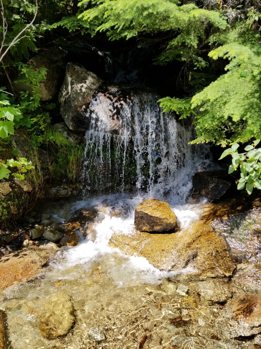
One pleasant diversion was a spring near the top. With the dry weather and heat, I assumed it would be dry. Instead, it came gurgling out from underneath a tree. Fresh cold water at 6,000 feet on a hot day of hiking is a way to pump up the gratitude.

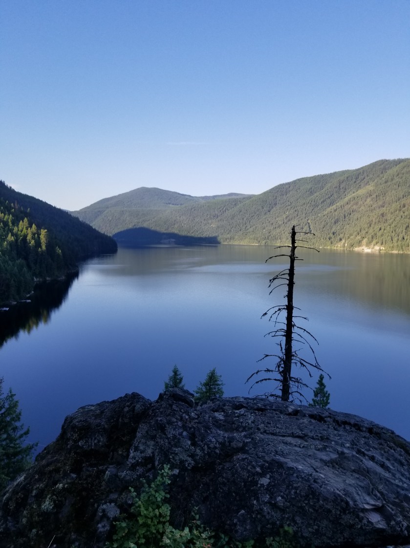
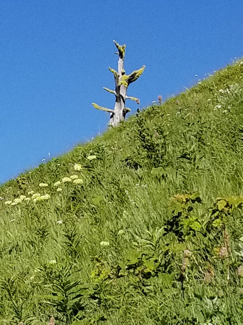
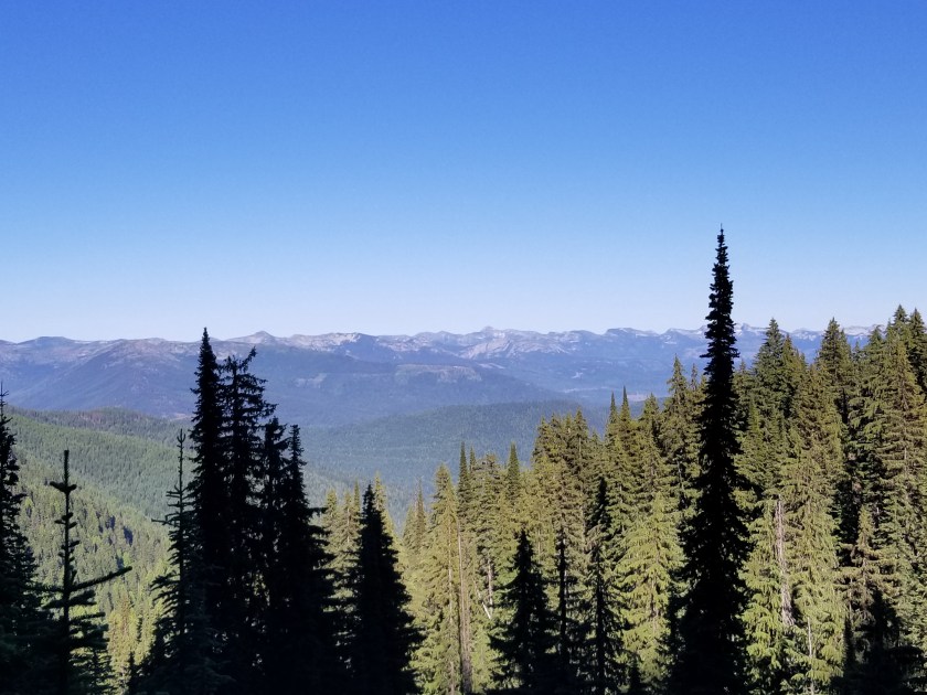
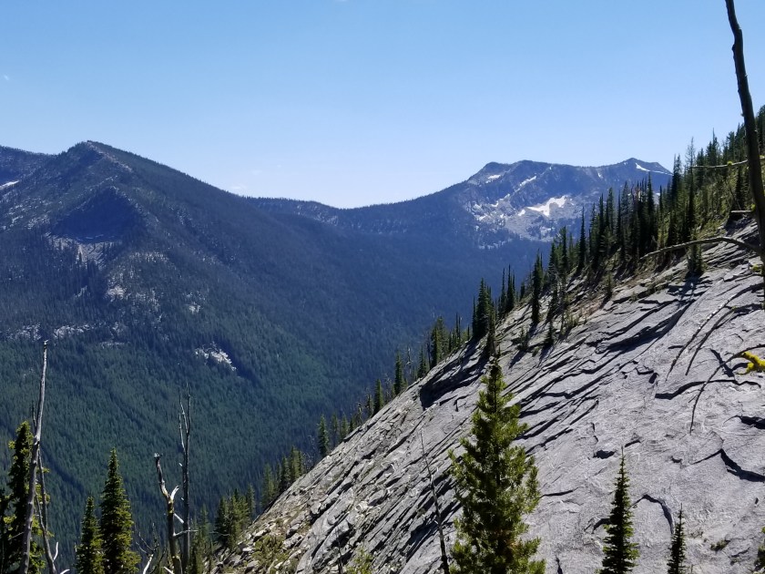
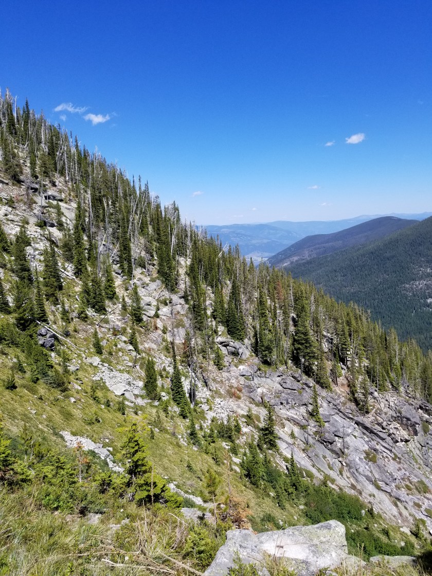
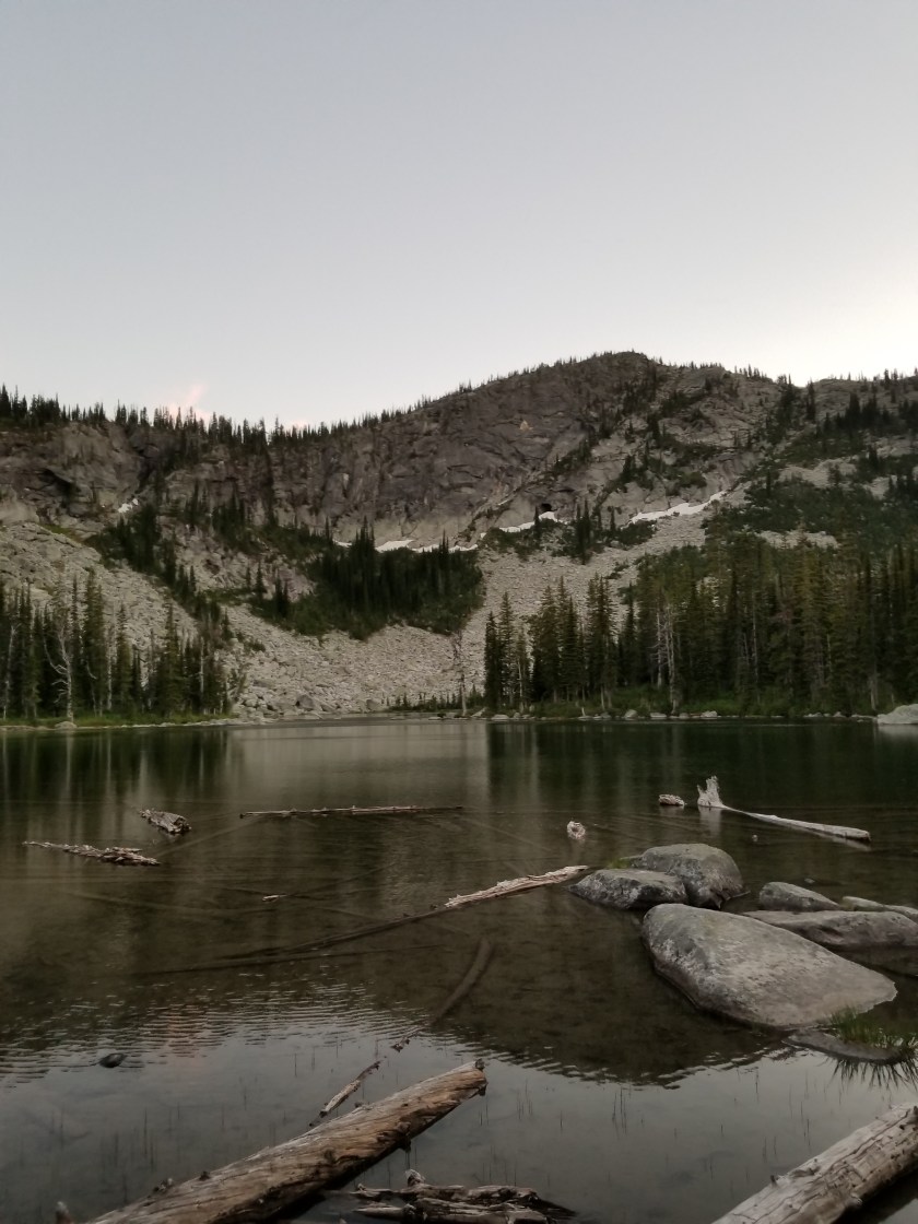
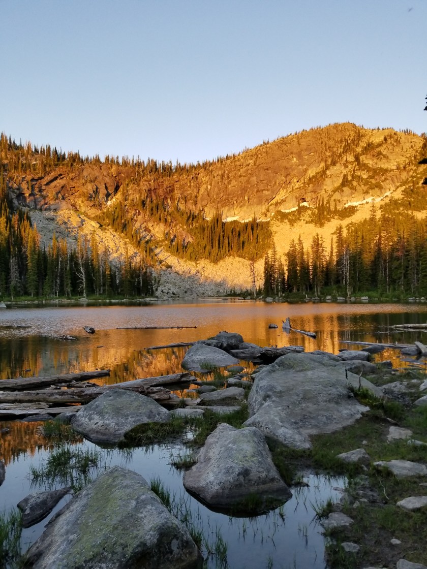
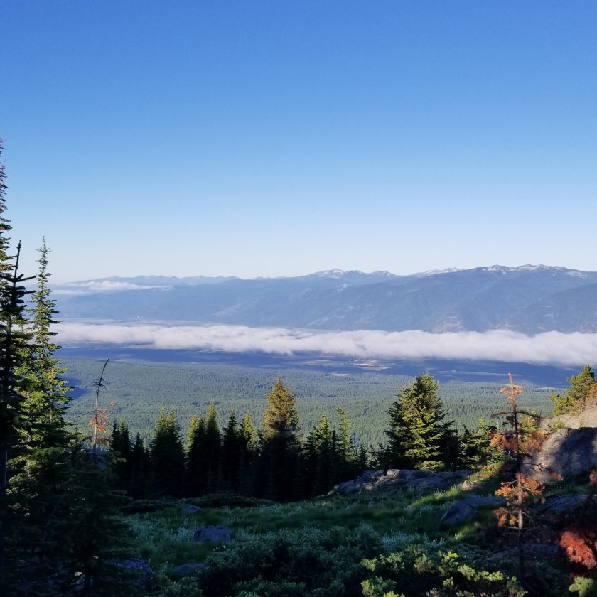
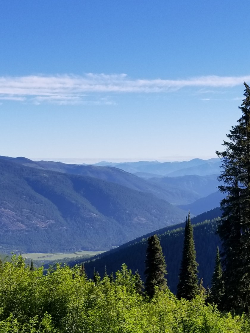
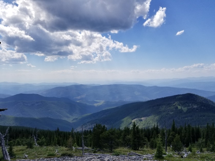
The view fron Abercrombie Mountain was impressive, but muted slightly by smoke. I love mountaintop views, but in this section all the mountains look roughly the same. In many mountain ranges there is a diversity which adds interest and gives reference points. For example, the Cascades have some distinct whoppers. To be clear, the views are great, just not exceptional. Oh, and I was disappointed Abercrombie and Fitch had not created a Fitch mountain nearby. Selling naming rights for mountains is an untapped revenue stream for the forest service.

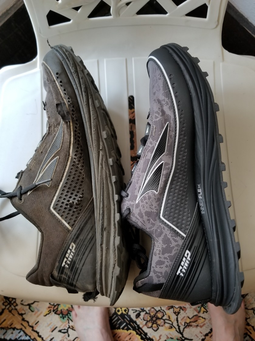
I thought the hike down would be challenging as it started with a lot of scree in the trail and I had on new shoes which might slip a bit and result in blisters or jammed toes. It worked out okay, but the trail changed in another, negative way.

This may be too “insider” but some trails seem designed for backpackers and some for mountain bikers. A backpack trail will be longer and straighter on switchbacks. A mountain bike trail will be more gradual and emphasize “S” curves. If you are backpacking down, like I was on Abercrombie, I just wanted to get down safely, not float down like a Disney ride.

I made it to the bottom, later than I had expected. The great news was a crude campground was at the trail head. Nobody was there and there were five campsites. Simple folk, backpackers consider a picnic table, pit toilet, and fire ring a luxurious setup.

About 90 minutes after I got there, ate, and set up my tent, Indigo and Snowberry showed up. They camped nearby.

I was feeling good. It had been a great climb, I found a sweet campsite, and the new shoes felt good. Just before going to sleep, an owl showed up. I could see its profile and it was smaller. I called this a polite screech owl. It made a measured screech every minute or so, but nothing as loud as a real screech owl. Regardless, it was not enough to keep me awake.

Metaline Falls

July 17, 2018. Sullivan Lake to Metaline Falls.

After a great night’s sleep, I got up rested. I tried to eat breakfast, this time an overnight soak of a 10-grain cereal with fruit and nuts. Not a favorite.

Pretty straightforward lake hike. It was an attractive lake.

There were a few day hikers out early. There is an air strip at the end of the lake.

The rest of the way was a six mile road walk. If the road had been busy, it could’ve been frightening as their was little shoulder.

Pretty country, but I was most focused on getting to town. Foremost, I was looking forward to my new pair of shoes.

Around 9:30, I walked into town. The Post Office wouldn’t open until 10:00. Fortunately, one of the town’s two restaurants was open. I enjoyed this second breakfast much more.

I got my shoes and found a place to stay.

Metaline Falls is a town that peaked in the 1910s. Mining and, later, cement and other resources were the drivers. Except for one zinc mine, everything is shut. As a result, almost all businesses in town are shut.

There is some very interesting architecture. One is an apartment building with ornate green brickwork at the top.

Best of all, there is a residence called the Rock House. It has two outbuildings. The main residence is built with local stones. My photos I took don’t do justice to the creative work. There were two gorgeous stone chimneys.

The coach house.
The garage

A Fire and a Lake

July 16, 2018. From the side on Mount Mankato to Sullivan Lake.

It was very still last night. I thought and hoped there would be more of a breeze, but it was stagnant though the temperature did drop as ome.

When I started hiking the first thing I saw was a forest fire in the valley below. Uh oh.

A plume of smoke.

I knew I should report it, but to whom? How? I turned on my phone and had a few bars. 9-1-1 seemed wrong. I googled the forest service for this particular area. I dialed the local office. It was early, so it was a recording. However, I was able to leave a message, but given the garbled connection I wasn’t sure it all went through. I also sent a note to the PNT trail association.

It was a great morning for hiking with many open meadows to cross.

The day kept getting hotter. Before I entered a lengthy burn area, I found a very unique mushroom. Previously, all mushrooms had been traditionally shaped.

Having reached the peak height for the day, I crossed a meadow that would lead to several hours in a burn area.

The burn area was depressing, inspiring, and boring. All the death and destruction is depressing. Ancient trees, countless animals, all burnt.

It still smelled like burnt wood in here.

Inspiration came from the plants literally rising from the ashes and animals and insects trying to gain a foothold.

It was such a contrast to have this bright butterfly in the stark, burnt area.

As the temperature soared with no source of shade, hiking was tough. I experienced this weird feeling where I just had no appetite. My rational mind knew I should eat, but my physical condition could not stand food.

Around 3:00, I finally left the burn area to follow a cool, noisey creek downhill. Appropriately named Noisey Creek, it would eventually feed in to a reservoir named Sullivan Lake.

At first, the creek and trail rapidly descended. However, at some point the trail switched away from the stream and began long, gradual switchbacks.

For a day hiker or casual mountain hiker, these broad leisurely paths might be very appealing. When you’re an exhausted through hiker, these paths are frustrating, in this case adding, I guessed, two miles more distance than necessary.

Finally, I reached a drive in campground between Noisey Creek and Sullivan Lake. It was 4:30 and I guessed it to be around 95 degrees. Tempting as it was to just buy a campsite, I knew the RVers would have a different schedule and they would be running their generators to run their air conditioners.

So I pushed on. A road ran down one side of Sullivan Lake and a four mile footpath down the other. I started down the trail,but had to rest. For the first time on this trip, I stopped for an extended break. It was too hot. Salt crystals were visible on my shirt and hat marking the days exertions.

After 30 minutes, I resumed my lake trail, constantly looking for a campsite. However, this side of the lake was a steep slope. After a few miles I came to a perfect campsite. A level place for my tent, close to the lake, and some prior occupant had made a bench at the water’s edge.

I ate dinner on the bench watching the sunset soaking my legs. A waxing crescent of moon appeared. Like a dimmer switch, as it descended toward the ridge across the lake, darkness increased. Once behind the ridge, it was dark and beautiful, with small waves touching shore.

My Worst Day

July 14, 2018 From Pyramid Lake to stealth camp on Lion Creek.

I woke up way early and forced myself to stay still for a bit. I knew the family wouldn’t be up. I snuck out to get a sunrise pic of the lake and grab my food hang.

Another sunny day. It would start with a climb to two nearby lakes. From there it would be bushwhacking. In case you are wondering, bushwhacking means taking a course between two points with no established trail. As the name implies, you must go through bushes, downed trees, bogs, etc to achieve your goal. Without these obstacles it would be walking or traipsing or strolling or perambulating or something.

The first lake (Upper Ball) was beautiful and I regret not having the daylight or energy to get there the previous day. The second lake (Lower Ball) had families with barking dogs.

I scaled a hill and the first part of the bushwhack began: cross a mountainside. It was a little steep, but manageable. Until the rock slides. Then, I had to edge my way uphill to get above the steep area with no apparent footholds. This happened a second time as well. Falling here would be unpleasant, to say the least.

The only consolation was that some of the rocks at the ending ridgeline appeared to have fossils. It reminded me of Sandia Crest near Albuquerque where I found fossils at 6,500 feet elevation. This old earth sure moves around.

The rock on the left had formations that looked like fossilized sea anemones.

The next installment was to go down a heavily vegetated hillside, veering west slightly to end up in a particular canyon.

At first there was a trail, but after about 100 yards it disappeared. Most of the bushes are alders ( I believe). They grow about 4 to 8 foot branches. The devilish part is they grow in the same manner as crabgrass: the branches shoot out, then up. So, they end up interweaving their branches. This makes for tough hiking.

Downhill, I eventually made my way to the right location. Allegedly, there was an old faint trail. While this was true at times, other times it wasn’t. In fact, the further down Lion Creek I got, the more frequently the “faint” trail disappeared.

The main point is that it is slow and difficult to push your way through shrubs and step over downed trees on a hot day. I reached a point where the guidebook and GPS map said I should be connecting with a real road, but that was simply untrue.

I eventually stumbled out of the woods sweat-soaked, bleeding from lacerated arms and legs and in a foul mood and odor. Immediately I met a family pulling a wheeled igloo cooler in swimsuits. We both looked at each other like WTH?

The back of my legs.

After several more people passed me in flip flops and swimsuits, I asked a couple what the attraction was. Apparently there is a natural waterslide famous with the locals. This trail eventually turned to a road, but before it did there were several cool streams that provided needed refreshment.

Exhausted, beat up and late in the day, I weighed my options. The official trail climbed a mountain to a….Lookout! And then climbed down to meet the gravel forest road I was now on. Hmmm.

So I stayed on the current forest road, listening to an audiobook. One kind couple stopped and asked me if I wanted a ride. Tempting as it was, I demurred. Near the bottom where the stream I had been following almost all day (Lion Creek) was going to feed into Upper Priest Lake, I found a stealth camp away from the road but near the creek.

I ate dinner and then washed my wounds in the cool creek water. It reminded me of why I always filter water.

* * *

P.S. an obvious question is why don’t I wear pants. The answer is that pants, on me, get sweaty and thus tug and bunch and chafe. None of us are here for an anatomy lesson, but suffice it to say I chose the coolness and flexibility of shorts even if it means scratches.

Rebound to a Good Day

July 15th, 2018. From stealth camp on Lion Creek to Mankato Mountain.

It was warm to start. Normally, camping by a creek can lead to waking up with a damp temp as cold wet air sinks. Not this morning. It was going to be warm.

I cruised past all the RVs and boats and jet skis and ATVs at the campground. When I get home, u want to add up how much America spends on all of these and I will bet it probably ranks in the GDP equivalent of some European countries.

Don’t get me wrong. I am not trying to be self righteous and insist my way of enjoying the outdoors is best or right. Instead, I am concerned that people take so many mechanical distractions with them to the wilderness.

Off of my soap box, I traveled past Upper Priest Lake and some great campsites. Then, without warning, I entered an area that was epic. Recently society has screwed up the word epic by applying it to common things. Thus we lose the true impact of epic when used appropriately.

I entered a land of giants. Cedars. Trunks 12 or 20 feet in circumference. Crowns reaching hundreds of feet high. Walking on a forest floor of decades of fallen needles and cones. A smooth green shag carpet of ferns wherever a ray of sunlight would penetrate. No wind. Once in awhile a whitetail. This went on for several miles. I’ve been to the Sequoias and redwoods, but this was so unexpected and vast that I have to call it epic.

But then hot road walking kicked in. Eventually it switched to trail. Finally, it switched to uphill forested trail.

I climbed up along Jackson Creek. I was very thankful for the tree cover because it was hot. The guidebook suggested collecting a lot of water at the bottom. I did and was lugging five liters which is 10 lbs.

Surprisingly, the mosquitoes were horrendous. At least 20 or 30 around me at all times. I used DEET 100. Some people hate it and I may end with numerous tumors and lesions, but by God did I get relief from the little bastards. Except, of course, when it dropped in my eye along with sweat which is a feeling comparable to someone grinding lemon juice with tobasco into you cornea.

Except for the mosquitoes and passing dozens of streams with plentiful water, I felt good and trudged my way up. I entered a burn area with fantastic views. I had my eye on a saddle between peaks that was level and I could have sunset and sunrise views.

Finally, as I approached, I saw tents. There were three ladies camping there, enjoying their dinner and my view. We chatted a bit, but I pushed off, hoping that the saddle in a half mile would offer similar views.

Upon arrival, I found the Washington Trail Association trail crew. This was great because these were the heroes cutting up blowdowns and making the trail clear. Selfishly, it sucked because the next flat area on my map was a half hour away and it was getting dark.

Out of the blue, I spied a little flat area about 50 feet downhill from the trail. I was able to scratch out an area big enough for my tent. As is my custom, I sent out a satellite note to my family identifying my stopping point. I was surprised to see I was on the slopes of Mount Mankato. In Minnesota, Mankato is a sleepy college town on flat land, so I have no idea how this mountain got named.

Just glad to be laying down, I watched as darkness enveloped the valleys below while the relentless mosquitoes still tried to get in my tent.

The Selkirks start with a Bang

July 13, 2018. From West Side Road to Pyramid Lake

At 7:00 Sharlene, the trail angel, was there to pick me up. A thoughtful person, she was interesting to speak with on the drive to the trail.

I skipped a 9 mile paved road walk. I have paved roads at home I can walk if I feel a burning desire. I started at trailhead for Parker Ridge. I’d heard and read that this was a real quad/calf buster. Also there was strong advice to fill up at the trailhead stream because there was no other water source for 16 miles. I drank a full liter, carried 4.

I knew it would be a low mileage day since I started out at 1,800 feet and sought to end up at 7,200 feet ideally. Oh, and it was supposed to top 90.

Parker Ridge was the center of a fire a few years back. The Forest Service and volunteer trail crews had remade the trail. Early on, the steady switchbacks rose through old exposed areas. The bonus was huckleberries to munch on.

After an hour or so, I entered the burn area. The crews had designed a trail that alternated directions and drew attention away from the glum monotony of a burned forest.

There was some interesting vegetation jumping in to the void. That brought insects. More curious to me, I found a pair of woodpeckers. I assumed they must like their insects extremely well done, definitely on the dry side. My quest has been to video baby grouses flying. I got sort of close.

My legs and lungs felt really good. In my experience, in longer hikes there is a whole bunch of physical and mental melodrama for the first few weeks before things settled down. Now, I felt fine.

Once around 6500 feet, the landscape changed to boulders and stunted trees, dotted with some lingering snow patches. I gladly dumped out my warm stale trailhead water and collected snowmelt for filtering.

The sky was a beautiful blue and a gentle evening breeze was starting. I decided to push for 17 miles. I know that doesn’t sound like much, with the elevation gain, five days food, and the hauled water, it seemed good to me.

Pyramid Lake was my destination. I could see its namesake mountain from a distance. It was indeed a three sided pyramid top. Finally, around 7:30, I neared the campsite. Having seen nobody during the day, I thought my mind was playing tricks since I heard the sound of children. Sure enough, the campsite had two families there with four adults, six kids, and two french bulldogs. I was in shock. How could these people and dogs covered such a hike? I mean, french bulldogs?

Turns out the locals take a dirt road to a trailhead 2 miles away. Somebody probably carried the dogs. Anyhow it was quite a contrast to their elaborate meals and my cold- soaked lentils & quinoa; my fastidious food hanging and their just laying food around the campsite. At least they went to bed at a decent hour.

Pyramid Lake was beautiful and I was tired and as I lay in my tent, the wind started to gust every 10 or 15 minutes cooling the air perfectly for sleep.

A (Not So) Brief Recap of Bonners Ferry

July 12, 2018. Zero Day in Bonners Ferry.

If you have been reading this blog for some time then there are two things: you need to get better reading material and you know I love to hate bad signs. You’ll have to resolve the first thing and I’m not sure where the latter comes from. It could be EOGOG (Early Onset Grumpy Old Guy), but is it really all that much to ask that people who make big, permanent, useful signs take maybe just a second to double check their work?

With that set-up you know exactly what I had to accomplish today: where the hell did the apostrophe go? Edwin Bonner from Walla Walla, Washington ( a town they loved so much they named it twice) had one of the few official licenses to ferry people across the Kootenai River. So, why was it not Bonner’s Ferry?

Until the historical society opened, I first mailed home some extra gear, bought mosquito repellent, and then went to the library to catch up on blog posts, perform some financial stuff, and research the town I was in. I must say librarians, contrary to stereotypes, are generally friendly and extremely helpful.

In case you forgot or are hamstrung by youth, the Ruby Ridge incident occurred here in 1992. Oddly, it happened on Caribou Ridge. Long story short, federal law enforcement agencies had a shoot-out, then a siege, with a reclusive family. The man at the center lost his wife (sniper shot) and son and dog. A US Marshal died as well.

At the time, my simple mind encapsulated it as nut job shoot out with trigger happy feds. More nuanced than that, in the beneficial light of hindsight, it really was a tragedy. Weaver really should’ve just gone with the flow and appeared in court and not escalated things. The feds really made a mountain out of a molehill and got way too aggressive. In short, it was a bunch of guys who wouldn’t back down or compromise.

Back to the hot topic of the day, I noted the time and went to the Historical Society for Boundary County. When I walked in, a bearded fellow who must clearly perform some Santa Claus work in season, put down his browned historical newspaper and greeted me. I explained I am hiking the PNT and like to learn about the towns I visit and asked if he could give me an overview of the museum.

Immediately, I got the sense they tend to get one type of visitor. His smooth opening line explained there was a $2.00 admission fee and the bathrooms were down the hall.

Having cleared that up, he overviewed the following areas / collections

  • Railroad
  • Mining
  • Farming (early, 1930s, today)
  • Chinese workers
  • Women’s roles through time
  • Wooden clock collection
  • portrait gallery
  • Saloon
  • First Doctor
  • Native Kootenai history
  • Gun collection

And a whole lot else that I didn’t catch. Fearful he might grab me by the elbow and show me all of it, I broke off to the railroad & farming.

Wouldn’t you know it, one of the first exhibits about farming was a large display contrasting early versus current farming.

I patiently extracted my $2.00 worth of value. They truly had tons of stuff. I’m not sure many people died in Boundary County without naming the historical society as a beneficiary. Indeed, there was a collection of about 30 large wooden clocks. They were all elaborate scroll cut pieces with a generic clock put in it. Clearly these were kits. The blessed retiree obviously spent 1,000s of hours on his hobby. However, I’m sure his long-suffering wife must’ve pleaded like crazy to be sure the entire collection was donated to the historical society to get it out of the house.

The portrait gallery was surprisingly large if not awfully good. One early hero was painted with quite a fetching style.

There was one truly remarkable exhibit. An albino woodland caribou. Native Americans killed it in the late 1800s and a local saloon owner obtained it and made it his mascot.

At last, I returned to the front. I said “I am not an English teacher, but I cannot find an answer to why Bonners Ferry doesn’t have an apostrophe?” He sighed, looked down at the old newspaper and said “For a long time we tried to correct it, but it just became customary to use Bonners.”

I grumbled my way back to the motel. Letting the matter go was cathartic. After all, we have a grocery store back home established by Russell Lund and it is not called Lund’s, just Lunds. I was hungry and just wished this town had a McDonald’s.

On the walk back I noticed a few pickup trucks with Confederate and US flags flying. The ignorant, hopeful part of me tipped my hat to these scholars who were passionate about state’s rights, but the realistic me accepted I was in the heart of Aryan Nation country.

Leaving Bonners Ferry, I was brooding. It is a beautiful town in a sumptuous valley where the untamed Kootenai River created a fertile flood plain. When the river was dammed, the land could be farmed. Mining and lumber come and go. It would be stunning to have a house on one of the local ridges, catching both sunrise and sunset, witnessing the first snowfall on the all-surrounding mountains or the bright yellow canola crops in the summer. However, like many smaller towns, meth is a problem and there is the white supremacists stigma. However, every worker I met from motel owner to the restaurant employees to librarians were all hard working and considerate. Like Montana, people here look you right in the eye. I like that.

In summary, I am glad I spent a whole day in town. A roadtrip here could be in my future. Maybe I’ll get a modified camper van and call it Kevins Van.

Hurry up and wait

[NOTE: If there is a PhD level of WordPress blogging, I am struggling for my GED. This post is out of sequence. Sorry.]

July 10, 2018. From crappy place to Bussard Mountain

Not surprisingly, I did not feel too rested. I broke camp and dropped down to the valley. I was in a hurry and excited.

Ahead was the Feist Creek Falls Resort and Bar, an”on trail”restaurant.

I knew it wouldn’t open until noon as I walked up about 9:30. A nice lady tending the beautiful garden gave me permission to sit on the covered patio where I thankfully charged my electronics.

The place was beautiful. I could clearly see the bar, but the resort not so much. In the back of the restaurant/bar there is a legitimate waterfall. The bar is made of logs and has the required animal heads. In the front, there is a large covered porch with huge hanging flower baskets. The porch overlooks a trout pond, the Moiye River, and then Bussard Mountain. The trout are huge. There is a vending machine inside the bar to buy food to throw in the pond. I bet the fish enjoy bar patrons getting tipsy and buying fish food.

A bit after 10:00, the three hikers from London showed up. We talked trail and gear and FIFA world cup. Half an hour later, an employee let us in early and offered coffee. Ahead of schedule they opened the kitchen and I enjoyed a hamburger and fries.

My batteries were fully charged, but I needed to get some tap water. I filled up my two liter platypus bottle. (Platypus is a brand of refillable containers that are flexible and lightweight.) I packed up, said goodbye to the Londoners, and was on my way.

It had remained overcast in the 50s with no rain. Frankly, this was perfect for hiking. I went past a large, old mule operation on the floor of the valley. Another reminder of how times have changed. George Washington was a famous mule breeder and one could argue mules helped open the west. Now, Bussard Mountain Mules was downcast and overgrown. As an aside, I was not able to find out how Bussard was named and why the locals all pronounced it “buzzard.”

The climb up was easier than I expected. I had fewer stops and fewer still complaints. On the way up, my sixth sense kept bugging me with a feeling I had left something behind. I tried ignoring it as silly. After all, I had only unpacked my electronics and Platypus. Finally, my paranoia got the best of me, fearing I had left behind my charger. The good news was my electronics were intact. The bad news was my two liter water container was gone. Althoughed pissed, I was glad because I did have an extra one on hand. The only challenge was that I had very little water with me.

Looking back down to Moiye Valley.

I was ahead of schedule knowing that my ride into Bonners Ferry would not be until late tomorrow afternoon. As a result I set up camp a bit early. I was right near the top of Bussard following an old mining road. Some hunters had already set up their camps along the way with cut and stacked firewood. That was tempting, but I found a natural niche in the thick shrubbery and pitched my tent, built a fire ring, and ate.

After dinner, I gathered firewood. Nearby, the mining road changed to my next trail. As I approached I saw a jumbled pile of boxes and plastic. Amazingly, it was boxed food grade five gallon plastic water containers. I figured the hunters wouldn’t stash water here far from their camps. It must be surplus water for trail crews. Thanking the trail gods, I helped myself.

Queen Mountain viewed from Bussard Mtn.

Enjoying my little fire a bit later, I heard voices. I assumed it was the Brits. (Note: based on their homeland and the westward hike, I refer to them as One Direction.)

Instead, it was Steve and Zeke, just out for a lung-busting mountain bike ride. They must be in amazing shape. They were real helpful and had good local information, even confirming the water was excess forest service.

After they left, it began to drizzle a bit more, so I crawled into my tent and drifted off to a faint ping on my roof as it darkened.

A Beautiful Decline

July 11, 2018 From Bussard Mtn to Highway 95.

I woke up at 5:30 and tried to sleep in. It worked a little, but by 6:30 I was too restless.

The fire still had some embers, amazingly. During the night I had to get up once and there was a glow from the fire on the ground and brilliant starlight above. I had not seen the milky way in two years.

I tried to pack slow knowing I had a lot of waiting ahead. I used some of the miracle water to make sure the fire was totally out. I dispersed the fire stones and used forest debris to mask where the fire had been.

Gathering my food hang, I was finally ready to go. It was glorious hiking.

Almost immediately I had views down into the Kootenai valley. There were some low clouds in the valley and the sun shone on the next mountain range to tackle, the Selkirks.

The Kootenai valley was beautiful. Large patches of canola crops made for yellow patchwork.

The other side was beautiful, just without a big valley.

The trail meandered for a few miles. There had been a lot of stabilizing work and trail-raising. I suspect there were motorcycle fees that had been allocated and this trail won. I didn’t mind as long as no motor bikes used it while I was on it :-).

The well-maintained bike trail went right, but my foot trail veered to the left. Of course, the trail sign had misspelled the word Bethlehem.

…and there was no room at the in. Poor baby Jess.

I didn’t mind. As I went down I passed a tree that produced 100s of perfectly shaped pinecones.

There were also some interesting meadows.

These white flowers are about the size of a thumb tip, but can grow in eye-catching clumps.
Finally, a butterfly that would hold still.
This burned tree had about 80% burned through but still stood.

Alas, I arrived at highway 95. I had four hours before the trail angel in town could pick me up. I tried hitchhiking, but it was not an ideal spot. Mostly trucks, family vacation mobiles, and Canadians. After an hour, I gave up, found some shade and waited.

Finally, Sharlene arrived. She was very helpful and thoughtful. She had started section hiking the AT a few years back and found out about the trail angel concept. Coincidentally, after noticing some backpackers in town, she discovered the PNT was in her backyard and desperately needed a trail angel.

I checked in to my motel, the Kootenai Valley Inn. My first reaction was Whiskey Tango Foxtrot, we have a situation. The outside of the office was a decaying mess and the office was a barren room, like a murder had occurredand they had just finished removing the blood-stained carpets and walls.

Ed, the brand new owner, quickly put me at ease. He and his brother had purchased the place as a semi-retirement activity. He was clearly busting his hump and there were some diamonds in this rough. My room was clean and the carpet had been deep cleaned. The bathroom was sparkling.

Next door was a restaurant that both Sharlene and Ed recommended. They both called it the “chicken chop.” I went there. It was “Chic-n-Chop” and while the name made no sense they had classic dinner choices. I don’t know about you, but when I’ve been eating couscous, lentils, and quinoa, I’m jumping all over the special of two pork chops, two broasted chicken pieces, a biscuit and baked potato.

In fairness, I did order a full dinner salad first.

I was asleep by 9:30.

Yaak is Prettier Than it Sounds

July 8, 2018. One stealth camp at Bunker Hill Creek 24 miles to a roadside camp at Midge Creek.

It sprinkled during the night. I was surprised some drops had made it through the canopy to my tent.

I was very sore. I got rolling in the deep woods. Soon, I was on a forest service road heading to a river in the bottom of the valley. I was going through the Yaak valley.

There was not much to see. I dropped down in to the valley, followed a few paved raods for a few miles and saw three vehicles. I suppose 8:00 am on a Sunday morning is not a time most folks are out. The town of Yaak is about 10 miles south, but I had no desire to see it.

Eventually I left the paved roads for a forest service road that climbed. It was a hot sunny day so I tried to move to the side with the most shade as I hiked. I saw only one vehicle in four hours on the road. I put on the audiobook to break the monotony.

Another mountain, another Lookout that can be rented. Garver Mountain Lookout tower was at the very top, but I stayed on the trail. Once past the lookout, I was on trail, not road, it was nice and slightly rolling in the woods, but still a bit warm.

Eventually, the trail descended to more forest service roads which were my future for the rest of the day. I saw absolutley nobody for the last five miles.

At the end, the road just stopped at a bridge. It was as if it had been maintained just to get to the next section of trail. There was a gravel turnaround that had become slightly overgrown with grass. I was going to pitch my tent here.

Just as I had reached that decision, a big white pickup appeared. The occupants were disappointed the road ended. The driver kept insisting there was a back-road way to go from Eureka to Bonners Ferry. I showed him my phone app map and he seemed disappointed, like somebody just explained there is no northwest passage.

I threw together my dinner and campsite. I did startle a few small mice that bolted through the grass. Great, I thought. I ended up hanging my backpack and food bag.

25 miles.