I slept well. Sometimes when I drop elevation and sleep indoors I freak out a bit. Not this time.
This won’t be a lenghy post.
Eureka is a long town spread out over a few miles straddling a north-south highway. A few miles north is Canada. Thankfully, our border is tight there and we are keeping out those Canadians who want to sneak into our country to mow our lawns, pick our produce, and steal jobs in meat packing plants.
Besides pickup trucks there are tourists. My legs protested but I walked a half mile to the post office to pick up my resupply package. Then, since the library didn’t open until 11:00, I found an out of the way local burger joint that was fantastic. A double bacon burger at 10:30 is good living. I walked the full three miles of Eureka, including the residential section.
At the library, I took care of some financial stuff and updated some blog things. Then, about 50 six-year olds invaded and it was time to go.
Montanans seem to be look- you-in-the-eye, hard-working people. There are a lot of NRA stickers, but people are friendly. A weird vibe of “I’ll talk to you but reserve the right to shoot you.”
Eureka is not a pretty town. But the Tobacco Valley in which it sits is very pretty. I hope to come back again. In a car. Or better, a pickup.
Tomorrow, I walk along the highway and cross Lake Koocanusa (42 miles long between beautiful Montana and Canada). My next town is Bonner’s Ferry Idaho in six (slow) or seven (fast) days.
July 2, 2018. Blue Sky Creek junction with Forest Road 114
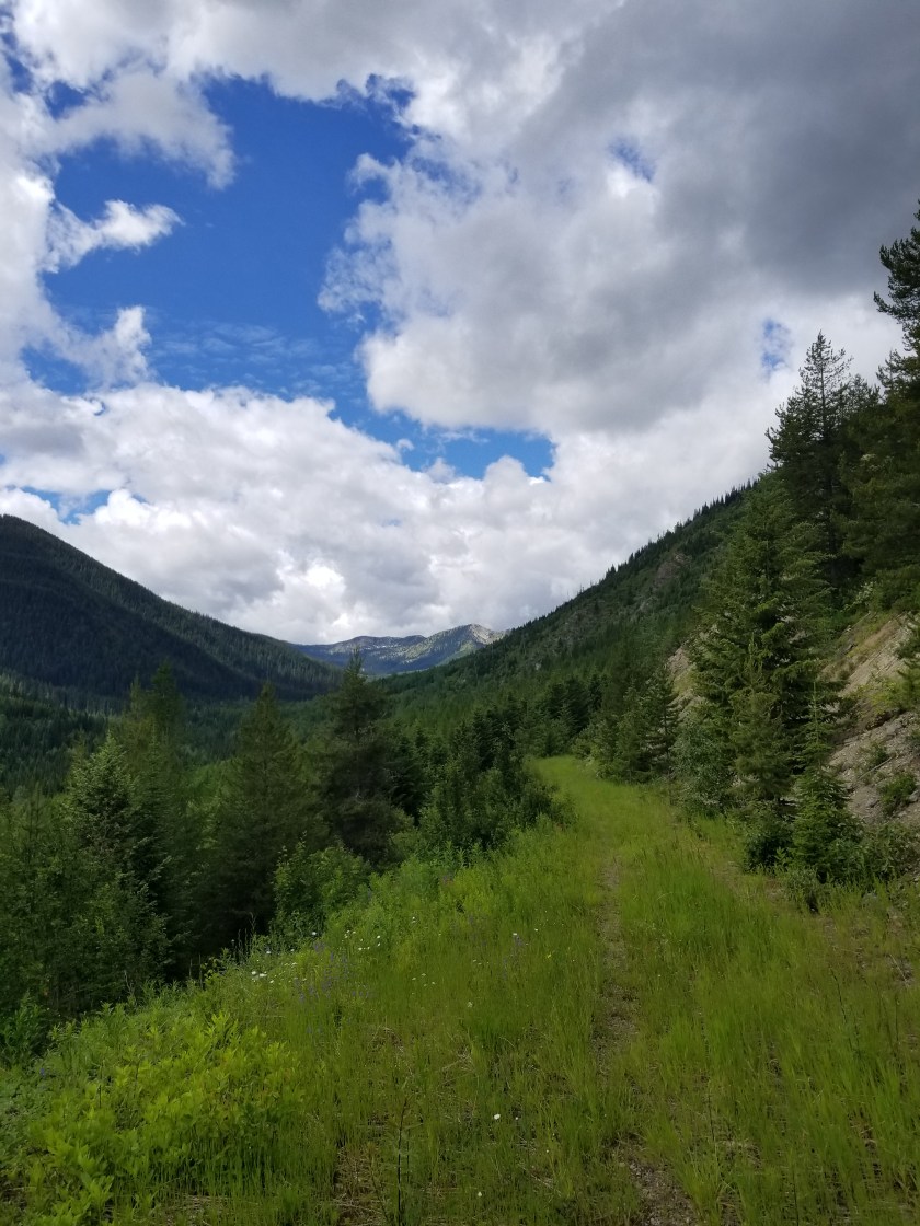
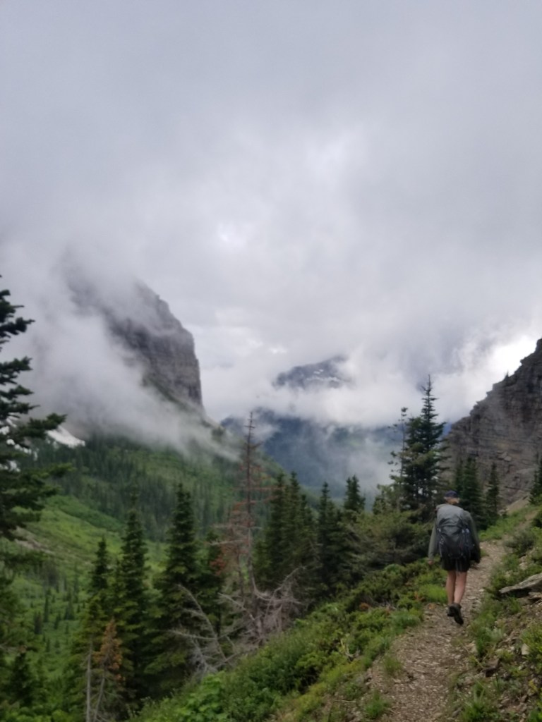
I woke up feeling pretty good. I packed quickly and noted the weather was slightly more sunny than cloudy. Today would be up along the ridgetops. These kind of hiking days are love / hate. If the weather is clear, they are lovely with views to the horizon. Stormy and you hate almost every minute.
The snow mounds were limited at first. Limited to trees and northern areas. Indeed, the views were pretty good. Once I came to my first ridge, I could see the trail going up the next ridge in the distance.
I could see the trail climbing the mountain ahead.
On a whim, I turned on my phone and got reception. It is very random how connectivity appears on one mountain and not another. I did the only reasonable thing I could and that was check social media.
I started cruising along the ridges. From the footprints, it looked like two people were about three or four days ahead. That was a relief from a route-finding perspective. The snow became almost continuous on the ridge.
After about 30 minutes, the footprints were overlapped by a more recent traveler: a bear. It was cool to see how the bear used the trail, even following on switchbacks. I presumed it was not stalking the others and it did not seem fresh, so I was not worried.
Another traveler joins the trail.Although the snow melt made it bigger, here is a comparison to my size 13 shoes.
It started drizzling. The views disappeared. I stopped for a snack and had a hail storm roll over. The hail turned to graupel then snow. I entered an area that had burned the prior year. It felt eerie. The ground was charrred and skeletons stood, half burned, large charcoal logs. The white snow contrasting with the black reminder of what must’ve been a hellacious fire
The weather gets bad over the burned out forest.It was eerie, almost like walking through a graveyard.
I stopped just short of the top of Mt. Locke, 7,200′. The wind really picked up, driving the snow almost horizontally. I made a sarcastic video about the elements and wondering why more people don’t go backpacking. Within 20 seconds of finishing, a massive lightning strike hit nearby. “Holy Mary Mother of Jesus” ( I’m paraphrasing). I knew this was very bad and I had to get down.
I sprinted the 50 feet to the summit, following a clear trail. However, the trail stopped at a sheer dropoff. There were the obvious remains of a former lookout tower, two sheer sides, and the slope I came up. I was stumped and a little panicky. “Where the f*** is the trail?” Please understand that at that moment I am the tallest living thing around and I am carrying two carbon fiber hiking poles in a backpack with small aluminum stays.
I whipped out my map, but it didn’t help. I ran down the trail, resolving to take my chances in the charred landscape I had just come through. However, out of the corner of my left eye, I caught a small flat spot on the blackened ground. I looked and sure enough it was the trail leading away from the top.
My mind kept up the refrain “This isn’t good. I’ve got to get lower.” For my age, I did a pretty good job running down the foot-wide path. However, the trail was only about 30 feet below the descending ridgeline. In short, while I was losing elevation, I was still relatively exposed to the high point. Soon, I saw a sequence of trees along side the trail. I set my sights on the shortest one. First, I stashed my hiking poles. Next, I dumped my backpack. Then, at last, I assumed the position near the short tree. Supposedly, you should squat down as this creates the least amount of body for a lightning bolt to transit. (Not to be cynical, but I did try to imagine how much chipper I might be if lightning only traversed a three foot squatted me versus a six foot standing me.)
Unfortunately, another bolt struck. It was close. Deafening. It made the air smell weird. You know that thing where you are supposed to count “One Mississippi ” to gauge how far away the bolt struck? Well, this was at “O”.
Considering my age, the fact I was squatting, and the proximity of the strike, I was proud that the only thing to come out of me involuntarily were some swear words.
Hoping that the electrical component would move on, I decided to wait 20 minutes. No more lightening occurred and the storm’s fury eased noticeably. I grabbed my poles, backpack, and pep-stepped down the trail, eventually reaching a junction that would pull me off the ridgeline. Ironically, I was now on the Bluesky Trail.
Leaving the stormy ridgeline to join the Bluesky Trail. Note the Pacific Northwest Trail marker below the trail sign melted in the heat of last year’s fire.
The next two hours were spent descending a steep trail in a slow persistent drizzle. I stopped to put on my rain pants and noticed how scarred and blackened my legs were from climbing over charcoaled trees in the burn area. I also realized I had lost my glasses in my panicked run.
After the steep trail and clambering over blow downs, I came to an abandoned road that was now the trail. Oddly, about 5 miles from the parking lot at the start of this trail, I came across an abandoned wheelbarrow.
Pushing a wheelbarrow five miles uphill was a feat of strength and futility for some soul.
Those last miles were wet and slow, but around 6:00 I reached the parking lot, came back up the trail a bit, and set up a soggy campsite in a meadow. Almost 11 hours to cover a lousy 19 miles, but I was glad to be alive.
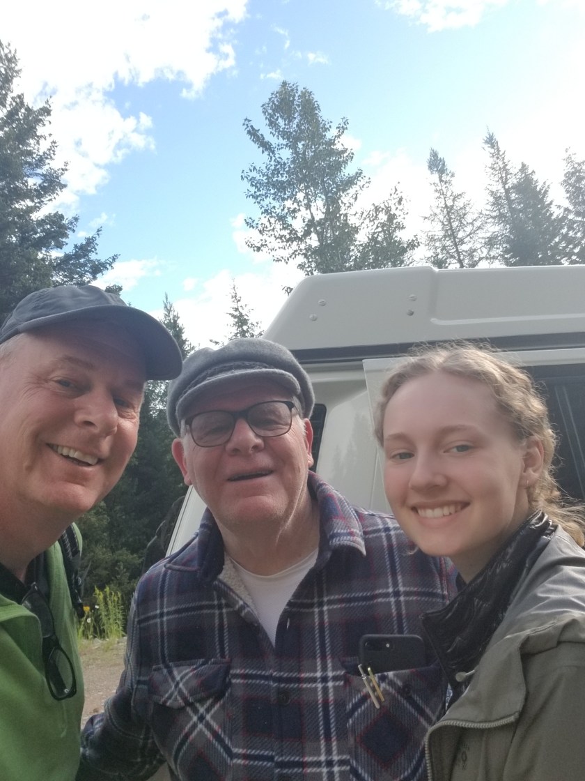
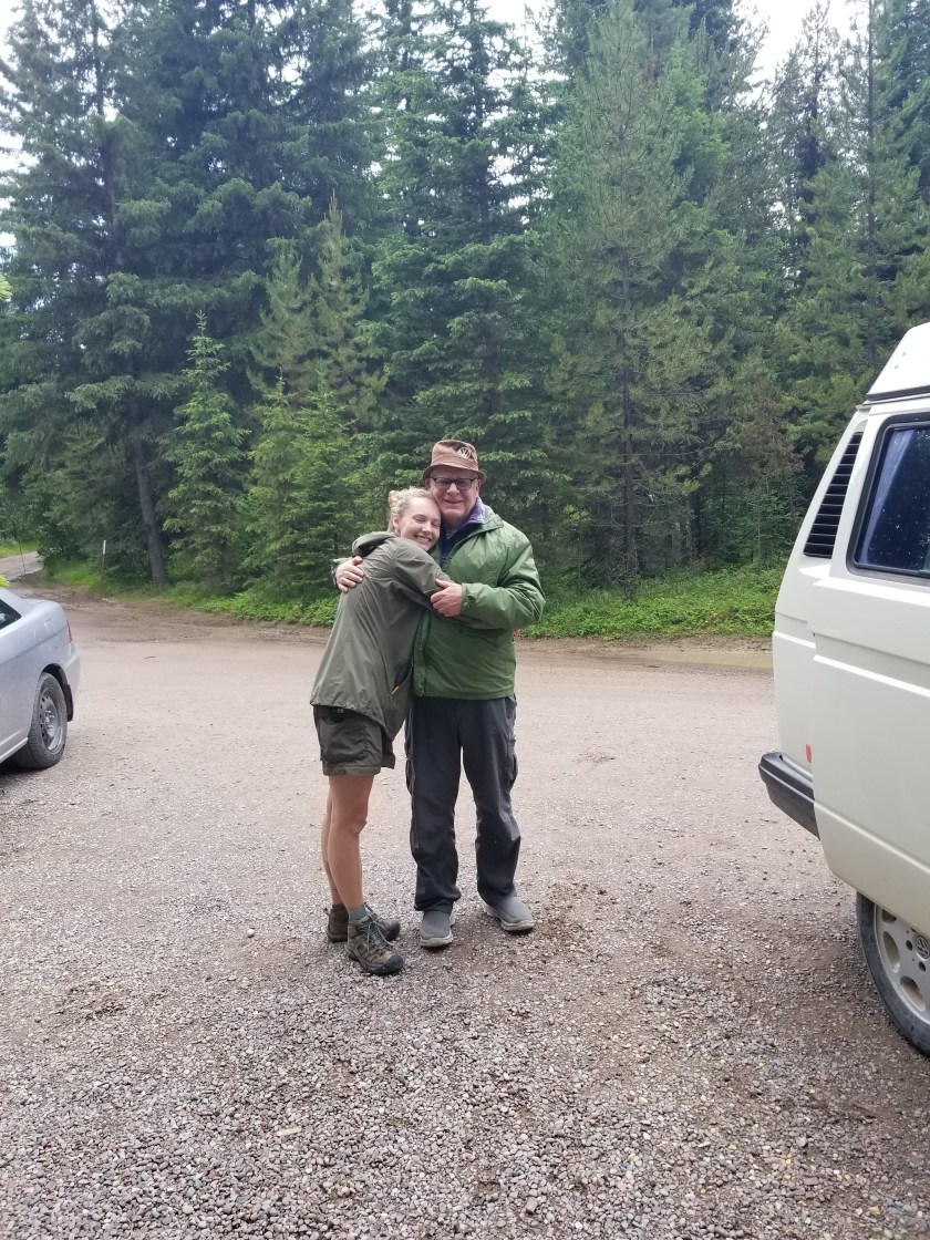
We were to meet for breakfast. Ing would get on Amtrak back to the twin cities and my Dad would drop me off at the trail. Amtrak notified us of a massive delay (four hours). So we ate breakfast, then Dad & Ingrid took me to the trail.
We said goodbye on a Forest Service road. I was glad Grandpa and Ing got some bonus time together, but a little sad to be on my own.
Again, the clouds hung low as I walked for a few hours on a gravel road. The mosquitoes were fast. Usually I can out-walk them, but these guys ingeniously drafted me and got the back of my legs pretty good. Eventually, it started drizzling so the little buggers disappeared and I popped open my umbrella.
Amazingly, I saw another backpacker. I caught up to her. Originally from Israel, she has lived several places and hiked some long trails, like the Colorado Trail, which overlaps part of the CDT.
The road eventually turned into an abandoned forest service road. I saw my first official PNT trail marker. Alders and huckleberries grew in from the sides. It was a great way to use an old road. The Forest Service cant afford to maintain all their roads. I read somewhere they were the equivalent of the largest construction in the world.
While this trail was good for me, it was also a highway for bears. Indeed, on one section it seemed like a rest area. Needless to say, there was a lot of “Hey bears” from me along the narrow parts.
It switched to a real trail as I got higher. I stopped at the transition point. Two guys and a pack mule came by, said Hi and went on another trail. A real good cowboy chat that was.
Alders pushed in from the sides as the abandoned road turned to trail.
I descended the narrow trail across and down a steep slope. At the road at the bottom, I still felt strong so I went past the Red Meadow camp and pushed on.
Looking across the valley before Red MeadowLooking down the valley before Red Meadow Camp
I missed my last creek water supply and settled for a snow melt pond just before I went on a trail again. I immediately encountered snow patches on the trail. Snow patches are a big hassle. You step up on them and, depending on the temperature and consistency, walk across, slide, or sink in to a deep hole. In short, it is slow.
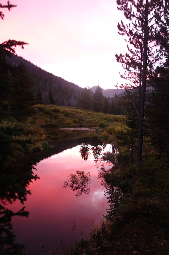
Knowing the trail would soon climb a ridgeline and stay there, I found a flat, snowfree place to camp. I built a little fire to take the damp off the 20 mile day and went to sleep early.
We were ready on time. There is a rhythm to breaking camp in the morning. Even after just a few days, it becomes comforting. Also, I noticed the lightness from having consumed three days worth of food.
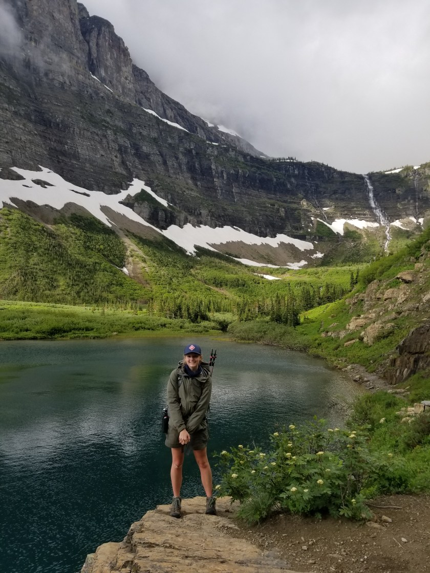
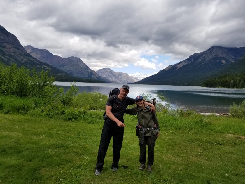
Today we would climb 900 feet through Brown Pass and then descend over 2,000 feet, ending with a six mile hike alongside Bowman Lake. I was leery of another icy pass, but it turned out to be snow free. Before dropping over, we took one last look east into Glacier.
The steep descent was made more challenging by fallen trees across the trail, a reminder of how severe the weather can get over the winter. Ingrid was a natural for choosing from a) under b) over or c) around.
Eventually, we heard chainsaws. Then, we saw the crew. They were working on a huge 3 tree collapse across the trail. I sent Ing down and around to get the chainsaw worker’s attention. Never, ever surprise someone operating a chainsaw.
I took the high route above where a massive tree’s roots had been pulled from the ground. It was about 8 feet of loose rock sharply down to the trail. I took two steps, then both my feet flew out and I landed flat on my backpack on the trail right in front of the trail crew supervisor. He complemented me on my grand entrance.
It drizzled off and on as the gray clouds clung to the mountainsides. We were making good time. In reality, I could not keep up with Ingrid. I think she felt sorry for me and every 30 minutes would stop and wait for me, ostensibly to check the map on my phone.
We had made plans to meet my Dad at the campground at the foot of Bowman Lake. That, combined with the prospect of cooked food, a shower, and a bed was exceedingly motivational. Almost exactly on time, we found him and he was happy to see his granddaughter.
After a snack, we headed first to Polebridge Mercantile for some baked goods and then on to West Glacier for dinner and a motel near the Amtrak stop.
For me, this his has been an incredible trip. Usually, I schlump along and take photos to communicate to others what I saw. However, on this trip I was able to share the experience with my daughter. I hope she enjoyed it enough that one day she will take her son or daughter to watch waterfalls and mountain lakes. Plus, being able to end the trip meeting up with my Dad, who tried to instill an appreciation of nature in me, was an extra blessing.
Sorry, WordPress is still not letting me embed pics.
We never figured out what exactly was breaking sticks in the woods. There were several “Hey Bears” and fruitless probes of the darkness with headlamps. We bantered back and forth for an hour before falling deeply asleep.
It was supposed to be a fairly mild day with manageable elevation and just under 10 miles. We started out in the waist deep foliage filling the floor of an old forest. We saw a few deer who were totally unafraid of us.
As we approached Waterton Lake, I caught the Border Patrol cameras so we made some comedy sketches for them.
Waterton Lake is long and lies in both Canada and the U.S. there is a popular resort on the lake in Canada and people can take ferry ride to the southern end of the lake and go through customs. We chatted with Border Patrol (they hadn’t seen our sketches) as well as the Park Rangers. One of the rangers was from near our home.
After some border photos, we began the gradual climb to our campsite at Francis Lake. A trail crew had been ahead of us. In addition to the beautiful, rich scent of the forest, we would occasionally pass some freshly sawn lumber.
It started drizzling just as we picked our tentsite at Francis Lake. Undaunted we walked down to the shore. Absolutely stunning. About 150 feet across an almost turquoise lake rose a massive wall with a waterfall that must’ve been 200 feet high. We just sat on the beach and watched as the rain gave way to sun, revealing the shifting mist clouds high up the waterfall, catching and releasing the sunlight. This park is so astounding. I was so happy to have Ingrid there. I don’t push backpacking on anybody, but sometimes I feel like a nutjob describing some natural beauty. This time I was allowed to share the beauty in person and forever.
We ate dinner and went to bed early as the rain returned. We were both tired from the night before and knew we needed to start early for the long day ahead.
{NOTE My blog vendor, WordPress, is not allowing me to load photos remotely. I will try Instagram as a way to provide visual interest to the dry, crusty written word in my blog. Will add photos here later. Sorry.}
Yesterday, we made it to Many Glacier ranger station. We hoped to get a permit that matched the online reservation we made months ago. The challenge was that we requested a route over two passes and this was a heavy snow year. The ranger was hesitant to give us our route. However, we finally won her over with our microspikes, ice axes, and experience, plus a full-on charm offensive. I’m sure it was the microspikes.
We had to watch the bear video that also covers other hazards. The Park Service recommends that people ford rivers by linking arms and walking perpendicular to the current. Admittedly I am an amateur, but this seems absolutely daft. First, if the current is strong enough to knock one over, wouldn’t the rest fall like dominoes? Second, if my arms were linked to yours and I fell in, no matter how much I loved you, my fingernails would be two inches deep in your flesh, sealing your fate to mine.
Anyway, they gave us a permit for a route which they said was “not recommended.” I was very tempted to ask whether the ever recommended routes they did not permit.
We were able to check in to our motel early, drop our packs, and take a 10 mile hike. We took a popular out-and-back trip to Iceberg Lake. All shapes and ages and sizes were on the trail, almost all happy. Except for the parents of young kids who were stomping down the trail grumpy with grumpy kids.
As billed, Iceberg Lake had an iceberg. Also, there was that guy. You know, the one who understands that the park rules and several signs saying No Dogs applies to everyone else, not him.
The next day we were picked up by the shuttle taxi. It was very interesting to meet David and Rhonda. They live on the Blackfeet Reservation. They started the shuttle service to transport folks around the Glacier area. In addition to educating us about their culture, challenges on the Reservation, and their business. I was most impressed with how they have adopted four children in their community from parents unable to properly care due to drug or alcohol problems. I felt small next to them. They know full well that each of these kids are prone to the same problems as their birth parents, but Rhonda and David opened their hearts and home to give hope.
Around 11:00 we reached the Canadian border at Chief Mountain. We took the obligatory border photo and then started hiking.
The meadows were full of flowers and the forest was a lush green. We spent the first hour descending to the Belly River. Once there, we encountered several hikers and enjoyed the snow capped peaks. Just before we broke off the main trail we ran into the ranger who issued us our permit. She was hiking off-duty and was helping an on-duty ranger with an injured hiker. She checked our permit. Thorough.
We climbed up out of the valley and reached our destination after eight miles. It was Coseley Lake. As the park name suggests, most lakes here are long and narrow since they fill glacier carved valleys. About 150 feet across from our campsite rose a massive stone mountain. Behind behind us, another. While beautiful, the effect was a bit of a wind tunnel.
To manage bear vs backpacker issues, you must camp in designated campsites and each site has a separate food preparation and storage area. During dinner we met a young couple from Missouri on their second backpacking trip and a local, experienced mother-daughter team. It was great dinner conversation but we turned in early.
All in all, a great first day. Ingrid was a natural at finding the right route. The weather was perfect. A good start.
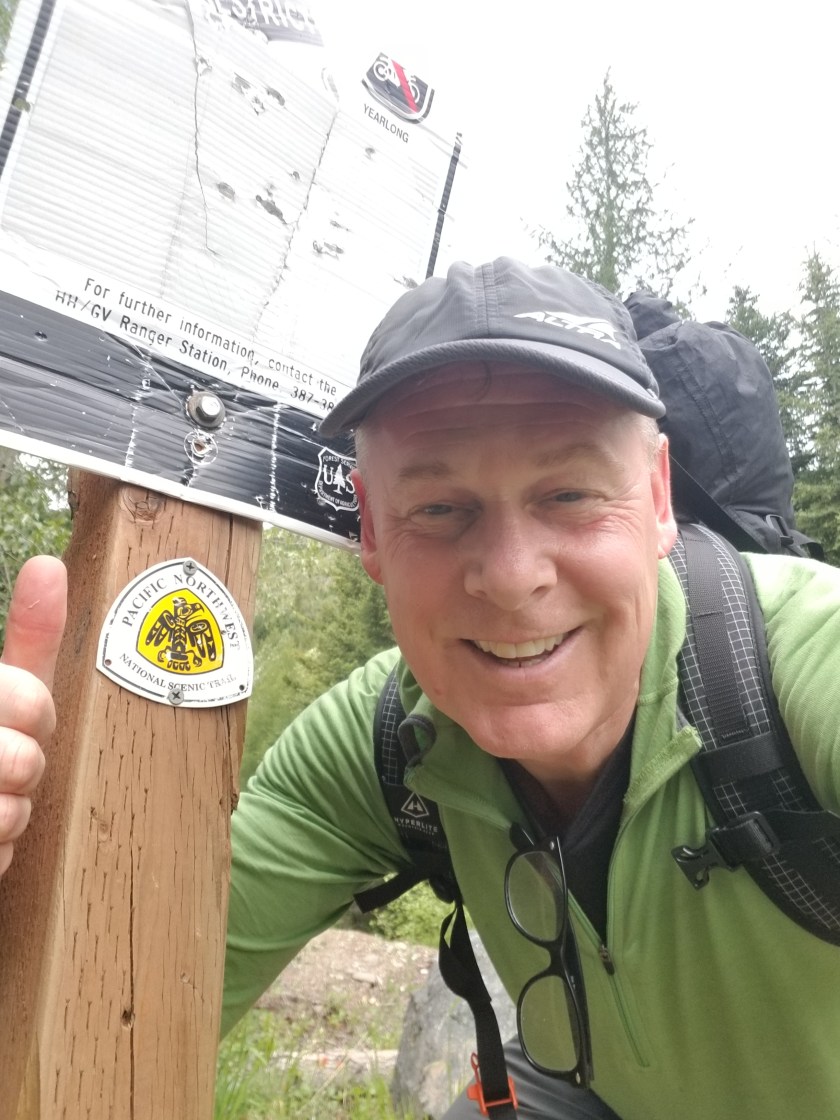
So we are beginning! I am very fortunate to be hiking the Pacific Northwest Trail. Even more of a blessing is that I’m being joined at the start by my daughter, Ingrid. She is joining me for the start through Glacier National Park.
About the Pacific Northwest Trail
There are three famous National Scenic Trails. The Appalachian Trail (AT), Pacific Crest Trail (PCT), and Continental Divide Trail (CDT) make up the famous Triple Crown of long distance hiking in the US. They are approximately 2,200, 2,600, and 2,800 miles long heading in a north/south direction. While also a designated National Scenic Trail, the Pacific Northwest Trail (PNT) is far less traveled and not as well known.
I was attracted to the PNT for several reasons. First it is an east west trail. A hiker going west starts in Glacier National Park and goes across northern Montana, Idaho’s panhandle, northern Washington, across Puget Sound (on a ferry…I’m not swimming across), and lastly it crosses the Olympic peninsula with a final beach walk to the westernmost point of the continental 48 states. It goes through three National Parks and covers some of the most remote mountain ranges around.
The second attraction is its distance: approximately 1,200 miles. Roughly half the distance of the Triple Crown trails, the PNT is long enough to be an immersive experience, but not so long that people forget you and your kids start referring to you by your first name instead of Dad.
Lastly, as a less traveled trail, I like the notion of an uncrowded adventure. Although the westerly direction I am taking is the most popular, I’d be surprised if there were more than 150 people doing it this year. As a frame of reference around 6,000 people hike the AT each year.
Expected Challenges
Hopefully my wife won’t read this section. She is a worrier.
There are a few challenges to this route that go beyond the regular ones I faced on the CDT.
First, this is a young, evolving route. Between fires and trail closures, the route changes. There is an “official” trail, but even the “official” maps recommend alternatives. And those alternatives can change. The challenge is not only getting lost, but finding new trails not quite as described.
Second, forest fires are a bigger risk on this trip. Southbound on the CDT I avoided most fire dangers. July and August through Idaho, Montana, and Washington is just asking to come across a forest fire. In case you are wondering what happens, the Forest Service shuts down areas likely to be in the path of a named fire. To their credit, they try to work with trail organizations like the Pacific Northwest Trail Association (PNTA) to identify alternative routes.
Third, beach hiking. I know it sounds simple but some areas of the trail are covered at high tide so I need to know my tide charts and avoid being in certain areas at the wrong time. Plus, given my propensity for falling, slick oceans rocks are a new hazard. And hiking on sand is just painfully slow.
Rewards
Foremost, backpacking with Ingrid will be great. Starting anything in Glacier is amazing. Walking through truly wild areas of the Pacific northwest will be interesting. I have read that the Pasayten Wilderness is some of the most beautiful country in the 48 states. Walking through a legitimate rain forest via the Olympic peninsula is another highlight. Plus, my Dad is planning on driving out to meet Ingrid and I when we finish our hike through Glacier.
Blog
I am an irregular blogger. Sometimes it is a lack of cell service. Honestly, there are times when I just crash at the end of the day. Not surprising to those who know me, many times I have nothing to say. So don’t expect pithy daily notes from the trail. However, I will try to provide reasonable updates to my loyal blog readers. As all five of them can tell you, I do stay in touch.
Going on a long backpacking trip is not something done on a whim. I prepare physically, work hard on logistics, and try to minimize the impact on my family.
Physical preparation
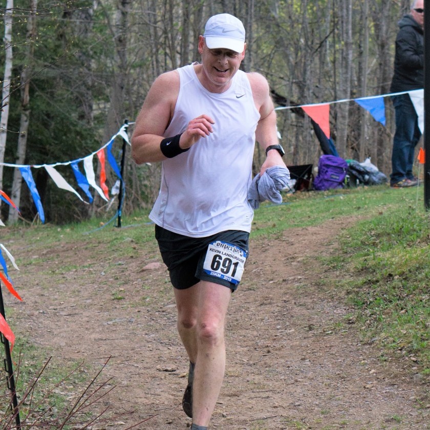
This time I have combined trail running with strength training. Unfortunately, where I live trail running in the winter is problematic. As a result I spent much of this winter and spring on a treadmill. I use the local gym where I do my other exercises.
Running on a treadmill is better than nothing. But it does not replicate outdoor motion such as uneven footing and variable steps. I also used the stair master.
I love my local gym. It is a smallish branch of a franchise. The owner and manager make an effort to provide a good facility. The other members are great. Almost everybody is there to stay healthy and enjoy themselves. Yes, we have the occasional visit from the stereotypes of gym royalty (Lord Gruntsabunch and Sir Dropsalot), but it is the kind of place where you feel good training and develop respect for those members who work out regularly even though you know it is not always easy.
I managed to participate in three races. I had done all of them previously. This year I was markedly slower in all, especially the 25ks. Hopefully this does not portend slow hiking.
As an aside, I kinda like trail running. I am definitely not a natural runner. It is hard and smoking for 27 years didn’t help. Yet running on trails makes it fun. First, there is the concentration of finding where I should take my next step. It is like a video game. Failure to do it right can (and, in my case, will always) lead to a fall. Second, running on a trail is relaxing, especially when the weather is perfect in autumn. Third, it really encourages exploration of outdoor spaces in your community.
Logistics
Planning takes some effort. I mail myself resupply packages to be picked up along the way. To be clear, I plan and prepare the packages, but am totally dependent upon my wife to send them timely.
So, I get topographical maps, a spreadsheet, and a guide book. I estimate how fast or slow I might go in an area and then estimate where I might add stop. Uphill, downhill, road walking, and bushwhacking are the main considerations.
Once I have a daily plan, then I develop a resupply plan. A traditional resupply plan would use Post Offices and the handy priority mail boxes. You ship a box to yourself General Delivery and pick it up when you come to town. When possible, I modify this approach by sending packages to motels along the way. This helps avoid the frustration of walking into a small town Friday evening and having to wait until Monday for the post office to open.
I prepare my own meals in advance. I go stoveless which means my meals are slowly rehydrated. I can’t afford freeze dried meals (financially or nutritionally). Conversely I cant stomach resupplying out of gas stations and living off top ramen. As a result, I spend some time dehydrating meals and packaging them.
Time Away
It is hard on a family when one member wants to wander around for months at a time. If you have kids, there is the weight of missing milestones or events. Household responsibilities that were shared get heaped on the one at home. Plus, there is that nagging fear that if my wife realizes she can live without me for three months, well, then maybe she can go a lot longer. I am assuming that when I stop receiving supply packages the gig is up.
It should be worth it
All of the above may sound a touch whiney, but I don’t intend that. I want to be starting a trip physically confident with a plan for travel and support. It takes time and effort. Yet it allows me to spend my hiking time enjoying the hike versus worrying about details.
I was never good at good-byes and keeping in touch. As a result, I’ve lost some good friends and probably lowered the quality of my life. It also explains why it should not be a surprise I stopped writing this blog the day I finished the Continental Divide Trail (CDT).
Very soon I will take another backpacking trip. To bridge the gap between one trail ending and another beginning I wanted to provide a brief reflection on the CDT.
I ended up walking about 2,700 miles. It took me 4 ½ months. I lost 50 pounds, 49 of which I really needed to lose. I swear I lost about a half inch of height. I grew a beard, lost some hair, acquired two scars I still have, and my right pinky knuckle will always be smashed and crooked. It took me about 6 months to regain complete touch in my fingertips. Clearly, this was a great trip.
238 lbs of optimistic ignorance
188 lbs of happy experience
In spite of that list of physical things, I still have flashbacks. There is no specific trigger, but sometimes an image will just pop up in my mind. It is usually a view from up high or a beautiful sunset or a hell of a storm. But it is vivid and real and feels like a micro-vacation. I’m not sure how long these flashbacks will continue. I hope forever.
This slideshow requires JavaScript.
This slideshow requires JavaScript.
The CDT is a tough trail. In the hiking community the catch phrase associated with the trail is “embrace the brutality”. That’s a bit of hyperbole. I think it comes from people who have had the luxury of following a well-marked, established trail with trail signage every 200 feet. The CDT is like a youngster, still maturing and filling out and finding its way.
I am so glad I went southbound. Once the trail was clear enough to start south from the border with Canada, my only specific weather risk was to get through Colorado before heavy snows might force me off. Northbounders face two snow risks: lingering snow in southern Colorado and early snow in Glacier National Park. Plus, the thunderstorm risks in Colorado challenge northbounders. Lastly, Montana burns every August.
Surprisingly, the people I met were an incredible piece of the trip. Almost all other backpackers were friendly and helpful. Strangers in towns or drivers picking up hitch hikers were generally curious, helpful, and engendered in me a sense of pay-it-forward. I know there were a few jerks along the way and there is this annoying sub-culture in backpacking to be fast or to have done a lot of miles. But I must work hard to pull those memories forward.
Lucky Strike, Curtis, and Cristiana
Crunchmaster, Grizzly, Snakebite, and Lucky
Lucky Strike, Curtis, and Cristiana
Crunchmaster, Grizzly, Snakebite, and Lucky
What about the animals? I still get goose bumps when I recall startling bull elk with huge antlers and watching them crash through the forest. Moose, marmots, mice, mountain goats. Cattle herds that would either stampede away or, sometimes, give the star treatment and follow like a pack of groupies. Bears. If you read the blog, you know I had an unpleasant situation with a black bear and her cubs outside Leadore, Idaho. I still remember that. I replay what I should’ve done different and what I did right. I have no desire to be close to a bear again. I don’t hate them, but I think they are too unpredictable to be near. Still, I am very grateful I was able to see so many animals in their natural habitat.
I learned a few lessons I wanted to jot down so I don’t forget them:
Do not roll-the-dice to get through one more pass during a lightning storm.
Down mittens are excellent around the house, but not so much outdoors.
My go-to medical technology is duct tape.
There is no prize money for finishing the trail the fastest. I am not the fastest. Or fast.
Do not hike with somebody who is carrying emotional baggage, it will weigh you down.
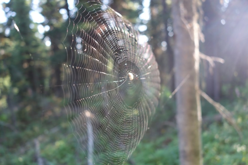
Always let the tallest hiker go first in the morning, they will clear all the spider webs.
I slept better than I thought I would. I feared I would constantly wake up, but I didn’t. For the first time in a long time, I got up immediately when the alarm on my watch went off.
I was packing steadily in the dark. Backpackers have a routine of what items go where in their pack. As I was reflexively putting mine in order, it occurred to me it does not matter. I won’t pack or unpack again for the trail.
I noticed back up the trail a faint light. It was a headlamp. I figured it was probably another southbounder heading to the finish. But, this close to the border, I did not want to wait around and find out it was something else. I covered my lamp, finished packing and took off at a pretty good pace. When I felt like there was some distance, I turned my head lamp back on.
Not to be graphic, but nature called. This would be my last crap on the trail. Trust me, I dd not get sentimental. I was not going to miss the ritual of digging, doing, covering, and then sanitizing hands.
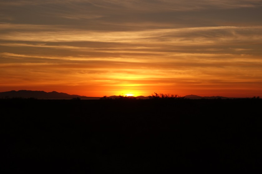
Here comes the sun
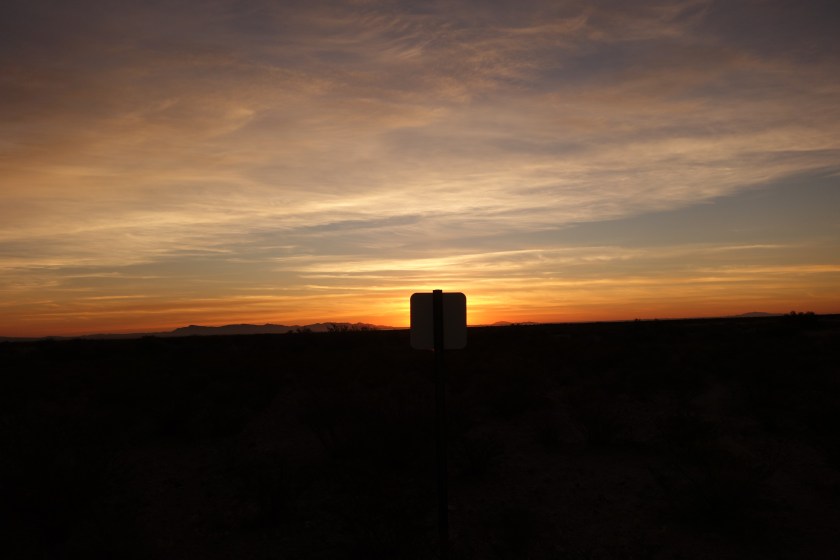
The trail came to a large cattle tank. I went over to check it and it had some good water, but I still had two liters from the last cache. At this point, the trail left the gravel road and the final section was real trail. There was some faint tread. However, the direction was east and the rising sun made sign spotting difficult.
A trail marker outlined by the dawn
I managed to come across a lonely cow. At first she called out to me hoping I was the herd. But she realized I was a human and charged off a short distance. Last cattle encounter of the trail. Not going to miss them, either.
Eventually the sun rose enough that I could see the outline of the posts and signs. At this point I started getting a little excited and quickened my pace. My rational mind said it was stupid to hurry since it was only 7:15 and the shuttle out would not come until 10:00. My emotions, however, were urging me to get this over with.
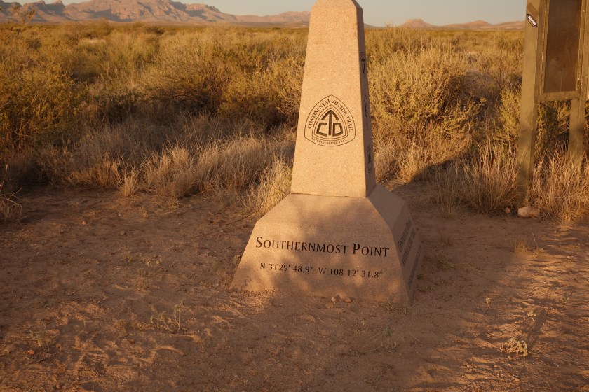
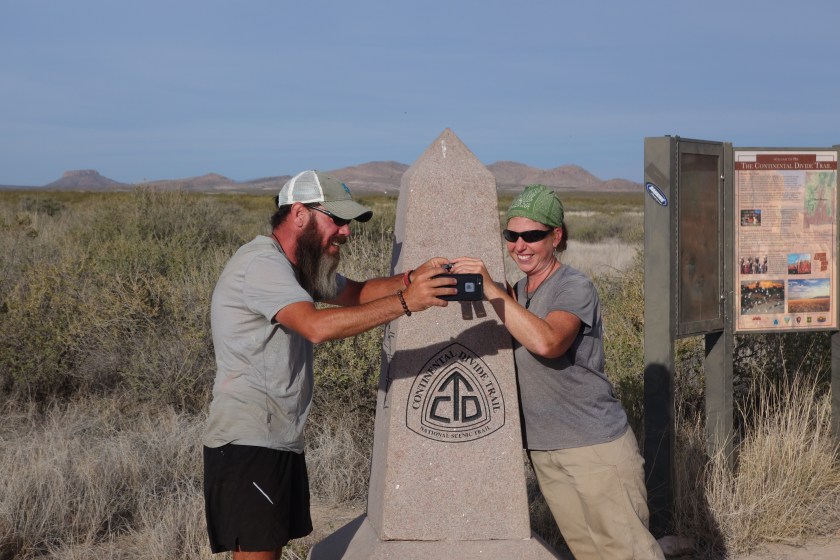
Then, I caught the outline of the monument marking the end. I could see it had an informational board and some type of canopy. I walked a little bit faster. I was walking as fast as I could without running.
I made it to the monument. It was not an excessively emotional moment for me. I was happy. I was proud that I had accomplished what I had set out to do. It felt good.
there it is….
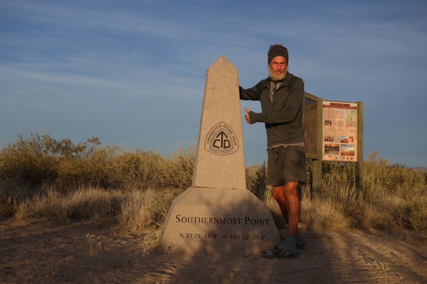
I sent a satellite text to a couple people, put my foot through the fence to touch Mexico (before the Unity Wall is built), and then did what modest, contemplative, thoughtful people like me do: took some selfies.
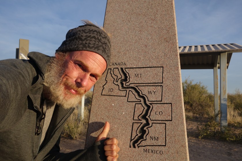
My daughter calls my combination of grey colors “groutfits”. The trail is not to scale on this map
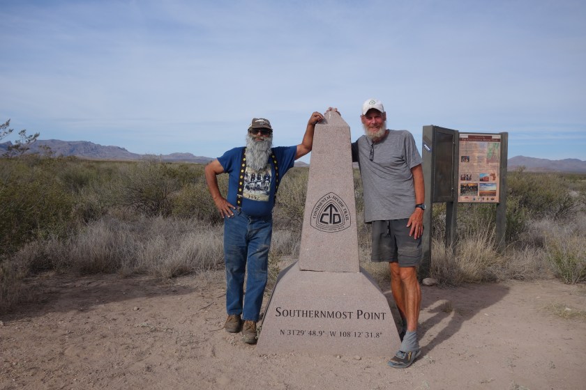
About 45 minutes later I saw two figures coming down the trail. The headlamp I saw did belong to CDT hikers. As they got closer, I could see it was Sweet Baby James and Moon Light Lady. It was good to see people I had hiked with off and on finish at the same time. They were jubilant and much more emotional than I had been. I think the sense of shared accomplishment for couples must be huge.
They did have an exciting story about waking up at night to some noise outside their tent. Four guys dropped their huge backpacks and ran when SBJ shined his headlamp on them. He immediately recognized the situation as drug smuggling. He and MLL packed up as quickly as possible and bushwhacked up high and spent a sleepless night on a rock outcrop. They tried to report the encounter to the Border Patrol and the CDTC, but nobody was particularly responsive.
I took a few pics of them and also of our shuttle driver when he arrived. None of us had been able to find champagne in Lordsburg, but they toasted each other with miniature bottles of Jack Daniels.
Sweet Baby James and Moon Light Lady enjoy a selfie of their toastJuan and I
The shuttle driver, Juan, showed up ahead of schedule. He was dropping off a CDT Section hiker. We happily got in his vehicle and began the rough road out. Until it hits pavement after an hour, the ride can be quite exciting. A Chevy 4 door with Texas plates was abandoned with a crushed oil pan, serving as a silent testimony to the wisdom of a high clearance 4 wheel drive vehicle as the preferred way to travel.
As we were on the road, we drove by a solar well and stock tank. I craned my neck, trying to see if the tank held water. Then it hit me. I did not need to check all possible water sources. I was done.
^ ^ ^ ^ ^
I suspect some people take these long backpacking trips searching for something or trying to leave something. Cheryl Strayed tried to use backpacking as a transformational tool in her book/ movie. However, while I enjoy the time to think through things, I never expect any big epiphanies.
Nevertheless, I think I did end up learning one lesson on this trip and it is consistent with the blog name. Initially, I found myself wanting to go fast. I wanted to keep pace with the younger backpackers and post big miles. It seemed to me I had always been competitive, wanting to be the alpha male. Wanted to be good at basketball in high school, working my way up the corporate ladder quickly, retiring before age fifty. In Montana when I had a leg infection, it infuriated me to have a bunch of other southbounders passing me as I limped along. I was going nuts when I had to rest for a few days in town while the medicine went to work.
But somewhere in Colorado, I realized I was not going to keep up with the faster hikers. And that was OK. I concluded that when you are young you want to live life fast. But as you come to grips with the fact your physical body has peaked, you don’t want life to go so fast. You want life to go well. When I focused on the hike and not the speed, I truly began to enjoy backpacking over the hill.
^ ^ ^ ^ ^
Thank you for following along. I don’t understand WordPress statistics, but it looks like well over ten people have read this blog and that’s not even counting my Mom, but I have a sneaking suspicion she just looked at the pictures. Your indulgence for poor writing is very much appreciated. For example, I pride myself on a unique style of writing where I changed tense often and will use incomplete sentences. To keep the reader guessing.
Also, blogging from the trail is difficult and I was not up to the task. In addition to the obvious challenge of being beat every night, there are others. For example, not using up all your battery or lacking connectivity. I do not offer this as an excuse, but I hope it puts the long periods of silence on this blog into perspective
I may post another entry like “Advice to Future CDT Hikers” (and perhaps a gear review) at a later date. Those are pretty nerdy topics so a non-backpacker won’t be interested. However, I may very well conclude that those topics are like checking out water sources and not something I need to do any more.