Metaline Falls

July 17, 2018. Sullivan Lake to Metaline Falls.

After a great night’s sleep, I got up rested. I tried to eat breakfast, this time an overnight soak of a 10-grain cereal with fruit and nuts. Not a favorite.

Pretty straightforward lake hike. It was an attractive lake.

There were a few day hikers out early. There is an air strip at the end of the lake.

The rest of the way was a six mile road walk. If the road had been busy, it could’ve been frightening as their was little shoulder.

Pretty country, but I was most focused on getting to town. Foremost, I was looking forward to my new pair of shoes.

Around 9:30, I walked into town. The Post Office wouldn’t open until 10:00. Fortunately, one of the town’s two restaurants was open. I enjoyed this second breakfast much more.

I got my shoes and found a place to stay.

Metaline Falls is a town that peaked in the 1910s. Mining and, later, cement and other resources were the drivers. Except for one zinc mine, everything is shut. As a result, almost all businesses in town are shut.

There is some very interesting architecture. One is an apartment building with ornate green brickwork at the top.

Best of all, there is a residence called the Rock House. It has two outbuildings. The main residence is built with local stones. My photos I took don’t do justice to the creative work. There were two gorgeous stone chimneys.

The coach house.
The garage

A Fire and a Lake

July 16, 2018. From the side on Mount Mankato to Sullivan Lake.

It was very still last night. I thought and hoped there would be more of a breeze, but it was stagnant though the temperature did drop as ome.

When I started hiking the first thing I saw was a forest fire in the valley below. Uh oh.

A plume of smoke.

I knew I should report it, but to whom? How? I turned on my phone and had a few bars. 9-1-1 seemed wrong. I googled the forest service for this particular area. I dialed the local office. It was early, so it was a recording. However, I was able to leave a message, but given the garbled connection I wasn’t sure it all went through. I also sent a note to the PNT trail association.

It was a great morning for hiking with many open meadows to cross.

The day kept getting hotter. Before I entered a lengthy burn area, I found a very unique mushroom. Previously, all mushrooms had been traditionally shaped.

Having reached the peak height for the day, I crossed a meadow that would lead to several hours in a burn area.

The burn area was depressing, inspiring, and boring. All the death and destruction is depressing. Ancient trees, countless animals, all burnt.

It still smelled like burnt wood in here.

Inspiration came from the plants literally rising from the ashes and animals and insects trying to gain a foothold.

It was such a contrast to have this bright butterfly in the stark, burnt area.

As the temperature soared with no source of shade, hiking was tough. I experienced this weird feeling where I just had no appetite. My rational mind knew I should eat, but my physical condition could not stand food.

Around 3:00, I finally left the burn area to follow a cool, noisey creek downhill. Appropriately named Noisey Creek, it would eventually feed in to a reservoir named Sullivan Lake.

At first, the creek and trail rapidly descended. However, at some point the trail switched away from the stream and began long, gradual switchbacks.

For a day hiker or casual mountain hiker, these broad leisurely paths might be very appealing. When you’re an exhausted through hiker, these paths are frustrating, in this case adding, I guessed, two miles more distance than necessary.

Finally, I reached a drive in campground between Noisey Creek and Sullivan Lake. It was 4:30 and I guessed it to be around 95 degrees. Tempting as it was to just buy a campsite, I knew the RVers would have a different schedule and they would be running their generators to run their air conditioners.

So I pushed on. A road ran down one side of Sullivan Lake and a four mile footpath down the other. I started down the trail,but had to rest. For the first time on this trip, I stopped for an extended break. It was too hot. Salt crystals were visible on my shirt and hat marking the days exertions.

After 30 minutes, I resumed my lake trail, constantly looking for a campsite. However, this side of the lake was a steep slope. After a few miles I came to a perfect campsite. A level place for my tent, close to the lake, and some prior occupant had made a bench at the water’s edge.

I ate dinner on the bench watching the sunset soaking my legs. A waxing crescent of moon appeared. Like a dimmer switch, as it descended toward the ridge across the lake, darkness increased. Once behind the ridge, it was dark and beautiful, with small waves touching shore.

My Worst Day

July 14, 2018 From Pyramid Lake to stealth camp on Lion Creek.

I woke up way early and forced myself to stay still for a bit. I knew the family wouldn’t be up. I snuck out to get a sunrise pic of the lake and grab my food hang.

Another sunny day. It would start with a climb to two nearby lakes. From there it would be bushwhacking. In case you are wondering, bushwhacking means taking a course between two points with no established trail. As the name implies, you must go through bushes, downed trees, bogs, etc to achieve your goal. Without these obstacles it would be walking or traipsing or strolling or perambulating or something.

The first lake (Upper Ball) was beautiful and I regret not having the daylight or energy to get there the previous day. The second lake (Lower Ball) had families with barking dogs.

I scaled a hill and the first part of the bushwhack began: cross a mountainside. It was a little steep, but manageable. Until the rock slides. Then, I had to edge my way uphill to get above the steep area with no apparent footholds. This happened a second time as well. Falling here would be unpleasant, to say the least.

The only consolation was that some of the rocks at the ending ridgeline appeared to have fossils. It reminded me of Sandia Crest near Albuquerque where I found fossils at 6,500 feet elevation. This old earth sure moves around.

The rock on the left had formations that looked like fossilized sea anemones.

The next installment was to go down a heavily vegetated hillside, veering west slightly to end up in a particular canyon.

At first there was a trail, but after about 100 yards it disappeared. Most of the bushes are alders ( I believe). They grow about 4 to 8 foot branches. The devilish part is they grow in the same manner as crabgrass: the branches shoot out, then up. So, they end up interweaving their branches. This makes for tough hiking.

Downhill, I eventually made my way to the right location. Allegedly, there was an old faint trail. While this was true at times, other times it wasn’t. In fact, the further down Lion Creek I got, the more frequently the “faint” trail disappeared.

The main point is that it is slow and difficult to push your way through shrubs and step over downed trees on a hot day. I reached a point where the guidebook and GPS map said I should be connecting with a real road, but that was simply untrue.

I eventually stumbled out of the woods sweat-soaked, bleeding from lacerated arms and legs and in a foul mood and odor. Immediately I met a family pulling a wheeled igloo cooler in swimsuits. We both looked at each other like WTH?

The back of my legs.

After several more people passed me in flip flops and swimsuits, I asked a couple what the attraction was. Apparently there is a natural waterslide famous with the locals. This trail eventually turned to a road, but before it did there were several cool streams that provided needed refreshment.

Exhausted, beat up and late in the day, I weighed my options. The official trail climbed a mountain to a….Lookout! And then climbed down to meet the gravel forest road I was now on. Hmmm.

So I stayed on the current forest road, listening to an audiobook. One kind couple stopped and asked me if I wanted a ride. Tempting as it was, I demurred. Near the bottom where the stream I had been following almost all day (Lion Creek) was going to feed into Upper Priest Lake, I found a stealth camp away from the road but near the creek.

I ate dinner and then washed my wounds in the cool creek water. It reminded me of why I always filter water.

* * *

P.S. an obvious question is why don’t I wear pants. The answer is that pants, on me, get sweaty and thus tug and bunch and chafe. None of us are here for an anatomy lesson, but suffice it to say I chose the coolness and flexibility of shorts even if it means scratches.

Rebound to a Good Day

July 15th, 2018. From stealth camp on Lion Creek to Mankato Mountain.

It was warm to start. Normally, camping by a creek can lead to waking up with a damp temp as cold wet air sinks. Not this morning. It was going to be warm.

I cruised past all the RVs and boats and jet skis and ATVs at the campground. When I get home, u want to add up how much America spends on all of these and I will bet it probably ranks in the GDP equivalent of some European countries.

Don’t get me wrong. I am not trying to be self righteous and insist my way of enjoying the outdoors is best or right. Instead, I am concerned that people take so many mechanical distractions with them to the wilderness.

Off of my soap box, I traveled past Upper Priest Lake and some great campsites. Then, without warning, I entered an area that was epic. Recently society has screwed up the word epic by applying it to common things. Thus we lose the true impact of epic when used appropriately.

I entered a land of giants. Cedars. Trunks 12 or 20 feet in circumference. Crowns reaching hundreds of feet high. Walking on a forest floor of decades of fallen needles and cones. A smooth green shag carpet of ferns wherever a ray of sunlight would penetrate. No wind. Once in awhile a whitetail. This went on for several miles. I’ve been to the Sequoias and redwoods, but this was so unexpected and vast that I have to call it epic.

But then hot road walking kicked in. Eventually it switched to trail. Finally, it switched to uphill forested trail.

I climbed up along Jackson Creek. I was very thankful for the tree cover because it was hot. The guidebook suggested collecting a lot of water at the bottom. I did and was lugging five liters which is 10 lbs.

Surprisingly, the mosquitoes were horrendous. At least 20 or 30 around me at all times. I used DEET 100. Some people hate it and I may end with numerous tumors and lesions, but by God did I get relief from the little bastards. Except, of course, when it dropped in my eye along with sweat which is a feeling comparable to someone grinding lemon juice with tobasco into you cornea.

Except for the mosquitoes and passing dozens of streams with plentiful water, I felt good and trudged my way up. I entered a burn area with fantastic views. I had my eye on a saddle between peaks that was level and I could have sunset and sunrise views.

Finally, as I approached, I saw tents. There were three ladies camping there, enjoying their dinner and my view. We chatted a bit, but I pushed off, hoping that the saddle in a half mile would offer similar views.

Upon arrival, I found the Washington Trail Association trail crew. This was great because these were the heroes cutting up blowdowns and making the trail clear. Selfishly, it sucked because the next flat area on my map was a half hour away and it was getting dark.

Out of the blue, I spied a little flat area about 50 feet downhill from the trail. I was able to scratch out an area big enough for my tent. As is my custom, I sent out a satellite note to my family identifying my stopping point. I was surprised to see I was on the slopes of Mount Mankato. In Minnesota, Mankato is a sleepy college town on flat land, so I have no idea how this mountain got named.

Just glad to be laying down, I watched as darkness enveloped the valleys below while the relentless mosquitoes still tried to get in my tent.

The Selkirks start with a Bang

July 13, 2018. From West Side Road to Pyramid Lake

At 7:00 Sharlene, the trail angel, was there to pick me up. A thoughtful person, she was interesting to speak with on the drive to the trail.

I skipped a 9 mile paved road walk. I have paved roads at home I can walk if I feel a burning desire. I started at trailhead for Parker Ridge. I’d heard and read that this was a real quad/calf buster. Also there was strong advice to fill up at the trailhead stream because there was no other water source for 16 miles. I drank a full liter, carried 4.

I knew it would be a low mileage day since I started out at 1,800 feet and sought to end up at 7,200 feet ideally. Oh, and it was supposed to top 90.

Parker Ridge was the center of a fire a few years back. The Forest Service and volunteer trail crews had remade the trail. Early on, the steady switchbacks rose through old exposed areas. The bonus was huckleberries to munch on.

After an hour or so, I entered the burn area. The crews had designed a trail that alternated directions and drew attention away from the glum monotony of a burned forest.

There was some interesting vegetation jumping in to the void. That brought insects. More curious to me, I found a pair of woodpeckers. I assumed they must like their insects extremely well done, definitely on the dry side. My quest has been to video baby grouses flying. I got sort of close.

My legs and lungs felt really good. In my experience, in longer hikes there is a whole bunch of physical and mental melodrama for the first few weeks before things settled down. Now, I felt fine.

Once around 6500 feet, the landscape changed to boulders and stunted trees, dotted with some lingering snow patches. I gladly dumped out my warm stale trailhead water and collected snowmelt for filtering.

The sky was a beautiful blue and a gentle evening breeze was starting. I decided to push for 17 miles. I know that doesn’t sound like much, with the elevation gain, five days food, and the hauled water, it seemed good to me.

Pyramid Lake was my destination. I could see its namesake mountain from a distance. It was indeed a three sided pyramid top. Finally, around 7:30, I neared the campsite. Having seen nobody during the day, I thought my mind was playing tricks since I heard the sound of children. Sure enough, the campsite had two families there with four adults, six kids, and two french bulldogs. I was in shock. How could these people and dogs covered such a hike? I mean, french bulldogs?

Turns out the locals take a dirt road to a trailhead 2 miles away. Somebody probably carried the dogs. Anyhow it was quite a contrast to their elaborate meals and my cold- soaked lentils & quinoa; my fastidious food hanging and their just laying food around the campsite. At least they went to bed at a decent hour.

Pyramid Lake was beautiful and I was tired and as I lay in my tent, the wind started to gust every 10 or 15 minutes cooling the air perfectly for sleep.

Hurry up and wait

[NOTE: If there is a PhD level of WordPress blogging, I am struggling for my GED. This post is out of sequence. Sorry.]

July 10, 2018. From crappy place to Bussard Mountain

Not surprisingly, I did not feel too rested. I broke camp and dropped down to the valley. I was in a hurry and excited.

Ahead was the Feist Creek Falls Resort and Bar, an”on trail”restaurant.

I knew it wouldn’t open until noon as I walked up about 9:30. A nice lady tending the beautiful garden gave me permission to sit on the covered patio where I thankfully charged my electronics.

The place was beautiful. I could clearly see the bar, but the resort not so much. In the back of the restaurant/bar there is a legitimate waterfall. The bar is made of logs and has the required animal heads. In the front, there is a large covered porch with huge hanging flower baskets. The porch overlooks a trout pond, the Moiye River, and then Bussard Mountain. The trout are huge. There is a vending machine inside the bar to buy food to throw in the pond. I bet the fish enjoy bar patrons getting tipsy and buying fish food.

A bit after 10:00, the three hikers from London showed up. We talked trail and gear and FIFA world cup. Half an hour later, an employee let us in early and offered coffee. Ahead of schedule they opened the kitchen and I enjoyed a hamburger and fries.

My batteries were fully charged, but I needed to get some tap water. I filled up my two liter platypus bottle. (Platypus is a brand of refillable containers that are flexible and lightweight.) I packed up, said goodbye to the Londoners, and was on my way.

It had remained overcast in the 50s with no rain. Frankly, this was perfect for hiking. I went past a large, old mule operation on the floor of the valley. Another reminder of how times have changed. George Washington was a famous mule breeder and one could argue mules helped open the west. Now, Bussard Mountain Mules was downcast and overgrown. As an aside, I was not able to find out how Bussard was named and why the locals all pronounced it “buzzard.”

The climb up was easier than I expected. I had fewer stops and fewer still complaints. On the way up, my sixth sense kept bugging me with a feeling I had left something behind. I tried ignoring it as silly. After all, I had only unpacked my electronics and Platypus. Finally, my paranoia got the best of me, fearing I had left behind my charger. The good news was my electronics were intact. The bad news was my two liter water container was gone. Althoughed pissed, I was glad because I did have an extra one on hand. The only challenge was that I had very little water with me.

Looking back down to Moiye Valley.

I was ahead of schedule knowing that my ride into Bonners Ferry would not be until late tomorrow afternoon. As a result I set up camp a bit early. I was right near the top of Bussard following an old mining road. Some hunters had already set up their camps along the way with cut and stacked firewood. That was tempting, but I found a natural niche in the thick shrubbery and pitched my tent, built a fire ring, and ate.

After dinner, I gathered firewood. Nearby, the mining road changed to my next trail. As I approached I saw a jumbled pile of boxes and plastic. Amazingly, it was boxed food grade five gallon plastic water containers. I figured the hunters wouldn’t stash water here far from their camps. It must be surplus water for trail crews. Thanking the trail gods, I helped myself.

Queen Mountain viewed from Bussard Mtn.

Enjoying my little fire a bit later, I heard voices. I assumed it was the Brits. (Note: based on their homeland and the westward hike, I refer to them as One Direction.)

Instead, it was Steve and Zeke, just out for a lung-busting mountain bike ride. They must be in amazing shape. They were real helpful and had good local information, even confirming the water was excess forest service.

After they left, it began to drizzle a bit more, so I crawled into my tent and drifted off to a faint ping on my roof as it darkened.

Yaak is Prettier Than it Sounds

July 8, 2018. One stealth camp at Bunker Hill Creek 24 miles to a roadside camp at Midge Creek.

It sprinkled during the night. I was surprised some drops had made it through the canopy to my tent.

I was very sore. I got rolling in the deep woods. Soon, I was on a forest service road heading to a river in the bottom of the valley. I was going through the Yaak valley.

There was not much to see. I dropped down in to the valley, followed a few paved raods for a few miles and saw three vehicles. I suppose 8:00 am on a Sunday morning is not a time most folks are out. The town of Yaak is about 10 miles south, but I had no desire to see it.

Eventually I left the paved roads for a forest service road that climbed. It was a hot sunny day so I tried to move to the side with the most shade as I hiked. I saw only one vehicle in four hours on the road. I put on the audiobook to break the monotony.

Another mountain, another Lookout that can be rented. Garver Mountain Lookout tower was at the very top, but I stayed on the trail. Once past the lookout, I was on trail, not road, it was nice and slightly rolling in the woods, but still a bit warm.

Eventually, the trail descended to more forest service roads which were my future for the rest of the day. I saw absolutley nobody for the last five miles.

At the end, the road just stopped at a bridge. It was as if it had been maintained just to get to the next section of trail. There was a gravel turnaround that had become slightly overgrown with grass. I was going to pitch my tent here.

Just as I had reached that decision, a big white pickup appeared. The occupants were disappointed the road ended. The driver kept insisting there was a back-road way to go from Eureka to Bonners Ferry. I showed him my phone app map and he seemed disappointed, like somebody just explained there is no northwest passage.

I threw together my dinner and campsite. I did startle a few small mice that bolted through the grass. Great, I thought. I ended up hanging my backpack and food bag.

25 miles.

Mount PUD

July 7, 2018

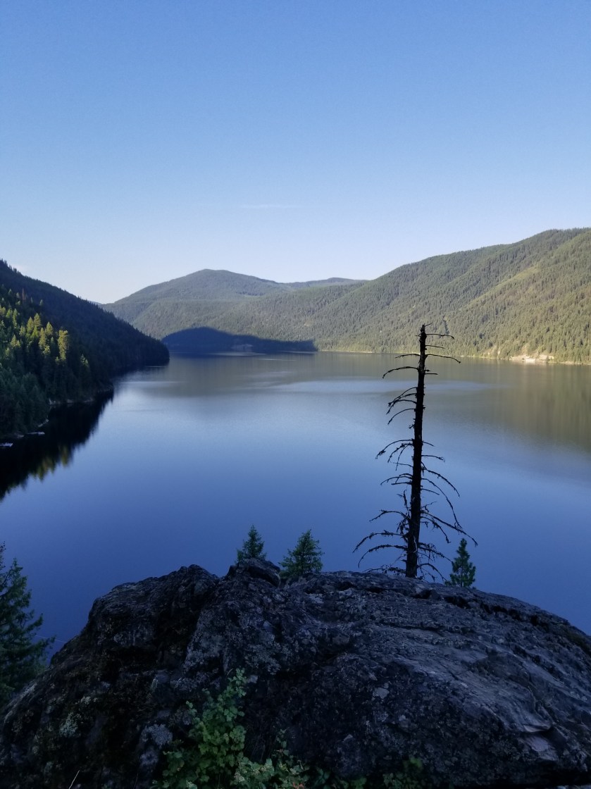
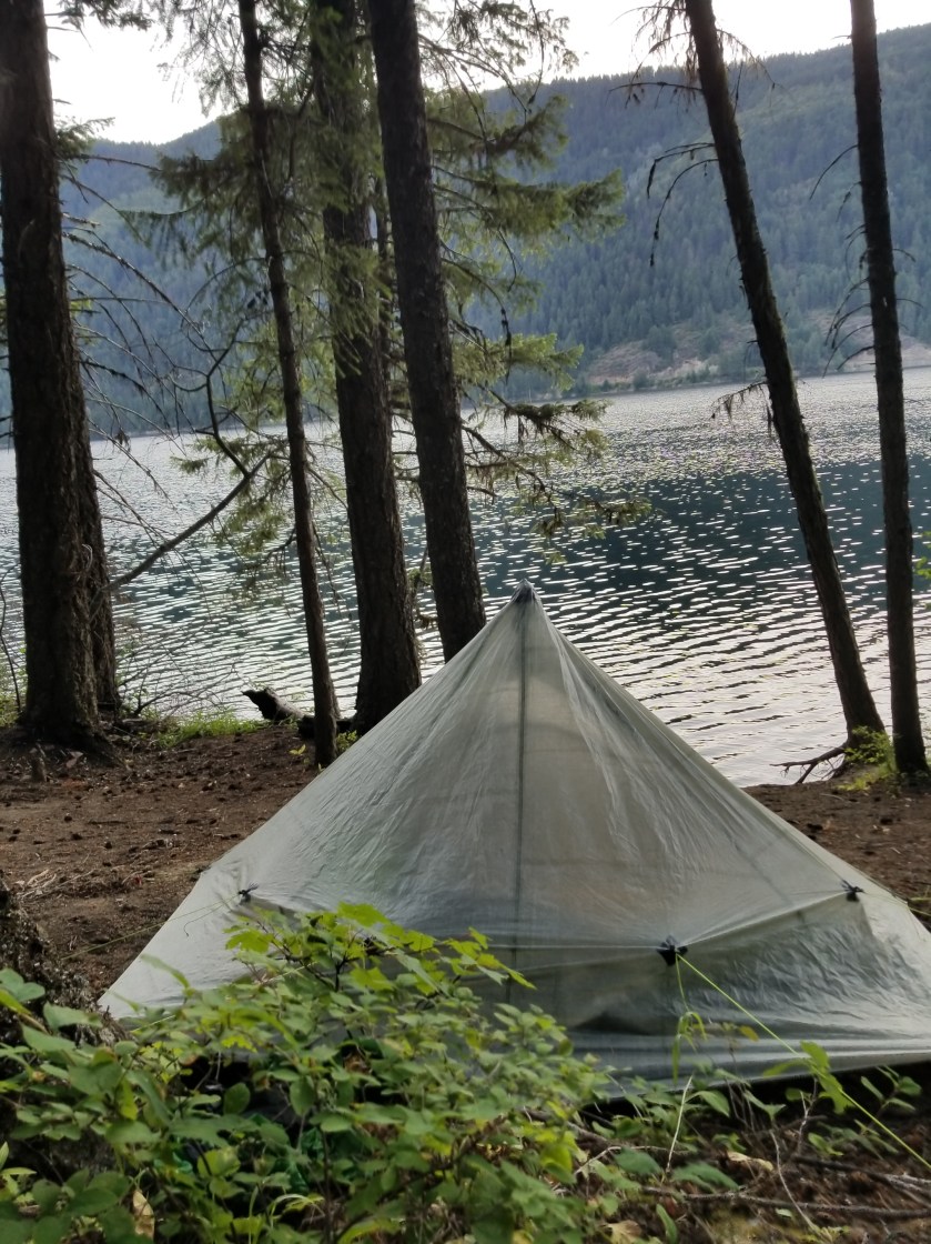
Stealth camp on road to stealth camp near stream.

There is an acronym attributed to hiking the Appalachian Trail: PUD which stands for Pointless Up and Down. Obviously, backpacking through mountains includes a fair amount of going up and down, but today on the Pacific Northwest Trail it went from neccessary to PUD.

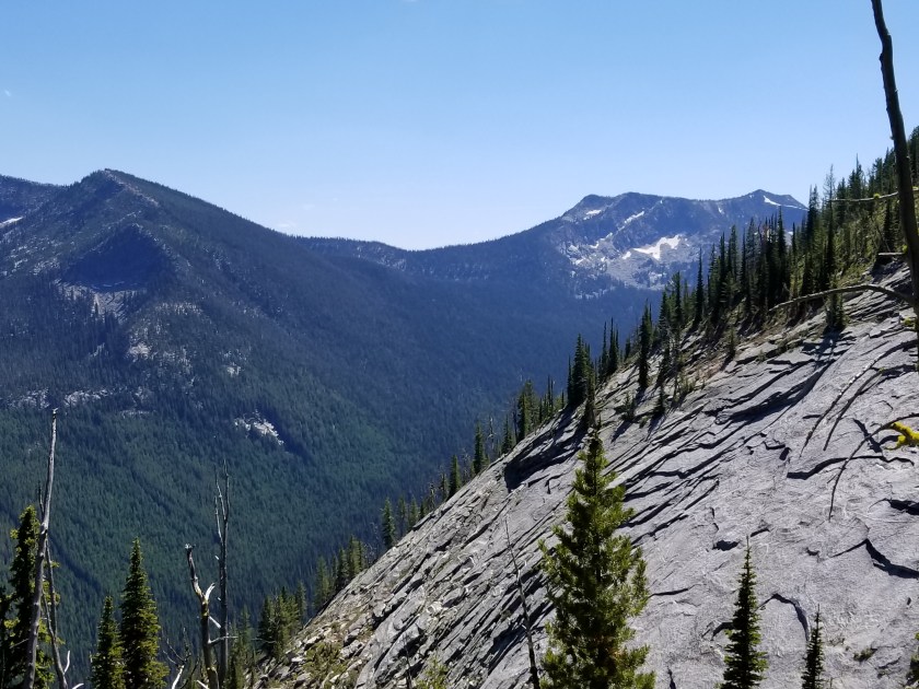
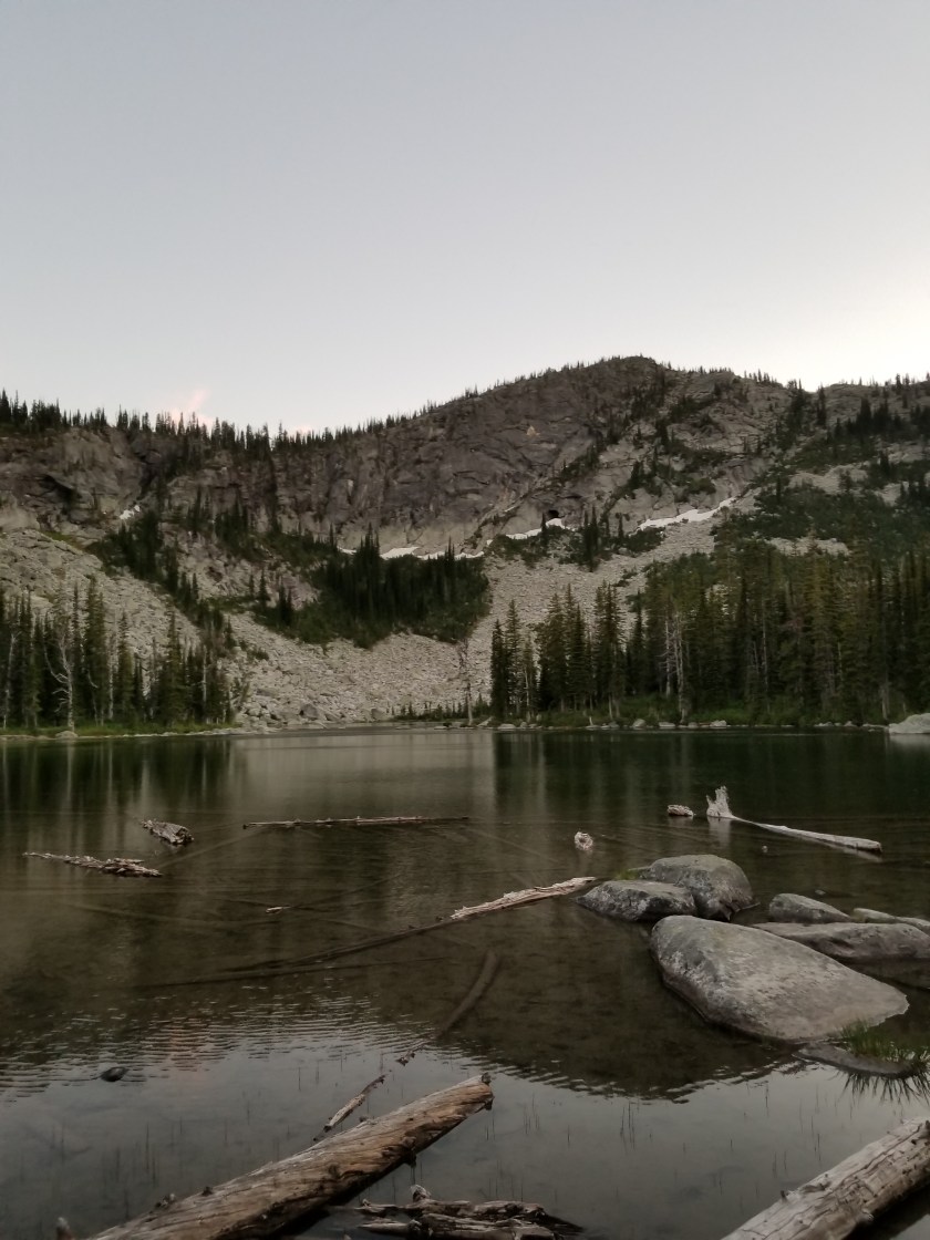
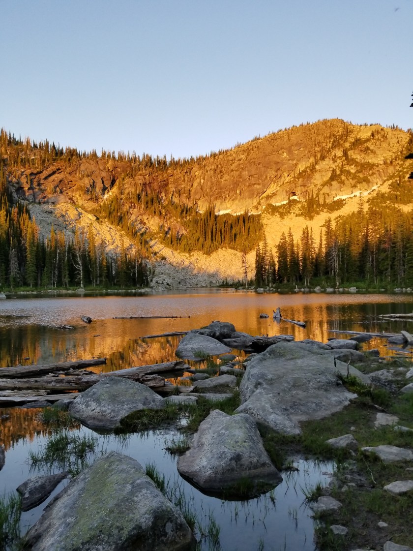
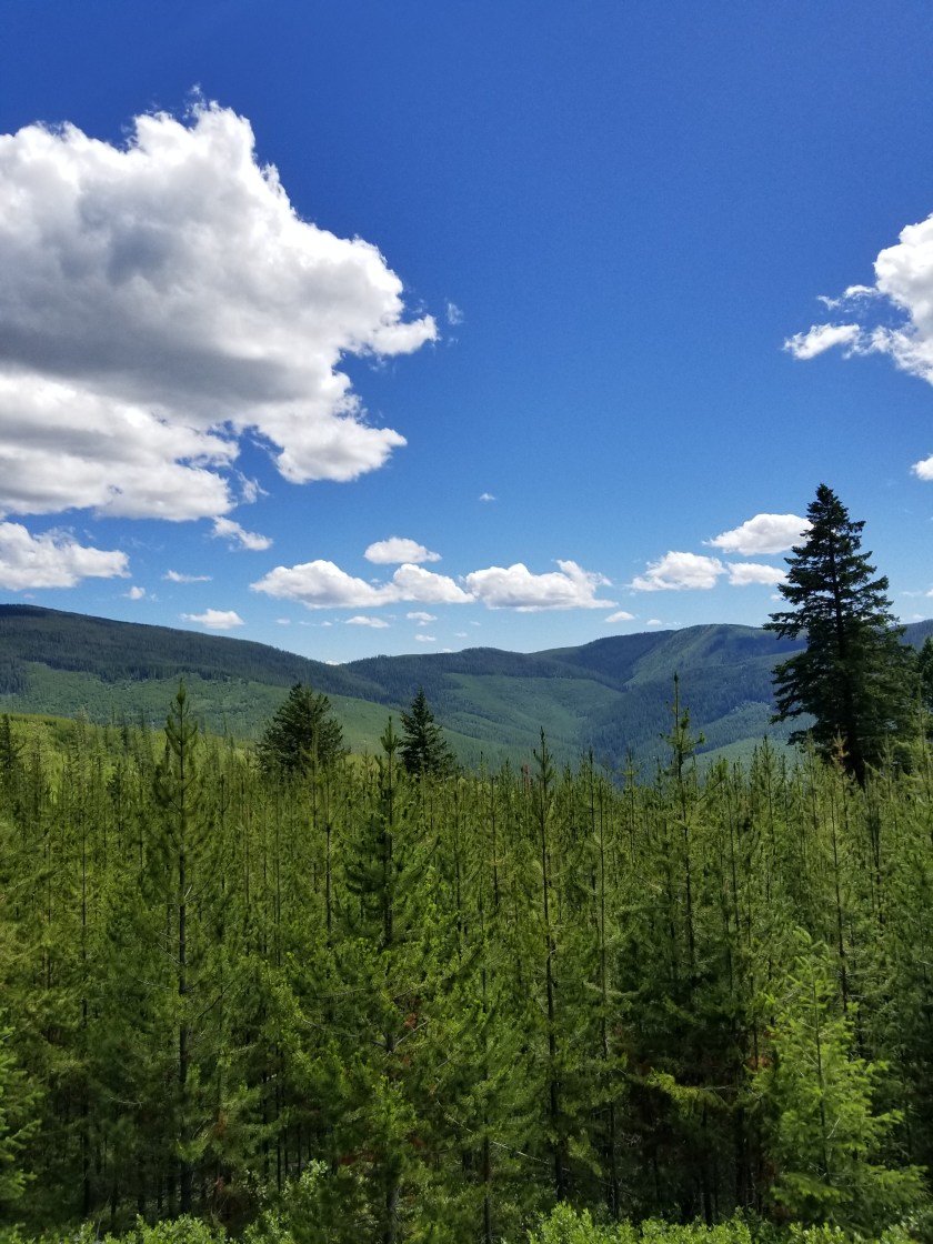
The mountain range I am in is called the the Purcells. They all max out around roughly 7,000 feet above sea level and most have rivers between them. They cover the northwestern part of Montana and the eastern part of Idaho’s panhandle. They are not as steep as the mountains between Polebridge and Eureka. This means they are slightly more amenable to forestry. Therefore, a lot of the hiking is through forest that:

  1. could be harvested,
  2. was harvested (30 years ago) or
  3. a burn area.

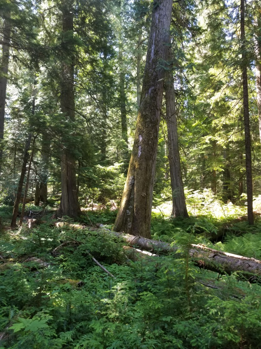
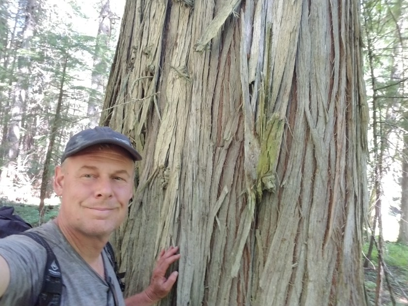
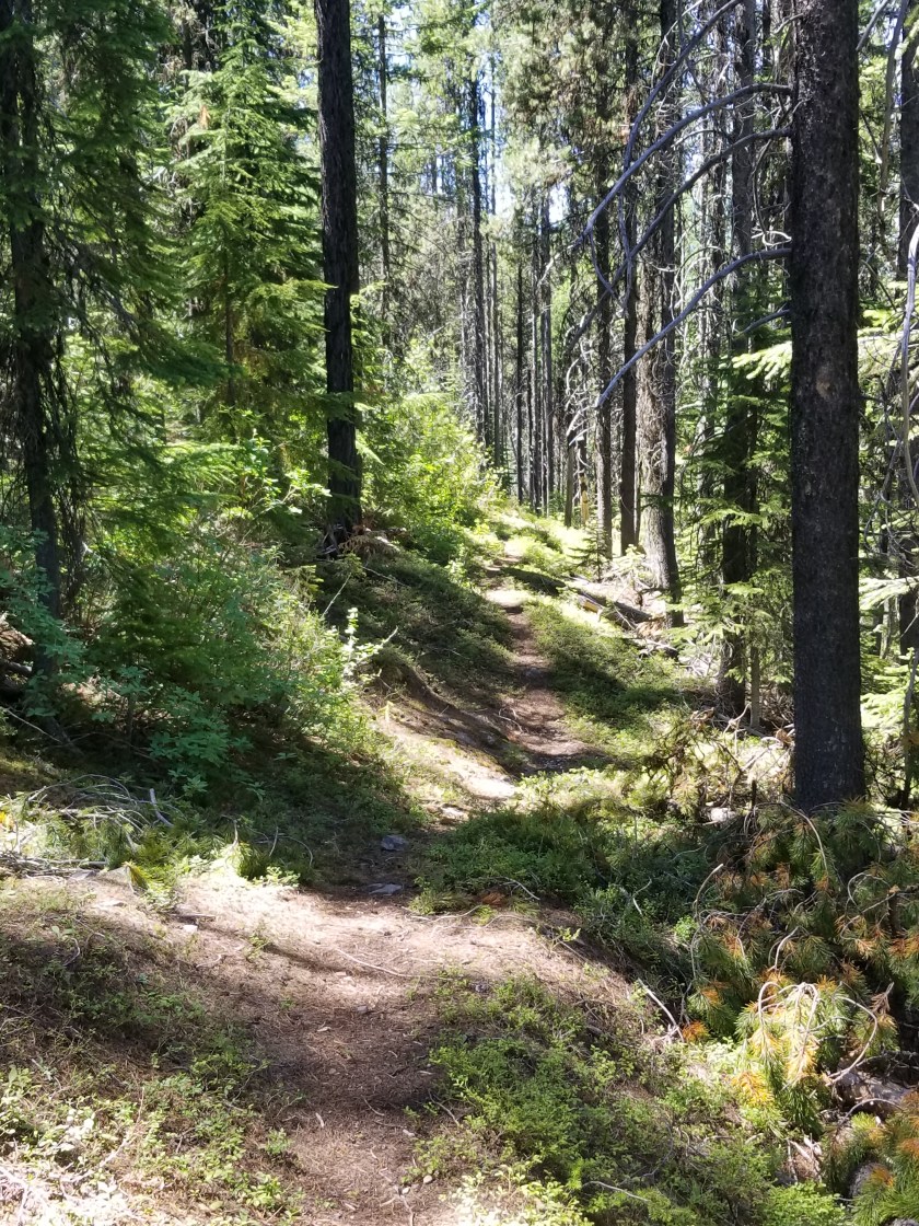
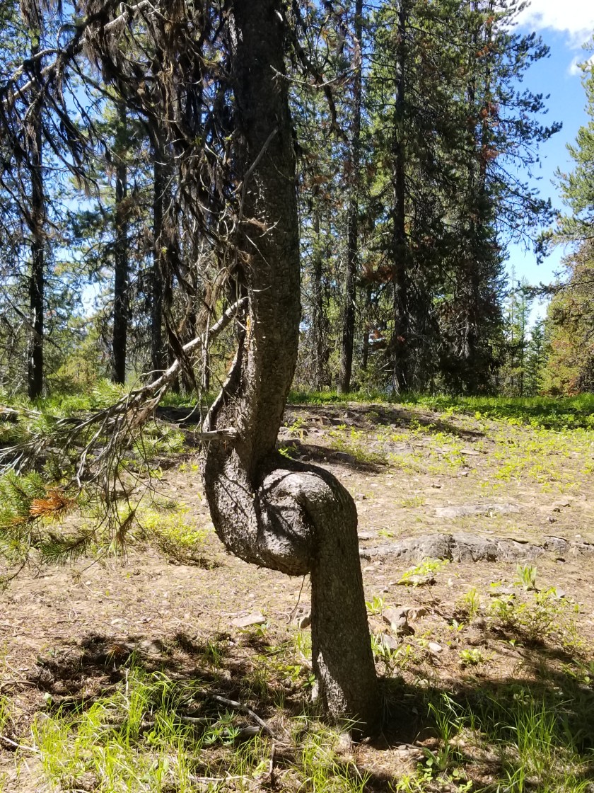
By far, the “could be harvested” is the most compelling to hike through. Huge trees block out almost all undergrowth with the forest floor mostly old pine needles. This duff almost feels like walking on those really thick shag carpets from 1970s (younger readers use your imagination or Google). It is eerily quiet. And big trees produce big pine cones.

The “was harvested” is okay. It feels like a working forest. While clear cutting was the old method, the newer approach is to leave a few mature trees and let nature runs its course. Impenetrable understory of alder and huckleberries and young conifers battle for space. Except for the conifers, the shrubs top out at five feet, roughly. Unless opened by a landslide or natural meadow, the general feeling is of the understory pushing in. It is very clear why there are so many animal tracks on the trails; these are the only really viable way to get around. Except for moose. There is a lot of moose scat in these woods.

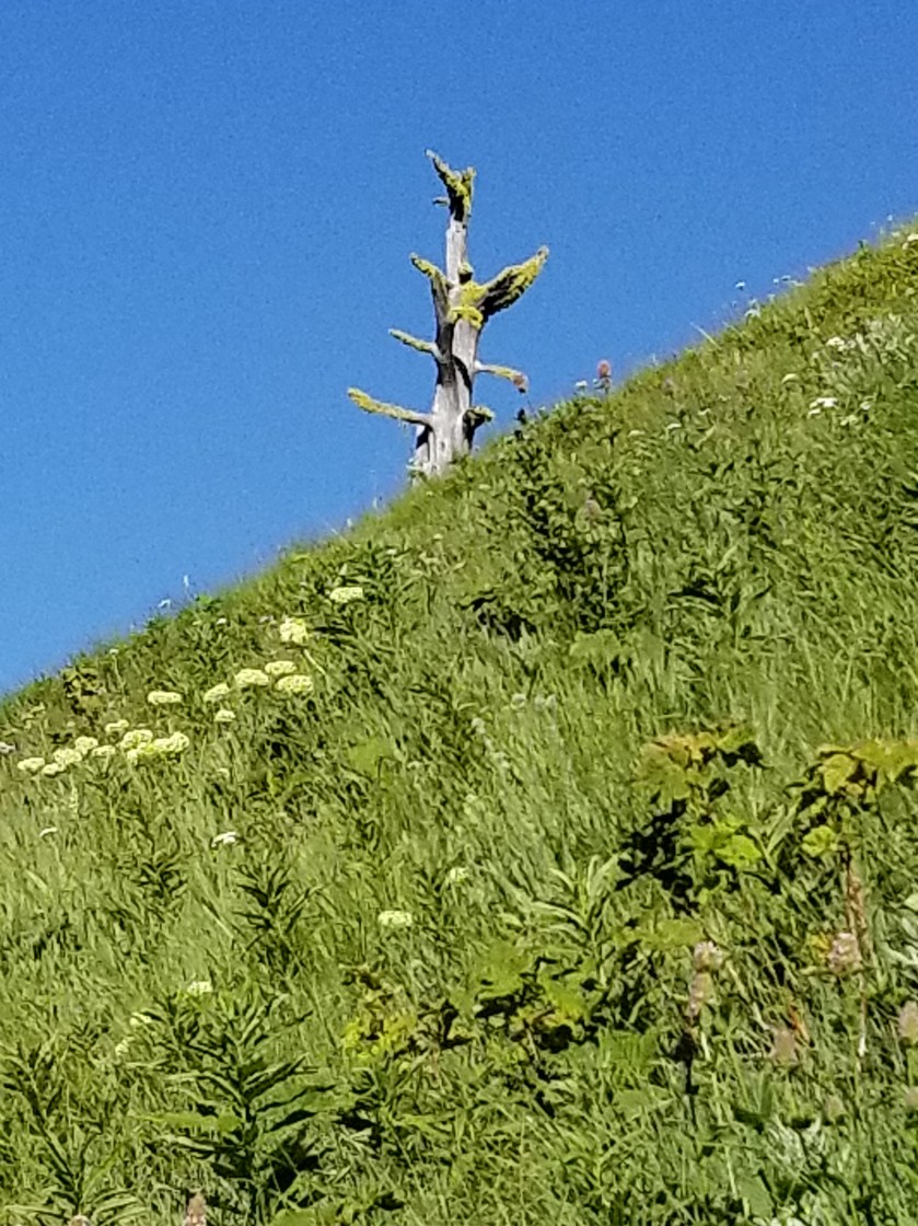
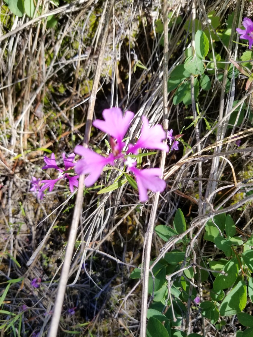
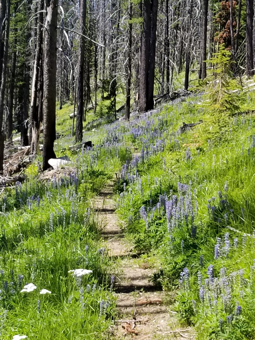
The “previously burned” areas offer some harsh contrasts. Nature abhors a vacuum, so dense stands of young pine and larch grow. On rocky slopes, grasses and flowers make a land grab. The shrubs take what they can. Hiking through these forest offers more vistas, but they can feel a bit claustrophobic walking between dense walls of thousands of tall skinny 15 foot trees.

All of this is backdrop to today. I started in a harvested area. Mostly shaded, the early morning climb was perfect. Except for the mosquitoes who were fast and relentless. (I don’t use bug sprays or headnets when hiking. The chemicals are too harsh and the headnet feels like walking around in shady cheesecloth. At camp, it’s a different story.)

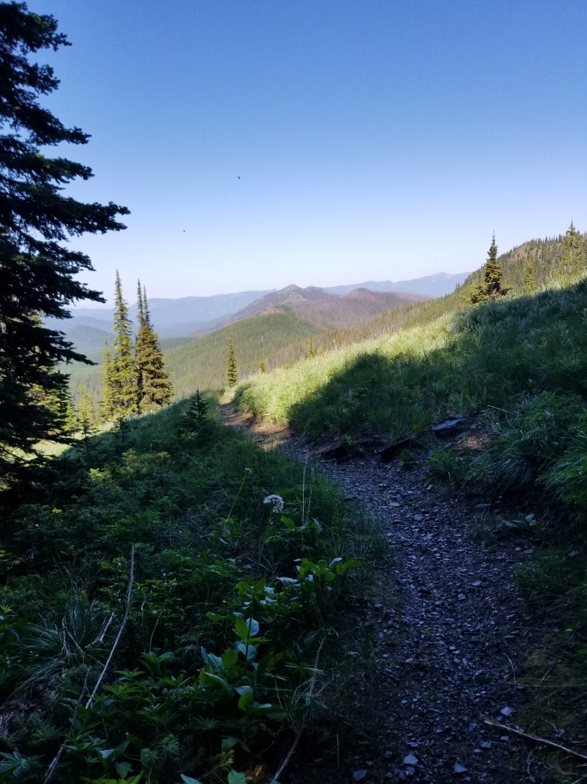
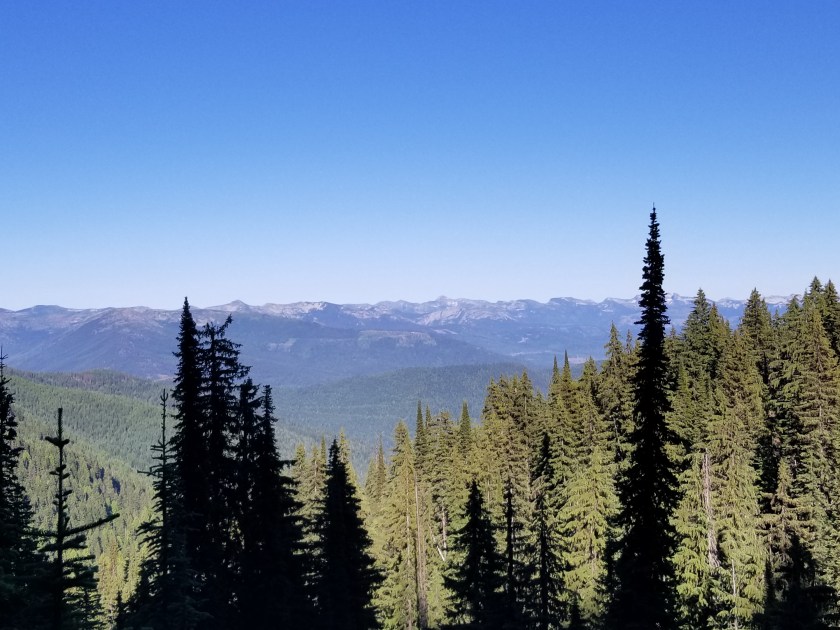
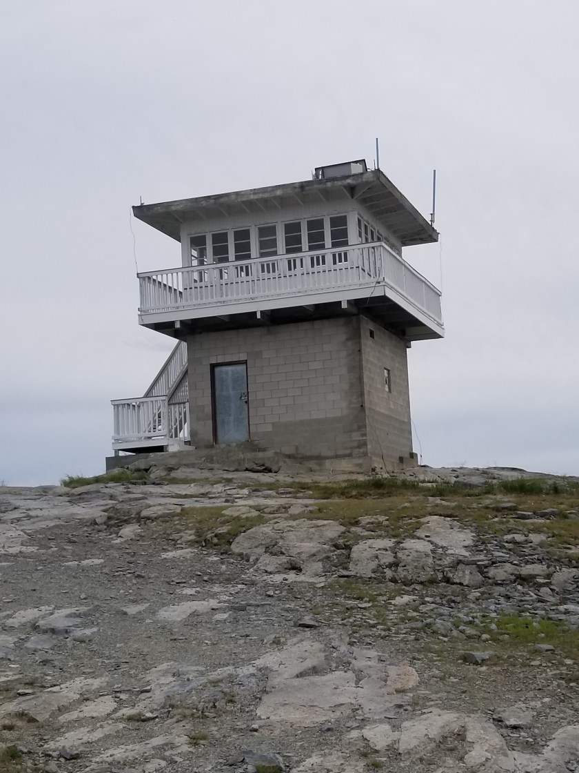
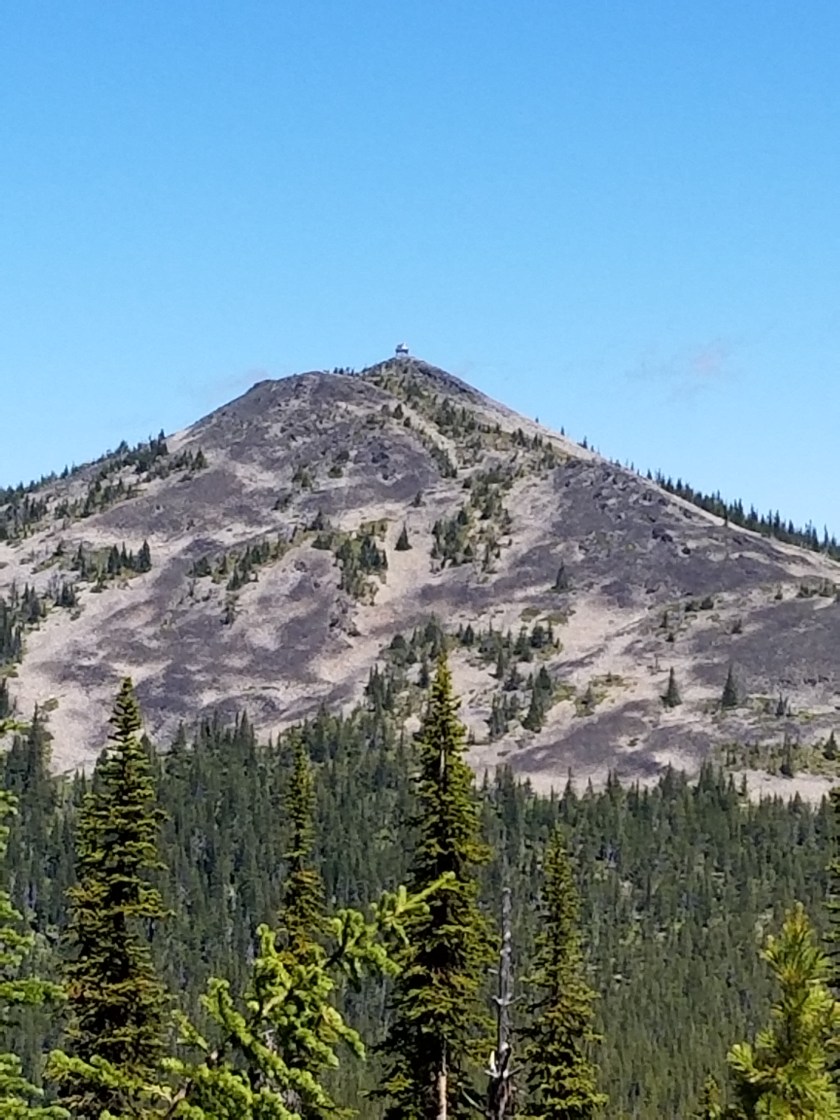
I got up to the first mountaintop and the next several hours were a rolling climb along a ridgeline with ok views. The “highlight” was a climb nearly to the top of Mount Henry which had a lookout tower.

From there it was a kneecap crushing descent from 7,000 to 3,500 feet over 4 miles. It was about 3:30 when I bottomed out at Fish Lakes and stocked up with water. A campsite was available, but the directory noted “rodent problems.” Regardless whether it is eating, sleeping or traveling, my hard and fast rule is to avoid anything with a rodent problem. So, I began a long steady climb up a mountain, in all a seven mile trip gaining 3,000 feet and losing (you’ll never guess… ) 3,000 feet. I was going for Mt. PUD.

About a half hour in to the switchbacks, I saw a trail sign to a forest road. The number seemed familiar. I looked at my map and that road went along the south and west side of the mountain which was where my current trail would connect. Should I stay on the official footpath or take an unknown shortcut? I chose to stay on my current route over what was to become Mount PUD.

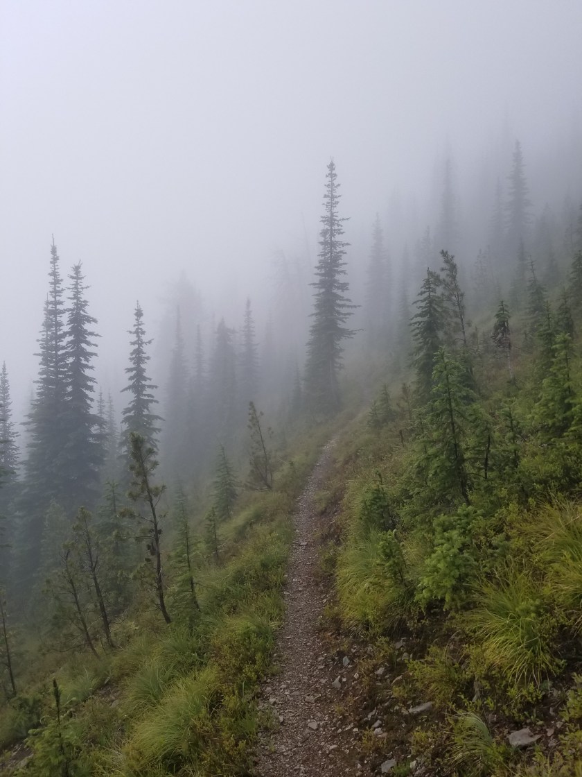
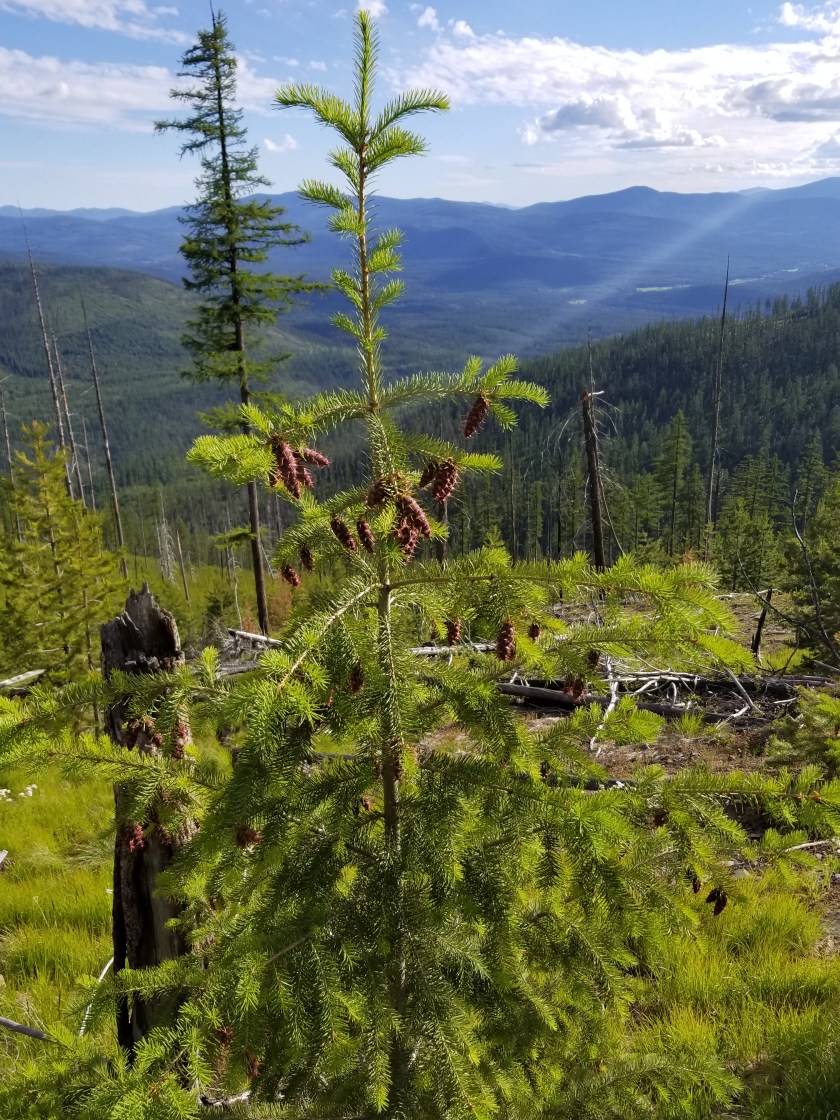
Slowly ascending switchbacks through an area that had previously burned, I was in a walled off corridor of conifers for a long time. The trail was losing visibility when it popped out to a grassy area higher up. I got the feeling this trail had not been maintained in the last two years.

While it was nice to be able to have a view, the barely visible trail through knocked down trees suddenly changed gradient. Previously, I had to stop every five minutes from the exertion. Now, the trail designers suddenly must’ve identified a new target market. However, they chose toddlers and seniors as the target. Watching the sun creep lower while making no uphill progress was infuriating.

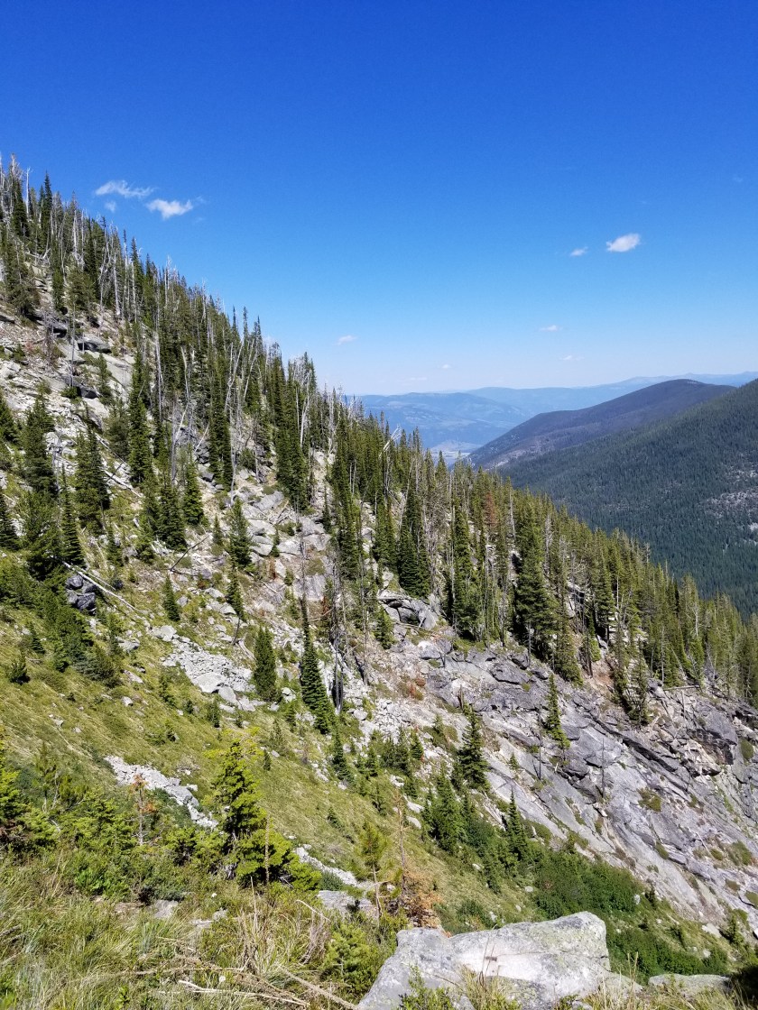
Eventually I was mostly above tree line. Trails are difficult to see on hard surfaces. Heavily traveled trails will have small stacks of rocks called cairns. Unfortunately, this trail was so forlorn it was hard to tell what was a cairn and what were two random rocks. I was generally able to patch together the trail and reached the zenith where I was to cut through a rock canyon and finally begin my descent.

This rock canyon was v-shaped. As such, all trees that fell on the sides rolled to the bottom. It was blowdown central. Tired, knees aching, light fading and now I have to parkour my way through this.

When I came out the other side of the canyon, my shorts had a new breathing panel where one least expects such a thing. Down to one pair of town shorts.

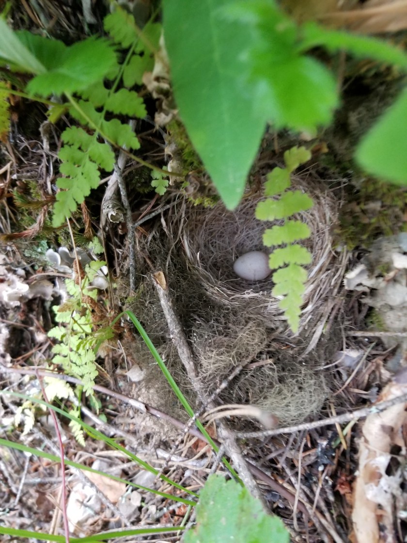
I surprised many grouse today. Some have no chicks, some have hatched chicks, and some have flying hatched chicks. If you aren’t familiar with grouse, they are primarily land based birds, taking flight just to avoid danger. Agrouse chick flying is the cutest thing in the world, reminiscent of a piglet flying.

The sun was just sliding behind the western mountains. As I was starting to feel some relief, the trail now headed east. Crabby, I cussed the trail designer who created a route to the Pacific Ocean that goes east.

At least it was through ancient forests. It took some stress off these old legs bounding down on a blanket of needles, many years old and many inches thick. The canopy blocked a big chunk of the fading light. I had to get down to a creek at the bottom. Not only for water, but also a flat place to camp.

Around 9:00 I found a relatively open space and cleared a spot. I did not feel hungry, but forced myself to eat. Right after brushing my teeth, I went straight to my tent. Once inside and away from the mosquitoes, I thought I would just drop to sleep. Instead, I listened. There was nothing. The soft ground absorbed any sounds that made it through the silent canopy above. Sometimes I have difficulty sleeping when it is so quiet because even the littlest sound from far away is magnified. Fortunately, a bird somewhere started its evening song and that’s all I needed to fall deeply asleep, ending my adventure on Mount PUD.

Feeling Overthehill

July 6, 2018. Eureka, MT to stealth camp near Boulder Creek.

Last night in the motel, I was presented with an interesting scenario. On one side a young family checked in. At first the baby was giggling, but eventually got fussy and cried. I have been in their shoes. On the other side, an older couple checked in and they were hard of hearing and thus spoke loud and had the television cranked. I will be in their shoes soon enough.

I walked out of town early, about 6:30. I was loaded with 6 days of food plus water. Watching a town wake up is always interesting. At the last gas station before leaving. I grabbed s cup of coffee.

For a small, tourist town, Eureka had a gem of a hiking / biking trail. It was well maintained and several miles long following the Tobacco River, then, roughly the shore of Lake Koocanusa. I saw two bald eagles along the river.

All good things must come to an end and so I eventually cut over to the freeway. A hot 11 mile walk as RVs, logging trucks, and motorcycles whipped by. Thankfully, I had my MP3 player so I listened to an audiobook most of the way.

It was a pretty boring hike. I was walking along Lake Koocanusa which has a pretty blue undertone. The name is a mashup of Kootenai county. Canada and USA. It is a river dammed several years ago and it stretches 40 miles crossing the US /Canadian border

I did rile up an osprey in her nest. She initially took flight and circled me and her nest. Eventually she settled came to roost down and settled down to her chicks.

I crossed the steel bridge to get to the other side. Thankfully, there was a pedestrian walkway. As I age, I am increasingly nervous about heights. About halfway across the winds started making a weird sound rushing through the railing bars making a bizarre sound. The rest of the way I closely hugged the inside railing.


There was an interesting “shrine” a bit further on the western side. It was unclear whether the honoree died at that spot or was simply honored there. Homage was in the form of beers, bullets, and quarters. Atop was a tasmanian devil in a dress. I’m not sure how I’ll be remembered when I’m gone, but this would not be my first choice.

Finally, I reached the base of Mount Webb. On a hot, dry afternoon it was a 3,300 foot climb in a few short miles. It was an exposed ascent. I had brought 2 and 1/2 liters of water, but it was soon evident this was not enough.

I eventually reached the old lookout station. It too could be rented, but was not occupied. I walked around the catwalk. It was windy. I think staying overnight could be absolutely beautiful with panoramic sunrises and sunsets or a sheer trip through hall in a windy lightning storm.

All of my water was gone. It was 7:00. I still had over a mile until the next water source. Of course, the trail I was on was the Thirsty Mountain Trail.

After I guzzled down a liter of water, I filled my two liter container and then tried to find a place for the night. The forest was a mix of tall, older trees with very little room in the understory and it was steep.

Finally, I found an area that had been trampled by cattle when grazing had been allowed. There were cow pies, but they were at least two or three years old. In a hurry, I put up my tent and ate my dinner. The mosquitoes here were numerous but dumb.

I climbed into bed about 9:30 and almost fell asleep instantly. Later, I was awaken by on and off sprinkles even though there were stars clearly visible.

I was pleased I had managed to crank out a 26 mile day, but my feet and legs were protesting.

A Blue Theme

July 3, 2018. Bluesky Trailhead to Bluebird Lake.

I slept great, there was very little new rain, and I was ready to start a new day. After all, today I was going to climb over Mount Wam.

To start my day, I hiked up two different gravel roads. During the almost five miles, I was only passed by Forest Service and Conservation Corps vehicles. All heading up, hopefully to clear trail for me.

Once again, the damp clouds hung low and periodically dropped rain. On trail, the path was slightly overgrown with huckleberries or, alternately, alders, either of which was glad to drop their accumulated rain onto my shoes.

Last night I had camped at 4,500 elevation. I took a slight break at 6,400 feet to get water and prepare for the steep climb up to Mount Wam. Although I have not seen much wildlife, I was able find two different types of bird nests. Both make their nests on the ground and are very good at camouflage.

This nest was from a sparrow-like bird.
This nest was from a plover or sandpiper-like bird.

Like any normal person, I wondered where the name Mount Wam came from. I googled it previously to no avail. By no avail, I mean I couldn’t find anything on the first page of search results. I couldn’t recall a famous Wam, surely a memorable name. As I climbed the steep trail to the 7,000 elevation, I imagined the name came from a Batman comic fan who dreamed of a Mt. Blam and Mt. Pow. Or, it was meant to be an acronym such as What A Mountain or Wait A Minute or Wasted All Memory.

All this helped pass the struggle up. At the top, there is a restored fire lookout with stunning views that can be reserved for overnight stays. It is quite a hard reservation to get, apparently. However, as I struggled to see 30 feet into the clouds surrounding me, I felt bad for the person who hiked 5 miles up hill to a reservation in this weather.

On the way down away from the peak, I came across two guys on the trail. They were a little older than me. I asked if they had reservations and, fortunately, they did not, just out for an overnight trip. They were flabbergasted when I told them I had started in Glacier National Park. They were good guys and I was glad to see a couple buddies taking on a tough trail in tough conditions.

The rest of the trail was going to stay above 6,500 feet. The intermittent rain plus increasing snow on the ground plus blowdowns every hundred feet made the second half of the day a real struggle.

The trail is safely protected with snow.

By late afternoon, about 75% of the trail was under snow. The rythmn was:

  • Step up on to snow bank
  • Take two steps
  • Slip if steep
  • Sink in to knee
  • Repeat until end
  • Walk on visible trail for six feet
  • Start over

By 5:00, I was exhausted. My quads were aching. I could not feel my toes. Rain was intensifying. My original plan was a 23 mile day to set me up for a shorter walk to town the next day. I had to give that up. I was soaked and getting cranky, warning signs.

Oh sure, sun in the valley!

I made it to Bluebird Lake. A truly beautiful campsite in better weather. A grassy meadow looks over a small crystal lake at the foot of a huge wall spiked with rugged pine trees at the top.

Bluebird Lake

At first I gathered dry firewood with the intent of building a huge fire to dry out. The drizzle, unfortunately, turned to a heavy downpour. I pitched my tent, put all my necessities in it, and then huddled under a big old spruce tree eating my not-fully-hydrated dinner. Still in downpour, I hung up my food bag and splashed in to my tent.

I was very cold and soaked. My down puffy had gotten wet and both my merino wool layers, too. I only had one thin change of dry clothes. I made the change and then struggled for the next 30 minutes to warm up inside my down quilt and stop the shuddering.

In hindsight, I was a dummy for only bringing a wind shirt versus a full-fledged breathable rain jacket. The wind shirt blocks wind and light drizzle, but eventually soaks through in heavy rain. My brilliant plan was to use my umbrella for heavier rains. But I needed both hands free to catch myself on the snow and thus no umbrella. On top of this, the wind shirt traps body perspiration, essentially soaking from within. Lesson learned.

I fell asleep before darkness as the rain turned to drizzle then to nothing. It was a hard fought 18 miles.