Day 1: Here we go….

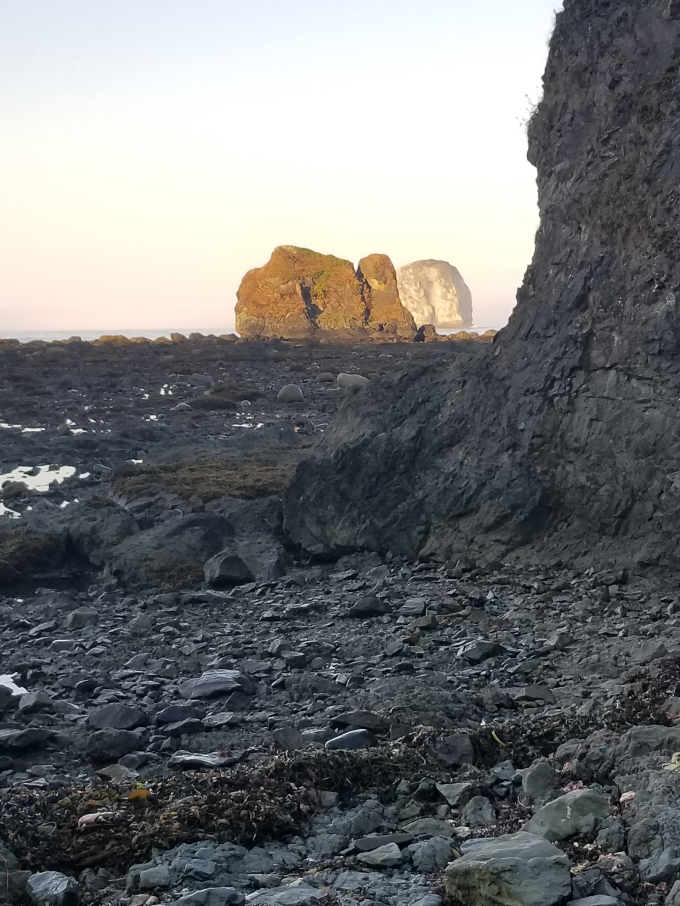
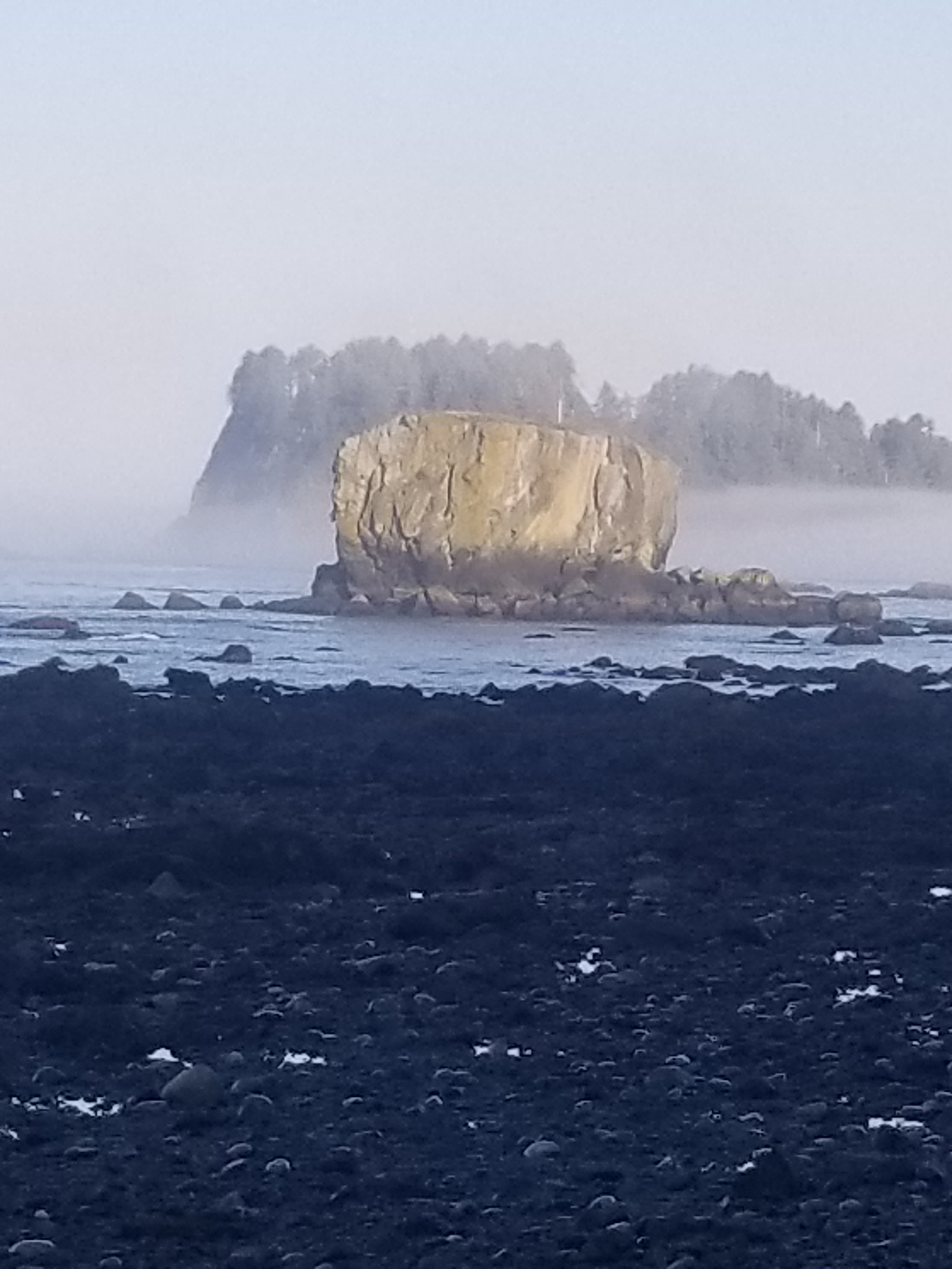
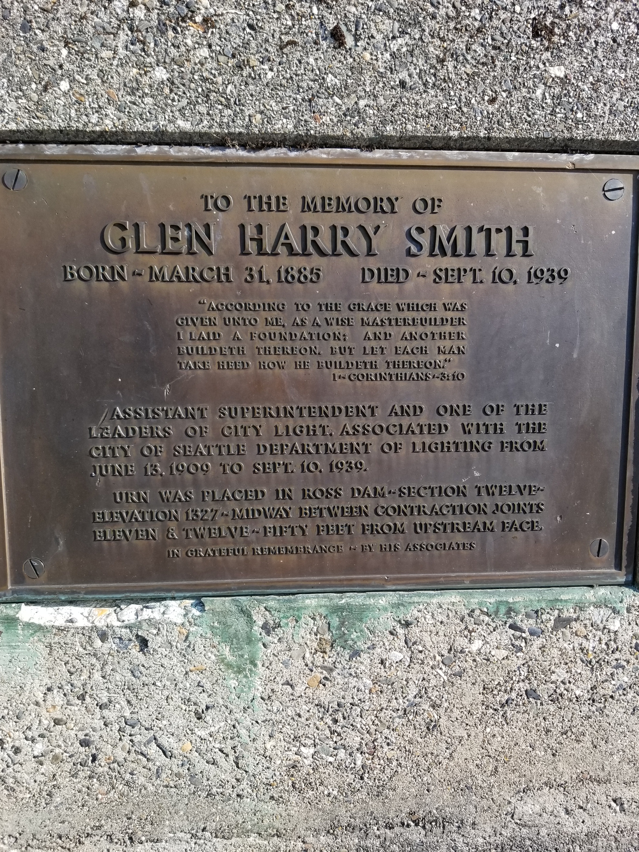
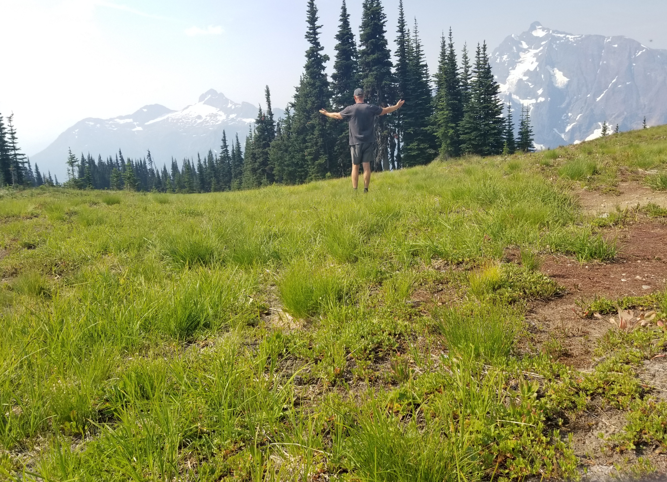
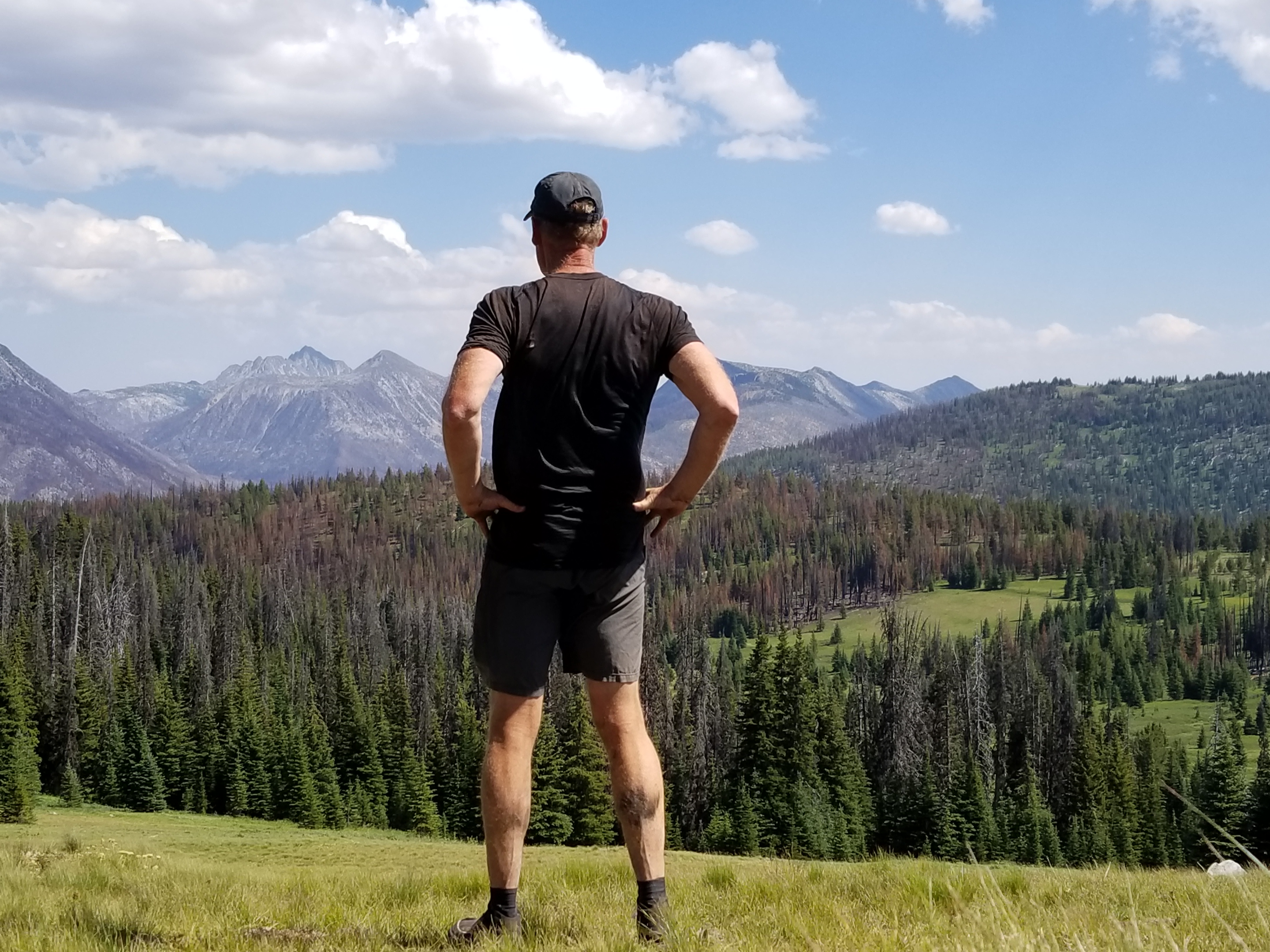
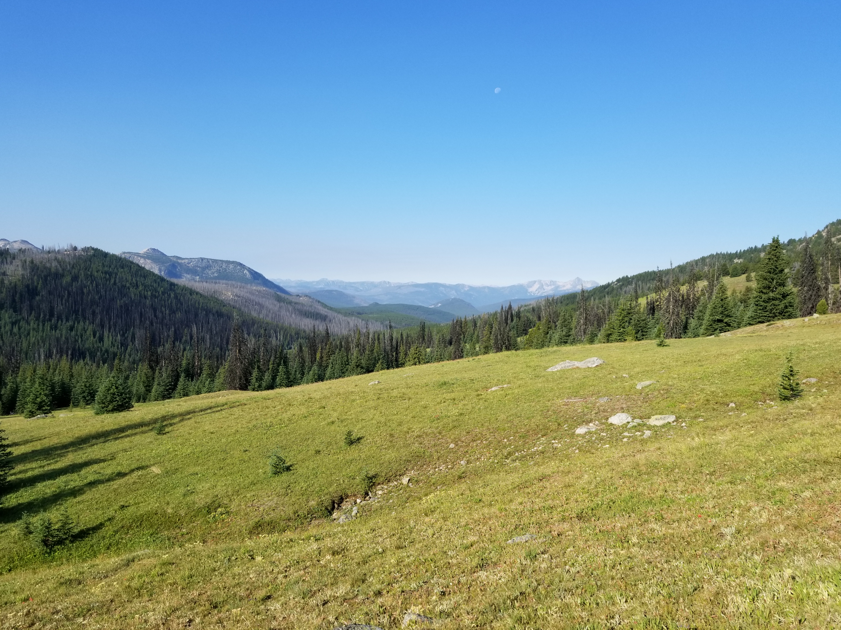
June 26, 2020. Methow Valley Trail 480 to Brush Creek junction with PCT

I was up and ready to go by 6:00 am. Thanked my Dad, said goodbye and started to the trailhead. Weather was perfect.

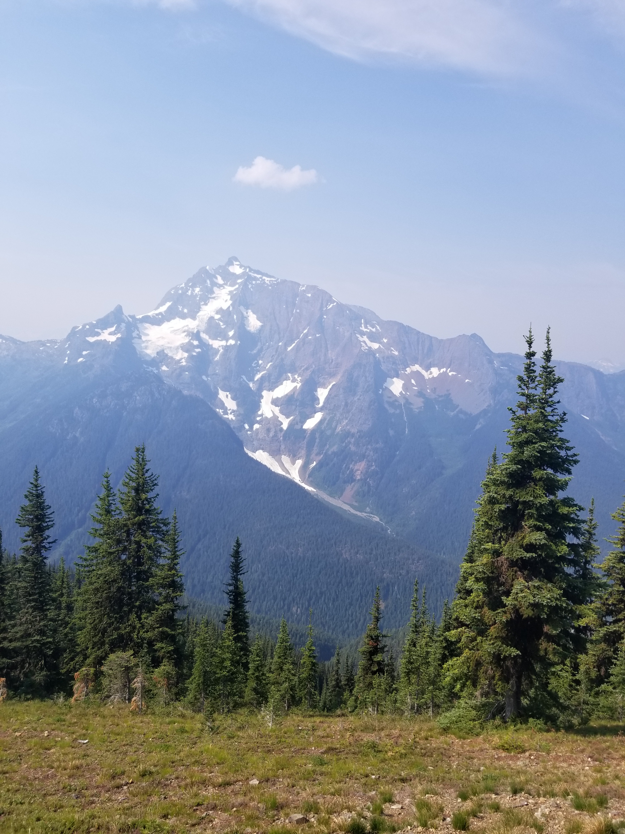
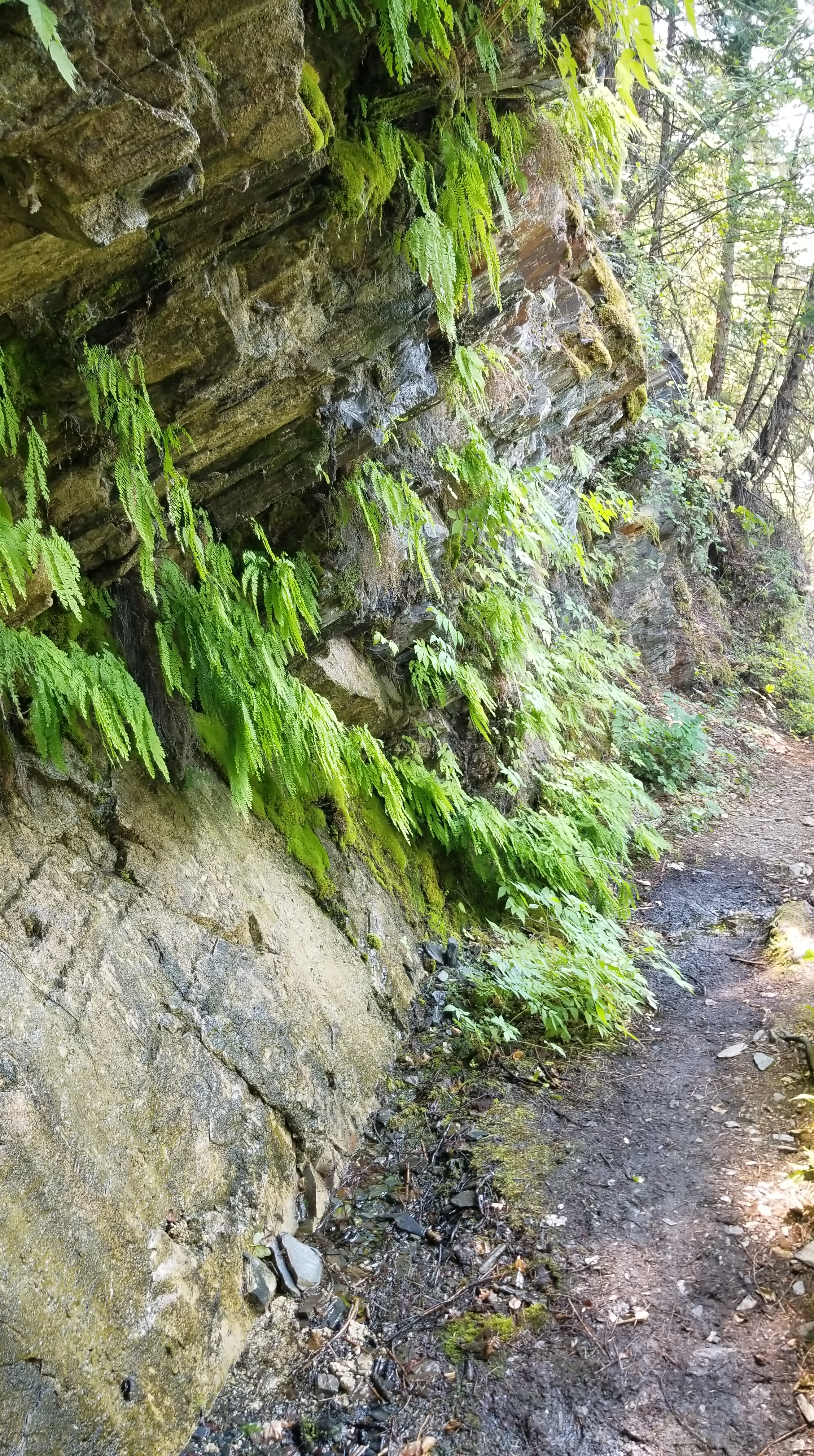
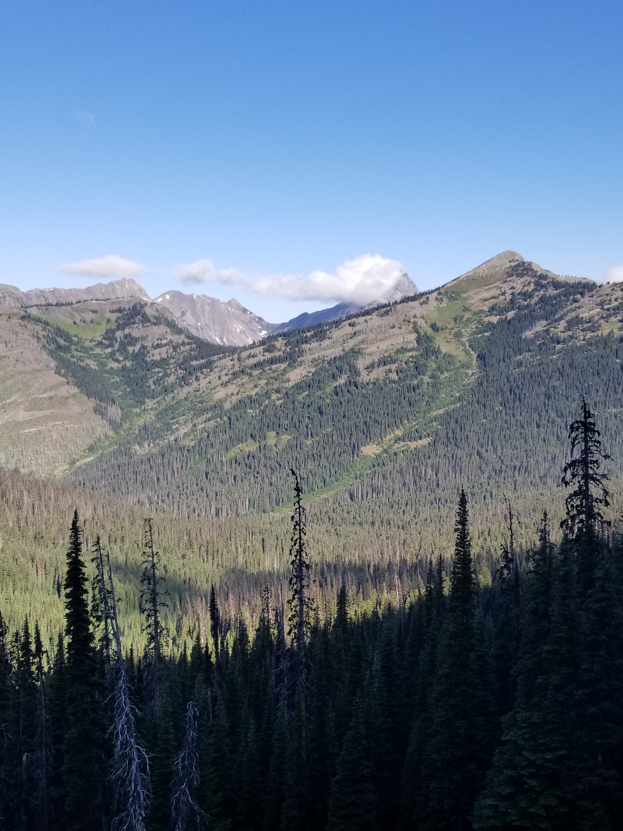
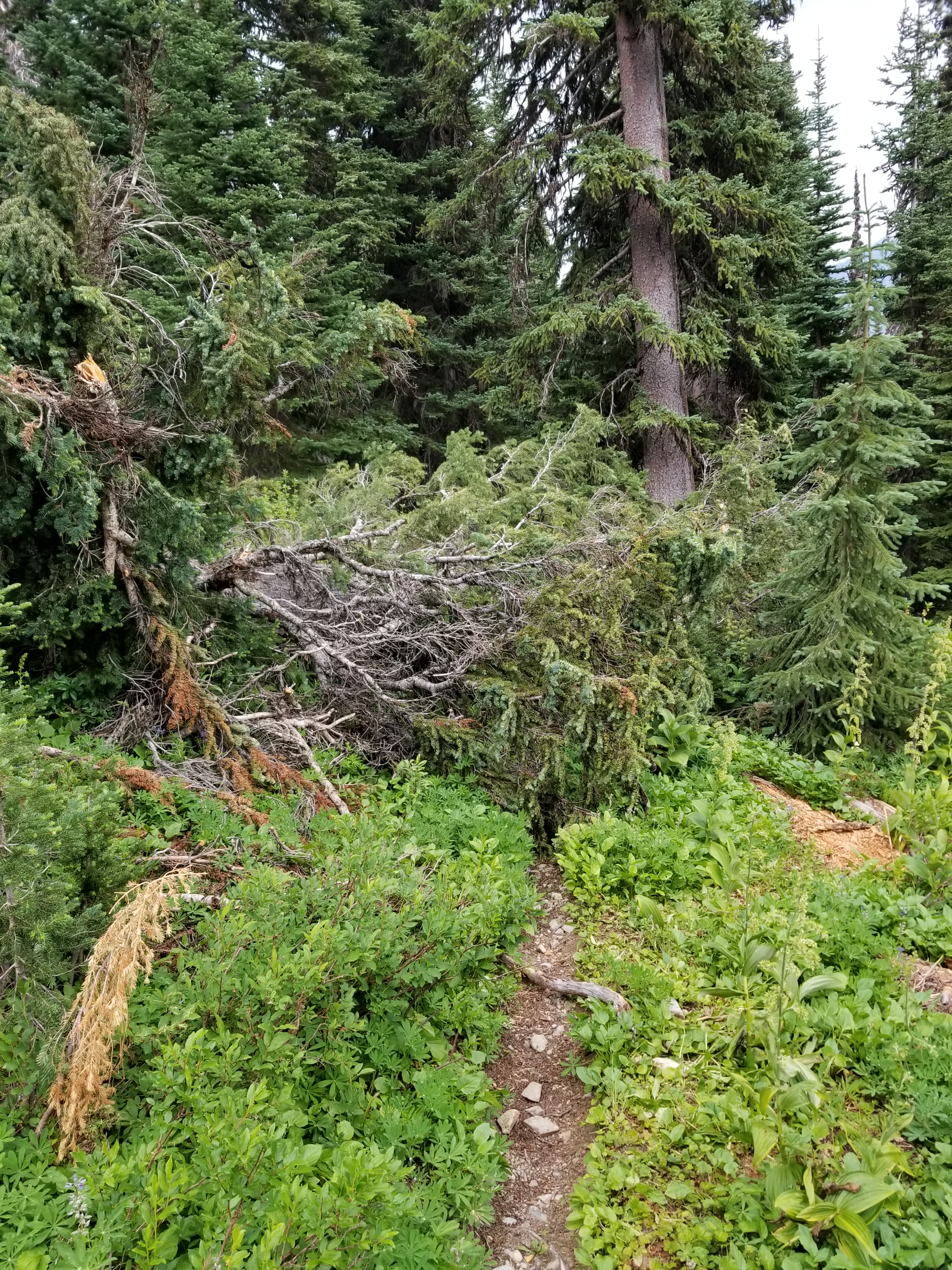
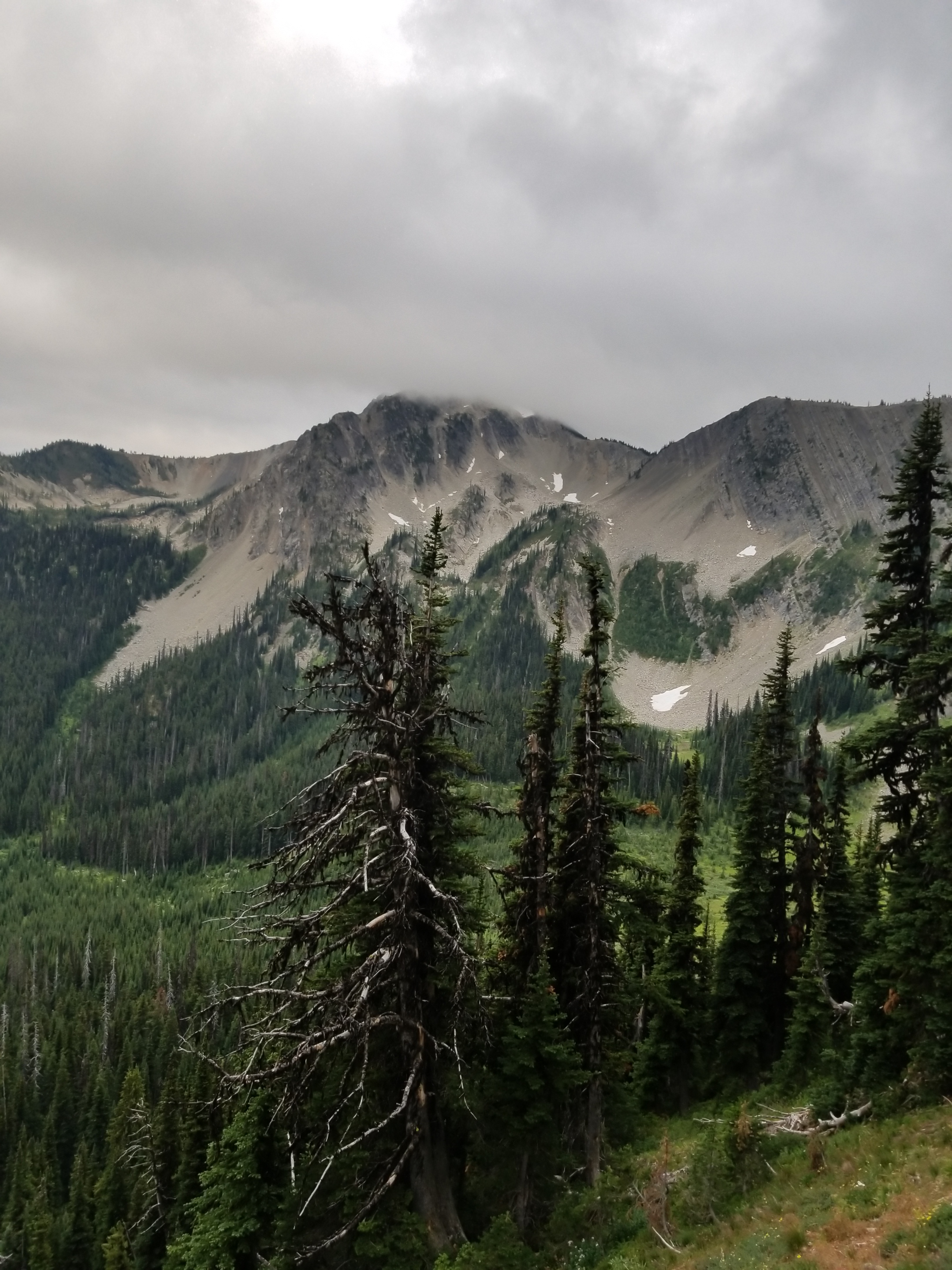
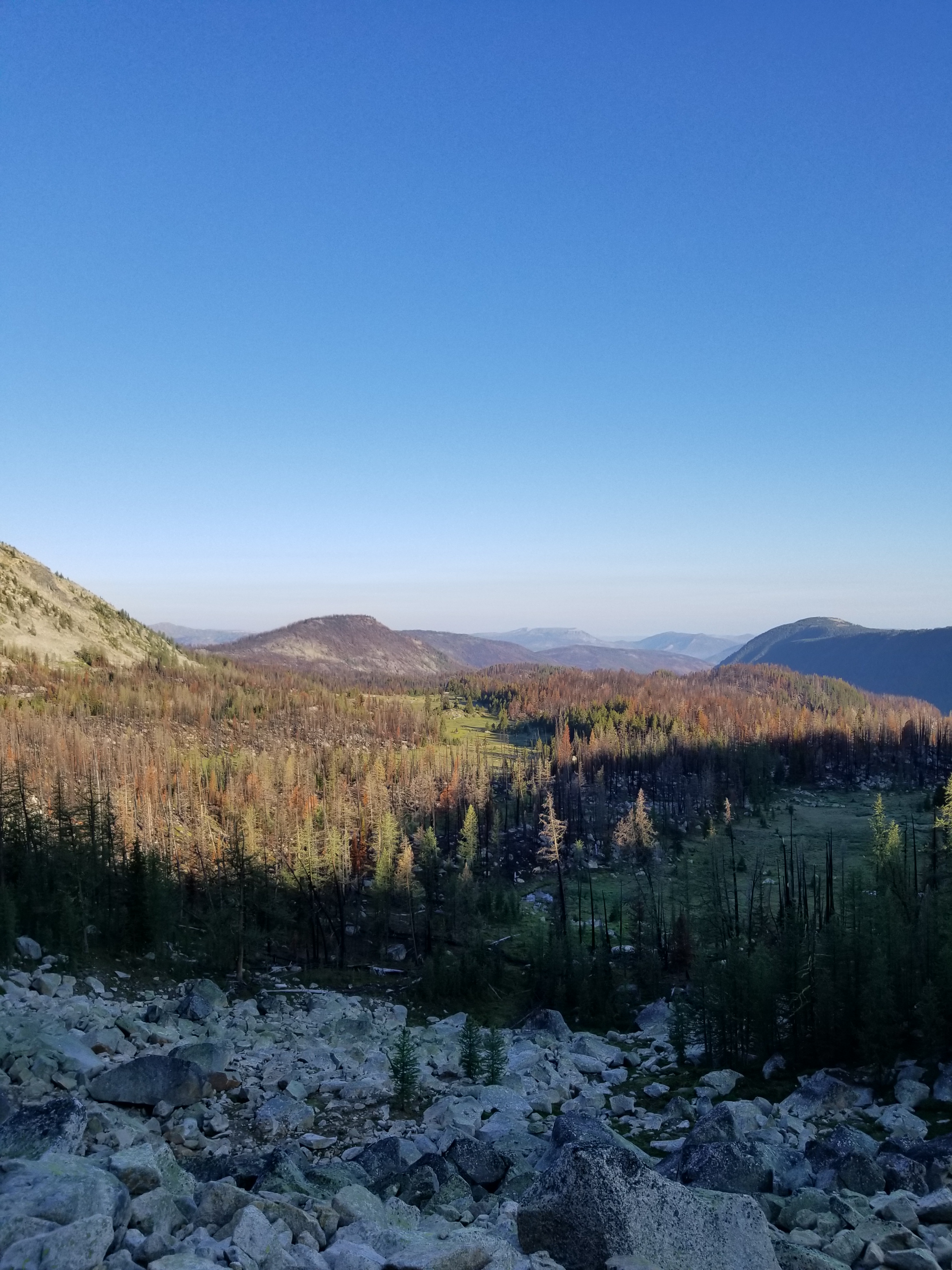
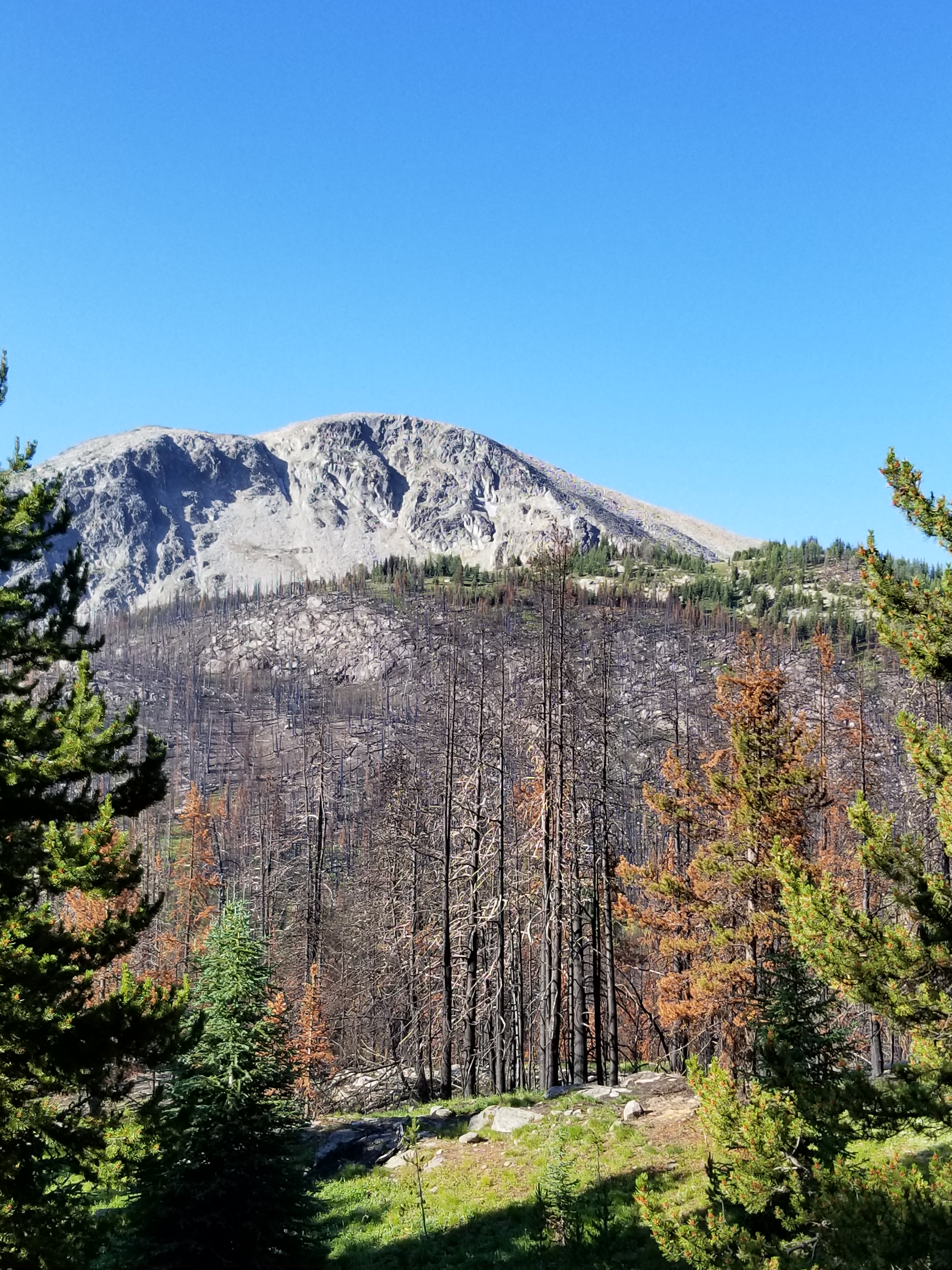
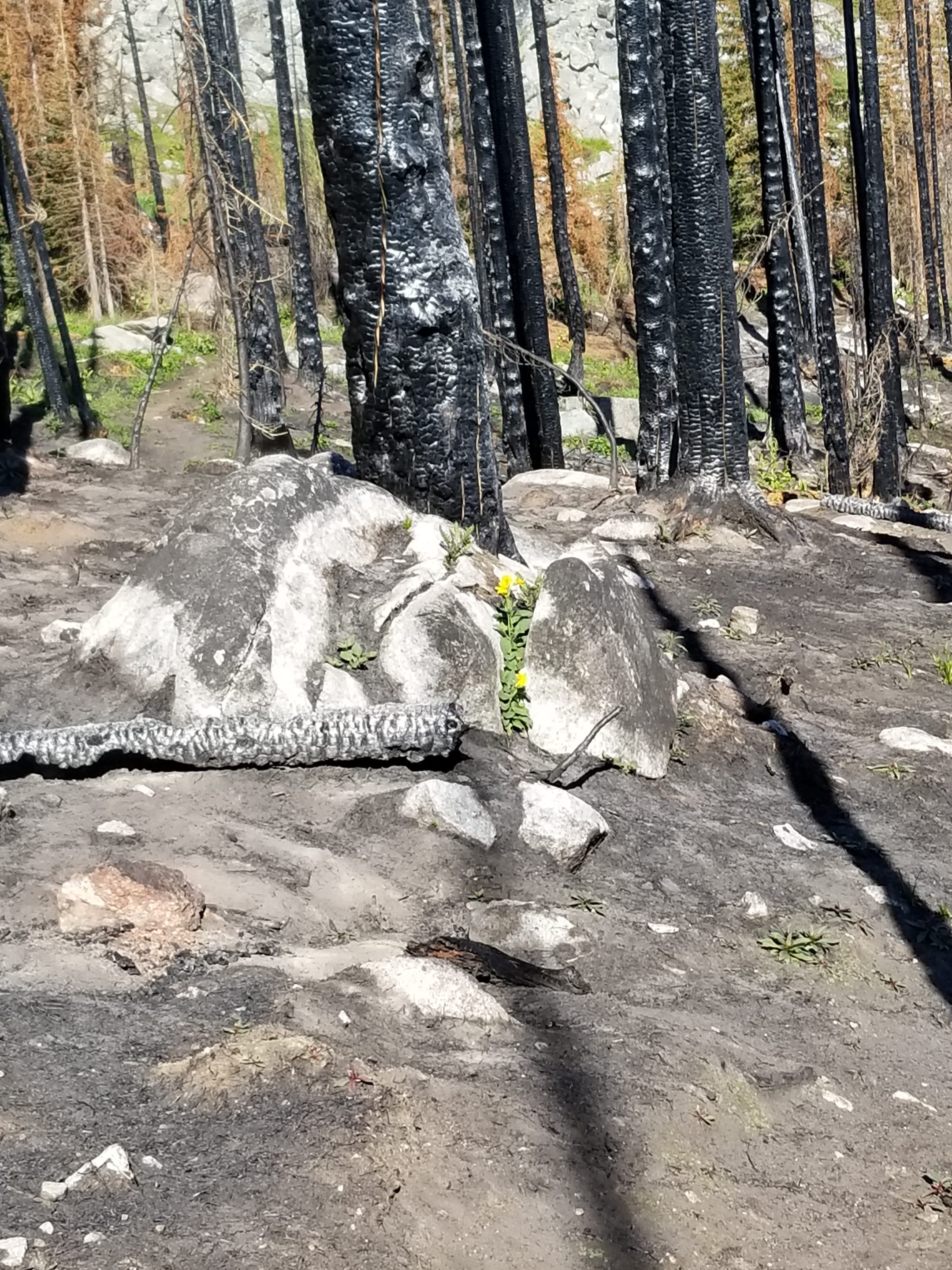
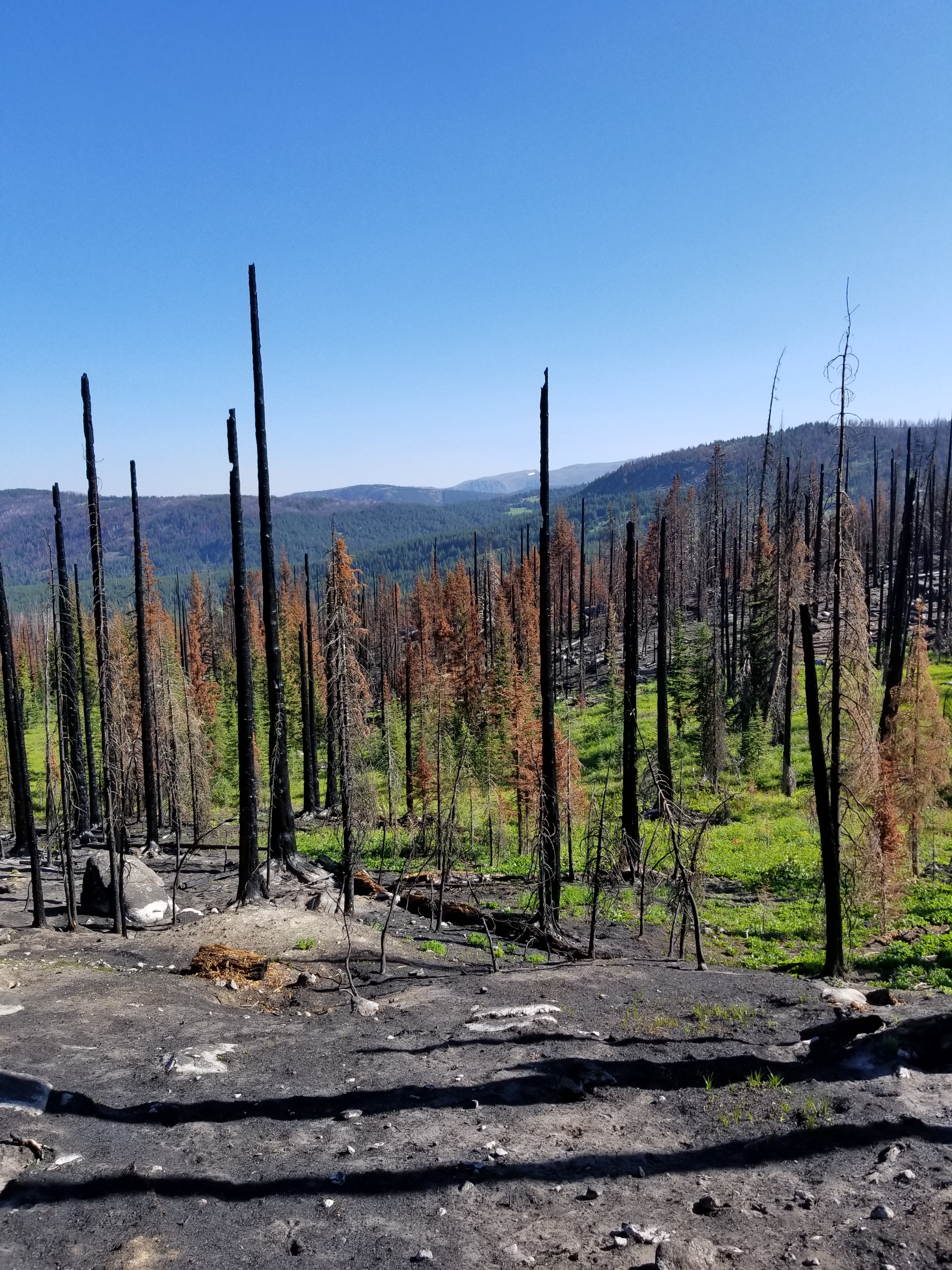
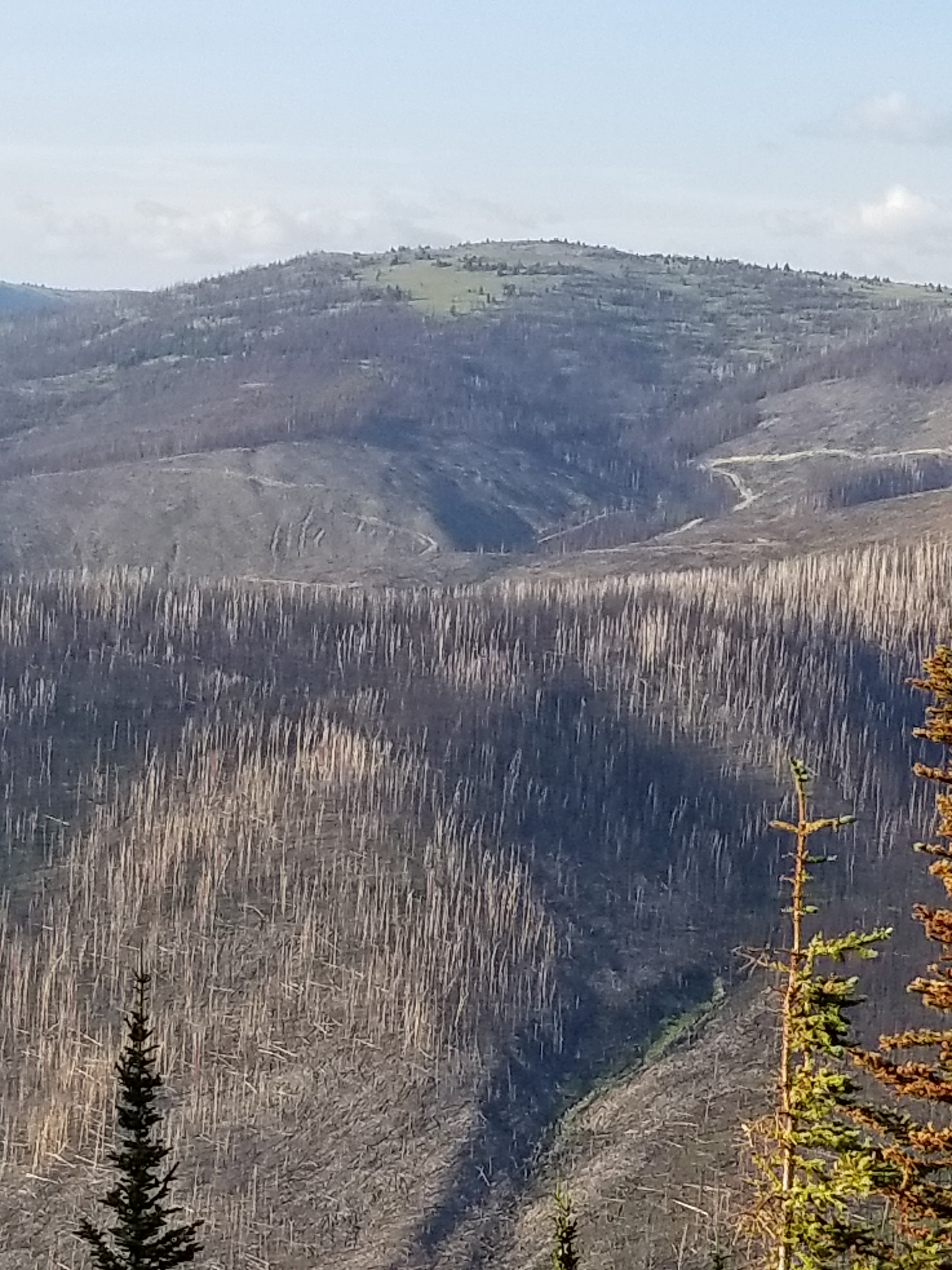
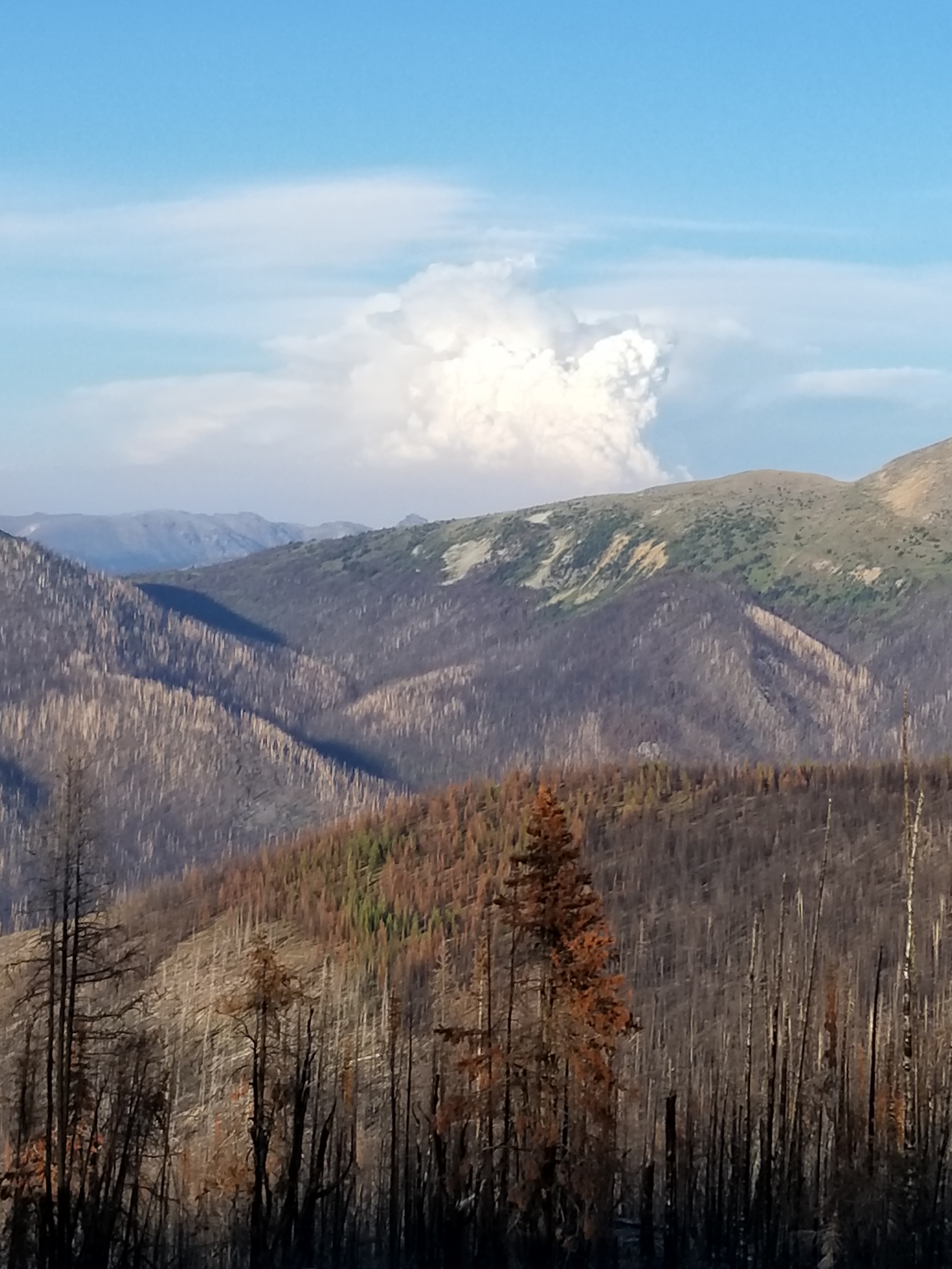
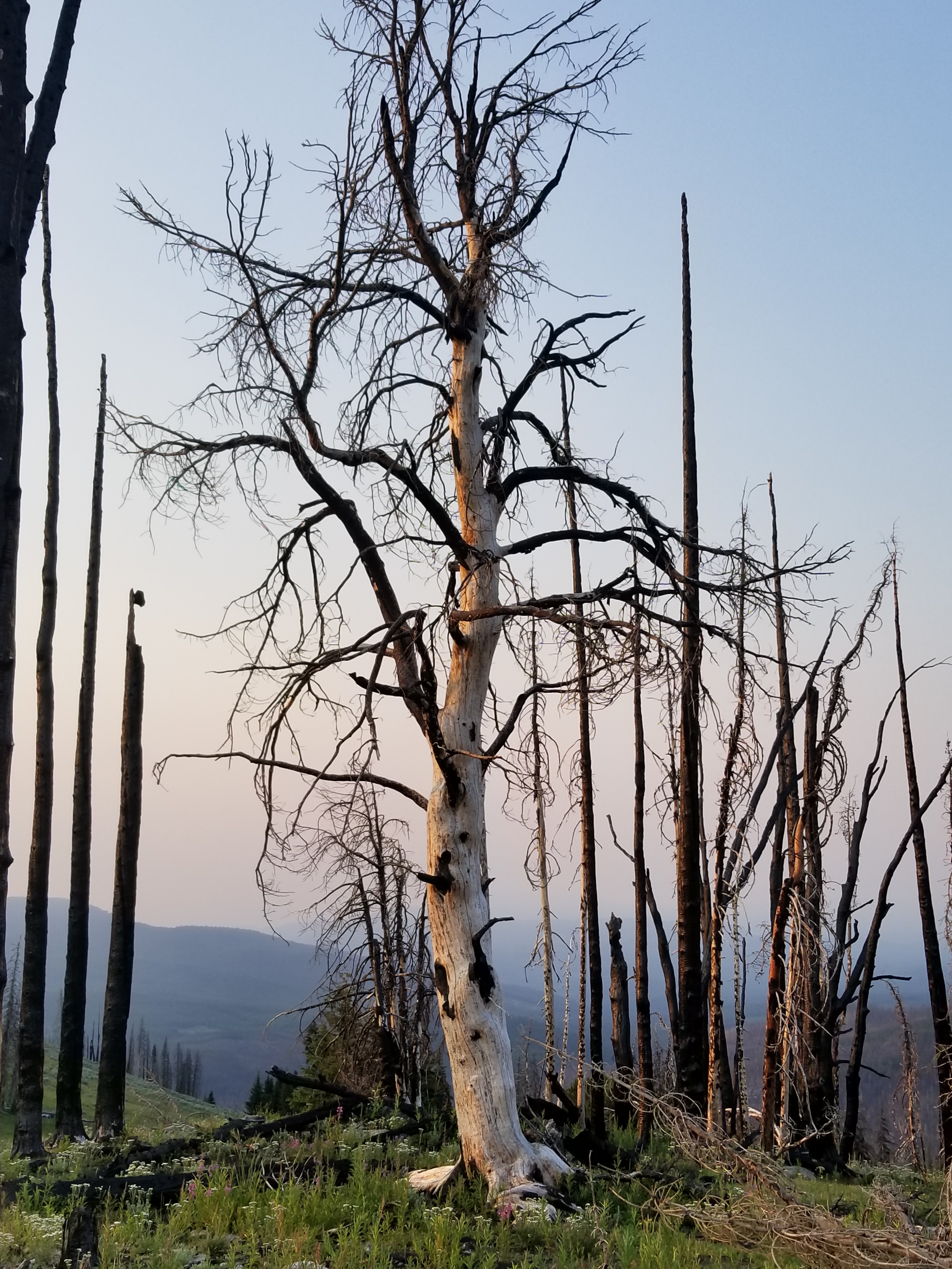
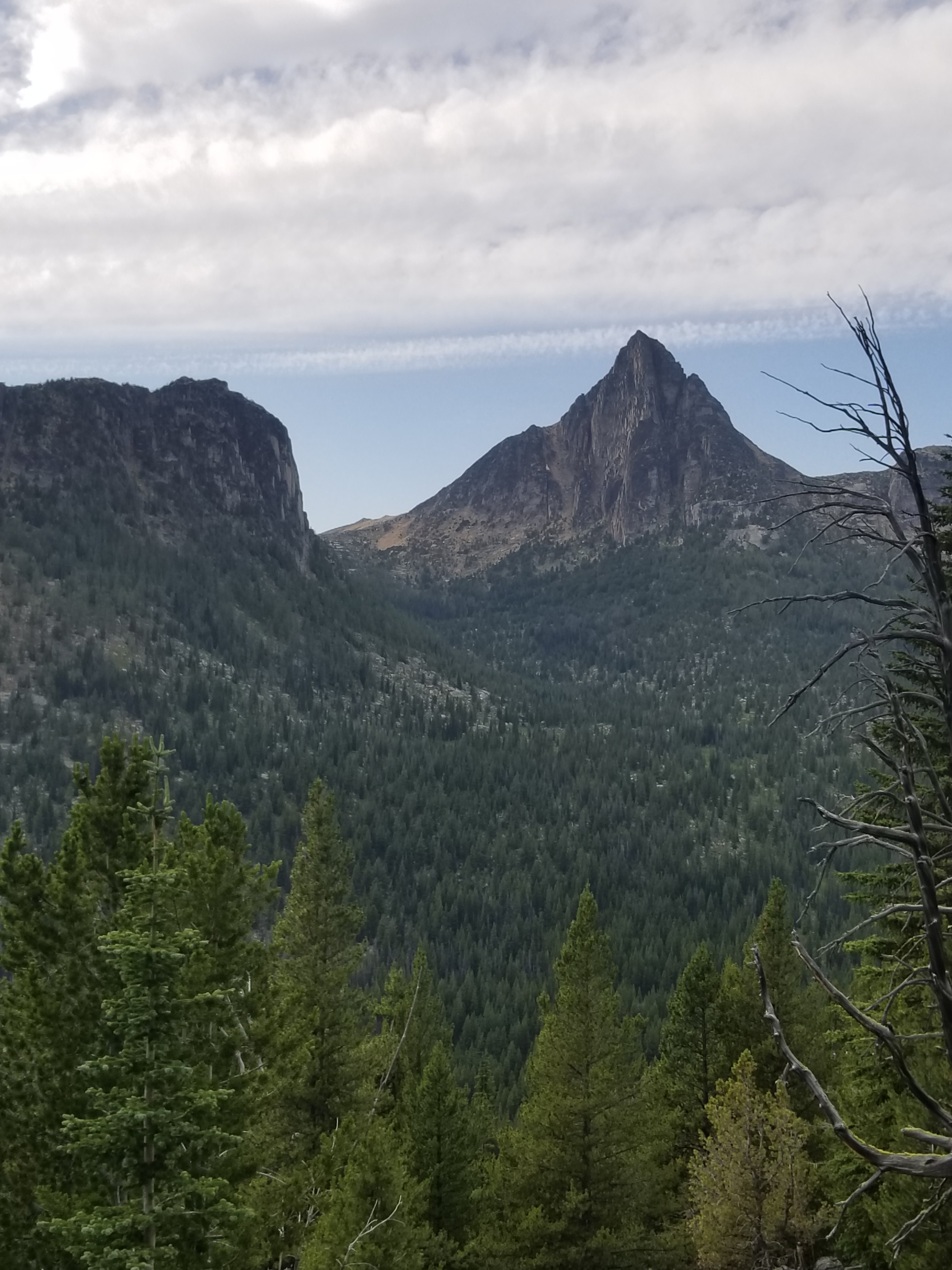
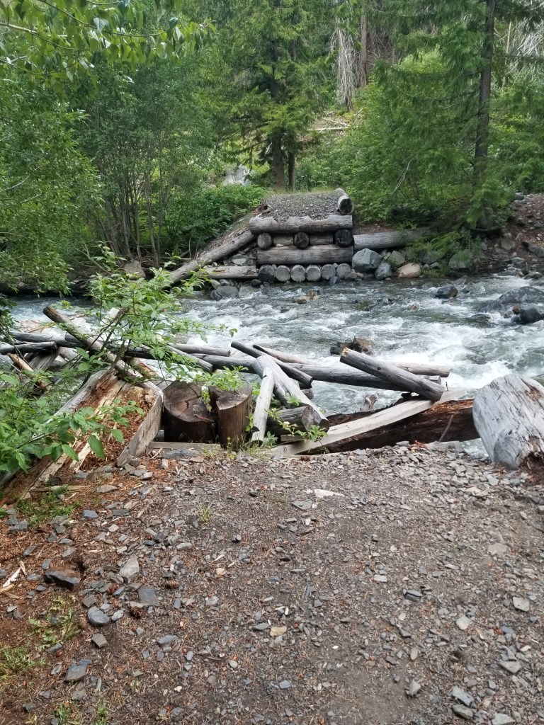
I had researched this little used access trail. It was a known problem that about 2 miles in a bridge was destroyed, requiring a ford. Also, there were notations about the trail being “impassable” to stock. The area had burned about 15 years ago. Standing burned trees topple over, like sticks, so it was not surprising to see the description.

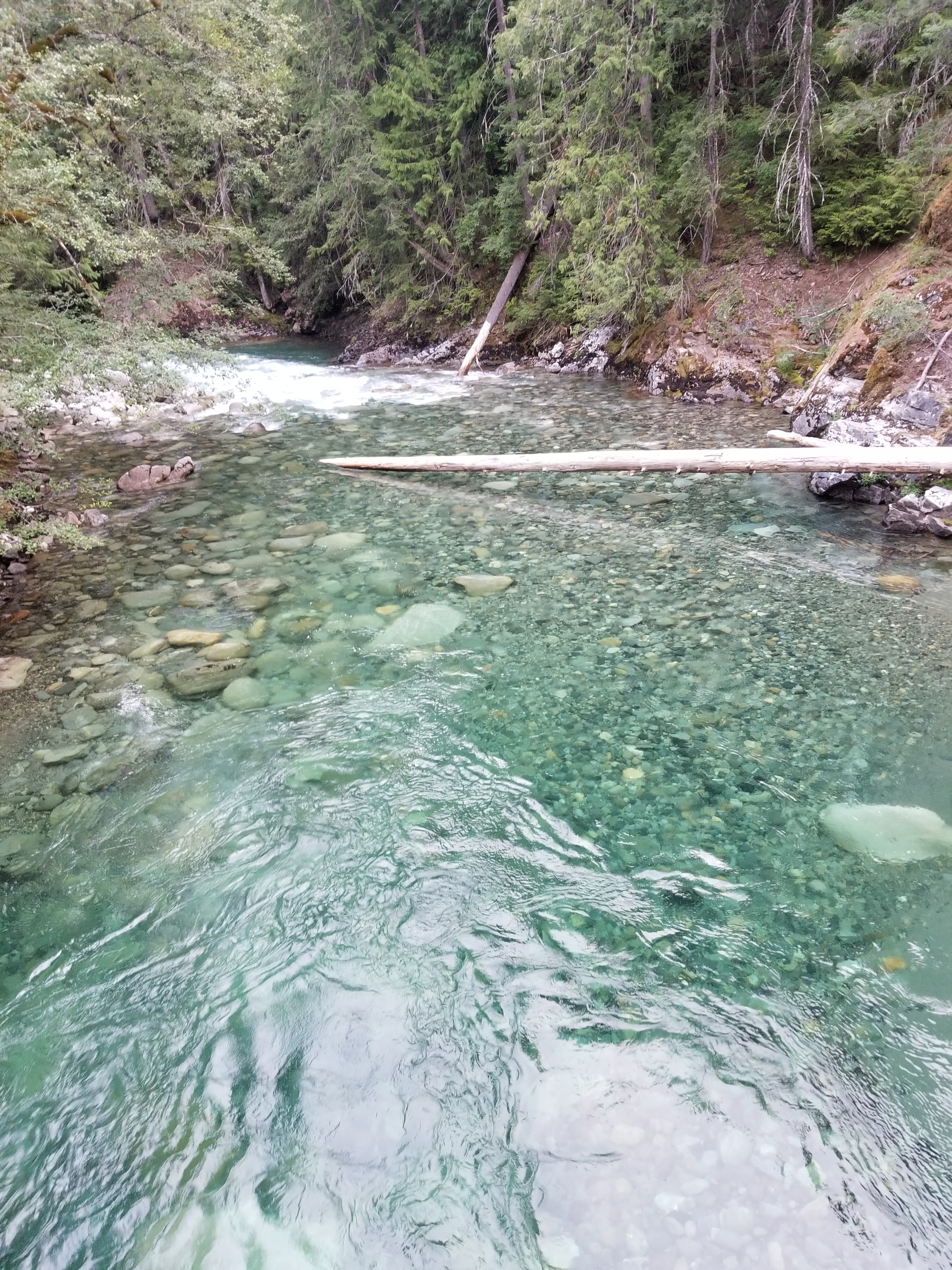
The missing bridge proved a minor challenge. Walking slowly across a stream of snowmelt is bracing! Although one unexpected dip caused me get as deep as my pockets, I numbly emerged on the other side victorious.

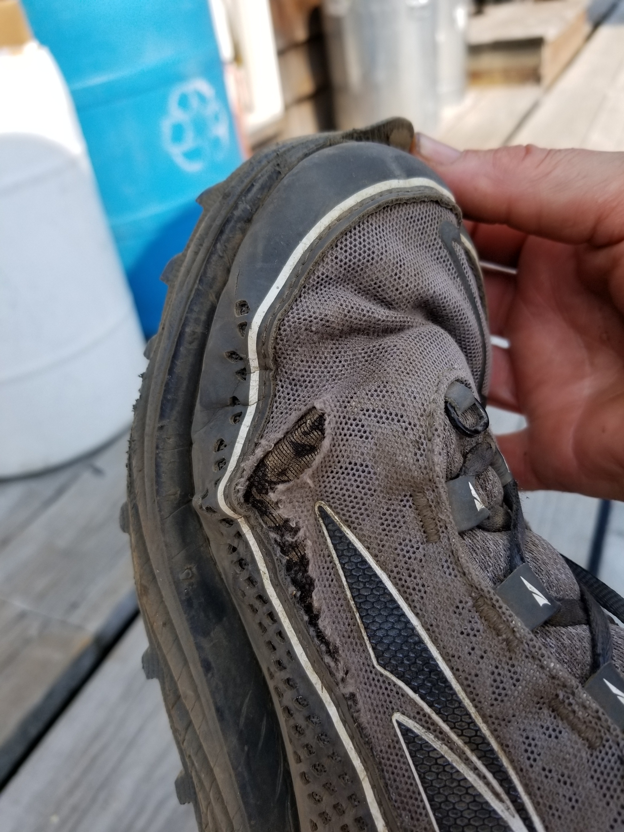
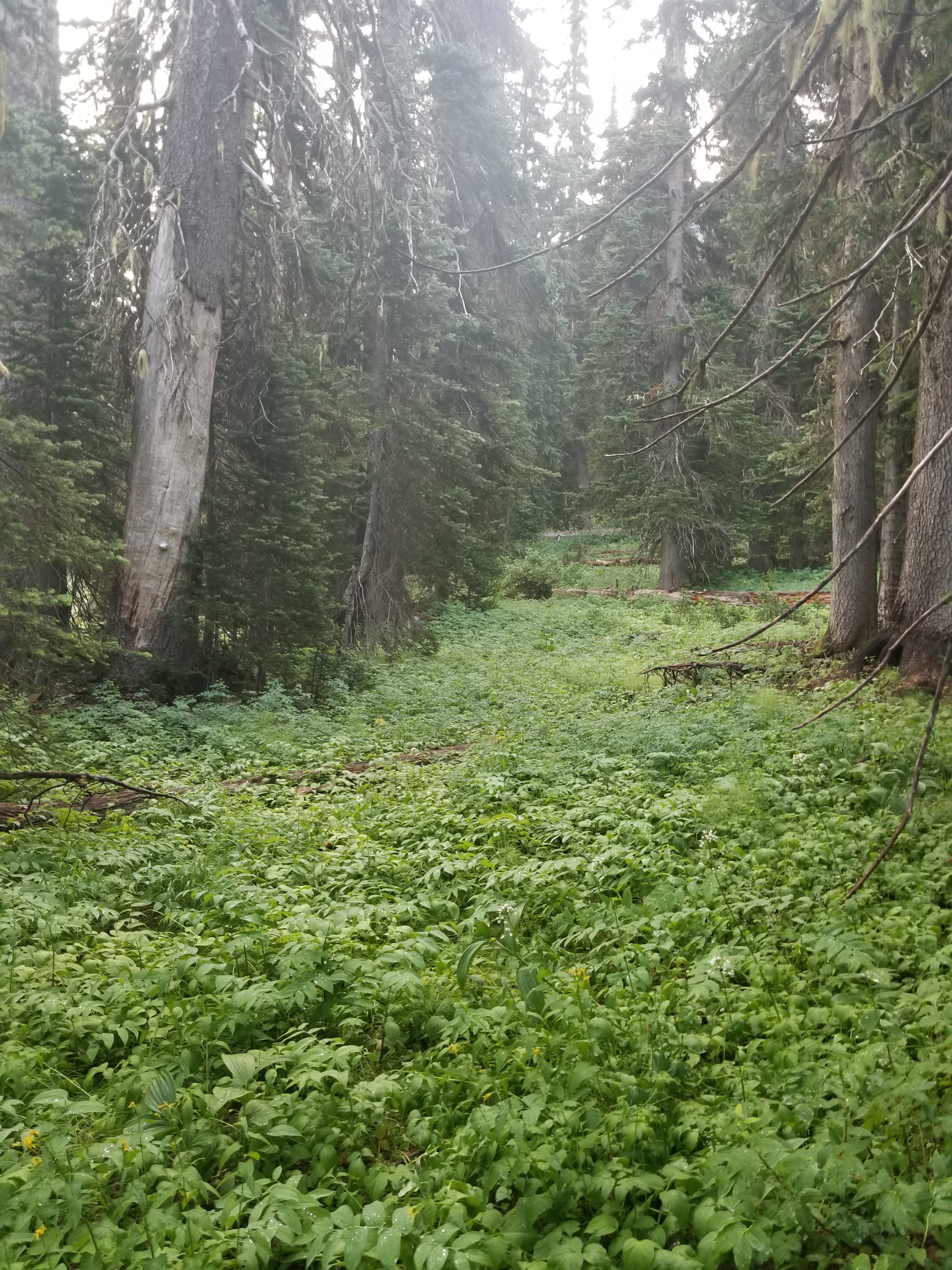
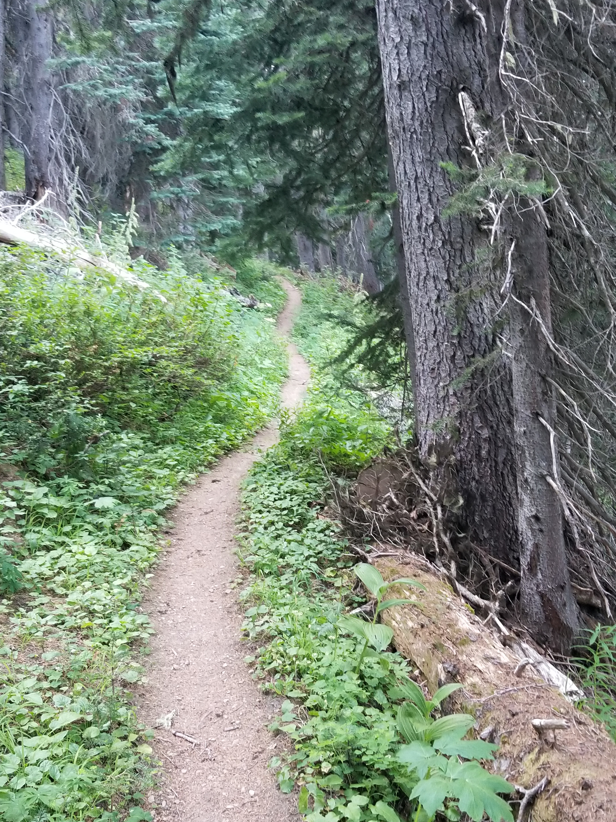
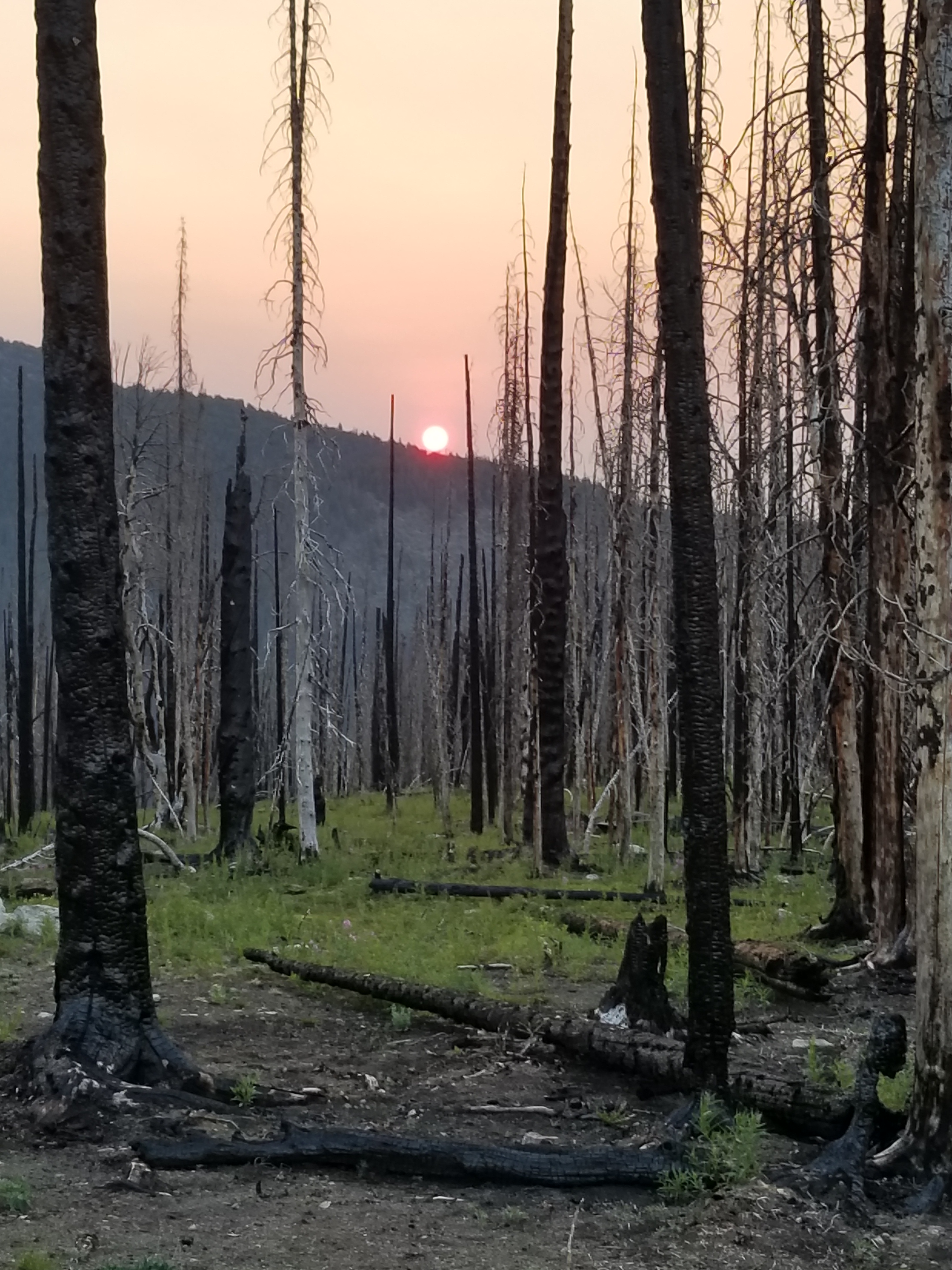
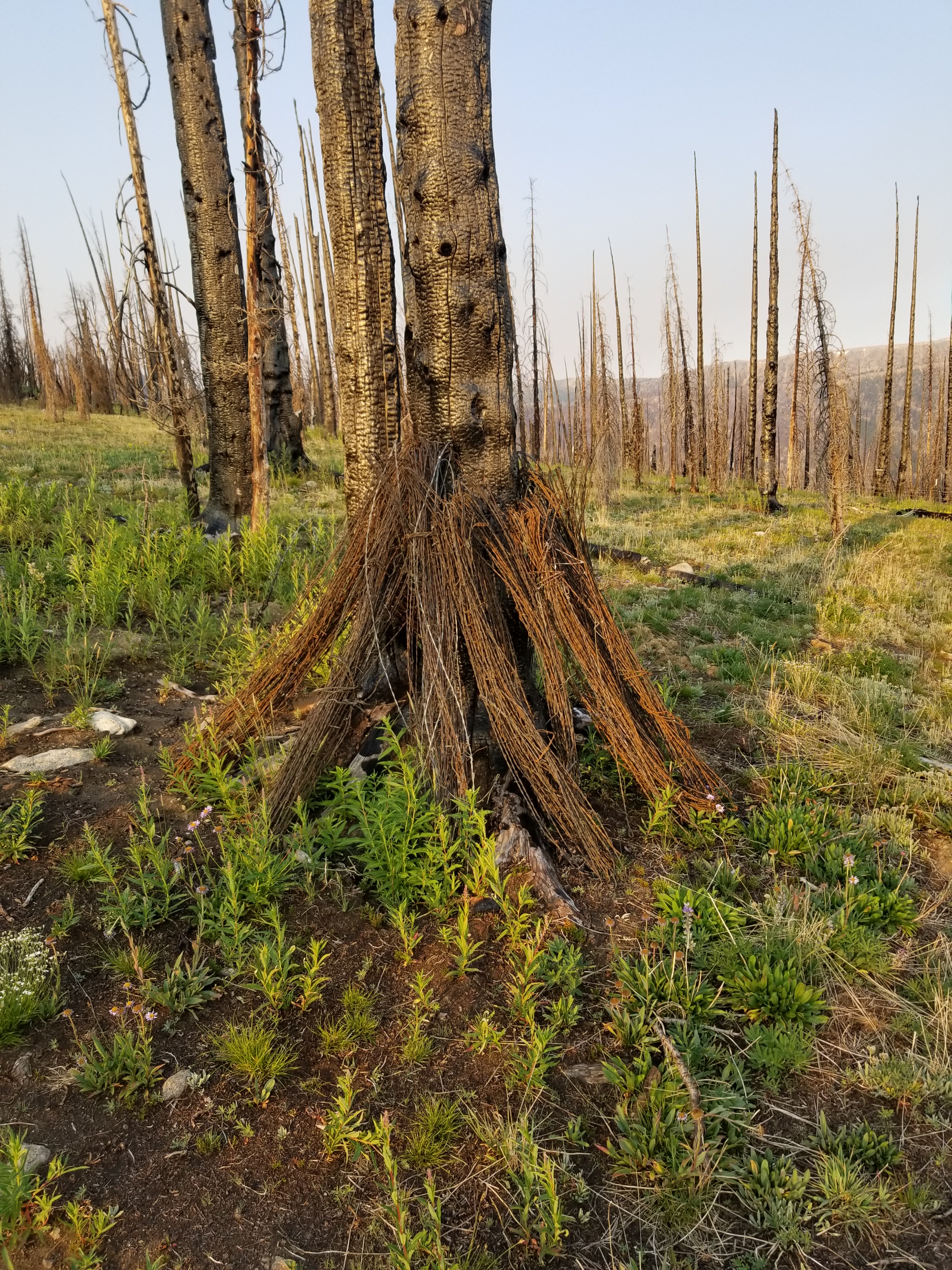
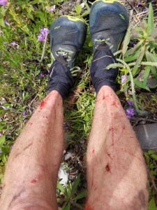
After another mile my pleasant hike up the Methow River Valley turned into Satan’s shrubbery. Let me back up. Nature abhors a vacuum. Thus, after a fire, certain “successor” plants like fireweed grow. However, the most aggressive plants are shrubs. Not like boxwood or other “friendly” shrubs, these grow out and then up. The goal must be to block sunlight from reaching the nearby soil. You can picture two of them sprouting up on opposite sides of the trail. They both grow out to block the other and then race to own sunlight. This creates intertwined and overlapping branches. Walking through it is a nightmare. You lose track of the original trail and are stuck flailing in six foot shrub jungles. It was frustrating, exhausting, and bloody.

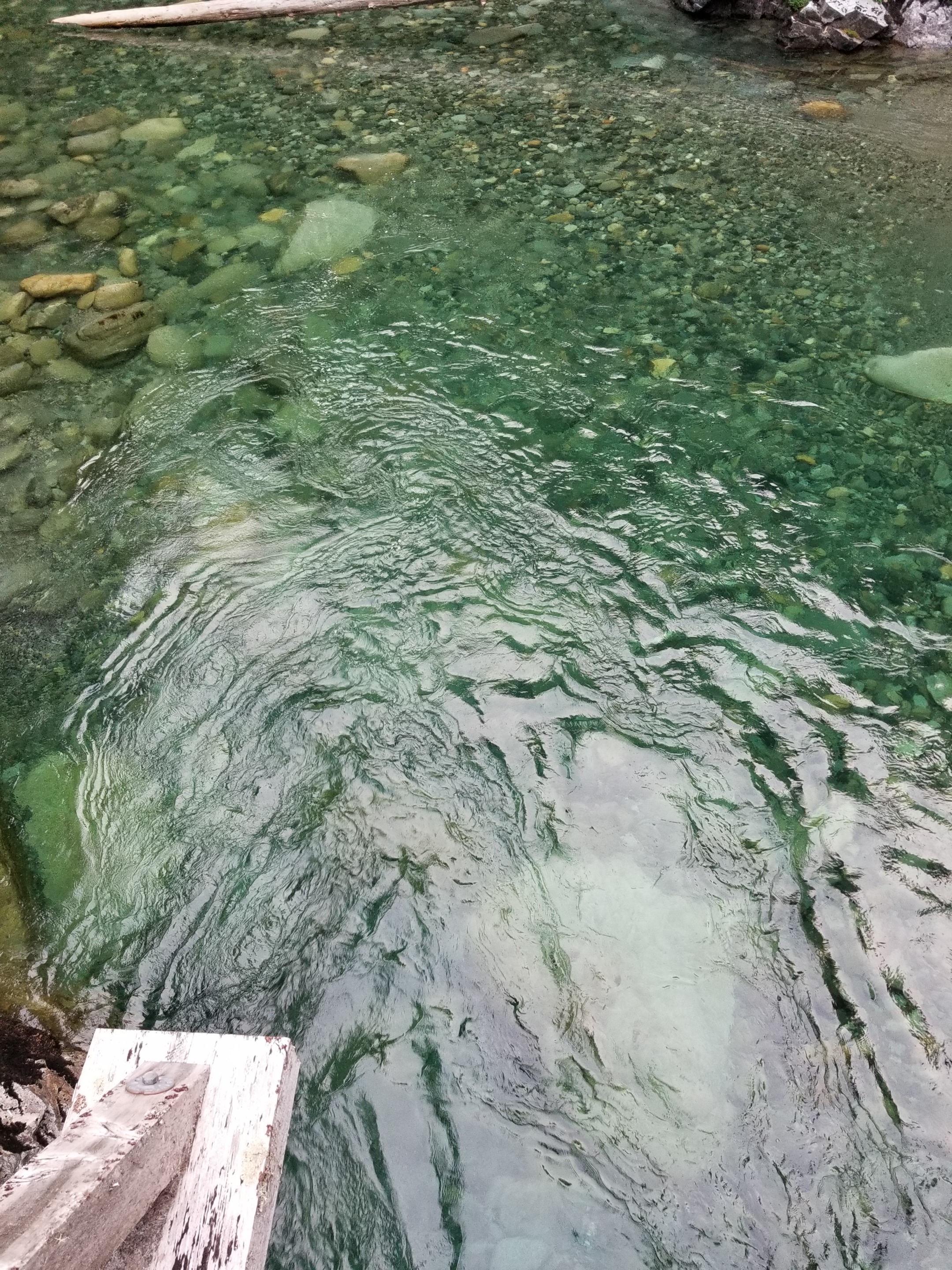
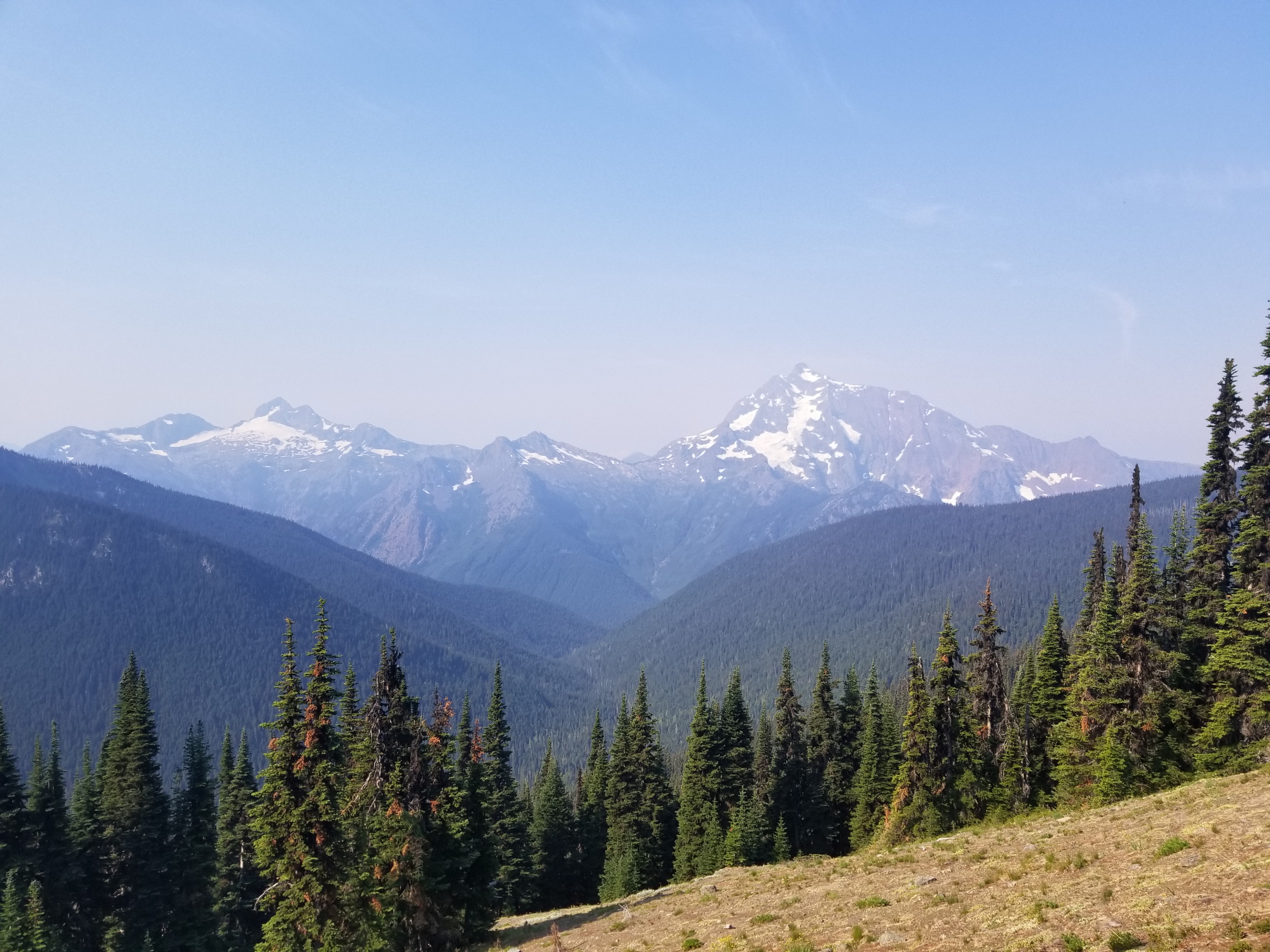
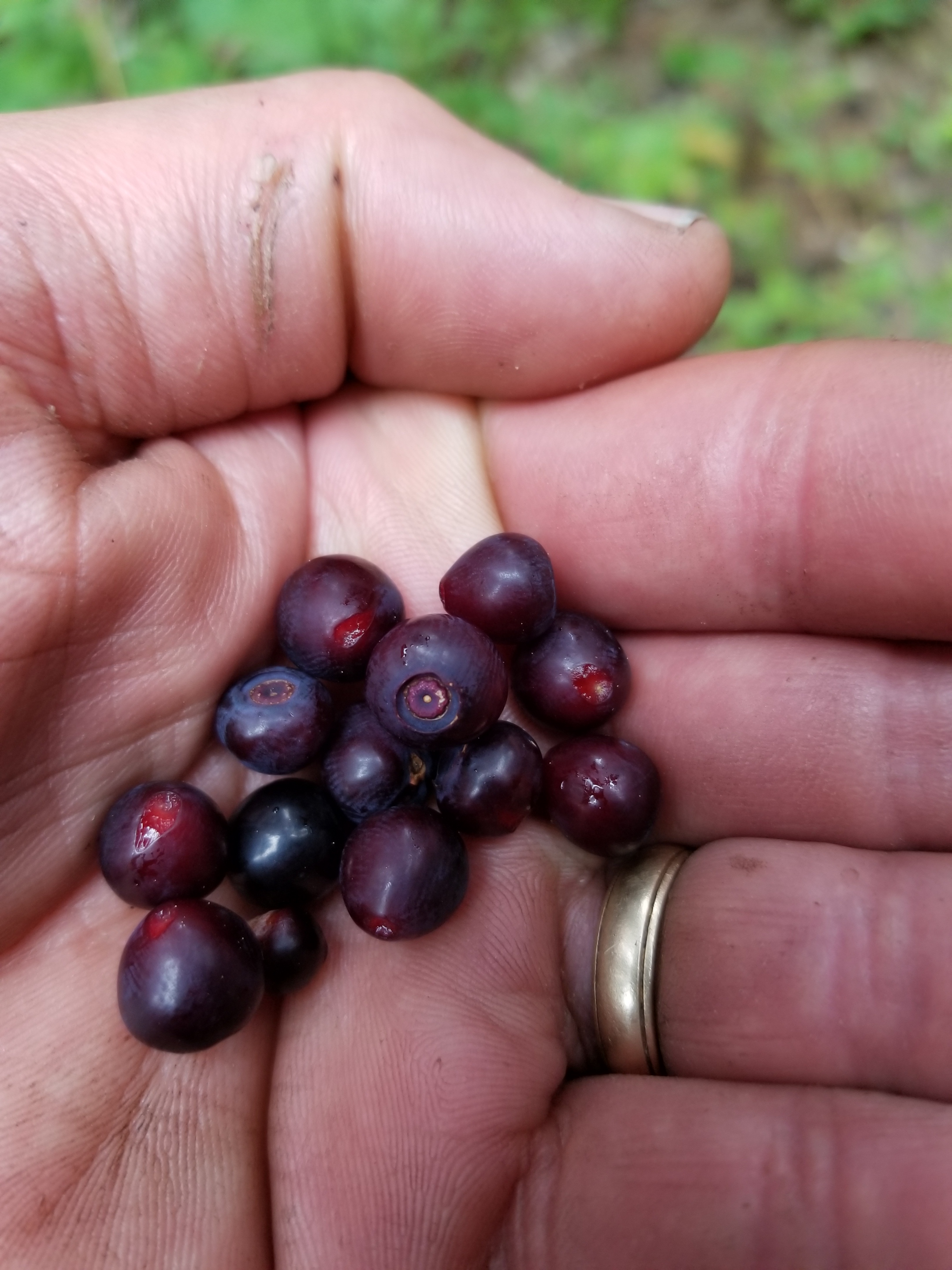
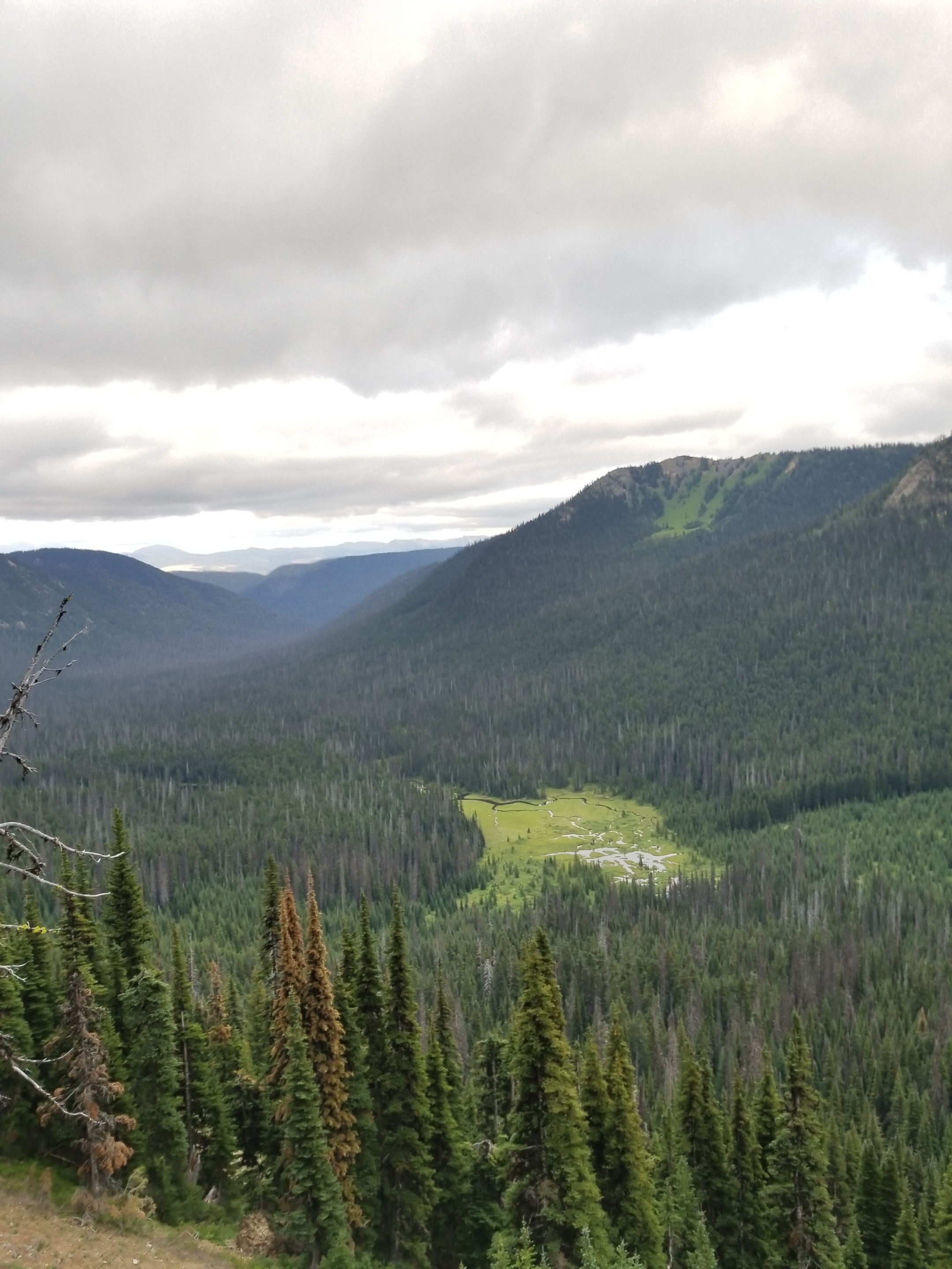
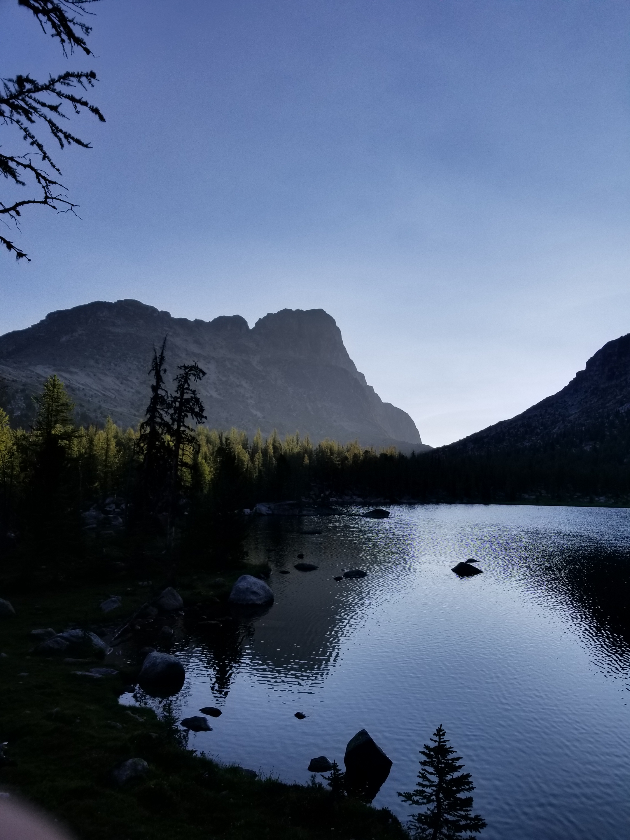
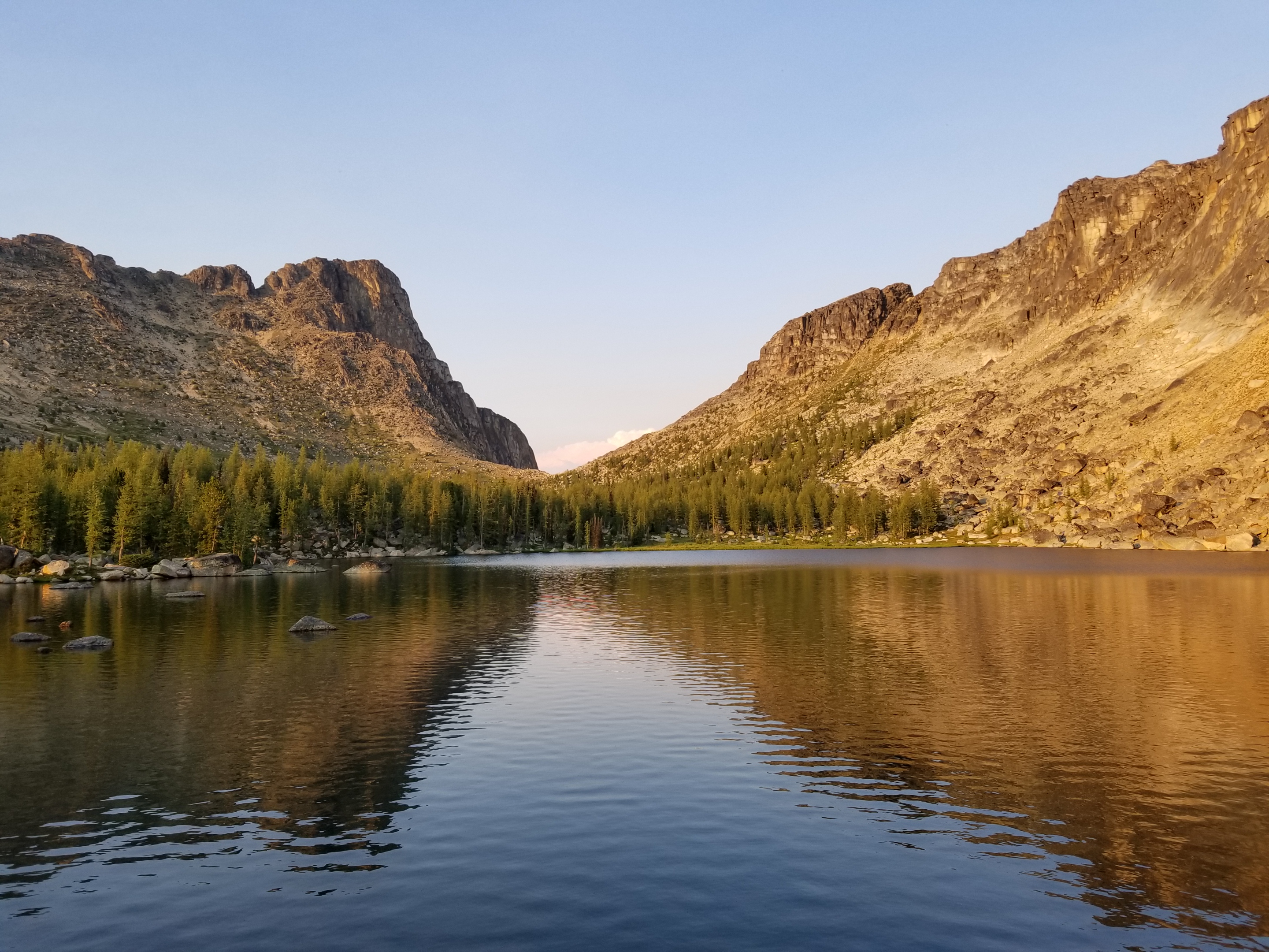
The biggest irony was that I could hear the mountain stream rushing through the valley, but I couldn’t reach it to drink.

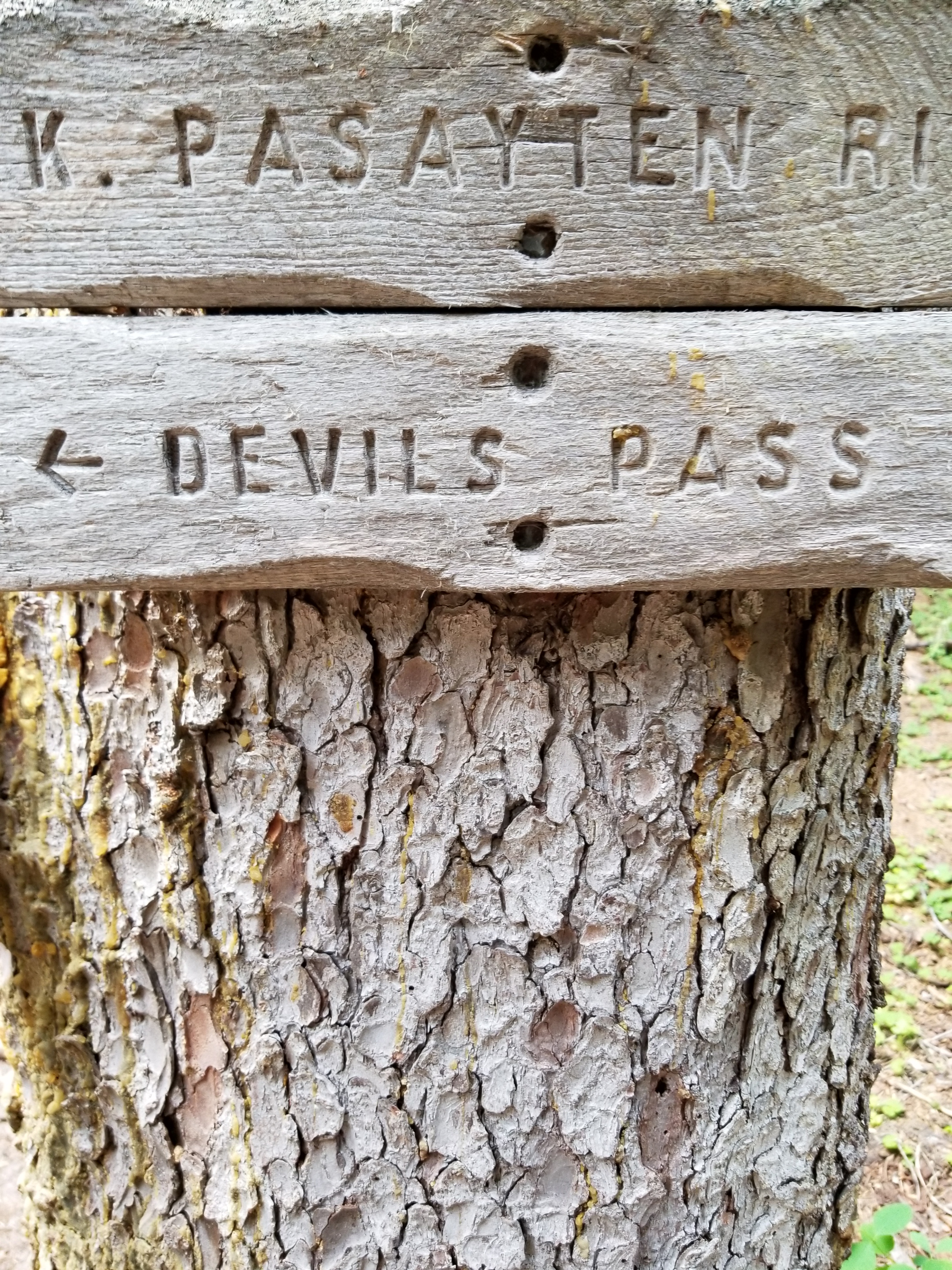
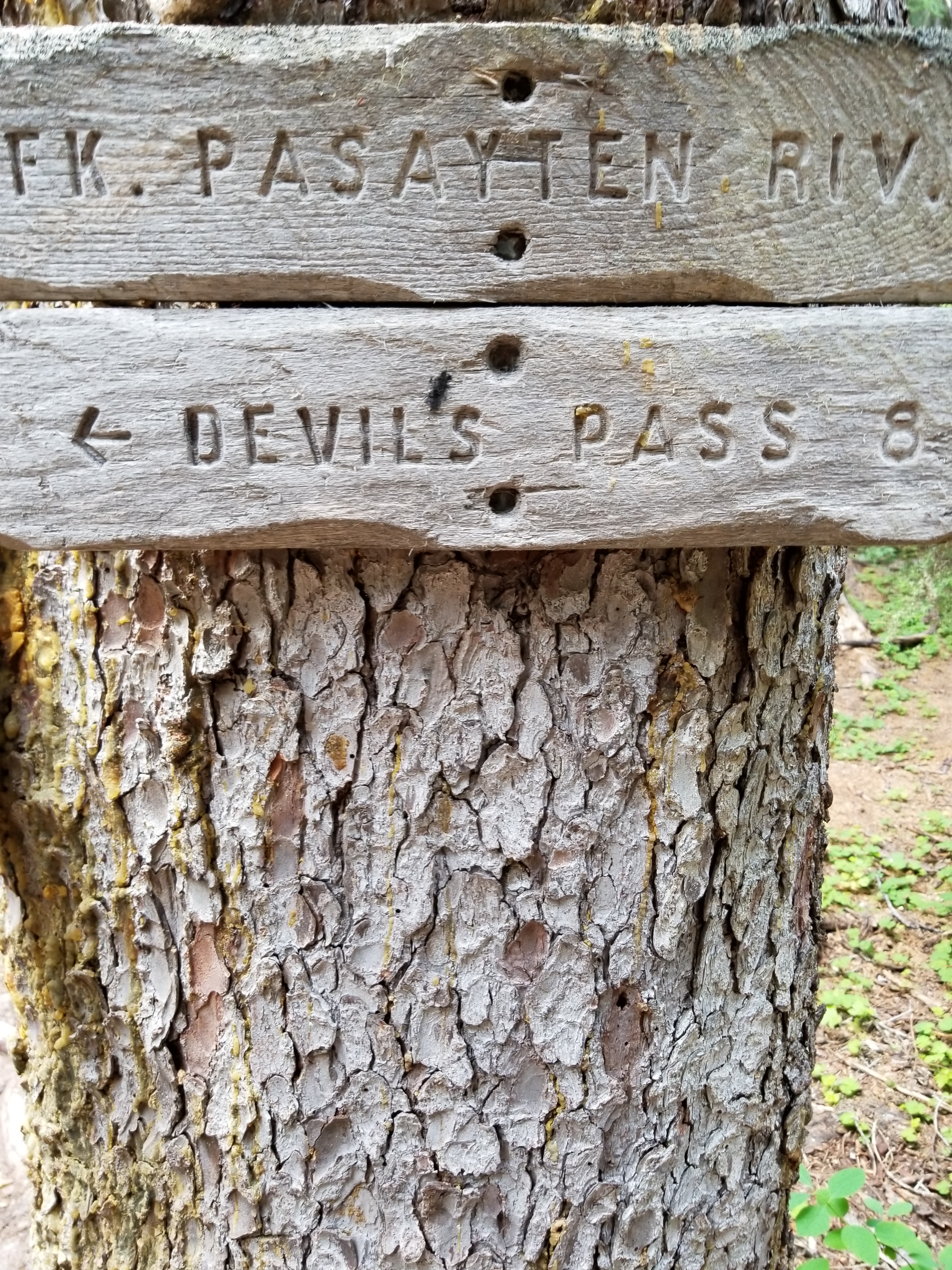
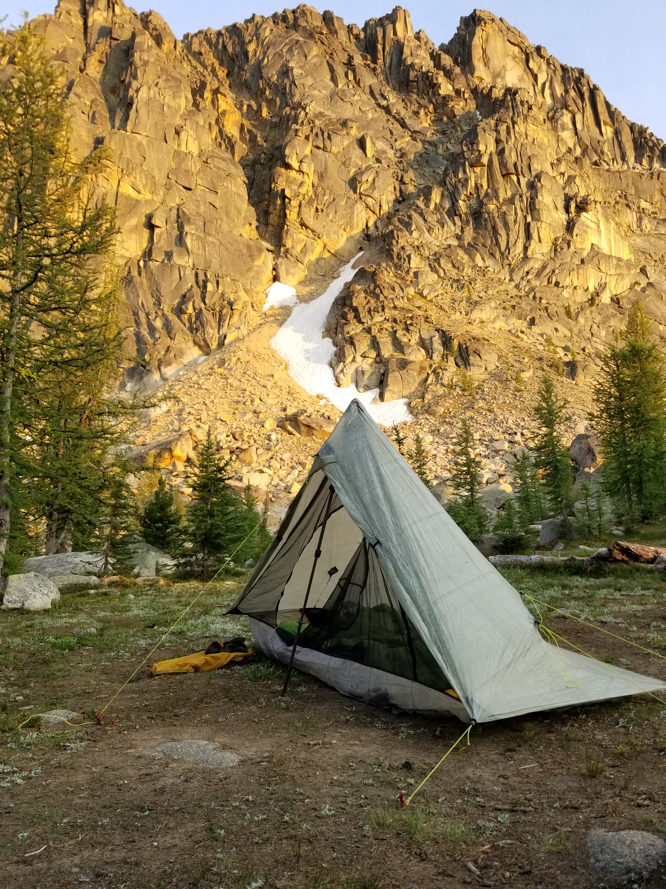
Eight hours, eight miles, and I finally made my goal, a Pacific Crest Trail campsite on Brush Creek. I was getting muscle cramps in my hands, toes, hamstrings and back. Fortunately I had some electrolyte pills. I drank three liters of water and after about four hours felt better. I paid the price, I was on the PCT

Food

For this trip I am once again packing and shipping most of my meals.  Likewise, I am also going stoveless (or cold soaking), which simply means I will rehydrate meals with unheated water.          

I originally thought going stoveless would be terrible. However, with enough variety it is a good way to travel. It just requires planning and basic nutrition concepts.

I have prepared 118 dinners. They include Beanritos (refried beans, rice, fritos), QLMW (quinoa, lentils, mushrooms, walnuts), Chili beef, coconut cashew curry noodles, couscous with pine nuts, Spudken (potato flakes with freeze dried chicken and gravy), and good old rice and bean variations.

Instead of a blue plate special, I guess it’s the silver mylar special….

Breakfasts are likewise stronger grains (steel cut oats, 7-grain, and tsampi). I soak them overnight with variations of fruit, nuts, dehydrated honey, cinnamon, and coconut milk powder. In the morning I have a ready meal while I break camp. And yes, it is possible to live without coffee.

“There is a great future in plastics. Think about it. Will you think about it?”

I have 27 resupply packages all set to go…

They may lose money on Amazon, but I am helping the USPS.

All the planning and preparation is worthless unless you have an excellent resupply guru. I am extremely fortunate to have my wife Helen. She is detail oriented, thinks ahead, and has the patience of Job. She has bailed me out countless times. I can’t predict fires, weather, or covid restrictions, but I can count on her.

Preparations: logistics

A long distance hike requires planning. At a minimum, there’s the path and mileage and opportunities to get food and water. For the most popular trails, there has evolved a basic set of GPS locations, topographical maps, and descriptions of communities along the way that might provide food, shelter, resupply packages, or other services.

You first need to decide on a direction. The Triple Crown of U.S. trails (Appalachian, Continental, and Pacific Trails) have historically been followed from south to north. The arguments for this approach include following warmer weather (snow melt) north, starting and finishing earlier, and tradition. Going in a northbound direction is called a “NoBo.” The problem with this approach is that in the case of western trails (PCT and CDT) you are likely to experience two snow challenges in mountains. The first is early on when entering the Sierras or San Juan’s. Remaining winter snow can be a challenge. And if you are not careful towards the northern end, early fall snow in the Cascades or Rockies can be a risk.

A southbound (“SoBo”) trip has some advantages. Satellite imagery and snow sensors tell exactly what starting conditions will be like relative to snowpack. Additionally it is less crowded. The biggest negative is the challenge of getting through the southern end of mountain ranges before winter snows begin.

I’m going SoBo on this trip. I have estimated hiking speeds and developed a resupply plan. One goal will be to eat more. On my CDT SoBo, I lost about 50 pounds.

In 2016 I was able to convert my body fat to facial hair.

Next, I’ll write about food.

The Last Day

August 27, 2018. From stealth camp near Yellow Banks to Cape Alava.

I had a restless night. Finish Fever, I guess. By 4:30 I started packing.

The guidebook indicated the last four miles would be rocky, so I thought it would be wise to start early to ensure finishing before high tide.

It was dark when I set out. The full moon (sturgeon moon) was just the night before, so this morning’s moon was big as it shone above the western horizon.

The moon provided excellent light.

Like yesterday, I started with a smooth beach walk. For some time I followed the footprints of a coyote that had scavenged the low tide. While the sun struggled to rise in the east, the moon seemed to resist setting in the west.

I stopped to eat the last of my food near the end of the appropriately named Sandy Beach. Out of the woods came a deer, wholly unconcerned about my presence.

When I rounded the next headland I was surprised to see small bear pawprints in the sand. In addition to the deer, coyote, and several bald eagles, it seemed bears visited this beach, too. When I looked up the beach, to my surprise there was a mother bear and a smaller blob. They were scrounging in the debris washed ashore at high tide.

I promptly pulled out my cell phone for video to capture the moment and bear spray in case the moment turned bad. If you read my blog on the CDT, you’ll know I’m not a fan of mother bears with cubs.

Just like at Deer Lake, everyone followed the training manual. I made noise and waved my arms to establish visual and auditory presence. Cubs exit to trees in land. Mom gives me menacing look and then follows cubs.

There was one moment when she was heading into the woods but suddenly reversed course for the beach. My pulse quickened. But it was just momentary and she then scampered off.

Understandably, I gave a wide berth around the place they entered the woods. Each time I looked back, I could not spot them.

I was relieved to find out that the guidebook’s warning about a rocky shoreline generally meant a lot of smaller rocks, not large slippery ones. This meant I was making much better time than expected.

The large rock formations were the defining image of this coast, in my opinion. There were some engaging ones this last day. One having a hole in it. Another looked almost like a loaf of bread.

I love how waves can drill through rock.

This one reminded me of a loaf of bread.

Another spectacular sight to wrap up the PNT was just around Wedding Rocks point. There were petroglyphs carved into several of the stones. I know I did not find all of them, but the ones I did see were impressive. Estimated to be between 300 and 500 years old, it struck me how it is such a human characteristic to want to create something meaningful and ever-lasting.

Not my area of expertise, but I translate this to mean “leaf us alone.”

Early emojis.

Finally, after less than four hours of hiking, I reached Cape Alava. The sea lions were making a ruckus on islands offshore. The sun was just reaching the outer edge of the beach. Only two people were visible, vandalizing this place by chiseling something into rocks off shore. I was pissed at first, but then considered that one man’s vandalism is another man’s petroglyph.

I took the obligatory selfie, let loved ones know I had finished, and then sat on a large driftwood log. I don’t know why, but I decided I would just sit and look and not think. Once the sun reached me, I would step off the beach and hike the three mile connector trail to the campground where my Dad was waiting to pick me up.

The sun reached me. 61 days and roughly 1,200 miles. It was time to leave the PNT and go home.

Happy Panther

August 6, 2018. From stealth camp on Ross Lake to Big Beaver Camp.

Excited to resupply and get my electronics charged, I was up early and moving. I crossed beautiful blue Ruby Creek and found a series of educational displays that gave the history of the Skagit valley before the dam.

On the “Happy Panther Trail” i passed a few waterfalls. I recorded a video of the downhill portion and was amused to see the video makes it actually seem like a backwards-flowing waterfall. I am easily amused.

I approached the dam with some excitement and just a hint of fear about heights. It was an amazing structure. I learned over to take a picture looking down…stupid.

After I crossed the dam, I immediately detected two smells from Ross lake Resort: cooked food (yum) and fuel (not yum).

I eventually made it to the resort. It is unique because the whole resort (office, cabins, boat facilty) floats on the lake and is only accessible to boat or walking. It has an exclusive reputation, with reservations often needing to made two years in advance.

They had my package, and let me charge up my gear. It was interesting when around 10:00 all the guests showed up and wanted their canoes. Kayaks, motor boats. After an hour, it was calm again. The resort was friendly with one lady offering me many delicious strawberries. Later, she cooked bacon for BLTs for the staff lunch and I was close to offering o e of my internal organs in exchange for some bacon.

I was able to call home and work out a way to get some shoes to replace my disintegrating pair.

Eventually, I packed up and left in the afternoon heat. It was just a four mile hike to my designated campsite at Big Beaver Campground. As I approached, I first passed the equestrian campground with places to tie up stock. Past that, I approached the boat campground. There were about 20 frenetic teenage voices. I had heard some employees discussing a boy scout troop when I was at the resort. I immediately turned around and went back to the isolated, empty, and quiet equestrian campground.

I swam in the reservoir and rinsed my clothes. That felt great. The hot, dry air quickly dried my wet clothes. I stored my food and backpack in the metal bear box. I was easily off to dreamland despite being able to hear snippets of teen noises from the boat campground far away.

Longest Day Yet

August 5, 2018. Sky Pilot Pass to Ross Lake.

Everything was damp when I woke up: inside and outside of the tent, my sleeping bag, the ground and plants. Fortunately, I did not die in a landslide, although I did hear a smaller one during the night.

I got ready for the day. I put on my wind pants and jacket. Then, with much hesitation, and a hint of irony, dry socks inside wet shoes.

Sure enough, all foliage was wet and it hung over the trail. Thus, every step on the trail liberated the water onto me. My water resistant gear simply channeled all water to my shoes. The day was sunny and dry, so I knew this was temporary. I entertained myself by thinking of words to describe my situation: damp, dank, sodden, wet, moist, waterlogged, inundated….

Yes. You will get wet.

By the time I reached the steep area where my paranoia focused last night, the amount of rainfall was obviously less and the trails in tact.

Around 10:30, I shed the wind pants and jacket. It was a great day, but unfortunately the wind was from the south and thus it blew in smoke from a fire. I loved the views, even when they weren’t clear. This area had magnificent views around Devils (sic) Dome and elsewhere.

Which is Prettier?

This is, I believe, Jack Mountain.

I began the descent to Ross Lake, a reservoir built in the 1930s. I was assuming I would not like a long, flooded valley. Almost immediately, I began encountering hikers on the trail. I stopped counting switchbacks at 22 and uphill hikers at 16. One poor guy lagged his group and noted the gallon of water he was carrying seemed heavy. Yup.

The temperature steadily rose as I declined. By the time I reached the lake it must’ve been 90+. Thankfully, the westside trail gently ambled slightly up and down. The water was clear, cold, and beautiful. I couldn’t hate it.

The westside trail was well maintained and gently followed the reservoir.

The stump was about eight feet below the surface.

Life just wants to live. A dead stump provides (ill advised) hope for a young tree .

The trail led past an amazing spring, it dropped water down from about 12 feet. Underneath, the rock had chipped away and the stems and fronds of ferns grew down, gently waving in the breeze. Did I stand underneath that spring and let cold water shower me? You better believe it! What an amazing scene.

The stems of the ferns grew down and out. The fronds grew down, like fingers. With occasional small, cold drips catching then falling. I watched this for 15 minutes.

I wanted to get close to the dam so I could cross it early the next day to get my resupply package and charge my depleted electronics. The printed directory and maps showed a campsite called Ruby Pasture, but when I got there at 7:30, it did not exist. Instead I pushed on and stealth camped on a man-made ridge down towards the lake.

It had been a long day (14 hours and 28 miles) and my knees ached from the downhill pounding. Even though it was hot and mosquitoes were in my tent, I conked out right away.

There goes the Drought

August 4,2018 From Frosty Pass to just past Sky Pilot Pass.

In the morning I heard a couple more deer make their way across the pass while I tried to wake up. I was in a cloud. Literally. The cloud cover had dropped. However, it quickly lifted while I was packing, even showing hints of blue in the west.

I was going to spend a good chunk of the day on the Pacific Crest Trail, the Pacigic Northwest Trail’s famous cousin. Importantly, PCT hikers would be nearing the end of their 2,600 mile journey as Canafa was just a few miles north.

I packed swiftly and rambled down to the legendary trail. “Where did I go wrong?” I have hiked the Grand Enchantment Trail, Continental Divide Trail, Superior Hiking Trail, Border Route Trail, and now part of the PNT. Generally considered rougher trails, you could’ve knocked me over with a feather when I got on the PCT. 18 inches of perfect tread. Even over scree it was city-park easy.

Within 20 minutes, I met my first PCT hiker, a German lady who was excited to finish but needed to go back south to cover areas she skipped due to fire. She used hiking poles. Soon, others appeared. All were excited about their impending milestone, not a one interested in my trip at all. Which is ok.

I spent 12 miles on the PCT and met 14 hikers. All different shapes and ages. An observation I have about backpackers is that they do not look like they were picked in the first or second round in PE. All different types of people just decide to get up and go. I think that is absolutely great.

There were some great views from the PCT, including my first marmot of the trip.

All good things must come to an end. Eventually, I turned off the PCT on the trail to Devils Dome. Almost immediately there was a tree across the trail…welcome back to the PNT.

A tree across the PNT.

There had been some clouds, but nothing like thunderheads in the Midwest. I was hoping to camp up high again.

There some interesting flowers. The first one reminded me of a Dr. Seuss creature.

Around 4:00, I heard distant thunder. Within a half hour, I could see flashes and heard thunder nearby. This was bad given how dry the forests were. I was now going to just go over Sky Pilot Pass and camp early.

That plan changed when lightning struck very nearby. I used my satellite device to text my wife for any info on fires and weather. In the meantime, I stored my pack, grabbed my rain gear, and scooted downhill to wait out the lightning. It started raining, which was good for the forest.

Quickly, my wife texted me information on fires (none nearby), the weather (big rain), the position of Russian submarines in the north Pacific, and a new lead on Jimmy Hoffa’s body. I don’t know how she does it. Even more, I don’t know how I could do this without her.

Eventually, the thunder and lightning stopped. The rain diminished but the trail was a creek. I did make it over Sky Pilot Pass and located the flattish area indicated by the topographic map. I was pretty wet and the inside of the tent was my only dry sanctuary.

After eating dinner under the branches of a large spruce, I plopped down to sleep. As I was laying there, I heard a loud slow crashing sound, like a quiet herd of cattle slowly stampeding. I got out to look. I figured it out: landslide. I looked up and sure enough the hillside was steep and the good drenching just naturally loosened things up.

Back in the tent, I lay awake wondering about a landslide reaching me. Then, I looked at the map and, sure enough, tomorrow’s trail went across some very steep slopes. What if they washed out?

Then, I told myself to get a grip. Was I going to worry about plague and pestilence too? Enough. Worrying wasn’t going to change anything.

Once I got my head straight, it was a lot easier to get to sleep.

Another Day, Another Pass

August 3, 2018. From Bunker Hill to Frosty Pass.

Per usual, I got up in the middle of the night to adjust my fluid balances. I was surprised to look up and see no stars. Thick-minded, it took me a few seconds to realize I had solid clouds above me. I got back in my sleeping bag hoping it was just clouds, no rain. It would not be fun scrambling to set-up a tent on rocks in the dark.

In the morning, I was keen to get moving. Although I love being up high in open meadows, sometimes a lightly traveled trail like the PNT gets swallowed up by the robust meadow plants. I followed cairns for awhile, and then the trail entered a different burn area. This area was a lodge pole forest that had burned 15 years or so ago. Every year, more 40 foot tall skeletons of trees would topple over like the children’s game of pick up sticks.

The trail was faint. People had tried to make mini cairns. I was accepting at first, but after a couple hours (and more than a few cuts and bruises), it started to get annoying. It felt like the trail had not been tended to in five years. If the Forest Service treats a National Scenic Trail with such disregard, when will there be a critical mass? In other words, if maintenance waits for more hikers, but hikers wait for better rtails, how is the riddle solved?

At least there were huckleberries!

As if answering my question, after crossing the Pasayten River, I ran in to a trail crew. It was one person in charge and about eight teenagers. Because it was a Wilderness area, they were not allowed to use motors. So, no chainsaws, just the good old two person saw. It was a huge relief, I thanked each of them and shook their hand. Except for the one guy who was just laying down and napping. I figured he was a management trainee.

Tools of the trade for a trail crew.

I had a gradual climb up along the River. It was still overcast, which was actually good, keeping the temperature low for hiking. I did run across a chipmunk that had the chubbiest cheeks and was willing to come out for a photo. I presume this is what I look like at home when I get in to a bag of potato chips after 10 pm.

What chubby cheeks?

Later, I saw a pika which is probably the cutest animal on this trail.

Pika = Cute. Google it.

After I loaded up on water, and started soaking my dinner, I finally came across more hikers. They were three guys in their 40s or 50s eating dinner around a campfire. They wanted to chat with me while they ate dinner, but I wanted to get going as I had my heart set on sleeping up high again, this time at Frosty Pass.

I slogged my way up the switchbacks, climbing from 5,300 feet to over 6,400 feet above sea level. I did meet another backpacker on the way up. He was kind of an area expert having hiked numerous north cascade trails over time. He was very helpful. Not wanting to be rude, I did push off since my body was cooling off rapidly and I still had a climb left.

Eventually, I made it to Frosty Pass. It was very cool. Sorry. Again, these sound so funny to me when I am hiking.

The clouds were low, maybe 100 feet above, moving from west to east. They went over me, but covered the higher peaks to my left and right.

No cowboy camping tonight. I set up my tent. Then, I made a small fire. It was comforting and a great way to cap off the day and head to bed. Twice, deer scampered by over the pass, showing that humans are not the only ones who travel the path of least resistance.

The Battle for Bunker Hill

August 2, 2018. From Upper Cathedral Lake to Bunker Hill.

I had to pry my eyelids open in the morning. I wanted to hike, but my face wanted to sleep.

It was a crisp, sunny morning and the sun’s first rays crept through Cathedral Pass.

I followed the night-hikers footprints down the trail. I came to overlook a sweet, flat valley with a nice meadow in it. Somehow, the meadow had escaped the fires last year.

The footprints went on for more than an hour. They hiked quite a distance, presumably using headlamps. I have night hiked before but found the one-dimensional lighting from the headlamp a bit distorting and disorienting. I could hear their voices when I came to a trail junction that also included a back country ranger station.

I kept on hiking and noticed that Jackson’s footprints went a different direction. Sure enough, the route he followed was the bail out to Winthrop.

I now entered some very crispy hiking. It was hot and stepping over the many blow downs inevitably led to charcoal smears all over the legs. I did cross the Ashnola River and washed some of the soot off. There, I noticed my shoes were tearing again. I did the math and it was about 360 miles. At $120, Altra’s cost me a dollar every three miles.

Later, there was a reprieve where the trail popped out of the burn. It was after Sheep Mountain and around Quartz Mountain. Spectacular views while walking along high mountain meadows.

Unfortunately, the trail would descend again into the 2017 Diamond Creek burn.

Note: rubber tires on wheelbarrows burn easily.

I was pretty wiped out and tired by the time I descended down to Dean Creek. There were just a handful of footprints on the ash covered trail. My best guess was that One Direction was through here as there were three sets of prints that went in lock step.

I had to make one last push to reach my intended campsite: Bunker Hill. I hoped the Brits were not also camped there because then I would have to naturally retake Bunker Hill for the sake of history.

I raced the sun going down in the west as I heaved myself up to the top. A northwest wind was picking up and I was in that weird place where I am sweating and working hard, but the breeze is cooling exposed areas pretty fast.

I made it to the top. However, finding camping spots was a problem. True to the topographical maps, the top was flat. However, a coarse dried moss covered rocky ground. Plus, the stunted pines provided little protection from the wind.

I improvised and found a niche where some animals had smoothed out a rock free area. Using my umbrella, a few trees, and my backpack, I was able to set up a comfortable cowboy camp.

As the sun went down, I snagged another photo of the Canadian fire’s smoke plume.

I settled in to my sleeping bag, noting the wind was dying down. Soon, I was out like a light.

This is What I Hoped For

August 1, 2018. Goodenough Mountain to Upper Cathedral Lake

I woke up tired and a bit groggy. I was only up a little earlier than the sunrise. I wanted to catch it as it passed through the smoke plume. I was able to only get a few photos, nothing interesting.

There is one kind of tree that turns white when it burns. I “liked” the contrasts between the charred branches and white trunk on this one.

To me, this white trunk with blackened branches stood out in a ghostly way.

I soon was walking as the morning was just a little cold. I reached the peak of Goodenough Mountain. I spent some time wondering about the name. I could not recall anybody famous with that last name. Surely, the name could not be for an explorer. Can you imagine signing up for an adventure led by Colonel Goodenough? “We shall name that Mount Average, this one OkayPeak, and this one we will name after me, Goodenough Mountain.” It reminded me of the Oregon town named Dufur. The story goes that the pioneers were heading west and stopped at a site. The Lead Pioneer said “This will do for now” and the town name of Dufur was born.

When the trail headed downhill, I regained focus. I noticed that there was a lot of scrap barbed wire and a barbed wire fence, not items I would normally associate with a “Wilderness” area.

Folded barb wire laid up against a tree.

A lot of the day was spent on a trail contouring around mountains. It was nice trail and often provided beautiful, lush meadows with panoramic views. This is what I had imagined as the Pasayten.

I met one couple. they were on a ten day trip to Ross Lake. They were stopped at a stream tending to blisters from their boots after just one day. I hope they made it.

I saw a few interesting things along the way. First, the ants seemed to be in a hyperactive mode. Twice I went by large mounds of pine needles where the ants were frenetic. Just watching it made me itchy.

Second, I found another bird, beside the grouse, that does not like to fly. I came across ptarmigan mothers and their young. They are pretty gutsy or unimpressed by humans. The mother produces a low cooing sound. Fun creatures to watch.

Late in the day, I passed an old tungsten mine. A cabin had been refurbished and it looked like some people had occupied it so I did not go in.

There was also a much larger and longer original cabin. I went inside and it was dark, musty, and slightly dilapitated. Im not sure why so many people think carving their name in a historic piece of wood grants them immortality, but they try.

My goal for the night was to reach Upper Cathedral Lake, just after Cathedral Pass, the highest point on the official PNT at 7,550 feet above sea level. The last pass before reaching my goal was very cool. It was called Apex Pass. It was all larch trees. They are unique conifers in that their needles turn yellow and fall off in autumn. I bet his pass was stunning when all the larch are yellow and it is set against the green of neighboring pines.

Coming out of this meadow, I was complaining to myself about losing altitude just to have to climb again for Cathederal Pass. I looked up and saw it. It occured to me that the name Cathederal may not come just from the shape of the peak on the north side. It could be from words that kept coming in to my mind everytime I looked at it: Oh my god! Holy (crap)! God dang. If you’ve seen earlier blog posts, you know I am no wizard with the camera. I could not capture the powerful beauty of this monolith that shot up across from Amphitheater Mountain. What a highlight it was.

I reached the pass around 6:30. I could see my campsite as the lake was visible from the pass. I hurried down thinking it might be crowded. There was only one other camper there.

I snagged a nice place at the far western edge of the lake. I hoped the wind would die down so I could get a mirror image of the pass in the water, but it was not meant to be.

Still, having the rock wall next to me was cool. Except for when some rocks broke loose in the night and tumbled down. That, you might guess, made me a bit nervous, but not enough to keep me awake.

The only other odd note is that as I was falling asleep, two women hiked by conversing. Well, at least I heard two women talking, there could’ve been others, but I was impressed that they were going to do night-hiking in such a place.

Wish I could make this a screen saver.