Operation Bailout

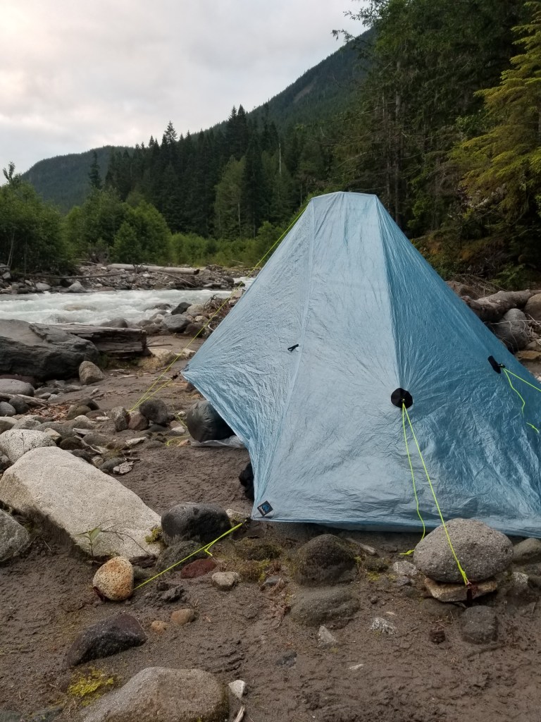
Day 12, July 7, 2020. One miserable makeshift campsite to another.

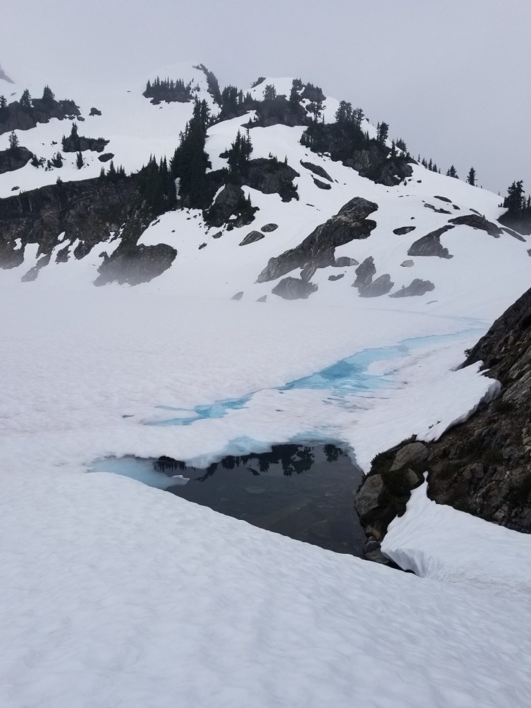
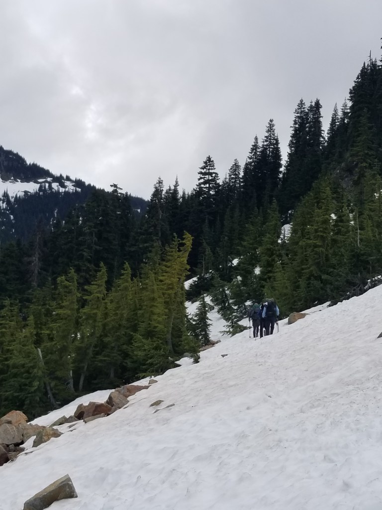
We all woke up to terrible conditions. Down insulation soaked and ineffective. Continuing drizzle. Temperature around 40 degrees. The only thing different today was that we did not have to climb switchbacks to get to snow….we were already in it.

We spent the morning struggling through tough conditions. Most people do not realize that hypothermia often happens in temeratures above freezing. We were in classic bad hypothermia weather: cold, wet, windy. Each of us had varying degrees of pain or, worse, numbness. I began to shiver. It was from the core. I knew from experience this was an urgent sign to stop and put on more layers, my last. I did so and felt better about an hour later.

Even more snow…

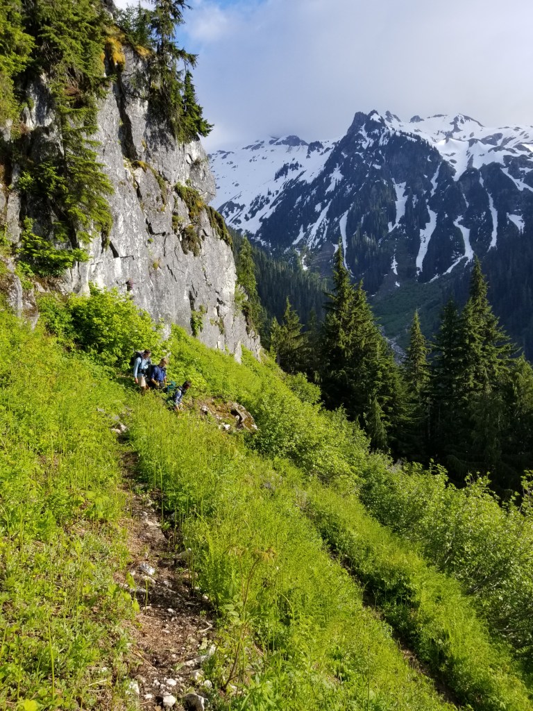
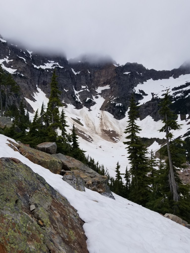
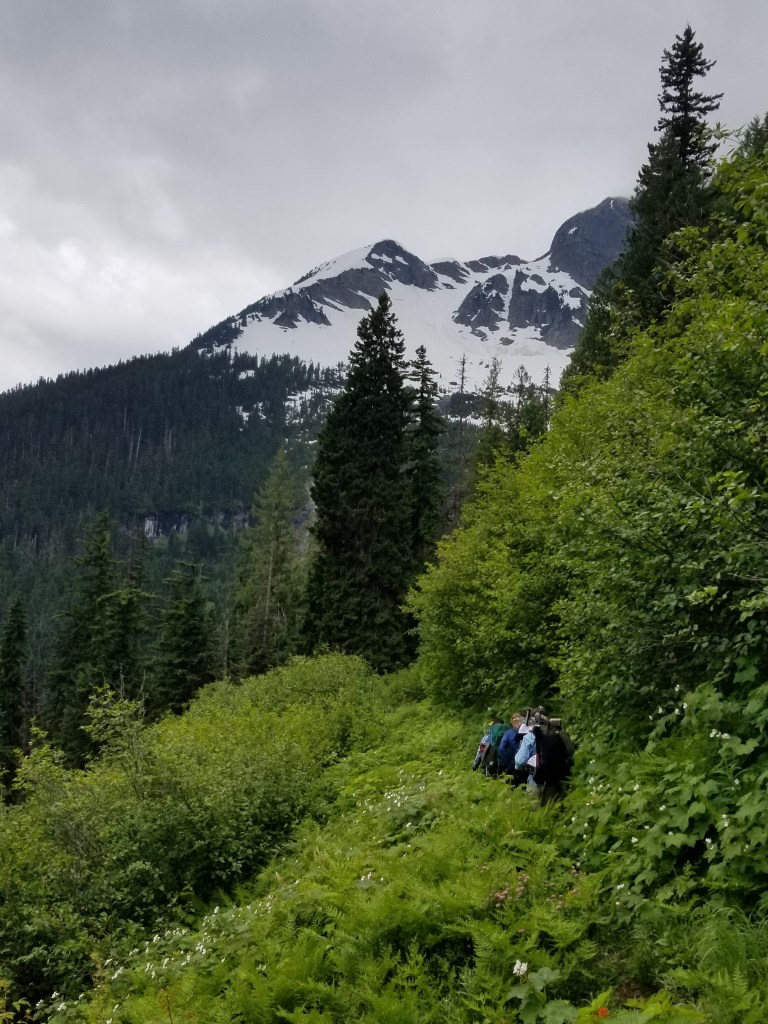
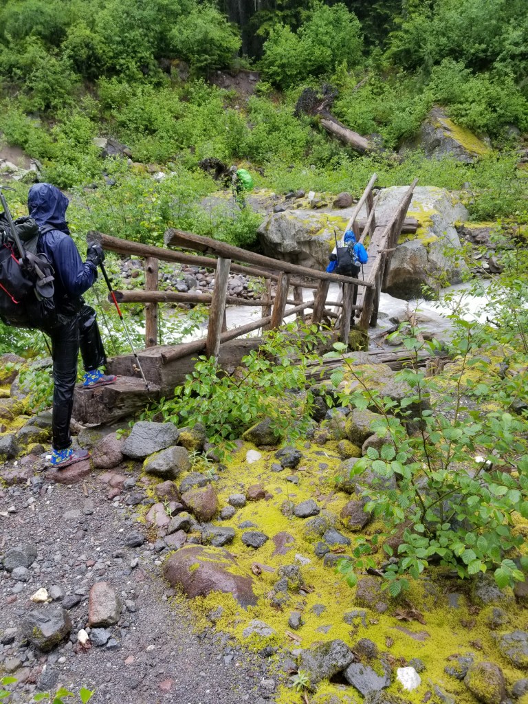
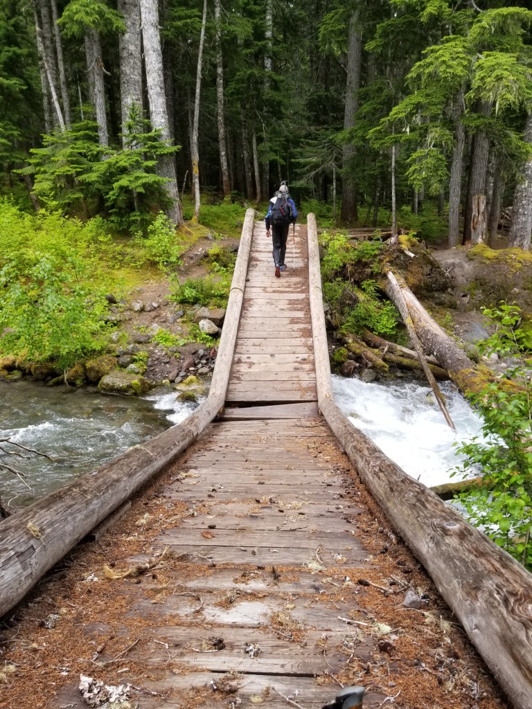
After about four hours of traversing slopes in the snow, we dropped down. Symbolic of our trip thus far, even a few of the bridges we crossed were broken down.

London bridge …..
…is falling down

So the reality we faced was: 1)we are only reaching about 10 miles a day due to to snow; 2) there is going to be snow the rest of the way to Stevens Pass; and 3) we do not have enough food to make it.

Given these constraints, we had no choice but to bail. There are two issues with bailing out of a trail: where and how. We had a near term option that led to a long, uncertain trail or a certain trail, but a little further away. Fortunately, Josh was able to coordinate with his mother via satellite and she did a fantastic job evaluating the options and coming up with the best choice (Sauk River). Next we had to determine the “how” I had a resupply package in our planned town of Skykomish and it contained a digital watch i did not want to leave behind. Fortunately, another through hiker (Dan) had reached out to me via social media offering a hand. Operation Bailout was in play.

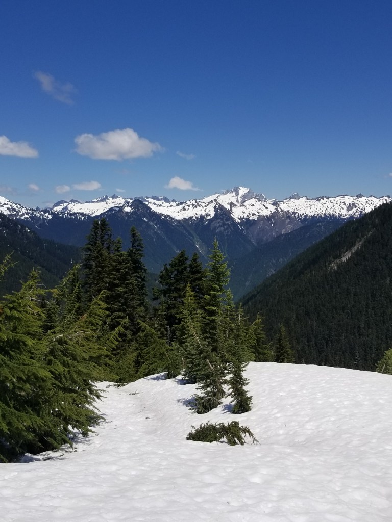
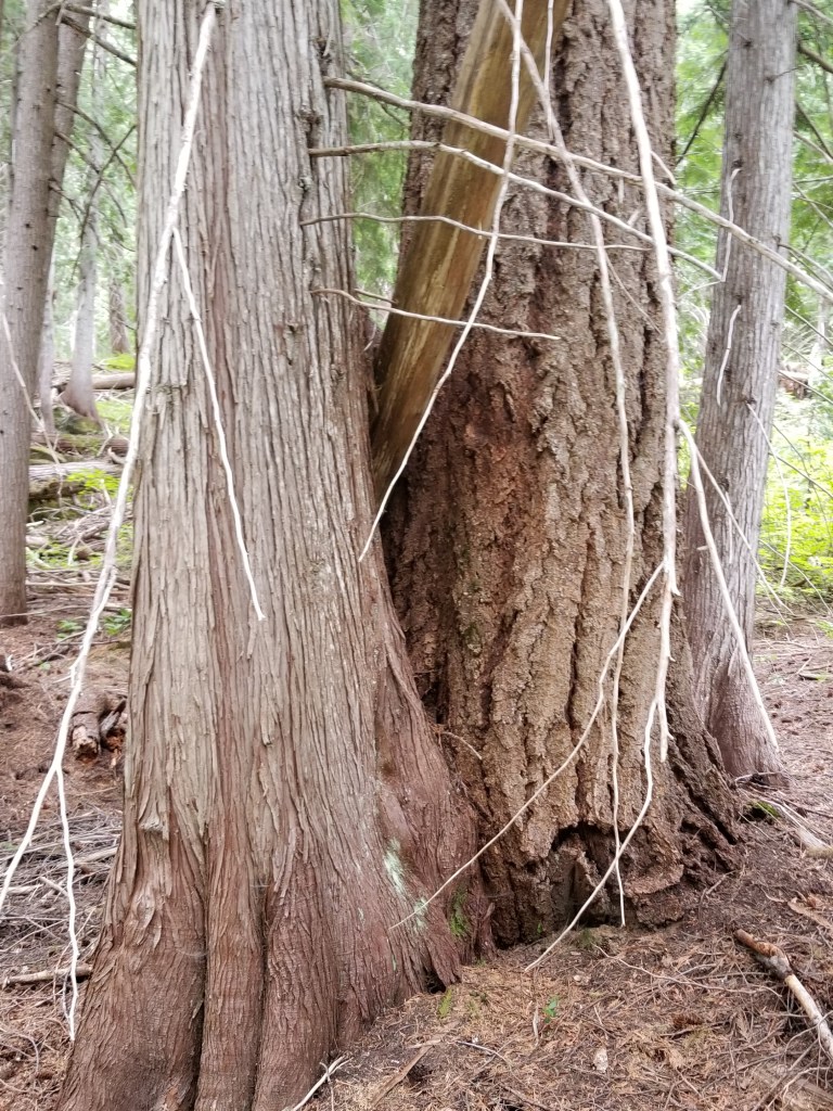
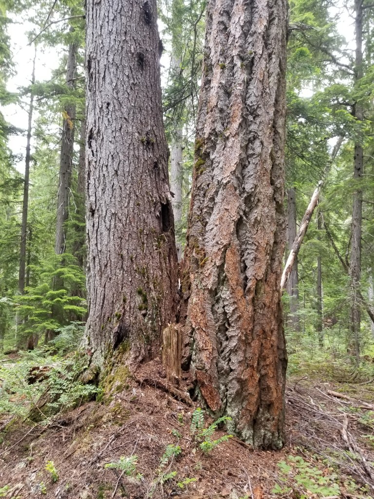
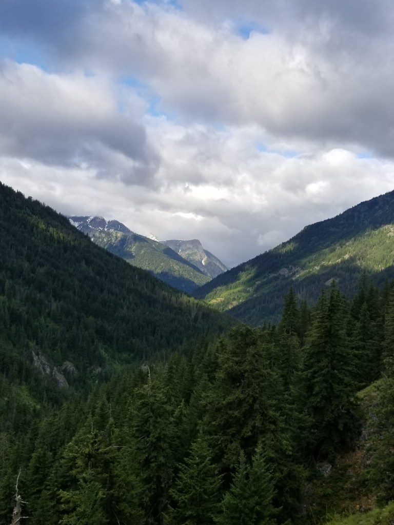
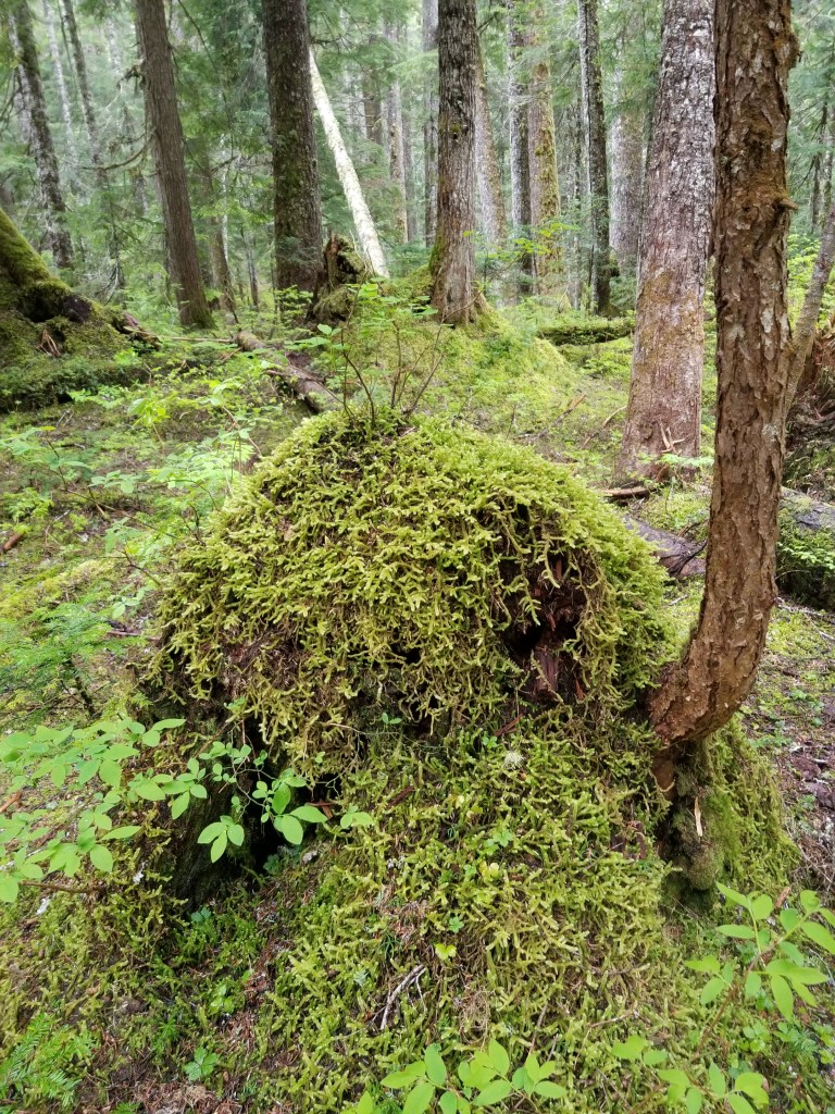
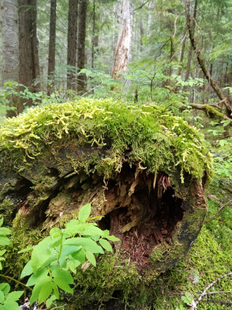
Back on the trail, I enjoyed being down in the heavy forest. There is a subtle feeling of power. Everything is green and there is this feeling of slow growth. Indeed, nature’s desire to create growth is clearly on display. Trees that die are immediately put into service feeding new plants.

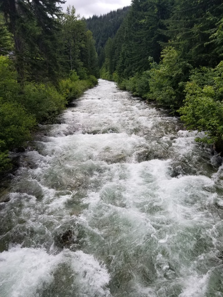
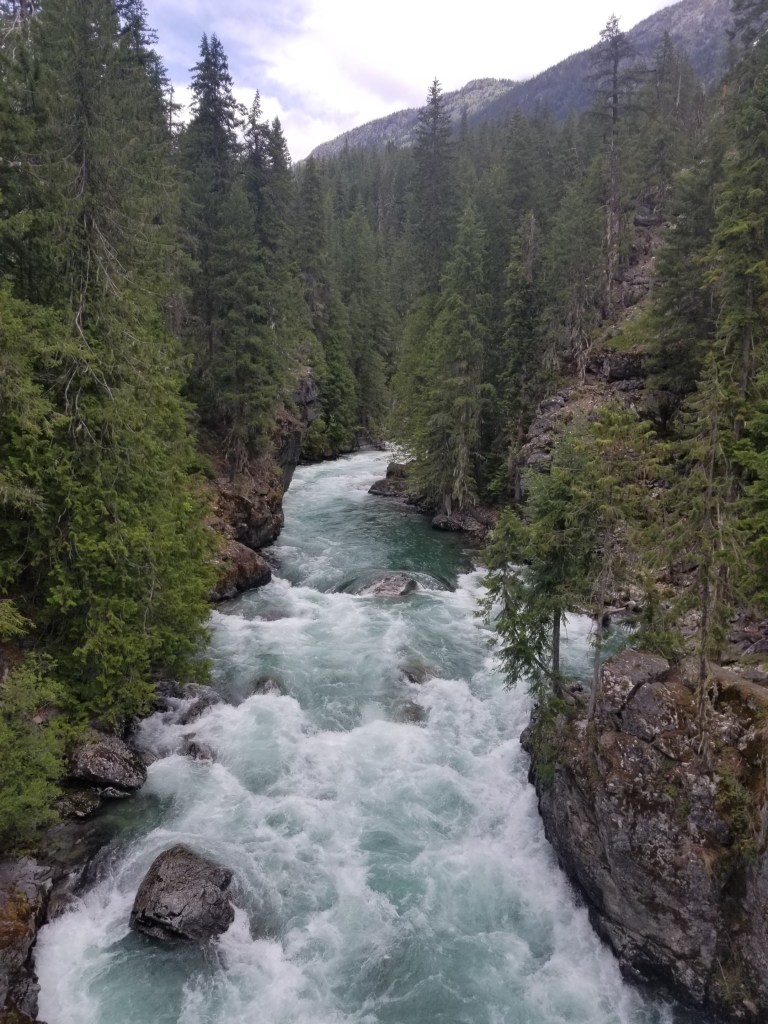
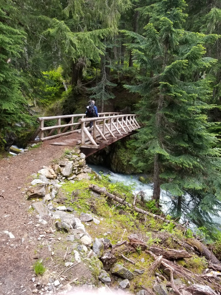
In a possible sign of hope, we crossed a powerful stream on a bridge that was not broken.

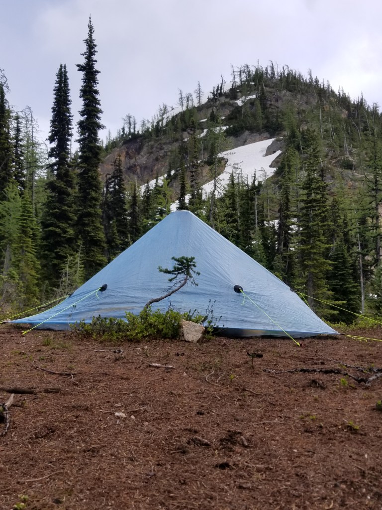
To finish the day we once again went uphill and ended up in the snow. We reached a campsite goal only to discover everything covered. We were tired but stubborn. None of us wanted to go backwards. We each found a small place to pitch our own tents. Our sodden sleeping bags and clothes provided hardly any insulation. I managed to eventually fall asleep to the incongruous sounds of a light drizzle as a snare drum on my tent interrupted by huge drops of water falling off the nearby pines sounding like kettle drums.

Trial by Fire

Day 11. July 6, 2020

I had set my alarm to wake up early. Apparently, I never heard it over the sound of Milk Creek. We all woke up and packed. The sky was cloudy. We knew our day would be a copy of yesterday: switchbacks for breakfast, snow for lunch.

By now, you’ve got a sense of how things have been going. This day, we contended with overcast skies. One of the rewards was reaching Mica Lake. It is a snow-fed lake carved into the stone. Although still mostly covered, it wasn’t hard to magine how beautiful it must be in warmer waether. The second reward was getting over Fire Creek Pass. Towards the top it was very steep.

Mica Lake

It was again slow going down the other side….route finding, traversing slopes. By late afternoon we were still on steep slopes. I had fallen twice. Both times I was able to use the ice ax to self arrest before falling too far. It is scary and exhilarating. I had not fallen previously and it was sobering.

When we approached a small island of trees on the slope, I asked the team if it would be better to stop. We were tired, there was just more dangerous slope ahead, it seemed slightly dangerous. We assed our little island in th snow. Cole and I pushed ourselves into flattish spots under different trees. Josh and Brad decided on using the trail that was clear between two snow banks; it was flat, fairly smooth and wide enough for a sleeping pad. Nobody else was out here so it was not going to be a surprise or inconvenience. We all cowboy camped since there was not enough room to pitch a tent.

We ate and went to sleep in our makeshift campsite. I had used my Garmin satellite device to get a weather forecast: 20% chance of rain. We should be okay cowboy camping. Around midnight it became clear there must’ve been a zero missing from the forecast… it should’ve been a 200% chance of rain. I pulled the fabric of my tent on top of me. Still, cold rain dripped on top of my down sleeping bag and little rivulets ran underneath. I feared Josh and Brad were even worse, exposed on the trail. It was not a good night’s sleep.

Another Day Another Pass

Day 10, July 5, 2020. Suiattle River to Milk Creek.

Once again, we strted out by climbing up through a dark deep forest of huge trees and moss. We overcame the now expected blowdowns, stream crossings, and switchbacks.

We hit snow around 4,800′ at the top of the last switchback. We got lucky on this day because the clouds disappeared and we had perfect temperatures. Cole had been struggling a bit this day. Josh, Bradley, and I trudged up ahead. We knew the drill by now: walk 200 feet, check Guthooks, course correct and go another 200 feet, repeat. I was struggling to keep up with them at the altitude and slope. They could’ve kept cruising knowing that I could follow their steps, but they kept letting me catch up.

We were very near the peak. We stopped at a dry spot for lunch. The views were amazing. It was a nice reward for the hard work.

A dry spot in the snow
Snow on every peak.

Going over the pass was not too steep. However, once we got to the other side, we were in for a doozy of a day. Our first challenge was a steep slope that went in and out of trees. Cole missed a step and quickly flew down about 20′ luckily catching a big log safely. Next, we had to go around a huge “bowl” at the head of a valley that was pure snow. The bowl got steeper towards the end.

We had some slow, dicey snowfields. Cole was often scouting out ahead. Again, he paid the price by slipping and taking a fall. It is such a helpless feeling to watch 100 feet away as a friend goes shooting down a snowy slope straight into trees. I really thought there was going to be some broken bones. He was OK, stopped by trees before he shot off a 75′ drop-off. I think trees are looking out for Cole.

Eventually, we cleared the woods and peered down in to a steep canyon. The maps indicated a steep decline with a huge number of switchbacks. We were down a little bit because we were not even close to one mile per hour in the snow. Now, in addition to the physical challenges and risks of snow, there was a risk of running out of food.

Glad to be out of snow, we trudged down the switchbacks. There was a ton of fresh black bear scat. The plants were chest high. A bear would not see us coming. Gladly, no bears. However, when we got close to the stream in the valley (Milk Creek) it was clearly a raging torrent. I could not see a way for us to ford it safely…we were tired, the water level was at its highest after the sun was melting snow all day, and it was moving. I hoped there was a bridge.

It seemed like for the first time we lucked out. There was a wooden footbridge across the stream. There were no campsites…the valley was too steep and the brush too thick. The only flat spot was the bridge. We cowboy camped on the wooden bridge, hoping the bear(s) did not have a pressing need to cross the bridge at night.

Like the night before, I went to the bed with the sound of a powerful stream as background. This night, however, I did not sleep well, tossing and turning and watching the sky cloud up slowly.

Our First Snowy Pass

Day 9. July 4, 2020. Sitting Bull Mountain to Suiattle River.

We were up early, packing quietly in the gray morning. Apparently Lobster was an experienced backpacker in this area. The warning about the snow and turning back cast a pall.

Within a quarter mile, we had to cross a creek by walking right through it. You may have had mornings with bad hair, lumpy oatmeal, or burnt toast. I would suggest that an even worse way to start your day is to walk through a stream of ice melt, soaking your socks and shoes in preparation for a day of walking in snow. Try it for yourself sometime.

After we climbed above patches of snow, it became continuous. That created two problems: a buried trail and slipping.

While yesterday was marked by fairly easy travel along an obvious trail, snow changes the game. All you see is snow. It is not clear where the trail goes. Fortunately, we have an application (Guthooks) that uses a smart phone’s GPS to provide a location. It displays this over a very precise map of the trail. Thus, a user can travel in the direction the trail should go, and then check the app to see what course corrections, if any, are needed. I call this route finding. It slows things way down because you stop every 250 feet to check. But the alternative is to be off course because you “think” the trail goes one way and then you keep going off course.

The other problem is slipping. Late in the spring, the snowfields have consolidated and compressed from warmer weather and rain. Depending on the air temperature, the snow ranges from firm to sloppy. A regular trail shoe can slip esaily. Thus, we all had a product called “microspikes” that are a collection of about 20 metal teeth connected via metal chain. They slide over our shoes like galoshes. They greatly increase the grip and grab of a footstep. When crossing a snowy slope, using a “kick step” and the spikes makes for slow, but much safer, travel. Plus, we all have ice axes that provide walking support and a life-saving “self-arrest” function, more on that to come later.

My three travel companions from Texas were already skilled in the process of snow travel. They had tried to go north to reach the canadian border. While unable to reach their goal, they gained valuable experince traveling on snow and snowy slopes. Thus, I was glad and confident when they started kicking steps in the snow to lead the way. We made our first pass and were relieved. Later, we had our first mistake of thinking the trail went one direction in the snow. By the time we checked Guthooks, it looked like we were not far off, maybe 300 feet. What that didn’t reflect was there was a 50′ cliff as part of that difference. Eventually we slipped and bushwhacked our way back to where the trail was buried. As we descended, more of the trail would be visible.

Traversing snow

Later in the day, we descended even further. We were hoping to reach campsites where the trail crossed the Suiattle River. Unfortunatley, it was the 4th of July. Our destination was easily accessible to weekend hikers. That is why all the developed campsites were taken. We ended up stealth camping on the shores of the river.

I was tired from the stress of snow, the energy expended crossing snow, and the downhill descent to the River. We were all beat up. Cole had some nasty blisters on his feet. Brad and Josh were a little beat up. We ate our dinners talking about today, planning tomorrow, and thankful we didn’t turn back.

I fell asleep quickly. The Suiattle River rushing by 10′ away blocked out all other sounds and all other thoughts. I was asleep by 9.

Suiattle River

Back on Trail

Day 8, July 3rd. Stehekin to Sitting Bull Mountain

I had met three young backpackers from Texas. They had about the same schedule and the good fortune of meeting a local who was willing to take us to the trail early. Best of all, the local was willing to stop at the bakery on the way to the trail.

Sure enough, at 7:15 John and his wife showed up at the Lodge. They were driving a 1959 pickup with a couple folding chairs in back. The four of us jumped in the back. We stopped at the bakery, launching into a frenzy of buying something for this morning’s breakfast, but also strategically stuffing sandwiches and pastries in our packs. We were planning on six nights to the next spot, Stevens Pass 109 miles away.

I bought a day old sandwich, two ham and cheese croissants, and a loaf of sourdough bread. John had refused payment for giving us an 11 mile ride to the trailhead. However, we had coaxed out of him that he and his wife the bread was their favorite thing at the bakery. So I bought a loaf, snuck out and put it in the cab of their pickup. The other guys were in cahoots.

We piled in to the back of the pickup. John’s wife asked who’s bread it was. We all played dumb or confused and she eventually figured out the quid pro quo.

It was a chilly ride. But a chilly ride beats a slow road walk. By 9:00 we disgorged from the truck at High Bridge. The locals were kind enough to take a photo of the four of us.

Moi, Josh, Cole, Brad

I would be hiking with Josh, Cole, and Bradley. They were young (early 20’s), enthusiatic, and down to earth. Selfishly, they were tall. This meant that I could have them hike in front of me to clear out spider webs.

The day’s hike would start low at 1,625′. We were hoping to get past our first high pass called Suiattle. we were hoping for about 17 miles.

Starting out, the trail was obvious. While there were sometimes trees down across the trail (“blowdowns”), the traveling was easy. While we rose gradually along Agnes creek, the forest was often filled with old trees providing cover. One unusual feature I noticed was for two different species of trees to grow right next to each other. I couldn’t figure out is there was some strange biological benefit or if this was nature’s display of long term stubbornness, one species refusing to budge for the other.

“I was here first….”

I forgot that traveling in a group has drawbacks. For example, a single hiker passing a hornet’s nest will get them to sound the alarm. The second hiker will definitely get the hornets excited. Thus, the 3rd and 4th hikers are the victims of the hornets being riled up. Bradley and I each got stung twice as we trailed the other two.

Overcast and cool, our hiking would switch between gradual climbs in forests to steeper switchbacks in open areas. The open area trails were slightly overgrown but provided views.

Thick vegetation in the open areas.

The flowers are just starting to peak.

Late in the day, as we were climbing to the approach for Suiattle Pass, we encountered just a few patches of snow. Then, we ran into Drew and Lobster. They were heading back to Stehekin. They said the snow was too dangerous. Neither had microspikes or an ice axe. We thanked them for their advice.

We chose to see for ourselves. Personally, I had already bailed from snow once and did not want to do it again. My trail buddies also wanted to take a look before turning around. We knew we were too late in the day to try the pass. We found a designated campsite, dropped our bags, and wandered up to take a look at the pass. Yes, there was snow. Yes, it was continuous above a certain elevation. No, we weren’t going to quit.

We found a way to get 4 tents into a three person site. We set up camp and ate. Around 6:00, I looked over, and all three of them had disappeared into their tents. The woods were wet from rain and snow melt. It was overcast, in the low 40s and felt like drizzle on the way. I tried building a small fire to warm things up. It was too much effort with the damp wood. Worried about tomorrow’s snow crossing, I crawled into my sleeping bag around 8.

Days 6 & 7: Tweakin’ in Stehekin

July 1 & 2, 2020 zero day in Stehekin

Stehekin is a fascinating place. So many contradictions. You cannot drive here, but there are many cars and about 20 miles of roads. There are some gorgeous lakeside cabins that rich Seattleites must shell out big money to own and maintain. There are also many homes that are dumps or in construction purgatory.

The cars are a trip. Since there is no law enforcement, owners feel no obligation to pay their tags. The oldest I saw was 2002. As a consequence, whimsies such as safety are also given short shrift. For example, passenger side doors are less common than you would think. Whether the door disappeared through passenger ejection, neglect, or simply a compelling Ebay bid is hard to figure. Inevitably, when the remnants of the vehicle cannot run and the costs of repair or recycle are too high, vehicles are just sort of left to decompose. Like a radioactive-free Chernobyl, rusting hulks dot the landscape here and there.

911 what’s your emergency?

Still, the area’s appeal is immediate. You are in a remote, isolated mountain community. A beautiful lake, stunning river, rich soil, clean air, mild weather. I saw some homesteads with thoughtful crops, orchards, modest husbandry, and a complete sense of being self-sufficient. Additionally, I saw some cabins that would be at home on Lake Como, screaming out “cozy” to the world.

Red geraniums?

There are also homes where I “get it” and see that somebody thought this would be their nirvana. But they didn’t think through the cash flow. Or the cost of getting to and from. So you see the “starter” home and the “cabin” that was supposed to be rented out on Airbnb to pay for completing the starter home but didn’t work out.

There is a great bakery. What a joy for backpackers. I wonder how they recruit and retain employees? In addition, the garden is stunning. The overall vibe is the bakery is nurturing and comforting in it’s place.

The lodge is a let down. I was hoping for something like the grand old destination lodges, but it is a serviceable collection of cabins, motel rooms, and duplexes. The restaurant was takeout only due to covid. Overall, the feeling was “outsourced concessions” brought to you by the government. Beautiful setting, nice people trying hard, but it ended up feeling like chateaubriand with velveeta and ketchup.

Looking north
Looking south

There were many backpackers getting off and on the ferries and at the lodge a few were definite SoBo PCTers. I came across a great bunch of guys from Texas that I saw on the trail…me heading back, them charging forward.

Zero days are weird. They are supposed to be about recovery (muscles, bones, mind) and replenishment (nutrition and family via electronics). But this early, it feels like too much. I’m antsy, edgy. The first morning I woke up early and went for a run. Think about it. On my day “off” from a 2,650 walk, I was stir crazy and went for a run.

The only fun thing has been the scars on my legs. Quite a conversation starter! There are a few mothers with small children that see my scabbed and scarred legs. They tend to grab their children and move them briskly away from me as though I am a leper. I really wish I had a few alka seltzer tabs I could put in my mouth to start foaming and chase them. After all, the sheriff is a Ferry ride away.

I head out tomorrow morning. The Texas guys found a local willing to drive us to the trailhead early. It will be 6 days on the trail. No blog or instagram updates. Just a 100+ miles to a road juncture leading to Skykomish. I am looking forward to finally stringing together some full length days. I will also look forward to updating this blog!

Day 5: Streakin’ to Stehekin

June 30, 2020

Six Mile camp to High Bridge camp

I woke up at 5 and my neighbor had left already. I knew I had a short day ahead of me, so I was in no rush. If you sleep near a stream you are more likely to wake up with condensation. There was a little, but it dried quickly.

While packing up, a deer entered camp. It was not shy and knew exactly what it was doing. It was looking for places where people peed. The salt residue is what it was after. Within 30 seconds it located my 3:00 am call of nature.

Oh deer

Another good day for hiking. Mix of clouds and sun. These north Cascades are characterized by steep, v-shaped valleys. The overwhelming impression is that water and gravity dominate. That is, there are lush forests and meadows, but they seem to live only because avalanches, landslides, and mudslides let them be.

Steep valleys

The rivers are fast, cold, and beautiful.

During my hike, I talked with two people. The first was a Park Service employee who had just finished building a wood bridge across a creek. She was a young person and maybe topped 100 pounds if she was carrying a 10 lb sack of flour. But I wouldn’t want get on her bad side judging by the size of logs she was moving around. She said the backcountry crews work 8 days in a row on their shifts.

Later, I came up to my neighbor from the night before. He was struggling a little bit. I could’ve just passed him, but it didn’t seem right. So we hiked along together. I asked questions, he always asked me to repeat myself. It became apparent to me he was losing his hearing. Then it occurred to me that maybe somebody hard of hearing doesnt ask questions about others simply because they may not hear/ understand the answers. I was too quick to judge my neighbor.

I ended the day way too early. My reservations in Stehekin were the next two days. I stayed in a free campground that I had to myself. There was a three sided lean-to originally built by the CCC 90 years ago.

90 year old structure built by CCC
Stehekin River

Day 4, Redemption and Return

June 29,2020. Rainy Pass to Six Mile Camp.

The weather improved overnight. So did my mood. Helen had confirmed my next resupply location was open. My Dad would drive me to where the PCT crossed highway 20, about 15 miles on the trail from where I bailed. Someday I will have to come back and complete the Rainy Pass-to-Canada section. Until then, the southbound trip continues.

A reader would reasonably question why I wouldn’t expect another sketchy high pass. Looking at the maps, I won’t hit another 6,500′ pass for a couple hundred miles. So, all systems go.

We stopped at a little tourist town called Mazama. I got a water filter and hat. To be candid, I also got a coffee, ham sandwich, and chocolate croissant. Hiker hunger was kicking in.

My Dad dropped me off at Rainy Pass. The sun was out. We said goodbye, I crossed the highway and started hiking the PCT again, refreshed, rededicated, and even more determined. It only took me 15 minutes to realize I had started hiking north, the wrong way.

I had only a short day of hiking. I originally planned to take a zero day at the lodge in Stehekin. Since I didn’t have as far to go as I had thought, it was two easy days.

I reached Six Mile Camp after, well, six miles. I passed one couple backpacking, but other than that solitude. Trails crews had been through and there were no blow downs. Great flowers again and wonderful.mountain views.

The campsite was about a quarter mile down from the trail. About six tent sites next to a stream. There was a designated food area with a bear box. (A bear box is simply a large metal cabinet requiring modest dexterity to open.) I chose the tent site farthest away from the bear box.

A white sticky upus

As I started my cold soaked dinner of polenta, mushrooms, butter, another backpacker came in. “Not many tentsites” he exclaimed. I wasn’t sure whether 10 or 30 would’ve made him happy. He quietly pitched his tent, ate, and did other chores.

I went back over to the food area and ate my dinner, silently giving thanks to Trader Joe’s Umami seasoning. My new neighbor came out to chat. Since he never asked a question about me, I quickly learned he had hiked over 1,200 miles, then had hip replacement surgery, and was now taking a test hike. He was 65, a little grouchy, and soon went to bed.

I was also soon to bed. With the sound of the creek as a backdrop I eventually dozed off.

Day 3: Houston, We Have a Problem.

June 28, 2020. Granite Pass back to the damn beginning.

Rain, ice, snow intermixed all night. Not good because the existing steep snowfield has gained more liquid weight. My two risks are 1)sliding downhill fast with a backpack; and 2) avalanche.

I figure I can manage the first risk. I have microspikes for my feet and an ice axe. If you’ve never seen it, the process involves kicking in a horizontal footstep, poking the axe in the snow uphill, and then kicking in the next horizontal step. I’m pretty sure I could self-arrest. Just not sure how far down I would go and, if I’m honest, whether I’d have confidence to move again.

The second risk is out of my control. When a cornice or sheet of snow decides to give is a decision made by science and God, neither of which I fully understand.

It was cold, snowing and I was by myself. I felt like the risk was too great. My Dad was still in the state, so maybe he could pick me up where I started and I could try a different point to continue hiking. I sent him a satellite text saying I was bailing. I packed up and, tail between my legs, headed back the way I came.

Astute readers may recall this course of action would require me to go back through Satan’s trail. I was not happy, but without alternatives, it had to be. The one difference was the weather. Because of the continued rain, the brush and scree would be wet. Also because of the continued rain, I was still wearing my base layer leggings with my wind pants on top. Maybe my scarred legs would fare better.

My strategy was to stay uphill on the scree as long as possible. To make a long story short I did go a little faster and my legs were not scratched as much. However, the trail did take its toll by relieving me of my hat, water filter, and water bottle at different times. Glancing back up the valley at the continued tempest, I knew I made the right call.

That stream crossing at the missing was slightly more difficult late on a rainy day. The rain and snow melt raised the level of the icy water. Once I was safely across I made great time down to find my Dad in his 1990 VW Westfalia van. The 20 mile bail out from 6,000′ to 2,500′ was over.

Day Two: The Real PCT

I managed to sleep without muscle cramps. I woke up about 4 with the first bird sounds. During the night I acquired a neighbor so I tried to be quiet.

Moving by 5:30, my legs got immediately soaked. It had drizzled overnight and plants naturally reach out and scoop up as much rain as possible. With the Covid 19 constraints, very little trail maintenance has occurred. Whether swishing between water laden branches across the path or ungracefully dragging my butt over blown down trees, I was soaked all morning. I wore my wind pants to protect my wounds.

The flowers are absolutely beautiful. I know the names of some (Columbine, fireweed, lupine). Others I make up names : blueous flowerus, stinky white, purple frittata.

Most of the day was walking up. After the flower fields, dark,wet forests. Then, around 5,000 feet, snow. Patches at first, then bigger patches, and near 6000feet just snow.

On the way up, I passed one guy coming down and then two dudes. The first guy said Cutthroat Pass (2nd pass ahead) was too dangerous and he was bailing. The two dudes were mountaineers. They had just come down from one 7,000′ peak and were going to bag another the next day. They said conditions were perfect and Cutthroat Pass should be a snap, although they hadn’t climbed it this year. Hmmmm.

Cresting the first pass (Methow Pass) was gorgeous. Snow capped peaks, mountains all around. The trail went across the side of one mountain and, fortunately, it was south-facing so was free of snow, mostly. I reached a flat spot just before Cutthroat Pass. It seemed too late and too many miles for me to attempt a crossing. This crossing would involve a very steep snowfield, portions of which had cornices menacing above. I went to bed early thinking I would make a decision to bail or cross in the morning.

Mi casa

At 6:00 it started to drizzle. The wind picked. And I headed for my sleeping bag. The temperature dropped so I ended up putting on my down jacket in addition to being in the sleeping bag. As I dozed off, the drizzle turned to ice pellets.