Windigo Pass and Thunder Storm

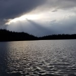
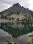
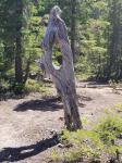
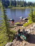
After exterminating the mosquitoes that snuck into my tent before I zipped it up, I stared at the ceiling. No wind, no sound. The worst conditions for falling asleep in the woods. Then, from across the lake, a wood chop. Just one. I had not seen anybody else on the lake. There was no trail. I mean, it was Hidden Lake after all. I laid there waiting for another. Nothing. Just my imagination. Then, another wood chop. I still don’t know what the sound was or how it happened. Drove me nuts for a couple hours. Finally fell asleep.

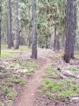
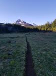
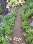
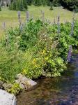
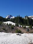
Most of the day was meandering around ponds. Later, it was level hiking on a hillside. It was strange how the trees grew. Out and then up. My best guess was winter snows each year forced them to grow downhill until they were strong enough to hold their own.

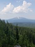
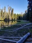
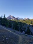
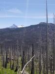
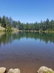
Midday I could see a plume of smoke from a forest fire. There was a helicopter circling. I was afraid they were going to close the PCT so I hustled along Summit Lake to get in to deeper forest. I n some distorted way of thinking it would be harder for them to pull me out than it would be to prevent me from entering.

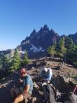
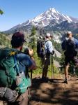
All afternoon thunder heads were slowly building. The Cascade mountains create perfect updrafts. The trail also rose. I had reached a two mile stretch along a ridge near Cowhorn Mountain. The longer I went, the more menacing the clouds. I started hearing cloud-to-cloud lightning. I started jogging to get down to a lower level. I made a video. Just after I finished, I came across a northbounder. I asked him if he thought he could make the two miles. "No problem. "

I was no longer on the ridge. Still, I hurried because I wanted to reach my goal and get my tent set up before any possible storm. At Windigo Pass, there was an amazing set-up. A local had supplied several 5 gallon jugs of water. Plus, there was hand sanitizer, a solar charger, insect repellent, bandages, ibuprofen, etc. I took water and some insect repellent wipes. Then, the thunder grew louder.

I packed up and hoped to get in a couple miles. I got a couple feet. First rain, so I put on my rain gear. Then the lightning and then hail. I got under a large spruce. Being from the midwest, I expected the storm to blow through. We typically experience a cold dry front ramming into a wet, humid front and the storms just move along. Not here. The mountains effectively acted as a conveyer belt shooting hot air up and providing energy to a storm that just sits there.

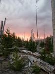
I finally gave in and pitched my tent. I ate my dinner during a downpour of rain and hail that was interrupted with occasional flashes and booms. After about two hours, the sun dropped and took away the energy the storm needed. Helen was super helpful because she could look at radar and tell me what was happening via satellite.

The forest smelled great and made a strange symphony with different sized water drops falling on different surfaces. It was muggy inside my tent, but a peaceful place to sleep after a tense afternoon.

Smoke, Ski Huts, Trail Magic, & Finding Hidden Lake

Day 32. July 27.

When I woke up I could smell smoke. I sent a satellite text to Helen to see if she could find anything. Nothing too close.

It was nice mature forests in the morning. To me, walking in a mature forest of large trees feels like being in a cathedral.

I was out of water and stopped at Charlton Lake. The sun poked through the clouds and smoke, hinting at nice weather.

Next was a huge steady climb.I was getting in a little better shape, but I had to stop several times. This was almost two miles of incline.

Near the top, a local cross country ski club has built and maintains a log hut. With winter use in mind, it had a woodburning stove and a sleeping loft accessible by stairs. Glad to have reached the top of the hill, I looked around and signed the guest book before leaving. I never sleep in these type of wooden shelters. There are always mice.

What comes after a long, difficult climb? A long, difficult descent of course. Actually it wasn’t so bad. At first it was actually pretty nice rolling slightly up and down along the forested ridge. Then it began with a few great views and a series of switchbacks.

A few different sets of trail runners passed me. I had difficulty walking up this route and they were running. And talking while they were running!

I dropped down to Rosary Lakes. Pretty, clear lakes with quite a few campers, it looked like about a six mile uphill hike for them to reach the lakes.

At the botTom of the descent I came out by a big gravel / sand barn for the highway. There was an electrical outlet on the outside so I took a few minutes to charge my electronics.

I crossed a highway to begin climbing up into a lake area. A former PCT hiker had left some beers as a gift for current hikers. It is often called "trail magic" when somebody provides an unexpected gift or treat. I grabbed a beer to have with dinner.

Mosquitoes were now a persistent nuisance. When I stopped I had to put on my head net and my wind gear to cover exposed areas.

Near 7:30 I found a spot I considered ideal. It was near the trail, but not visible. On the shore of a nice lake I made camp, ate, and enjoyed my trail magic. It gave me a chance to try and figure out why somebody names a place Hidden Lake. If it is named and on a map, how"hidden" can it be?

Leave No Trace

Day 31. July 26.

Was still a little full when I woke up. I could tell it was going to be a warm day.

Most of the day was spacious forest. I ran into several northbound PCT hikers and a group of local woman who had tons of questions about through hiking.

Every time I stopped to get water I was swarmed by mosquitoes. The imperfect solution I had was to use individual wipes that were 30% DEET. They were strong enough to deter mosquitoes, but not so strong they ruined synthetics or caused crippling pain if sweat dripped into my eyes. However, sweat was exactly the factor which caused effectiveness to fade.

The end of the day unfortunately combined a burn area with an uphill climb. It was hot and challenging getting over and around the dead trees. I think the burn was relatively recent as there was no greenery.

I navigate with a phone app called Guthook. To save battery, it uses the phone’s location that works in airplane mode. It lays my location over a detailed map showing the trail, tent sites, water sources, among much else.

Once I reached the top of the hill, the burn area was just about finished. It was late and I needed a tent site. Guthook indicated there were four tent sites nearby that the people who maintain the trail had created. These were innovative sites developed with the "Leave No Trace" (LNT) approach. LNT is supposed to result in backpackers leaving no evidence they were in the woods. In addition to packing out all garbage, LNT practices would leave no sign of a tent.

I searched for 30 minutes, constantly checking Guthook. I could not find any of the four LNT sites. The irony was perfect: you can’t find the LNT sites because there is no trace. So, I finally just settled for a flat spot. I made a mental note for the morning to leave a big trace so other campers could re-use my spot.

Challenges

Hello reader. Someday, hopefully, readers.

Just an explanation. I am actually in Truckee California today about to get back on the trail. I had to skip about a 90 mile section due to fire closures. My blog, unfortunately, still has me in the middle of Oregon in July.

Why? Well, I have three devices that use energy. My smartphone, I believe it is a Samsung 1. This serves as a blog writing tool, camera, and map. I also have a satellite device over which I can transmit text without cell phone service, it tracks me, and, finally, has an SOS function if needed. Lastly, I have an MP3 player on which I have some audio books and which I can sometimes use to pick up random radio stations.

All require electricity, but my battery power has been limited. I can go four days easily. Five days and I have to be careful. Six days, and I have to shut off devices. In my view, the priority is the satellite device (SOS and ability to always text), next is the phone (map & route finding, but no photos), and I don’t use the MP3.

So, besides being wiped out when I reach camp at night, I have had to be parsimonious writing blog entries.

And don’t get me started on WordPress changing their application mid-trip! Now, I have to submit entries via email and can only attach photos at the end without a description.

The good news is that Helen sent me a much more powerful battery. Now, I plan to catch up on blog entries and try to stay current.

Also, I have enabled a link to my Instagram account. It should appear on the right hand side. You can click on the photos and hopefully see the banter I sometimes attach. That tends to be a fairly current snapshot.

I apologize for the gaps. I should catch up and make this feel like timely rather than an old man reminiscing about days gone by. I appreciate your patience.

Obsidian to Elk

Day 31. July 25.

I woke up in a pretty good mood, my feet slightly sore from the lava rock. It was chilly.

Hiking by 6AM. I enjoy hiking in the early morning hours as night creatures settle down and day creatures wake up.

I climbed a good sized hill as the sun was rising. I could see smoke in the air. Summer in the west is about forest fires and it looked like the season was starting.

Next, I dropped down into a meadow. It was cold and dewy. Off to the side, something red caught my eye. It was a deflated mylar balloon. One of my pet peeves is people buying these helium filled beasts and then letting them go outside. I have done this myself when I was younger. But backpacking has shown me how ugly it is to find these in remote natural settings.

After a wonderful walk through a lupine-filled forest, I popped out to Obsidian Limited Entry Area, an area protected because of its fragility and rarity. I could see why. On top of wonderful springs and creeks, there were amazing outcroppings of obsidian, a shiny black stone. My ineptitude with a camera kept me from capturing the full beauty, but if you can imagine walking through an area with sparkling black stones all around you would have a feel for it.

I ended with a walk past a waterfall, Obsidian Falls, which was great, especially as the temperature was going up.

The rest of the day was spent going through forests and meadows. I met a lot of weekend hikers. Apparently there were many good loop hikes in the area. I also saw a few trail runners.

One meadow I came to had a wonderful creek. Waves of flowers crowding the banks. Wonderful cold water I couldn’t wait to drink. Some weekend hikers came along and their dog, not on a leash, walked in to the creek upstream and laid down while I was getting water. No apologies. No efforts to stop it. I waited to see if they were going to get water so I could go upstream and lay in the creek.

I ended the day with a race. I saw that there was a resort with a restaurant about a mile off trail. Via satellite Helen was able to tell me when they closed for dinner. Despite the pack weight, I made good time. I found a site just before the trailhead, pitched my tent, hung my food, grabbed my Platypus 2 liter bag, and made quick time to the Elk Lake Resort. There was a band playing, small serving sizes with big prices, and a great view. The server was helpful and charged my batteries and filled my water bag.

I got back to my tent and fell asleep right away. 26 miles and a full belly can do that.

Three Sisters Without Three Brothers

Day 30. July 24.

I walked to the Shuttle Oregon starting point. It was a modern van with one other passenger and a great driver. We stopped in Sisters to pick up another passenger and within an hour, we arrived at the trailhead. I chugged a couple bottles of water and grabbed some fruit the Shuttle offered. The van left. I was alone. It felt wrong to be hiking without my three trail brothers, but I put on my heavy pack and headed towards Three Sisters.

As the day warmed up, the trail started off meandering around forested areas. There was a water source at a religious youth camp. It was closed for remodeling, making the most out of the covid situation. Hiking along the dirt road leading to the camp, a man in a camp chair outside a camper yelled out to me "This road dead ends!" He was trying to be helpful, but it only ended for motorized vehicles.

Getting water from a hose at an empty youth camp felt eerie. I called out several times but heard nothing. I saw cars. No people.

Furthering the sense of apocalypse was a stretch of burned forest.

The real show was about to begin. I entered a huge field of lava rock. The trail had been chiseled through the sharp, rough lava. Sometimes the trail was boot-sized chunks of lava rock, sometimes smaller sized. Lava rock is challenging to walk on because of the odd shapes and sharp texture. On a hot cloudless day, it definitely had an other-worldly feel.

By the end of the day islands of trees started appearing. This broke up some of the drudgery and lifted my hopes of finding a tentsite.

I crossed a two lane highway. Some well-meaning person had made a sign showing the mileage from that point to both Mexico and Canada. While the craftsman with a big heart had great intentions, their compass skills were wanting….the sign was posted backwards pointing north to Mexico and south to Canada.

Near sunset, I found a level spot between two large sharp lava rocks. A nice cooling breeze kicked in as I ate my dinner and watched the world darken. I had hiked almost 20 miles. I had passed about 10 northbound hikers and one southbounder. I felt good and I felt tired.

Extra Days in Bend

Days 28 and 29.

I had to spend an extra day in Bend, Oregon. It was my own damn fault. I created a negative feedback loop with the postal service.

To shorten the sad story, I used the wrong post office address for general delivery. They were not the designated general delivery post office. So main PO would get package and send it to branch PO near me. Branch near me saw "General Delivery" and returned it to main PO. Repeat.

Still I got to explore Bend. It is a large sprawling city. Pretty bad land use planning. About every third car had California plates. Talking to locals, it appears the Bend real estate market is incredibly hot for two reasons. First, covid 19 has made people realize a lot of work can be done remotely. Second, localized factors make people want to leave their homes in nearby Portland (civil unrest) or adjacent California (fiscal cliff-diving) to come to a temperate, 4 season area with 300 days of sunshine and skiing and fishing and tons of other outdoor activities. Bend is beautiful, but it is clearly getting californicated.

A real life example. I was in downtown. At a clearly marked crosswalk (big white stripes, flashing light) I started across. A car with California plates rolled through a stop sign and almost hit me. He honked. I pointed to the sign and told him "I am in a crosswalk." Quickly scouring his brain for an intelligent response, the best he could come up with was flipping me off and speeding away, presumably to gather with other cretins.

Like any urban area on the west coast, there’s a fair amount of obvious homelessness.

Bend had a pretty good library, a few museums (closed) and some nice older neghborhoods. I even found an amazing food truck, the Tin Pig, that made the best chicken sandwich I have ever eaten.

I think if I were to move to Bend I might look into one of the older homes and avoid the planned communities, with their faux log cabins and million dollar homes. I definitely want a signed crosswalk.

Back to business, I resupplied. I also found a shuttle, Shuttle Oregon, that would take me from Bend to the exact spot I left the trail, Santiam Pass, for $20. I also went to the grocery store again and bought too much cruddy food. I’m sure my pack weighed over 40 pounds.

I was set to hit the trail. Next up: Three Sisters Wilderness.

Dufur to Done

Day 26. July 20.

Spirits were high in the morning. We had 20 + miles, but it was our last full day.

Since our camp last night was dry (not near water), the first order of business was to get water. We also found a few vistas with cell service. This was great for Brad, Cole, and Josh as they finalized plans to get home. It was a little awkward for me since I had no plans.

Before the day got too hot, we reached our last pass near Mt. Jefferson. We. took some photos and prepared for a hot, bug filled day.

It was standard fare for the most part: some burn areas, nice forests, Rockpile Lake for a quick dip, and then a grind to a late day highlight: Three Fingered Jack. I was beat and falling further behind. The other three guys seemed to fly up the switchbacks and reached the crest. They waited for me. We knew where our final campsite was, so they didn’t have to wait. At the time I thought it was pretty classy. However, now I’m not so sure they didn’t have some kind of wager on whether this would be the pass where I died. They pretended to be glad when I made it to the top. Alive.

As Josh said, "it was all downhill from here." Still, it was worth appreciating the way the setting sun moved the shadows around on the mountain.

We did fly down. At our final camp, the mosquitoes seemed to sense the future decline in their food supply. We ate with headnets and smelled of Deet.

Bend

Day 27. July 21.

Brad, Josh, and I were up on time, quietly packing. Cole was stirring. I had stayed up a little late. Up there with dripping faucets and a dog barking in the distance, one of the most annoying nighttime sounds is a mosquito in your tent. I had to dispatch a few of these stowaways before I could sleep.

We had a short four mile hike to the trailhead at Santiam Pass. It was all downhill and most went through a burn area. At the trailhead we cleaned up a bit so that Carolyn, the lady picking us up, wouldn’t be scared. I took a good look at the mountains I would be passing when I returned to trail: Mt. Washington and the Three Sisters.

The 30 minute ride into town was a breeze. I was amazed all our stuff fit. We offered to buy Carolyn a can of Febreze.

We were early to the hotel. We dropped our bags and went on a search and destroy mission for breakfast. We found an incredible restaurant. It was Portuguese and only served breakfast and lunch. All of us downed two entrees apiece; the food was that good and we were that hungry.

After brunch and checking in, the only chores were to ship some things home (ice axe and microspikes for me) and buying a few odds and ends. It was hot in Bend and we were glad to be off trail. We also ran in to the Washington couple; they had reached Bend the day before.

Later, we went out for our last dinner. All three had super early flights. They were nice enough and paid for my dinner. If I had known, I would’ve got dessert. We said our good byes in the lobby and parted ways.

I have never hiked with a group before. I’ll admit I was pretty skeptical at the start. They were younger than me (about the age of my oldest daughter) and seemed to be good friends. I was pretty sure we would part ways that first day given the age difference.

But these guys ended up being a great group. They were fun, funny, positive and hard-working. When we were nearing the steepest part of one of the snowy passes in Washington, I had what must’ve been a panic attack. It was extremely steep. I was last of the four kicking steps in the wall of snow. We were in our unofficial order of Brad breaking trail, Josh navigating, Cole kicking in deeper footholds and me offering useless advice. Clouds had rolled in, limiting visibility to 30 feet. I looked down the steep slope and just saw it disappear. Out of nowhere my mind started saying "I’m going to fall. I’m going to fall." I turned and faced the snowy slope. It wasn’t deep breaths or happy self-talk that pulled me out. It was the steady kick -scrape -scrape-stab ice axe into snow. It was just the comfortable sound of our small team fighting our way over Washington’s snowy passes. It was going to be fine.

I will always remember how Brad was always optimistic and ready to take the lead. His honesty and good nature should serve him well in life. Likewise, in addition to learning about what kind of things Cole was willing to do to become an Eagle scout, I enjoyed seeing him overcome some major obstacles (legendary blisters) and hope he pursues his dreams. Josh is a great guy and will be a great man. Creative, thoughtful, and willing to learn he has a bright future ahead of him and the world will be the better for it.

I started out thinking I was going to ditch (or be ditched by) a group of young guys. I ended up having to say goodbye to three brothers.

Brietenbush to “Dufur” Day 25. July 19.

(Note: WordPress, my blog’s platform, detected that I was able to use it flawlessly. Immediately upon this discovery they implemented several key changes to make sure I could no longer enjoy the product I paid for. I am trying this workaround until I can get a PhD in computer science. )

I was groggy getting up, but the temporary absence of mosquitoes made things better. So, too, did the nearby pit toilet, a true luxury.

Exhibiting the flawless teamwork rarely seen outside a NASCAR pit crew, we packed up and were within 30 minutes of our targeted start time.

We spent most of the day going around the western and southern sides of Mt. Jefferson. There were a few snow fields to conquer, but nothing that required an ice axe.

As the day heated up, we slogged through a relatively recent burn area. One interesting sight was where an avalanche had pushed rocks and dead trees across the trail and 30′ up a side slope.

At the peak of the heat, Brad came across a small mountain pond. Without hesitation, he dropped his pack, got down to his shorts and went in to the little lake. It didn’t take Cole and Josh long to get the idea. The little oasis had vegetation and a persistent group of swallows that would do their acrobatics. Quite a contrast to the gray and brown of the surrounding burnt forest.

The late afternoon and evening had us doing another long climb, starting at Milk Creek. I regretted not tanking up on more water. After a few hours of switchbacks I was out of water and thirsty. Finally, we crossed a tiny but cold trickle and that was perfect.

Brad and Josh cruised ahead while Cole and I plodded. Close to sunset, Josh and Brad had scouted out a great tent site not listed on the maps. It reminded me of the story I heard about how the Oregon town of Dufur (pronounced "dew fur") got its name. Supposedly some pioneers on a wagon train stopped on the eastern side of the Cascades en route to the lush, deep-soiled Willamette Valley. One of the pioneers asked the leader why they were stopped. Allegedly, the leader said "This’ll do for now" and thus the name.

It was a great campsite, everybody was tired but happy. Except for the bugs, we would’ve cowboy camped. To his credit, Josh did get up in the middle of the night and took some great photos of the stars.