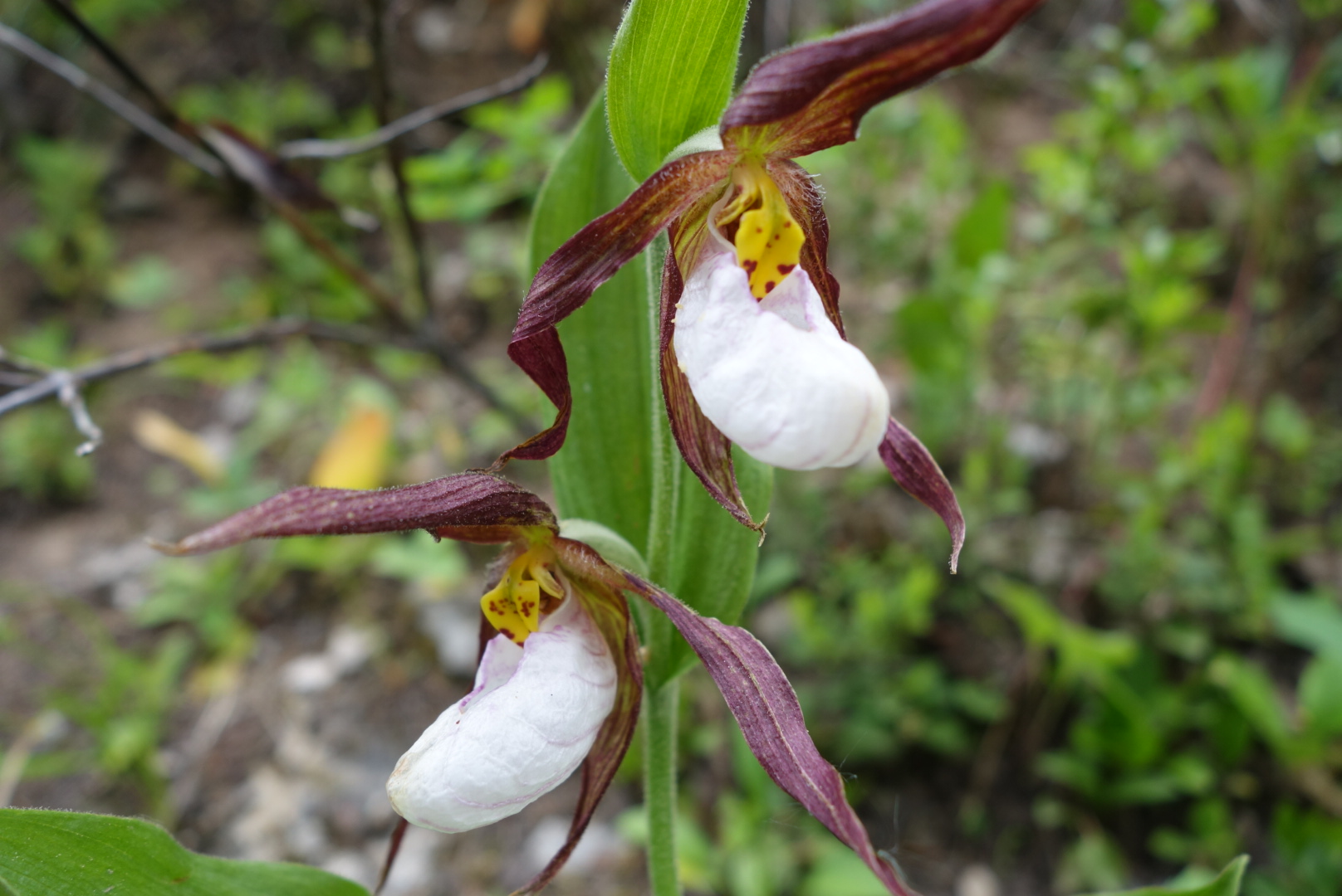
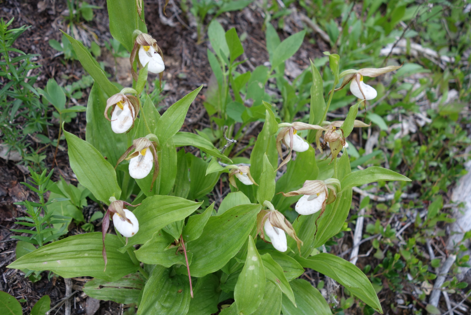
Montana Rain

(Friday June 24)

I use a Delorme inReach product.  It has a weather forecast feature.  We awoke to sunny skies.  We all made fun of the “forecast” which called for rain at 7:00 am, but within an hour it was a full throttled thunderstorm.  But that was OK.  That is because we were heading to the famous Chinese Wall and the sounds of thunder echoing off the wall were going to be amazing.

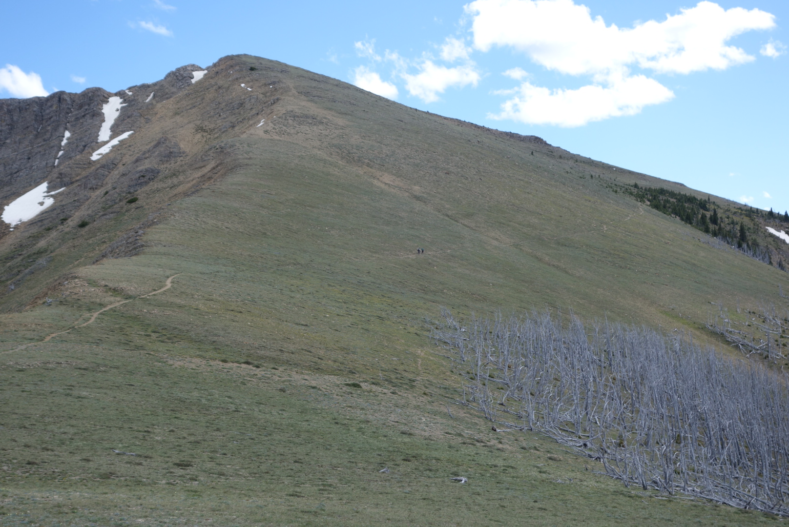
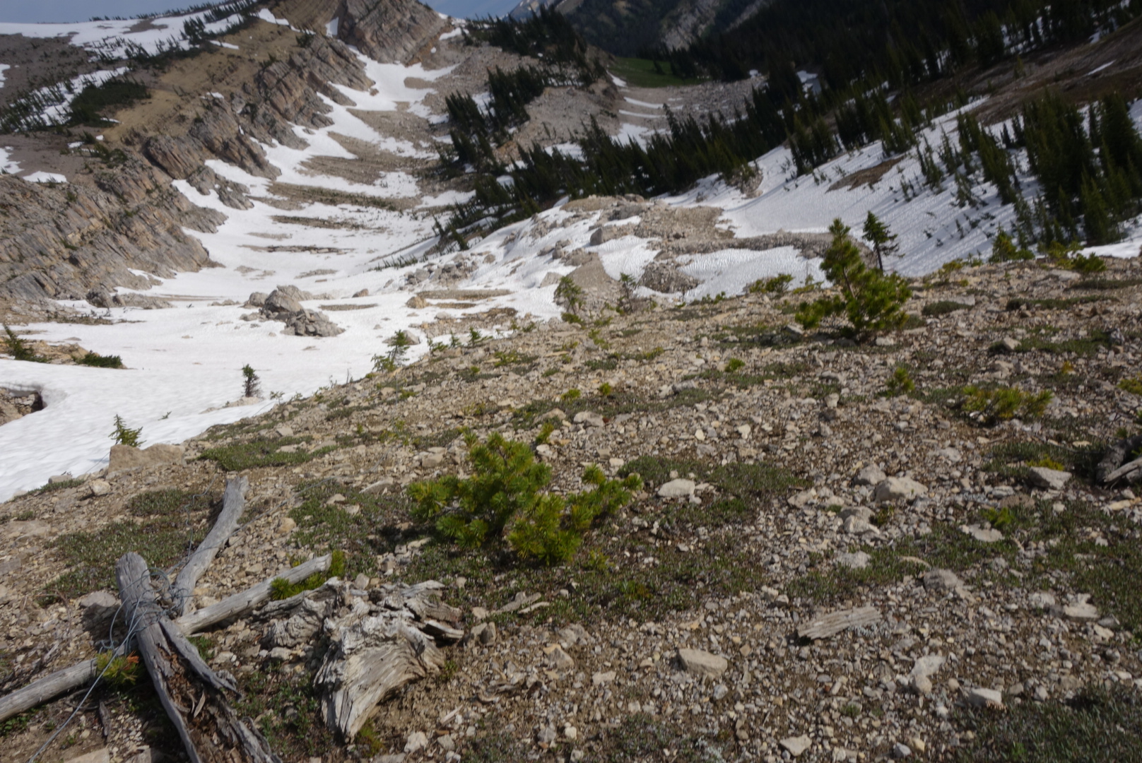
The others left camp before me,  I tried to catch up, but got lost in some snowfields and had to angle my way over to where I eventually intercepted the trail.  I still get a little nervous being off-trail in a wilderness area.  But I continue to grow confident on using common sense and the topographical maps.

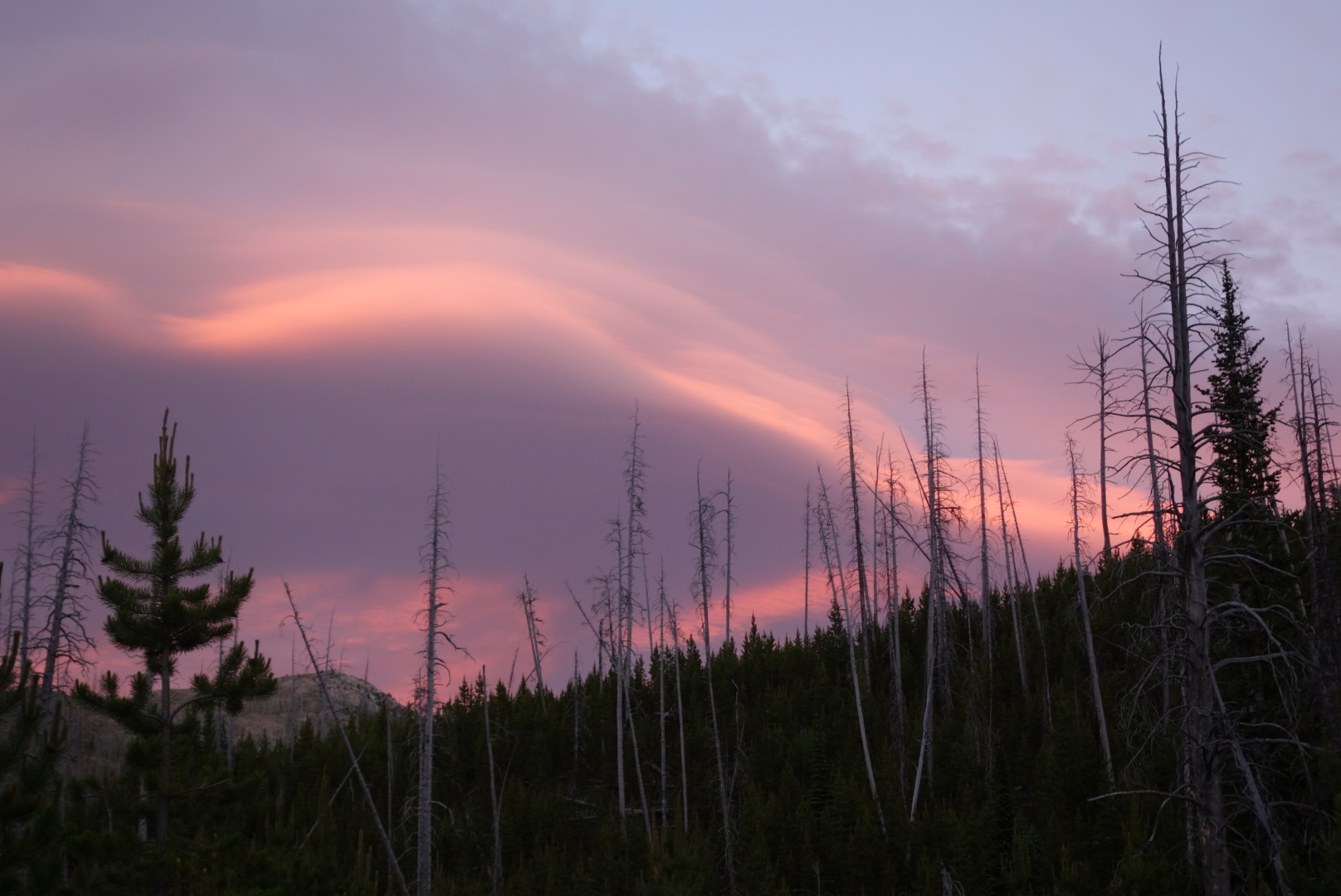
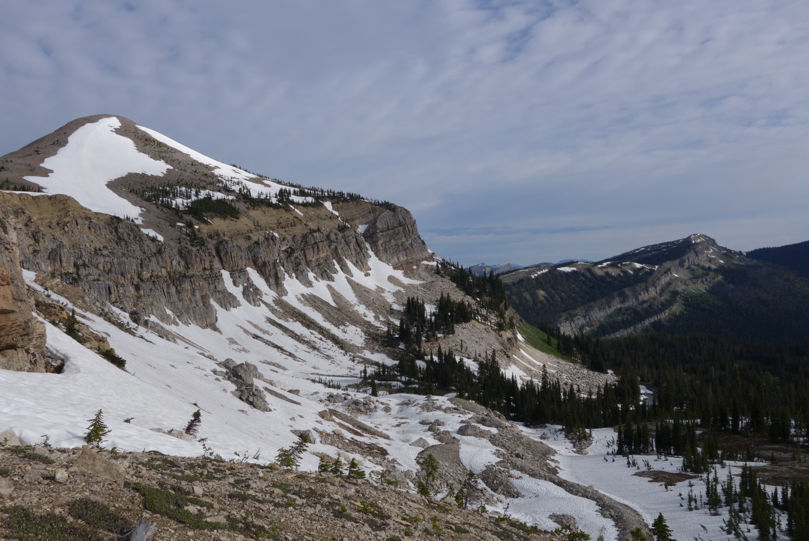
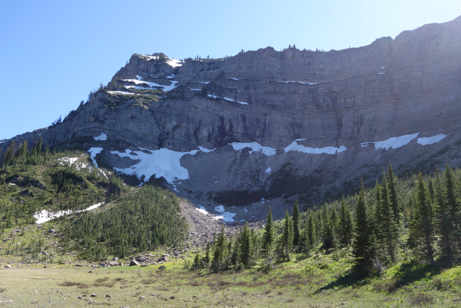
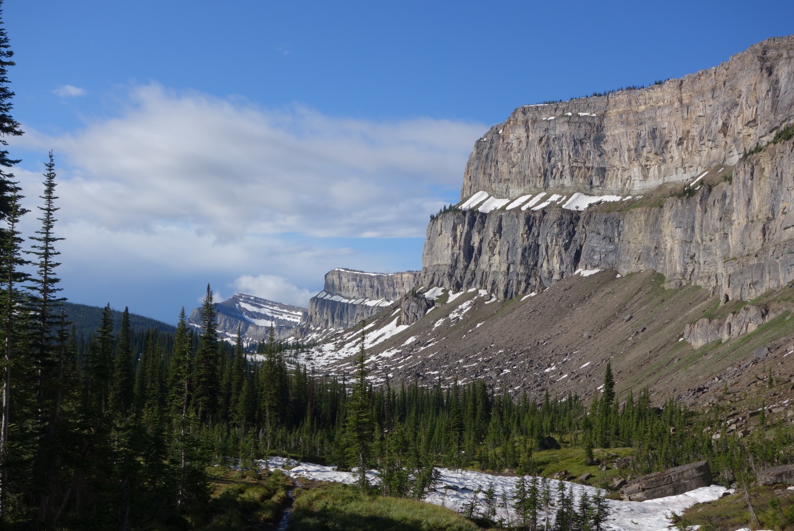
I reached the Chinese Wall about half-way through the thunderstorm.  It cleared for about 30 minutes creating a photo-opp of the whole wall.  However, after 30 minutes of clear sky,  a day-long drizzle commenced.

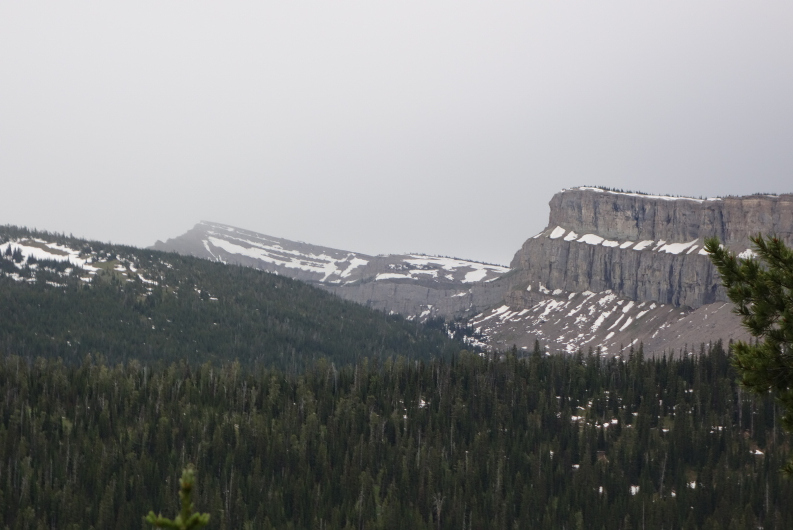
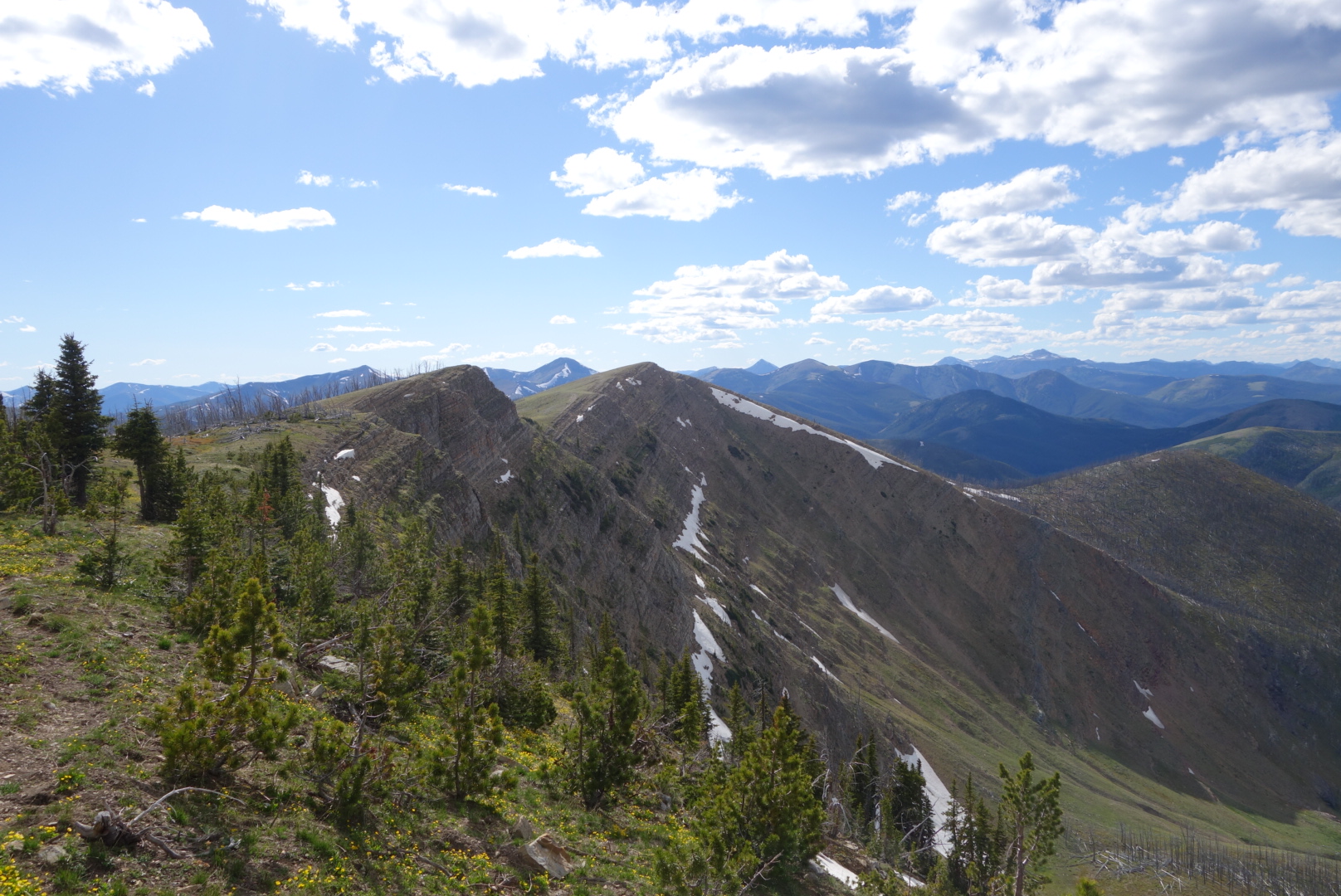
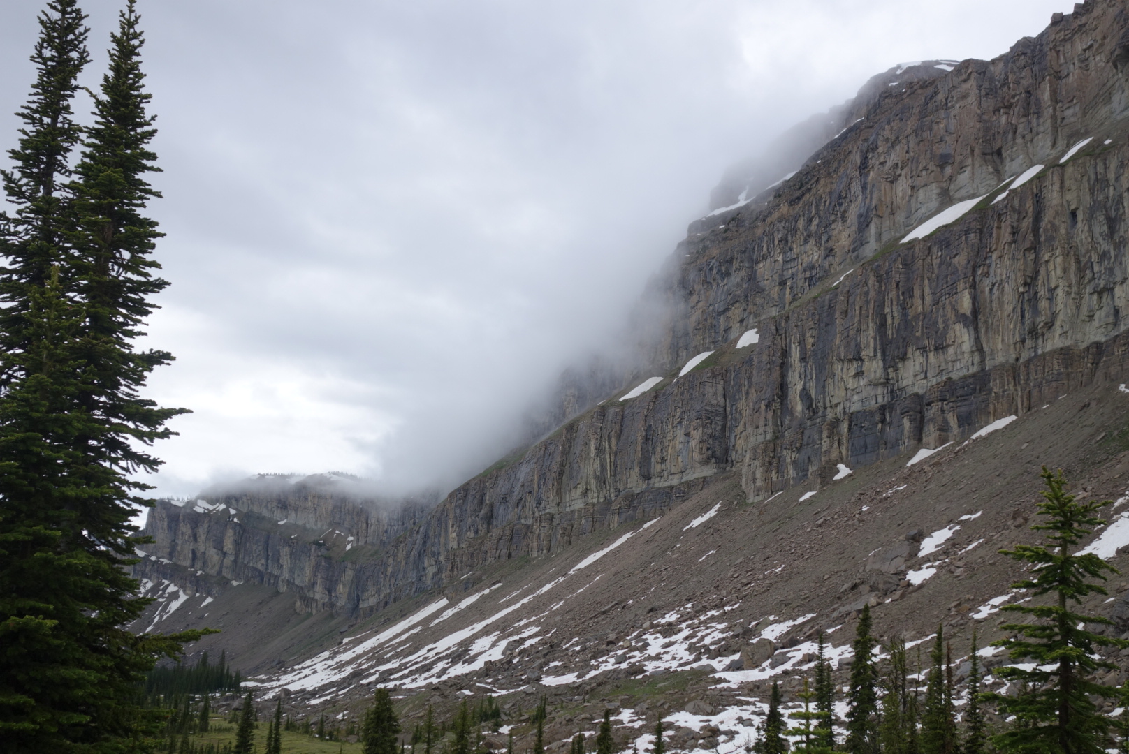
Before leaving the Chinese Wall (it’s about 10 miles long) I was able to get some photos of low clouds swooping down the cliff face.  It looked like something out of a movie set.

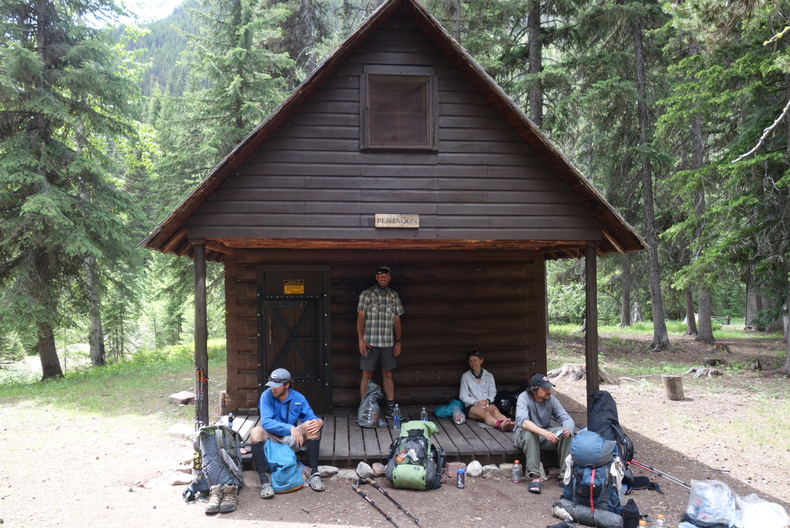
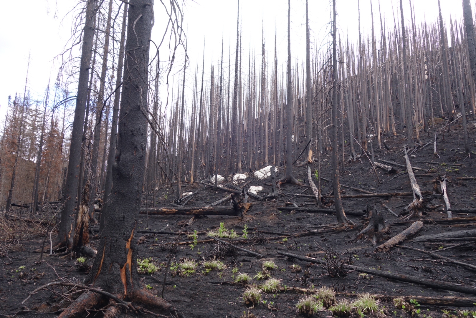
I eventually caught up to Grizzly’s group.  We were all pushing for the next resupply point, Benchmark Ranch.  Crunchmaster went ahead and found a site just as the rain was going to start up again.  The problem was that we were in a forest that had burned about 10 years ago.  Consequently, a lot of dead, burned trees were still standing, waiting for the right time to fall down.  He found a clearing where it looked like if the trees at the edge blew over they would not reach the tents.  Ended up finding a campsite in a clearing of dead trees.  Fell asleep to wind and drizzle.  Probably hiked about 23 miles in 12 hours.

This beautiful plant only appeared 2 times, both near creeks. Any idea what it is?

Finally, the Divide

(June 26)

Last night I had slept near a stream.  That sounds nice, but I should’ve known better.  You never want to sleep in a meadow or near a stream as these locations naturally draw condensation which you invariably end up packing away.

I did learn a neat trick for wet socks, though.  Normally, people make a little fire and try to dry them over or near the flame.  I experimented by placing flat rock over the edge of the fire.  Rather than risk the possible loss of a sock due to flame (and in my case the release of toxic fumes).  I heated the rock.  It stayed warm for several hours after I put out the fire and went to sleep.

Now the trip has started to get interesting.  I started hiking along the Dearborn River.  The forest was extremely crowded as small pines competed for space in an area that must’ve burned 20 years ago.  It was like walking along a path through a lush green grove of 6′ bristles.

Next, it was older forest.  Later, the terrain finally busted out into drier and higher altitude mountain tops.  Prior to this trip, I had envisioned walking along the roof line of America and having wide expansive views all around.  It was finally happening.

As I climbed up one 8,000′ ridge, I paused to watch a black bear forage its way up the opposite ridge.  Bears must just wake up in the morning looking for food and not stop looking until they fall asleep.  For humans it is recommended that we need 1 gram of protein for each pound of body weight.  If the same holds true for a 400 lb bear it would need to find the equivalent of 3.5 jars of Jif peanut butter per day.

I’ve been catching my feet on roots and rocks and my right foot is starting to hurt.  I have managed to catch up to a different group of CDT hikers and we spent most of today passing each other.  Eventually, however, the foot pain caused me to go real slow, especially down hill.  To make matters worse, I had barely brought enough water to get me to the end of the day.

Eventually, I stopped at the next water source.  The folks I just met (Gypsy Artist and Indie) were camped nearby and later I was glad to see Grizzly and company come in to camp.

I estimate that I hiked about 20 miles in 13 hours.


Oh Big Sky country, stop it.
The trail climbs along the ridge.

This flower bunch was no bigger than a teacup

Scapegoat Wilderness

(June 25) Most of the scenery today was scorched earth.  It gave me a lot of time to think.  I was hiking by myself. I woke up much earlier than the others.  I had hiked in to the Benchmark Resort and obtained my resupply package.  It was drizzly to start and then overcast.

The name Scapegoat Wilderness intrigued me.  Who came up with that name?  I know officially it was named in 1974 after Scapegoat Mountain, but didn’t somebody raise a hand to object?  The full weight of Congress went ahead and honored a Wilderness area by naming it after a person who is blamed for the sins or shortcomings of others?

Not to sound like an old guy, but it used to be you honored people who would own up or fess up to something.  I seem to recall there was a certain pride (and consequences) for accepting responsibility for what you did.  I’m talking about the short, sweet “Yes, I did that” variety.  Not the kind the modern athlete has their attorney prepare when they get caught doing something stupid.

Apparently, we needed to honor the scapegoat, the fall guy.  The one who takes it for the team.  I guess in today’s world with 24 hour digital access and scrutiny we need to have those folks around.  One of the most famous (and tragic) I could recall was the TV station that announced the names of the pilots of an Asiana airliner that crashed in San Francisco.  In case you don’t remember, the news station wrote out the names, displayed them and read them on the air:  Captain Sum Ting Wong, Wi Tu Lo, Ho Lee Fuk, and Bang Ding Ow.  So, who got blamed for this?  a summer intern at the National Transportation Safety Board was blamed for “confirming” the names.  Not the station reporter who made up the names, not the producer who was responsible for the show, not even the NTSB manager who presumably had the power to tell interns not to confirm information about airline crashes without approval.  The summer intern as a scapegoat must get used a lot.

Sorry to rant about the name,  but it was burned over country and I had time to think.  One certainty for me is that I promise to visit the next wilderness area that Congress designates:  the Imavictim Wilderness Area.


My Lake

Trip from Dean Lake to My Lake

(June 23rd)

During the night, Lucky said he heard a crunching sound.  We camped near a 30 foot snow field.  Some critter probably walked across.  In the morning, however, it was clear we had a new, temporary teammate.


An old mountain goat was hanging out within 15 feet of our camp, walking calmly back and forth.  As luck would have it, my camera battery had drained due to cold.  So I frantically tried to charge it while the goat was so close.  Eventually I got a couple pictures of the old guy.  The Bob Marshall Wilderness does deliver.

This old goat was patient with photos

Our first challenge of the day was getting over Switchback Pass. This was supposed to me a smooth series of switchbacks that led easily over a high pass.  However, due to the snow fields it was precarious.  The trail was high on the steep snow fields.  Since I am naturally brilliant, I had reduced pack weight in East Glacier by getting rid of my micro-spikes and ice-ax.  We chose to go along the bottom of the snow field.  This was slightly more level and had less snow.  Of course, the trade-off was a sheer drop off of 100 feet if we slipped in the mud.

Thus far, Lucky has been our main pathfinder. I am pretty good with balance (that ballast I carry in the middle comes in handy) and open area routing.  As a result, I led us over to a point directly below where the pass was located.  The only thing between us and the pass was a steep snow field of about about 150 to 200 feet.  At that point, I decided the only logical thing to do was to yield the lead to Lucky.  He had microspikes and the Trail Name to make it all possible.  Eventually we got on top and were very relieved.


Looking down from Switchback Pass.
The rest of the day found me hiking alone.  Lucky’s injury was clearly hurting him.  There were a lot of blowdowns and I scraped the heck out of my shins. I arrived at the Forest Service back country cabin at Pentagon Creek.  Not only did my current group show up, but also the first team I started hiking with.  The Forest Service outhouse was unlocked and most of us took advantage of the opportunity and gave high marks to the quality of the privy.  We have been in the woods awhile.


(Left to right) Crunchmaster, Grizzly, Snake Bite, and Lucky. Pentagon Cabin.
As the afternoon wore on, I eventually found myself getting ahead of Lucky and STD, but trailing Grizzly and the others.  I enjoyed the time and really appreciated the Bob Marshall Wilderness.  It just has a feeling of being in the wild. I had read some comments about it being boring, but I truly felt like I was in remote wilderness.


While navigating the many blowdowns, I eventually came to the last hill.  It was a climb over Larch Hill to the day’s destination, My Lake.   I chugged up the hill, my thighs protesting, my lungs working overtime.  To take my mind off the challenge, I thought of what I would say when I reached the Grizzly group.  When I finally staggered into the campsite, I told them “Look, you can camp anywhere you want, but I just want you to know that this is My Lake.”  At first they thought I was insane, but quickly they realized the altitude had caused me to come up with corny humor.


Ironically, I fell sleep to the sound of jet engines as I was sleeping under some type of common flight path.

Dean Lake: Elevation Gain

A lot of CDT hikers met today and overlapped.  There was the original group I started with (Grizzly, Crunchmaster, and Snake Bite) plus a couple of other hikers.  There had been some route finding issues trying to find where to cross the middle fork of the Flathead River.  Eventually we solvde that problem and got on the path.


A waterfall on our way up the Trilobite Range

The goal was Dean Lake.  It would be about a 20 mile day.  Most travel was rolling up and down following streams.  However, around 4:00, we started our ascent.  As you know by now, climbing at higher elevation is not my strong suit.  Once we got around 6,00′ feet, I finally took out my trekking poles.  Everybody was passing me as we made our way up along Trilobite Ridge.  The trail became the drainage creek for the remaining snow. It was cold, hard, muddy, and wet.


Still, there was beauty.  At one point there was a spring on the trail where the water shot out of the middle of a boulder at a fairly good flow rate.  Plus, being able to look back down at the valley below was cool.  Eventually, by 7:00 we reached Dean Lake.  It is a beautiful snow fed lake with granite peaks as a backdrop.


Animals will rub against a particular tree repeatedly to mere territory.
We set up camp in a flattish area and ate a hearty meal and tried to dry out our feet. I was wiped out from the climb and was asleep at 10:00.


Oatmeal & Hamburger

No, this is not another recipe entry.  Although I have loved my meals so far, I wanted to give an update on health issues.

Thus far, the trip has seen more rain than sunshine.  The nature of backpacking is having to ford creeks. As a result, wet feet are a common problem.  As an added feature, if the temperature drops below freezing at night the wet shoes and socks become frozen.

You are welcome to try this at home, but I do not recommend it.  Placing a frozen sock over a nice warm foot that just emerged from a cozy sleeping bag is challenging.  Placing the socked foot into a frozen hiking shoe is a battle:  a battle of will, engineering, and words.

Lucky put on his frozen boots at Strawberry Creek and hiked.  He is like me and we both wake up when the birds start chirping.  However, by 10 in the morning we stopped and he checked out his feet.  Sure enough, the frozen upper part had been pushing down on the big toe of his right foot and he had a bruise that would make a boxer cringe.

As for myself, I have developed blisters on both heels.  Moreover, walking through creeks and rain and muddy trails means my feet are always wet.  At night, when I finally get into my tent and sleeping bag, I take off my shoes and socks.  The best I can describe the appearance is to say the bottom of my feet look like uneaten oatmeal that has sat near the dishwasher for a few hours and my heels look like hamburger.  I try to rub my feet and apply a lotion to repair overnight.  It mostly works.  Can’t wait for drier weather.

(Out of respect for both my blog followers, there are no pictures for this entry. )

The Bob

(6/20/16)  Starting up the hike again,  I completed approximately 20 miles.  I left the hostel in East Glacier Park around 6:15.  We stopped for the day around 4:00. Perfect hiking weather.

I have developed blisters on the heels of both feet.  It is painful, but I have to carry on and develop thicker skin.  If you are interested in the slightest,  my preferred treatment is to apply antibiotic, a gauze pad, and secure it with duct tap. I realize this is probably not the approach of most  (or any) medical professionals, but the duct tape  is secure, tough, and the shiny surface reduces friction.  

I mostly followed Lucky today and Steven the Destroyer  (STD) was behind.  In bear country, that means Lucky is appetizer, I’m entree, and STD is dessert. Lucky is a strong hiker and shouts a verbal bear warning every 30 seconds.  I struggle sometimes to keep pace,but that’s okay. 


We left Glacier and it’s rules and entered the Bob Marshall Wilderness around noon. We crossed a highway, went past a campground,  and then entered wilderness.  We met up again with some great,fast hikers named Curtis  and Christiana (sp?) and their dog Sable.  We took an alternate that required several wet river crossings.  We camped at an old elk  hunting campsite and we’re all in tents as a beautiful sunset unfolded.  

Strawberry Creek

Today was a real hiking day. Lucky, Steven the Destroyer (STD), and I left for a destination called Strawberry Creek.

Initially we walked along old 4 wheel drive roads.  We ascended over some blowdowns (trees that have fallen down across the trail).  The day saw us walk in environments ranging from open, recovering burn ares, to thick forests.

At one point we came to a meadow that sloped up and the morn I ng breeze blew down the hill. Lucky saw a black bear at the top of the meadow.  It eventually heard us,got on it’s hind legs,  and ultimately bolted away. 

Towards the latter part of the day we came to a juncture.  The map indicated a traditional route around a lake or an “alternative” that was shorter but of mixed quality.  While Lucky and STD rested, I went ahead on what I thought was the traditional route.  Quickly, I became aware it was the alternate.


I thrashed back and forth through a thick bog with a lot of down trees.  My feet were soaked.  Eventually, I just decided to climb up hill, relying more on common sense than electronics.  Finally reached the trail and wanted to leave signs for the other guys.  I made an arrow and wrote “Lucky” but hesitated to add  “STD” to avoid the perplexion a traveller might have coming across a sign pointing to Lucky STD.


The trail took me through an area tha had just burned this year.  It was eerie.  Scarecly any green penetrated the harsh black, only ocaisionally broken by stark white rock.  At last, coming over a pass I found a meadow which had fresh water, greenery, and campsites.   I hoped that Lucky and STD would catch up, but was not sure.  Eventually they did and we camped in a meadow for a night that was clearly going to get cold.

Slow miles

Note:  I am way behind on blog updates.  Have not had connectivity.  Sending this from 8500′ mtn in Scapegoat Wilderness.  Will eventually catch up.

I finally started climbing up.  It was interesting to note the breathing difficulty the higher up I went. I was hiking with Lucky and Steve.  However, there is a knot of southbound hikers so we passed and were passed by some.

Finally reached a beautiful glacier fed lake and camped for the night.  Overnight a mountain goat entered our camping area and just hung out.

image

Another Pass

I ended up hiking with a different group. These folks had a similar itinerary so we agreed to try to connect. I started off on a slightly different trail, knowing we would connect later.

As I started my day, I looked down for trail signs. It was a little disconcerting to see a paw print larger than my size 12.5 shoes.
image

Admittedly, I was scared to be hiking by myself. About every 50 feet I would yell “Hey bear.” It feels stupid at first, but you get over it.

Later, I saw a truly scary series of paw prints: cub prints with no adult prints. To me, that was nerve wracking wondering if the sow was out looking for the cub. Eventually they disappeared.

As a matter of background, bears are smart. If humans come into their territory and build lovely trails, then the bears will choose the easy traveling of a trail versus pushing through brush. So, trails tend to increase the likelihood of hiker/bear encounters.

I breathed a sigh of relief when I connected with the others. This day we were going over Piegan Pass at 7,800. We crossed some snow fields and made our way above treeline. The mountain walls seemed like something out Lord of the Rings. There was a large waterfall fed by snowmelt plummeting between the walls. Every time I stopped (which was often due to the thinning air) I looked around and said “Wow.”
image

We finally came to the top and stopped to admire the panorama. Interestingly, at the top there was a colony of pika to greet us. They are curious, cute, and the predators love ’em. All the way up, there were cat prints (probably bobcat or lynx) in the snow. Plus, there were prints from either coyote or fox.
image

image

We descended over a few sketchy avalanche chutes. I finally put on my microspikes for the most dangerous slopes.

Finally, we crossed the famous Going to the Sun Road and saw lots of tourists. On the heavily traveled trail down to the St. Mary’s River I saw where a grizzly marked it’s territory by clawing a tree.

image

The day wound down as we collectively cooked our meals around a smoky fire. The group I am traveling with is friendly, interesting, and experienced. Should be a good day tomorrow.
image