Rawlins is the kind of town where if you asked a resident how they came to live there, you would not be surprised if they answered “My car broke down here, I couldn’t afford repairs, so I stayed.”
My view was slanted a bit because I was in a wedge of town that was placed next to a rail line and between two interstates. In this oasis were only chain motels, chain restaurants, and, providing critcal mass to these orbiting sites, a Walmart. As such, my food choices were typical of anywhere, not the unique “taste of Rawlins” I hoped for. Of all the fast food concepts out there, my favorite is the combination KFC and Taco Bell. I did not go there, but coming off the trail after dehydrated quinoa and lentils to see that, in one place, I can order a chalupa plus a bucket of extra crispy is startling.
Rawlins is definitely pickup truck country. A plurality of vehicles were pickups, most with complicated aftermarket additions. Judging by the signage, oil & gas is a dominant industry out here. One gets the impression that a career as a CPA or dentist is likely to get you beat up.
All in all, Rawlins rested my body but did not steal my heart.
If you’ve suffered through some of the previous blog posts, you have a sense that the day of a town stop is exciting. I got up and moving for the final 8 miles. With a lighter pack and the anticipation of warm, perhaps fatty food, cooked by someone else as an inducement, I cruised along.
I passed through a few cattle operations. One was notable because the rancher had one fenced area with numerous cow/calf sets plus a young bull. He had the shape and equipment of a bull, but not quite the mass of a full grown one. On the other side of the fence, without cows, was a real bull. As I walked through the first group. the young guy was making some noise and acting a little protective of the cows. Certainly nothing intimidating to me. I went through the gate and saw the big bull. He was sauntering my direction. In case you don’t know, I hate bulls. Anyhow, it soon was clear he wasn’t interested in me, but in the cows and the gate. I stopped for a moment to watch. The young bull was clearly talking smack, safe behind the barbed wire fence. The older bull had some choice resonses. He started kicking up some dust with his fron hooves and increased the volume and lowered the bass on his comments to the young fella. Interesting to watch, but I thought I caught a whiff of bacon on the wind and resumed my push to town.
I did get to town early and checked in to my motel. In fact, their continental breakfast was open for another 15 minutes. I shamelessly set some informal food eating record in that 15 minutes. Even more exciting were my packages. It was like Christmas. I had three packages. The first was my resupply package. The second was a new pair of shoes. Lastly, my replacement backpack was there.
I did the usual town chores and ate and cleared out my old pack. I had planned a zero here so ther was no pressure and I was glad to be off trail and able to catch some of the Olympics.
I was determined to top 30 miles today. It was actually a pretty good day for hiking in the basin: slight overcast, a little wind, but still nice views.
I may have created some confusion about the landscape. Let me clarify. For the most part, the soil is arid and nutrient-poor. Later on, past Rawlins, it is alkaline. In short, life is hard here. While there is some life in the form of insects, horned lizards, rabbits, and antelope, the land is sparse. However, there are hills and some areas of interest, so it is not entirely flat at this stage.
Human signs are rare. The wild horses who escaped are one example. Test diggings from miners are another sign. Also, there is the ubiquitous herd of cattle left to munch out an existence as best they can.
I leapfrogged with MLL and SBJ at watering holes. I skipped a cow pond which I regretted (why, after all, am I carrying Propel if not for these situations??). Got water from a slimy creek later, and finally ended with two excellent man made water sources. In the evening, after achieving 32 miles, I camped at the A&M Reservoir. This turned out to be a popular destination as there were two separate continental divide bikers and then MBL/SBJ also camped around the man made reservoir.
These guys are hard to photographNot a slalom course
The Basin had flattened out. Well, at least the route did. While there would be hills to the side, most of the route for most of the day was along gravel roads. I loved walking along in this area in the morning. There was a sweet spot when I turned off my headlamp, let the first hint of light brighten the sky and listen to the coyotes and cows discuss their plans for the day.
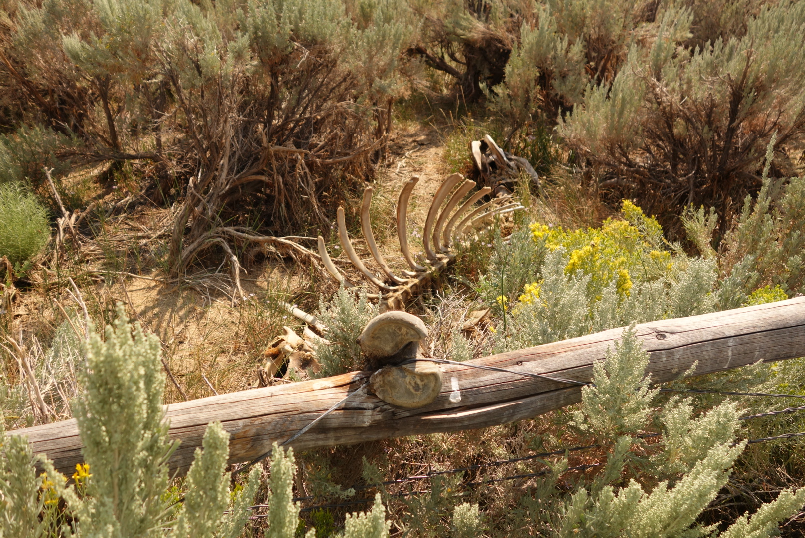
One thing the ranchers /BLM do that is worth praising is preserving water sources. Often there is a concerted effort to protect the scarce springs and to manage their flow. The rancher benefits from a clean predicatble flow. Other travelers benefit from a source without cattle trampling and pooping. I’m sure there are also some desert micro-environments that are saved as well. Unfortunately, at Bull Springs, a solar powered well that is protected by a wood and barbed wire fence, I saw the downside. Apparently a steer just couldn’t resist the green grass and water on the inside of the fenced area and tried to jump the fence. Its hoof got caught in the barbed wire and, after the scavengers of the area had completed their tasks, a skeleton remained to tell the sad story. For me, it was a sad personal victory confirming my suspicion that while the cat may indeed have played the fiddle without opposable thumbs, there is no way the cow jumped over the moon. Hey Diddle Diddle.
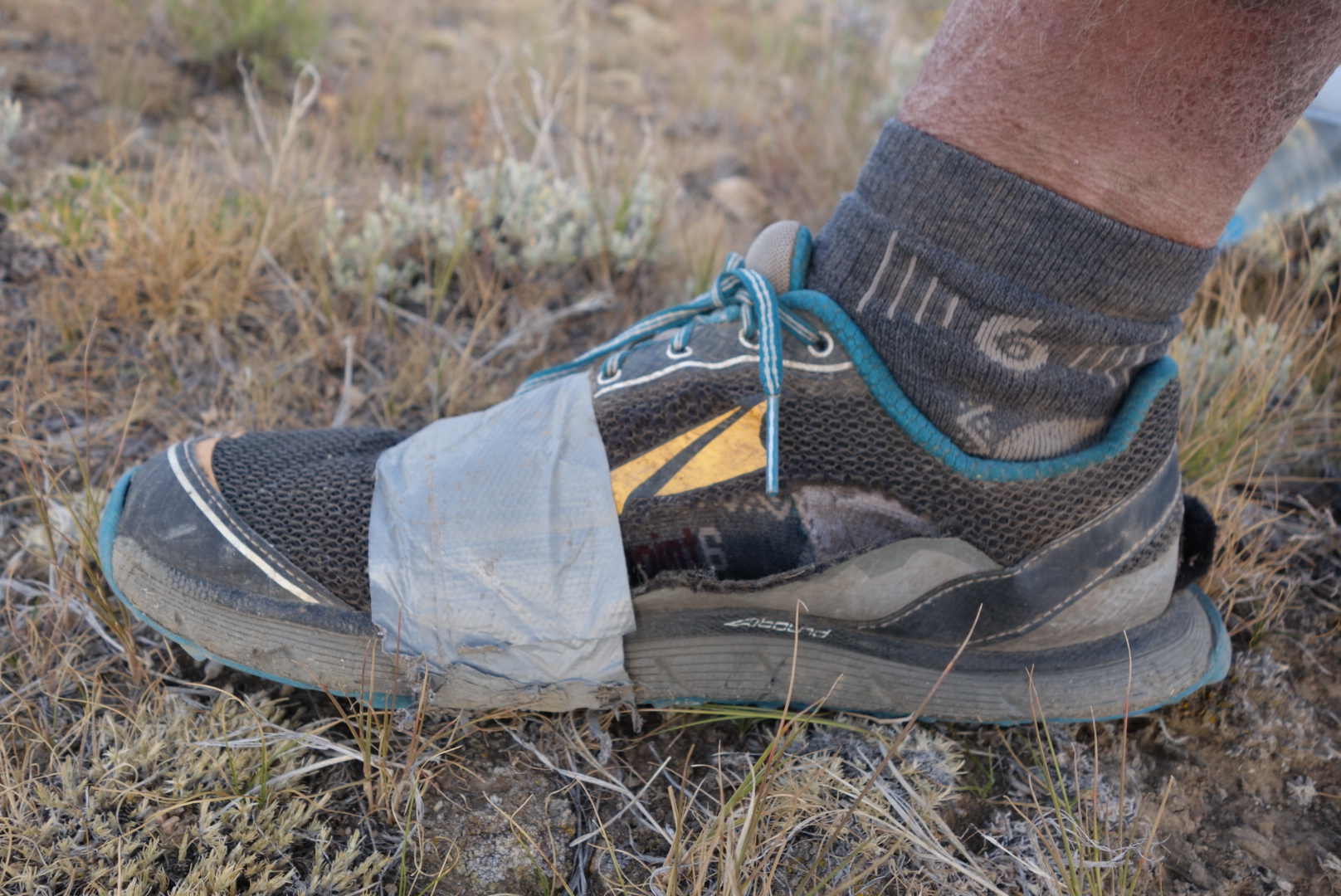
Later on, as the trail neared Highway 287, there was again a coice to stay on trail through innocuous scrub land or walk along a raod. By this time, the side of my right shoe was blown open and the duct tape repair I made in South Pass City was coming undone. I elected to walk on the pavement to stop getting crud in my shoe. Once at the highway I walked up the hill and found the marking where I should leave the paved route and rejoin the official trail.
Well, this “trail” was something new altogether. Before I begin a description, it is important to acknowledge a significant portion of the trail is developed and maintained by volunteers. These are amazing people who take time to make the route possible. However, in this one particular section, I think I pieced together what happened. The trail builders were given some signs and tasked to go create the trail. They put 2 or 3 signs into the hard, rocky soil about 1/4 mile apart. They were so proud and happy they went out to happy hour and celebrated. Hard. In fact, they could not remember where they had worked, so the next time they did the same thing a little further along. The net result for hikers are randomly placed trail markers with no connecting trail nor contouring logic. The maps attempt to document a trail, but there is none. Fortunately, as this section nears a reliable water source, there is a solution. The animals all know where the water is, so one must find a game trail and then follow it.
I arrived at the Fish Pond Spring at dusk a little frustrated, thirsty, with shredded shoes. My heart sank when I saw the spring was solar powered and realized it was off until morning. Fortunately, there was a holding tank downhill a bit that still had some water. I attached my dirty water bag to the tip of my hiking pole and was able to lower it into the holding tank.
As I left, I was able to witness an interesting example of animal behavior. I knew from their sounds that wild horses were waiting for me to leave the area. As I left I went up a hill. Once I was about halfway up I turned to see the horses. There was one patch where a pond formed outside the spring’s fence and standing water could be seen reflecting the fading sunlight. Further downhill was a puddle that looked dried out. The strongest looking horses (about 5) were gathered at the obvious water. They stood grouped behind an apparent leader. However, they were not drinking, I assume they had done so as I climbed. However, at the lesser pool were about 5 more horses. I deduced that there must’ve been some sort of caste system. One last observation was that at the lesser pool, the whole group stood with their heads together.
As the sun set and the moon rose, I tried to find a level sheltered spot to camp. It was going to be a clear night, so I only intended to cowboy camp. As I came up to a promising looking clump of shrubs, up popped a buck mule deer’s head. Then, as if on cue, three more popped up in a row, each about a half second after the other. As the last one popped up, the first decidided to bolt and it was quite a sight to see them head off and gracefully clear a barbed wire fence in a single bound.
I took their well chosen spot as it was protected and had a good vantage point, even if the principal feature was the highway below. Wanting to avoid ticks, I chose a spot about 15 feet up from where they had been. I fell asleep to the hum of the traffic below and the beauty of the heavens above.
Like most through hikers in the Great Divide Basin, my approach was like what they used to say about voting in chicago: hike early and hike often.
Let’s be honest that there cannot be much material for a blog entry about walking through the basin. It is mostly road walking. However, there are a few key points to this day.
First, the trail follows the old Oregon and California Trails to the west. My ancestors who settled in Oregon may have actually traveled this same path.
Second, there was actually a new spring right near the road which was not on any map. The water appeared to be non-alkaline.
Third, I actuially encountered a couple hikers in this sparse land. The first was at one of the springs. He was heading northbound, attempting to complete Wyoming. The other pair I found late in the day at a fairly disgusting cow pond after about 12 waterless miles. I had seen their footprints and eventuially their figures in the distance, but we appeared to hike about the same rate, so I never caught up with them until very late in the day when they stopped to make dinner.
Fourth, fairly close to the middle of nowhere, a fancy, fenced informational display about the continental Divide Trail has been built. It is not clear to the novice why they chose this location at the junction of dirt roads Aren’t We Lost and Too Bad the GPS is Out. Also, I bet every through hiker had the exact same thought I did: maybe some of the scale could’ve been reduced and invested in a well.
After visiting with the couple (Sweet Baby James and Moon Light Lady…I did not probe on the origins), I pushed on, finding a cooler with bottled water. It was a gift from a local CDT through hiker (“Rainbow” I believe) and so much more pleasant than the filtered cow pond water. I grabbed a liter.
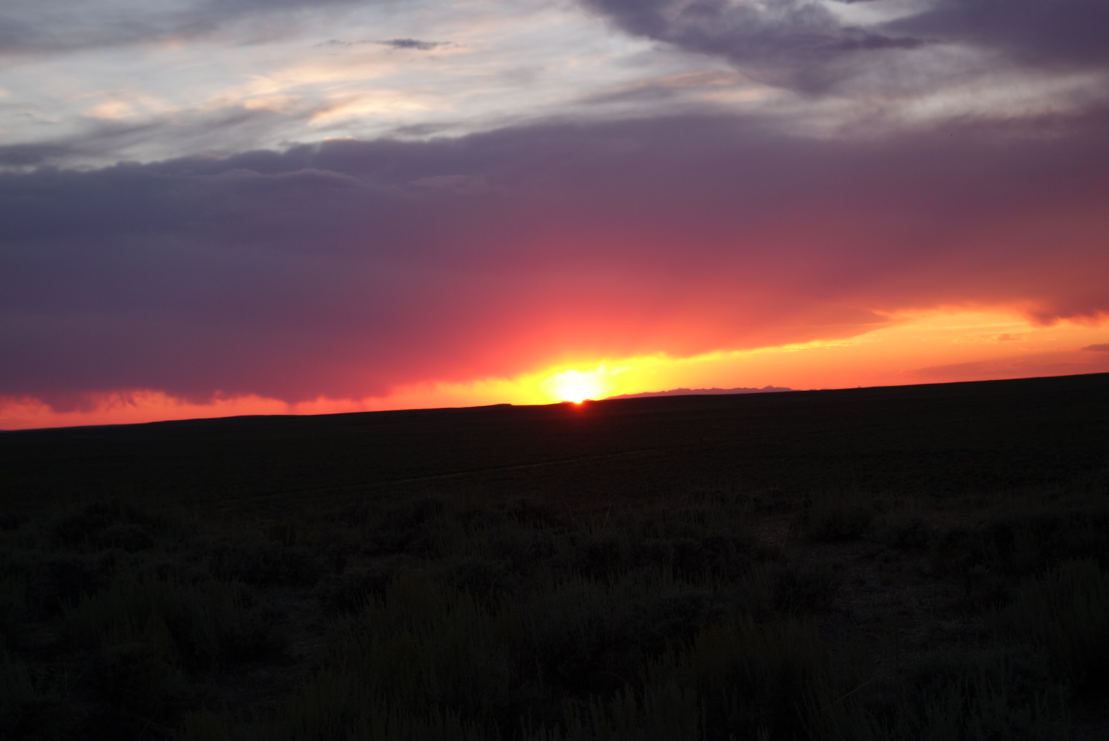
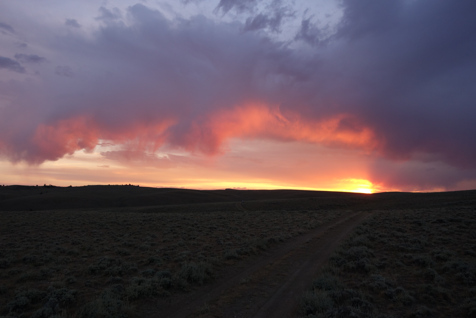
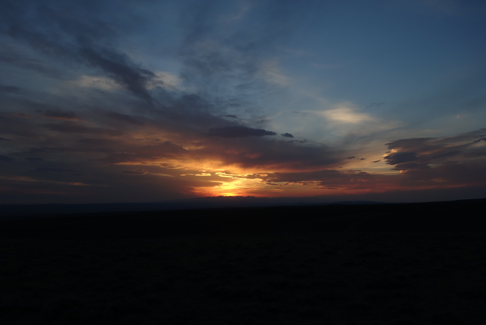
I climbed the mostly barren hills to get a campsite up high so I could see the sunset and the sunrise. Just before reaching my eventual campsite, I saw two wild horses on a distant ridge. Able to get some nice sunset photos, I fell asleep among the sagebrush on a hilltop in the Great Divide Basin as coyotes in the distance did thei evening roll call.
I wound further down onto the plains. My destination was South Pass City. I had to cross several dirt roads. Eventually, I came out to the highway (28) where hikers hitch to Lander Wyoming. Along the way I passed a surprising amount of game and a family that appeared to have simply pulled their camper off the road and set up summer camp.
Another unusual erosion situation
Once past highway 28, the land was mostly flat and sagebrush. At first the trail followed dirt roads, but then it was designed to go across the terrain, marked every quarter mile or so with a carsonite post with a CDT sticker at the top. One would think a walk through sagebrush would be easy, but it is not. Sage brush does not spread symetrically and unless there is a worn tread, the process is to generally note a path with some gaps between sagebrush plants and then twist through. There are inevitably a lot of leg scratches in this kind of terrain.
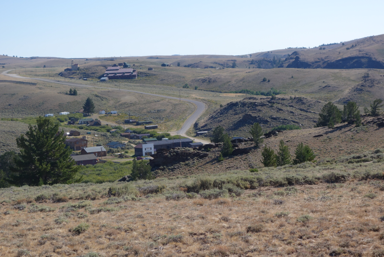
Around noon I dropped down into South Pass City. It was a historical town I was looking forward to seeing, plus it was a resupply point. It is a town with most of the buildings well preserved. You get a very good sense what it might’ve been like to live in a mining town on the frontier. I was struck by two things. First, people really had hard scrabble lives, having crude selections of foods, information, and people. Second, to combat this, people seemed to spend their time on diversions such as gambling and alcohol which nowadays have robust help programs. Incidentally, you can notice where some of the old pine structures were repaired in the recent era. It is striking how the old logs have no beetle damage, but the new ones are obviously scarred.
South Pass City from above
As a backpacker, South Pass City is also pretty nice. They hold resupply packages, have free elctricity and water, and will let you camp in a discrete area if you ask. Unfortunately, a few backpackers have taken to sleeping in their public restroom, so it is not clear how long the welcome mat will be out. Regardless, the lady in the General Store when I went through, Sandy, was incredibly helpful. On a lark, I wondered if she had any duct tape which I could use to tape up my rapidly disintegrating shoes. She said she did not, but thought the maintenance people would, so she closed shop, found the maintenance crew, secured the duct tape, and let me use as much as I needed.
After spending almost two hours at this site, I headed out towards the Great Divide Basin. To get there I had to climb a last few mountains. I pulled out my umbrella to reflect the heat as I left the historic site. There was a tour group concluding and I believe they got a kick out of a through hiker walking past with an umbrella. Also, it was intersting to note, once I got up on a vantage point, that there are still some some small scale mining operations that appeared to be running. Hope springs eternal (depending on commodity prices).
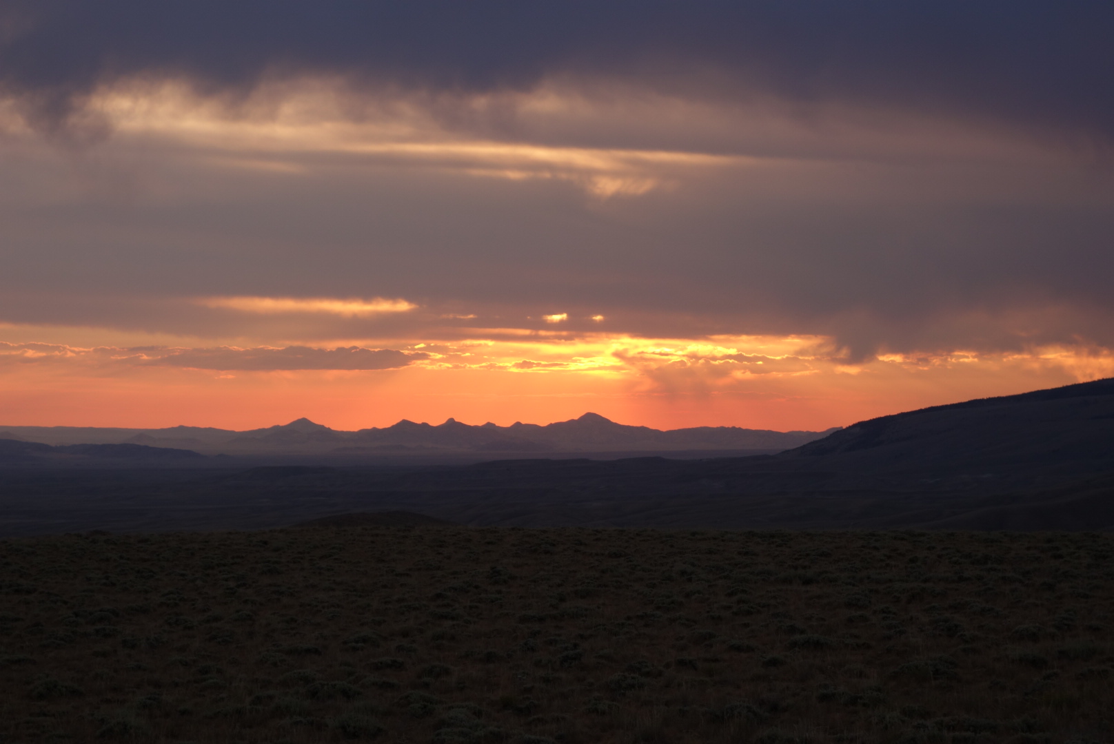
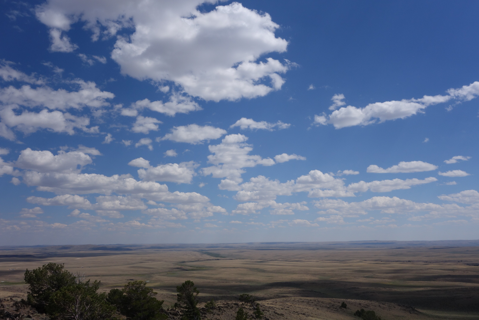
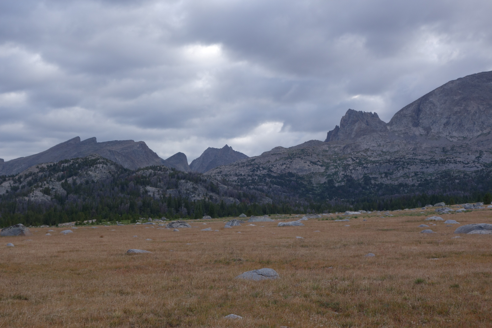
At last I was on a peak where I could see the Great Divide Basin spread out in front of me. It is a treeless expanse stretching for over 100 miles each way. Little known, the ironic fact about this area is that it is an endorheic basin which means that any rainfall goes to neither ocean and stays in the basin itself. Thus, the Continental Divide Trail spends a considerable amount of time at the ridge line of our continent, but also cuts through one of the largest areas where there is no divide.
My first view out in to the Great Divide Basin
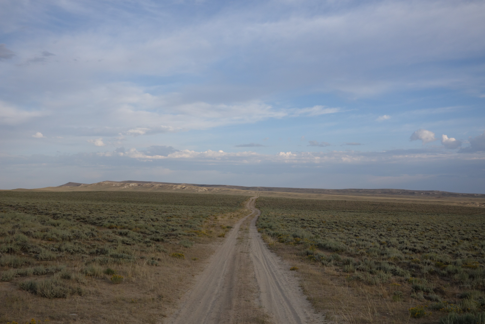
I walked down and in to the Basin. It was clear and warm with a slight breeze. I generally try to stay on the official trail. However, once down in the basin the trail parallels a graded gravel road for 17 miles. I tried to stay on the trail as it followed a low ridge, but the lack of tread, missing trail signs, and sharp rocks on unraveling shoes prompted me to get over to the gravel road.
Most people driving by were courteous: they slowed down to reduce dust clouds, waved, and then sped up after they passed widely. One dude, unfortunately, actually accelerated and stayed close to my side of the road. This one negatve was grossly outweighed by several kindnesses. For one, a guy with Oklahoma plates drove past, stopped, and then backed up. He asked me if I’d like some water or ice. I could not believe the singular contrast of a through hiker in the Great Divide Basin walking along with a liter of ice cubes. For another, I was talking to a continental divide biker who came along. I was sitting on the ground. A car stopped and asked if I needed help. Again, sometimes when you see fewer people the greater your appreciation for humanity.
I ended up near a bridge that crossed the Sweetwater River. I had never considered cow dung to be a sweetner, but that appeared to be the principal addition to the River from what I could see. In the fading desert light, I found a shallow clearing in the sage brush on the opposite side of the fence where the cattle would come at night to congreagate by the River and add their sweetness. Out here you learn quickly that cattle love to gather at night and it is a noisy process.
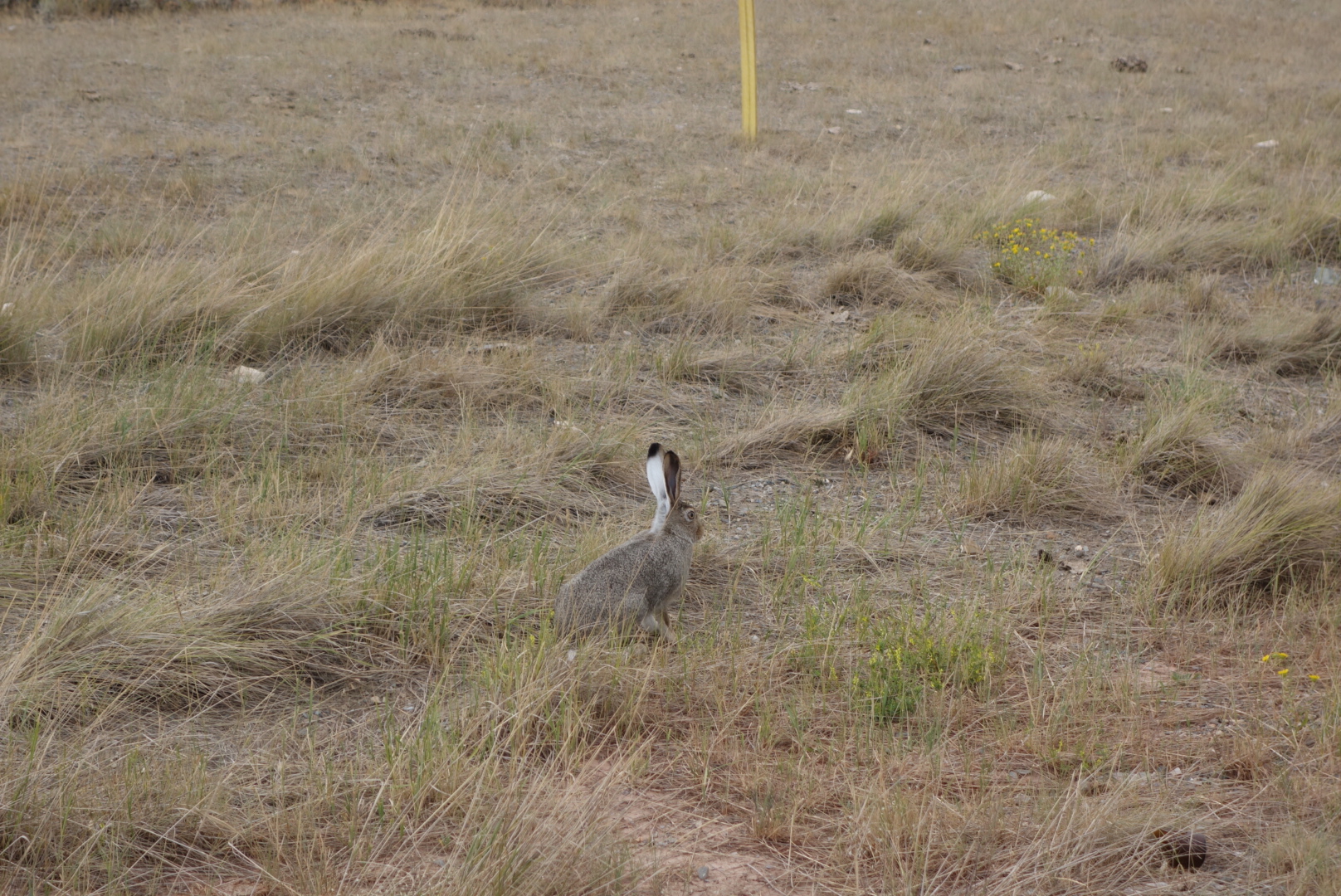
I fell asleep cowboy camping just before the moon rose. After about an hour, I was jerked awake by a very close sound. There is no way to tell who was more surprised. Me, upon seeing a large eared jack rabbit looking at me from about 8 feet away or, the jack rabbit seeing a large blue sleeping bag suddenly rise at one end with a scruffy face peering out of the end. We left it as a tie and I went back to sleep as the cattle sorted things out in the distance.
A trail monument identifying where the Pony Express crossed the current trail
I was, like most backpackers in the badin, determined to up my miles.
The trail passes historical markers identifying where the Oregon and California trails overlapped the CDT. Some of my early Oregon ancestors may have traveled this same route decades ago.
Later on, I met a section hiker at a spring. He was trying to complete Wyoming. Later in the day, I steadily followed a pair of footprints. Around 7:00 I eventually came across Sweet Baby James and Moonlight Light Lady (SBJ &MLL) at a nasty cow pond.
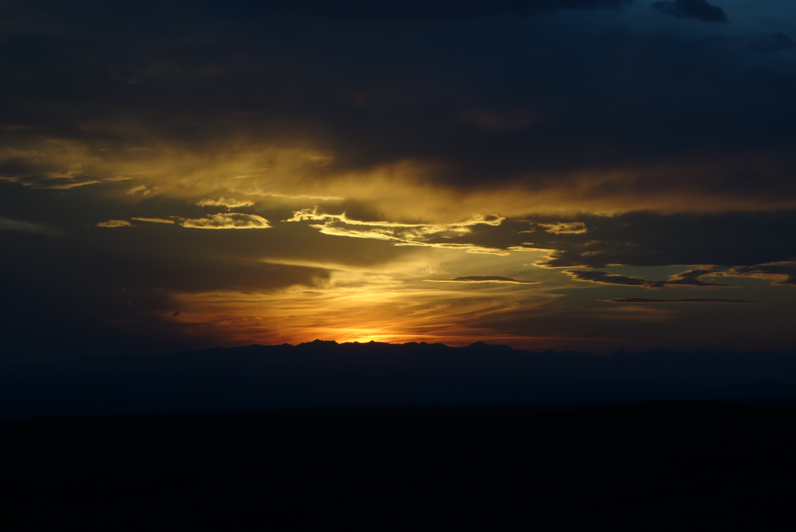
I climbed up until I reached a peak where I could see the sunset. Along the way I saw a pair of wild horses across a canyon. I did capture some sunset photos and fell asleep to the subtle sounds of the basin at night.
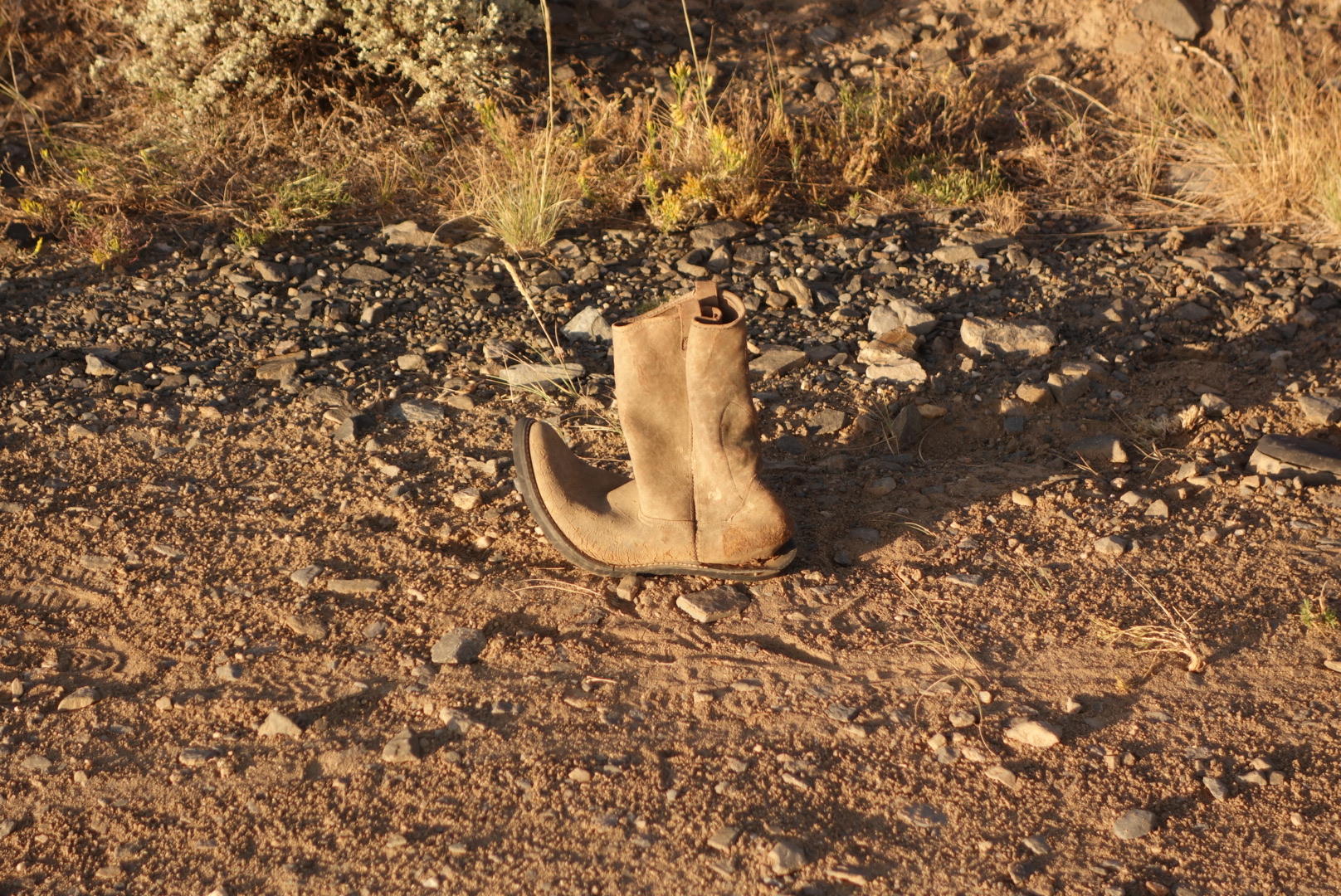
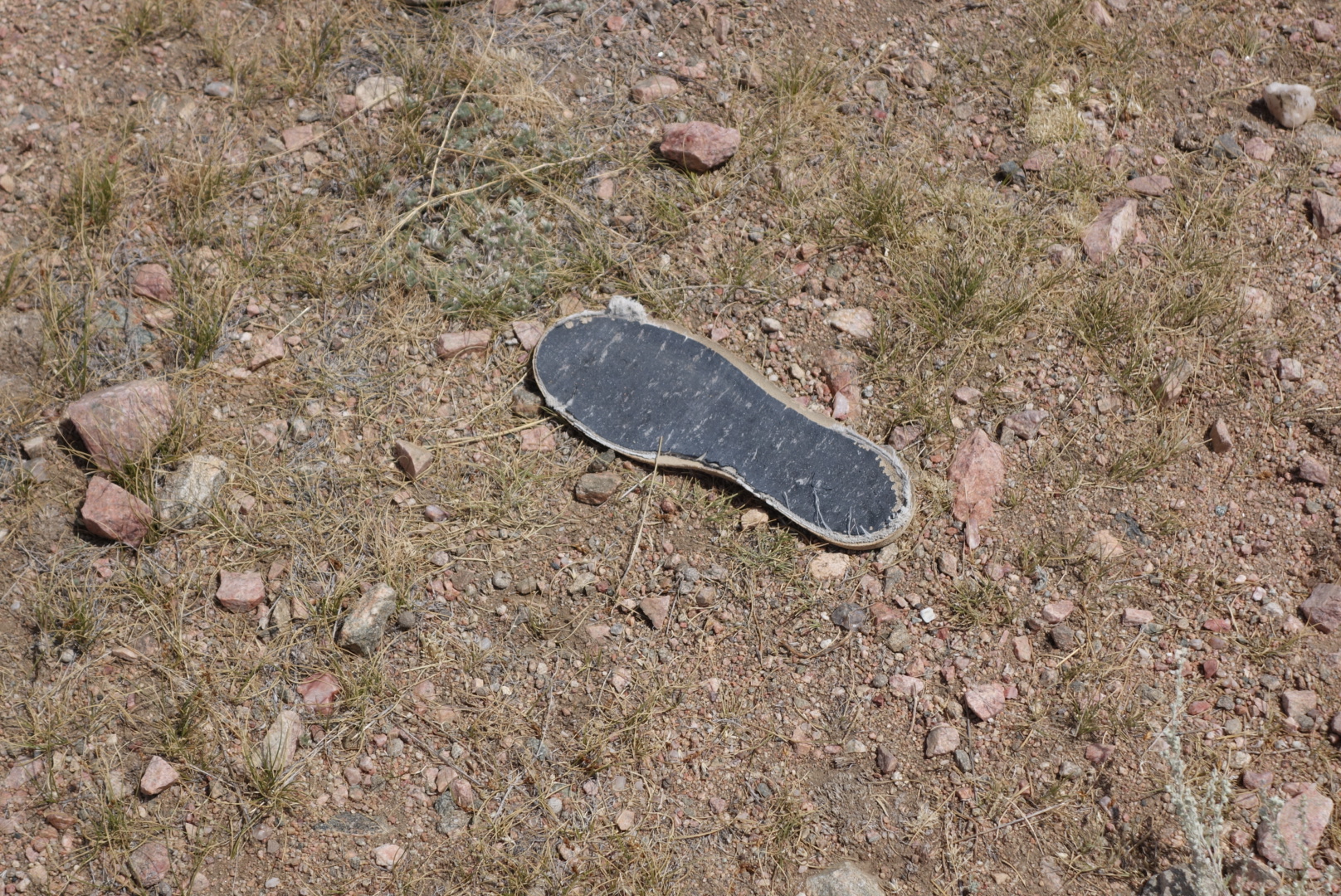
I can only guess that old Lefty walked through heremSomebody left their sole on the trail.First Sobo cactus
As I was descending in the morning the catitle were moving from their sleeping areas to their grazing grounds. I always try to let them know I am near, but try to hold still so they don’t stampede.
One group was quite alarmed. They made a noisy, crunchy run. After they were done, I met some Nobos breaking camp. I think the cattle probably sped up their morning. It must be disconcerting to be in a tent and hear a herd of cattle stampeding near you.
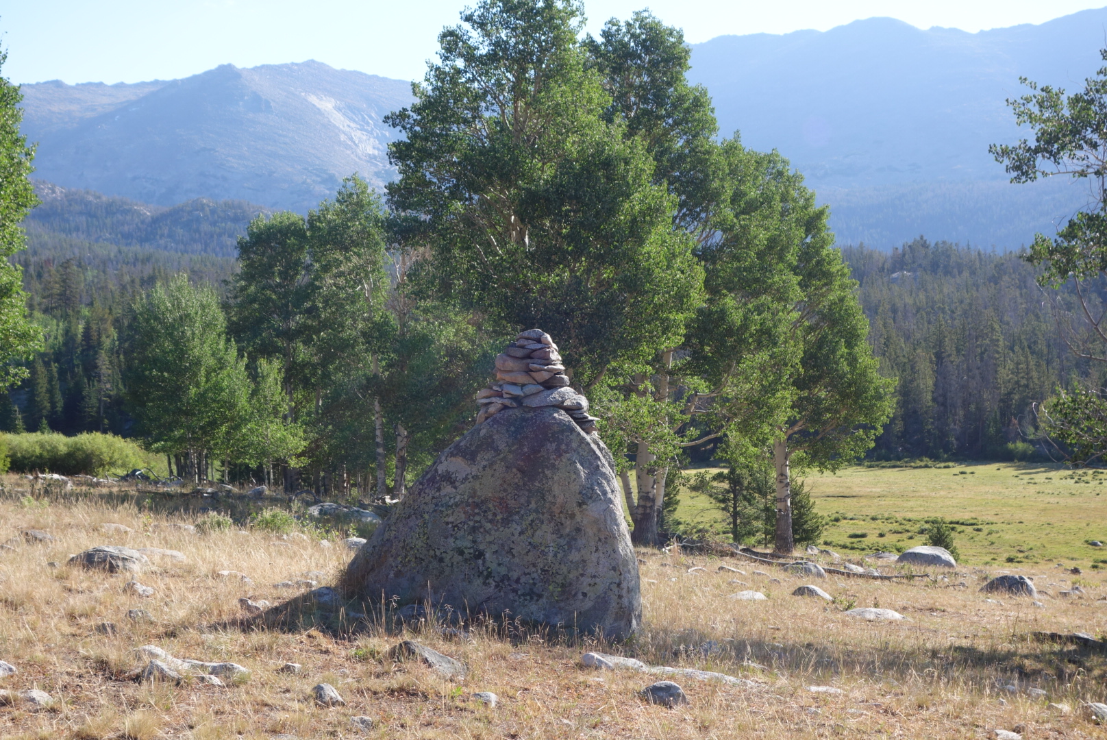
Cairn making gone wild.
After a vigorous morning climb, it was mostly downhill. I went from high forest to a mix of sagebrush and clumps of forest. Luckily, I was able to follow Qtip’s footprints most of the way. As I descended the temperature increased. I did manage to surprise some elk.
Two elk watching from the trees
Later in the day I got close to a moose. It was in a forest fringed meadow surrounded by sagebrush. I entered a short s-curve and where it turned again I saw a large rump and my first thought was that somebody left their horse their. However, I realized it was a moose so I got my camera out to video. It heard me and ran about 30 feet up the meadow. It was a bull. I was talking to it while filming. But I swear I could see it doing “moose math” in its head: “I am 4 times the size of him, I have antlers, and he has a backpack weighing him down…”
He turned to face me. I immediately turned off the camera. Still talking, I made an exit up the trail, nervous that he might follow.
I hiked until dusk. I cowboy camped and was treated to the perseid meteor shower.
When I woke up I hoped to catch up to Qtip. I suspected he was going to be hard to catch, but it is good to have goals.
Since my trail was mostly flat, I cruised quickly through the alpine terrain. I was warmed inside and out by the rising sun. I quickly dispensed with the down puffy and the wind shirt.
Surprisingly, I did find Qtip. He had wiped out on Knapsack Col and had some nasty scrapes. I gave him the prescription antibiotic gel I received in Helena. We started hiking together. But, regardless of injuries, he was still stronger on the hills and soon disappeared.
It was ok hiking. Alternating between austere terrain and forest. Definitely some nice trout fishing up here.
Late in the day, I met a trail crew. It was just two young ladies. I felt bad for them. The trail was just rocks and sand. No matter what they did, one winter would wreck the trail. This is the type of trail where boots are superior to trail runners. Its rough rocks that range in size from billiard balls and bowling balls.
Met another grumpy northbounder.
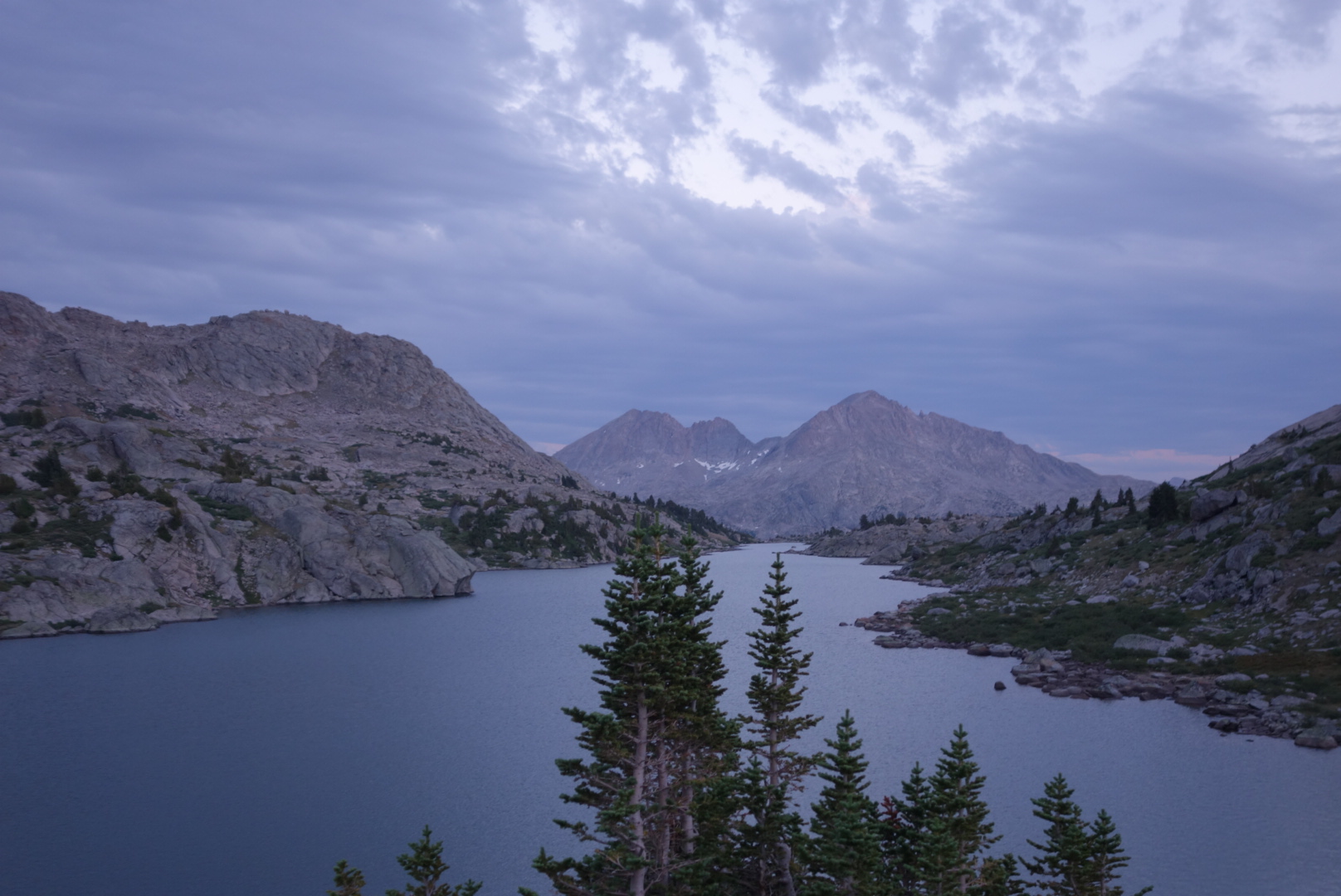
Just towards sunset I reached my goal lake: Sandpoint Lake. There was a fairly casual sign posted stating there was a fire in the NE corner surrounding the lake and people should be cautious. At first I thought that was a little lackadaisical. However, when I got to the lake, I saw where the fire had been and it was not a big deal.
I set up camp in the waning light. There was a canvas tent with some horse campers and another campsite across the lake with a family.. Once the final mountain winds blew out, it was a quiet night.
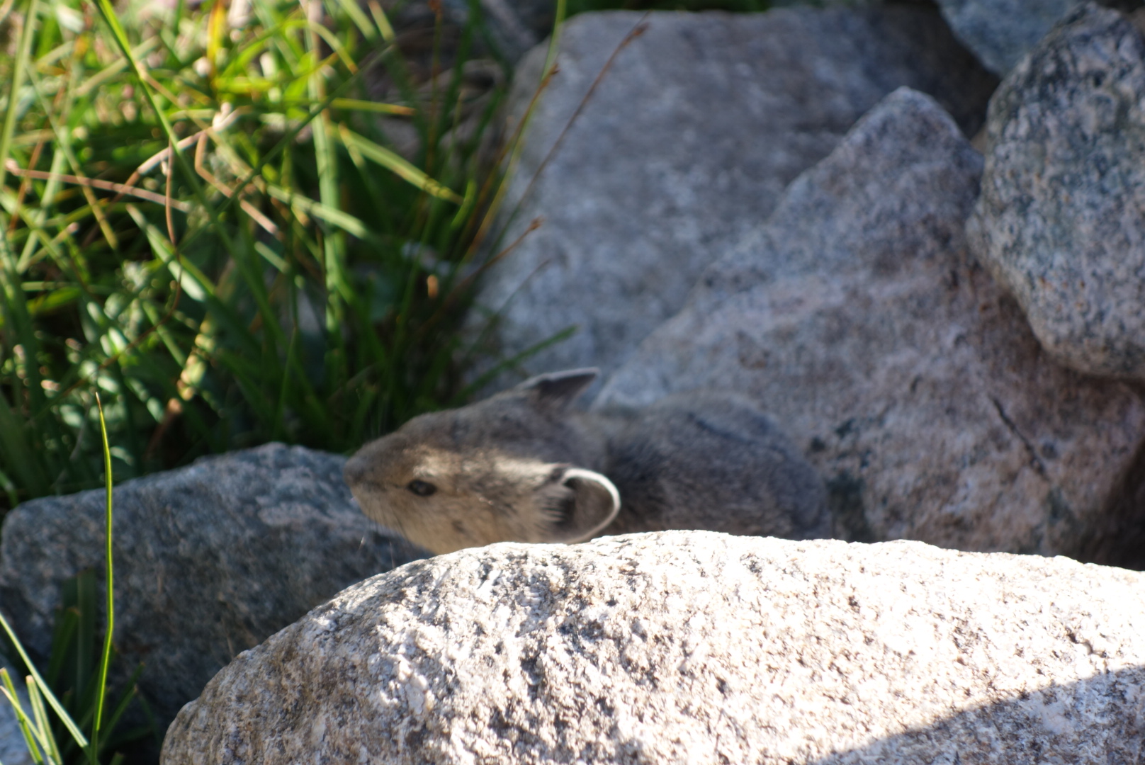
A pikaMore weird rock erosion; this time the top is eroding slower than the support
Right away in the morning I met Qtip. We descended to the Green River and then headed upstream. The day would be easy ascent up along the River, then sharp, steep climbs the rest of the day.
The hike was beautiful. Immediately, there are the two big Green River Lakes. Then, Square Top Mountain appears. It is a textbook example of a monolith: a block of stone rising almost vertically with what appears to be a flat top. Later on, the trail follows the Green River which is colored by all the sediment.
There were a large number of backpackers and horse riders on the trail. At one point, there was a mini traffic jam. Most were weekend visitors.
Around mid-day, the climbing began. Qtip planned on taking an alternate that goes over a geological feature called Knapsack Col. Many CDT hikers do that. A col is a steep pass between two mountain peaks. I chose to skip this. To me, a steep climb up a boulder field to reach a place with not much of a view only to climb down the equally steep other side held little interest.
I lost sight of Qtip at the top of the first set of switch backs. I had a crappy hike when I went from Vista Pass to Cube Rock Pass. Basically, one climbs up a boulder strewn valley. At the base of the valley are the biggest boulders. Allegedly, the trail climbed from the base up to one side and was marked with cairns. Cairns, as you may recall, are rock piles, sort of land buoys. This works great in meadows, but, not surprisingly, is less effective among piles of rocks. After I boulder-hopped and smashed my hands and legs, I eventually found the “trail” and made it.
You can see the trail just vanish the minute it heads up the valley
I got a little twisted around at the top but eventually sorted everything out. I needed to climb Shannon Pass to get to my destination. I was tired, bruised, and not loving the altitude. I kind of bonked, or hit a wall. After taking a late day snack break, I recharged and tackled Shannon Pass. I have a niece named Shannon and vowed to not hold my dislike of this pass against her.
View back from Shannon Pass
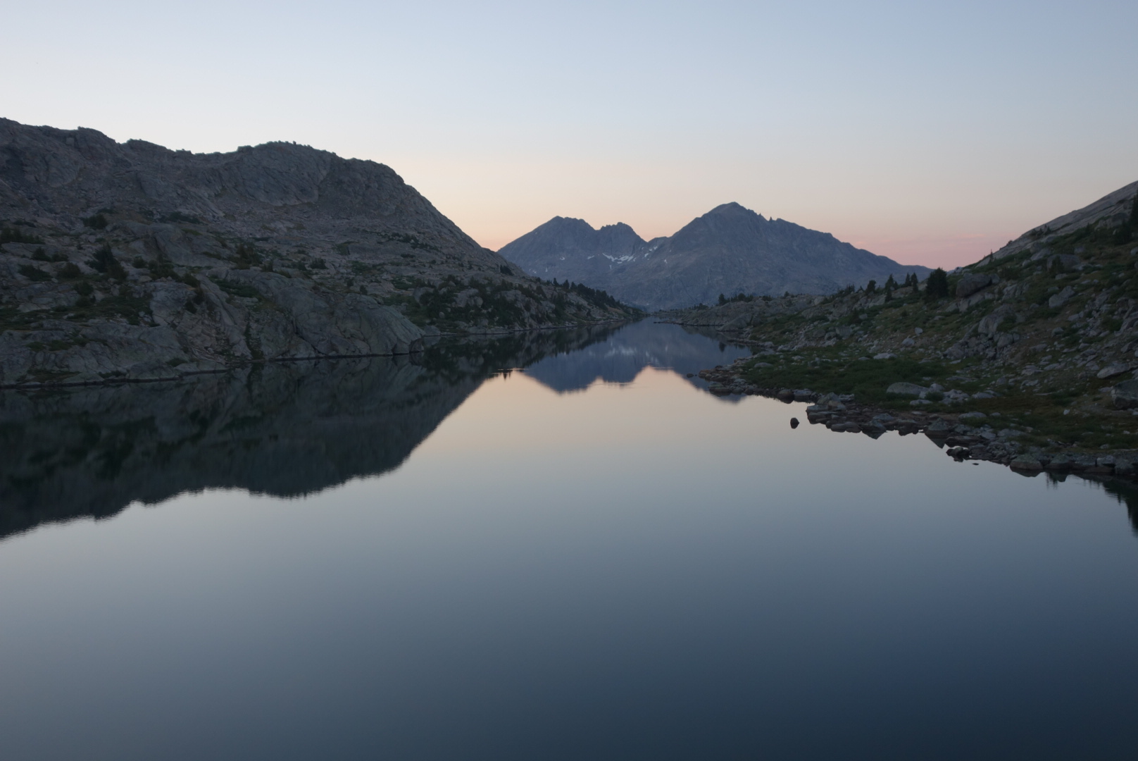
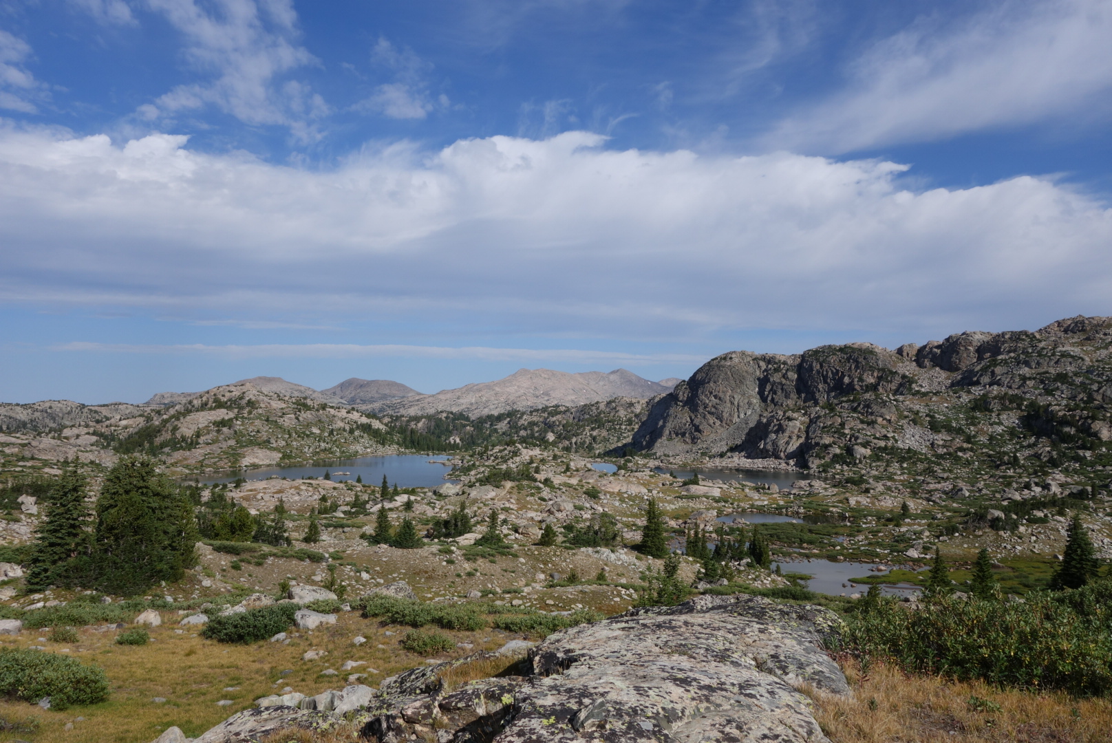
To help visualize, this terrain is all above treeline. It is craggy grey rocks jutting up, some small shrubs, and many lake fed by ice melt. It is austere. If you have been in the high Sierras you have a closr approximation.
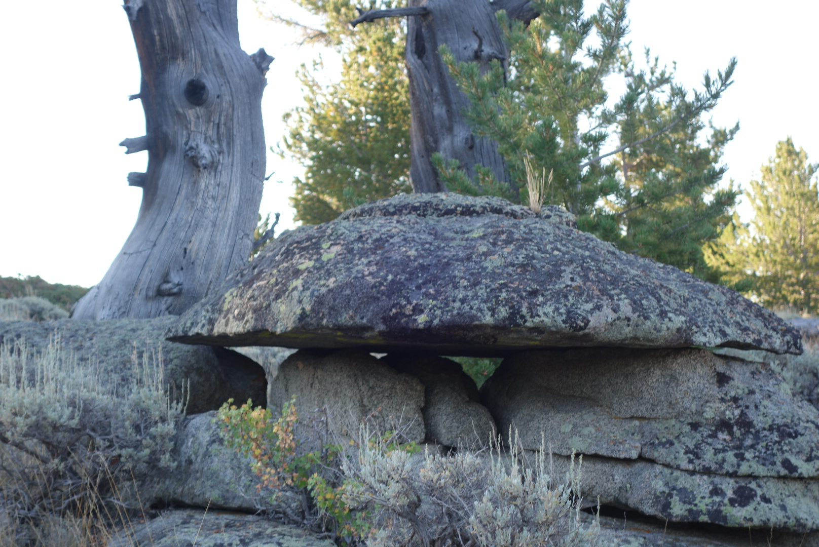
One of the oddities is the differing rates of erosion. Lots of boulders resting on top of ridges.
I eventually came to a nice campsite on a ridge overlooking Upper Jean Lake. The clouds were interesting; they left the mountains around sunset, but consolidated above when it was dark. Even got a mild sprinkle overnight.