I Thought they were Solitary Creatures.

August 28th

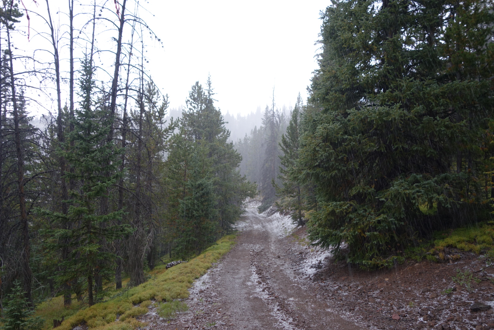
The morning was spent hopscotching a trail open to motorcycles. Some trails are quite popular with motorcycle enthusiasts and they have two results. First is a convex tire repeatedly ridden over dirt creates a deeply rutted concave trail which the human foot is not meant to walk upon. Second is to churn up all kinds of rocks making each step an adventure.

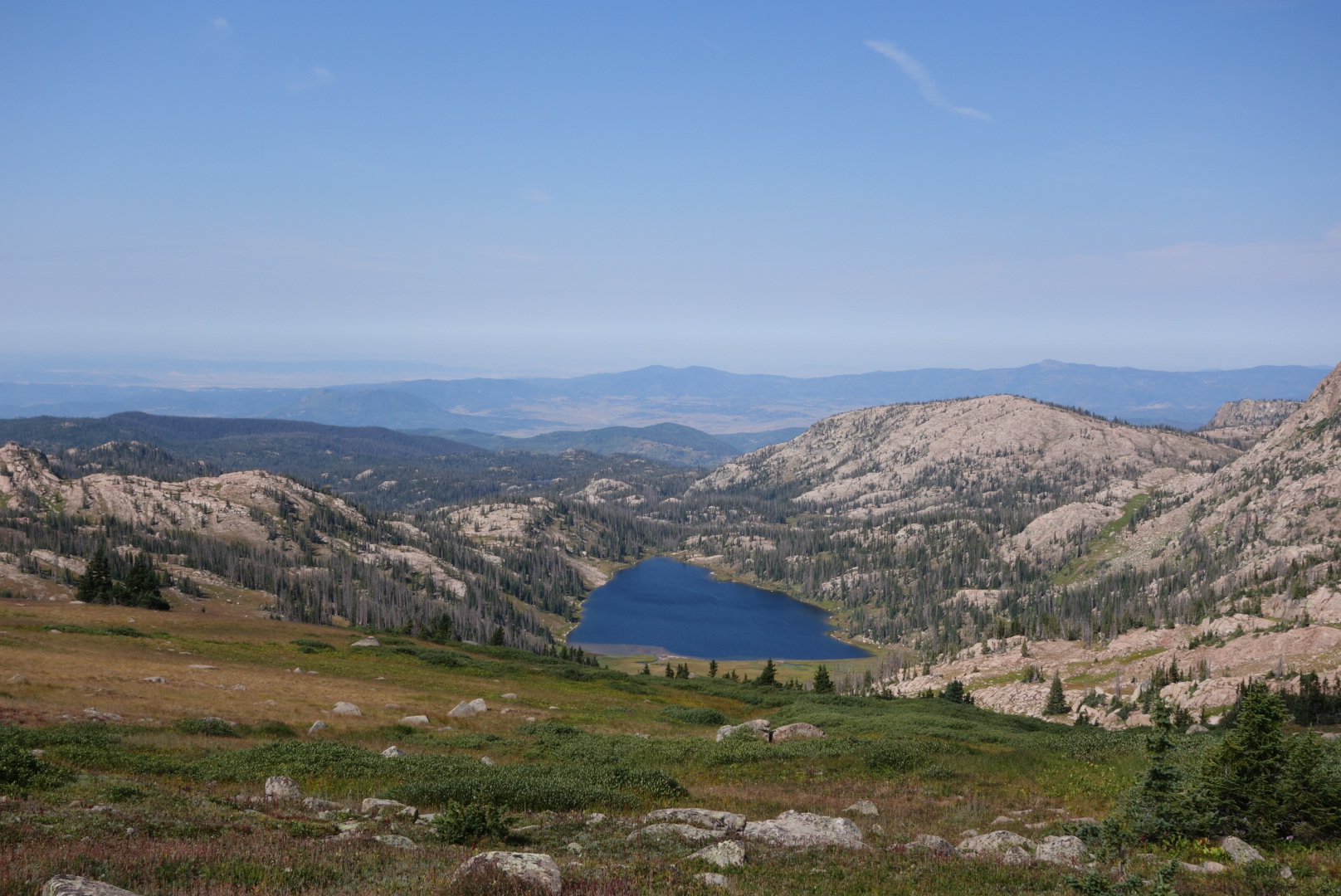
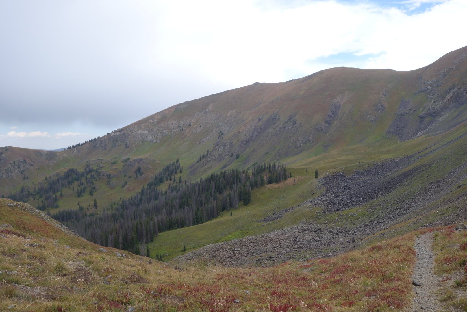
Nevertheless, the trail followed a small stream, Trout Creek, uphill until the headwaters were passed. Then, a serious uphill climb.

I came to the  turn for official trail and it looked sketchy.  In some places on the CDT there is a vicious cycle of low usage leading to low maintenance leading to low usage, etc. Instead, I took an alternate up the Illinois River. At first it was a gravel road with grazing cattle and then a fairly decent trail.  

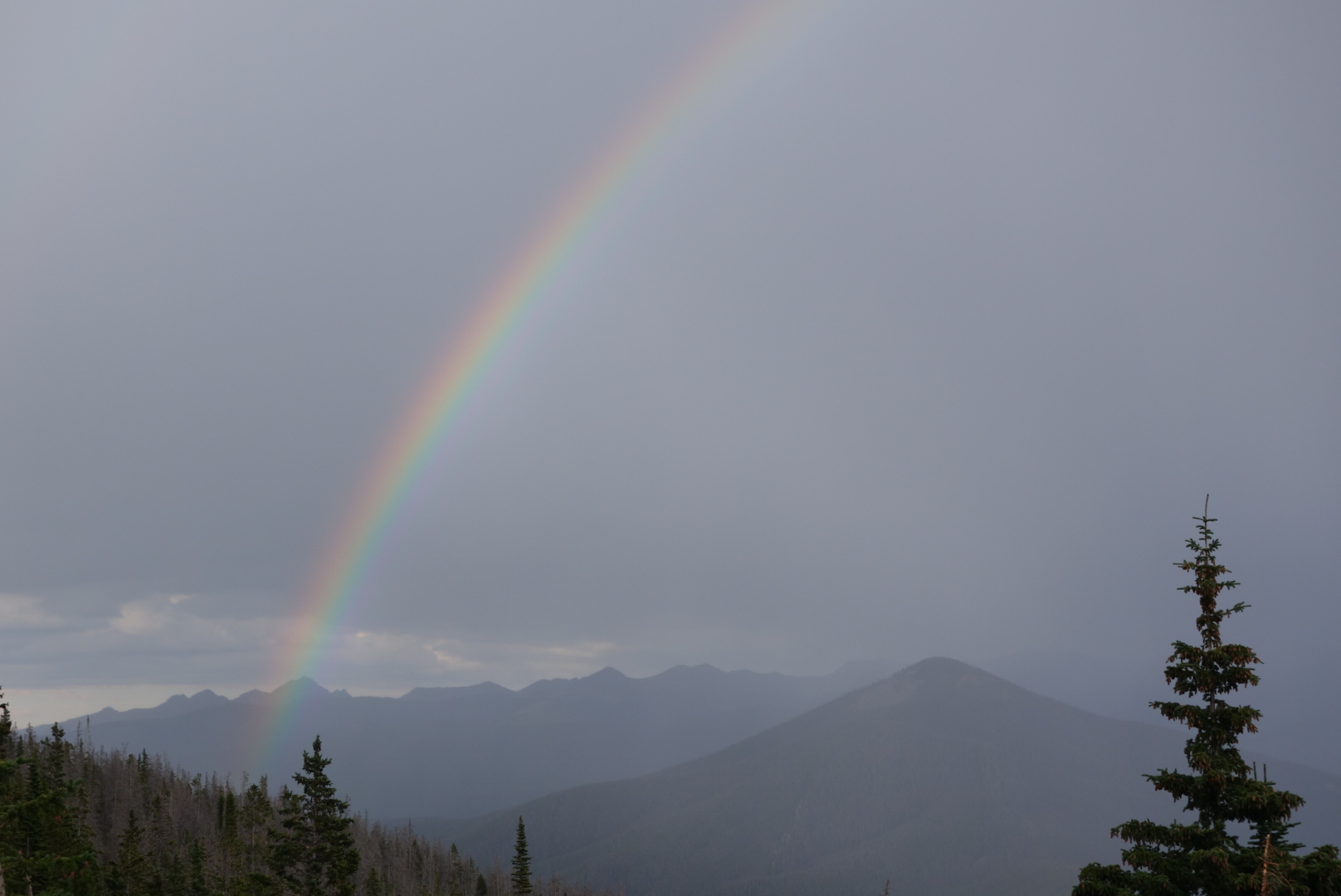
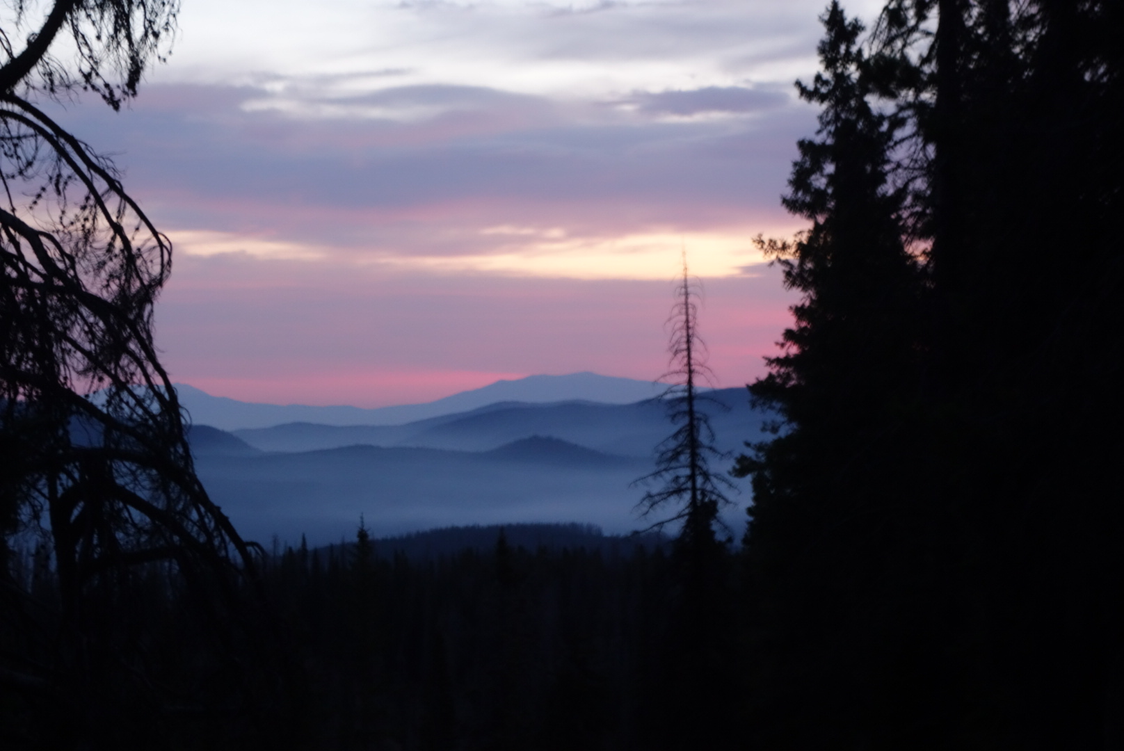
As per usual in my case, clouds thickened and drizzle started. In case I have not elaborated on it before, there are a few hassles with rain and backpacking. First, you want to avoid stopping and taking off your backpack. Next, if you haven’t guessed right, your weather gear (insulation and water resistance are the two main ones) is probaby buried in your pack.  Lastly, it is putting on and adjusting your clothing and regaining the momentum of the trail. 

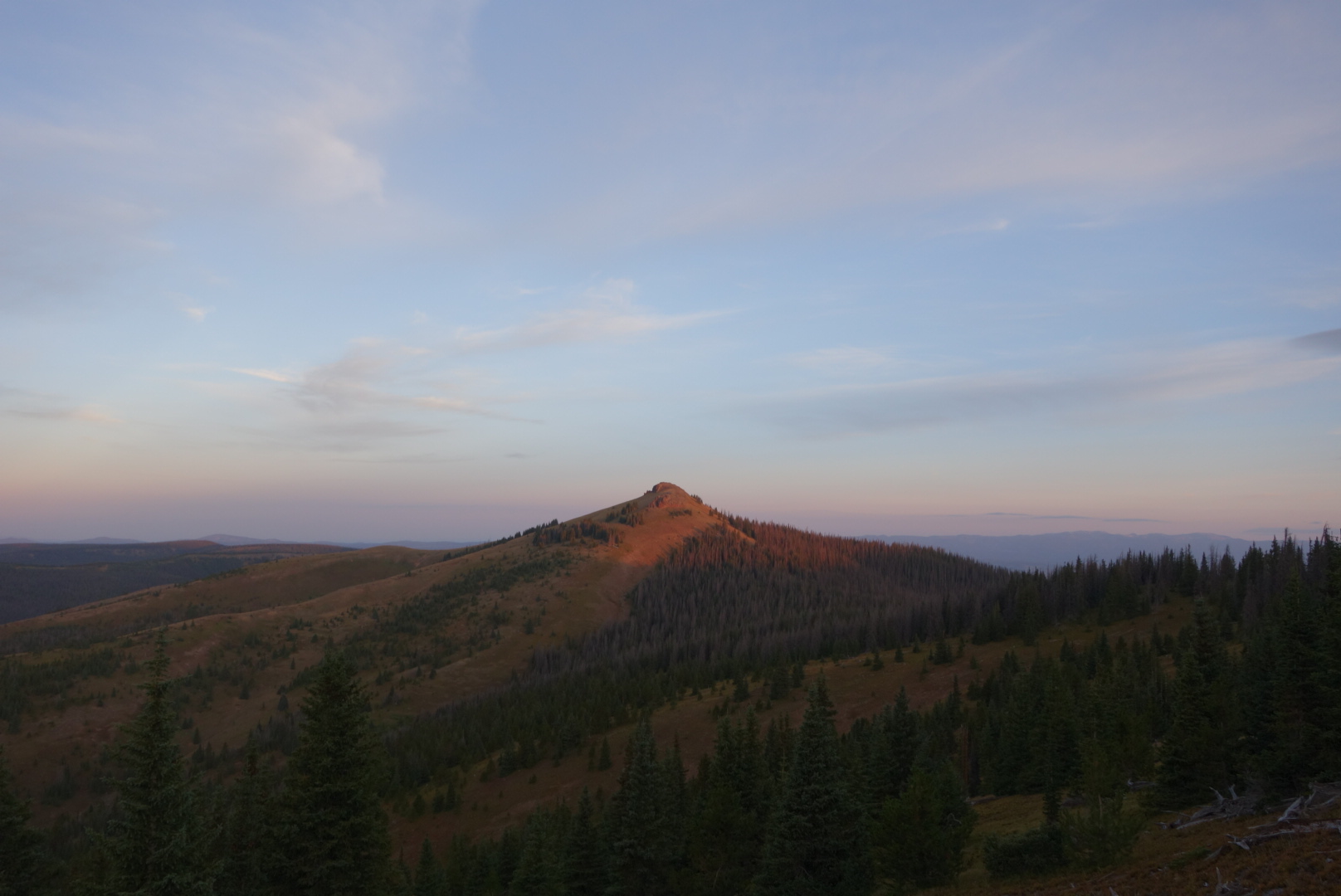
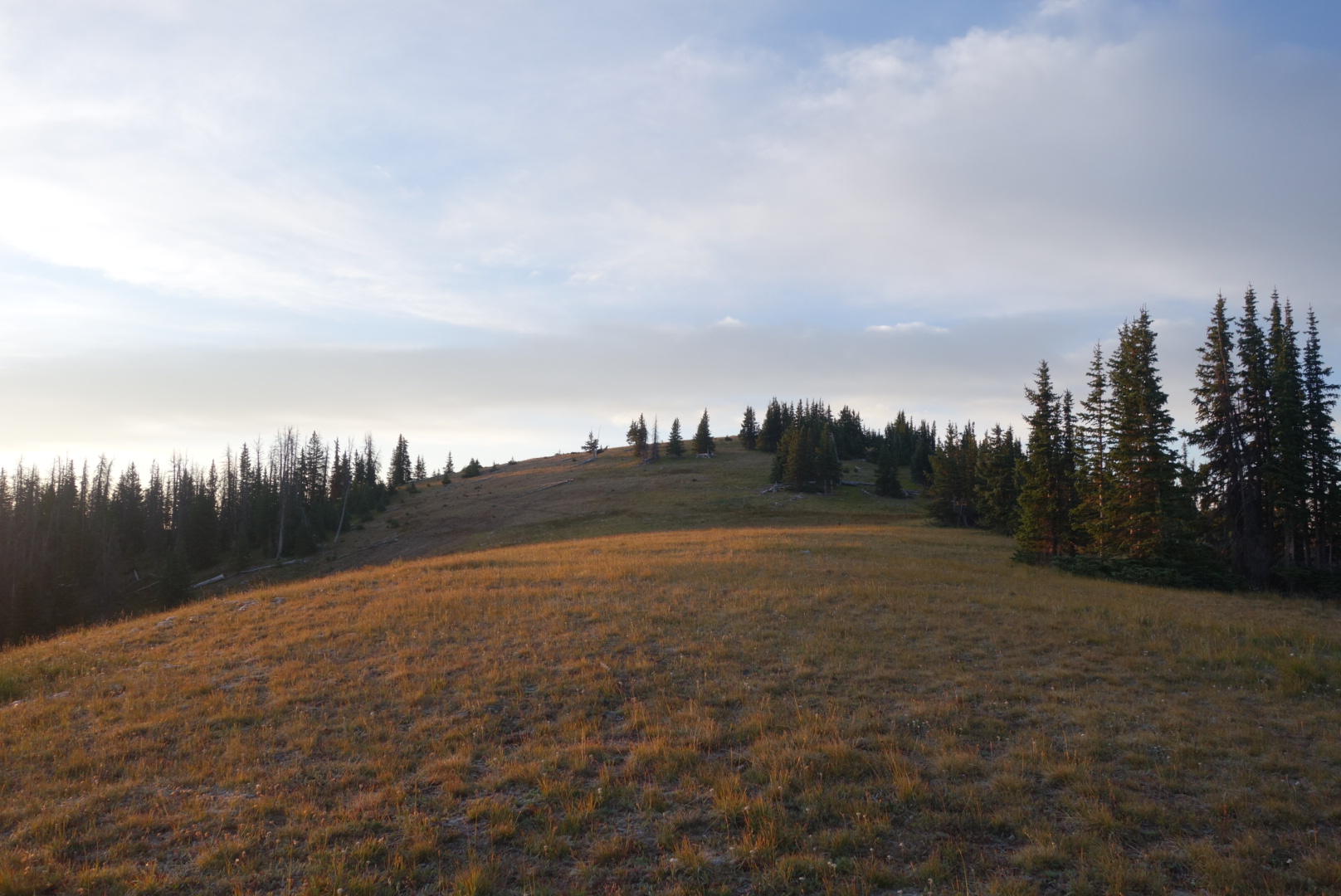
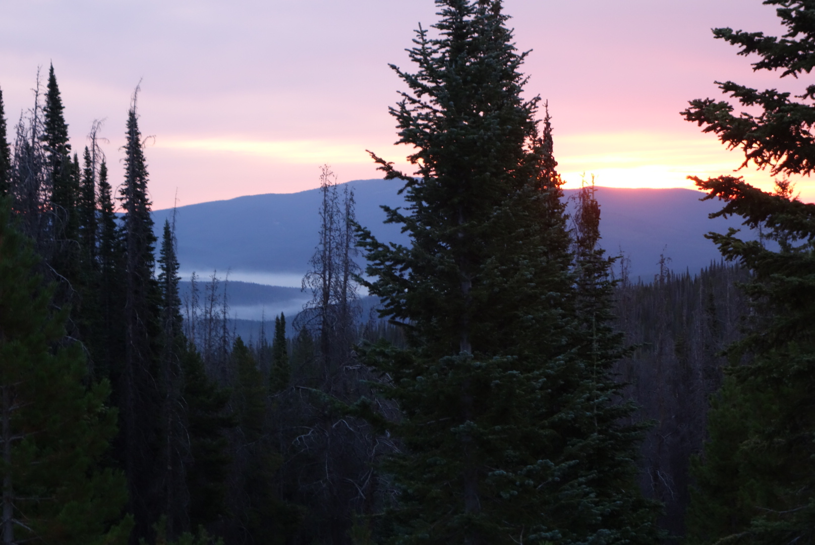
Thus, my umbrella was not enough for the increasingly stronger drizzle and slowly dropping temperatures. I added insulation and my rain pants and forged up to Bowen Pass, 11,475 feet,  where my alternate rejoined the official CDT. 

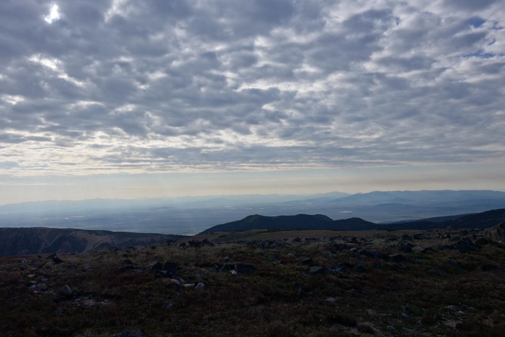
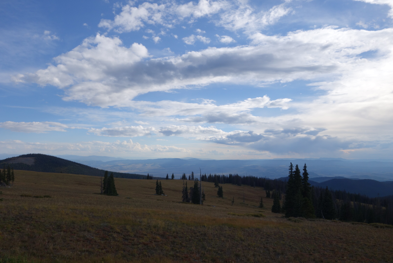
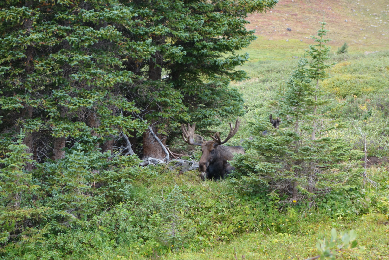
The pass was above treeline.  As I descended into the valley I spotted a bull moose feeding in a clump of shrubs.  This was all the more interesting because I could plainly see where the trail went directly through those same shrubs, not 15 feet from the bull.  As I went down another set of switchbacks, I saw there was another moose, without antlers, also feeding in the same island of vegetation. 

This didn’t bode well as a bull with a cow might get defensive.  Several people on the trail had said moose were more dangerous than bears.  Still, I believed that all previous moose I encountered ran when they saw a human.  Thus, I hoped to approach the moose and get some good video as it saw me and ran off.

The angle of the trail relative to the shrubbery, plus the wind direction, let me get close to the feeding bull.  Further away, I could not see the other moose.  When I could see the antlers, I pulled out the camera, started the video function, and stood up straight hoping to get a clear focus before the bull ran off in fear of me, the mighty  apex predator.  Well, 20 feet away the bull was extremely unimpressed by me. He continued eating. It was strange to have eye contact  with a large,  wild animal.

He was not the least bit intimidated.

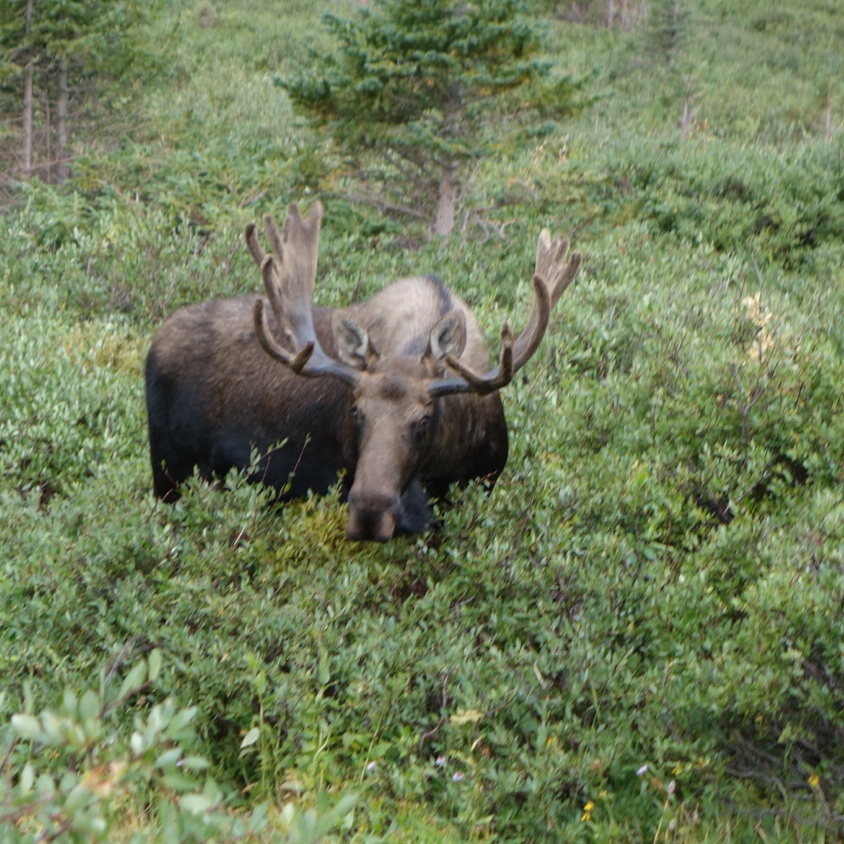
I tried to quickly determine if this was good or bad.  He could charge forward in about 10 steps and deliver some hurt. I, on the other hand, was pretty much confined to a thin trail chopped through thick shrubbery.  I decided this was bad and kept talking and walking.  Much to my relief, he stayed put as I passed. Much, much more to my surprise were the three other moose that suddenly stood up 15 feet away to see what was going on.

These young guys popped up to see me.

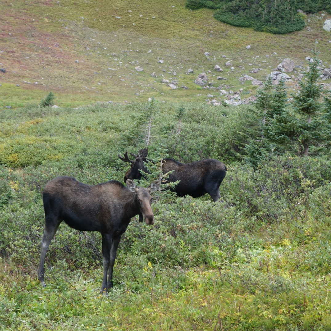
“This is not good.”  I  am not sure why saying this out loud was helpful, but I did it anyways. Although I now had five moose all looking at me, I was slightly relieved to note these three were young males, only one with a small set of antlers.I could tell they were torn between staying or fleeing.  I was definitely into fleeing. 

As I edged past, I was amazed to see the biggest bull lounging on the ground. This guy was big, even laying down. I had thought moose were solitary creatures, but now l had six moose all in one place.

This guy was big, even laying down

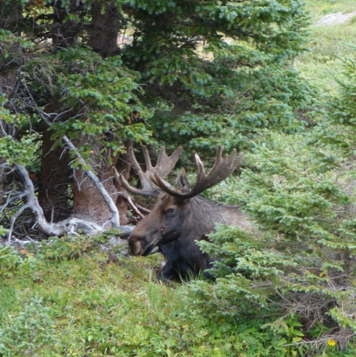
The big guy laying down gave me a look that clearly conveyed “Don’t make me stand up!” I had to get a picture so I took the chance of a few snaps. He looked pretty mad now.  An inventory of quickly accessible defensive weapons available to me only came up with an umbrella.

Talking and walking smoothly,  I did slide by and finally I started to shake a little.  I had just walked past over a literal ton of bull moose. Wow.  

Although a memorable experience, I had to focus on the rain which had increased in intensity.  Since the trail followed a creek downhill, the hiking was fast. After several miles, I ran into three young ladies out for a day hike. They mentioned they worked at the Shadow Cliff Hostel in Grand Lakes, which is where my resupply package awaited.  I originally planned on one more night in the woods. However, after chatting with them, I guessed that I could push all the way to the hostel.  Once again, Helen came through and got me a room for the night. 

I high tailed it down the trail. For the most part, the trail was now indistinguishable from a creek.  I reached the highway. I could walk the highway to town or follow the official CDT.  I chose the latter and regretted it. Sweeping curves that just ended up back at the highway. 

As the rain stopped, I eventually walked into town. I ate some dinner at a restaurant.  The waitress was impressed that I wolfed down two entrees, a full rack of ribs plus a chicken burrito. 

Through the dark town, I made my way to Shadow Cliff.  I met Qtip there which was great.  I grabbed my sheets, made my bed, and went to sleep.

Another Gluttony day

August 25th

Another zero day.  Decided to make the most of it.  Caught up some blog entries in the morning after motel’s continental breakfast. 

Went to strip mall and got much needed haircut. Felt so much better. 

Got some groceries to take out of town in addition to resupply. 

 I had a hamburger plus bowl of chili for lunch. Took a power nap back at motel. The highly recommended Italian restaurant was too far for dinner, so I settled for another hamburger, this time from an Irish pub.  I ordered a sub from the  sandwich shop next door to bring on the trail. 

 Also, given my luck with hitchiking, I ordered a cab to take me to the pass. 

Ridge Walking Colorado Style 

August 27th

Got to traipse along some high, narrow ridges today.  Great names like Poison Ridge  and Troublesome Pass. I went around Haystack Mountain instead of over.  I wanted to save my strength for Parkview Mountain this afternoon. I found some ripe raspberries along the way, which was a sweet surprise. 

Parkview Mountain rises to 12,300 feet above sea level.  The approach was above treeline with amazing views. One of the views was of clouds thickening in both color and size.  The last half mile  came down to me counting 50 steps and then letting my pulse calm down.  Man, I  truly wish I had not smoked for 27 years.

Eventually, I did reach the top. There is an emergency shelter there in case of lightning. Massive amounts of rodent feces and graffiti were the two dominant interior design themes. 

Shelter on Parview
The only thing as bad as a long climb is a long descent.   I came down 1200 feet in a half mile.  More gradually, a forest service road swept downhill in switchbacks.

Maybe it was the downpour that finally occurred,  but I missed my turn.  Rather than climbing back up or bushwacking, I chose to follow the forest service road as it swept back and forth downhill.  I made a last stop for water when I dumped out onto a two lane highway. 

Nice rainbow to lead the way.

I had about a mile walk uphill on the highway until I reached Willow Creek Pass where the trail crossed.  It was almost dark enough for a headlamp.   There was hardly any traffic.  As I neared the Pass, a little old lady in a Subaru stopped. She rolled down the driver’s window, her chin barely above the door, and asked if I needed help. What a sweet, fearless lady. 

I ended up putting my tent up in the dark on a wet piece of what I thought was level ground. This guaranteed a night of discomfort and fidgeting with the tangential benefit of a wet tent to carry tomorrow. 

Another Classic Hitchhike

August 24th

Did not sleep well. The rain stopped and the skies cleared, but I tossed and turned. I slept in until 6:00 thinking there was no need to rush to the highway for early morning hitchiking. 

Almost immediately I ran into Sweet Baby James and Moon Light Lady.  I followed them to the highway and the three of  us tried to hitch in to Steamboat Springs.  My streak continued and we had to wait 90 minutes.

The family that picked us up had seen us and turned around.  They were in a van towing a camper. They were a young couple from Michigan and had their three young kids plus a dog. SBJ, MLL, and I climbed on to the front bench seat with our backpacks on our laps.

The driver kept turning back to ask me questions about the trail and SBJ/MLL were talking to the kids.  As the driver barreled down the highway, I learned the vehicle had over 200,000 miles on it and several parts had to be replaced soon.  His wife was serene during all of this. 

At last we descended into Steamboat Springs.  They needed to visit Walmart and we agreed to split up there. I had dug out my wallet and pulled out some gas money.  We went our separate ways in the parking lot and I made a beeline for a burrito joint.

Before I ordered, I checked my pockets.  Panic. No wallet. I retraced my steps to the van.  Sure enough I could see my wallet on the floor as their dog barked at me.  Normally,  I would’ve tried the van door. However,  when you look and smell like I do at this point, people are immediaately suspicious.   So, I sat and waited for an hour.  My paranoia was that I would go into Walmart to find them and they would come out and leave me with no ID or credit cards or cash.

It all worked out.  I got to my motel, ate too much, and did laundry.  I did have the best meal on the trail at a place called the Ore House.

I fell asleep at 9:15.

High Altitude 

August 23rd

 I got going early in the dark.  All the underbrush was wet, ensuring my shoes had no chance to dry out.  I ascended past a few sleeping campers, careful not to shine my headlamp on them.

I woke up three bull elk.  These ones had lost their velvet and were developing the fall colors. They sprinted a short distance uphill and turned to watch me squish on by. 

As the day got lighter, I reached a plateau.  It had a few clumps of spruce and pine, but was mostly dried grass.   The trail led over to  a large peak.  As I made my way,  I ran across a group of male mule deer.  There were probably a dozen.  I guess they all gather up high to sort out who is who.
I came to the base of Lost Ranger  Peak, 11,900′ above sea level.  It was already cold but now it got windy.  Within 10 minutes of climbing, i stoppef and put on all my down vlothing: beanie, jacket, mittens.  Layered up, I progressed slowly up the treeless, blustery slope.  It got to the point whete i would count 50 steps andvrest for 20 seconds.

Once at the top, the views of the Colorado mountains was fantastic.  For the next several miles I went  up  and down with great views of the lakes below.  I met a few weekend hikers along the way.

View from Lost Ranger

A bumble bee jumped into the lower flower as I was taking this shot.

Later, I descended 2,000 feet down to the Elk River. Of course, then I climbed to get it all back.  Late in the day, I met a guy with Louisiana plates.  He had all kinds of questions about the CDT. He was a personal injury and divorce attorney . He gave me his business card, oddly.


I climbed out of Buffalo Pass and went by a major set of communication towers. When you have been so out of touch, full bars and rapid Internet are like candy.

I ended the day trudginger through an eerie forest.  A lot of pine trees were either standing up or laying down dead.  The skies were darkening.  I finally turned off at Round Lake.  I set up camp and had just boiled water for dinner when it rained heavily.  I fell asleep as the rain tapered off.

Colorado!

August 21st

(No phototos. Sorry)

Woke from cowboy camp I had made just after Fraser Peak.  My right shoulder was sore from a spectacular wipe out I had late yesterday. 

Some of the smoke from the fires had settled in the valleys.   The rising sun gave the smoke some interesting colors. 

Smoke in the valleys


More ATV trails up high. Some backpackers look down on off road vehicles. Initially, I confess, I was one of them.

It is easy to find fault.  One interesting family yesterday consisted of mother, father, son, and daughter. The parents led in a side-by-side. If they were flying,  they both would’ve asked for seat belt extensions.  Indeed, I wondered if they had something like a cat’s whiskers which would warn them off paths too narrow where their overhang might snag. The acorns didn’t fall far from the tree, presumably with a thud.

Their vehicle was balanced with a huge cooler strapped to the back. Why that much beverage capacity was needed by a family of four is unfathomable. 

Daughter was next in one of those golf cart vehicles with 4 wheel drive.  Last was son on an ATV drinking a beer. None were wearing helmets. 

At first, it was hard for me to grasp the attraction. I pictured a family skipping the 401 (k)s and 529 plans, instead buying vehicles and the means to transport them. In the woods, it seems unlikely they see or hear much wildlife as their uncovered combustion engines power them along.   I suppose any wildlife they do see must be so deaf or maimed that it would be frightening. 

However, on further reflection, there were some good things. First, they were a family doing an activity together. Second, they were out in nature, not in a mall or separately watching programs on little screens. Lastly, when they got back to their camp, they would undoubtedly enjoy the quiet (before they fired up the generator and satellite link).   So, if Congress ever decides to do something crazy with our national forests  (give to Chinese in exchange for debt forgiveness), these people and I will be side-by-side saying no.
As I descended, I came to a large sheep operation. They had fouled the water and I was terribly thirsty. I hiked on, making a mental note to eat lamb chops once off trail.  

As the day was ending, I was hungry, tired, and thirsty.   I kept going because I wanted to reach Colorado (and the purported spring nearby).

Finally, I came to the border.  Wyoming takes the time to actually announce their state line.  Colorado is silent.  I tanked up on cold, filtered spring water and went off to find a campsite after 26 miles backpacking over the hills. 


Made it to Colorado

The Ups and Downs; Bearanoid 

August 22nd

The day started clear, but soon grew overcast. During the night a persistent mouse had tried to get in to my tent.  I still hang my food far away, so I am not sure what it wanted.  I was tempted to give it a blast of the bear spray I keep in the tent.  Even though Colorado is not known as bear country, I still take precautions.   I call it being bearanoid.

The morning hike was on broad ridgelines.  There was 2 track road down the middle with trees generally cleared out 15 feet on each side. I startled a huge bull elk with a tremendous set of antlers. He couldn’t pinpoint where I was and he moved towards the road. I quietly unzipped my camera pocket.  He was about to step on to the road about 20 feet away, but he heard the snaps on my camera case as I opened it and ran off.  Ten minutes later, I roused a mule deer buck with nice antlers. If I was a hunter, this would be my spot. 
While it was a great morning for hiking, all good things must end. I had two descents to valleys. The first was a broad meadow with a meandering creek I followed for a few miles.  The second descent was steep and rocky and slow.
At the bottom of this second valley there was a sign saying the bridge was out and I needed to take a road detour for a bridge further down.   This seemed insane given the size of the river, so I decided to go ahead.  Sure enough, with some ingenuity and luck I was able to cross the river and stay dry.

My trail followed the river down to a campground.  I crossed another, bigger river  (on a bridge) and climbed a steep hill as thunderheads formed. I climbed still further along a gravel road.  The skies let loose. I opened my umbrella and cruised along, waving to the car campers I passed.

The thunderstorm cleared just as I came to the entrance to the Zirkle Wilderness. Oddly,  some creature had been steadily gnawing away at the sign.  I registered and went past the entrance. I stopped  and wondered why I was leaving the relative safety of the “real” world and entering a wer, dark wilderness. 
I climbed steadily as the light faded.  The spot that looked nice and level on the map turned out to be burned, with lots of dead trees standing,  just waiting for the right breeze to bring them down.  A couple years ago a Pacific Crest Trail hiker was crushed to death by a tree that fell.  I moved on.
Eventually,  I found a semi-level spot where I could squeeze in my tent.  I ate a cold-soaked meal and enjoyed it. I had to.  My feet were soaked and I gladly climbed in to my dry sleeping bag deep in the dark, damp wilderness.

What’s eating the Zirkel Wilderness sign?
View from ridge after Lost Ranger

On the Trail Again 

August 26th 

The cab was a great idea. He was there before 6:00 waiting for me.  I grabbed 2 apples from the continental breakfast being set up and we left.

It was a long, cold walk along a two lane highway.  Until the sun rose, it was quite cold.  

Colorado is hard to understand in terms of driver relations.  In Wyoming, you simply wave to everyone.   Here, it’s not so clear.  Some people  glare if you wave, others wave back. 

As the day warmed, I took out my sub sandwich. It is weird to walk along a highway and eat a sub.  The best part, however,  came with the flaming hot cheetos.  I opened the bag, unzipped my wind shirt, and tucked the bag inside, held snug by backpack straps.  I could walk down the highway, reach inside and pull out a handful of cheetos.  Who needs cars and cupholders?

After about 9 miles on the paved highway, I took a forest service road that rose past cattle up in to the forest. 

I got to do some ridge walking in the Rabbit Ears Range before dropping down to camp at Arapaho Creek. 

The patterns on uprooted stumps can be mesmerizing (or not)
The day ended with a nice sunset.
Snake on the gravel road
A 20 minute snow / rain storm in the afternoon.

Out of the Basin and in to the Woods

August 20th

Today was going to be big.  I’d leave the Basin and resume walking along the high points of the Continental Divide.

First, I had a cold, steep climb up from Fish Creek.  Then after crossing “Truckdrivers Creek” I did turn and get back in to forest.

I could feel the climbing muscles get to work.  Mostly, the trail was well markd, but there were a few patches with blowdowns where creativity was important.

At the top of one peak, I came across a sobering sight.  Someone had placed an etched stone memorializing a loved one who lived from 1962 to 2010.  A modest, understated monument to someone who died at 48 years.  It was touching to me because that was the year I was born and 2010 could’ve been the year I died if I had not changed several things in my life (work, smoking, not exercising, etc.)  I concluded that I was thankful I did make those changes and had a family that supported me.  Tio be able to hike the CDT and ponder what might have been was sobering but also made me grateful.

The Capital D

August 19th

Leaving Rawlins, a CDT hiker is confronted with a choice.  There is a road (10 miles paved, 30 miles gravel) that is straight.  From it, the official CDT breaks off after 3 miles and then does a 45 mile arc to then return to the road at mile 30 or so.  Another way to describe it is a giant capital letter D, with the road being the straight part and the trail the curve.  While I generally prefer trail over road, the additional miles of alkaline sage brush in waterless terrain was not interesting at all.

So, at 5:15 am I left my cozy motel with 7 days worth of food, 5 liters of water, new shoes, and a new balanced backpack. It was heavy, but I churned up the road.

There were few listed water sources, so the extra water was needed.  The road was lightly travelled so it was not too bad.  Basically, a buried aqueduct parallels the road.  The only other point of visual interest to me was that some type of air inversion was happening.  When I left Rawlins, it was foggy.  As I crested the pass leaving Rawlins, it cleared.  Later as I looked backwards, the cloud bank was making its way to the bluffs and alternately shrouding their tops or eerily sliding down the sides.


I did have a slight ethical challenge along the way.  At one point the aqueduct crossed a silty, alkaline stream.  However,a valve was broken.  Thus cold, clean water was leaking out and then in to the stream.  I would put the rate at about a gallon a minute. There were some small cairns nearby so I could tell this was a known water source. On the other hand, the owners of the aqueduct were clearly losing their product and did not know it.  I decided to look for contact information for the aqueduct owners.  However, the only thing I could find along the way was a number to call before digging.  Since I got no signal I failed to do anything.  Not sure if I will burn in hell for this one, but time will tell.

The only other thing to report was a preponderance of vehicles on the gravel road towing off road vehicles.  It is curious to me the range and popularoty of this recreational activity.  Some pickups will have a single ATV in the back.  Others will tow a trailer that has two side-by-sides in it, one a four seater and another a two-seater.

As the sun was going down I found a campsite away from the road and close to a creek that appeared to have a low TPG rating (turd per gallon).  The wind really picked up so I was in for a little bit of a noisy night’s sleep.