Winging It

September 3rd.

Moving early, I tried to find the trail junction in the dark.  I was on a trail paralleling a river. I needed the trail that went up the hill side. Three times I walked slowly past where both gps maps said the trail should be.

Not wanting to get frustrated, I just winged it and started bushwacking my way uphill through the trees.   Sure enough, after about 20 minutes I found the trail. Often the trail fizzled out, only to rally again around a cairn or tree marking.

On a positive note, the sunrise was delightful and I snapped a few pics.

The sunrise reflected off a slow part of the creek.
Nice sunrise.

Once I reached Ptarmigan Pass, I thought things would get better because I could see Silverthorne down in the valley. Nope. The trail split irrationally and I had to pick a spot on the horizon and just wing it by walking to that point.  

Respect for the sign maker who corrected ptarmigan.

Eventually, my sometime-trail intersected with a popular day hike trail. I flew down the switchbacks.  I found that backcountry trail behavior is not appropriate for popular day trails. In the backcountry you pee when and where it occurs to you. Not a good idea on this trail.  Fortunately, I heard the folks before any misunderstandings happened.

My printed map said to follow a certain trail and it would drop me close to my motel. Not at all. I was dropped down into the back of a suburban development where all the “log” townhomes looked the same.  It was a two mile walk into town.  Just winging it.

Eventually, I made it to my motel and the day’s hassles were washed away with a hot shower.

I often have trouble with spatial relationships. But to my eye, the people and dogs in this area must be gigantic if that is a 6 foot leash.

Let’s Just Get the Rain Over With

September 2nd.

Spoiler header, eh?

Because I was an idiot on route selection, I  was about one day behind on my schedule.  A friend from my gym in  the Twin Cities was flying out to meet me in Silverthorne and hike part of the trail. As a result,  I had to cruise.  Also, I had to take an alternate into Silverthorne.

I crossed the highway and climbed up to the ridge on the other side. Once I got up high and the sun started to rise, I  could see the atmosphere was unsettled. It really did not take  long to go from drizzle to wind-swept cloud.  Fortunately, the tread was clear on the ridge line.  Trying to make lemonade out of lemons, I was  thankful that at least I was getting the daily rain done in the morning.

Pink (or purple) in the morning, sailor take warning

The trail dropped off the ridge and it was different from the maps. The tread was faint.  I was anxious and wet and cold. Like life in general,  sometimes if you just grind it out, it turns out okay. The rain stopped. The trail was obvious. One scary moment was after I had put my pack on after a morning snack.  I always check for my phone and camera. My camera was missing.  The belt pocket in which I keep it handy was unzipped.  Finding a black leather camera case in the forest duff was tough.  After about 10 minutes I found it, a little wet,  7 feet away.  When I hurriedly slung on my pack in the rain, it flung the camera out of the unzipped pocket.  Lucky to have it back and functioning (as best it can in my hands).

The clouds were slow to disappear.

I circled around the top of a canyon and reached Jones Pass.  From there I had a set of ups and downs.  Later in the day I was high up on the ridge and it felt good to cruise with a clear view. Racing darkness, I dropped down into a canyon on a faint trail.  I quickly found a campsite in the dark and heated up a meal.  I figured I went about 24 miles this day.

Later in the day the ridges were a great place to be.
Some plants are already taking on fall colors

A Day to Remember

September 21st

The day started out foggy.  It was a creepy climb up the creek.  A lot of blown down trees that emerged through the fog.  Eventually I got up on the ridge. It was a beautiful view. But throughout the  day the weather wavered from clouds to clear.  Indeed, I could be on top of a ridge and one side would be thick clouds while the other side was clear.

Eerie figures in the fog.
Once in awhile the clouds would break offering great views.

Next wave of clouds coming at me.

By afternoon, I started hearing some elk.  I was on a ridge before entering the canyon that contained the Knife Edge.  The elk bugling got louder.  I looked down and saw a herd of elk.  The bull was fending off another bull.  It wasn’t the Mutual of Omaha, locked-horns drama, but the young guy was not giving up.  After  a while my scent must’ve blown down the hill.  A second herd of elk, this one higher up towards me, trotted downhill past the first herd.  The first bull now had a herd running through his territory plus the young guy.  Rather than stress him further, I mosied on.

The next canyon over had the Knife Edge.  This was  a quarter mile long gash carved into the shale side of a mountain.  It dropped almost a thousand feet.  The weather was getting worse as the wind picked up, the drizzle started and the sun slipped down to the horizon behind the clouds.  I got out my trekking poles and went for it. It was not as scary as I had feared. I made the hairpin turn at the tip and then entered a canyon where the rain was constant. 

About halfway along the Knife Edge, the valley floor just drops. If you have vertigo, this is a place to remember.
The Knife Edge goes along near the top
 

I searched for some small flat spot spot where I could pitch my tent.  Finally I found a crappy spot that would suffice.  It was on a bluff and had a couple trees to block wind.

Trying to sleep on an inflated sleeping pad on a slope is always an exercise in surprises.  At one point you wake up and you’ve slid on top of a root you didn’t notice.  Another time you’ll awake to find you’ve slid to the edge of the tent.  To make matters worse, I apparently had selected a site dead center of the elk equivalent of the bachelorette.  There must’ve been four different bulls at locations all bellowing / bugling all night.


Beautiful Fall Hiking

September 15

It was a chilly morning.  Of course,  the evening rain made for a very wet tent.  I know in normal life getting out of bed is tough, and I am not looking for sympathy, but going from a warm sleeping bag and putting on cold damp clothes and then taking down and rolling up a tent with ice/condensation on it is not a great way to start a day.  On the positive side, it sure makes you want to start hiking and warm up.

Mountains in the distance

The day witnessed a gentle, important change in my surroundings.   I moved from pine/spruce forests out in to more open land and all of a sudden aspens and ponderosa pines started appearing.  Of course,  I knew from experience that ponderosa pines tend to grow where its drier, so I was more attentive to water sources.  In short, the yellowing aspen leaves, cool temps, dried grass all combined to make it feel like Fall.

Aspen leaves are falling

The weather was clear and in the afternoon I was on an abandoned  logging road that went through a mixed pine / aspen forest.  It was almost surreal to walk throughba sunny, yellow tunnel on fairly level ground for a few miles.  Life is great.

As the day wore on, I passed a couple who were hiking the CT.  They were young and carefree.  We both got water at one of the last spots for several miles. As the sun went behind a ridge, I made camp on the opposite side of Van Tassel Gulch and hoped my tent would dry out.

It was a great campsite on the edge of the forest at the top of a ridge.  It looked over a grassy valley to a twin ridge on the other side. I made a little fire and enjoyed the night just a little longer than usual before going to sleep. Later, the Full Moon came up and showed the same valley in a new light.


Ranches in the grass lands

Crazy Day; Thank Goodness these Guys Don’t Govern Manhattan

September 14th

I woke up smelling smoke.  This was not good.  One of my irrational fears is a forest fire and massively confused hiking.  I had no internet access.  Via satellite text, Helen was able to let me know there were no fires on trail.  There was one fire to the southwest and that was probably just blowing smoke my way.

A cloud over the ridge above my camp
Walking along the trail through woods, I turned off my headlamp once I could see the trail.  I came across a bow hunter in full camo.  I am sorry, but I still get a wee bit uncomfortable around a grown man in camo with weapons.  Still, he was a nice guy and had a good hike ahead of him before he reached his designated elk hunting area.

The trail became annoying.  Annoying because of rocks.  Everybody complements the Colorado Trail Association about their great trail.  However, for a good stretch of it, motorcycles are allowed.  I suspect it is the US Forest Service that makes these decisions.  I can’t fathom the thought process…

Motorcycles + hikers

“OK.  We need to decide on who can use single path trails and who can use two-track trails. Any Ideas?”

“Yeah.  Let’s have hikers and horses use single track.  Anything with wheels goes on two-track.”

“No, no.  Lets put mountain bikes and motorcycles on the single track. They all use only  a single path.”

“But won’t motorcycles and bikes startle horses?  Don’t they move at a much  higher rate than foot or hoof traffic?”

“Naw.  Don’t worry about it.”

“In the winter, should we also put cross country skiers and snowmobiles on the same paths?”

Can you imagine if these folks also did traffic in Manhattan?  Applying the same mindset, they would have all cars, trucks, cabs, and buses go on the streets, while  pedestrians, bikes, and motorcycles would share the sidewalks.

Sorry for the tangent, but it is just a wrong way to divide natural resources.

Later in the day, Wash Pot caught up to me.  It was great to see him again.  He looked fit and relaxed after some down time in Colorado with friends and family.  He was hiking with a lady from Virginia whose trail name was Corbett.  Anyhow, we talked and hiked for while.  However, I cannot do both, so I let them cruise on ahead.

I tucked in to a level area  somewhere between Long Branch Baldy and Middle Baldy and just got my tent set up when the skies let loose.  In the vestibule of my tent, I propped my umbrella and had a cold dinner before heading off to bed.  It cleared up later that night.  Oddly, I heard grouse get startled in the middle of the night by something nearby.  Probably a coyote, but it was an eye opener to suddenly have a grouse’s wings thumping at 2:00 am.


Some flowers just keep blooming

Copper Mountain 

September 6th

I knew today was going to be tough. Second days are always tough, but I could hear Dan tossing and turning all night in his tent.  It may not seem like much, but between the wind, other sounds, and novelty of sleeping in a bag on a thin mattress on uneven ground is a difficult adjustment.

We cleared  our first pass (Uneva, appx 12,000′) early and then dropped down into the Copper Mountain ski area.  Dan had a tough time with the downhill.  Individuals react differently to downhill. I kind of like it, but several hikers hate it worse than uphill. In addition to the obvious knee stress, there is potential slipping.

Dan made the first peak of the day no problem

We grabbed a  meal and I bought a new headlamp since I had manged to lose mine.  Refueled, we climbed. Then we climbed some more. In fact, Copper Mountain was about 9,800 feet above sea level and we ended the day at Searles Pass around 12,500 feet.

I  got a little ahead of Dan and tried to find a good campsite, but pretty much everything was exposed.  It was interesting to see a herd of domestic sheep and how they behaved near the pass. There was a shepherd I could see.  What a life.

I managed to build a little fire with scraps of wood. We went to bed right after eating. I hoped Dan would sleep better his second night. It was fairly windy all night, so I was often disturbed by my own tent flapping.

This Colorado Trail even labels insect nests….
Our windy campsite

Racing Thor

September 1st

What a change a day makes.  The morning was crisp, quiet and I knew it would be a great morning.  With my headlamp on, I clumped my way over to the trail. In the process I came within 10 feet of stepping on some car campers sleeping under a tarp.  Oops.

The creepy car from last night was on the road. My guess was the person needed to sleep in their car for some reason.

There was not clear tread.  Mostly the first hours of the day were spent walking between trail posts every 400 feet or so. It was high country. Winter Park ski resort came and went in the distance on the west side, while sheer cliffs revealed snow-fed lakes almost directly below on the east.

Sunrise over an unnamed lake

Around 10:00, I started the climb up James Peak. At 13,300 feet above sea level it would my highest climb so far.  Incredibly, I passed a couple on the way up.  I also nearly stepped on a group of ptarmigan that were on the trail.

I also reflected on my friend James (I know him as Jim) for whom this peak was portentously named.  Actually,  I have no idea of the name source.  Anyhow, Jim and I met in college and were great friends. One of the smartest and funniest people I would meet in my life. He was the best man at my wedding. We had done two backpacking trips together: once in Oregon during college and then once again in Minnesota when I moved back there.  In between, life had come along. Moving, careers, kids, etc. Because he’s such a dedicated attorney and husband, I had not been able to lure him into all or a portion of this trip.  It would’ve been great to climb this peak with him.  I also reflected that, on an actuarial basis, we probably have less future years to hang out than the years passed since college. As motivation, I promised myself if I  made it to the top I would do my best to drag Jim out somewhere on a consistent basis to do smart, dumb, or even inert things.  Life is short and getting shorter.

Ptarmigan were almost directly on the trail.  They were not impressed by me.
The leg feathers are a pretty smart evolution for this climate.

I  did reach the top. It was amazing to see all the surrounding mountains. Besides the couple I passed, there were two other people up top.  Later, I passed them on the way down and we visited briefly. One was a dentist and the other was a retired gentleman named Kent who still climbed 14ers. Very inspiring to meet him out here climbing peaks that truly challenged me.

One view from atop James Peak

I followed the trail down.  Perhaps because of private property concerns, the trail seemed to take an elongated trip back down to the forest, across the Fall River and then come back up again. Although the trail seemed to only get use by CDT hikers, there was some impressive engineering on some of trail walls.

This is about the point in my Colorado blog entries where I mention the skies darkening.  Sure enough, as I reached Bill Moore Lake(11,300)  the rain started.  My challenge was that I needed to get over Breckenridge Peak  (12,900) and Mount Flora (13,100) to reach my goal of Berthoud Pass in five miles. I filled up on water, ate a Snickers bar, and set out.

Initially, it was just drizzle.  About halfway up Breckenridge Peak, the thunder started rumbling in from the south. By the time I topped out, the clouds overhead were a very nasty shade of dark grey and the lightning to the south was visible. I could turn around or go for it.  I went for it.  Struggling to keep a steady pace, I cleared the saddle and began climbing up Mount Flora. Out of breath, I reached the top, found the register,  made a quick entry, and left.

These clouds were getting darker as I moved quickly towards Mount Flora.
Through a break in the clouds and rain, you could see across to other mountains

Almost immediately, the skies opened up with cold rain and wind. I had on all my waterproof gear and my umbrella but I was still getting drenched.  Nevertheless,  I did count my blessings:the lightning did stay to the south.

As I approached the abandoned ski resort of Berthoud Pass, the rain stopped.  A highway ran through the pass. I found a stealth campsite away from the road and the rest area.  I knew all my stuff would still be wet in the morning,  but there was nothing I could do about it and instead reflected on how lucky I  was to have beaten Thor. This day.


Yes, I am an Idiot.

August 31st

It was close to freezing in the morning.  The trail climbed through a few meadows near lakes and a place called Coyote Park. The almost freezing grass and shrubs bathed my feet in ice water.

The view? Gorgeous. The grass? Cold, wet.

The trail reached Caribou Lake at the foot of Arapaho Pass. The climb up to the 11,900 foot pass was steep and I could look back down and see a group of young hikers, probably boy scouts, breaking camp.  

Caribou Lake on the left

I reached the pass and did what all through hikers do: checked for a cell signal.  The sun was out so I warmed up and checked in. I thought I was going crazy because I kept hearing voices. 

When I started hiking again, I found the source of my craziness. It was a group of about 10 day hikers just reaching the Pass from the other direction. They were kind of standoffish, so I just kept walking. In rapid order, I met a day hiker with his (unleashed) dog and a trail runner.  

The lady trail runner confirmed my suspicion: I was near a popular trail head. I took a break and studied my maps more closely. The shorter mileage was only for a first segment.   When I added in the second segment, I had chosen a route that was five miles longer than the official trail. What an idiot.

I ran in to all sizes and shapes of people as I descended.   It was a nice day and I enjoyed the descent.  I enjoyed it so much I missed my turn. What an idiot.  After climbing back uphill for about a half mile, I was back on the correct trail to Diamond Lake. 

I was finally chugging along.  There were the customary clouds gathering in the distance, but I was keeping a good pace. Then, the trail began going straight up over a mountain when the map showed it skirting all the way around. I retraced my steps,  looking for a blown turn. I bushwhacked looking for the old rail.  After an hour, I gave up and resigned myself to the fact the old trail had been rerouted and I was on an  unmapped path.  What an idiot.

Eventually, after a couple correct guesses at trail junctions, I was back on my misguided long-cut. The goal was to rejoin the official  (and shorter) CDT just after Devil’s Thumb Pass.  Now I could see the pass and also the big snow fields I  feared I might have to climb late in the day.

Snow field below Devil’s Thumb Pass. I saw three hikers up there.
Not expecting to meet anybody out here, I was surprised to meet a young woman hiking the other direction. She confirmed I would not have to walk over snow fields and that there was a good water source ahead.  She had an interest in backpacking and asked a lot of intelligent questions.  

By now you can predict at least one thing. As I began my climb up to the ridge, it began to drizzle and the wind swirled in the steep canyons.  After I made it the top, it was very eerie.  The clouds were being blown up out of the canyon and then swept out over the more moderate side I was now on. Also, I loved the name of the trail: High Lonesome Trail. 

As the sun set, the wind, wet, and dark forced me to seek shelter within a cluster of dwarf spruce just before Rollins Pass.  It was challenging to set up the tent in the dark and wind. Also there was a car that turn on its headlights, then creep along for awhile and then stop, only to repeat the action in 15 minutes.  Kinda weird.

I fell asleep to the wind slapping the tent. By small measures it tapered off. By 2:00, when I got out of the tent to pee, i was treated to a beautiful display of stars sparkling in silent, cold air from horizon to horizon.  I guess getting older and having to get up in the middle of the night can have its advantages.

Leaving Food

August 30th 

In the dark, I  left the hostel and walked down through a sleeping Grand Lakes.  No restaurants were open and the town was very quiet. 

The trail winds through town, then residential areas, eventually reaching a lakeside trail.  It was a nice sunrise.  The houses were across the lake and the trail ran through a natural area with several osprey nests.     

The lakes are man made, so I  came to my first dam.  I ate a little, took off some layers,  and headed  south. In a narrow section of a bay, I came across a couple who were in a sailboat.  I think they were just waking up.  Their quiet scene was in contrast to the campsite near the Twin Creek Ranger station that featured two pontoons, a jet ski, a large canvas tent and generator.

After the ranger station,   the trail climbed atop a bluff.  The maps warned of many blowdowns and there were.  A slow uphill climb over fallen trees is not ideal.  I just imagined it as an obstacle course instead of a trail and it seemed to go a little faster.

I met a husband and wife section hiking. Their names were, I think,  pot and lid, presumably referring to the cooking product.  

To my great surprise, I  ran into Adam and Denali.  I walked right past them as they took a break overlooking the lake below.  They were the enjoyable young couple I had hiked with in Montana before Butte.  We caught up a little.  They were going northbound from Chama, NM.  So, there was still a chance i would see them again when they later returned to New Mexico and finished their trip to the border with Mexico.  They are a positive, fun young couple and I always enjoy being around them.  

Continuing south, the trail eventually descends to the head of Lake Granby at Arapaho Bay.  There was a large campground there.  About 100 yards before reaching the campground, on the trail was something I had not seen in awhile: a large pile of bear scat.  

I ate lunch at the campground.  Looking up the valley there were dark storm clouds.  The wind was sharp. I put back on everything I had taken off earlier.  Also, the helicopter that I had heard and seen earlier flew by much closer this time.

I trudged up a gravel road to Monarch Lake.  This was the last man-made reservoir before I climbed into mountains.  There were a ton of cars at the end of the road, including a horse trailer with Iowa plates.   I met a search and rescue guy. He had a team out who helped a guy who was having trouble breathing.   The helicopter had been for him.  Where, but for the grace of God, go I.

Surprisingly, there were few people on the  CDT portion.  I came across an abandoned steam engine that was probably used to build the dam.  Also, I saw a lady trail running.  

I came to a fork.  I looked at my Ley maps which are annotated.  My tired eyes saw the words “no permit required” and 8 miles versus 12, so I decided on the spot to take the alternate route up Arapaho Creek.

The storm I had seen earlier had been through. Everything was soaked, so inevitably my feet got soaked.  I climbed from 8,300 feet to about 10,000 feet. Although the terrain was rough I found a flattish spot where I could look up at the peaks. As the sun set, it was cool to watch the clouds.  They were trying to reach over the mountain tops to come down into my valley, but they could not. So I was under clear skies while the other side of the mountains were cloudy.   After sunset, the show continued as I could see flashes. The lightning was far enough off to have no sound yet bright enough to have a light show. I had made a small fire and it was amazing to watch this show play out from my tiny campsite. 

The Longest Zero Day

August 29th

A zero day means one where no miles are hiked.  I extended my stay at the hostel for a day, got my resupply, said goodbye to Qtip, and then looked at th loop hike around Rocky Mountain National Park. 

The trail starts about 500 feet from the hostel.  It is about 25 miles.  It was 10:00. With no backpack, I thought I could go about 3 mph and be back before dark. So, on my day off from backpacking, I went on a long hike.

I just brought my down puffy and rain jacket. I drank a bunch of water before leaving; it’s better in you than on you is my motto. 

Initially the trail was mostly level. Without trying,  I cruised past the day hikers. It was nice to see families out enjoying the scenery.  I did  see a few backpackers coming down.

After 5 miles the trail started to climb.  I enjoyed not having weight on my back, but I was not that much faster. 

As I encountered backpackers going the way I had come from,  I asked them if they were looking forward to finishing.  It surprised me how many were planning to stop before the end.  Soon, it became clear that most were doing the loop in 3 days.  At first I was a little stunned by the short daily distances, but when I thought about the altitude, the desire for sightseeing, and earlier trips I’d taken, it made sense.  Not all backpacking trips needed to be about big miles. 

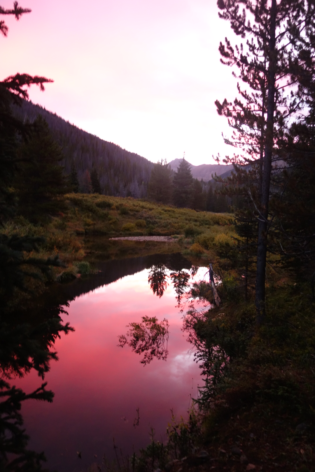
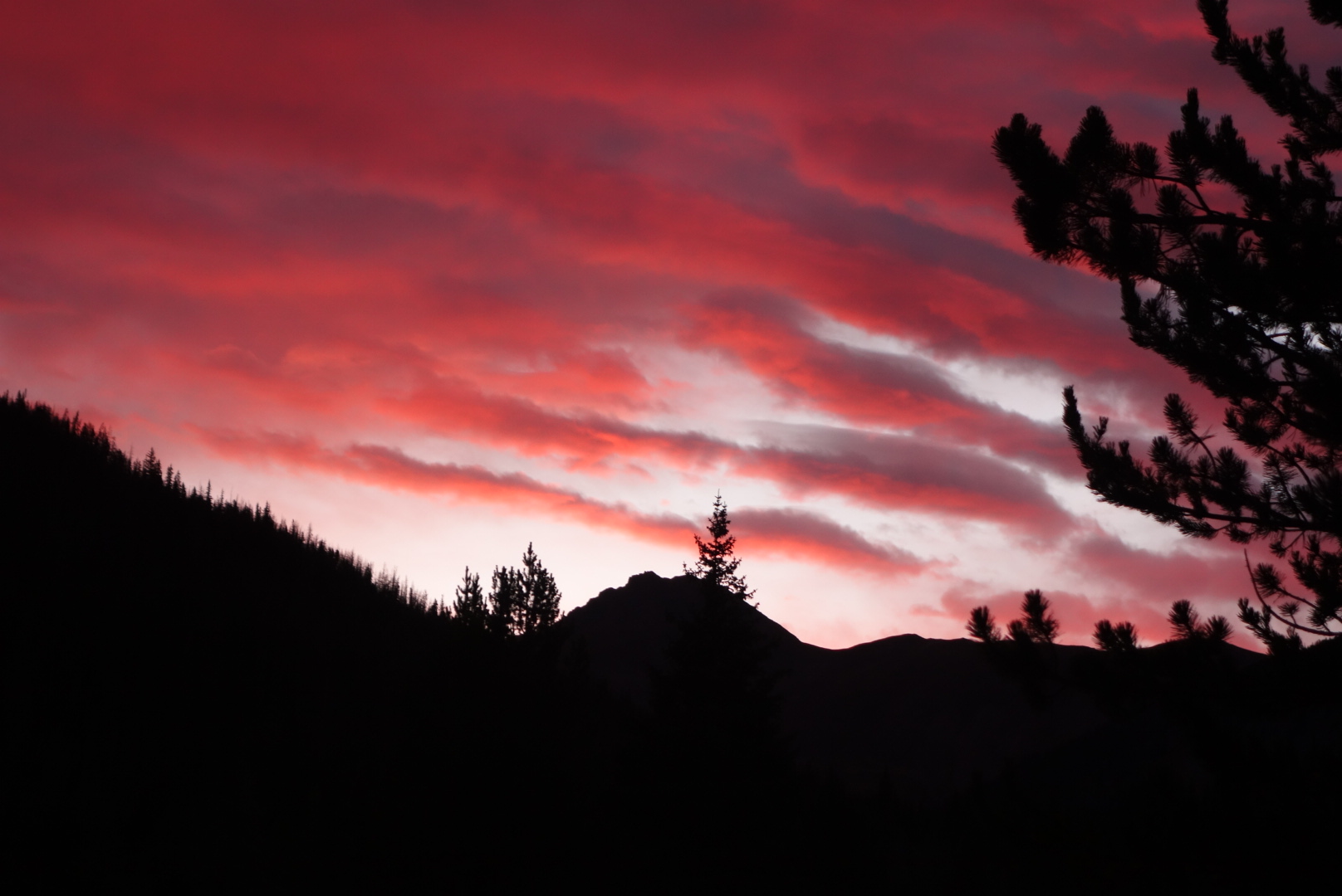
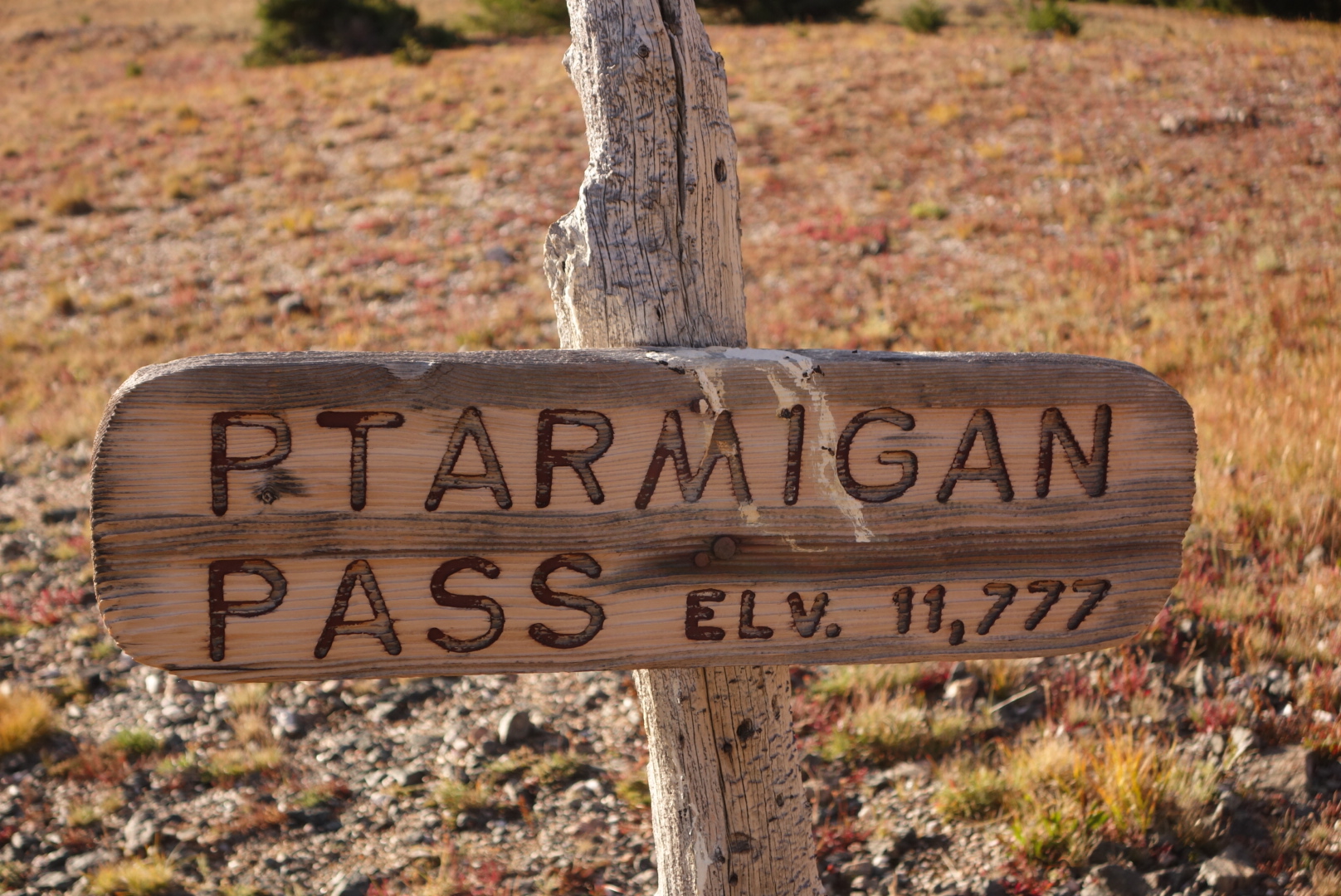
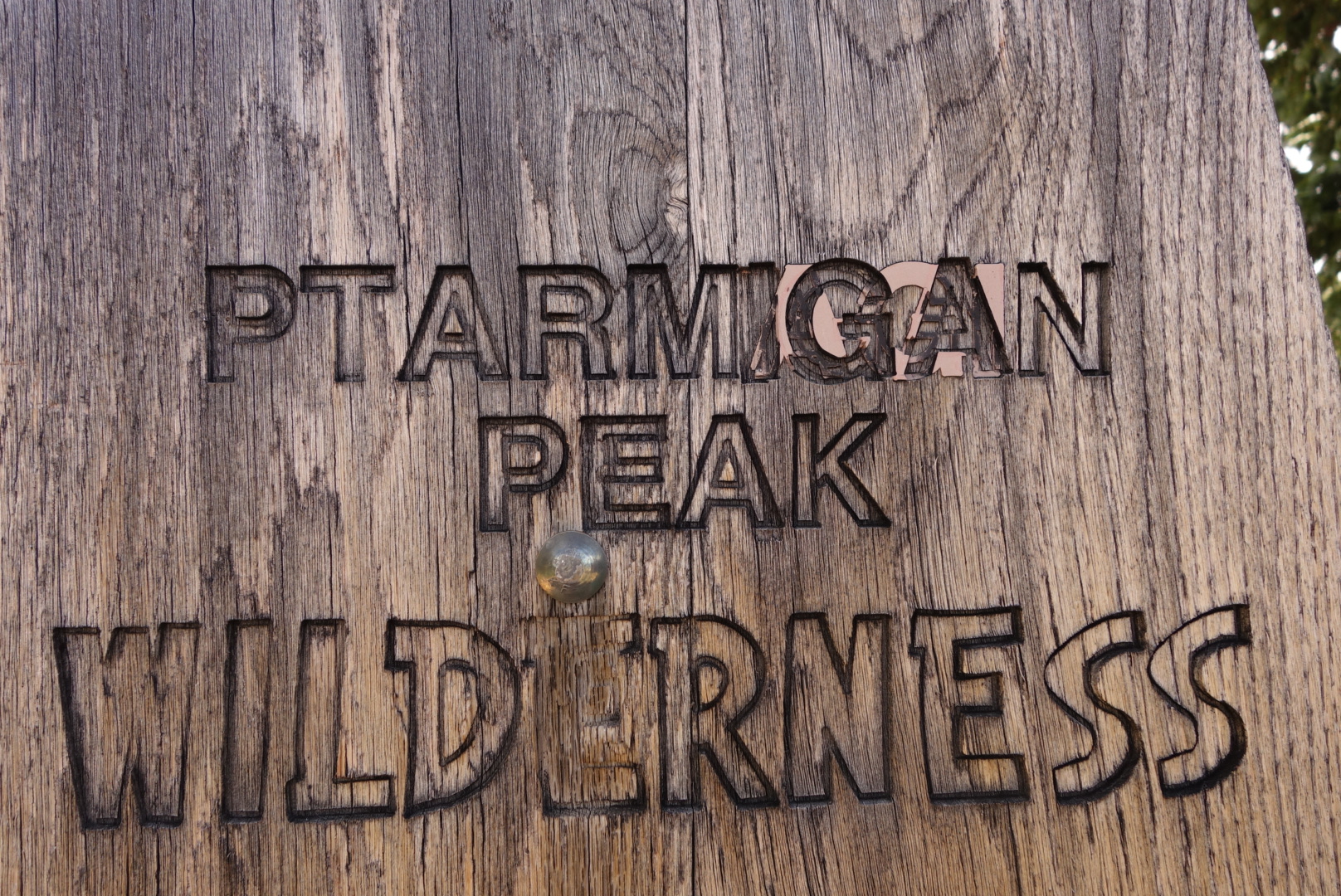
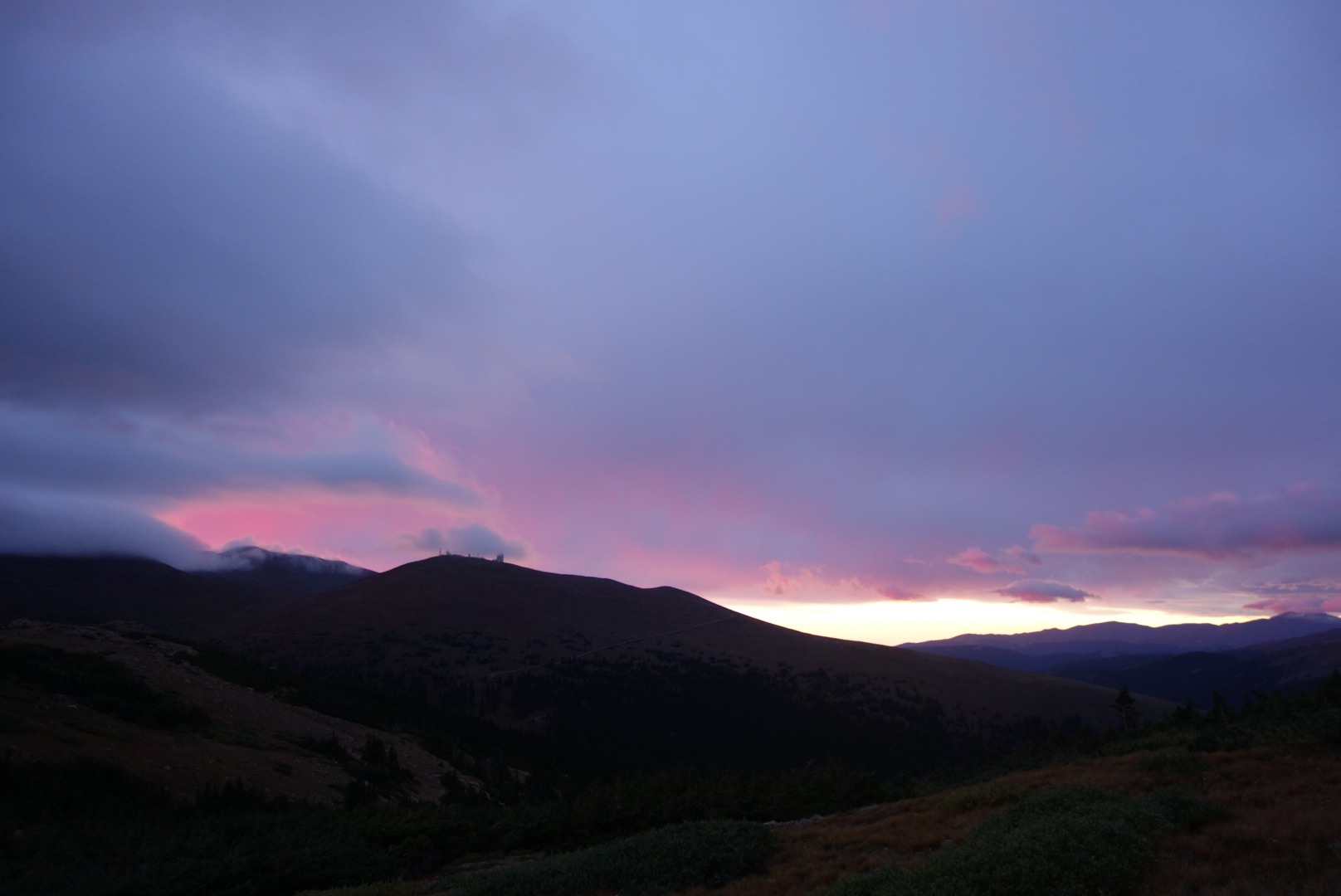
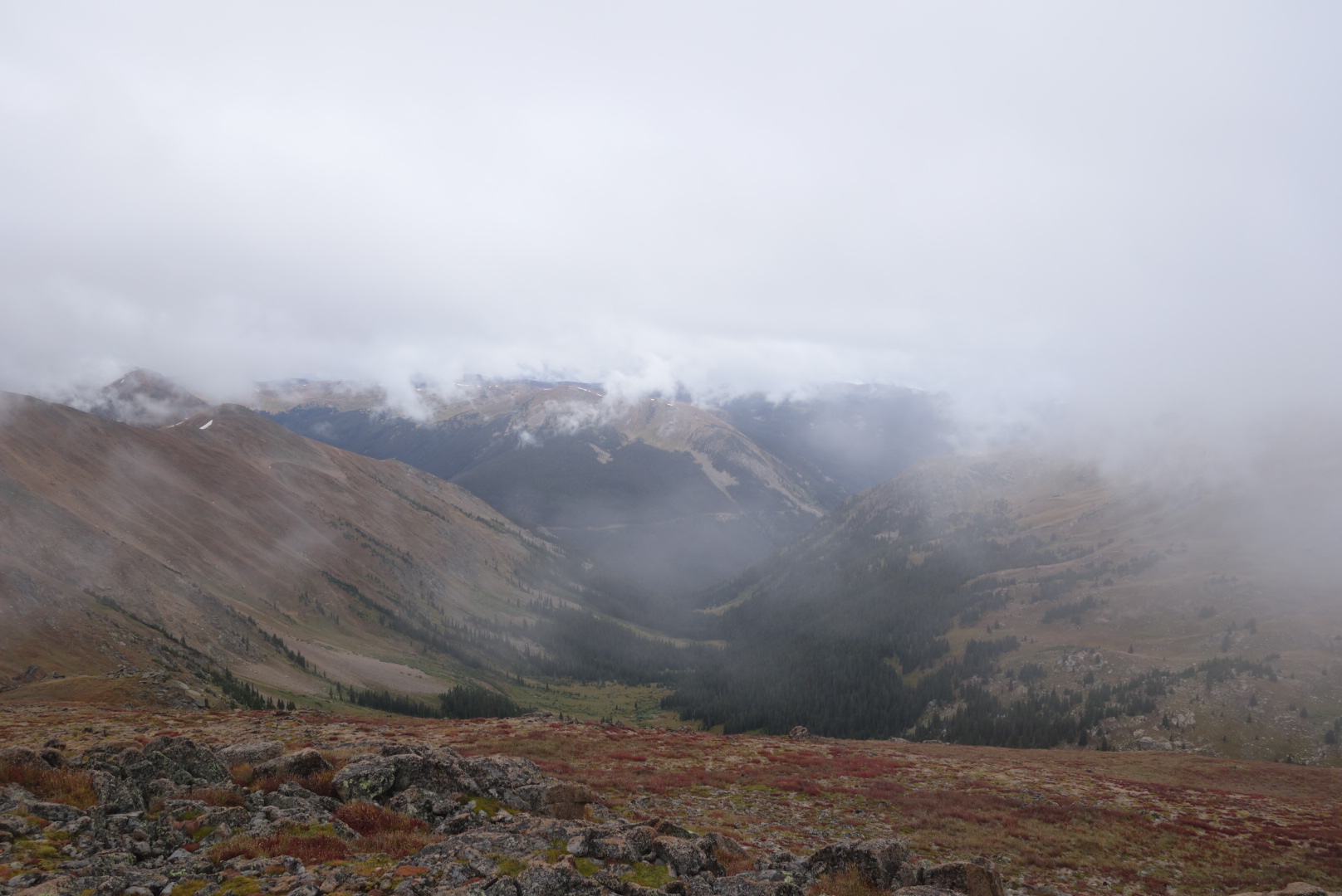
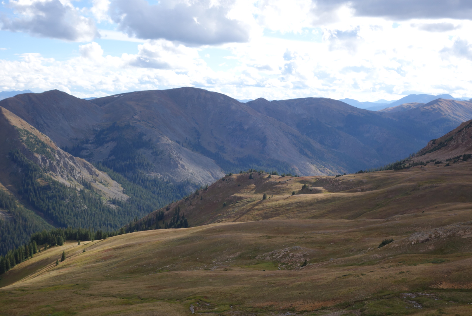
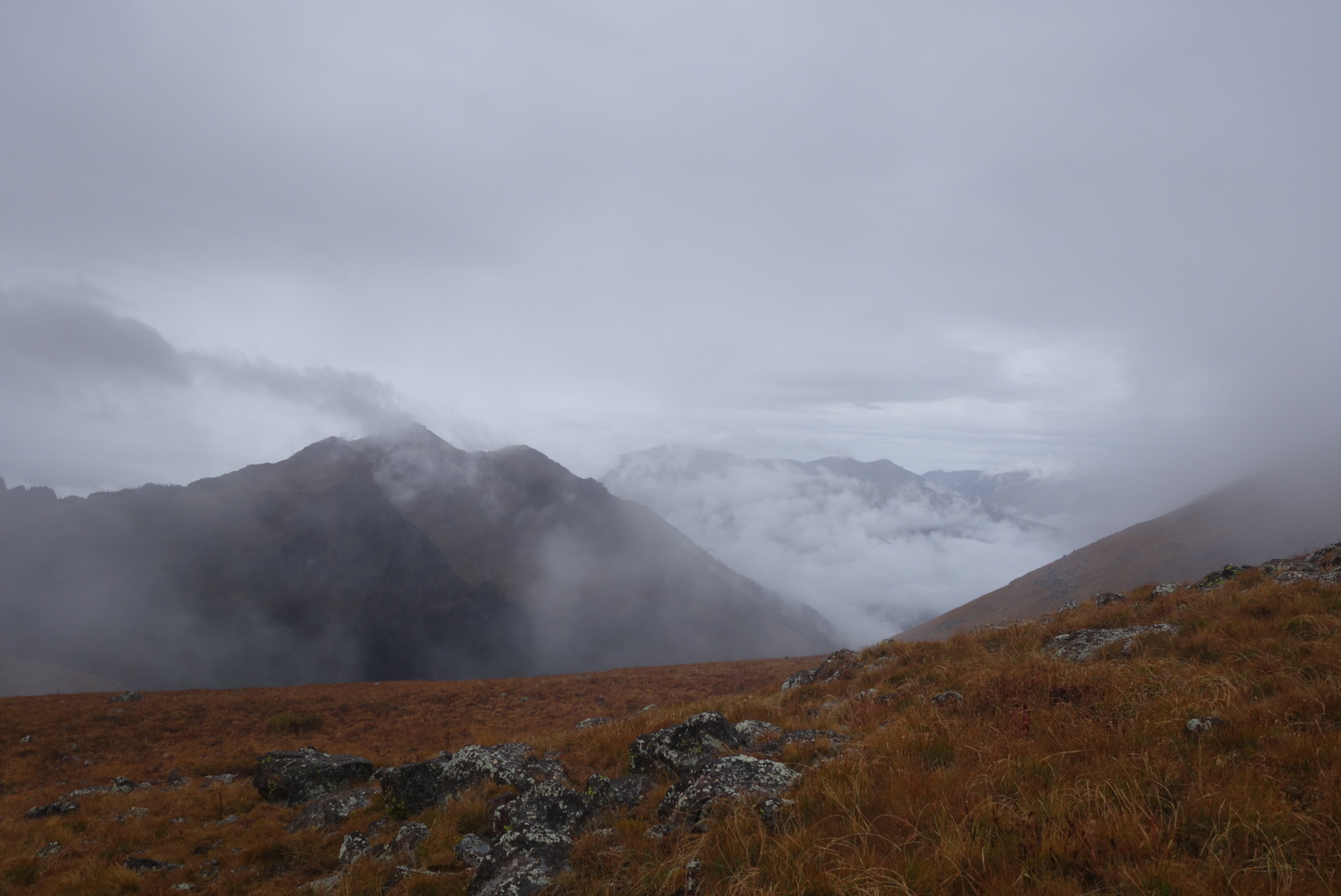
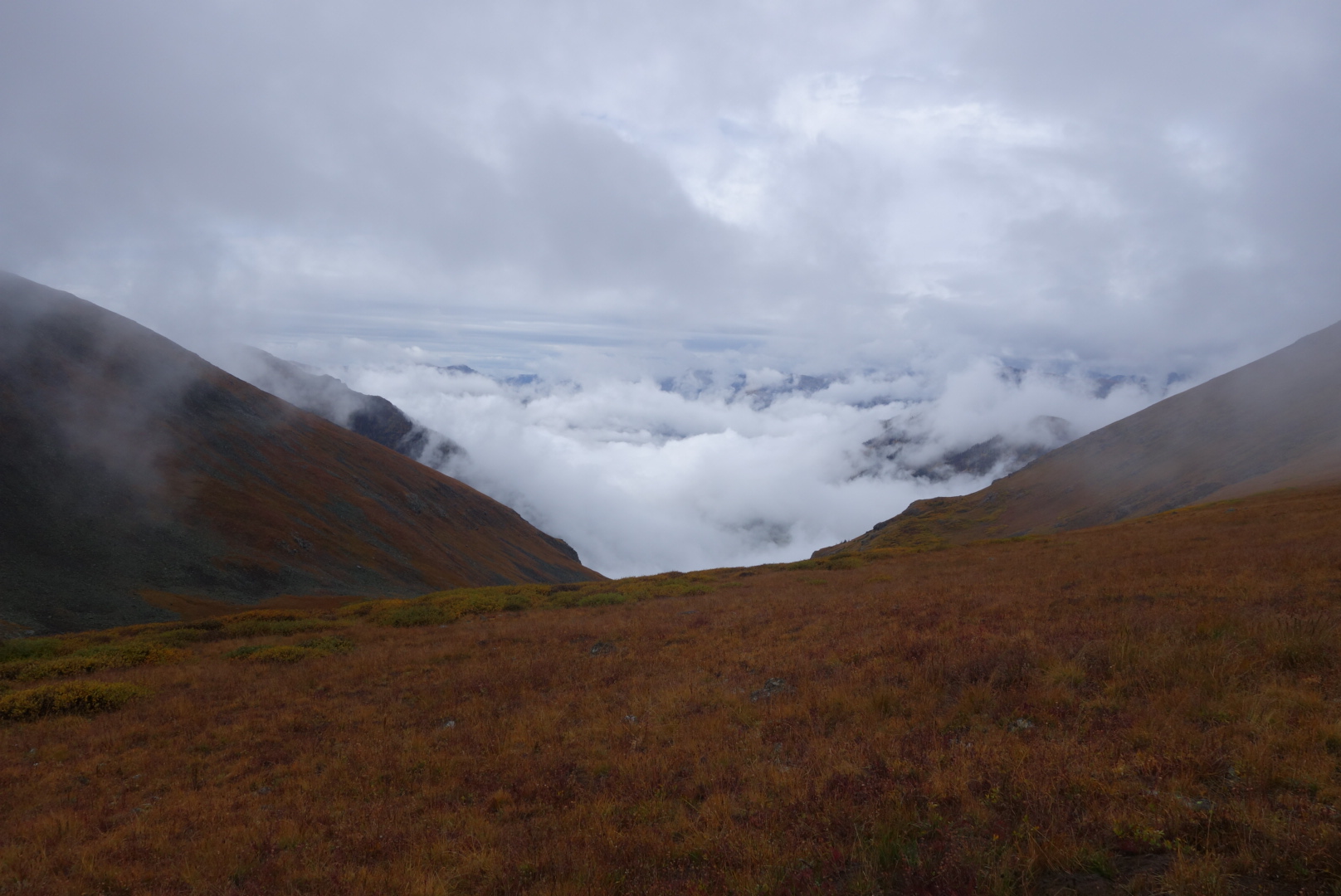
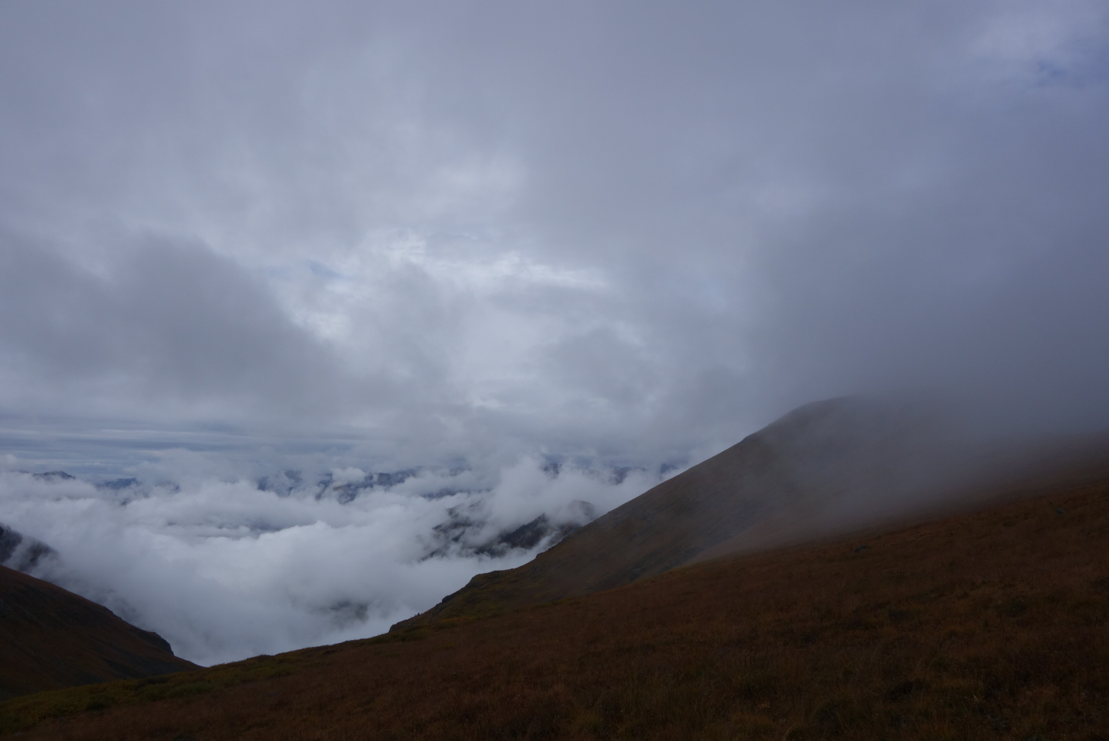
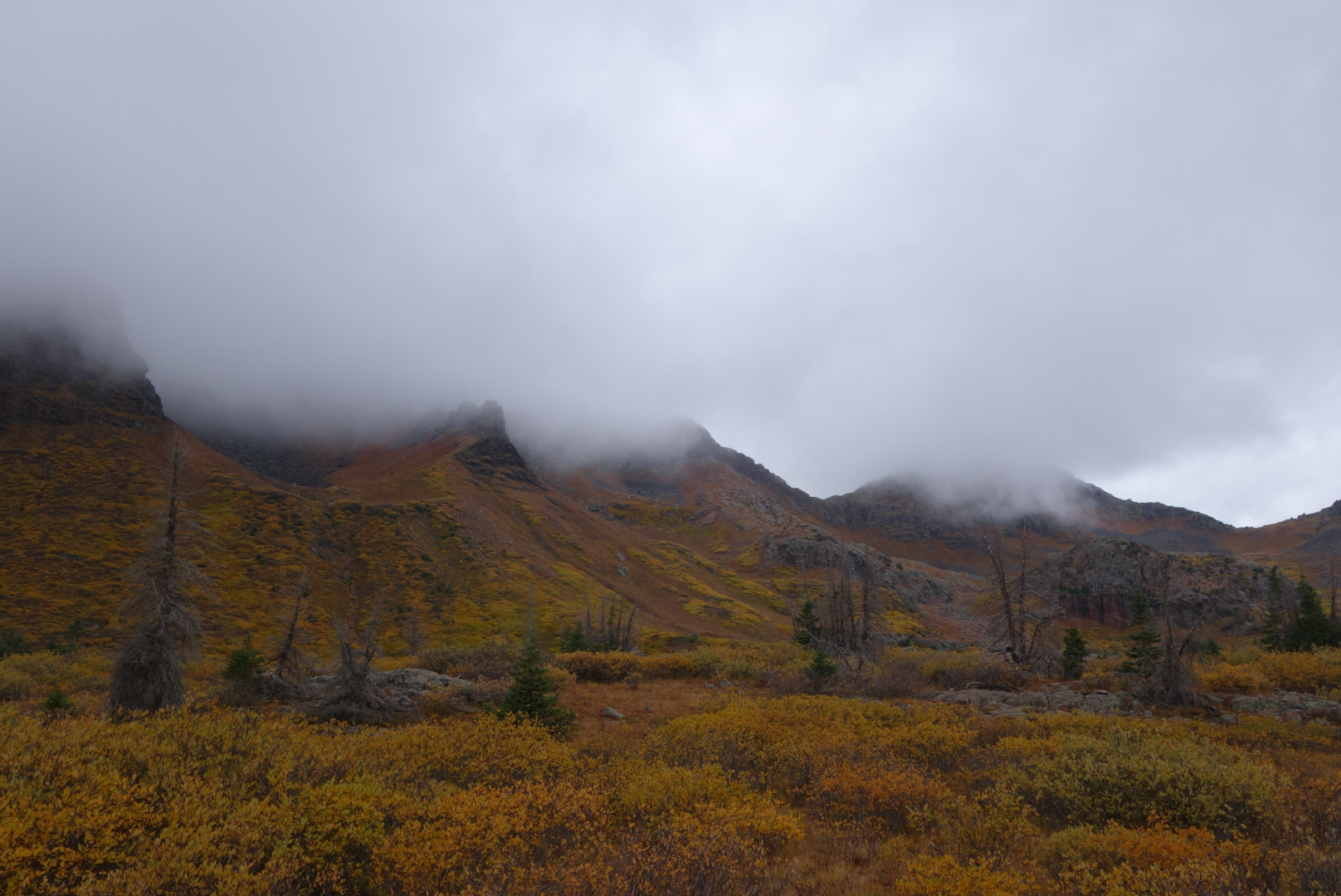
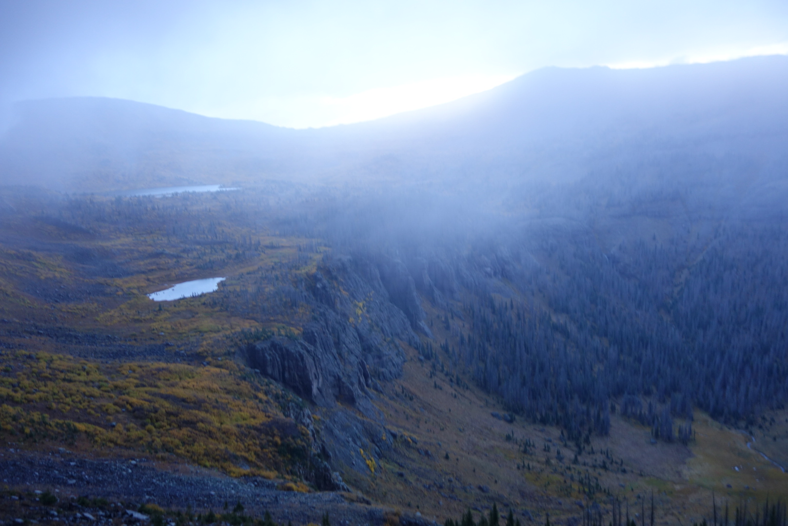
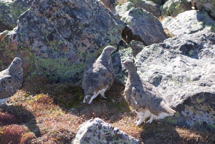
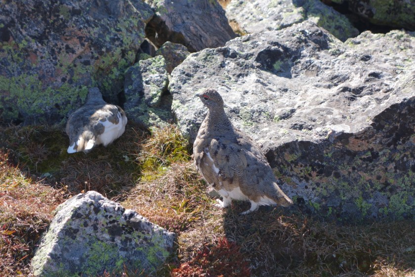
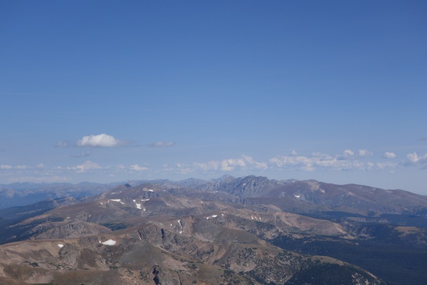
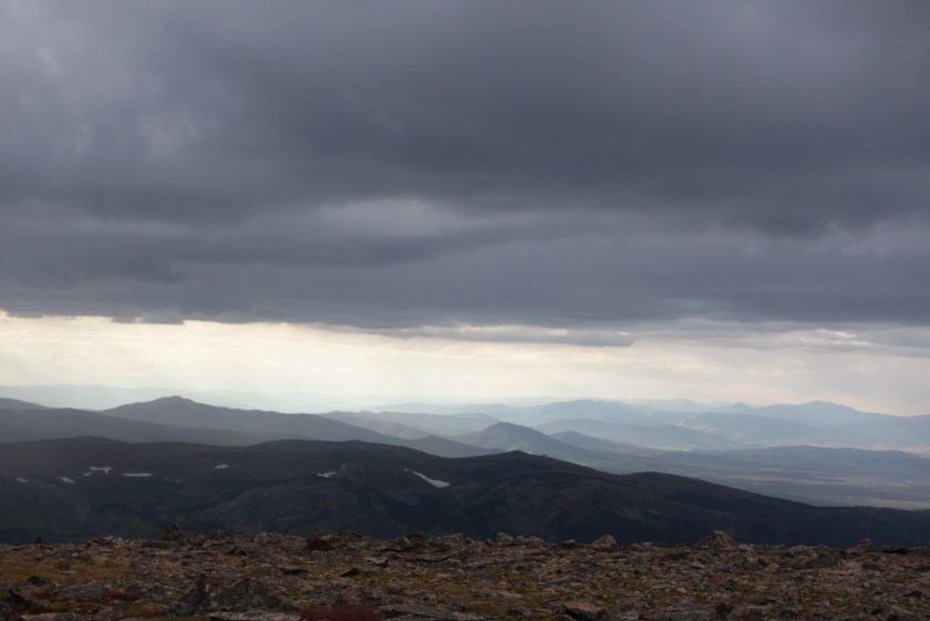
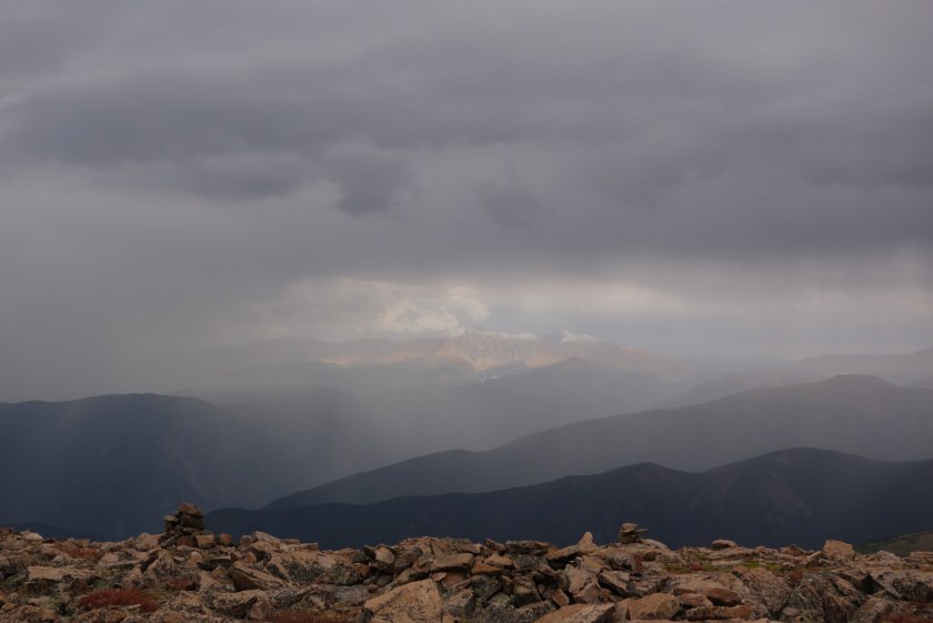
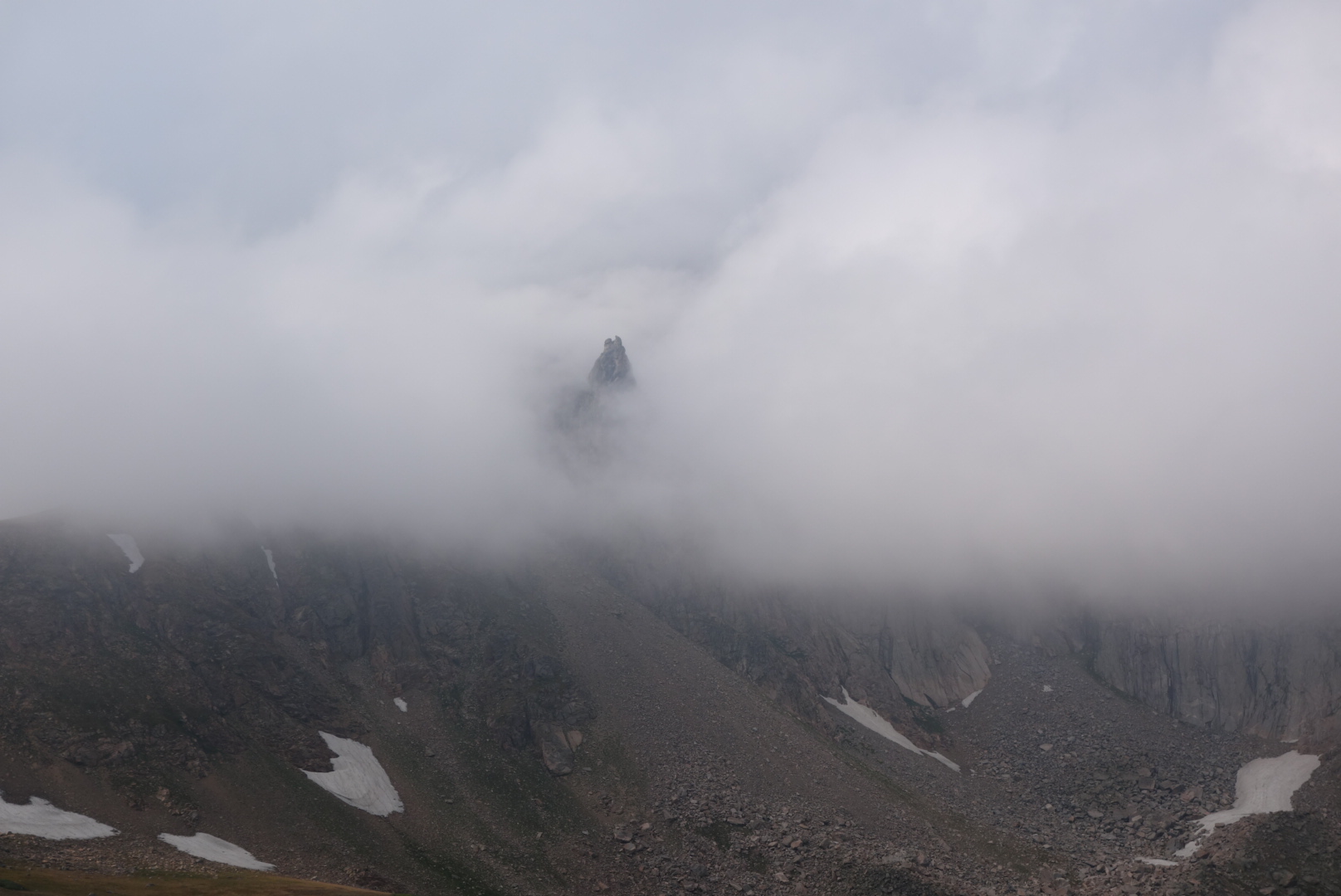
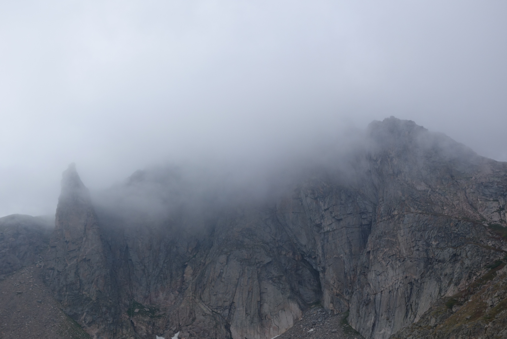
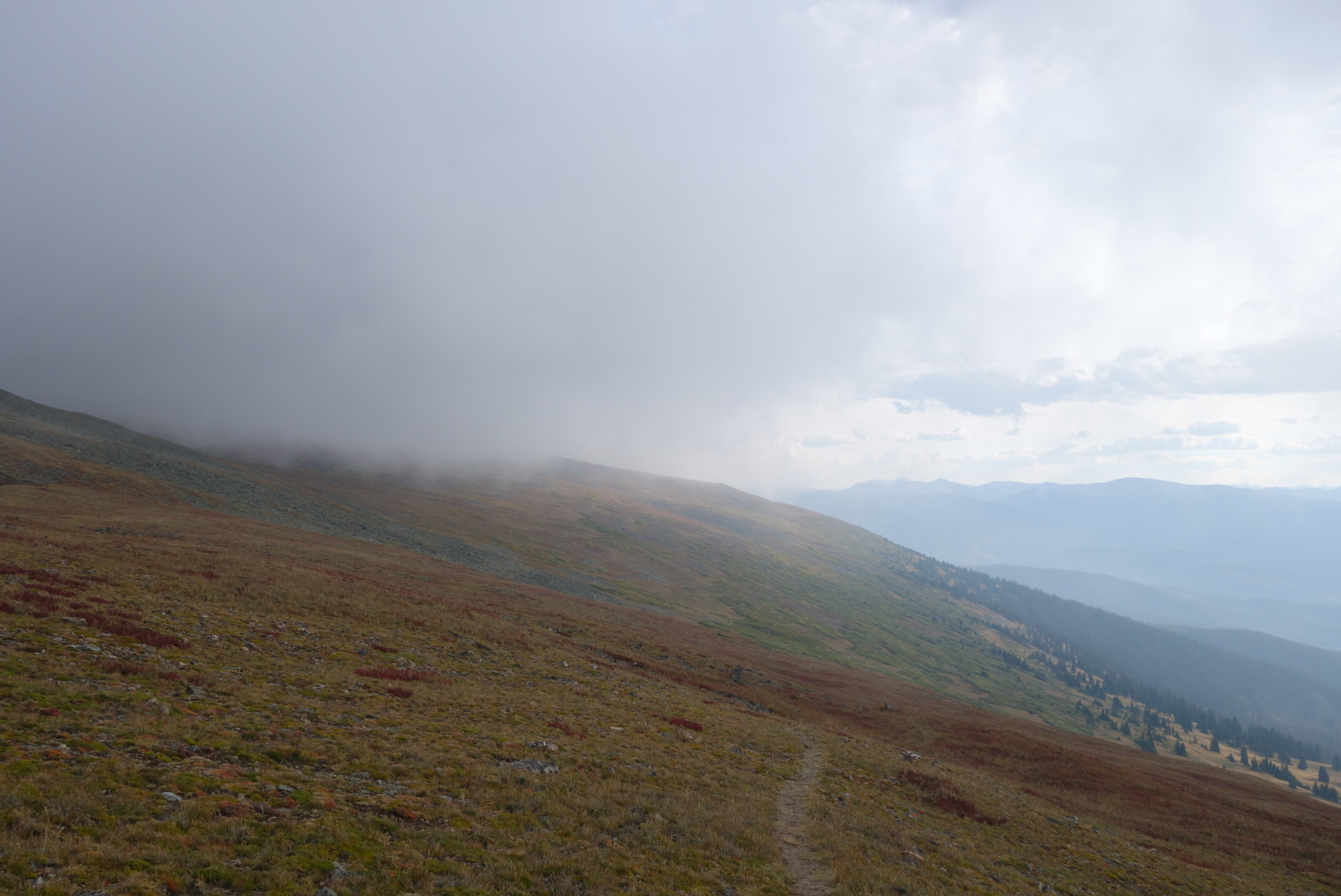
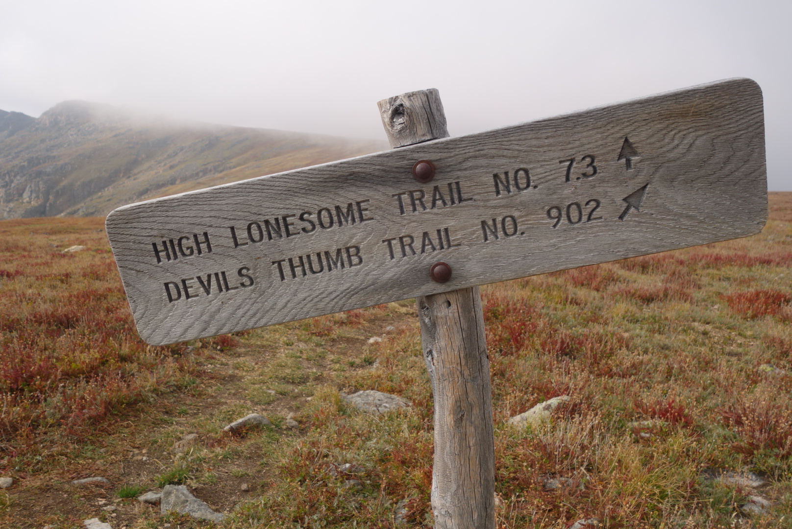
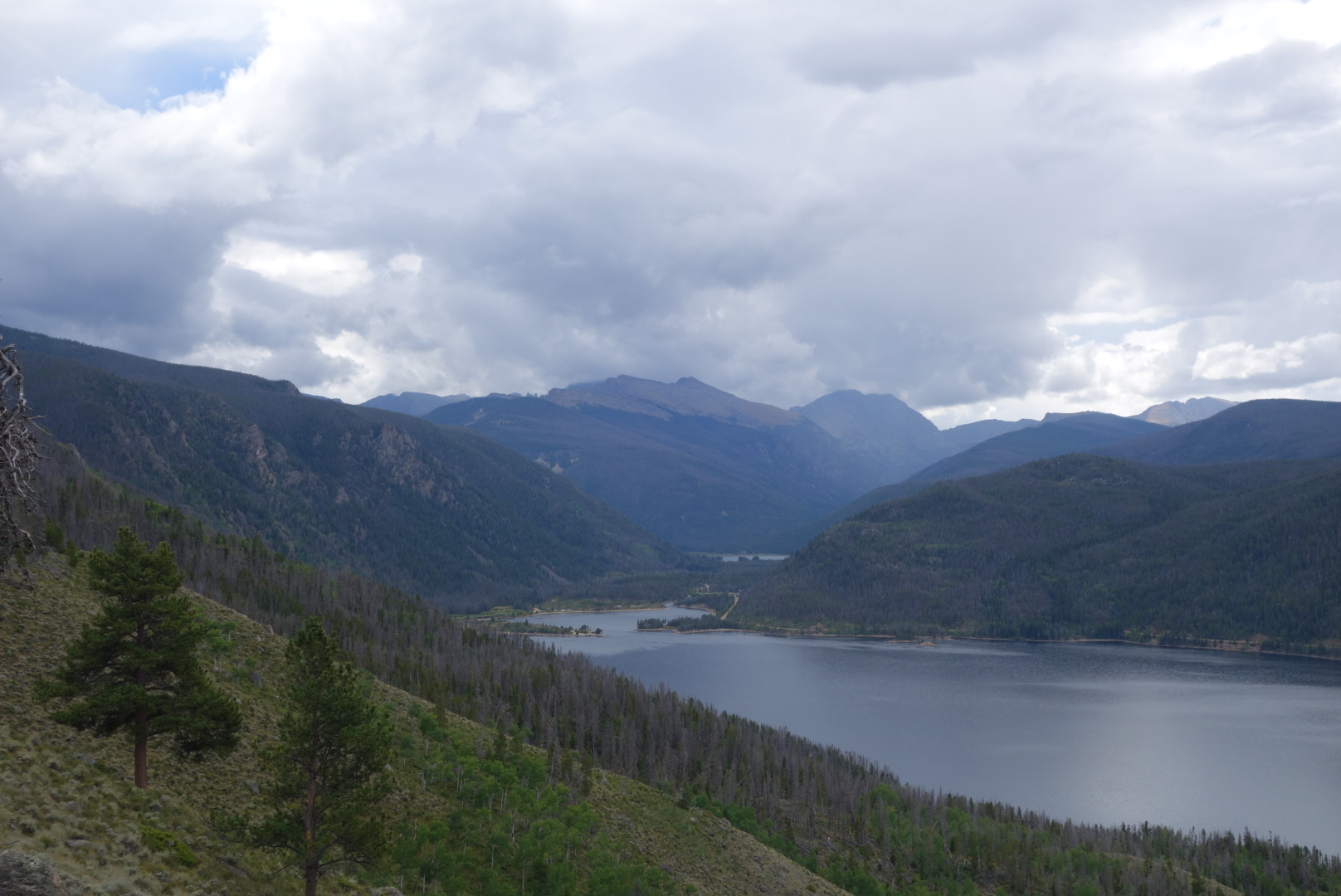
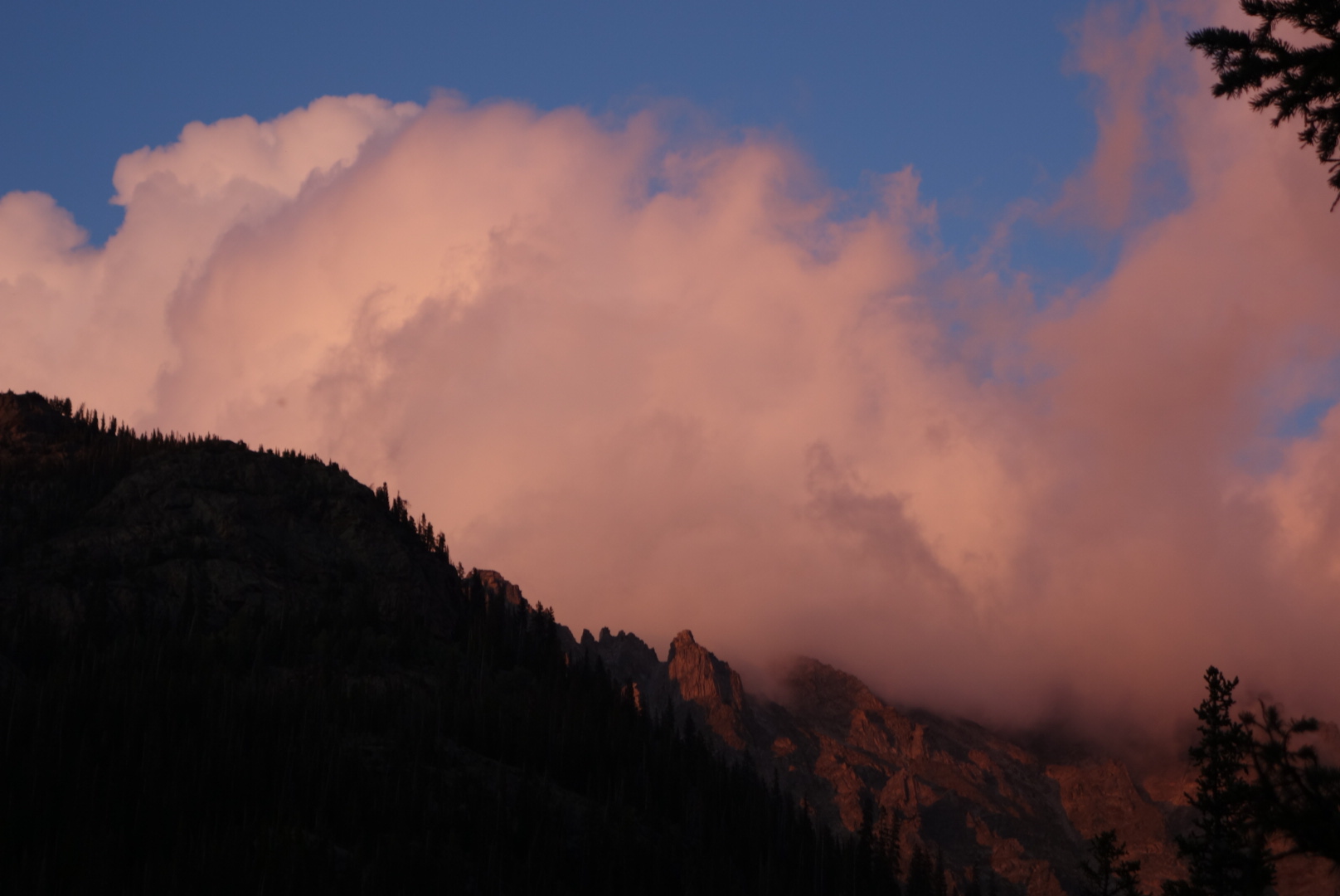
Disappointed is the best description of how I felt about myself once I got to around 11,000 feet. Instead of cruising easily and lightly uphill, I had to stop often to catch my breath.  The benefit, however, was the scenery. The trail fairly quickly gets above treeline for some impressive views back down the valley. Plus, once you get to the highest elevations, around 12,000 feet above sea level, it is roughly a plateau which presents several different views.

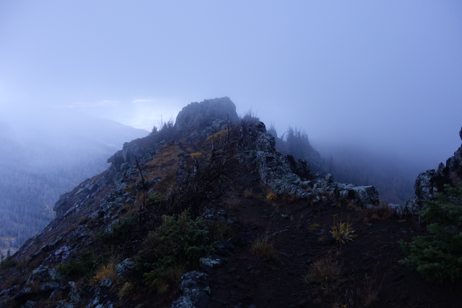
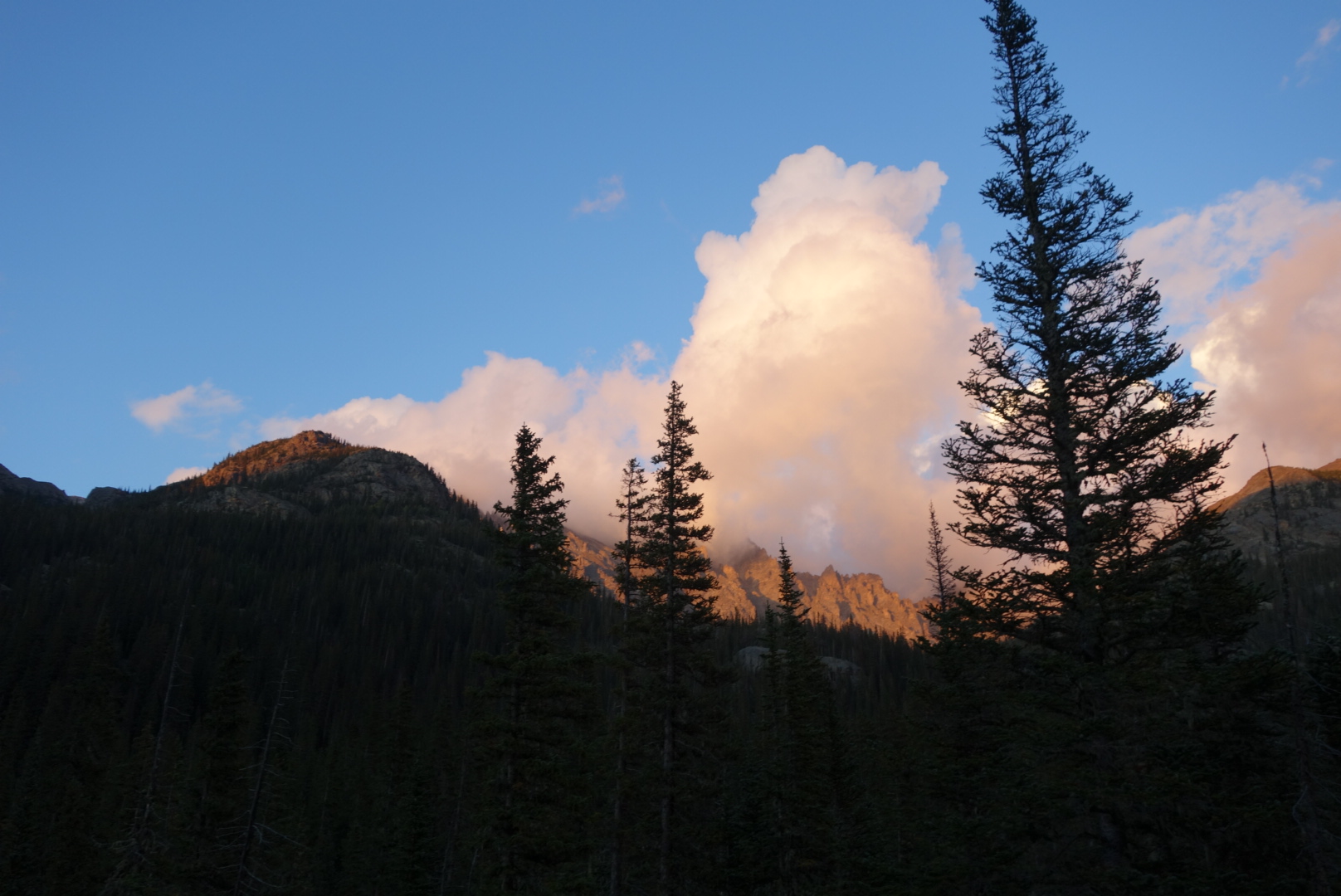
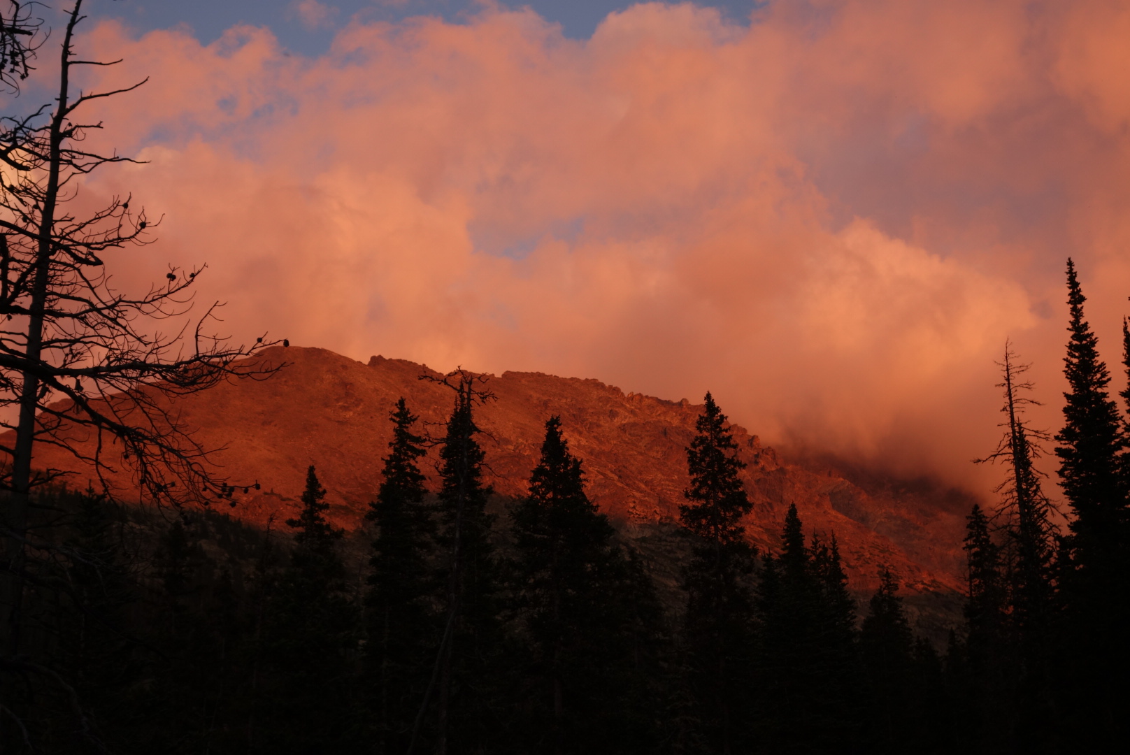
One of the views, unfortunately, was dark clouds developing. I had my puffy on already due to the temperature. I now hoped to be able to descend before the storm hit.

I came across a tall young guy with a fancy  camera and tripod.  We walked downhill together for a brief period. He was from Long Island and had spent a year visiting national parks and taking photos. He slept in his car and thought he was about through with his project.

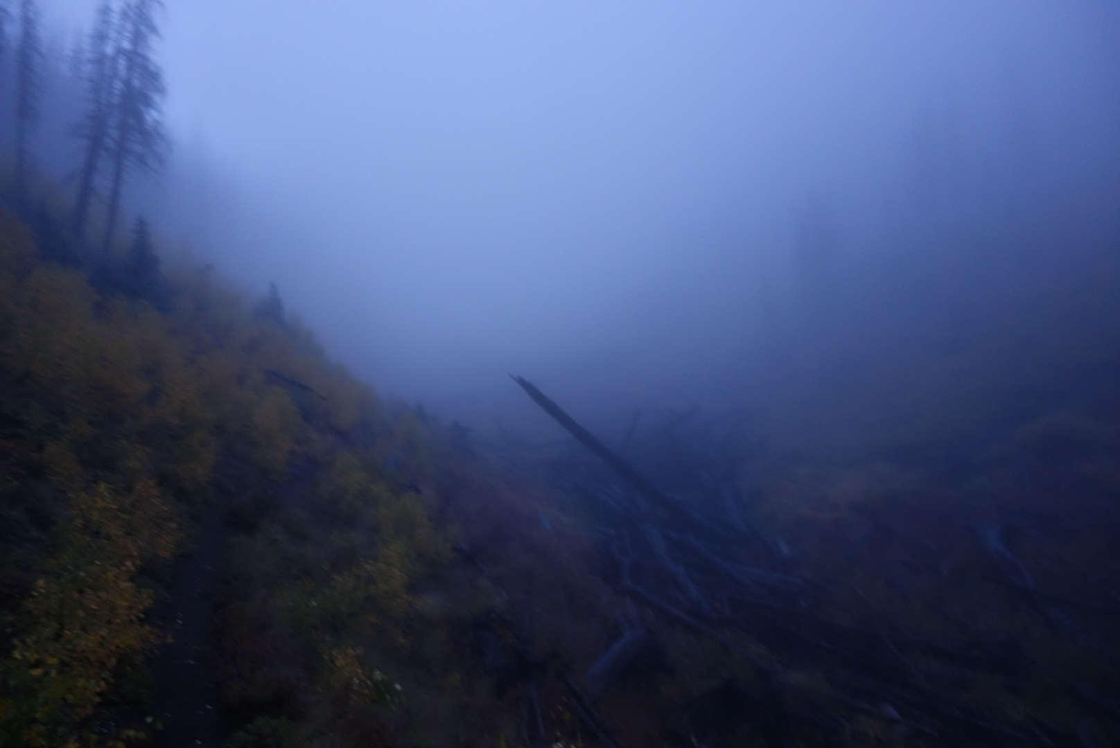
Somehow I pulled ahead.  I had about four miles to go until the end.  It was 6:00, so I figured I would be finishing in the dark. The rain came. So, too, did a strong wind.  I was in an area where the pine bark beetle had destroyed a lot of trees. These trees were either standing up dead or tipped over, caught on a nearby tree. As the wind gusted, the trees groaned and popped. Then, some started toppling with loud crashes.  

My strong preference was to not be crushed by a falling tree. Unfortunately, there was very little I could control; if a tree was going to fall there was nothing I could do.  So, I increased my pace, vowed that this was not the way I was going to die, and hiked as fast as I could to the hostel.

Cold, wet, hungry and alive, I made it to the hostel. I put on warm, dry clothes and headed into town for a hot meal. Later, I packed up knowing I would leave early.

All in all, the Rocky Mountain National Park loop was a great day hike. Although not as dramatic as Glacier, it still affords great views and I am glad I walked 25 miles on my day off.

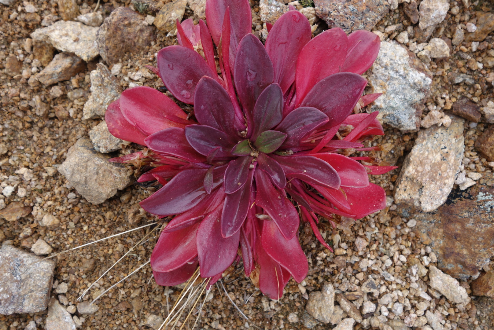
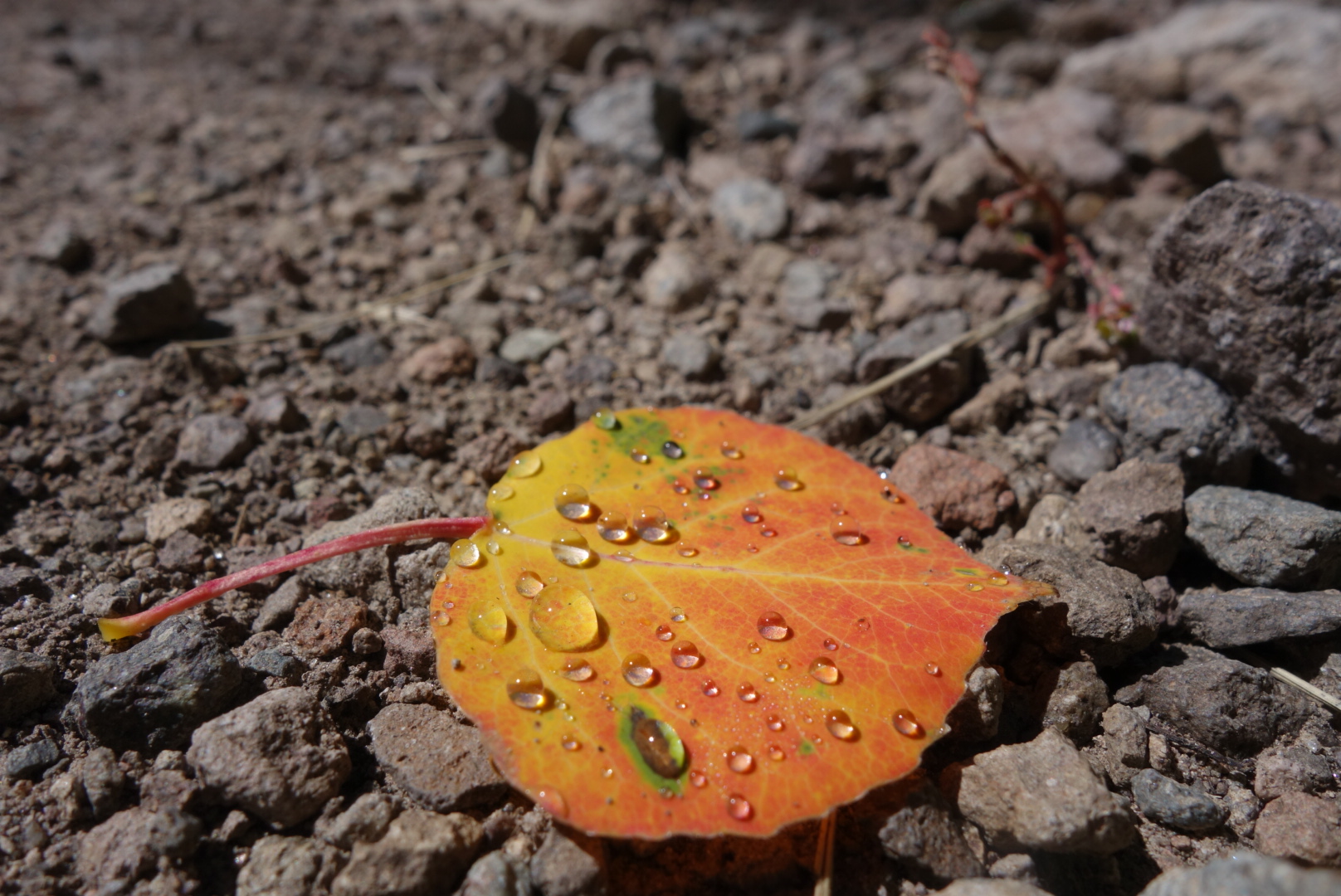
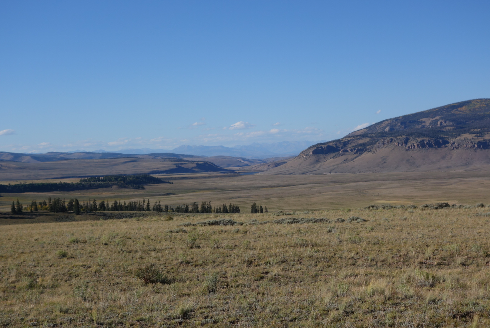
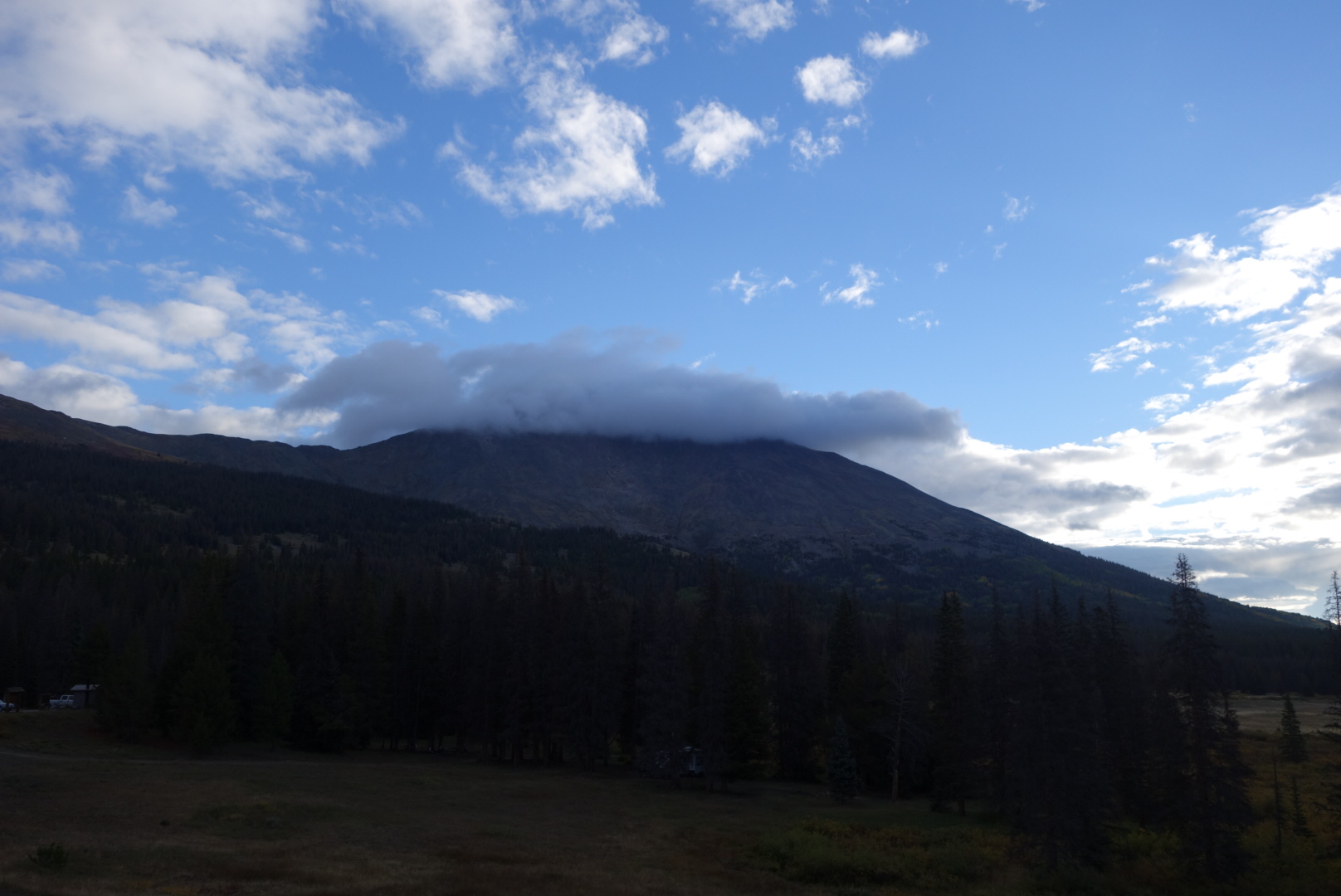
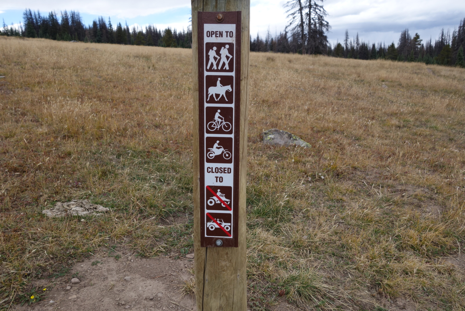
(Did not bring camera so no pictures)