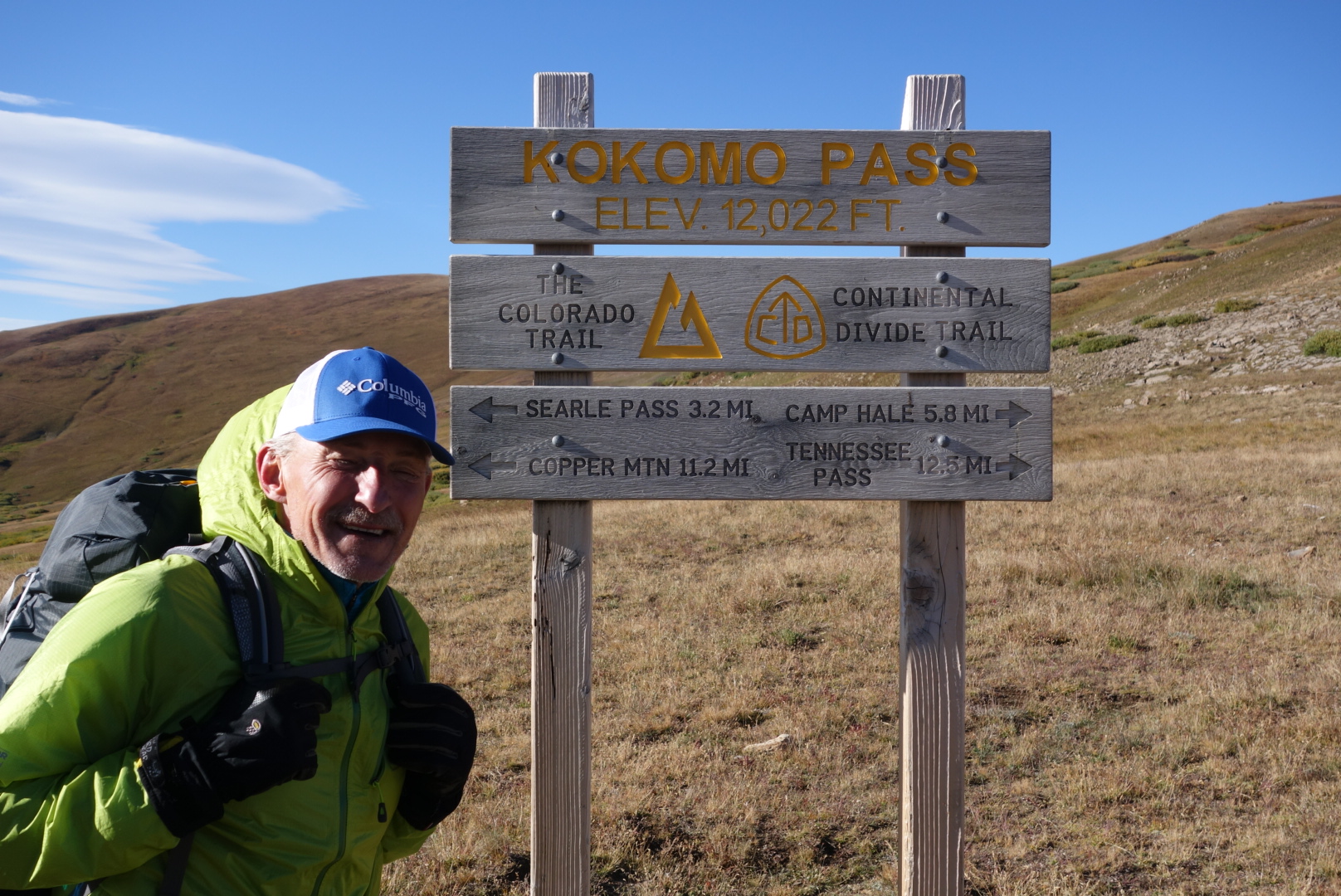
Monarch Pass

September 13th

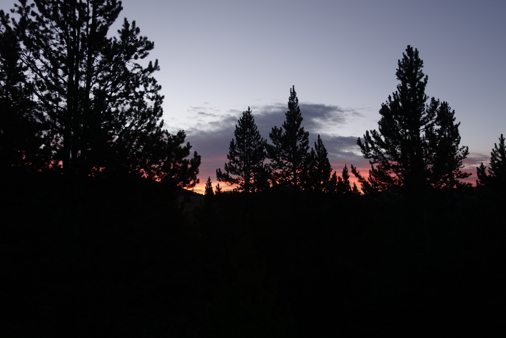
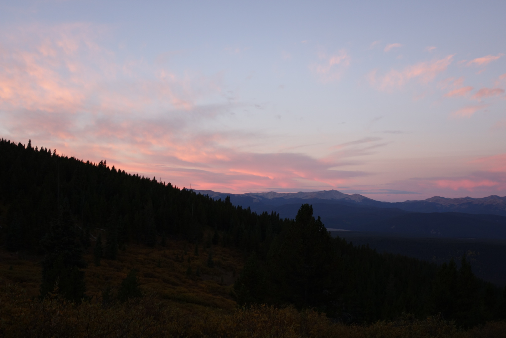
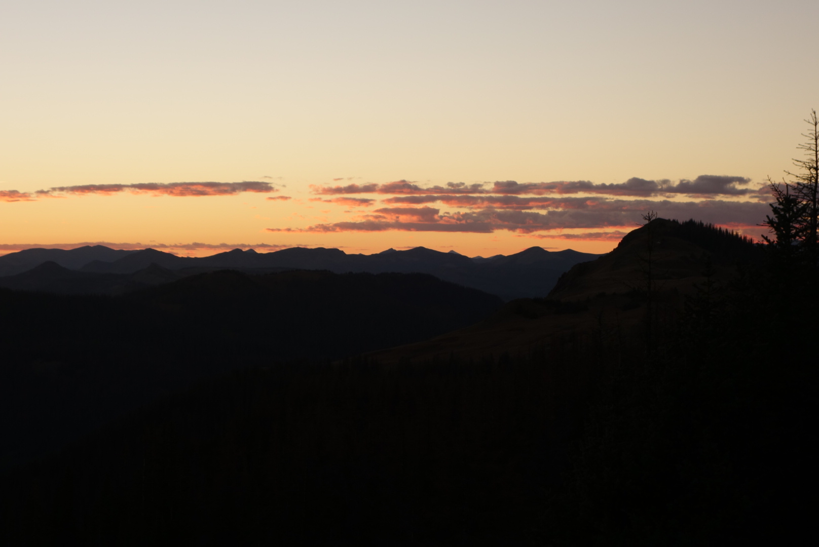
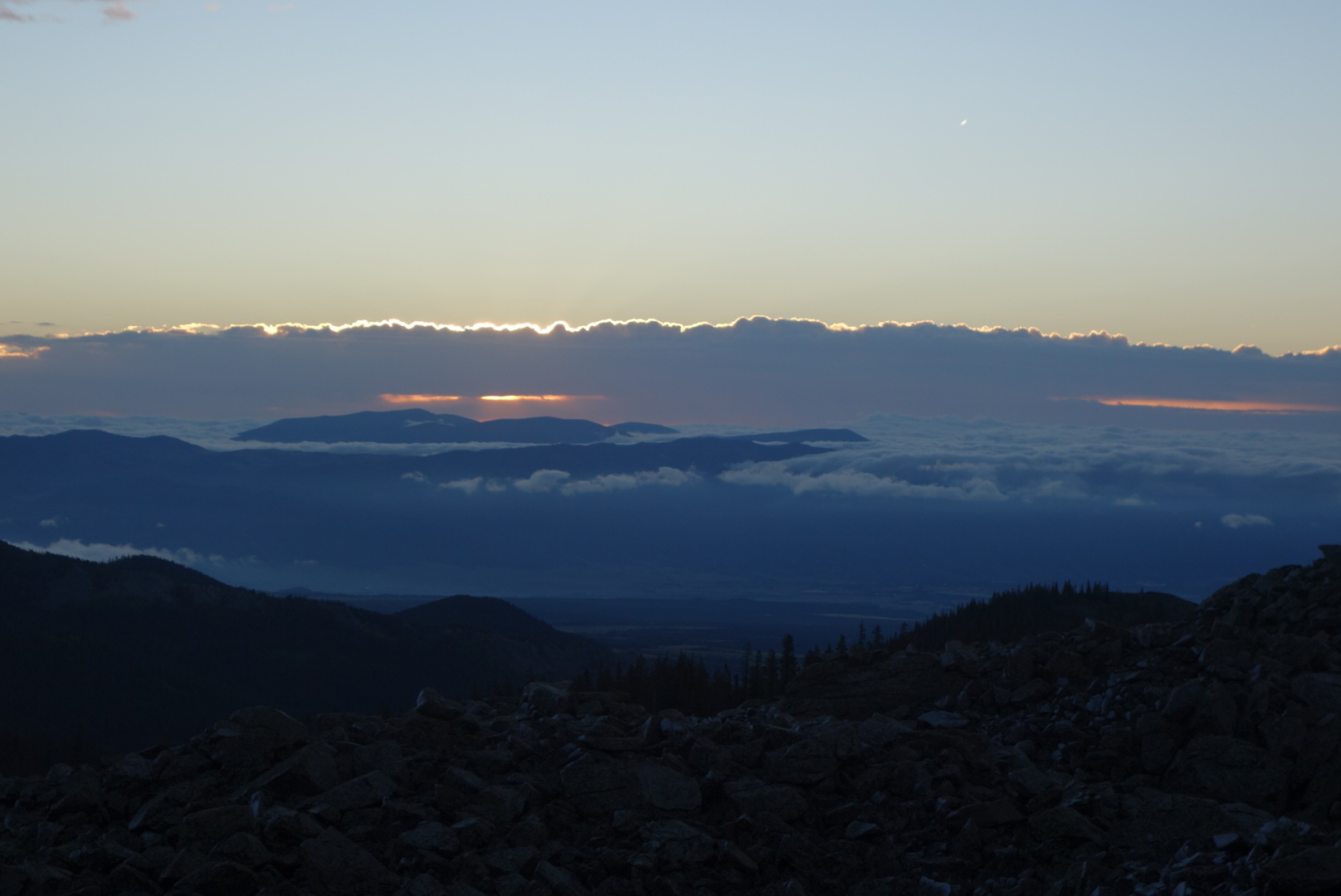
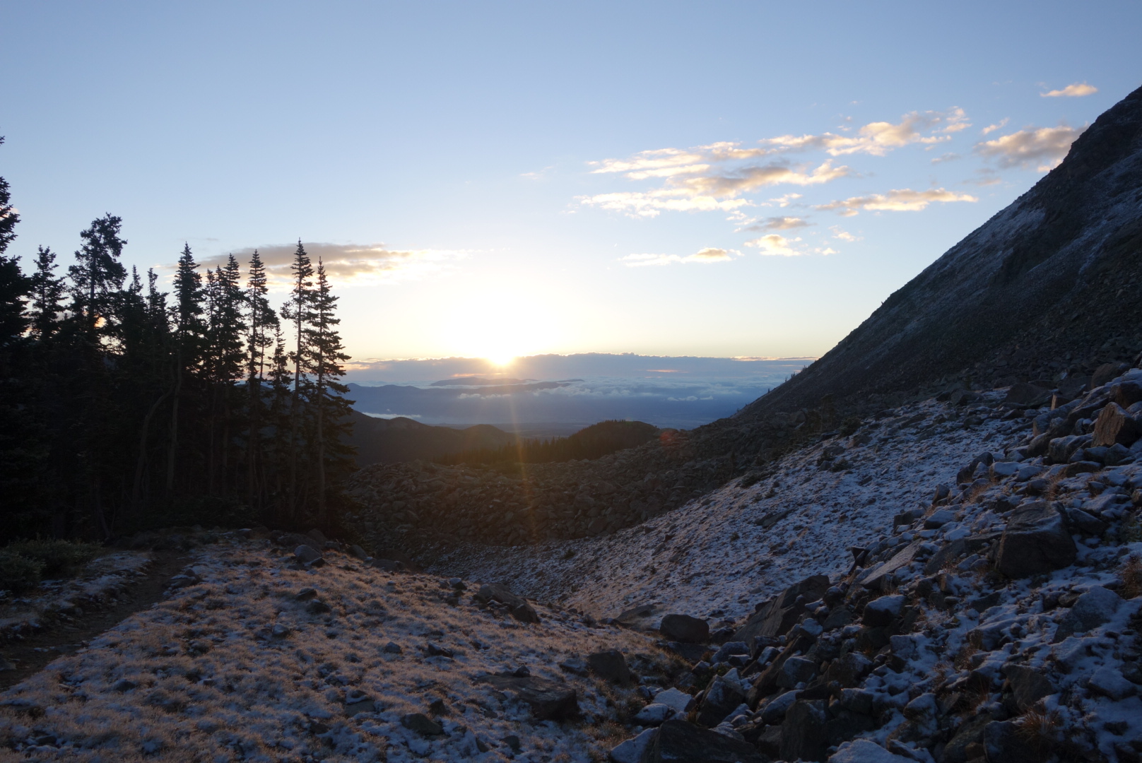
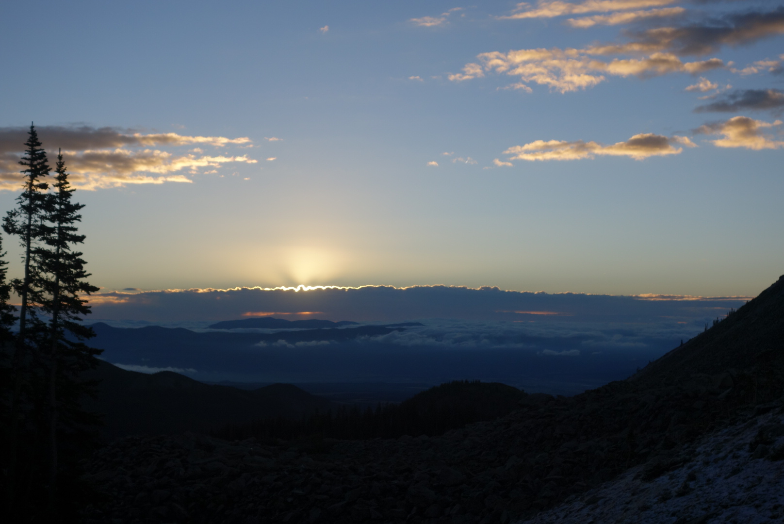
It was kind of eerie hiking with just a headlamp through a closed-in forest. It was very cold and my breath created little clouds which the light penetrated and then I penetrated.  When I came out of the woods to a small meadow, the grass crunched underfoot. I was near Hunt Lake.  I kept turning around to watch the sunrise.  It was so cool.  There was a blanket of low clouds covering the land below.  Then, some mountain peaks poked through.  Lastly, there were clumps of clouds higher up.  All in all it created a three level sight.  My weakness as a photographer really showed at this time.

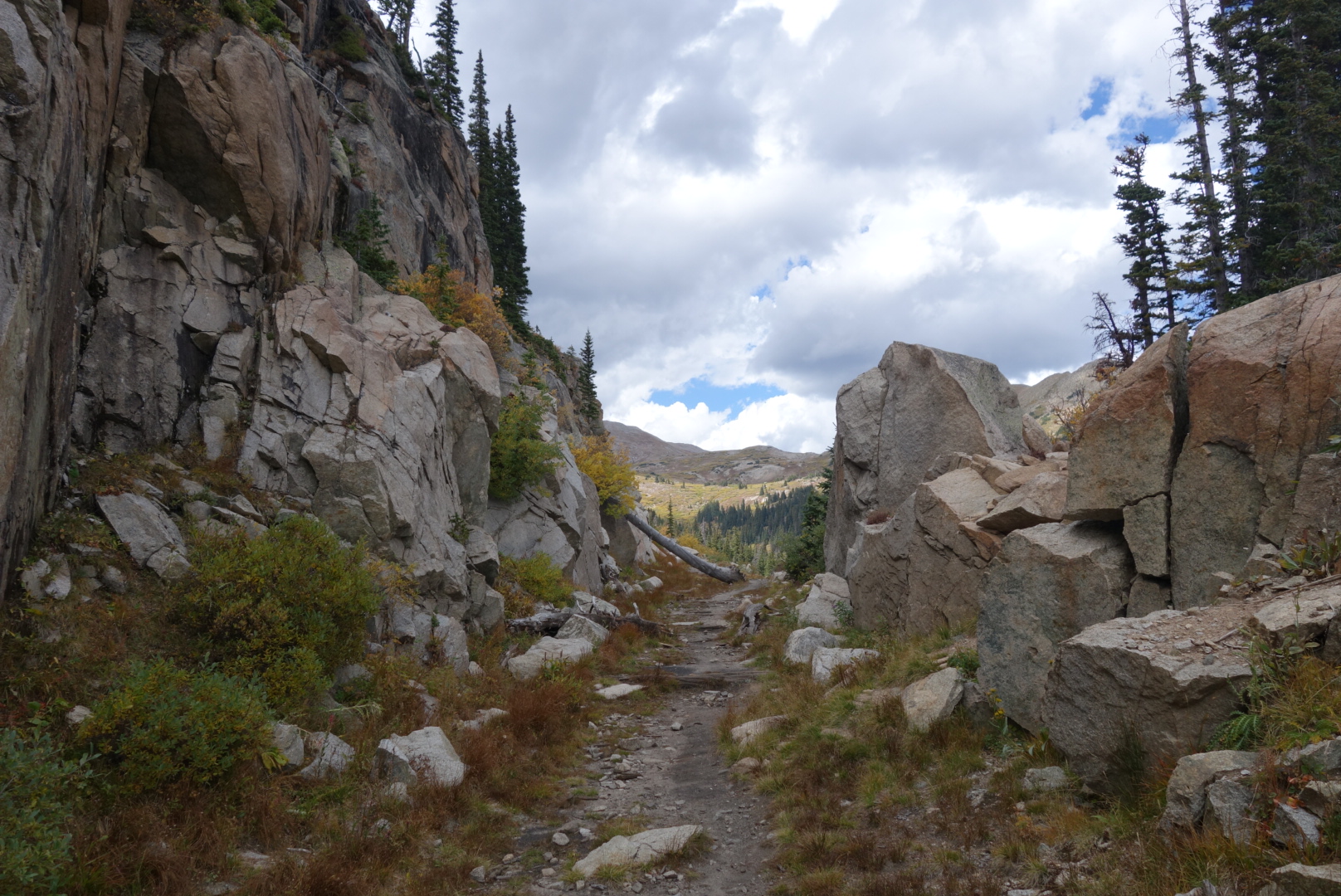
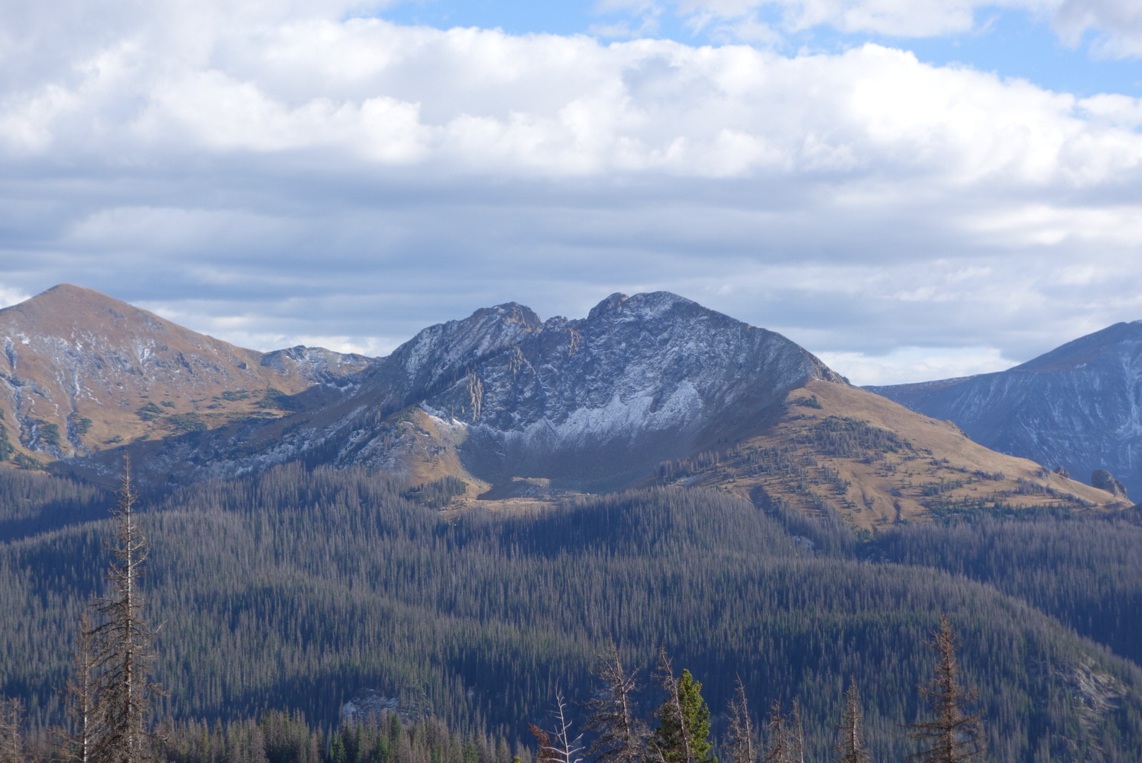
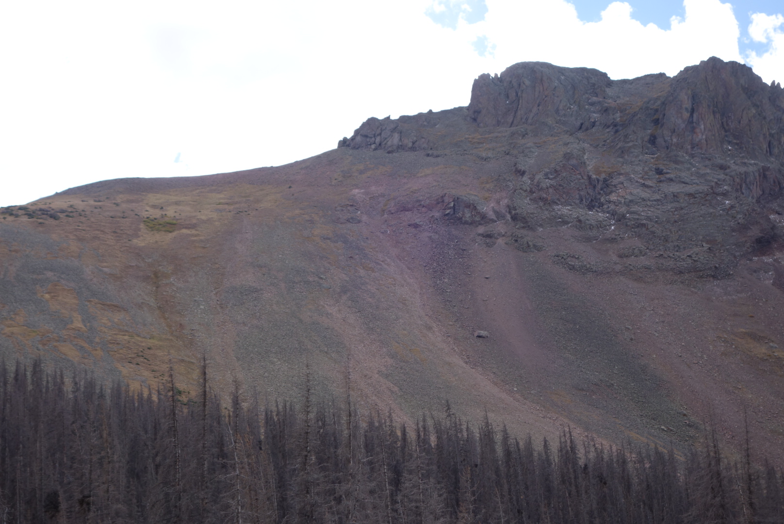
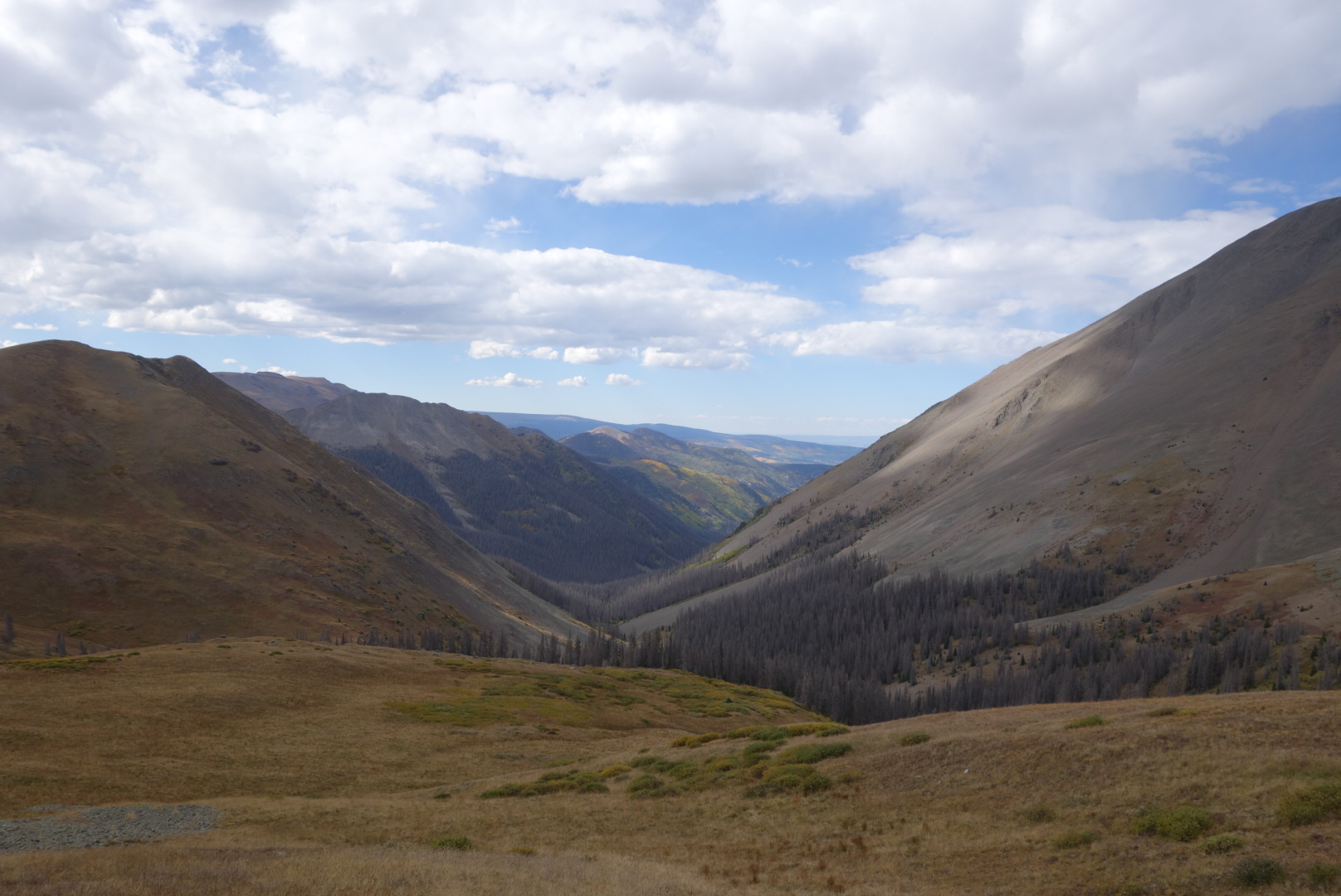
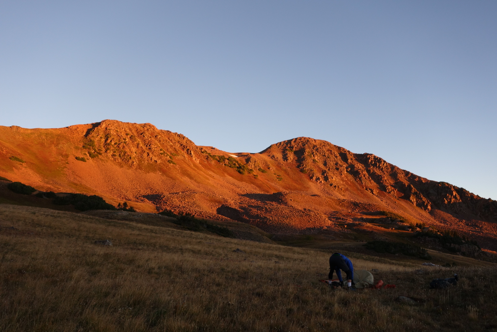
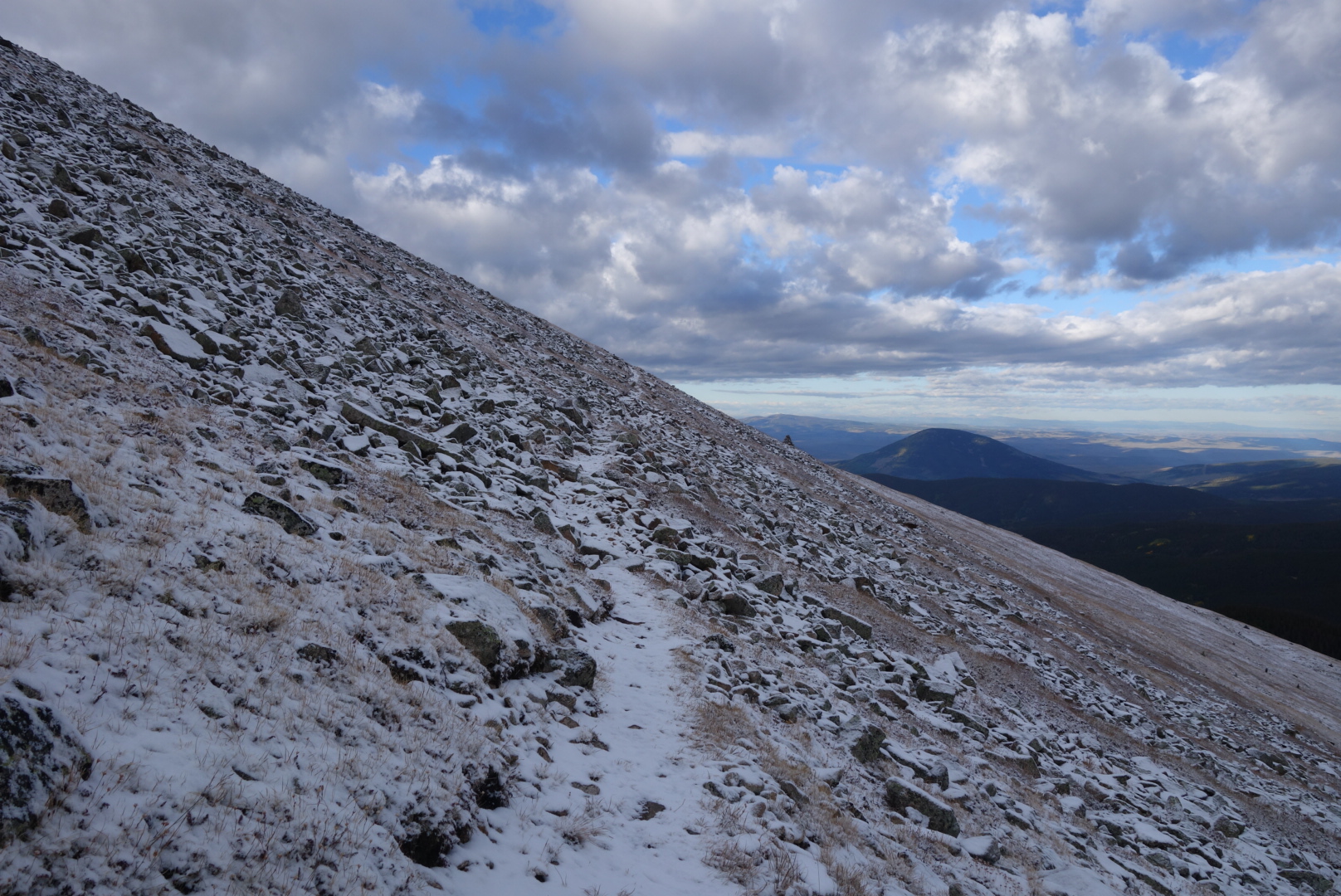
I kept climbing higher and I began to get into snow.  Between the time I left my campsite at Boss Lake Reservoir at 11,200′ and reached the apex of the trail at Bald Mountain at 12,500′, I had gone from cold to winter.  hiking above treeline in the snow was slow because the rocks are slick.  It was maybe 3″ deep, so I was only worried about falling, not sliding down the side of the mountain.  Still, I couldn’t help think of the headlines if I did my end here:  “Balding Hiker killed on Bald Mountain” or “Bald Mountain Claims One of Its Own”.


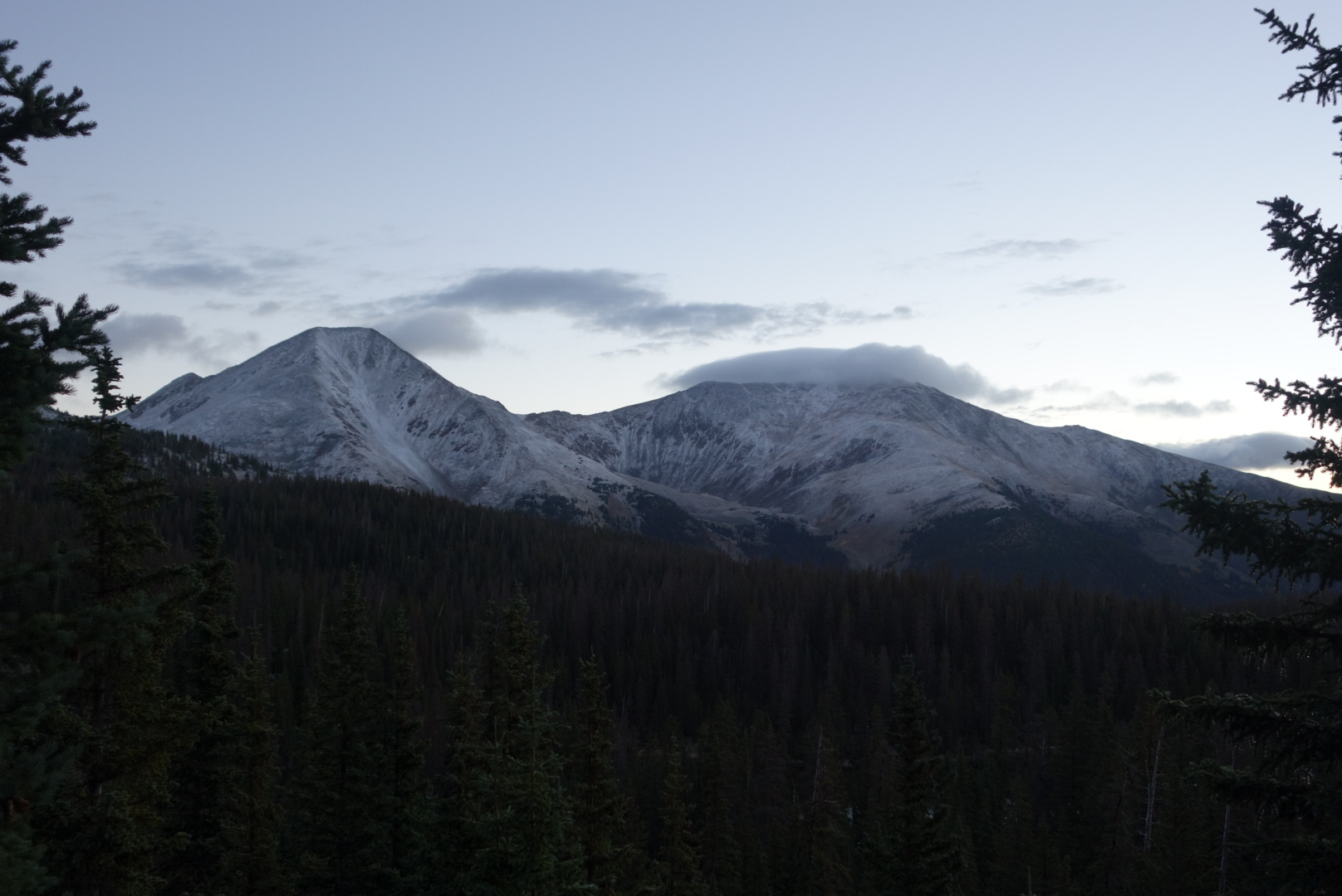
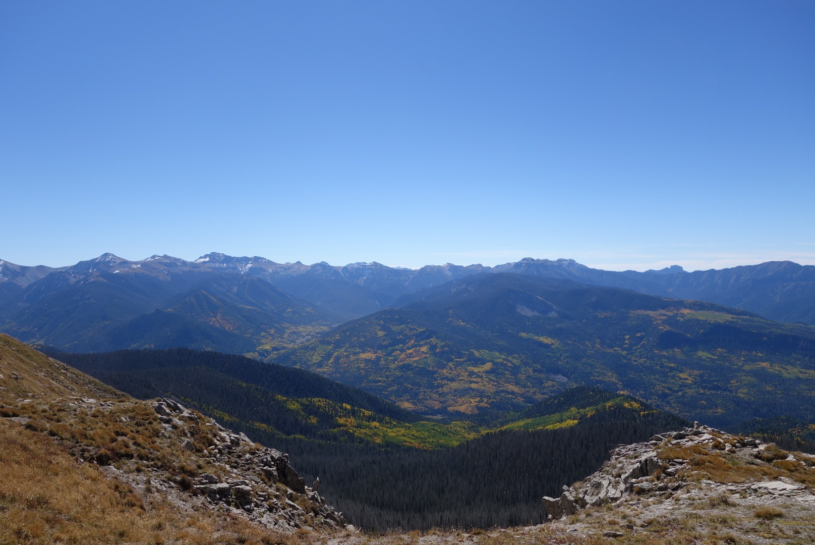
More concerning was a glance south.  My first glimpse at the San Juans.  If you have the misfortune to have read previous posts, you know the San Juans are the big deal for Southbound hikers:  get through before winter snows.  As I looked south, it was clear they had received a lot more than my 3″ of snow.  Better get moving.

I did make fairly good time.  The trail went along a ridge line and as the sun rose, the snow left.  There was even an interpretive display in the middle of nowhere.  Later, the tril went through the Monarch ski area.  Strange to think in 90 days this would be flooded with people.

I made it to the Monarch Crest Gift Shop around noon.  This place is on the trail, holds packages for hikers, and has both packaged and some “fresh” food.  When I visit a place like this I generally try to make a purchase and also charge electronics.  I did both. Of course, I did not do anything until I looked sharp with a new pair of shoes.

Hiker Tip:  At the Monarch Crest Store, lower your expectations for food.  With the exception of chili, ice cream, and fudge (not a trio to be messed with, by the way), everything is prepared as follows: remove prepared item from fridge, microwave, serve to customer.  As a result, both my egg sandwich and my hot dog had weird textures.  However, the chili dog was an upgrade.

I ran into Sampson there.  No, not the strong man.  Trail name.  He started Nobo this spring, hit snow, broke his leg and rehabbed.  Now, he was chunk hiking his way north again.  He still had a noticeable hitch in his giddy up in my opinion.  He was waiting for his resupply package to arrive, so we chatted for awhile.  Nice guy and I hope he finishes the trail in good health.

With junk like fudge, elk jerky, and Fritos,  at 3:00 I left the store at the same time as Sampson.  Almost immediately, it started snowing.  I signed the register and was surprised to see a couple names of people who were far back previously.

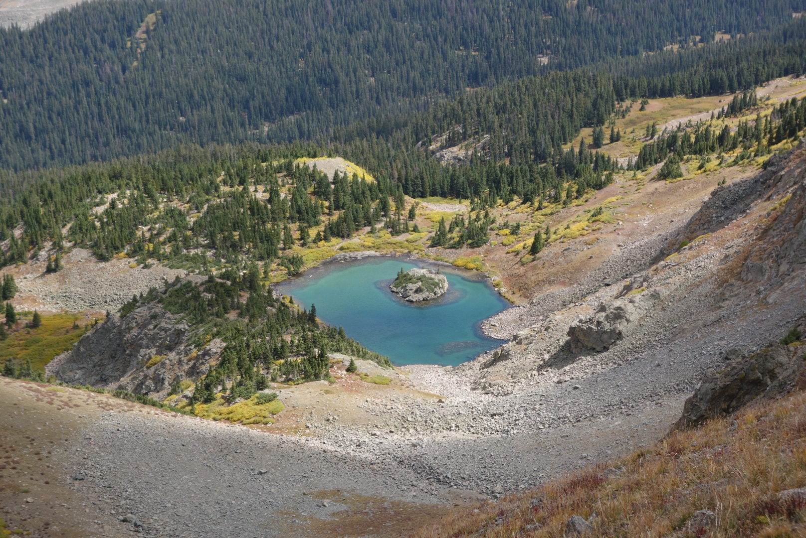
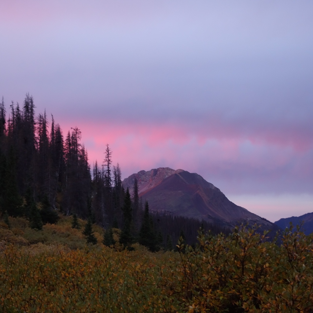
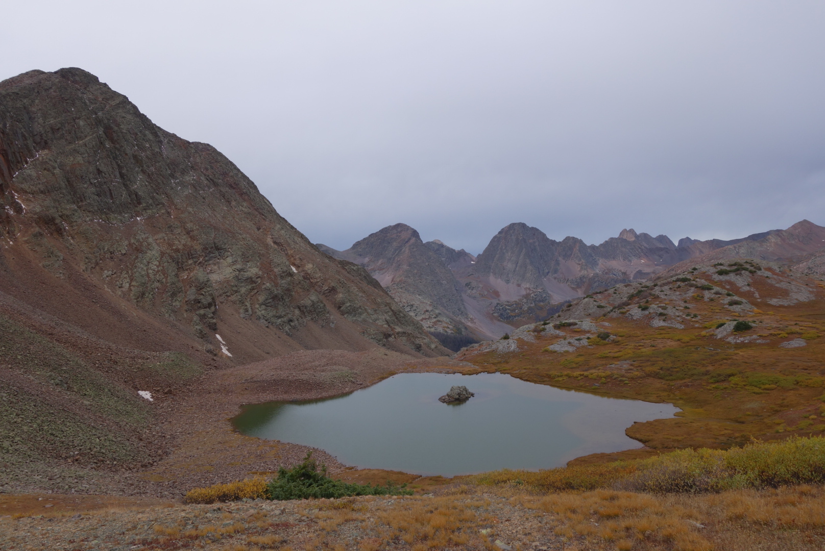
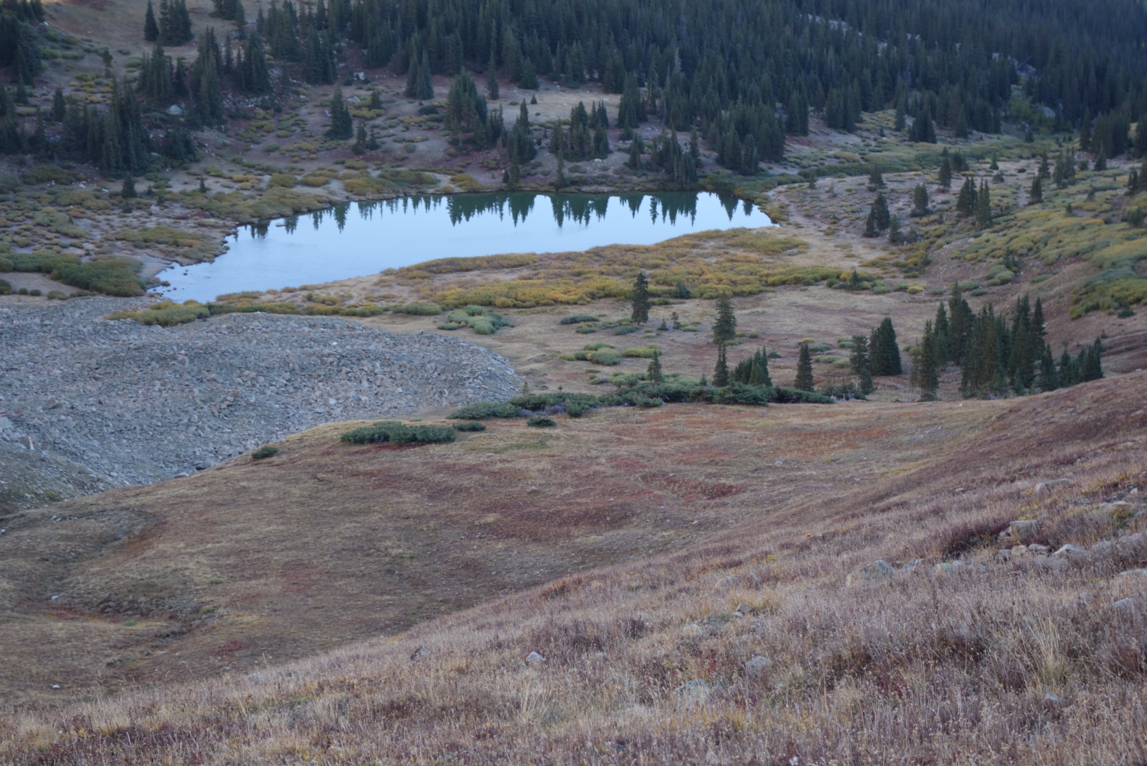
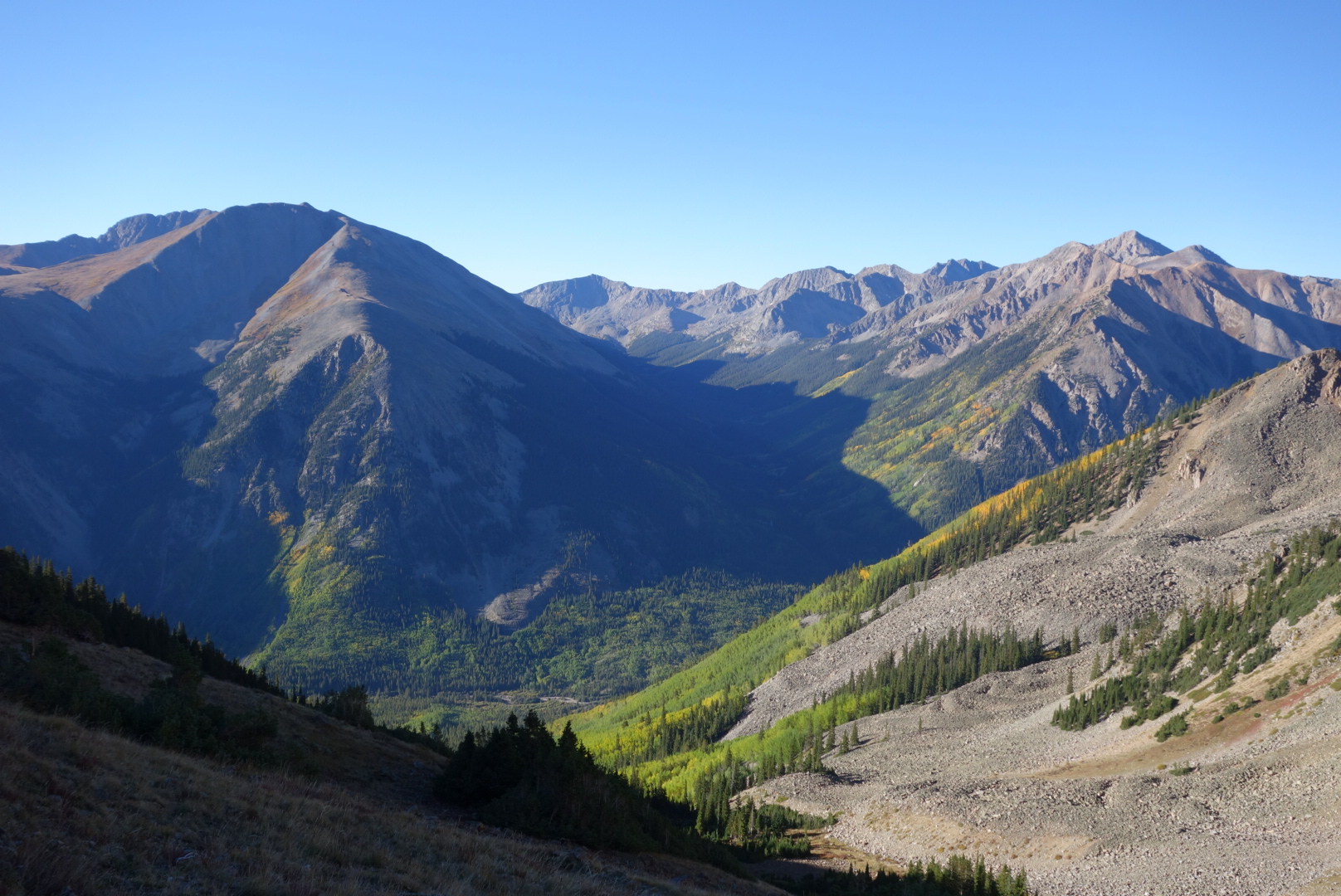
The weather cleared and the trail provided some great views.  It was nice to walk up high and switch between forests and open spaces.  I found some water late in the day.  Above treeline, I found a level campsite behind a clump of spruce.  The wind settled down after the sunset and I had a great evening after munching on junk food and watching the moon rise over the ridge above me.

Three Climbs

September 12th

Today would be a day of many climbs.  I wanted to get close to my resupply at Monarch Pass.  To do so would require a long day.

In the morning I went over one ridge and came across a high bowl in the canyon.  I saw something I had never seen before.  A herd of deer were standing in one of the shallow ponds common in these high meadows.  A few were wrestling each other.  It was cool to watch them play, but eventually they got serious and wandered off.

Next I climbed down a steep descent to the North Fork of Chalk Creek.  It is tough on a hiker’s psyche to go downhill and look across the valley knowing you will have to climb all that distance back up.  Also annoying to me was that it appeared somebody had ridden a motorcycle up and down this trail when that was not allowed.

Once I had climbed back up, I was in valleys that formed the headwaters of Wildcat Gulch.  I met a hunter.  He was in camo  clothing.  He and I commiserated on the absence of elk in this area.  He said his buddy with an elk tag was still out there somewhere.

Curiously, the trail crosses a historical anomaly.  There is an abandoned alpine railroad tunnel.  It connected Denver and Gunnison, was in operation between 1882 and 1910, and was a narrow gauge track.  I am guessing it was not a huge financial success, especially since it ran alongside Mount Poor (I cannot make this stuff up).  The tunnel, reasonably, is today  sealed shut, but the rail bed provides a gradual descent for a few miles.

The old railroad bed carved through rock

Next came a still active mining area called Hancock.  It always amazes me there are people who hold on to stakes and are weekend miners.  Hope springs eternal.  A bad by product, in my mind, is dicey water.  I saw a few creeklets coming out of mines that were an other-worldly color and they fed in to the main stream.

This was the resident ham in Hancock. Liked having his picture taken.

Hiking uphill  the temperature dropped and the skies darkened.  Near the head of the valley is Hancock Lake.  I met a couple Colorado Trail (CT) hikers.  They were in good spirits and that boutyed me for my third climb of the day, Chalk Creek Pass.

This ptarmigan was very talkative for some reason

Just as I crested and checked for a cell signal, thunder boomed from the direction I was going.  Undaunted, I went down.  I ran into another CT hiker.  He was struggling a bit, so I gave him as much encouragement as I could.

As the evening wore on, I followed more new silly trail.  It was new, marked CDT trail.  However, it was another one of those sweeping, swooshing trails that felt like a slalom course.  What was silly about it was that it often crossed a straight forest service road.  Oh well.

At the bottom, there was a bridge that was being repaired.  Despite signs indicating there was no bridge, there was patently a bridge across the creek.  Granted, it was not highly engineered, but for somebody this long on the CDT, a log and a stick are good enough.

Lastly, I pushed to get up to Boss Lake Reservoir.  It was up high and had views.

Deer playing in pond

Major ups and downs

Deer hunter

Old train tunnel

Rain

Camp by reservoir

High and Windy

September 11th

Given the various roots and rocks that I slept on, it was not too difficult to pop up and get going.  I was cold, but when I got to my first valley with a creek, it got real cold as I filtered water.  There was frost everywhere.  To make things a little better, it was shaping up to be a beautiful sunrise.  Rich, puffy clouds across the horizon.  Unfortunately, I could not get out of the forest to get a clear shot and instead had to settle with a view west across the valley.

Eventually, after a choppy hike down another Gulch (Prospector, this time) I came to Texas Creek.  It seemed a fairly popular tread, but during a weekday after school has started, I didn’t see any people.

Next up was Cottonwood Pass.  Although a challenging uphill climb, there were parts with some old trees.  They somehow make it feel like an adventure.  Maybe its their size, but it makes me feel like I am hiking in a forest rather than through one.

Above treeline, I went through expanses of alpine willow.  It is a tough shrub.  While it no doubt serves ecological purposes, in this section it appears to live only to scratch backpackers and to let its fluffy seedlings fly away.

Near Cottonwood Pass, I met a fresh looking day hiker coming down the trail with his dog on a leash (thank you).  I stopped and asked him where he was coming from as he was the first person I had seen today.  He said”The parking lot.”  I felt like a dork.  I reviewed my maps and this time noticed a paved road that  accesses the pass.

Sure enough, I crested the pass and saw the cars and the people.  As I navigated my way around them, I felt a little out of place. I was still in shorts and my merino wool hoody was my warmth.   I watched a few of them get 0ut of their cars and attempt to climb Cottonwood Mountain, but most would give up after a little while as the thin air took its toll.

There is a saying in backpacking which seems a little too mystical for my tastes.  “The trail provides.”  However, in this case, it was true.  I had been struggling with how to get a pair of gloves.  Ones from home would be too bulky.  I needed a pair I could hike in, provide a little warmth, but allow flexibility to grasp gear.  About a third of the way up Cottonwood Mountain, just beside the trail, was a pair of Mountain Hardwear gloves, Men’s XL.  Perfect.  No snot marks from wiping noses or blood from crimes.  I rejoiced.  However, I did pause for 15 minutes to see if somebody came looking for them.  None did, so I trudged on.

Looking down at Cottonwood Pass from Cottonwood Mountain

There ensued some beautiful ridge line hiking with great views.  Unfortunately, the wind got stronger and colder, so I put on some more layers. To give you a sense of this hiking, it means you are above all meaningful plant life.  The trail is usually rocky or gravel.  It can go over peaks or parallel around them from pass to pass.  If there are alpine lakes, you can look down into them, getting a great glimpse of their blue or green depths. It is glorious.  At least, if you are dressed for it.  I was now, with my trail gloves.

Lost Lake. I found it.

I met a couple weekend hikers who were about my age.  I was chatting with one.  we noticed a younger hiker coming towards us.  The weekend hiker asked me if the approaching hiker was a CDT hiker.  I noticed the shorts, super light wind shirt, and absence of hip belt for his backpack and pronounced him a CDT hiker.  He didn’t stay to talk.  He was interested in catching another hiker that I had seen disappear in the distance.  He was a younger guy and seemed to be that cohort of hikers who want to see who is fastest.

Once I got on the other side of the ridge, the wind died down.  I came down into a box canyon.  I came across two buck mule deer.  One was a little nervous, but the other could not care in the least.

I could’ve hit ’em with rocks
Nice antlers on these guys

Since I was going to be above tree line, I knew finding a rock-free campsite would be my main challenge.  I started my search earlier and found a spot just before Emma Burr Mountain.  (on a side note, the obvious attempt to honor Ms. Burr is wasted.  On the topographical maps I had, her last name appears with a grid line through it at the precise point over the r’s  thus showing the 13,000+ mountain as “Emma Butt”). 

 I set up camp in the cold, fading light.  I was surrounded by pikas who lived among the rocks and boulders that came off Emma.  Were they nocturnal, I wondered.

The highlight came when I looked up the cliffs.  A mother mountain goat and her kid were feeding.  These creatures are so graceful.  It was fun to see the mother effortlessly jump from ledge to ledge to get to better grazing.  Sometimes the kid could follow, other times it had to work its way around.  What a great way to close the day.

That night, it was windy at first, then rain, then ice and then silence.  Mountains have their own weather.


Wild raspberries

A Final Descent

September 8th

We both got up and going early.  I liked how Dan got going in the morning.  It matched my style.  Some people like to sleep in or  linger over a cup of coffee.  Dan, fortunately, liked to get down to business.

Met solo southbound Colorado Trail  hiker. In the small world category, he also was on Ski Patrol and knew Wash Pot.  We hiked with him for ahile, but then he shot ahead.

From the blog entries, I may give the impression everything is either uphill or downhill.  Not true,  we came across an area with some beautiful mountain lakes. We ate lunch at a small one just west of Galena Lake.

I cannot recall whether Dan was looking at something or vomiting.
After all the rain, mushrooms came out in style. My phone is on top to give scale. No, I did not eat any.

Unfortunately, there was a huge descent ahead.  It was a drop of 1,500 feet to the trailhead near Turquoise Lake.  We agreed that the bottom may be a good spot to call it a day.

At the very bottom, we managed to make a stealth campsite and have a good sized fire.  We agreed that we would hike solo over the next two days.  I needed to get going on my itinerary if I was to avoid snow in southern Colorado.  Dan was cool with this.  Plus, I took a lot of comfort seeing how strong he was with backpacking skills.

We celebrated as best we could.  I ate two dinners: my last and one of Dan’s extras. The night was perfect and I cowboy camped so I could get going quickly in the morning.  Plus, Dan got his trail name:  T-bone. Not an inconsequential achievement.


Another poser.

Better Trail

September 7th

Dan slept a little better, but not good enough.  We set out on some nice high trail, got some great views, and saw marmots aplenty. The first pass we went over was Kokomo Pass.  Gotta love it.

We eventually descended and came across the remains of the 10th Mountain Division WW II weapons bunkers.  

It was great hiking weather. Dan wanted a real campsite, not another windswept, treeless site like I had picked out before.

On the way to Tennessee Pass, the trail was an abandoned road.  There was  a rusted model T in the woods plus the remains of some huge old kilns.

I had trudged ahead and created a decent campsite in the woods with a functional fire ring. Dan showed up early and we enjoyed warm meals plus a fire.  A few people passed us on their way to some of the backcountry ski huts you can rent from the 10th Mountain Division Hut Association.

It was a great night’s sleep, even with the noise from cars and trucks on Interstate 24.

Riding with a Prayer Group but I still used my Seat Belt

September 26th.

I had to wait for the post office to open before I could start hiking.  I made a Wolf Creek Pass sign and went out to the road.  Let it Be had told me where to hitch.

After about 45 minutes, two ladies a little older than me pulled over in a Subaru.  They were part of a prayer group that had an appointment a few hours away.  The driver said I looked peaceful and was comfortable picking me up.  Alleluia.

They were affiliated with the Catholic church.  Interestingly, more of their efforts are devoted to in-life crises.  I expected it to be more end-of-life.  They were good folks.  The driver exuded a great sense of serenity.  I am not good with words, but she seemed very much at peace.  I donated $20 to whatever cause they wanted and got out at Wolf Creek Pass.


I had the now-typical experience near a highway trail head: I passed a ton of day hikers who were going a mile or two and then absolutely nobody.  The weather was beautiful and the views fantastic.  The snow had all melted.

Looking down a valley from treasure peak
Just a hint of snow left

I went past Wolf Creek Ski resort.  There were some nice views down in to the ski basin as well as the other way. Saw a baby horned lizard and colorful grasshopper as well. 

Baby horned lizard.
This little fella needs to work on camouflage

I was amazed at how fragrant the forest smelled.  Like a spruce tree air freshener. I couldn’t tell if it was me getting away from the slight sulphur smell of Pagosa or just the forest’s reaction to the snow.

I ended up camping on the ridge near Summit Pass.  It was a great night and I was able to have a small fire and warm dinner.

Nice sunset


Nebo and the Window

September 20th.

Heading down from Hunchback Pass, I got my first sign this was going to be the Day of the Willows.  This shrub grows very thick.  People who create the trails essentially carve a path through it.  Then, the trail becomes a creek.  Maintenance consists of cutting it back a bit.  Horse riders end up trying to go around because it must freak out the horses.

My hike down Nebo Creek and then up to Mount Nebo was almost entirely a struggle against the willow.  Thank goodness it doesn’t have thorns.


Midday the trail went along slightly more level ground.  It went around some pretty lakes, most notably Ute Lake.  (Utes were the Indian tribe known to live in these mountains.)

Later it climbed around a sort-of famous fixture on the trail:  The window.  It is a missing chunk of a mountain that looks like a rolled-down window. Before I went over to the east side of the mountains, I looked back and could see snow squalls moving in from the west.

It kept getting colder.  I met a young hunter.  He said he thought it was supposed to snow.  I told him what I had seen.  As if on cue, the snow came down.

I had a long descent down to a valley.  I crossed a marshy area and ended up at the edge of the valley where the North Fork of the Los Pinos River comes out.  I was too tired to hike up the steep canyon, so I slept at the base.


Beast Mode; What? do I Look Like a Mycologist?

September 16

Today was one of those hiking days when you know you need to put on the big boy pants and go.  I was entering some tall mountains later in the day.  I would have to get into Beast Mode later on.

In the morning, however, it was a gradual climb for several miles along Cochetopa Creek. In terms of terrain, the creek hike was nice.  A fairly mellow stream with just one crossing.  Side creeks with water.  The forest was colorful aspen and a strange mix of dead older trees and younger green trees in the under story.

There was a boulder the size of a bus that had rolled down the mountain but was stuck there.

As I climbed up the valley, I ran in to a few hunters.  One guy was hunting mountain sheep.  I thought that was physically demanding to climb these peaks and ridges in pursuit of the agile creature.  He thought I was nuts for lugging a backpack over the same ridges.

I passed some horse guys camped at a trail head.  They were in chairs and sipping coffee.  I asked if they knew the weather forecast and the older one went off about not having a weather forecast for three days.  One of the horse trailers had Iowa plates.  This was the second time I have seen Iowa plates on a horse trailer deep in Colorado.

I stopped at the two door pit toilet at the trail head.  The first had no toilet paper, not a big deal, but I thought Id check the second so I could use good old government issued material instead of my own precious supply.  I looked in the second and saw an entry into the backpacker hall of shame.

Some backpackers think it is some kind kind of badge of courage to sl3ep in a pit toilet for a night.  They usually say the weather was terrible and they could not put up their shelter.  I’m sorry, but if you cannot put your shelter up in bad weather, should you be backpacking?  Every pit toilet I have seen is square so at the very least you could pitch your shelter in the leeward side.  Well, whoever had slept here had also left their food wrappers.  Naturally this attracted rodents and there were mouse turds.  So now the mice know to come in to the pit toilets looking for food.  Great.  Thanks fellow backpackers.

After this, I noticed there were barefoot prints in the mud on the trail.  Oh here we go, I thought.  There had previously been a hiker who had the signature move of hiking barefoot.  Was this him?  Soon enough, I caught up with the barefoot hiker.  He turned to me and asked “are you a geologist?” I said I was not and immediately had the instinct to walk rapidly away.  He then asked if I was an expert on mushrooms and I cynically thought, “No but I bet you are.”

This trail has changed me a bit. I suppressed my suburban reaction to ignore/flee.  I asked him why he needed a mycologist.  He said he didn’t need one of those. I explained a mycologist is an expert on mushrooms.  He said he found some mushrooms growing in cow turds and wondered if they were the psychotic kind.  I explained I had no idea, but as a general rule I personally avoid eating or drinking anything that has touched cow turds.  He thought that was good advice and would hold on until he could do more research.

I asked him if he was hiking the CDT.  He was hiking the CT southbound.  I could see he had some sandals hung on the outside of his pack.  Most of his gear looked very worn down.  I asked him his trail name.  He said “Emily” but I think he meant the french pronunciation.

We spoke a bit longer, but then I said I needed to go.  He let me get  few feet ahead and then asked me to Wait Up.  He said he found some cool stones and that is why he wondered if I was a geologist.  He wanted me to have a couple and thought, at a minimum, they might give me “good mojo.”  What the hell, who can’t use good mojo.  I expressed my gratitude and went on my way.

Later, as I was having a snack, I thought about Emily.  He was obviously marching to a different drummer.  I suspected his drummer did not have a lot of money. He had given me a gift.  In most cultures, if you get  gift, you give  a gift.  I had extra snacks. So, I went back down the trail and found him making his barefoot way.  I gave him food, wished him well, and thanked him for the rocks.

Around 1:00 pm I started my day of uphill climbs.  I was tired but psyched.  Not to complain about the thin-air hiking, but it was the elevation gain-then-loss which I dreaded.  Also, I was going to pass an important milepost.  At one junction, a southbound CDT hiker can choose to take a lower level shortcut through the San Juans or stay in the mountains.  It is  called the Creede cutoff. Picture the San Juans making the curved part of a backwards capital “D”.  The Creede Cutoff would be the straight part of the “D.”

Through self loathing, snickers bars, and the beast mode, I cleared three different high altitude passes.  Importantly, I went past the one that led to the Creede cutoff.  I did see three hikers ahead of me take it, but to me it was part of the adventure to hike the San Juans.

The views, by the way, were impressive.  You are way up high (12 to 13 thousand feet) and looking down these long valleys.  In fact I was looking down one of these valleys when I got a message from home that a room and a ride awaited me a day early in Lake City.  That kind of good news lit an after-burner I dd not know I had.  In fact, I decided to do some night hiking.

It was like hiking in the early morning except without the confidence the sun would rise soon.  Fortunately, I knew the almost full moon would rise at some point to help.  For the most part it was easy.  I had one interesting encounter.  I came around a sharp corner to an area where the trail crossed a rock slide.  There were two shiny eyes looking right at me.  Whatever it was quickly and quietly climbed the rocks.  I was glad.  I was not going up or down.

Eventually, I found a fairly level spot around 12,500 feet.  It was just areas of grass growing between the willow shrubs.  A clear night, I set out to cowboy camp under the full moon.  I noticed owls swooping around trying to flush out some rodents.  While it is disconcerting to have owls fly within 10 feet of you and about 15 feet off the ground, I preferred that over snuggling up with a varmint in my sleeping bag.

Just before going to sleep around 10:30, I was brushing my teeth and looking down from the mountains.  I was struck most by what I dd not see.  Not a single human light for miles in all directions.  This was wilderness.

A valley view

Two High Passes

September 10th

Camp high, hike low.  Well, this morning it was camp high and hike higher.  I had a steady climb up to Hope Pass.  It was cold and clear.  I like getting a climb done straight away in the morning.  I passed a fancy abandoned log cabin compound.  It had at least three buildings plus what looked like a root cellar.

Hope Pass was interesting.  I guess because of the name, somebody had attached some Tibetan prayer flags.  At least I think they were Tibetan.  I went to an impoverished public school and Tibetan was not one of the choices for foreign languages.  It made me wonder how effective they were.  After all, Tibet’s leader has been exiled something like 60 years and presumably at least a few of his fans have placed some flags somewhere.

Heading up to Hope Pass


Regardless, it seemed like a nice gesture.  I continued down the eastern slope as the sun rose.  I witnessed an amazing scene.  Looking up at the ridge to watch the sun rise, I saw a couple bighorn sheep at the crest. The sun, from the other side, was heating up the wet ground and wool and sending a little steam up.  Wow.  I tried to get video, but by the time I got the camera out, on, in movie mode, and zoomed, the moment was gone.  Still, I have it in my head.  Oh, the valley I came down was Sheep Gulch.

As I came down off Hope Pass, I got to experience some dumb trail.  Basically, for about   2 miles, the trail goes up and down slightly while it runs parallel to a forest service road.  It must be these trail associati0ons have excess funds and feel compelled to build a trail even if it duplicates a perfectly acceptable dirt road nearby.

I then had a gradual climb up along Clear Creek. The weather was fine, so the steady grind uphill was not as bad.  I went by a trail head that provided access to one of Colorado’s 14ers.  They are passionate about their 14,000′ peaks and many residents consider it a rite of passage to climb all of them.  This was Huron Peak on the maps, but the trail signs inflated the title to Mountain.  Indeed, Huron needs all the help it can get at 14,003′.  One mischievous teenager and a shovel could knock this one down 4 feet and it would be a mere Peak again.

Further still, I trudged my way up past Lake Ann.  I needed to get over Lake Ann Pass to reach my goal for the day.  Lake Ann, at 11,800′ is beautiful with a small island and glorious alpine colors.  I finally cleared the Pass at 12,600′.  It was so cool to reach the pass, have the sun shine and the wind blow as I began the long series of switchbacks down the hill.

Lake Ann

Once I dropped below treeline, I began looking for level ground for a campsite.  It was a good slope, so, as was becoming my habit, I raced darkness to find a flat place to cowboy camp.  I ended up with something less than ideal near the trail and got a good night’s sleep.


Hiking with a Friend

September 4th and 5th

Dan works out at the same gym around the same time as me.  He was interested in hiking part of the trail in Colorado.  He put a huge effort into planning, gear and getting in shape.

After I did my usual town chores we got together for dinner.  I was a little embarrassed because of how much food I ordered, but figured he might as well see what hiker hunger was like.  As if on cue, the rain that had held off all night came down as I walked back to my motel.

We set out the morning of the 5th. It was cool seeing things through his eyes. Nice vistas, cool mountain sides, beautiful creeks were thing that I had been taking for granted. Dan quickly reminded me why I was out here.

Cliffs on the way up.

Going up to Eccles Pass, Dan thought this area looked like a place he had backpacked as a young man. It turns out he had been on this portion of the trail almost 30 years before.

Dan clears Eccles Pass

We cruised pretty far. The altitude was starting to take its toll. It was impressive how Dan kept grinding away at the trail.

We camped up high. I believe the saying “camp high, hike low” is true for adjusting to altitude.  Even though it was cold and windy, Dan was adept at setting up his gear and cooking a hot meal.  He knew his stuff. I was thankful.

An OK sunset
Some flowers just keep flowering