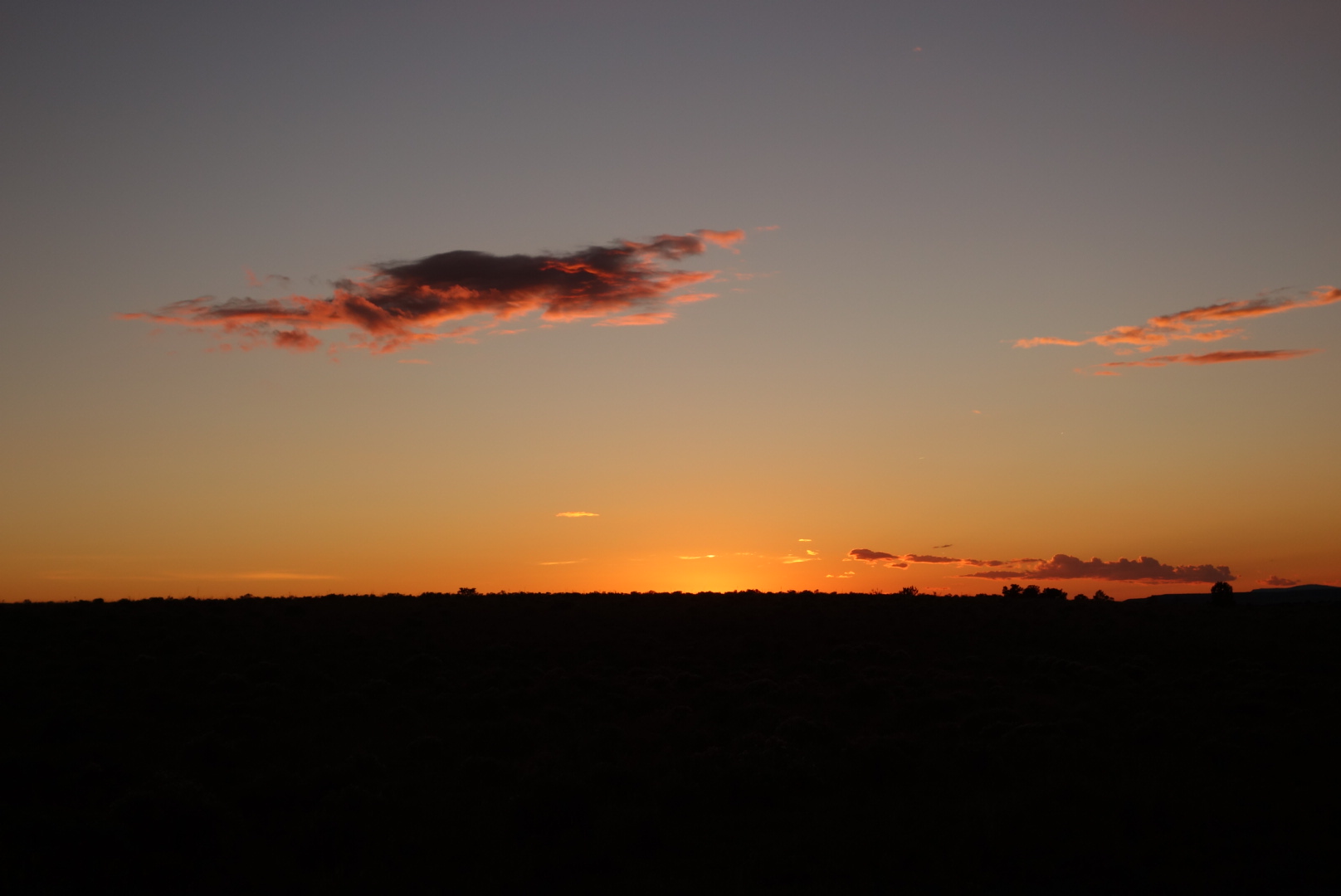
Mount Taylor

October 10th

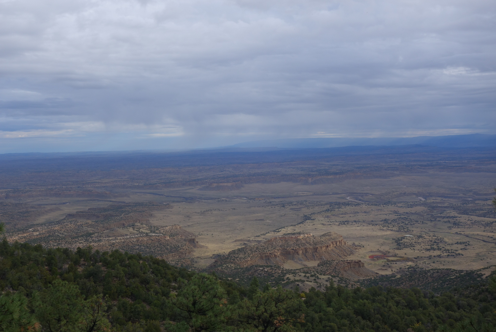
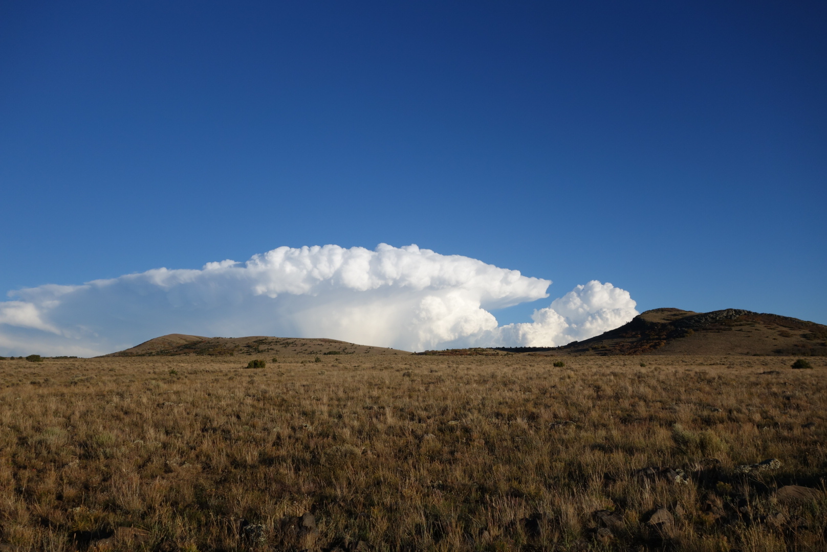
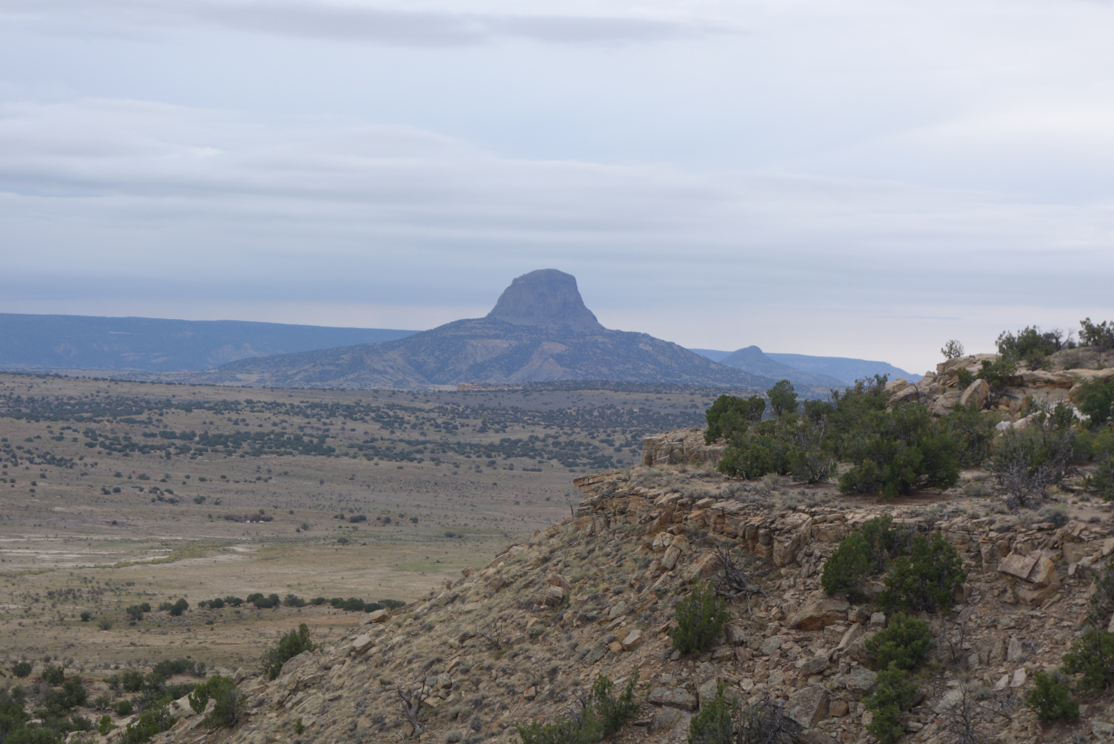
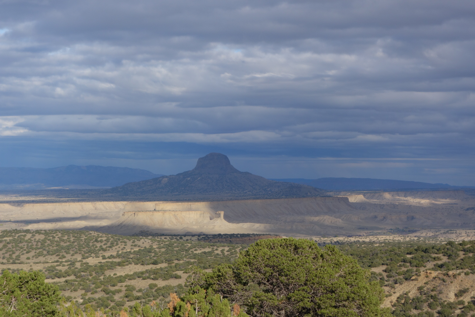
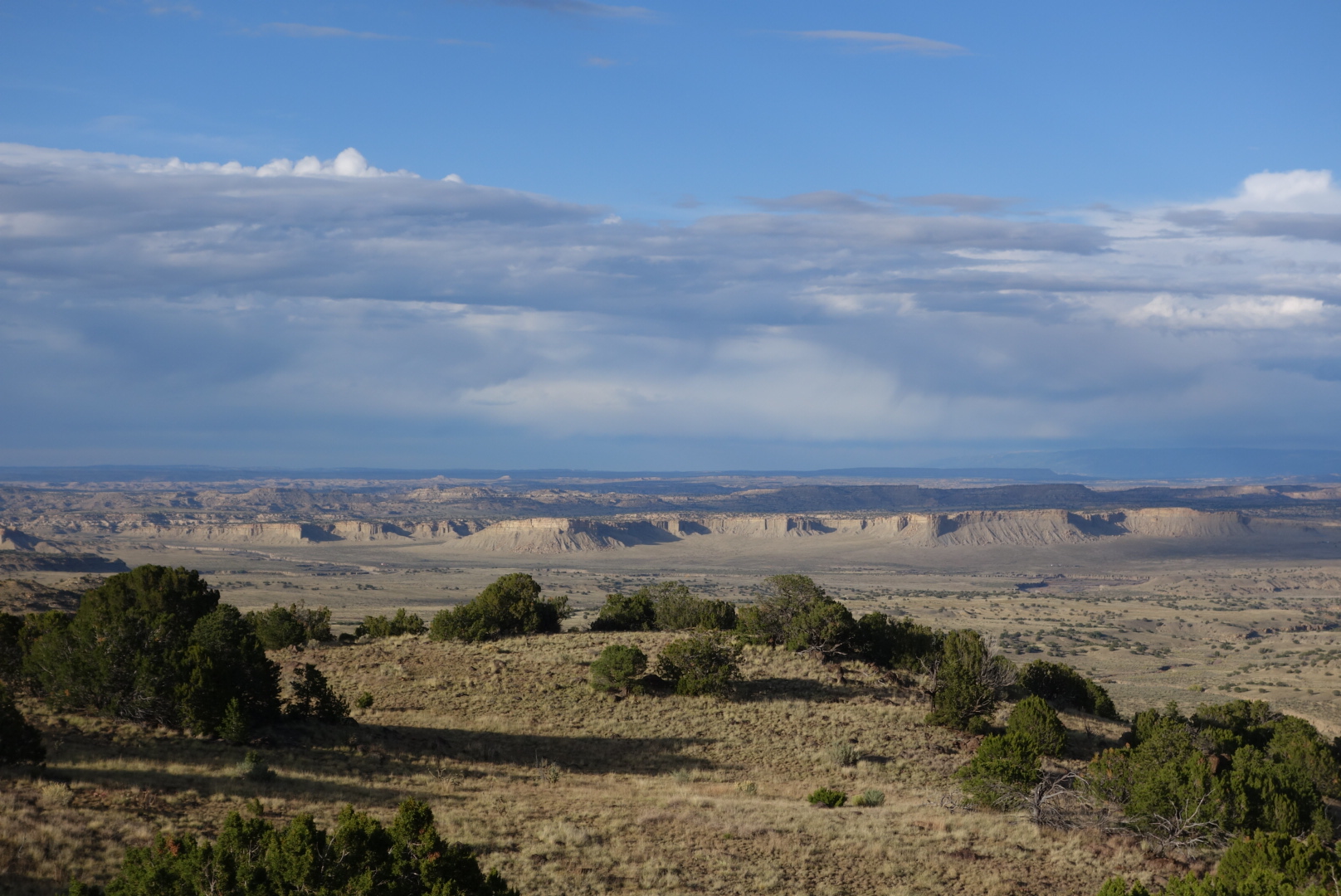
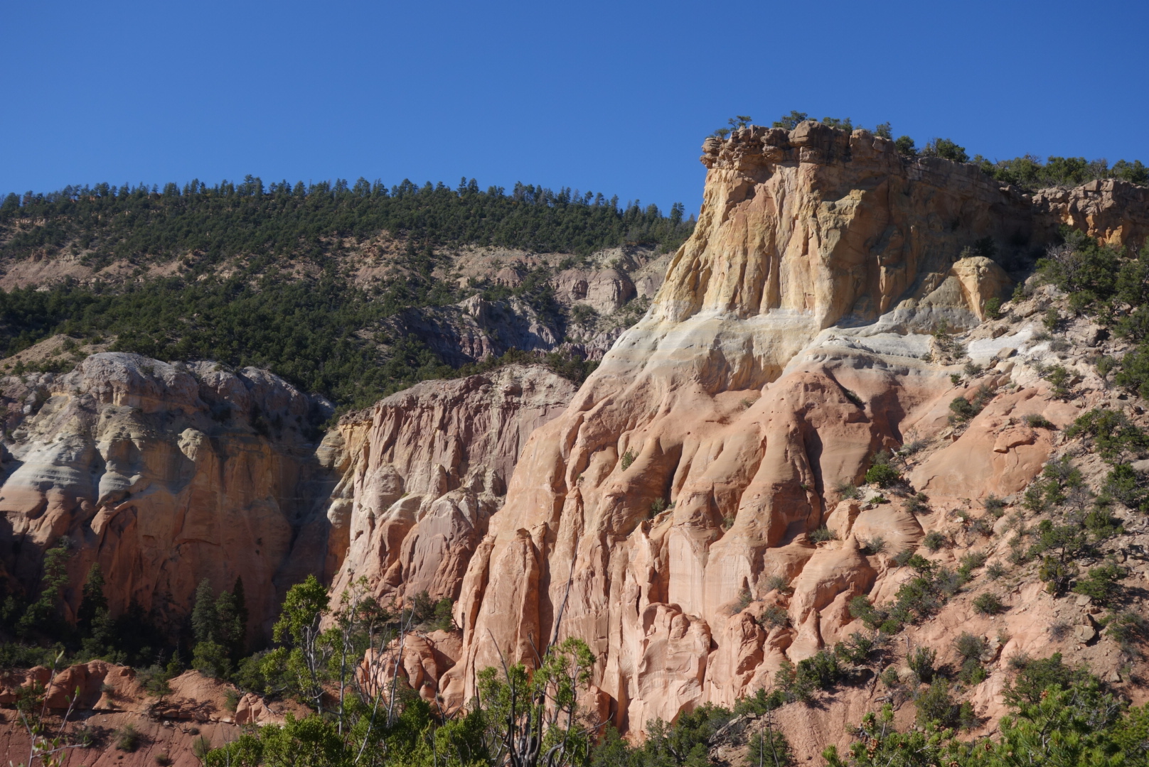
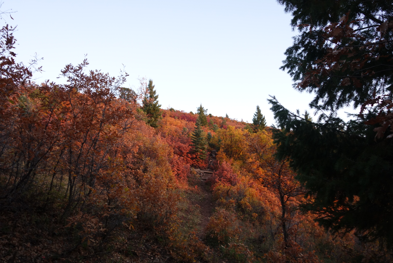
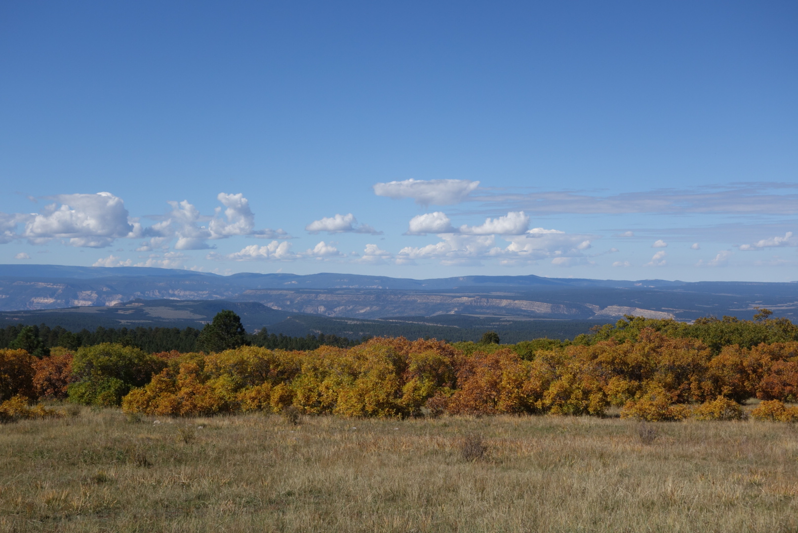
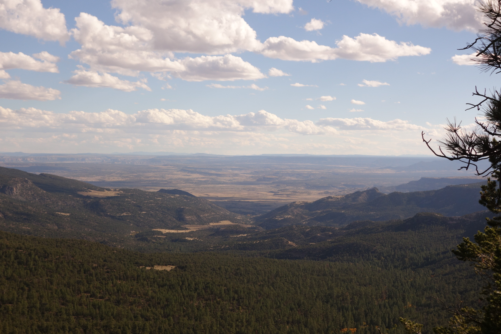
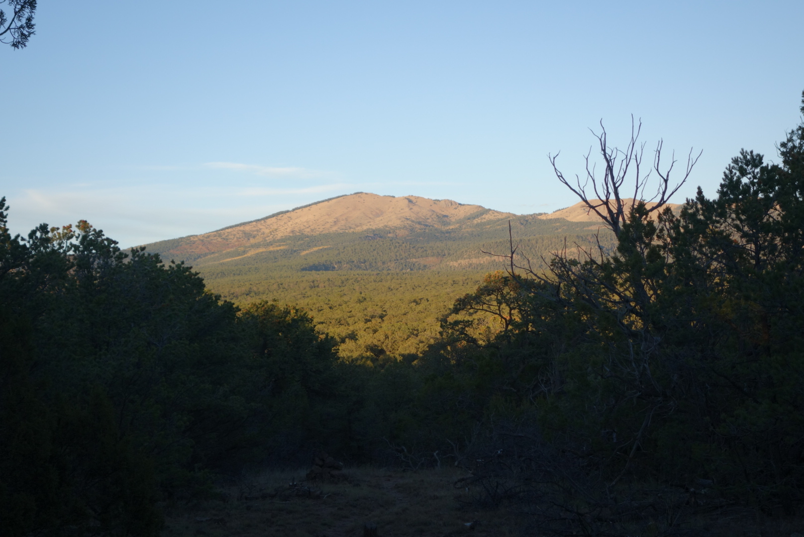
Today I had a decision about whether to go over or around Mount Taylor.  The Ley maps are unabashedly for going over the summit.  It is a fairly dry straightforward climb up and over.  The official trail circumnavigates around the north side of Mount Taylor with less up and down, a longer distance plus one reliable water source.  Mt. Taylor reaches a peak of 11,300 feet above sea level.  Also, it marks the southern end of the traditional Navajo nation.

I ended up walking around.  I wanted the comfort of water along the way and, at this point, being on top of an 11,000′ mountain is not that impressive to me.

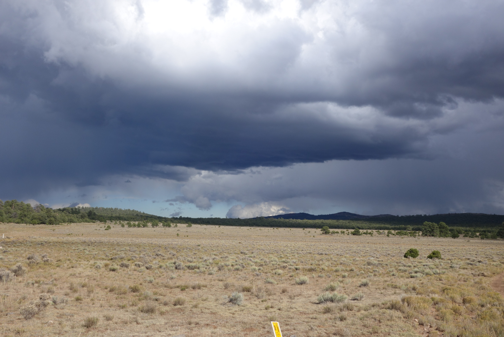
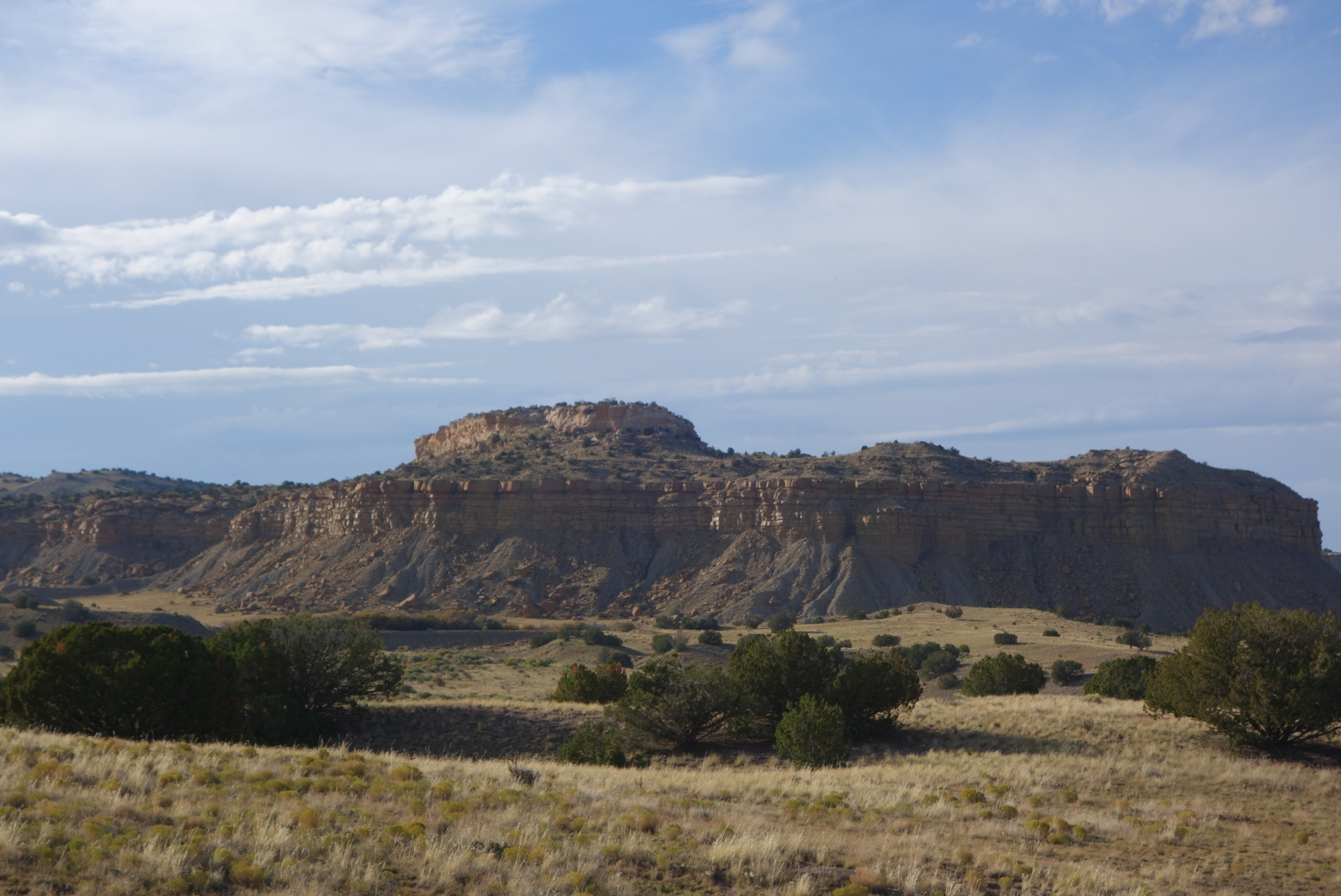
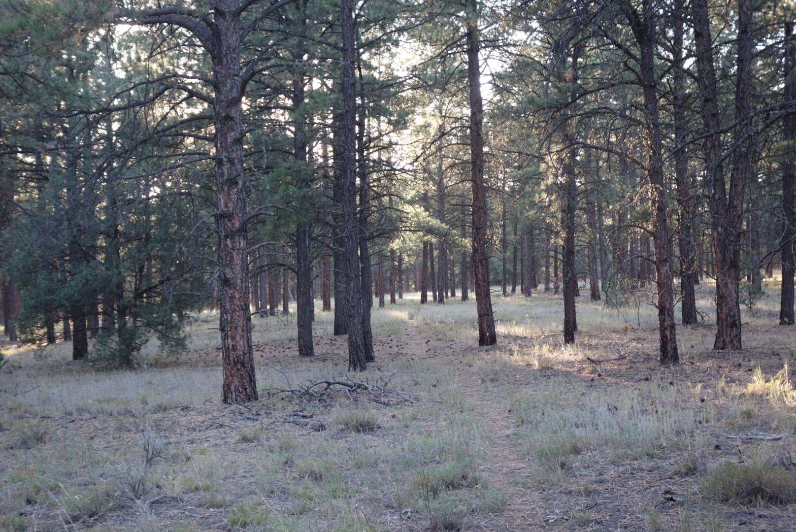
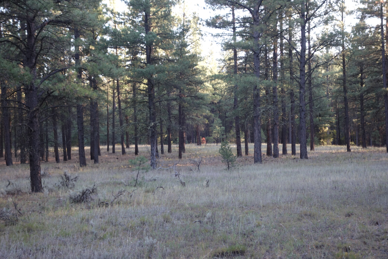
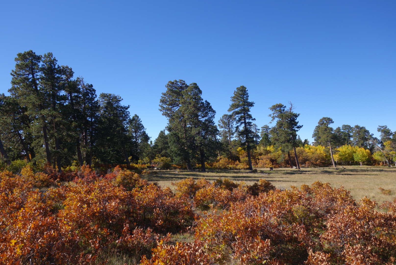
The trail was actually pretty nice.  It turns out the Mount Taylor 50k Trail Run uses both the official and alternate trails….it was run just the previous weekend.  There was interesting elevation gains, a good water source, and the tread was distinct.  Glad I took it.

Pretty nice trail

Many areas had a nice mix of aspens and pine


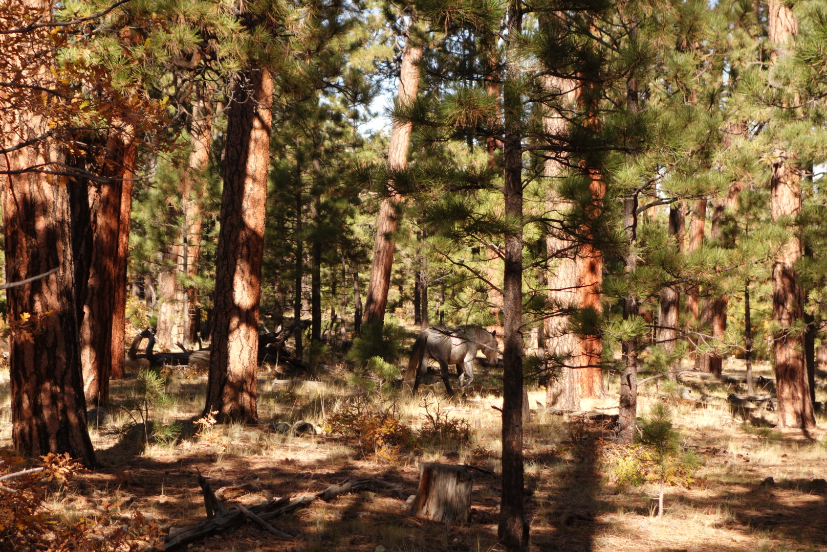
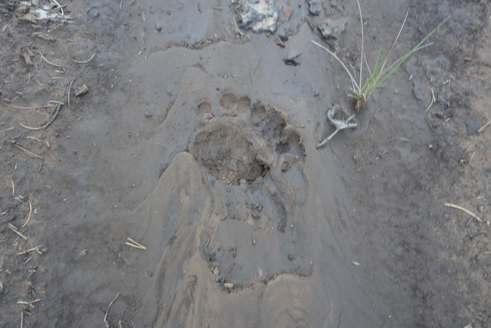
I found a gray mare walking through the woods on the eastern side.  She was neither afraid nor excited to see me.  (Later on I stopped at the Forest Service office and asked whether there was a horse reported missing.   He said there are wild horses all over and not worry about it.)

Bad photo, but the mare is in the shadow in the center of the photo

A local couple in their side-by-side stopped and we had a great discussion.  They both work at the correctional facility and this was their day off.  The man grew up in the area and knew it like the back of his hand.  They offered me water and food.  They even let me know their address if I needed anything.  I wish I was as generous as this couple.

A view south, where I am headed, from the mesa.

Mt . Taylor

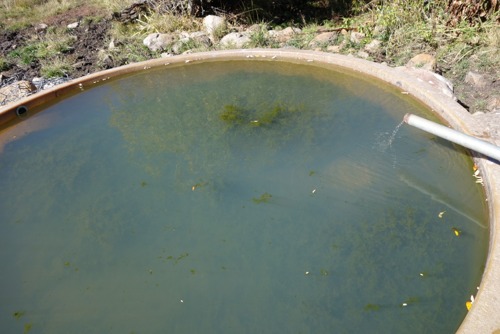
Late in the day, I found a black irrigation  hose.  Ranchers out here use them to transport water from a spring to a cattle tank.  They can go for miles.  This one had a leak about a half mile down hill.  I was glad to have the exrta water “just in case.”

Go away bear

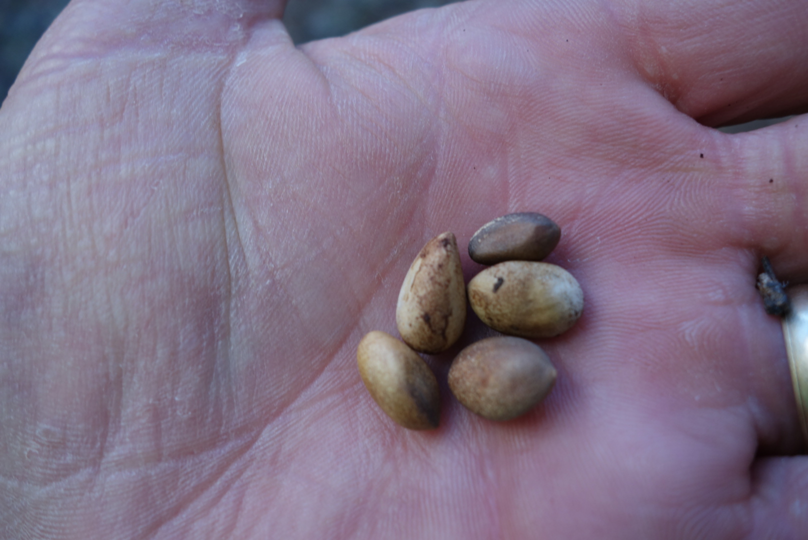
There have been a ton of pine nuts on the trail.  Considering how much I pay for these in the grocery store, I should’ve dumped my food and collected the pine nuts.  Later in the day, I heard pickup trucks and “thunking” sounds.  It sounded like somebody hitting a tree with a baseball bat.  I finally ran across the source: people out collecting pine nuts.  From the way one guy acted, I am not sure this was  an up-and-up  operation.  I ended up camping across a meadow from their base camp.

Pine nuts


Another Cloudy Day in the Desert 

October 9th

I got going and found that the rain had cleared the trail of all footprints, freshened everything up, and generally made the day pleasant.  I climbed up on to the big mesa, Chavito Mesa.  Great views and great hiking with a good mix of wide open areas and pine trees.

Looking back down from the top of the mesa.
So mesas will often have these open grassy areas with clumps of pines.
A burned forest on the mesa.
Pine nuts in the cone. There are very cool gray squirrels here with tufted ears that are hard for me to photograph.

Late morning I reached a reliable spring called Ojo de los Indios.  I hiked down and got some piped spring water.  I almost passed it up assuming the rain would fill up the “tanks.”  Glad I did not.

There was one long, straight stretch where the hiking was a little dull.  My new (old) backpack was not feeling too comfortable and the sun was warming things up.  The straight forest service road turned in to a miles long mud pit in the afternoon.  The forest service had been grading the road.  With this soil, adding rainwater made for a sticky, sloppy walk.  Hiking is not fun when your feet get heavier and slicker.

A long, straight muddy road is not a backpacker’s ideal route.

I did run across a couple interesting things:

some black bear paw prints that went right down the middle of the road for awhile. 

When will I be free of these beasts?
a guy who looked like he was preparing some type of bait for hunting.  I’m not sure sure what is legal and illegal in New Mexico, but he was surprised and did not seem happy to see me.

I saw a micro storm develop and roll over the top of me.  It amounted to nothing, but in the distance I could see it morphing in to a huge thunderhead.

This little micro storm developed quickly but also passed by me swiftly with very little rain or lightning.
Later on, all the little storms gathered on the other side of the mesa.

At dark, I ended up just setting up a stealth camp in the sagebrush.  The moon was bright and the night on my side of the mesa was great.  However, when I looked east, towards Grants, that huge thunderhead was still rumbling.  I was lucky to have missed that storm.

My sunset to the west.
The thunderstorm hovered on the other side (east ) of the mesa.
Sunset hitting the top of the thunderstorm.


More Desert Rain

October 8th

The desert trail was marked so well with cairns that the pre-dawn walking was easy.  The first part of the morning I walked around a few big hills called Cerros.  And, reminiscent of Montana and Wyoming, I walked around Deadman Peaks. 


The rocks are so interesting to me.  Several times I have come close to falling because I am looking at rocks.  It is also a little bit like aspens further north; I stop and take photos almost too often.

Gotta love the pillars.

This particular hillside had many interesting formations.

Unlike other rocks, this type erodes through chipping from the top.

This boulder was hollowed out.

I came down off the mesa and walked in some open terrain.  There were a few abandoned windmills as well as some active “tanks.”  Down here a tank is usually where soil has been used to seal off a canyon to retain water for livestock.  The water is invariably nasty.

There was a spigot that provided some well water.  It took me a little time  to figure it out, but I tanked up 2 liters with fresh groundwater.  Soon thereafter, a cache of water was supplied by the Trujillo family.  They had left some apples, too.  I took an apple and drank a half liter.  It was overcast, so I was not losing too much fluid.


There was still more open country hiking in store.  It was nice weather.  If the temperature was in the 90s, this would be a tougher section to hike.  I came to my last water cache and drank a liter and left with 2 liters.  There was a spring (Ojo Frio) coming up, but why walk away from a certain source for an iffy one?


Cabezon in the morning.

Cabezon from evening. It’s symmetrical shape served as a reference point all day. (Storm clouds in background. )

If you are philosophical, you might consider water caches left by trail angels.  On the one hand, the provide potable water in an arid area where heat and dehydration related illnesses are a legitimate threat.  On the other hand, they also present a bit of a moral hazard. Hikers unsuited for desert trail might assume the cached supplies will be there and charge forward. But if the source is not there, that hiker can be in dire straits.  I think sobo CDT hikers who went through the Basin are probably adept at arid travel by this point.

I crossed an almost-dry Chico Arroyo.  An Arroyo is a canyon formed by flood water.  Down here, water does not get absorbed easily so it tends to run off and the run off ends up in an arroyo.  This one had a few trickles and puddles left.  More importantly, the flat bottom was dry.  The combination of desert sand and soil can make these river beds into wet cement or quick sand.  I could see a cow had recently crossed with some difficulty.  I guessed that my lower weight and flatter foot would work to my advantage and it did.  I crossed without getting stuck.

I climbed a large mesa, about twice the height of what I had been going over the last two days,  I got about halfway up and saw a relatively flat spot at 6:00 pm.  Rather than push for the top, I camped.  To me, there were still enough mare’s tails in the sky to suggest setting the tent up.  One other twist about desert backpacking is that sweeping the tensite for prickly items is extremely important.  I found the site  was level but lumpy, so it was not perfect.

Looking back, the mesas from earlier in the day seemed trivial.

This was a mesa on a mesa.

Later that night, rain and wind swept in.  My guess was rain between 9:00 and midnight.  That’s a pretty substantive rain for this part of the country.  Between the lumps and wind, I had a spotty night’s sleep.


Leaving Cuba

October 7th

Up early, I walked through a quiet Cuba.  I stopped at McDonald’s to get a breakfast on the road.  The day was to start with a walk along a highway, although it was not a heavily traveled road.

Despite the chill, I enjoyed the road walk.  In fact, I enjoyed it so much I walked an extra mile past my turn off.  Shame on me.  I checked for and did not see any private property or No Trespassing signs.  Seeing none, I set my sights due south and bushwhacked to intercept the trail.

The trail was amazingly well marked.  Unlike last section where it was blue paint on trees, posts, or rocks, this section was white paint on wooden posts or cairns. I thought because of my missed turn I would find myself behind SBJ and MLL.  I did not see their footprints.  I could see a few others that looked to be a day or two old.

These fuzzy / furry insects are very interesting but hard to photograph.
She was laying eggs. She walked through an ant colony and they left her alone.

Eventually the trail wound over to the edge of the Mesa Portales.  It was a pleasant diversion to walk along and be able to look out.  The only bad news were some developing thunderheads.

The trail drops off the mesa to some flat terrain.  Some trail angels had left a supply of fresh water just before Jones Canyon.  This time, there was plenty left.  I took a liter and drank a liter.  The next water stop was Jones Canyon which was a cool old spring with some abandoned stone structure nearby.

This pine was growing straight out of the rock.
You can see this tree is uprooted on the right, but is still living in the center of the photo. Gotta be tough to live here.
Looking back at part of the mesa.

I gradually climbed the La Ventana Mesa.  I looked back and saw a pretty bad thunderstorm in the direction of Cuba.  I hope my fellow southbounders were out of town before that hit.  As it got dark, I found a place in the junipers where I could cowboy camp up high.  It was a good spot, but I was reminded of one of the real negatives of desert hiking:  the sand.

Some of the rock on top of the mesa has developed this tortoise shell pattern.
This was interesting to me. We’re the pebbles blasted in to the larger rock or pushed in?

Desert sand is not like beach sand.  It is finer and sneakier.  It sticks to you and gets into places you don’t want.  For backpackers, this means the fine gritty sand gets in your sleep system, perhaps your food and water, too.

It is Cold Here

October 5th

I left with my new, bright headlamp.  For the first half hour I was cruising, but I could not believe how cold it was.  Surely, I struck an odd figure walking down the road with a headlamp and my hands tucked under my armpits.

I was supposed to follow a trail off the road.  Could not find it.  I bushwhacked in the direction I should be going.  Eventually, I crossed a path.  It didn’t look exactly right, more like a horse trail.  I followed it in the cold for ten minutes, but gave up when it went the wrong way.

Eventually, I got on track.  This time the trail was marked by wooden posts with paint on top.  The trail goes by a closed museum and then cross country along a fence line.  Later, it climbed a forest service road and the temperature also warmed.

Colorful oaks under the ponderosa’s canopy

Later in the day, some sandstone cliffs

After following a small stream uphill, the trail veered off for some gentle climbs.  Late in the day, the trail came down and paralleled a forest service road (not my favorite).  Across the road, there was a cow path and a small herd was moving single file in the same direction as me.  The game was on.  Let’s make sure we all understand I was carrying a backpack, it was unfamiliar territory, and my trail took turns.  So, the fact the cows hiked faster than me over a half hour period should NOT be a surpirse.  Frankly, I think they cheated.

In the evening, the trail wove through level, open forest

A solitary bit of fall color

After crossing highway 92, the trail followed rolling ponderosa forests uphill.  I eventually found a flat spot just before the route steepened.  I cowboy camped.  Around 9:00 I was woken by some branches snapping about 50 feet awauy.  I turned on my headlamp and had about 40 glowing eyes looking back at me.  It was a cow herd.  Later still, there must’ve been two coyote packs fighting over territory because it was a pretty extensive period of growls and barks.  Not the sounds of a hunt.  Still, I managed to sleep.


San Pedro Peaks and Parks

October 6th

I cruised along in the morning.  I was a little surprised to see a headlamp behind me, but it was SBJ and MLL.  They easily passed me as they are great hill climbers.  The morning would be spent going up an old trail.

The trail was uphill but not as bad as I had feared. It eventually topped out in the San Pedro Peaks wilderness area.  It was mostly flat and had several meadows and grassy flats they called parks, for good reason.  I did encounter two pairs of other hikers.  Complete opposites.  The first was two guys.  “Hi” was the substance of our communication.  The second was two ladies.  The lady was very familiar with the CDT.

Descending, the trail rapidly went from alpine, to pine, to mixed deciduous/pine to, finally, shrubs.  The descent was along a stream that caught the sunlight and had colorful leaves floating in the pools.  Why does anybody hike this trail northbound?

Red berries missed by the birds.

SBJ, MLL, and I road walked in to Cuba, New Mexico.  I stopped at the Frontier Motel where I would find my resupply and my old Granite Gear backpack.  Cuba was a typical fading New Mexico town along a highway.  It had some great points.  El Bruno’s was a great restaurant.  The Frontier Motel was pretty good, with an almost brand new bathroom and the manager (Rosemary) was great.


New Stuff

October 4th

After visiting the two museums on site, I checked for my packages.  They only had one: the filter.  That was the most important one, but I wanted the headlamp,too.

Later, I found Sweet Baby James and Moon Light Lady (SBJ and MLL).   They were just swinging by top pick up a package.  The Ranch gave them a bit of run around saying they had to rent a campsite in order to do laundry or purchase a shower.  I let them use my room’s shower.  They stayed for lunch and left later in the day.

After asking twice more, I went in and talked to a volunteer around 6:00.  He found my second package right away.  It had also been delivered around noon.   I guess its about asking the right people.

I packed up and got ready for an early AM departure.


Idle Hands

October 3rd

(No photos )

I tried to sleep in and get some rest, but I am conditioned to get up and get going.  However, I was extra grateful I had made it into town as there was a huge downpour about 2:00 in the morning.

I walked around the facility and was impressed.  It can host up to 400 people and tends to cater to small groups interested in archeology, painting, writing, photography, religion, etc.  Ghost Ranch, incidentally, has been used in many movies, notably The Magnificent Seven, 3:10 to Yuma, The Missing, and City Slickers.

When I was there, painting, writing, and archeology groups were there.  The painting group would take up stations around the campus and try to paint landscapes, much like Georgia O’Keefe.  I amused myself by going up to them and saying things like “That’s good.  You should take lessons!” or “You really did well with the number 5 color.”  No, I didn’t.

Basically, I did town chores and caught up on some blog entries.  It is a lot of work to keep a blog going from the trail.  After a tough day on the trail, the last thing I feel like doing is write a blog entry.  And then screw around with photos, formatting, and posting.  However, whenever I feel that updating my blog is difficult, I think how awfully painful it must be to read it.

In a Hurry to Reach a Ghost

October 2nd

(10/12 photos added)

Well, you know about my headlamp issues, so I won’t rehash them.  The general frustration is that daylight is precious.  Days are getting shorter and they get shorter as I head south.  I need to get miles in if I want to complete the trail this month.  Hiking in the morning fits my personality and helps solve this loss of daylight.

This morning presented a new challenge.  Either at my last water source or climbing over the blowdowns, I lost a key part of my water purification system.  This was bad.  You simply cannot hike through cattle-happy New Mexico without a water filter.  I was able to reach Helen and she performed a few Sunday miracles and arranged to get a headlamp and water filter sent to me via overnight at Ghost Ranch (my next destination).

Even though it is elk season here in New Mexico, I still enjoy walking quietly in the morning and coming upon a herd or a single bull.  I came across a few bulls in the morning and they couldn’t figure me out.  I slowly reached for my camera, but they seem to be able to detect the sound of a camera case snap with great clarity.

I saw a few bull elk just after this section of trail.

“The trail will provide.” So goes the saying.  Well, in mid morning, I came across a cattle tank where the rancher had elevated the pipe containing incoming ground water.  The tank and pipe were accessible to the public in this case; usually ranchers fence it off.  I was so relieved to find fresh groundwater and tanked up for a full day, about 3 liters.

May not look like much to you, but that piped water was a beauty to me.

It was forest in the morning and then switched to mesa.  I find that I can hike fairly fast on mesa, mainly because it is flat.  Also, I was mad at myself for losing my filter and I find I hike faster when I am mad.  The upshot was that when I sat down for a snack at 1:00, I realized I might be able to make Ghost Ranch tonight instead of tomorrow.  If you have followed this blog… Ok if anybody had followed this blog, they would know the reward of town food is motivating to me.

The hills mellowed out in this section.
I dubbed this the Eileen forest. Due to the prevailing wind the ponderosa’s all grew slanted to the left.


I cranked up the hiking a notch and followed the alternate that went directly in to Ghost Ranch.  Ghost Ranch is famous for Georgia O’Keefe and her landscapes.  It is a Presbyterian retreat center open to all.  Through-hikers can stop by and enjoy the all you can eat (AYCE) meals.

It’s amazing what you find….

The alternate to Ghost Ranch follows a gently sloping mesa and then descends sharply into a desert canyon.  While I was on the mesa, I encounterd a larghe lump in the trail that created a lump in my throat: bear scat.  On closer examination (yes, I did), it appeared to be heavily tilted towards acorns.  Perhaps these black bears are related to the Glacier Park grizzly and tend to be vegetarian.

Acorn compote

As I dropped down off the mesa, the trail was challenging. However, the change in the ecosystem was awesome.  Within a mere quarter mile the land turned to desert with prickly pear, cholla cactus, and sandy soil.  There was a small stream at the bottom of the canyon.  I was in cruise control and went by some day hikers.  As if scripted, right after passing them, I slipped on a tiny rock in a tiny stream and fell on my butt.  The mighty through-hiker shows ’em how we do it.  More seriously, my replacement Zpacks pack started making weird squeaking sounds…similar to those the last time when the original one failed in the field. I decided to have my old pack sent to Cuba, NM and not risk having the Zpacks fail on me in the desert.

I recovered from my fall from grace and made it to the registration.  Got a room (campsites are available) and was ion time for the AYCE dinner.  In full disclosure, I did offer to buy two dinners knowing I would eat a lot.  They said it was fine and they were used to hikers.  While the food was not the best (think college food service), it was plentiful.   I ate thoroughly and was glad for the fresh veggies.


Descending to Ghost Ranch
I can see why people come here
 

Almost like a cake
Sunset from the Ranch

The Final Month?

October 1

I tried to get going early.  For some reason I woke up at 3:30 and stayed awake.  There was some creature breaking branches deep in the dark, motionless forest which did not help.  Unfortunately, my dang headlamp was stuck on an even lower setting so hiking in the dark was out.  So, I packed up and huddled around my gear until just a little dawn showed through.

The headlamp I have is from Black Diamond.  It came with an instruction sheet that unfolded into a sheet of paper large enough to sail a boat.  I would not be surprised if it offered instructions in Esperanto.  It can strobe, glow red, lock itself, and have high beams and low beams like a car.  All these functions are achieved through a series of taps and holds, like Morse code, via a button on top.   The first thing any real man will do is throw away an instruction sheet bigger than 8 1/2 x 11, especially if it has  Esperanto.  In the field, the lamp unilaterally decides its base level.  If it is high beam, great.  If not, and you haven’t memorized the code of taps and holds, you are screwed.  I was screwed.  Even doing the old computer reboot by removing the batteries did not seem to work.

Once able to move, I made great time. It was fantastic hiking for most of the day.  It was high forest of mixed deciduous and conifer.  There were plenty of elk.  I went around the Vallecitos Ranch which is a wilderness retreat center focusing on mindfulness.

Later in the day, I got my final water supply before moving away from water.  The trail then went on a weird tangent.  Somebody had posted a sign about a reroute due to dangerous trail conditions. It said to follow the flagging for an alternate.  The problem was there was no flagging.  Regardless, I eventually got synced back up.  The trail went through an aspen forest blow down.  There were a few hairy workarounds.

As with most things, it eventually cleared up.  I was in high meadow territory.  I climbed to the crest where a forest service road crossed and I found a grove of young aspen.  I was able to cowboy camp.  There were some hunters across the valley, but they were pretty mellow.