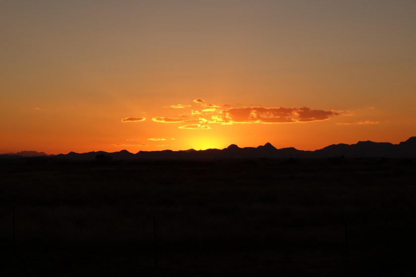
I got up and going, eager to climb the mountain first thing in the morning. I loved the trail in this area. Even in the dark, it was a beautiful climb. I wanted to be high when the sun rose as those are the prettiest photographs. However, it looked like it would be cloudless and therefore less visual interest.
There was a choice of taking an alternate which was shorter and in a valley or the official trail which was up high and longer. Also, the comment was the official trail was “wicked” in some parts. While there was one old section where no tread or cairns existed, enough tree notches were around to navigate. The rest of the official trail was gorgeous. It was graded well, stayed in trees, but offered vast views. I am so glad I did not take the short cut up the valley.
A pleasant surprise came in the form of a small seasonal creek. This area was hit with a storm a few days before and this one stream was still trickling out some groundwater.
The trail entered more arid, desert-like terrain. I did see a bobcat for the second time in my life. Coincidentally, the only other time I have seen one was about 18 months before and 100 miles southeast.
This tree was picked out.mountains in the background were burned except at the top
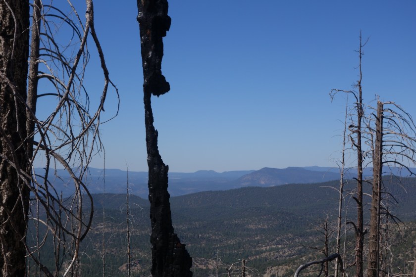
A skeleton of a tree in the burned area.
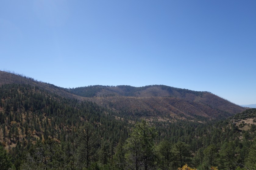
Later, I had a steep climb through a burned forest. That hot climb through a tough territory was rewarded with a long slow descent through a vibrant pine forest on the other side. Even an unreliable water source (Dutchman Spring) was full of water. As a result, my afternoon and evening was spent walking slowly downhill through an older ponderosa pine forest. I saw two cars in 6 hours. I also ran into a northbound section hiker named Arizona Chap.
The quiet road was surrounded mostly by ponderosa, but there were sometimes oaks to provide fall colors.
I camped at the edge of the forest. Out here, the ponderosa gives way to pine, juniper and scrub oaks before turning to grasslands. As the grass grew more dominant and the light more scarce, I went off the road and found a modest sized juniper with flat, smooth ground underneath. I made camp and listened to the cows and coyotes down in the grass. The moon was coming up later and later, so I went to sleep in the dark. It did not feel like it would freeze, but I still brought the water filter into the tent just in case it did.
I got going a little later. Much to my surprise, it wasn’t insanely cold, just mildly cold. As I was packing, a few vehicles went by. Hunters on their way to their posts.
Within about 25 minutes I was chugging up a slope. I heard an elk call ahead. I walked more quietly. Using my headlamp to pick out and avoid any sticks. On my right I see three faces turn to look at me. To my credit, I kept all noises, liquids, and solids inside my body. My first thought was leprechauns, but it was just some young guys squatting down to hunt hunt the small valley below. We exchanged whispered information and I was on my way. Turns out they were the ones who made the elk sound.
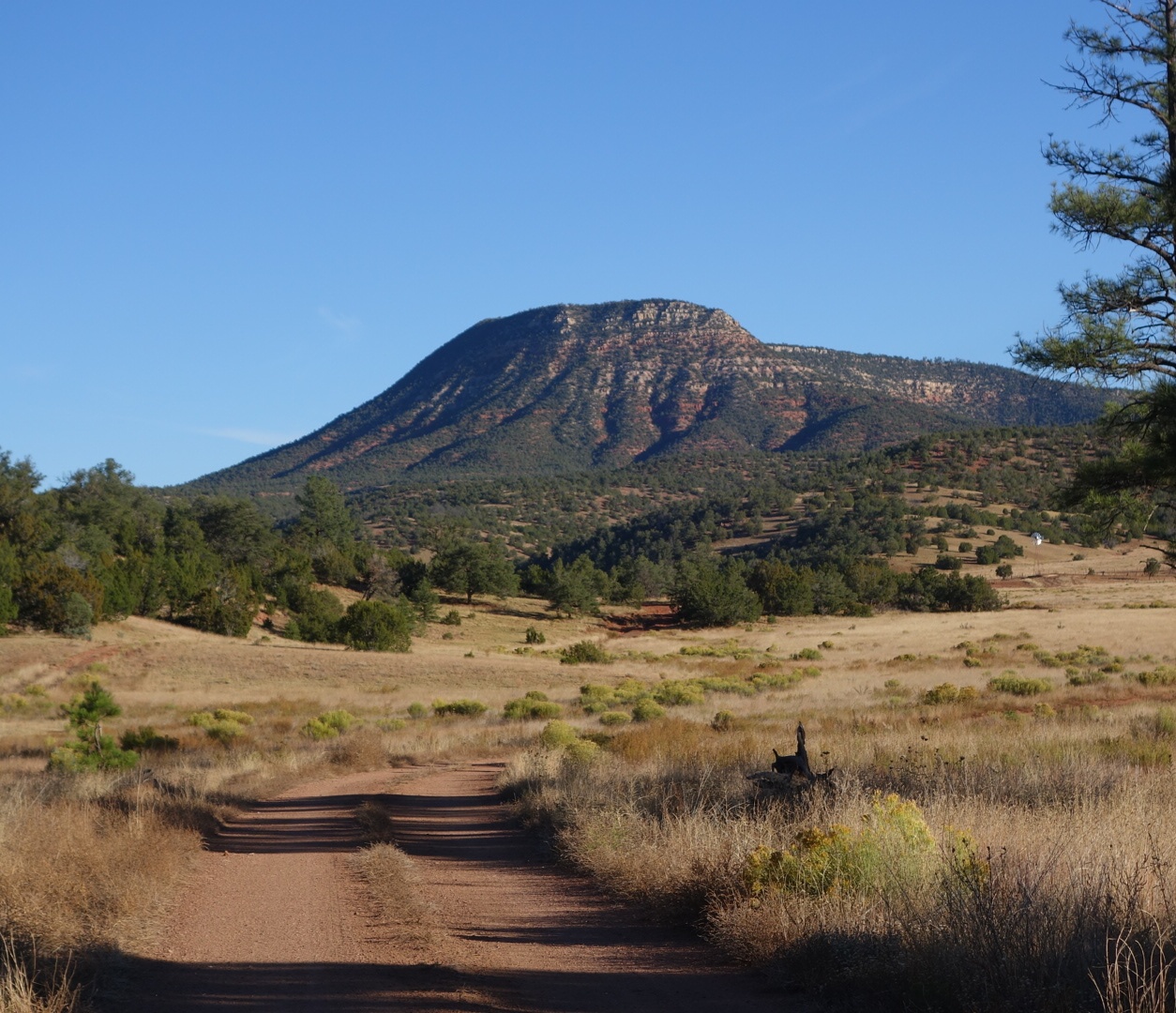
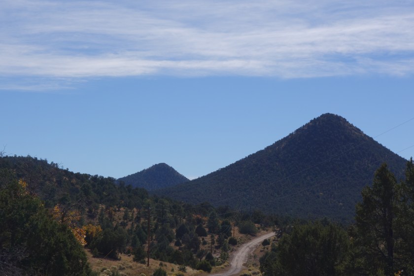
I climbed up Mangas mountain. It afforded some nice views looking south. I did not go up to the lookout. I believe they are no longer staffed by this time of year.
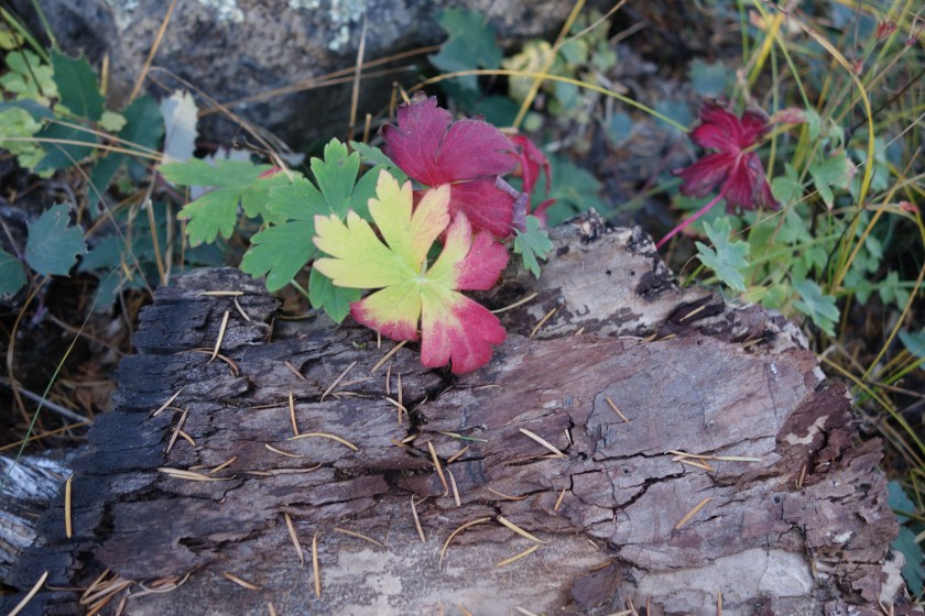
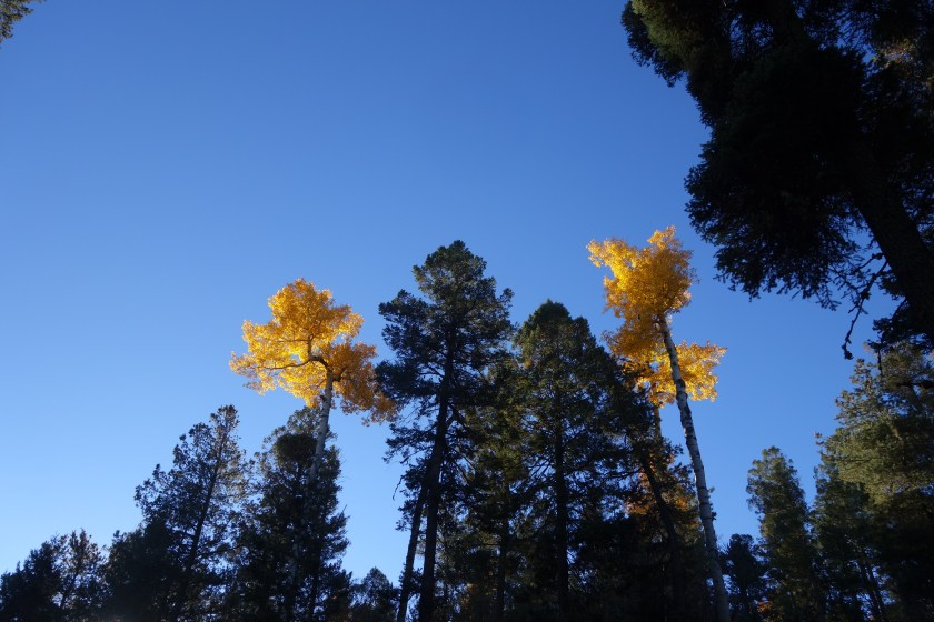
A few aspen break up the pine forest and provide color on Mangas Mountain
It was a fairly dull day after that. I walked down in to some valleys and was on forest roads. I did have one guy on an ATV come by while I was taking a break on a log. I was off trail a little bit and he did not see me. I was curious to see a large bag of some type of feed in the back of his ATV. An hour later, he came back and the feed bag was empty. Yea sportsmanship!
Late in the day I came to a large metal tank with an attached solar pump. However, since the cattle were gone, the pump was not working. The owner had locked it. I looked in the tank and it was quite the little ecosystem. Down on the side, there was a small trough which had clear water and some green aquatic plant, clearly the lesser of two evils. The water was actually cool and tasted OK after filtering.
Water + vegetables + animal protein = Backpacker’s DelightNo worries, my filter kept out most of the bugs.
I put water in my dehydrated meal. For the first time all trip, the bag leaked. Of course, it would be coconut curry that leaked. So, the outside back pocket of my backpack now smelled like a Thai restaurant and I was now carrying a bag of rehydrating food in one hand as I hiked in the twilight.
I was heading up a ridge and heard elk bugling. It sounded real this time. Sure enough, I could see the bull ahead of me in the thin trees. As I got closer, I got my camera out and got the video ready. I honestly convinced myself that I was going to capture dramatic elk footage with the camera in my right hand and a dripping bag of coconut curry in the left. Surprisingly, I got pretty close, I came around a corner and found the bull and a cow in flagrante. It doesn’t matter whether it was me or the curry, but they noticed me and took off.
Ended up cowboy camping on a bed of ponderosa pine needles on a small ridge. It was a little breezy, but a fine spot nonetheless.
Well, it was not the cars that kept me awake. Bull elk apparently are partial to the National Park Service. All night I heard from across the road the various grunts, bellows, and bugles that are the ruminant equivalent of a Barry White medley. The fact this must work does not speak highly of elk cows. Perhaps the almost full moon added a little extra zest to their passion, but I was glad for my alarm to go off at 4:30.
Have I mentioned that New Mexico is freakin’ cold? Again, I had everything on and was cold. I was first walking down the highway and then cut over to a dirt road that went up Sand Canyon, another well-named geographical feature.
My first water source was supposed to be a solar well. Since this was pre-dawn the pump would not be working and, besides, I could not find it in the dark. I later also skipped a one mile side trip to a wind mill rumored to have good water.
I passed many hunters camped along the road. The few I spoke with all said there were signs of elk but they could not find them. I wanted to explain where the bags under my eyes came from, but chose not to. After all, if the fact something kept me awake at night was reason enough for me to send hunters with guns to kill it, many dogs and car alarms would be gone by now.
I climbed steadily upward. I met my last two elk hunters as I neared the peak for the day. We were on a dirt road. They asked what my route was. I told them I would follow this road, cut north, and then descend a canyon on the opposite side. They were well intentioned and twice warned me this road dead-ended just ahead. I thanked them and went along. I grabbed water from a “tank” which was an earthen dam that collected muddy run-off. I would filter it as a last resort.
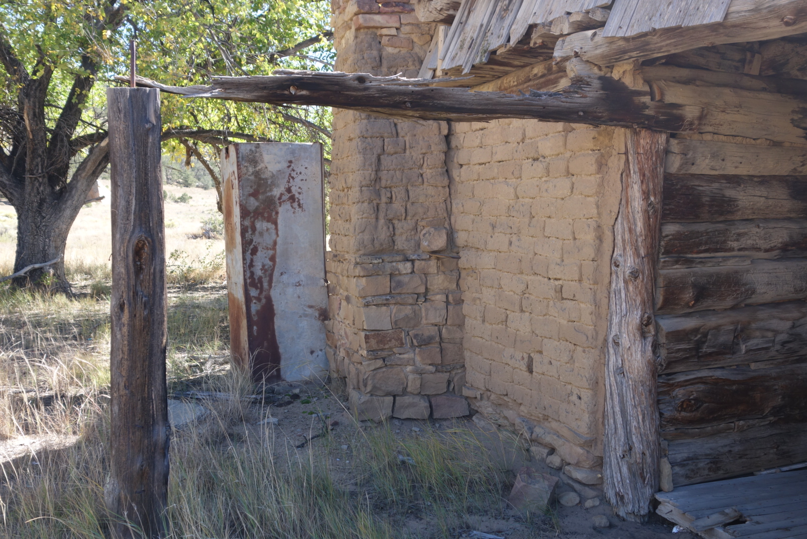
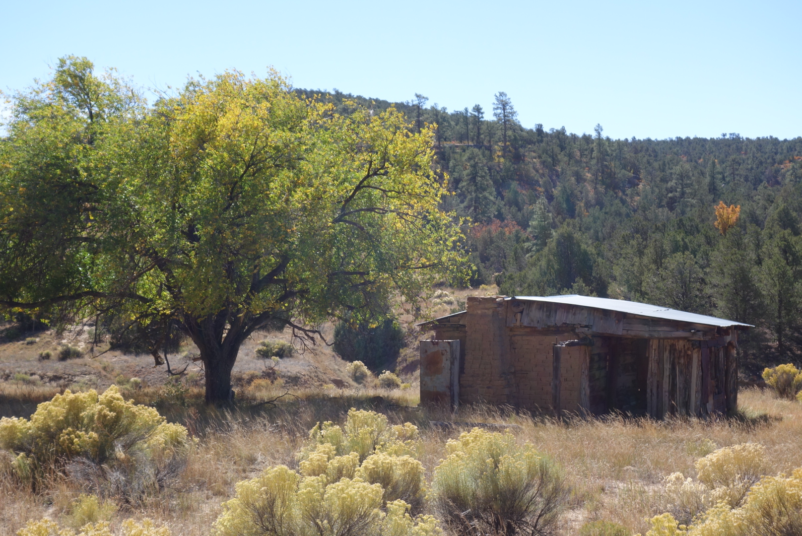
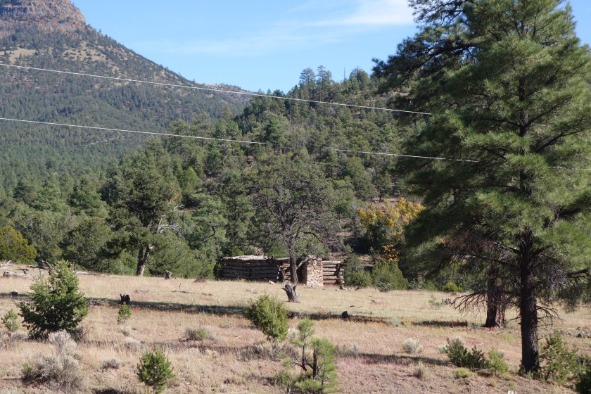
The hike down Armijo canyon went fast. The temperature waremed quickly. I came to a vary old cabin and dry spring. Allegedly, the original building dated from the 1200 and various occupants had added bits over time.
Some of the masonry was reported to be quite old.
The old cabin
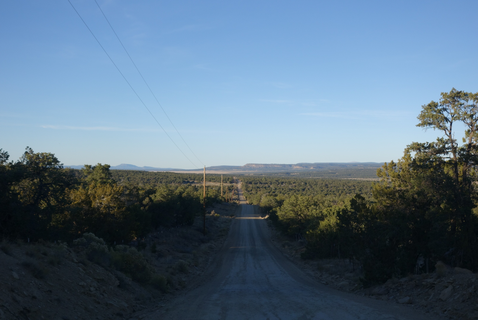
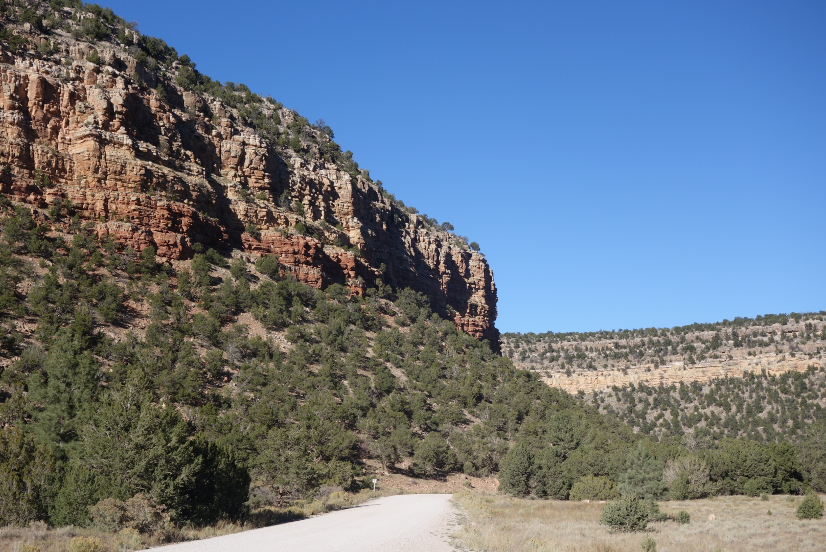
Finally, the canyon drops out into a broad canyon where ranching is the only activity. In fact, there is only one ranch, the York Ranch. ( Later I learned it is 180,000 acreas and was recently sold for $11million). The gravel road that would be my home for the next 24 hours was the York Ranch Road. Yup, York Ranch is the boss out here.
Looking back down York Ranch Road from a crest
I was down to my brown tank water. About every 20 minutes a vehicle would go by. I would shake my water botttle at the approaching vehicle, a sign I needed water. Nobody stopped. I gave up. At this point I was approaching a reliable solar well. It was big and beautiful. A solar pump poured water into a huge metal tank that must’ve been 20,000 gallons. when it came out of the pipe, the water was cold and delicious, coming up (I later learned) from 900 feet below.
As I got back on the road hydrated and lugging 5 liters (10 lbs) of water, the first car that came by stopped and asked if I needed anything like water or food. In fact, three more cars did that. Two drivers said there was another hiker behind me on the same road.
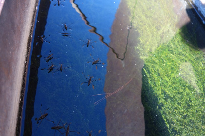
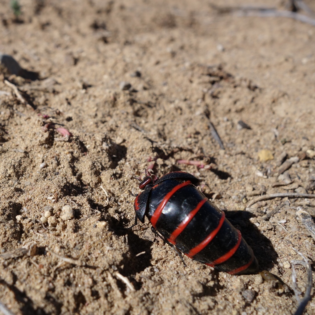
This odd bug was near the water tank. Its head is so tiny in relation to its body.
I made good time on the road, but as it got darker, it was clear that I was not finding any public land. On each side of the road, the familiar New Mexico hospitality signs of barbed wire plus “No Trespassing” greeted me for miles. Finally, around 6:00 I reached the Thomas Mountain Ranch which has a sign out front encouraqging hikers and bikers to come in for water. I came in and hoped I could find a patch of land to camp on.
The grounds were a collection of welded water tanks, a few idle recreational vehicles, and a large metal shed/ hangar. I was there during supper time, so I cautiously looked for a place to camp. Out of the hangar pops John Thomas. He insisted I come in. I met his wife Anzie. Over the next three and a half hours I would learn about their life preaching, working as a metal fabricator,, service in the Korean war, and political beliefs.
He was 84 and she was a bit younger. Both were sharp and entertaining. They lived full and intersting lives. They bought a little piece of retirment land and it turned out the Continental Divide Trail went right by their front door. They loved helping out the hikers and bikers with water and a place to sleep. They kept a scrap book. For every hiker there was a page and a number and a note. (I was number 261, I think.) The first entries were some college students from Minnesota that stopped and asked for water in 1999.
I was offered a defunct RV to sleep in. It had a bed and sofa. I slept on the sofa and left early the next day. In contrast to the cold, no trespassing, and barbed wire, I was glad to end my day in the warmth of the Thomas Ranch, their hand-welded fire box, and a warm family.
Well, New Mexico continues to be one of the coldest states on this trip. I bundled up with everything I had and moved along in the dark. I knew there were a couple good water sources ahead, but I also knew I would be going through a very dry area called “The Badlands” a name which must’ve gotten published without first running through the chamber of commerce.
Looking down the valley before crossing over to El Malpais
My second water source was a windmill tank. There was a slight breeze in the valley and therefore the windmill was pumping out fresh water from the ground. I filled my bottle and my 3 liter platypus bladder. My hands were very cold after that, but the sun was about to crest the hill and then, I knew, things would be very different.
I came to the highway and crossed it to reach the parking lot for the national monument known as El Malpais. Nobody there and surprisingly little signage. When all you have to offer is sharp rocks, no water, little shade, and hard-to-follow trails, it is no surprise that the public does not come streaming in. I did see an interesting symbol/sign. Perhaps I have been on the trail a long time and apparently crawling on your knees with a headlamp is a new trend, but not allowed in El Malpais.
Not sure what is going on in the next to last symbol on the right. Whatever it is, you can’t do it here.
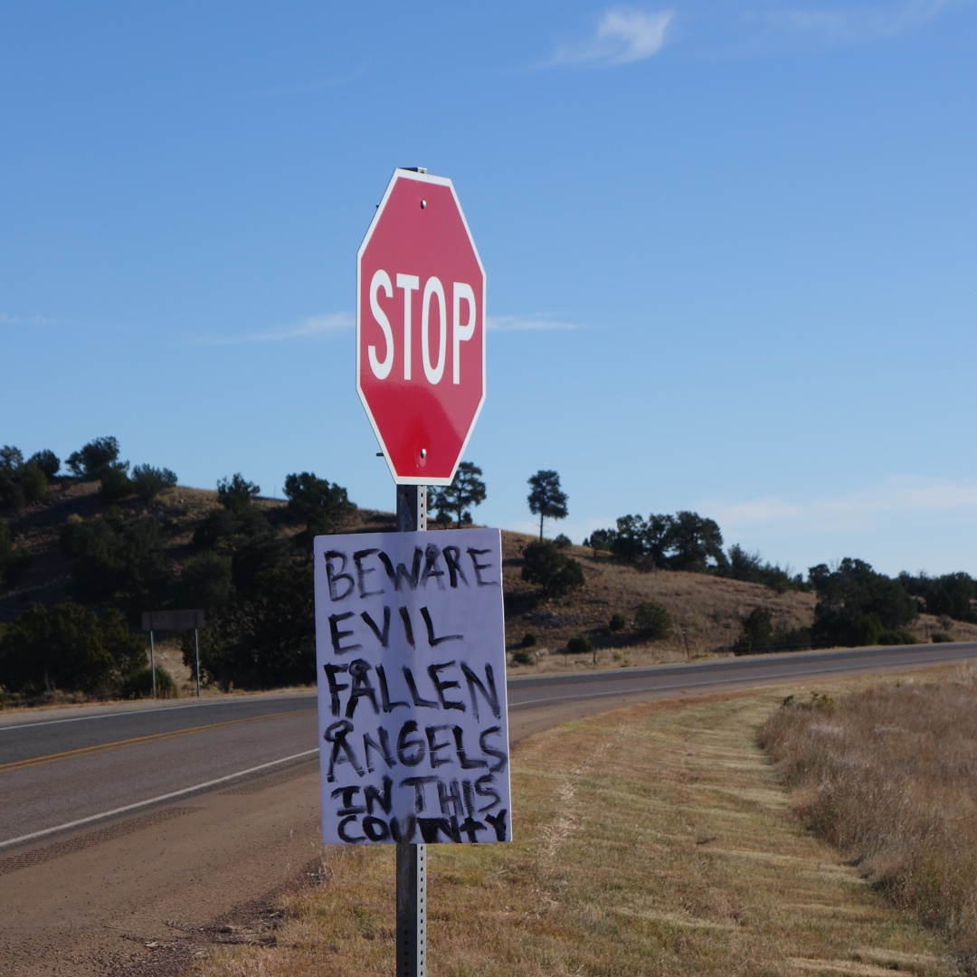
Also, there was a handwritten poster attached to the stop sign. On top of worrying about water and tarantulas, apparently I now had to watch out for fallen angels. Unfortunately I was out of range and could not google an image so I would know what to look for…
Thanks for the head’s up.
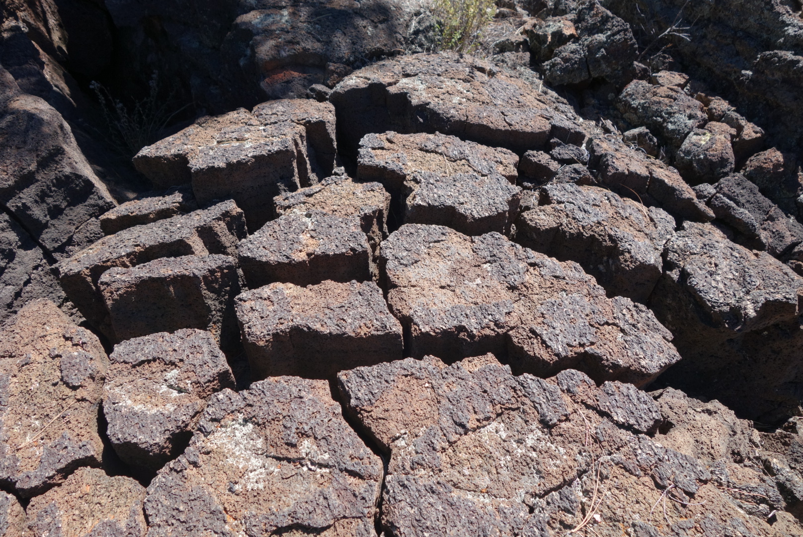
The badlands were not so bad. Volcanic rock is very grabby and so I stumbled a bit more. However, I grew to like the patterns the dried lava made and seeing some of the holes where it had spewed out millions of years ago. There was also a surprising amount of plant and bird life there. Later on, I met a hunter who explained that the remains of a father and daughter were recently found after going missing for six years in the Badlands. I could see how one could get truned around if there was not a lot of wilderness experience.
Dried, cracked lava.More plant life here than I expected.
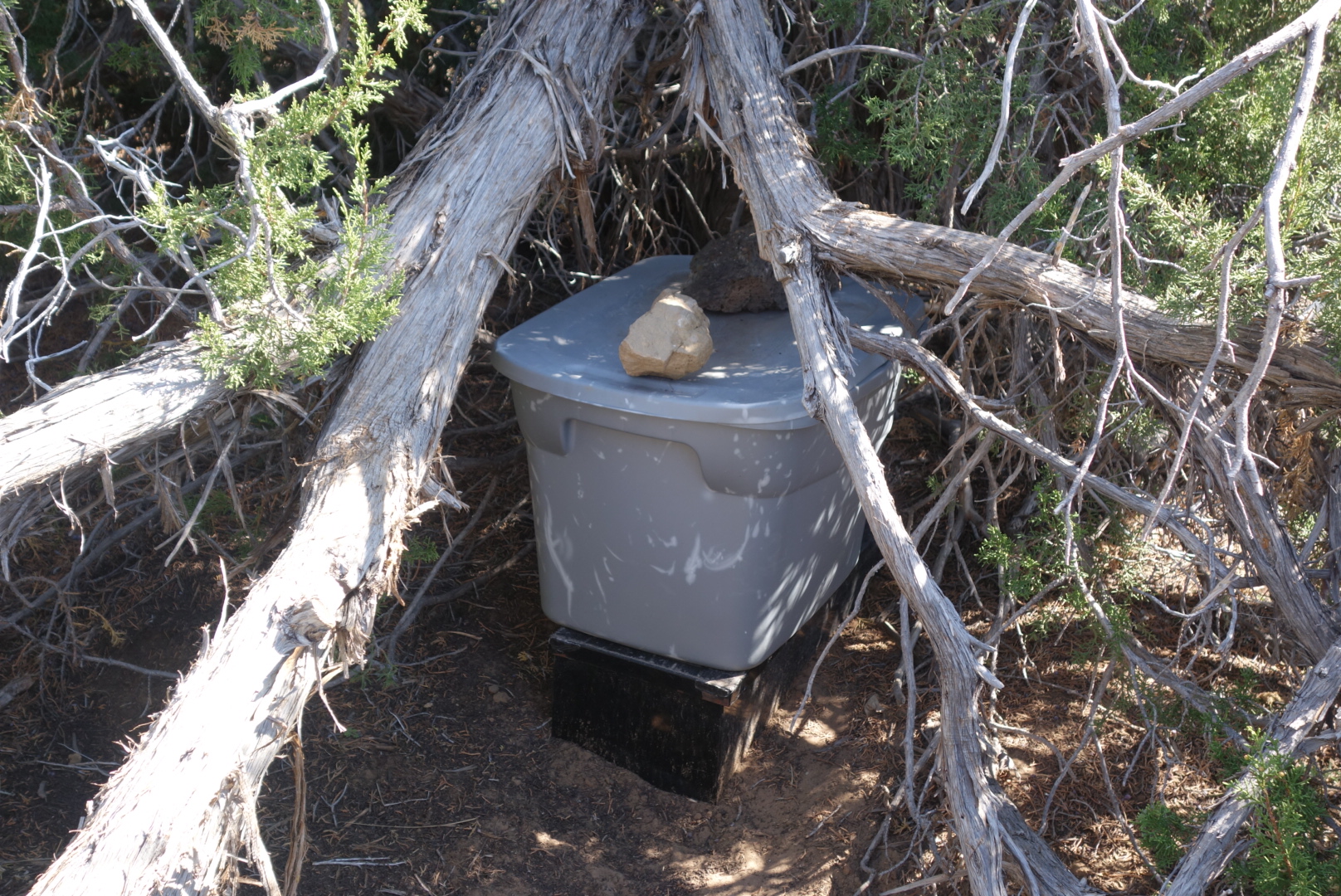
When I emerged from El Malpais, I found a lovely water cache maintained by the Mumms, a local family. The water was in a cooler tucked under a thick juniper. It was still cold from the night. I drank over a liter and restocked my water supply. What struck me as odd was that my predecessors would take a bottle, drain it, and then put it back in the cooler. For people who live and breath small spaces, why none of them crushed the empties and put the cap on to save space was amazing. I spent several minutes reducing the size of the empty bottles and then set out on a long highway walk.
Yes! Water cache!
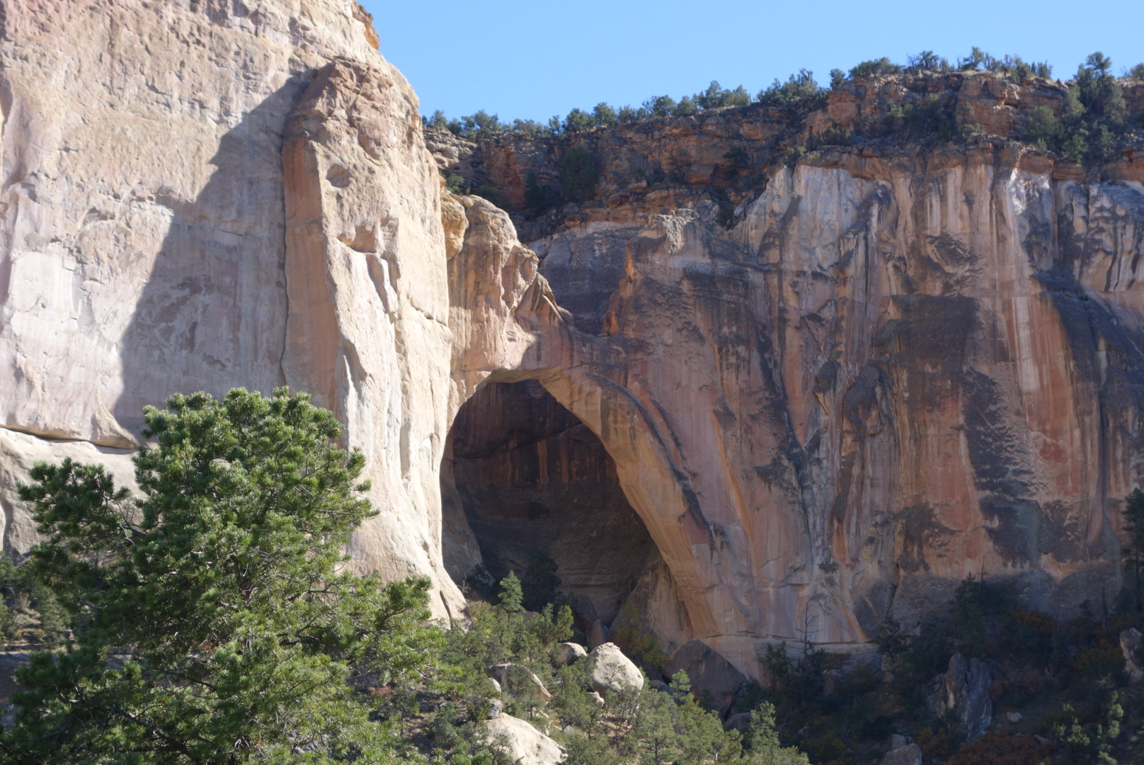
It was a long hot road walk along 117. I did go past the La Venatana arch. One route recommendation was to scramble up the hill beside the arch and walk along the mesa parallel to the highway. Why I would climb up to a thorny mesa to bushwhack my way above a highway was an unanswerable question. It promised a good view of the badlands, which struck me as both ironic and unappealing. Instead, I trudged along the narrow shoulder for 6 hours.
The Ventana arch. It was impressive up close. Just needed a McDonald’s underneath. ..Some interesting rock formations above the highway
For many miles this highway had robust barbed wire fences on both sides. On the east, every 150 feet was a placard indicating the land was owned by the National Park Service. On the west side, every 150 feet was a placard indicating the land was owned by the Forest Service. How many dollars were spent documenting and defending these boundaries was mind-numbing. I wondered, as I often do on long slow walks, whether there was some sort of unknown controversy where the Forest Service is squatting on Park service land (or vice versa) and we just aren’t aware of this terrible conflict.
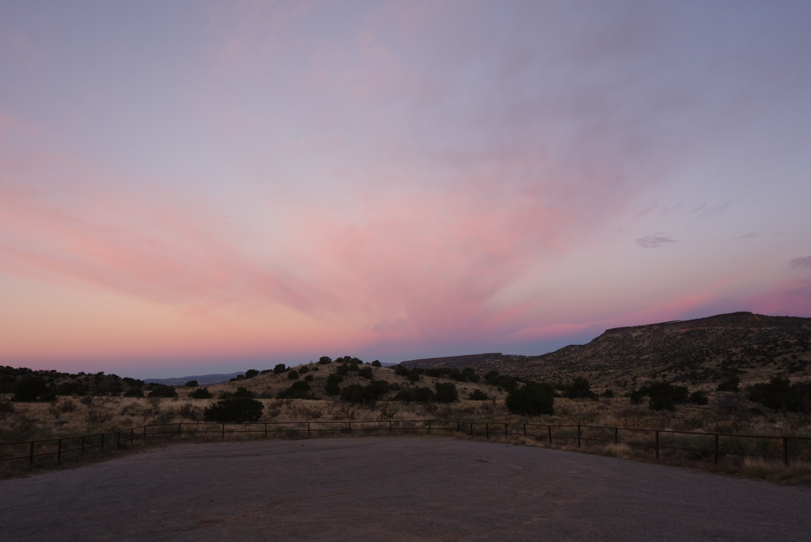
Towards sunset, the Forest Service won the eeny meeny and I hopped their fence. I went over grazing land and got next to some hills. The cattle were gone, but I surprised a few elk cows. Another lovely New Mexico sunset and moon rise helped soften the fact I was camping near a highway. I fell asleep before the 9:00 coyote cacophony.
My hip belt arrived. It was delivered to a different motel with a completely different name, but what is life without a little mystery?
I put on the new belt and was off around 11:00. My route would take me along old Route 66 through Grants, then through some sparse neighborhoods, up through a historic canyon, then south through a quiet canyon.
A new interstate goes around Grants. However, Grants most recently grew along Route 66. As a result, traffic bypasses Grants and the town is dying, or at least resizing.
Walking along the old Route is like walking through a business cemetery. Car dealers, small automotive repair shops, small grocery and appliance stores all shuttered. It made me realize how much cars have changed just in my life tinme. It used to be cars broke down all the time and people always sought an honest mechanic. Now, the car dealers have tied up warranties and service, the niche shops grab standard services (think Jiffy Lube), and big boxes grab chunks of business (I buy my tires at Costco). However, the fact is that cars are also so much better now. Growing up, I can remember knowing which cars were bad based on how often they were stranded on the highway.
The only thriving businesses in Grants, besides the prisons, are payday loans and fast food joints. I hope the town survives.
In case you are wondering about my physical well being, I received some objective feedback. In the middle of town, there is a park and at one there is an old building where the homeless and/or drunk people gather. When I walked past, I received a heart-warming welcome. I looked like one of their own and they were waving me over. Yes, I belong.
I finally exited Grants, crossed over the interstate, and worked my way up to the Zuni Canyon. An auto tour had been implemented to help drivers see the role this canyon played in transporting lumber from the local mountains down to sawmills in Albuquerque.
It was a hot day and the road, once it left neighborhoods, turned to gravel. Dusty gravel. If you every drive a dusty road, slow down for people walking. I concluded there is a special section in hell for drivers who don’t. They prefer to fling gravel and maintain a dust cloud reminiscent of the plume from an erupting volcano.
Entering the canyon. Note the gravel road.The gouge in the cliff was where logs were lowered from the mesa to the railroad
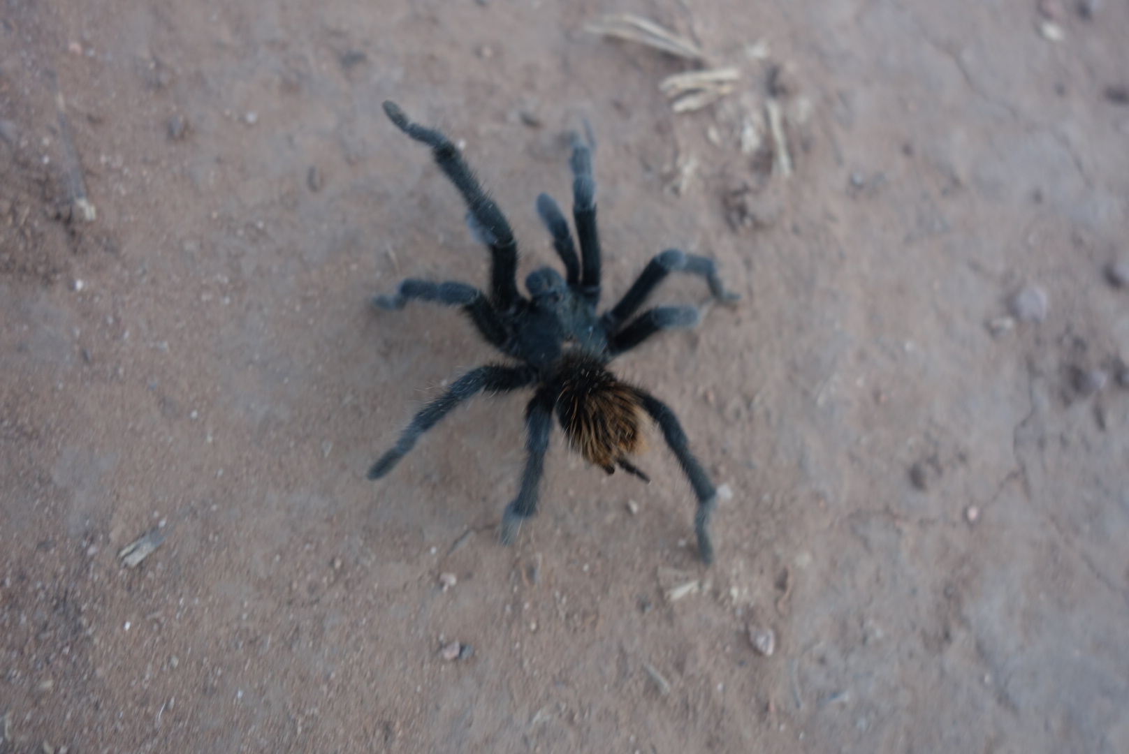
Around 3:00, I finally peeled off the gravel round to a less traveled road. It rolled gently through ponderosa pines. It was quiet and cool. I saw my first tarantula. It was very cool to see although not quite as big as I had imagined.
So cool. Maybe 2 inches long. I was surprised how furry it was.Another look.
I easily found a side canyon where I set up my tent as the night was coming on and the temperature was falling. What a beautiful part of the country.
I had reviewed the maps and determined that I could make one good push and get to Lordsburg in a day. My plan had been to get within about 10 miles and cruise in on a third day of hiking. However, I needed to figure out some logistics and thought I should just get in to town.
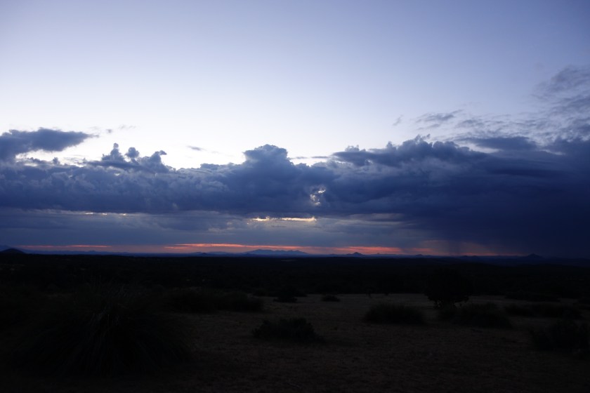
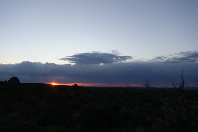
The early part of the day was mostly scrub oaks, pines, and Junipers. The trail went up and down a few hills, through some cattle operations, and eventually crested just above an abandoned mine. From there, I could make out Lordsburg in the distance. The best part of the morning hike was smelling the desert after the rain. It is not that organic, musty smell of a forest after a rain, but a sharper, more metallic smell. I liked it. Plus, the storm had moved to the east and the sunrise highlighted the remnants of last night’s excitement.
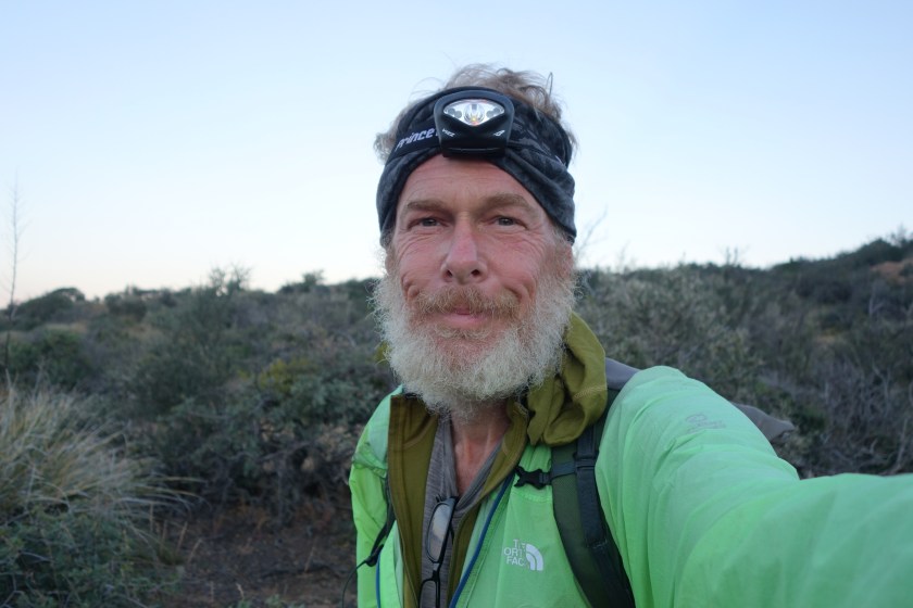
the remnants of last night’s storm. You might be able to make out where the rain is coming down on the horizon.Sorry, but I do tend to overdo it with sunrise pictures.In the words of Beyonce, I woke up like this. You may be surprised to learn that often I dressed myself in the dark and did not have any mirror. Honest.
For your edification, hiking trails in the desert present their own challenges. If there is little tread, it is very easy to mistake a small gully for the trail. Especially after a rain. And plants in the desert have this unspoken law where they do not grow up next to each other. They usually leave space. Determining whether you are looking at open natural space or a trail can be tricky at times. I probably took about 20 wrong turns during the day, but am experienced enough at this point to know quickly I am off course.
I passed one solar well that had great water and I filled up my two liter Platypus bladder and also my one liter bottle. (In case you don’t know platypus is a brand and a bladder is flexible plastic bag for liquids….I am not using the small internal organ of an Australian egg laying mammal.) This well pulled the water right from the ground through a spigot. Later, I came across a second solar well, but the water was terrible. It was sulfuric smelling and tasted rotten. This one filled a large tank and the tank then drained down to a lower, accessible tank. As I was leaving, I figured out the large tank had no top so whatever insects or creatures that lived (or died) in the large tank were invisible. I ended up pouring that water out.
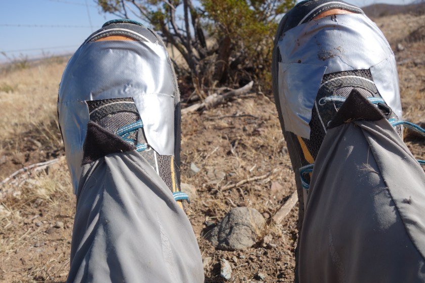
In the late afternoon sun the trail dropped to slightly level ground, it was a grueling walk of at least 8 miles across open terrain. The Continental Divide Trail Coalition had placed 8 x 10 white signs on six foot metal posts as markers for hikers across the tread-less land. Inexplicably, they only had signs that faced one way and most were positioned to help north bound hikers. Since the signs are posted about 100 to 200 yards apart, it took a pretty sharp eye to spot the next sign. On top of this, in the fall, the native grasses produce seeds. One grass in particular produces a seed that is dagger like. It went through the fabric of my trail running shoes, my wool socks, and lodged in my skin. After stopping a couple times to remove the offenders from my shoes, socks, and skin, I did the manly thing. I put duct tape over the exposed fabric part of my shoes. This did the trick.
Really, I made these modifications myself. No professionals were involved.
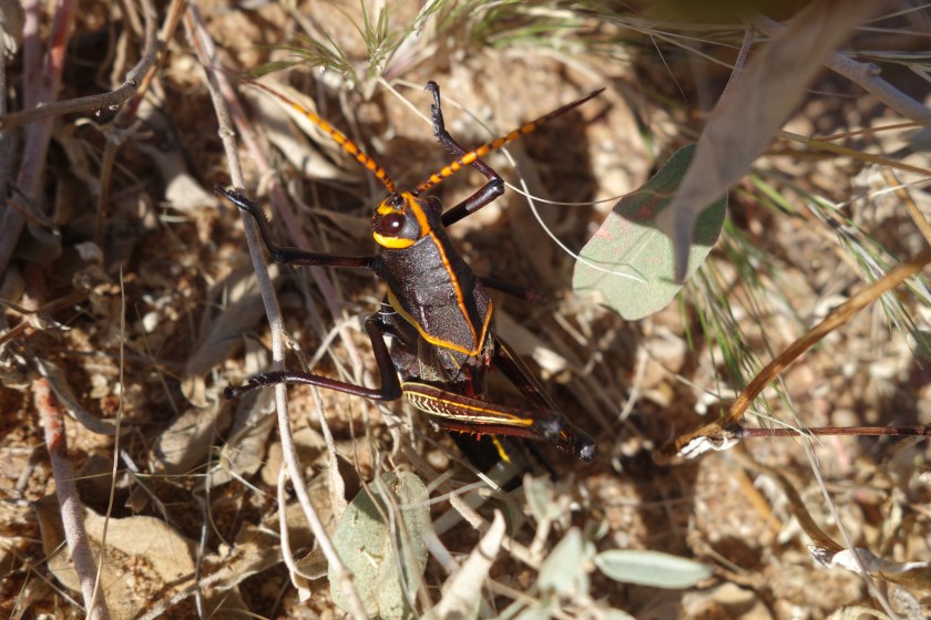
An odd thing that happened involved grasshoppers. All of a sudden, the size of the grasshoppers doubled. These southern New Mexico insects were huge and colorful. I tried to get some up close photos, but my shadow quite often spooked them.
This one was about three inches long
I ended up walking in to Lordsburg at night. On my left side, cars and trucks whizzed by on the highway. On my right, various size dogs would bark and lunge out of darkened front porches. I finally wandered through the city and found my motel and the McDonald’s next door. As I approached the McDonalds, a homeless guy was out front. He was going to hit me up for money, but as I got closer, he looked me over, shook his head slightly, and went to the other entrance. After I ordered, the homeless guy came in with a man who bought him dinner. Apparently, I look so bad the homeless people won’t ask me for money. While I waited, I looked down and noticed the duct tape on my shoes and realized I am a through hiker.
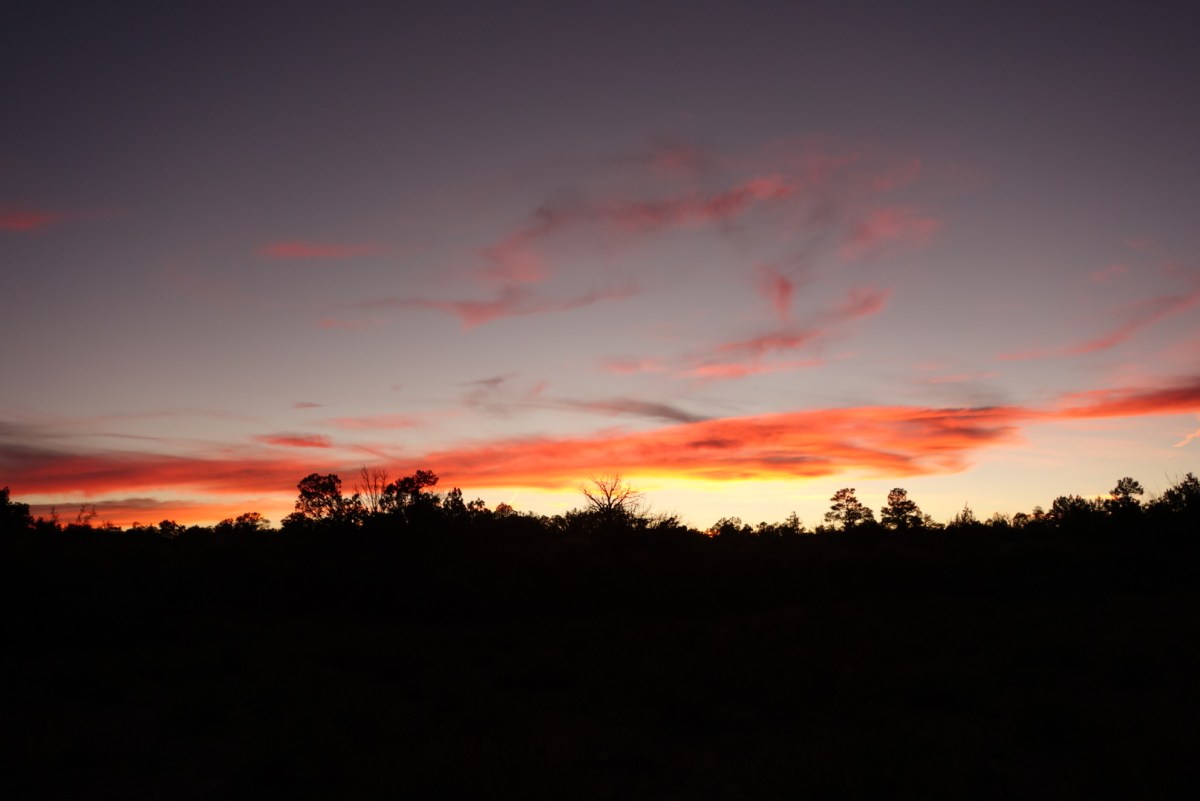
Sunset viewed from highway 90 walking towards LordsburgSunsets are so cool. They morph in shape and color.
I packed. Lucky and I went to the Gathering Place for breakfast. We discovered another way to tell CDT hikers: smashed smart phone screens. It was a dead heat between which one looked worst. His had more shards, but my screen’s damage spanned a much larger distance.
We ate, got our resupply packages from the post office, and went back to the Toaster House. I repacked and left. Lucky was going to stay for a while. The odd fellow was outside again with a roaring fire, unresponsive to any hello or good-bye.
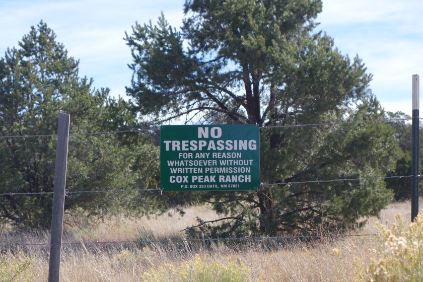
By 10:30 I was sweating. I retrieved some trail angel water from an animal shelter. It was hot, dry walking along roads without much traffic. The terrain gradually evolved from scrub pines and oaks to Ponderosa and taller trees. I saw a few old abandoned log cabins. I also came across an ironic place. So much of the land is marked with barbed wire and No Trespassing signage. Very law-and-order. I came to a place in the country the owner had decided to name the “Robber’s Roost.” This shrine to the rebellious and unlawful was, of course, surrounded with barbed wire and Private Property, No Trespassing signs.
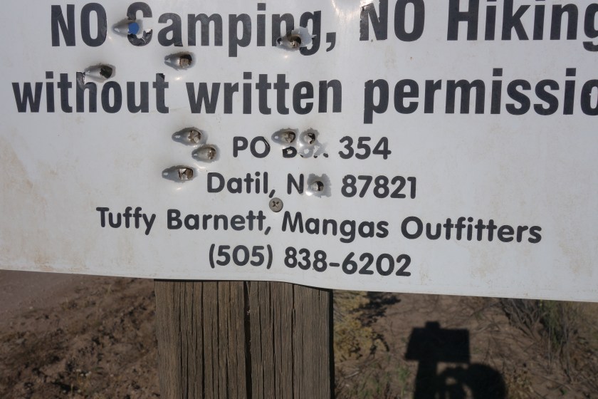
It is pronounced Maine Gas. If not, I don’t exactly know what old Tuffy is up to.Another example of the New Mexico welcome mat.
In the afternoon I came to a water source. The local landowner kept an electric pump near the road where hikers could turn on the pump and get fresh ground water. It was great and cold and I filled up my stomach and my bottles.
An abandoned log cabinPonderosa forests on the conical hills
Late in the day, the road took me high into a ponderosa public forest, out of the private lands. Sometimes, the transition is not immediate and there are patches of private land. I came across an interesting one. It must’ve had 3o vehicles in various states of repair. There was initially an old bloodhound chained up and he announced my approach. Repeatedly. Later, around car 22, a huge mastiff mix came running towards me with a deep, intimidating bark. We eyed each other, but when I walked past and broke eye contact, he came at me. I reached for my manly umbrella and turned towards the dog and yelled “No!” I couldn’t believe it. It worked. He got a little hurt look in his eyes and stopped short.
I met the owners of this menagerie of cars. Nice beer drinking guy. Told me some good places to camp. He didn’t offer me a beer though.
At last, I reached a crest. A series of utility poles ran up the ridge line. Many times these are a good place to look for camping sites because the utility company will trim trees away crating open spots. I found a great clearing among some pinons and oaks. As I was putting up my tent, I found bear scat with a ton of acorns in it. Great. What is it with bears on this trip? It was old and I figured they are smart enough to know when an area is exhausted, so I didn’t do anything different except hang my food far away.
I did have a small fire using some of the great firewood. Sometimes it is nice and relaxing to have a fire before bed and I enjoyed this one until about 9:30 before putting it out.
I got cruising early, making sure not to wake my hosts. The moon was full and bright. In fact, as I went down York Ranch Road, I would turn off my headlamp and just walk by the light of the moon.
Not too many interesting things to see. I came across a bunch of cattle penned up awaiting the arrival of the truck that would whisk them off to the feedlot and the grocery stores. Weird to think about your food this way.
I also refined my deeply religious thoughts concerning hell and gravel roads. Yes, I still believe there is a section in hell for people who speed past pedestrians on gravel roads. However, I developed a more sophisticated profile of its inhabitants. If they drove Denalis or new Suburbans, they were in hell because they NEVER slowed dlown. Also, if they were younger, they were in hell. (One sub-theme on this trip is how fast young people want to be… or how slow older folks want things to be) The most dangerous incident was a teenage girl with sunglasses and loud music coming towards me. She was driving a dually (4 tires on the rear axle) and the extra wide mirrors. She must’ve been going 60 and did not move over at all, her mirrors coming within inches of my shoulder. I hope I don’t see her in her little section.
If you’ve slogged through previous blog entries, you know that if I am heading in to town for resupply, I am a force to be reckoned with on the trail. I was making about 3 1/2 miles per hour. Perhaps even more motivating was the town name: Pie Town.
Pie Town is a random stop on the road. The idea was to set up a couple restaurants that sell pie and get people to stop. It worked. Not a big town, but a few restaurants and a lot of pie.
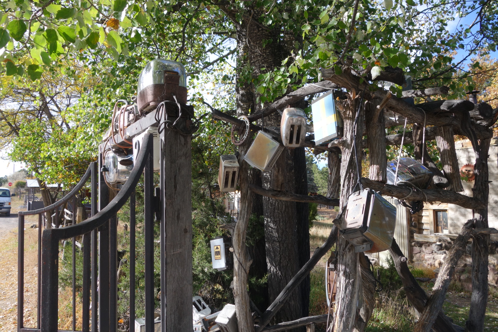
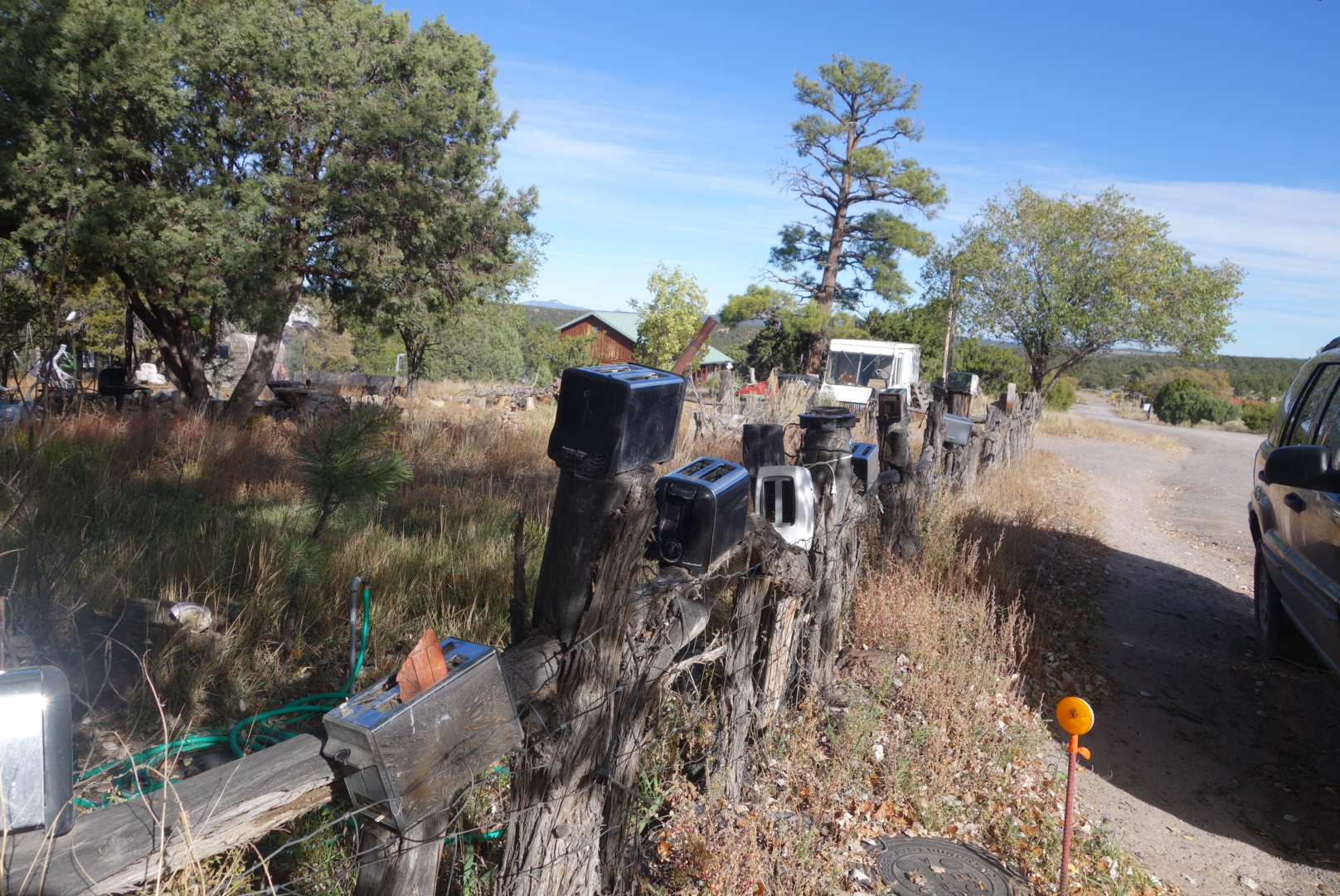
I ate my first lunch with two entrees and pie at the Gathering Place. It was Sunday so my Post Office package would have to wait. I went to stay at an unusual place called the Toaster House. It is open to any and all, free of charge. The name comes from the abandoned toasters serving as decorations on the front gate. There is hot water in the shower, running cold water from the taps, and two outhouses (including a two-seater, perhaps a tip-of-the-hat to the Romans). There are about 6 beds, a fridge and a stove. I met Tim, a Continental Divide biker from Seattle. There was another strange fellow there who didn’t talk and Tim warned me he was unstable. That dude stayed outside the whole time building and maintaining a substantial fire.
An easy way to identify toaster house….Toaster House
I napped and headed out for Lunch 2. Great conversation with the owners who run the Pie Town Cafe, open 4 days a week between 11 and 4. I was just finishing my pie when in walks Lucky Strike. It was great to see him. The trail had treated him well. Its like we had the opposite reactions to the trail: he was looking stronger, better, and younger while I was looking older, thinner, and haggard.
We spent the evening catching up on trail talk. John and Anzie Thomas came to visit for a spell. Later, Tim the biker came out and we talked for some time. Eventually, well past hiker midnight, we called it a night.
I did not sleep so well. The odd fellow would walk around in the dark, making the floors creak. Then he would put on a headlamp and walk around outside. Finally, around 3:30 he decided it was high time for a bath and spent an hour splashing around in the bathtub that was adjacent to my room. I did sleep off and on, but it was strange to be in this house.
I got up and was ready to head out. My neck still hurt. However, when I put on my pack, a sharp pain shot through my shoulder. I walked around for a little, but this was not going to work.
I extended my stay at the motel and tried resting (and of course, eating). Helen was able to find a smaller hip belt for my pack which is getting overnighted to me tomorrow.
I am frustrated being this far and having a stupid injury. However, I would hate to be in the middle of the desert and be immobilized by pain. So, I am taking a zero and hope to walk out of town tomorrow morning sometime.
I texted Qtip. Based on trail registers, the man was flying down the trail. I assumed he was done. He texted back saying he was laid up with shin split’s in Silver City. That must be really tough for him.
I cruised early on the easy-to-follow trail on the mesa. I enjoyed the hike.
When I reached the mesa edge, I had a two mile trail down the side. It was rocky trail and I stumbled a few times. My neck/shoulder hurt pretty bad. Part of the reason may be my clothing bag is my pillow and it is pretty thin now that I am out of the mountains. Also, my old/new Granite Gear Crown VC belt barely holds on the hips and therefore most of the pack’s weight is borne on my shoulders. Whatever, it got more painful as the morning progressed.
Sunrise
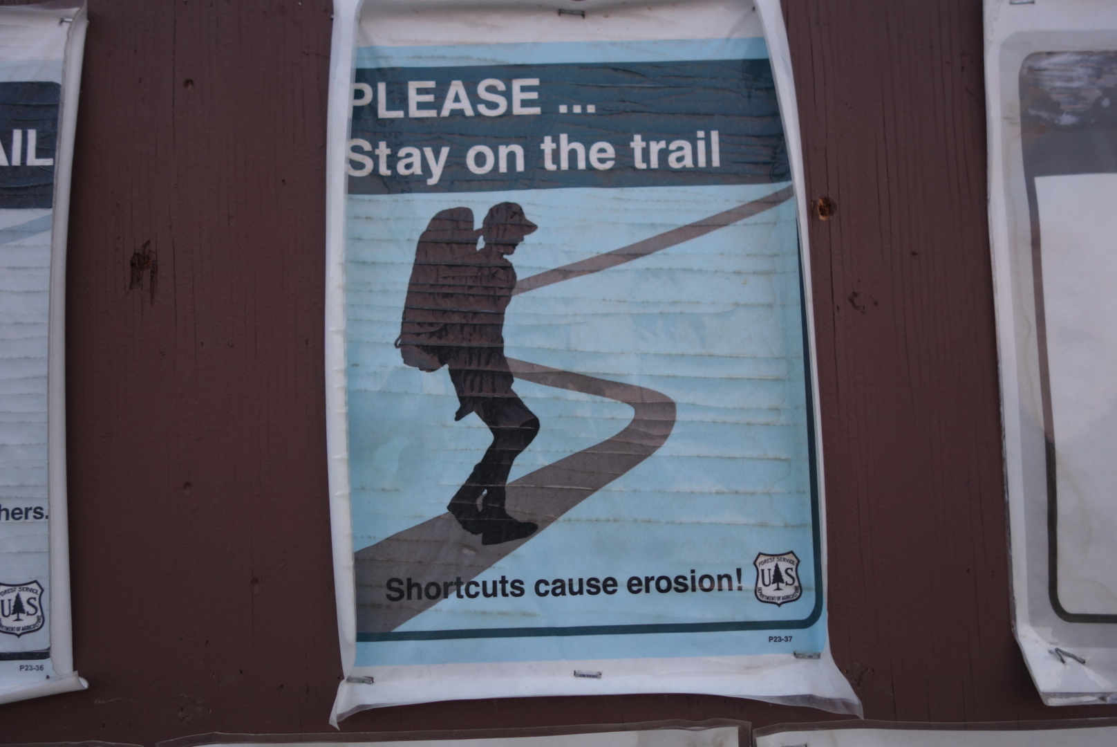
At the base of the downhill trail, there is a bulletin board. It has one sign that bugs the crap out of me. It is common to see signs that tell hikers to not cut switchbacks so we don’t damage the woods. Also, there will be signs telling hikers to stay on the trail. It galls me that I am told to not get off the trail because of the harm I can unleash, but the same organization leases out forest land to huge herds of cattle that destroy trails, meadows, and water sources. I can’t believe that my stepping off trail causes as much damage as a 600 pound steer that produces a turd every 15 minutes.
But cattle are free to roam….?
I road walked into town. My fantasy of easy-over eggs was fulfilled at a local restaurant. I walked along the old Route 66 to the motel strip which had a Walmart. I checked in and did my chores.
Sign near the correctional facility
There is an Asian AYCE buffet right nearby. It was not as bad as I feared. Yes, the food was a little greasy, but there were some very good choices as well.
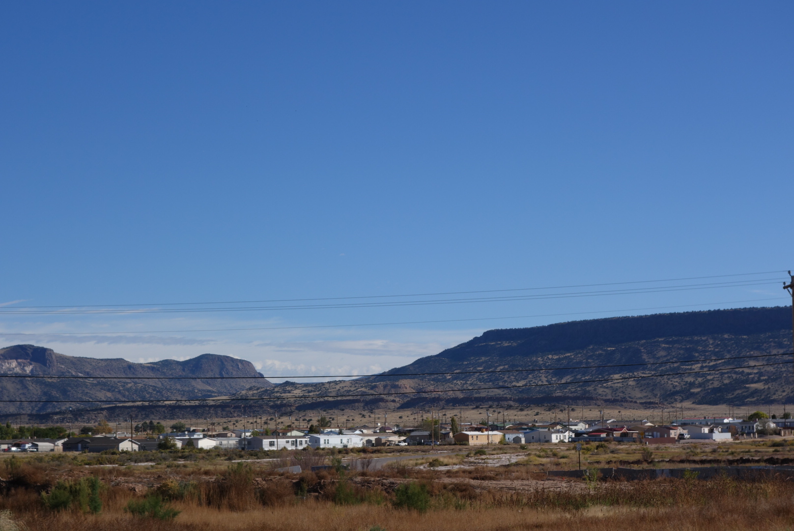
Grants in the foreground and the mesa I was on is on the right.I packed up and went to bed early in the hopes of a good night’s sleep. I was planning on walking through town in the morning to take the alternate route.