I was fortunate that my friend Josh Sagraves was in Tucson when I flew in. He generously picked me up from the airport. Even better, he drove me to the trailhead. As the crow flies, getting from the airport hotel to the Arizona Trail on top of Mt. Lemmon seemed simple enough. In reality, it was a long, twisting drive taking at least 90 minutes. Fortunately, Josh is a patient and forgiving friend
The Arizona Trail (AZT)
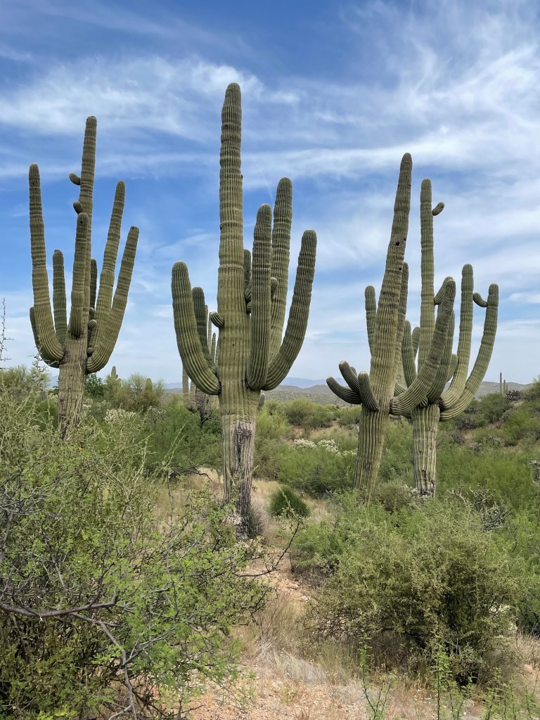
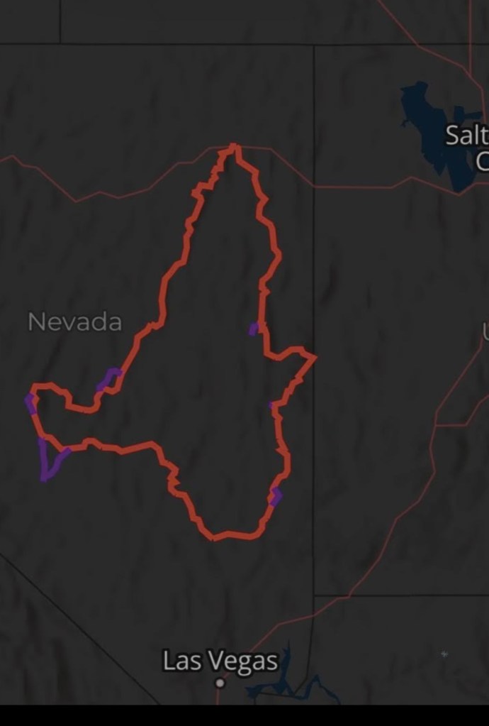
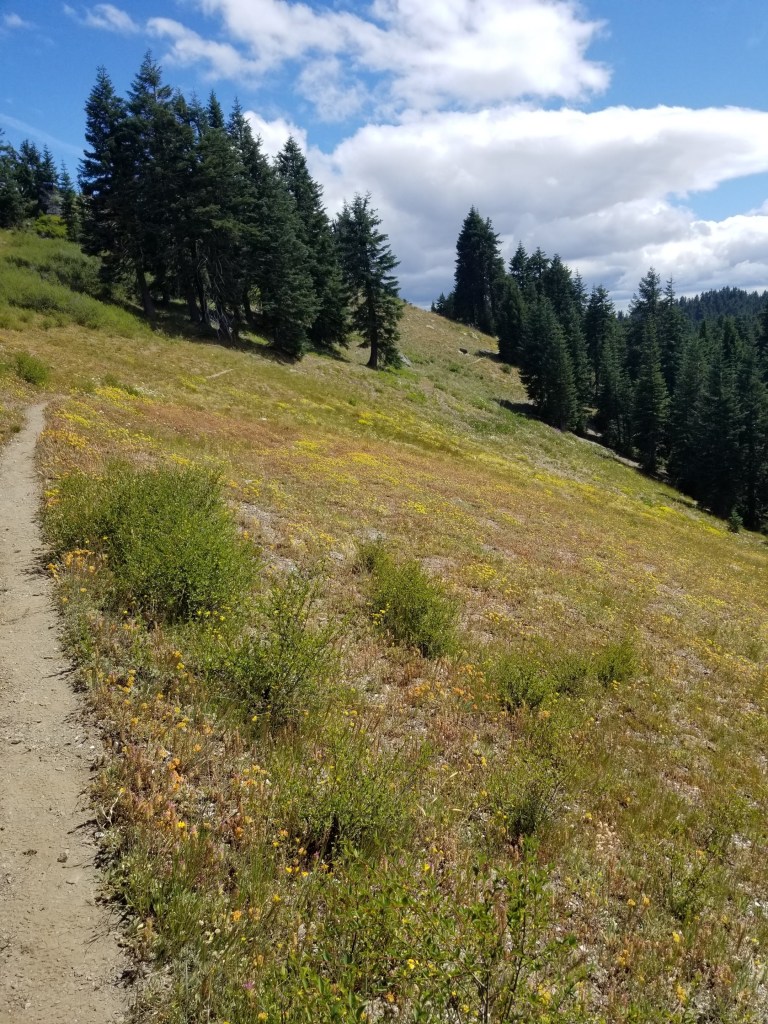
The AZT is an 800 mile north-south trail running the length of Arizona between Utah and Mexico. The obvious highlight for a hiker would be the Grand Canyon crossing. A less obvious highlight is that the best times to hike are early spring and fall. I am only using a portion of it, 45 miles. As you might imagine, one of the biggest challenges of this trail is hydration. Fortunately, the volunteer organization that maintains the trail does a great job supplementing natural and man-made waters ources with caches that are stocked with water for hikers.
My impression of the AZT is that it is a great trail. My theory on why this is true? Arizona is chock-full of retired Mid-westerners. Bored with golf and pickleball, they direct their volunteer energies to community service. Indeed, even some places along the route offer services like potable water (i.e., the High Jinks Ranch).
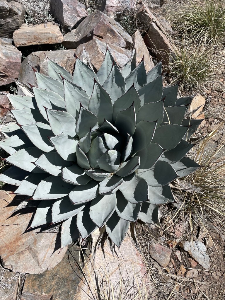
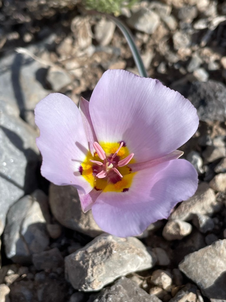
I only spent three days on this trail, but it was great. A wet spring truly elevated the quality of the desert this year. Tons of blooming cacti. I admit I had some challenges getting my hydration right (wicked muscle cramps at night) and getting my pasty white Minnesota body used to heat.
Cactus Blooms
Other than a single crabby rattlesnake, the AZT was a breeze. I did meet two other hikers that were trying to complete the whole trail. I met several cows, too.
The Pretty Good Western Loop is a backpacking route through the western United States. It attempts to leverage existing trails to create a beautiful trip that is accessible to experienced backpackers, but not requiring elite athleticism.
Inspiration
I am nearing the end of my backpacking adventures. I wanted to find a “highlight reel” trip. I loved the San Juan Mountains of the Continental Divide Trail (CDT), the southern Sierras on the Pacific Crest Trail (PCT) in the Fall, and some of the desert hiking on the Grand Enchantment Trail (GET). I also wanted it to be physically achievable for me.
There is a legendary route called the Great Western Loop (GWL). It was developed by Andrew Skurka, a famous, quirky backpacker who was made famous via National Geographic. This route is over 6,000 miles. It uses most of the CDT and PCT as the north – south legs. In the north, the Pacific Northwest Trail (PNT) is the east-west connector. There is no official east-west connector, but typically some portion of the GET is used. To finish in a single year, a hiker must average more than 30 miles per day. As best as I can tell, only six people have completed the GWL.
Like most pastimes, backpacking has been infected with one-upmanship. Initially, it was achieving a Triple Crown of completing the three major north-south long-distance trails in a lifetime (the Appalachian Trail, CDT, PCT). Then, it was “fastest known times” or FKTs, seeing who could complete a long distance route the fastest. Next, it was “calendar year triple crowns” or CYTC which means completing the Appalachian Trail (AT), the PCT and the CDT in a single calendar year. Both an FKT and a CYTC present challenges in addition to speed. An FKT requires luck to avoid snow and/or forest fires. A CYTC, additionally requires commuting between trails. For example, a hiker may head north from the southern end of the PCT, reach snow, travel to the southern end of the CDT and head north there.
These kind of “I’m a bad-ass” challenges do nothing for me. In fact, as I age, it seems my chances of being fastest at anything are decreasing. I am more likely to set the record for Slowest Known Time.
Nerd Details
I will start in Tucson, Arizona. I will use 45 miles of the Arizona Trail (AZT) to go north for a few days. Then, I will join the Grand Enchantment Trail for 300 miles. I will connect to the CDT, going north for 720 miles. I will then turn west on the American Discovery Trail (ADT) from Colorado through Utah and Nevada, roughly 1,400 miles. Then, I will join the PCT via the Tahoe Rim Trail and head south for 840 miles. A little bit after Big Bear Lake, I will veer over and join a newish trail called the Winter Through Hike (WTH) which will get me back to Tucson on a 900 mile trip through the deserts of California and Arizona.
The total is a little over 4,200 miles. Over my recent backpacking adventures, this will get me past my goal of 10,000 miles.
If everything goes to plan, I will start at the end of April and finish in early December. I will obviously will hope to finish faster, but I know I’m not always in control.
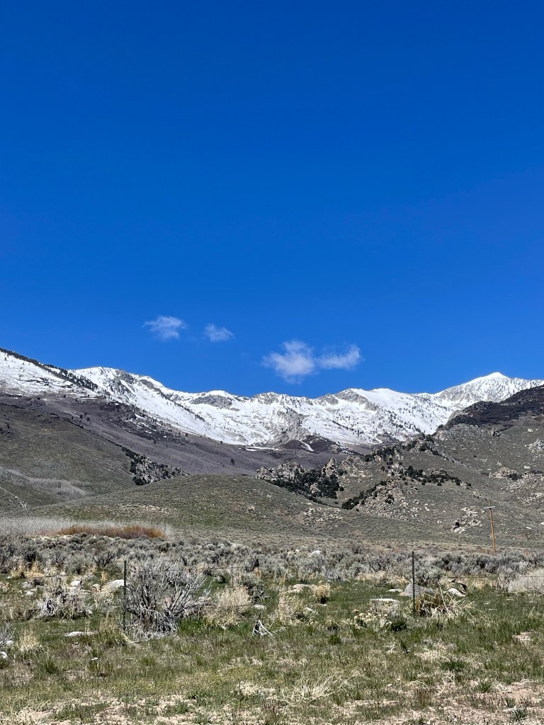
I had to bail on my Great Basin Trail (GBT) hike. 900 miles of 1200 and I threw in the towel. One part injury (painful fifth metatarsal…look up “Jones Fracture” if you are bored) and another part fatigue.
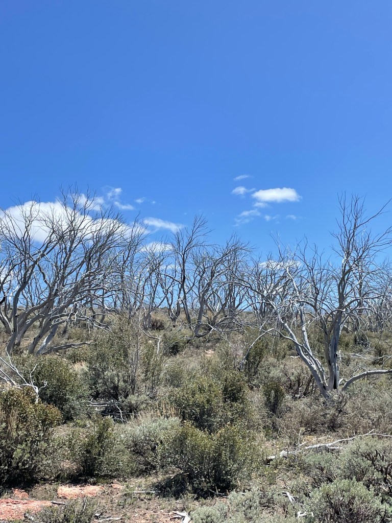
The GBT is intense. Definitely the hardest backpacking I have ever done. The terrain is high mountain ridges interspersed among long, hot valleys. It is lonely: I went 4 days one time without seeing anything man-made except for barbed wire, dirt roads, and contrails. I don’t mind loneliness; I seek it on most trips. But it weighs.
The architect of the GBT warns about the winds. My everlasting memory of the GBT is the binary situation of either wind or stillness. The stillness was incredible. The southern portion of the trail is near Air Force bases. I remember cowboy camping on ridges when the wind stops and all I hear are fighter jets and then nothing. It is strange to look over 15 miles and hear nothing.
But, oh, the winds. Like a needy pet or clingy child, it usually just pushes up against you. But then it asserts itself. In the valleys, it picks up the dust and throws it in the air or blasting along the surface. Up high in the mountains, it takes light rain or snow and turns it into a freezing abrasive.
I had always heard about Nevada’s Ruby mountains. In June, I was slammed by one of the feircest horizontal snow storms I recalled. Tucked behind a boulder on a high saddle, wearing all my clothes, I broke out my sleeping bag to stay warm while I waited out the storm.
The pattern of the GBT is fairly regular: climb a mountain range, traverse it’s top, then drop down to cross a sparse valley. If you are interested in geology and botany, then there is keen diversity, but to this political science major it seemed to become a little bit repetitive.
I was not excited for a few more Valley + Range weeks. My foot hurt. So, once I had a sleepless night due crazy winds at Overland Lake, I knew I was done. I slinked down to Lemoille Canyon, then Elko, then home.
In hindsight, I should’ve just taken a week off. There was one other hiker (Buck-30) who was about a week behind me. Healing and then hiking with another person for awhile would probably been just the trick.
After a zero day in Pioche, I took off for another four days. Pioche is a former mining boom town. They have pivoted to tourism, but feel it is important to post on every business there is no public restroom.
In the early morning climb out, I went past the old mining operation and then down past an electric transmission repair facility. Next, a long basin walk went past an abandoned car and motorcycle. Most of us, at one point in our life, have been so angry at a machine that we wanted to take it out and shoot it. I recall an HP printer clearly. Well, out here people actually shoot their failed gear.
This trail is very difficult in so many ways. Take noise. The silence is all encompassing. When you are in a wide basin with mountains in the distance all around, it is disorienting to have no sound. You stop, strain and maybe pick up an insect or bird. Or take the wind. Most afternoons the wind kicks in. Sometimes it is just shifting breezes. Other times it is powerful gusts lifting sand and dirt to pummel and blast the unlucky hiker. Wind or silence. One or the other, never neither.
Margins are thin. Life is precious and water dear. So far, not a single cattle herd has been seen. Ranchers are reluctant to spend resources on a herd not knowing costs. Water is the thinnest margin. Every natural water resource has multiple paths and a variety of prints. I’ve seen terrible sights. There was a natural spring. It had been fenced off to keep animals out of the source. This year the source was dry. A wild horse’s hoof was twisted in the top two strands of barbed wire, its leg bones pointing down to the rest of the skeleton.
Nellis Air Force Base is south of here and uses the remote area for fighter pilot training. I have heard a few sonic booms. Often I hear the fighters overhead but cannot see them. The pilots are also pushing themselves and their machine to the margin.
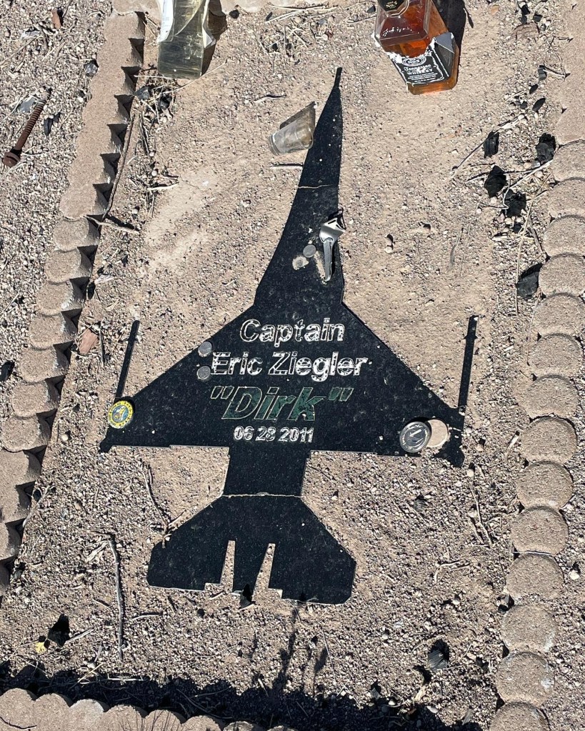
Crossing the basin, my eye caught an upright pole about six feet high. Other than sparse junipers or cacti, nothing grew that high. I angled over to it, about a half mile away. A metal sign on a wooden post proclaimed “Dirk’s Place” and there was a rectangular memorial on the ground. It honored Eric Ziegler “Dirk” and there was a bottle of Jack Daniels with a few sips gone. I paid my respects and moved on.
RIP
A later Google search confirmed my fears. Captain Ziegler, from North Dakota, was on his last battle simulation flight before advancing to the elite U.S. Air Force Weapons school. Investigators say he blacked out in a maneuver, lost control and crashed in the Nevada basin. He went past the margin.
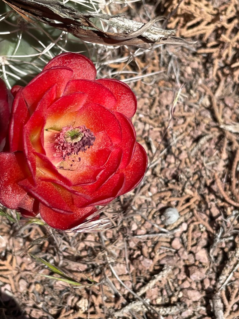
In spite of these challenges, the Great Basin Trail has beauty. I’m here in time to see many different blooms. I’ve also managed to find a nest with a solitary egg.
Cactus bloomLife goes on
I leave tomorrow for a long stretch. It will be 11 days to my next town. I’ll depend on cached food and water. I can’t wait to report back.
Driving down a lonely, gravel road in Nevada, I was excited, nervous, optimistic. Helen, my wife, was dropping me off at a “faint Jeep track” where I would start my Great Basin Trail (GBT) hike. She needed to get down to Las Vegas, return the rental car and fly home. We kissed, hugged and said goodbye for the next two months and she headed to the freeway. I headed into the sagebrush.
Storm clouds loomed in from the west, but they looked mild and I hoped they would miss me. Eastern Nevada seems like a mighty creature reached down and pulled a rake through from south to north. Mountain ranges go along in neat rows and hot dry valleys separate them. I was happy for this valley to receive rain, but I wanted no part of it.
Storm in the valley
As I gained elevation, I left the comfort of just following an old jeep track. As I started to follow geographic features, the flora changed from sagebrush to sparse juniper and pine. The storm briefly caught up to me and gifted me with some light rain and even a few snowflakes.
I arrived at my first water source and it was glorious. Indian Spring is a developed spring flowing with cold clear water. It was the last reliable source for several miles.
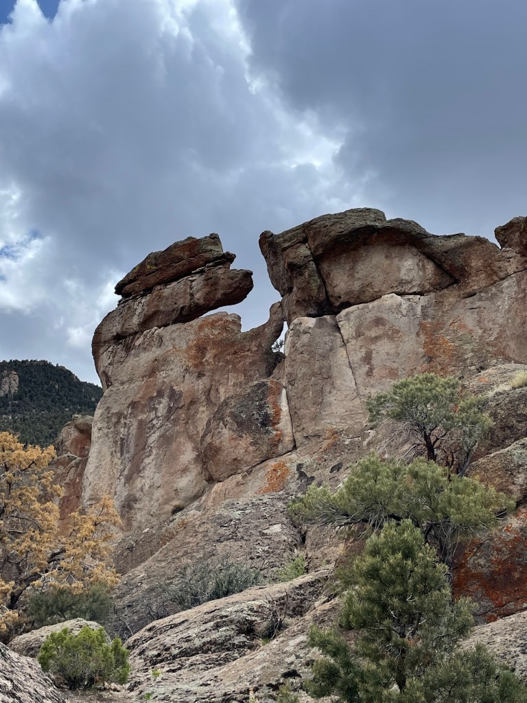
Leaving the spring, the route became very difficult. Scrambling up a rock formation, I tripped and extended my hands to cushion the fall. My phone, with detailed GPS information, bore the brunt and part of the glass cracked.
Strange rock formationsDo you see something in this photo?
Next I entered a very steep area where I was to follow game or elk or horse trails. There are three problems with this. First, animals are great pathfinders, but will vary their routes based on changes (tree falls, presence of predators, etc.). Second, in the early season the animals are lower enjoying the spring grass and giving birth. Third, I am 6’4” while deer are three feet from the ground at the shoulder. Thus, even if I get on a horse trail, my shoulders and face are pushing through branches that they miss.
I was making less than one mile per hour. The terrain was getting rougher with rocky cliffs. I fell again. This time slamming down on one of my carbon fiber trekking poles, snapping it. Towards dark, I did an assessment: almost all my water was gone, I was not going to reach my planned campsite, and somewhere along the way, my umbrella had been removed by a branch. Oh, and because I had been using my phone’s GPS mapping all day, my battery was nearing the single digits.
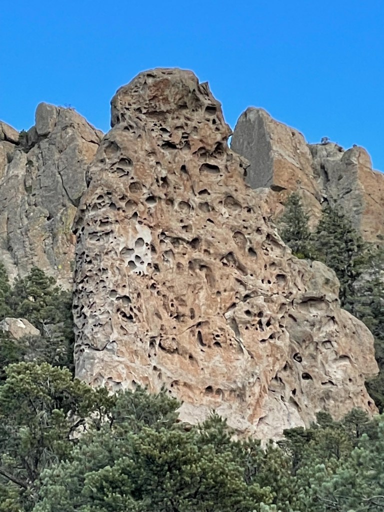
Geologists call this type of rock Swiss Cheese
So I pushed toward the nearest possible water source. As it got darker, I made my way up a dried stream bed. By the markings in the stream bed, other creatures had done this already. As the canyon narrowed, I finally found a slit in a rock containing a deep pool. Pushing aside the top layer of green growth i filled my filtering water bottle. I was glad that green is one of my favorite colors because in the fading light I could see a green hue even after filtering. “Wilderness wheatgrass”
The next day was more route finding among trees and shrubs, ending with a nice dirt road walk. I started to appreciate the silence and the smells. Smells from the plants, to be clear. Juniper, sagebrush, mountain mahogany, pine. If there was no wind, it was vast, pure silence occasionally pierced by a jet far overhead.
More rockAbandoned
The third day was brutal. Mostly pushing through mountain mahogany and then, later, weaving through manzanita. I’m not a botanist, so excuse my oversimplified descriptions. Mountain mahogany is a tall shrub with a unique smell, interesting bark, and branches designed to shred clothing, slash arms, and remove hats from passers by. Manzanita is a low growing shrub with waxy green leaves, charming little pink flowers, and numerous thick sharp branches designed to cut shins, grab feet, and hide the ground. I ended up on a high windy ridge dotted with manzanita as night fell. I tucked in next to a burly manzanita that blocked the wind. I cowboy camped under a vibrant starry sky watching satellites ceaselessly perform their orbits.
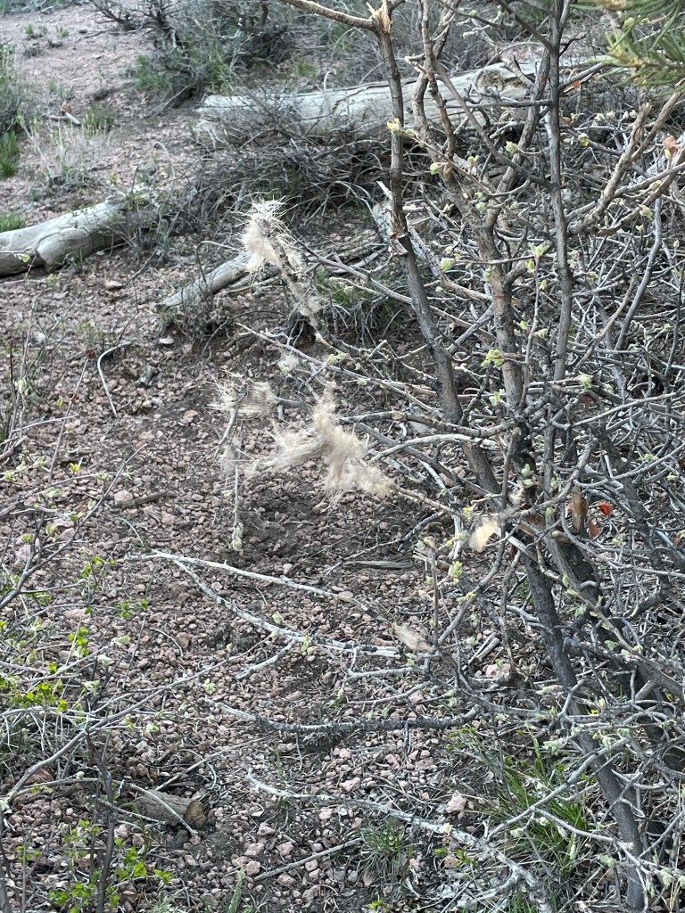
Elk fur snagged by mountain mahogany Remnants of a “forest” fire. Huge views
My fourth day witnessed huge elevation gains. It began with an unexpected surprise. Someone had cleared a six foot wide swath through the thick shrubbery and marked it with cairns. Was it a hunter? And old sheep herders route? A misguided, overzealous Scout troop earning their shrubbery badge? Regardless, I was happy and smiling.
The smile wore off as I looked up and ahead. In the distance, on a barren mountain at 9,200’, stood the radio towers I would climb to pass. The path was dirt road and it was sunny and in the 50s. I knew I had to continue working on my uphill and downhill muscles for the mountains later in my trip.
The views from the top were vast and great. I could look back and see where I started. The other direction I could see the tiny reflections of Pioche, my next resupply town. I sipped some of my dwindling water and began a knee-crunching descent. It was sunny, not windy and bereft of interesting things to look at, so I changed into shorts, fired up an audiobook, and set my own personal cruise control. There was, however, an intriguing geological feature. It was a large black, square lava tube that jutted sharply out of the forest floor. The top was almost flat with a miniature forest growing on top.
Having never seen a car all day, I walked in to my last water source, Page Creek Spring, where I would spend my last night before town. It was warm water with many green plant forms. Fortunately as I made my way up one side to find the source, I found a tiny spring releasing clear cold water. It was perfect.
There was an abandoned structure on site. An amalgam of stone, wood, and corrugated steel, I tried to figure out it’s former role. Home, loafing shed, who knows. I again cowboy camped on public land. However this night it was not windy. Very quiet and still except for the one round of coyote howls to each other across the valley .
My final day was a warm 20 mile road walk in to town. Desolate country. Besides one band of wild horses, it was just me, horned toads and lizards and an occasional antelope in the distance. I saw my first car and person since Sunday as I neared Pioche. It is pronounced pee oh shh. Grabbed a sandwich and water, checked into my motel and started my “town” routine.
Wild horses
In summary, it took me one day longer to travel 85 miles. This trail is tough. I have to get better at not using my phone GPS map every five minutes. This trip is going to be far less following a trail and much more forging a route. It is big, windy, lonely and I like it.
I am about to start another hike. All the planning, preparing, and training is done. This trip is unique because I had to “cache” food and water along an 1,100 mile route.
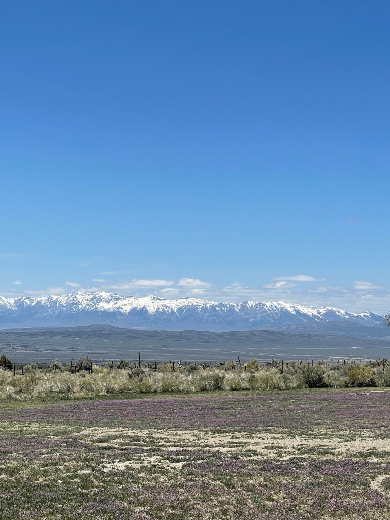
I am attempting a brilliant trail called The Great Basin Trail. It was created by a hiker who goes by Dirtmonger. He is an exceptional backpacker and I have followed his many trips online. Over a few years he created and verified this 1,100 loop trail through eastern Nevada.
Great Basin Trail
It’s a clever trail because it connects existing paths, route-finding when there are no trails (what I call bushwhacking), and wild animal trails. I actually be better off defining this as a route. There are no white blaze, PCT conforming elevation grades, or trail angels. As you might imagine, water is scarce and important, but the trail appears to have a number of natural springs, man-made water tanks, and, when necessary, caches of water.
The part I admire the most is that he has stitched the route together all on public land. I’m only familiar Dirtmonger and Brett Tucker as reliable wizards magically making new trails. I’m excited. Aboiding private property on a long route is difficult. If you have the Pacific Northwest Trail and remember that section where you basically walk through that dude’s backyard to get to a gravel road, you’ll know what I mean.
But I’m also scared shitless. This is remote country. There are extensive long ridge walks with potential snowfields, lightning, and all around “I’m scared of heights” moments. Honestly the times I get crankiest hiking is when I’m either bushwhacking or thirsty and this trail seems to indicate I might be posting quite a few cranky blog entries. (Sorry in advance Dirtmonger.)
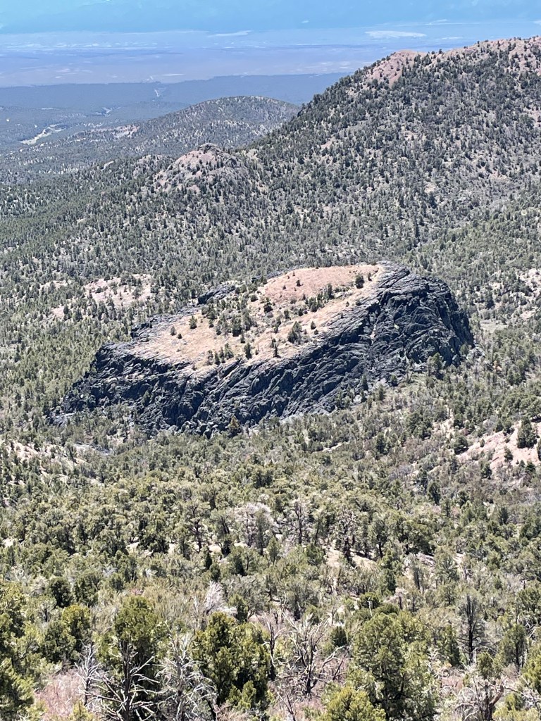
But, from driving a route to cache food I was amazed. There are mountains, wide open flats, and incredible solitude. I will see more cattle than people. One beautiful section will be the Ruby Mountains. I snapped photos (below). I pray a whole bunch of snow melts before I reach this section in June.
Ruby mountains Even more Ruby Mountains
It was interesting having my wife come out with me and help cache food. She is a great traveler and we buried ten odor-proof food bags plus water. I showed here where I would be hiking (jagged snow-covered ridges, arid dusty plains, and cow tanks I would drink out of) and I could see her trying to appreciate it, but momentarily asking herself why she married me. It truly was great to have her support on this crazy endeavor. I wouldn’t be anywhere without her!
Lastly, I’m not even going to try to provide a daily blog. I’ll provide posts when I can. I hope you enjoy them. If you don’t, then don’t.
Keeping a daily blog is tough. Especially when backpacking. On the PCT in 2020, I just stopped. I made bullet point drafts which I intended to flesh out and post. But I never did.
Here’s a summary of what happened. I entered California in a hot spell. I started seeing more smoke from fires. I went around Mt. Shasta, reached Belden and was forced to skip a section due to a fire closure and skipped down to Donner Pass. Made it all the way to Yosemite.
At a backpacker campground in Yosemite, the night before I was to head out in early September, the Ranger came up to me and said “Your hike is over.”
I asked why.
She said “The National Forests are closed.”
I asked which ones and she said “all of them.” This was due to terrible, widespread fires.
I didn’t like bailing out of Washington and was crestfallen to end halfway through California.
In 2021, one of the Texas hikers was married in Winthrop, Washington. Cole and Josh joined me to backpack the last section of the PCT to Canada. I then went on to finish the state of Washington.
Will I go back and fill in the details?
I might. If I do, I will just highlight interesting things during a section or a week. And photos.
But, you may recall, I am a slow learner. So I am starting another backpacking adventure in a couple days.
From Buckhorn Spring to amazing campsite overlooking valley past Man Eaten Lake.
Normal people probably react to a bad night’s sleep by sleeping in. I’m not normal so I don’t. Perversely, I react by getting up early.
It was just a little chilly as I broke camp, walked past the other hikers slumbering, and searched for any deer I might easily kill.
It was blustery as the sun came up, but it was obviously going to be another hot day. A few ups and downs early and then I entered the Marble Wilderness area featuring the cleverly named White Marble Mountain and Black Marble Mountain. I met a few hikers and passed a back country ranger cabin (unoccupied). Water was scarce in sections, but when it was found, it was gloriously clear and cold from springs. For example, Cold Spring lived up to its name, but it was a thirsty effort to return to the trail from the spring about a 1/4 mile away.
It was a long day. The sky was getting a little darker with smoke. I wanted to push on. Motivation for me was to see a body of water called Man Eaten Lake. What a glorious name! Was an entire man eaten at this lake? Just part of a man? By what or whom? Any relation to the Donner Party? Late in the day, I passed above it. Pretty lake. No half eaten carcasses that I could see. No way in hell I was going to camp there.
I crested a ridge and descended past a small lake with a lovely outlet stream. There were some tent sites nearby. Three of them were standard issue. One, however, was truly outstanding. It was at the top of a ridge that overlooked a valley. Looking down the valley one could see Mt. Shasta. Perfect. I had seen bear scat on the way down so I hung my food and backpack. I filtered water from the stream and rinsed the sweat and dirt off my clothes.
Just as it was getting dark a young lady cruised by heading toward the way I had hiked. I was going to suggest that she think about camping nearby as the next two miles for her had no tent sites just rocky slope and it was getting dark. I realized that might sound creepy, so I just said “Hi.” And I hoped she had a good water filter in case my sock washing hadn’t completely washed downstream.
I watched the alpenglow off the mountains as the sunset and got into my perfect tent. There was the customary evening breeze, like the mountain yawning, and then it was clear and quiet and beautiful.
It was hard to leave such a lovely tent site, but the trail called.
The mornning was cool, generally downhill, with plenty of water. Early on I passed a small lake with some backpackers. I waved. The smartest one among them shouted a question to me “Are you a southbounder?” I yelled back “No shit, Sherlock.” Truthfully, I just answered “yes” and went on my way.
A familiar pattern now, the day grew hotter, water more scarce, and I was getting wiped out in the afternoon. In fact, I dabbled in some very unclassy behavior. I was down to about a half liter of water when I crossed a paved road that led to a trail town called Etna. I actually waited there for about 15 minutes. My plan was to shake my empty water bottle as a sign to a passing motorist I needed water. It was sissy stuff, but I thought I’d give it a try since it was still 5 miles until my next source. No cars came.
I started up the trail and 10 minutes later I met a day hiker coming down. Since I had thrown away my backpacker pride with my willingness to flag down motorists, I doubled down and asked her is she had any spare water. She looked away and then stammered that she only had a little left and needed it to get to her car. It was a pretty bad lie, but I respected the quick elaboration compared to a simple “no.”
Plodding along, I eventually made it to a great water source and drank up. Cold spring water is always the best. I renewed my commitment to always drink a liter when I am at a water source. I brought an extra liter with me when I left.
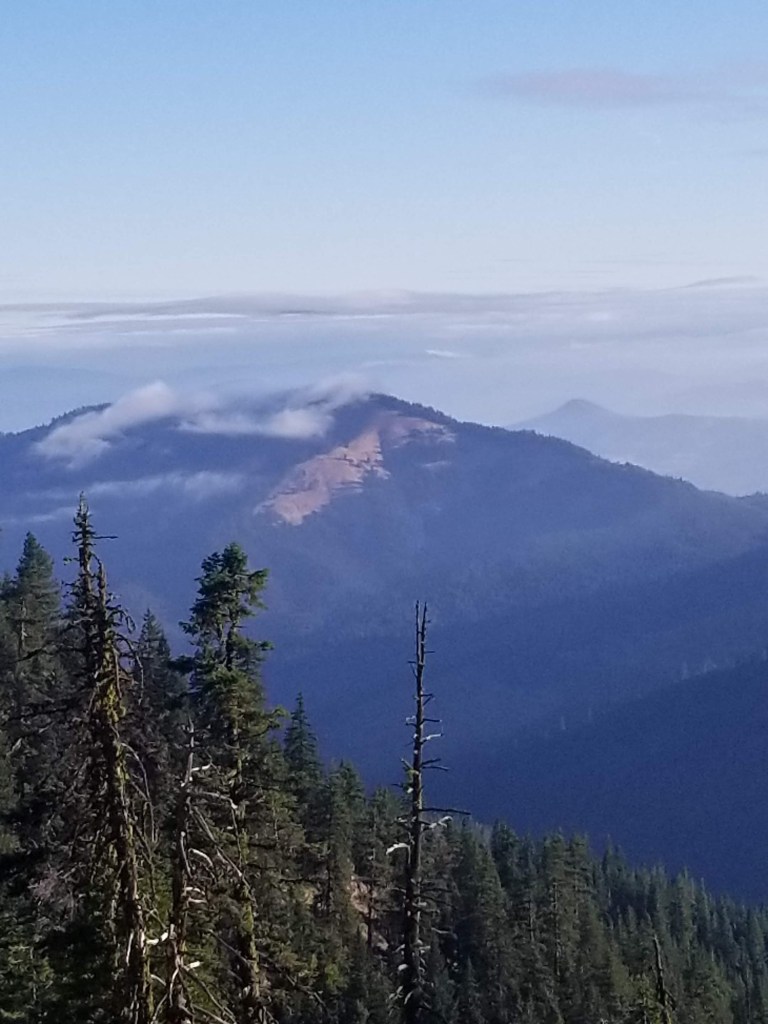
The sky grew incredibly smoky. Earlier, I had seen a plume down in the valley towards Mt. Shasta. But I suddenly found myself in thick, smelly smoke, and visibility dropped rapidly. The wind had picked up from the other side of the ridge which was west. I panicked a little and sent a satellite text to Helen asking if there was a fire near me. She replied there was not, but there was a Salmon fire more towards the coast and that seemed a plausible explanation with a strong wind from the west.
Late in the day the trail began a relatively steep slope for quite some time. I must’ve passed eight northbounders in this one section. It was getting dark, but after the previous night’s tent site, I again wanted to sleep up high. I stopped to take a few eerie sunset photos, put on my headlamp, and pushed to reach the saddle where my campsite was located.
Fortunately, I had it all to myself. I had some great views up at the sky, but there were no real views outward in the smoky dark. I pitched my tent and ate in the dark. There was one strong night gust of wind, but then it was totally silent. Just me sleeping on a mountain pass with stars, smoke and nothing else.
It was a pretty view in the morning. I was up high. There was a ceiling of clouds just above me. Low clouds skittered around the hills below.
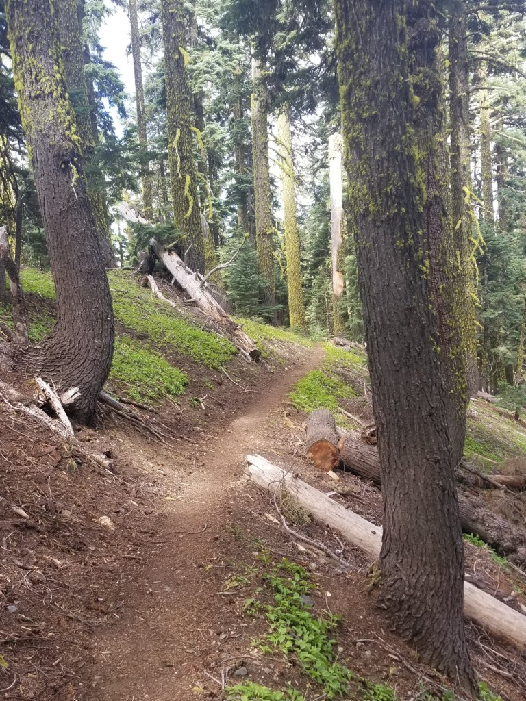
Remaining clouds burning off in the morning sun.Perfect trail
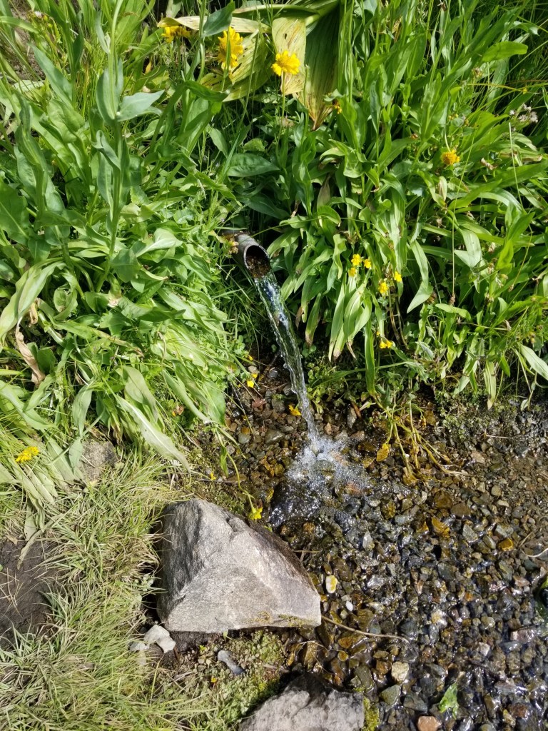
It was a great day of hiking, mostly slight ups and downs along ridges. In the late morning I came up to a wonderful water source: a spring that had been tapped with a pipe.
Spring Water.
A trio of ladies came to the spring as I was filling up. They were retired and had been doing PCT section hikes for years. All at least in their 60s, they were boisterous and energetic and brightened my day.
I was just walking along later in the day when I heard some people getting out of cars and preparing to go on a day hike. I said “Hi” and kept walking. Their energetic Labrador kept running to me and then back to them. I was surprised to stumble on the trail marker noting the state line between Oregon and California. I tried taking some selfies and the day hikers were nice enough to snap a photo. Dutifully I wrote my name in the trail register and continued on, feeling a lot better knowing I had walked from the northern border of Oregon to its southern border.
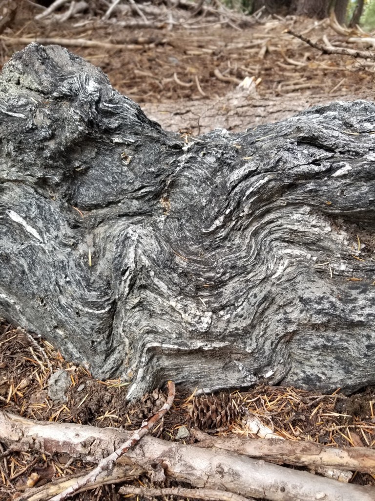
Water was just a little scarce. I filled at a creek where cattle grazed (not the best) and late in the day settled for a stagnant pond. However, there were some very interesting rocks. They had multiple thin layers. Some of them reminded me of how croissants are made…with layer upon layer of thin dough.
Layered like croissants but much tougher to chew….
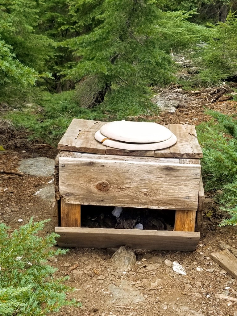
More puzzling was a strange toilet fixture. I had encountered variations of these a few times before on backpacking trips and puzzled on their purpose. They are usually a toilet seat on a wood frame about 12 to 18 inches high. Being a man who cannot rest unless I am able to unravel the mysteries of the universe, I had found that hunters make these and keep them near their hunting camps. In season, they dig a good size hole, place the fixture on top, and then have a functional, open air toilet for several days. At first, I wondered why they left them in the woods. However, when I considered the alternative of explaining to your spouse why you brought it home and your plan to keep it in the garage, the wisdom of just leaving it in the woods made tremendous sense. Sadly, I was dumb enough to go lift the lid. Even more sadly, some people had actually used the fixture and left their product just sitting there.
Leave no trace….
As the sun set, I had some sub-optimal tent-site choices. I ended up setting my tent within five feet of the trail. I always think this looks like a rookie move and didn’t like doing it. However, it was getting late and I knew I wanted to get up early and get going so I could drop down to my next resupply town, the Seiad Valley. My tent barely fit into the spot. I was surprised the temperature was falling so quickly and put on my down puffy and hat. I ended up sleeping in them, too, after setting my alarm for 4:00 am. With no wind, I was certain that if any animal walked along the trail at night that close to my tent, I would have some form of a coronary event.
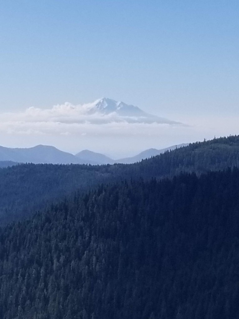
Shasta sometimes seemed to just float in the distance.