Cattle.

July 25, 2018. From Okanogan Forest camp to Cougar Creek camp. 22 miles

I was not well rested after the rough night. Still, I packed efficiently and even forced myself to eat my breakfast of cold-soaked 10 grain cereal.

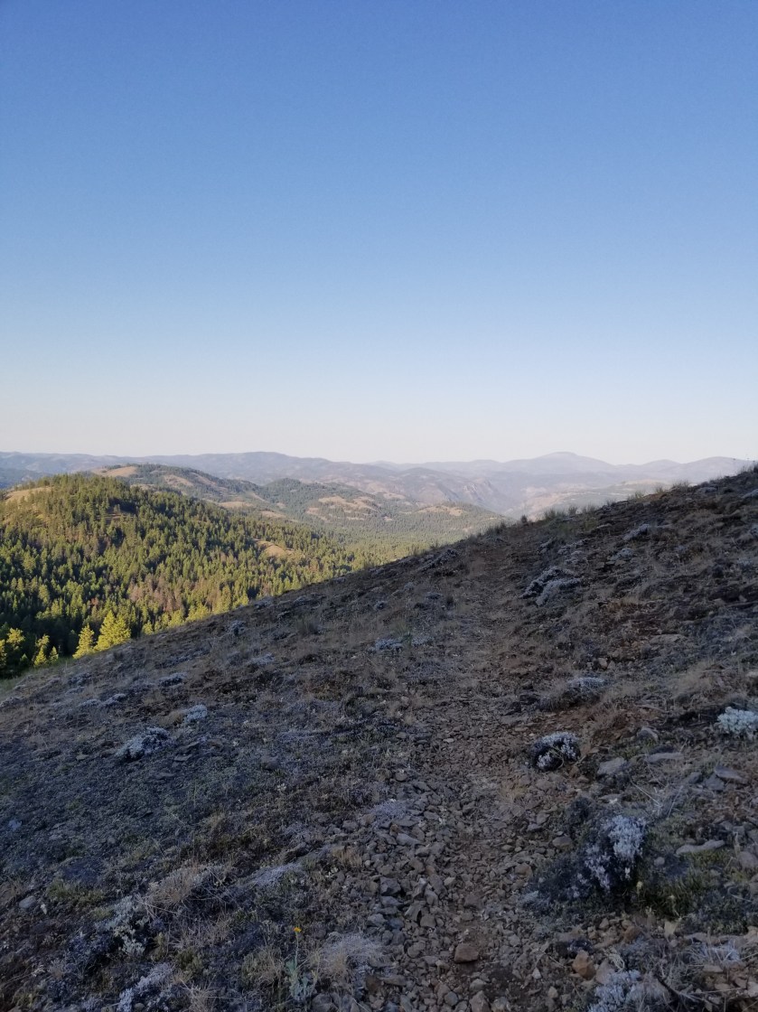
It was a beautiful day for hiking along this seldom-used road. I had seen no cars on it yesterday. With this solitude, you would not be surprised that when it came time to perform an important bodily function, I simply took off my pack and went a few yards into the woods to dig my cat-hole and take care of business. Well, as Murphy’s Law would have it, another hiker, heading the opposite direction, comes walking down the road. Nobody for days and this guy walks up on my dump. I tried to recover as quickly as possible, but it was certainly awkward.

We chatted briefly, but I was eager to get on with my life.

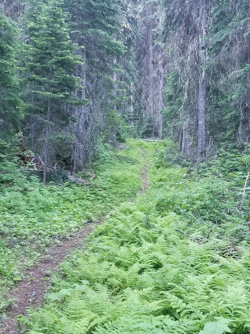
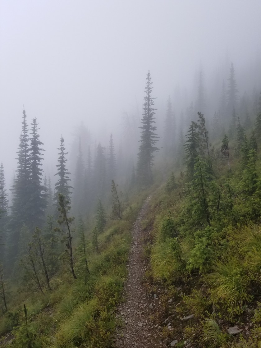
Later, as the day got hotter, I took the aptly named Sweat Creek Trail. It was a tough climb on a hot afternoon. Perhaps some steep climbs, I heard the chainsaws of a trail crew. After waiting in the distance for them to see me, I had a good, short visit. It was two adults and three teenage helpers. They were a legitime PNT crew. I expressed my gratitude for all the work they do and showed the younger ones all the scars on my legs from going over blowdowns, etc. Also, I let them know I was a dues paying PNTA member.

Their work is hot and difficult. I whine about carrying a backpack in hot weather, but these folks get up, put on long pants, work boots, hard hats, carry their gear uphill to the worksite, and labor in the sun all day. I thanked them again and let them get back to work.

Part of the work this crew had to remedy was eliminating misleading cattle paths. Generally, cattle are fairly good trail makers, sometimes they riff on their own. What this means is they will very often follow the main human trail, but, when it suits their bovine fancy, they cut a new path. Thus, in many areas a hiker has a very difficult time telling the difference between the human and cow paths.

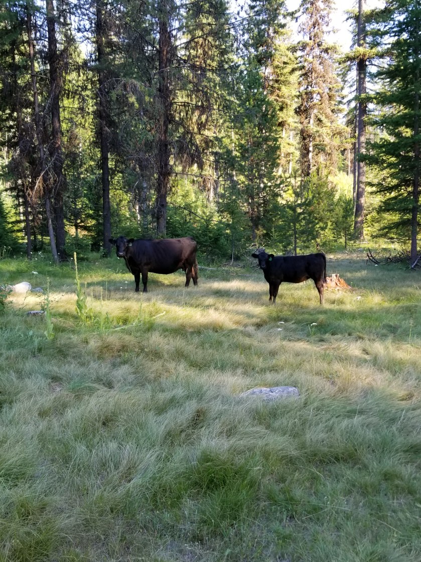
On my way downhill, I could see the trail crew had a lot of tree and cattle work. As if to prove the point, I encountered a small herd of about three pairs of cows and calves. Always, I stop and talk in a calm manner when I see cattle on the trail. While sometimes they amble off safely, other times, like this one, one bolts and the others follow. You might be surprised how agile these animals at going downhill at speed, jumping over obstacles. I waited a few minutes so they would not feel threatened. I don’t want either a calf or cow to get hurt running.

Unfortunately, I’ve seen this movie before and was not surprised to have the same process repeated. Two more times. In all, they probably ran downhill for a 750 foot elevation loss over a mile. Finally, one of the cows went left off the trail and the calves, who normally choose the trails, chose to follow her.

It was evening by the time I reached the bottom of the trail. The guide book made a vague reference that the trail seemed to go on private property but to veer left. Mild understatement. The trail basically dumps right in to someone’s yard. I didn’t see a dog, but clearly somebody lived in the trailer parked there. I went immediately over to the edge of the yard and moved quickly and quietly away.

Eerily, the occupant(s) had a fascination with skulls and decorated their yard with several plastic skulls and skeletal parts. At age 56, I am just too damned old to be abducted and converted by some cult. Think about it. You never hear about guys like me getting captured and converted, it is always younger people. So, I kicked in to high gear and got the heck out of there.

I came out on a public road. It switched between private property and public land. There were definitely some unique homesteads along the way. Maybe you live in a suburb or a nice urban setting. Indeed, you’ve also probably seen poor, blighted urban areas. However, taking a long walk really draws out a different variation of the American dream. There are rural areas where it is either the start, or fulfillment, of the dream to get a piece of land and park an RV or Camper on it and call that home. Sometimes there is evidence of a more permanent, traditional structure in various stages of completion. I can sort of understand the pride of ownership angle, but most of the situations appear to never convert to permanent housing. Instead a second or a third trailer is added. (I shudder to think what their septic solution looks like.) Pointedly, most of these smaller homesteads were the most prominent displayers of “Private Property” or “Keep Out” with a few specifically mentioning government officials. (Note I have the honor of working with municipal employees in my community and can’t recall any kind of professional that works harder to be fair, judicious, and considerate.)

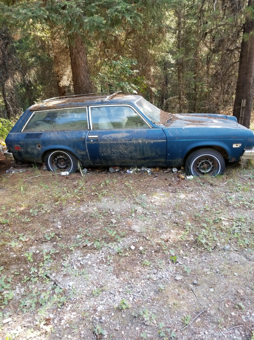
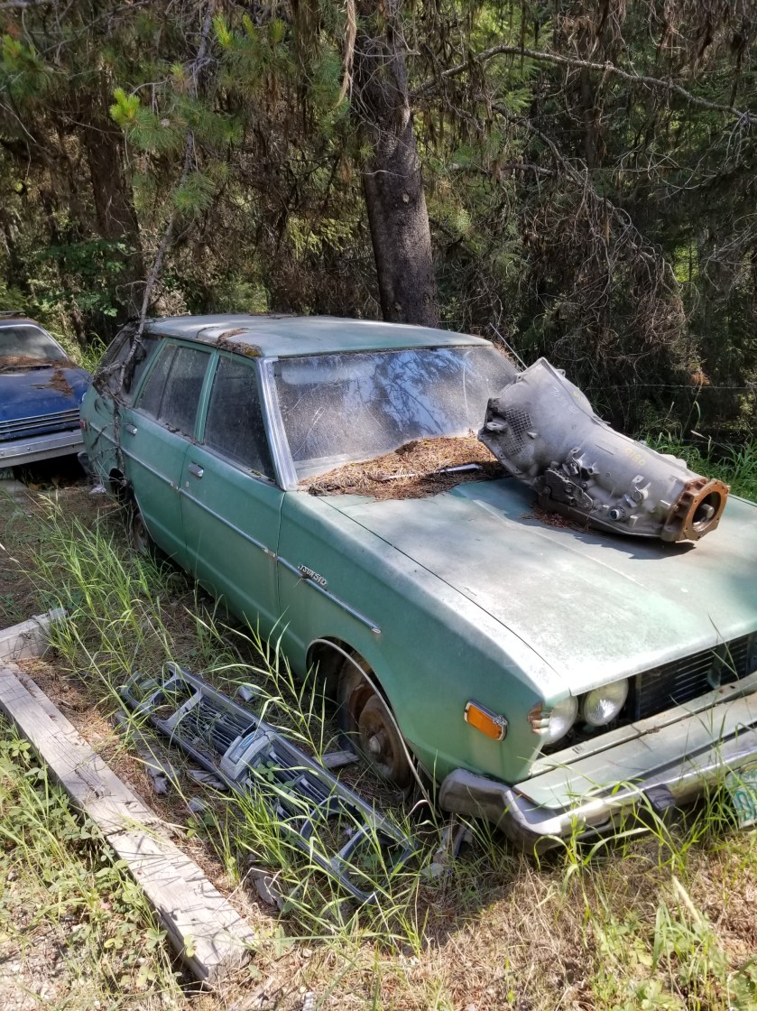
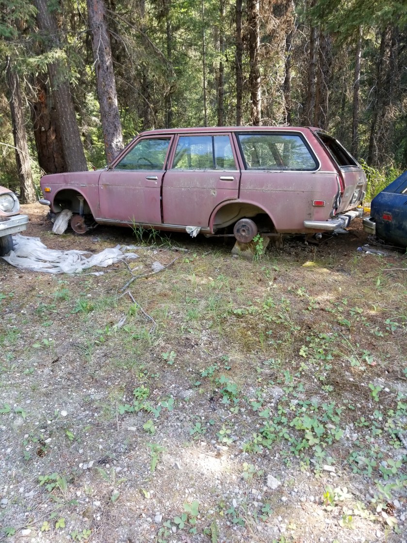
I passed a few properties where they spilled some of their excesses on to the public right of way. I’m not a “car guy” but one place was occupied by one who convinced himself (and perhaps a long suffering wife), that he would hold on to junkers to “part them out.” To nobody’s surprise, the Dodge Aries and various Datsun models did not generate much demand, so these vehicles decorated the road.

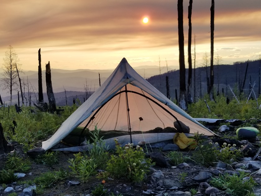
Eventually, I found a flat secluded spot on public property down by the creek. It got darker faster in the narrow valley. I ate my dinner while shooing away yellowjackets. I pitched my tent, hydrated some more, and went to bed.

While I initially dropped right off to sleep, in the night I was awakened by a sound. Not one crunching in the woods or brushing against the tent. Eerily, it came from underneath the tent. In the ground, there were subtle digging sounds and then a muffled pig-like snort. Being a guy and having lived in apartments, I naturally reacted by pounding on the ground. That produced silence. For a few hours. I had to repeat this one more time. In the morning, when i packed my tent, I could not see any obvious signs of tunneling or disturbed earth. I’ll never know what it was.

I find it fascinating that spruce trees will “feel” that they are dying and produce these clusters of robust growth, kind of like the opposite of cancer cells. I’m not sure if these anomalous growths are then intended to jumpstart regeneration when the tree falls.
Saw this grave marker along the gravel road this morning. Couldn’t tell if it was for a pet or an unpopular relative.

Tough Miles

July 24, 2018. From Thirteen Mile Mountain to stealth camp on Forest Road before Ogle Creek.

In spite of the strong moonlight, I woke up rested. I broke camp relatively quickly.

It was a brilliant, beautiful morning going slightly up and down on trail through grassy ponderosa forests. Great views.

Later in the morning I was cruising downhill, I went from sunny slope to a sharp shaded corner. That was where the accident happened. For my part, it took me two full steps before I recognized the sound of a rattlesnake. For his part, he waited until I was next to him before rattling as he wound himself up underneath a Bush. We both screwed up. I went back to see him and he had beautiful green markings. The video does not do it justice, but you can understand I did not want to stress the creature or, more to the point, get bit and die all for the sake of a more clear video. This isn’t Mutual of Omaha, people.

Later, I crossed a road with a trailhead. I loved it. There was a description of Thirteen Mile Trail. Best part? The length of the trail. All of my avid blog followers know I love goofy signs. So, both of them can understand my glee over the Thirteen Mile Trail being 16 miles. What do you think happened?

I was too tired to consider how a difficulty rating of difficult worked.

I dropped down an amazing canyon of Thirteen Mile Creek. It had huge 500 foot sheer walls and a churning stream. Suddenly, the stream disappeared. Just as suddenly, it reappeared, apparently choosing to run undergroundfor a quarter mile.

The photo fails to capture how high and sheer the cliffs were.

I next had a 2 mile walk on a highway with no shoulder. The Guidebook said this was the Grand Canyon of Washington. I was not impressed. Plus, there were a couple jerk drivers who clearly could’ve moved over, but chose to hug the lane and almost clip me.

Off the road, I had a dry trail uphill for several miles. It was tough. I had one of my oddest wildlife experiences. Given the amount of time until my next resupply and chance to charge batteries, I have been turning off my phone which is my camera. At a road junction, I was looking at my printed map. A spotted fawn trotted out of the woods. I reached for my phone and turned it on. On a whim, I told the fawn to “calm down.” Unexpectedly, it turned and came right to me. It was panting. It was obviously stressed, but I knew taking my pack off to give it water would spook it. By the time my phone turned on, the fawn was trotting away through the woods. So bizarre.

Late in the day, after passing cattle and timber harvesting, I came to a “V” in the road. A sudden crashing in the bushes uphill made me reach for my phone. I spied some black ears and a scalp. I wasn’t sure if it was a wolf or a black bear. As I was getting my camera ready to video, the bear cub came into the open. “Oh shit”. I hightailed it out of there not waiting a nanosecond to see where momma was.

An eventful day drew to a close when I found a beautiful grassy plateau for my camp. I hung my food far away and went to sleep. Or tried. It turns out I was on a bit of a lump, plus the zipper on my tent failed. So I spent a lot of the night fidgeting to find a comfortable position and waking to a mosquito buzzing my ear.

Long Day in a Burned Forest

July 21, 2018. Stealth camp near Kettle River to unnamed saddle in Kettle Mountains.

The night was very still. I heard some coyotes around midnight doing roll call. No problem with the camping.

As I continued down the road to cross the Kettle River, I walked along a quarter mile of the plateau and not a single private property sign was posted. I was relieved.

After crossing the river and highway 395, I was on a gravel road, passing a large piece of private property which had been logged. As best I can tell, the way landowners make a living is to graze cattle on their forest land and then periodically harvest timber. I would imagine lumber shortages and tariffs probably pushed a lot of folks to harvest lumber sooner rather than later.

Today I was feeling a little sluggish on the relentless gradual climb. I tried hydrating more, but it was tough. Plus, there were about six young guys on motor bikes whipping up and down the trail leaving annoying dust clouds. The scenery was nice, though.

These ferns grabbed a slice of morning light as they grew on top of a boulder.
Indian paintbrush (red/orange) and lupine (purple) are attention getters in meadows.

The day changed tremendously when I entered the burn area. In 2015, a massive complex of fires swept over a large swath of this country. I entered an area of standing deadwood, charred fallen logs, fireweed, and lupine. The trail dwindled from a gravel road used to salvage usable burned wood to abandoned forest service roads with multiple blowdowns.

It is such a contrast between the massive carnage of a forest fire and the rapid evolution of plants scrambling to seize the open terrain. Lupine has an explosive takeover strategy. It develops seed pods that twist and then pop open, scattering seeds. The most interesting thing to me was the absence of pine, spruce, and larch seedlings. They must bide their time and rely on their height genetics to overcome the early lead of other plants.

I’ve only seen two sets of footprints. That is, until I got to an intersection with a paved road. Then, a new pair of prints appeared. This was the famous Kettle Crest Trail.

Kettle Crest was a well maintained trail. I could not recall how many days since I had been on a real trail. It was good, but again seemed more like a bike trail than a hike trail.

I was able to get my last water supply and then followed the trail as it switched back and forth uphill. The map showed three turns, but there were at least six.

Fireweed
Sorry for bad focus, but seeing fireweed next to something that looks like a delphinium was an unusual sight.

Eventually, I reached the saddle I was shooting for. There was about 45 minutes before sunset. An odd cloud of smoke hung in the air. Plus, for once, it was windy. So, I made camp quickly, avoiding standing dead trees. I pointed the open end of my tent away from the wind. I had to put on my wool hoody plus my down puffy.

View from the saddle. The mountain saddle; I’m not on horseback.
Sun behind smoke cloud.

As a shock element, while I was eating my dinner, a mountain bike went whizzing past. Not sure if he saw me, but I hoped he made it to the road before dark.

My Zpacks Altaplex tent. The company stopped making them. Too bad because they were great for tall people.
First fire, then wind carved this.

It was the first cold night in weeks. I liked it and I liked sleeping up so high. It was a long hard day, but tucking in to a warm sleeping bag was a great reward.

My Worst Day

July 14, 2018 From Pyramid Lake to stealth camp on Lion Creek.

I woke up way early and forced myself to stay still for a bit. I knew the family wouldn’t be up. I snuck out to get a sunrise pic of the lake and grab my food hang.

Another sunny day. It would start with a climb to two nearby lakes. From there it would be bushwhacking. In case you are wondering, bushwhacking means taking a course between two points with no established trail. As the name implies, you must go through bushes, downed trees, bogs, etc to achieve your goal. Without these obstacles it would be walking or traipsing or strolling or perambulating or something.

The first lake (Upper Ball) was beautiful and I regret not having the daylight or energy to get there the previous day. The second lake (Lower Ball) had families with barking dogs.

I scaled a hill and the first part of the bushwhack began: cross a mountainside. It was a little steep, but manageable. Until the rock slides. Then, I had to edge my way uphill to get above the steep area with no apparent footholds. This happened a second time as well. Falling here would be unpleasant, to say the least.

The only consolation was that some of the rocks at the ending ridgeline appeared to have fossils. It reminded me of Sandia Crest near Albuquerque where I found fossils at 6,500 feet elevation. This old earth sure moves around.

The rock on the left had formations that looked like fossilized sea anemones.

The next installment was to go down a heavily vegetated hillside, veering west slightly to end up in a particular canyon.

At first there was a trail, but after about 100 yards it disappeared. Most of the bushes are alders ( I believe). They grow about 4 to 8 foot branches. The devilish part is they grow in the same manner as crabgrass: the branches shoot out, then up. So, they end up interweaving their branches. This makes for tough hiking.

Downhill, I eventually made my way to the right location. Allegedly, there was an old faint trail. While this was true at times, other times it wasn’t. In fact, the further down Lion Creek I got, the more frequently the “faint” trail disappeared.

The main point is that it is slow and difficult to push your way through shrubs and step over downed trees on a hot day. I reached a point where the guidebook and GPS map said I should be connecting with a real road, but that was simply untrue.

I eventually stumbled out of the woods sweat-soaked, bleeding from lacerated arms and legs and in a foul mood and odor. Immediately I met a family pulling a wheeled igloo cooler in swimsuits. We both looked at each other like WTH?

The back of my legs.

After several more people passed me in flip flops and swimsuits, I asked a couple what the attraction was. Apparently there is a natural waterslide famous with the locals. This trail eventually turned to a road, but before it did there were several cool streams that provided needed refreshment.

Exhausted, beat up and late in the day, I weighed my options. The official trail climbed a mountain to a….Lookout! And then climbed down to meet the gravel forest road I was now on. Hmmm.

So I stayed on the current forest road, listening to an audiobook. One kind couple stopped and asked me if I wanted a ride. Tempting as it was, I demurred. Near the bottom where the stream I had been following almost all day (Lion Creek) was going to feed into Upper Priest Lake, I found a stealth camp away from the road but near the creek.

I ate dinner and then washed my wounds in the cool creek water. It reminded me of why I always filter water.

* * *

P.S. an obvious question is why don’t I wear pants. The answer is that pants, on me, get sweaty and thus tug and bunch and chafe. None of us are here for an anatomy lesson, but suffice it to say I chose the coolness and flexibility of shorts even if it means scratches.

A (Not So) Brief Recap of Bonners Ferry

July 12, 2018. Zero Day in Bonners Ferry.

If you have been reading this blog for some time then there are two things: you need to get better reading material and you know I love to hate bad signs. You’ll have to resolve the first thing and I’m not sure where the latter comes from. It could be EOGOG (Early Onset Grumpy Old Guy), but is it really all that much to ask that people who make big, permanent, useful signs take maybe just a second to double check their work?

With that set-up you know exactly what I had to accomplish today: where the hell did the apostrophe go? Edwin Bonner from Walla Walla, Washington ( a town they loved so much they named it twice) had one of the few official licenses to ferry people across the Kootenai River. So, why was it not Bonner’s Ferry?

Until the historical society opened, I first mailed home some extra gear, bought mosquito repellent, and then went to the library to catch up on blog posts, perform some financial stuff, and research the town I was in. I must say librarians, contrary to stereotypes, are generally friendly and extremely helpful.

In case you forgot or are hamstrung by youth, the Ruby Ridge incident occurred here in 1992. Oddly, it happened on Caribou Ridge. Long story short, federal law enforcement agencies had a shoot-out, then a siege, with a reclusive family. The man at the center lost his wife (sniper shot) and son and dog. A US Marshal died as well.

At the time, my simple mind encapsulated it as nut job shoot out with trigger happy feds. More nuanced than that, in the beneficial light of hindsight, it really was a tragedy. Weaver really should’ve just gone with the flow and appeared in court and not escalated things. The feds really made a mountain out of a molehill and got way too aggressive. In short, it was a bunch of guys who wouldn’t back down or compromise.

Back to the hot topic of the day, I noted the time and went to the Historical Society for Boundary County. When I walked in, a bearded fellow who must clearly perform some Santa Claus work in season, put down his browned historical newspaper and greeted me. I explained I am hiking the PNT and like to learn about the towns I visit and asked if he could give me an overview of the museum.

Immediately, I got the sense they tend to get one type of visitor. His smooth opening line explained there was a $2.00 admission fee and the bathrooms were down the hall.

Having cleared that up, he overviewed the following areas / collections

  • Railroad
  • Mining
  • Farming (early, 1930s, today)
  • Chinese workers
  • Women’s roles through time
  • Wooden clock collection
  • portrait gallery
  • Saloon
  • First Doctor
  • Native Kootenai history
  • Gun collection

And a whole lot else that I didn’t catch. Fearful he might grab me by the elbow and show me all of it, I broke off to the railroad & farming.

Wouldn’t you know it, one of the first exhibits about farming was a large display contrasting early versus current farming.

I patiently extracted my $2.00 worth of value. They truly had tons of stuff. I’m not sure many people died in Boundary County without naming the historical society as a beneficiary. Indeed, there was a collection of about 30 large wooden clocks. They were all elaborate scroll cut pieces with a generic clock put in it. Clearly these were kits. The blessed retiree obviously spent 1,000s of hours on his hobby. However, I’m sure his long-suffering wife must’ve pleaded like crazy to be sure the entire collection was donated to the historical society to get it out of the house.

The portrait gallery was surprisingly large if not awfully good. One early hero was painted with quite a fetching style.

There was one truly remarkable exhibit. An albino woodland caribou. Native Americans killed it in the late 1800s and a local saloon owner obtained it and made it his mascot.

At last, I returned to the front. I said “I am not an English teacher, but I cannot find an answer to why Bonners Ferry doesn’t have an apostrophe?” He sighed, looked down at the old newspaper and said “For a long time we tried to correct it, but it just became customary to use Bonners.”

I grumbled my way back to the motel. Letting the matter go was cathartic. After all, we have a grocery store back home established by Russell Lund and it is not called Lund’s, just Lunds. I was hungry and just wished this town had a McDonald’s.

On the walk back I noticed a few pickup trucks with Confederate and US flags flying. The ignorant, hopeful part of me tipped my hat to these scholars who were passionate about state’s rights, but the realistic me accepted I was in the heart of Aryan Nation country.

Leaving Bonners Ferry, I was brooding. It is a beautiful town in a sumptuous valley where the untamed Kootenai River created a fertile flood plain. When the river was dammed, the land could be farmed. Mining and lumber come and go. It would be stunning to have a house on one of the local ridges, catching both sunrise and sunset, witnessing the first snowfall on the all-surrounding mountains or the bright yellow canola crops in the summer. However, like many smaller towns, meth is a problem and there is the white supremacists stigma. However, every worker I met from motel owner to the restaurant employees to librarians were all hard working and considerate. Like Montana, people here look you right in the eye. I like that.

In summary, I am glad I spent a whole day in town. A roadtrip here could be in my future. Maybe I’ll get a modified camper van and call it Kevins Van.

A Beautiful Decline

July 11, 2018 From Bussard Mtn to Highway 95.

I woke up at 5:30 and tried to sleep in. It worked a little, but by 6:30 I was too restless.

The fire still had some embers, amazingly. During the night I had to get up once and there was a glow from the fire on the ground and brilliant starlight above. I had not seen the milky way in two years.

I tried to pack slow knowing I had a lot of waiting ahead. I used some of the miracle water to make sure the fire was totally out. I dispersed the fire stones and used forest debris to mask where the fire had been.

Gathering my food hang, I was finally ready to go. It was glorious hiking.

Almost immediately I had views down into the Kootenai valley. There were some low clouds in the valley and the sun shone on the next mountain range to tackle, the Selkirks.

The Kootenai valley was beautiful. Large patches of canola crops made for yellow patchwork.

The other side was beautiful, just without a big valley.

The trail meandered for a few miles. There had been a lot of stabilizing work and trail-raising. I suspect there were motorcycle fees that had been allocated and this trail won. I didn’t mind as long as no motor bikes used it while I was on it :-).

The well-maintained bike trail went right, but my foot trail veered to the left. Of course, the trail sign had misspelled the word Bethlehem.

…and there was no room at the in. Poor baby Jess.

I didn’t mind. As I went down I passed a tree that produced 100s of perfectly shaped pinecones.

There were also some interesting meadows.

These white flowers are about the size of a thumb tip, but can grow in eye-catching clumps.
Finally, a butterfly that would hold still.
This burned tree had about 80% burned through but still stood.

Alas, I arrived at highway 95. I had four hours before the trail angel in town could pick me up. I tried hitchhiking, but it was not an ideal spot. Mostly trucks, family vacation mobiles, and Canadians. After an hour, I gave up, found some shade and waited.

Finally, Sharlene arrived. She was very helpful and thoughtful. She had started section hiking the AT a few years back and found out about the trail angel concept. Coincidentally, after noticing some backpackers in town, she discovered the PNT was in her backyard and desperately needed a trail angel.

I checked in to my motel, the Kootenai Valley Inn. My first reaction was Whiskey Tango Foxtrot, we have a situation. The outside of the office was a decaying mess and the office was a barren room, like a murder had occurredand they had just finished removing the blood-stained carpets and walls.

Ed, the brand new owner, quickly put me at ease. He and his brother had purchased the place as a semi-retirement activity. He was clearly busting his hump and there were some diamonds in this rough. My room was clean and the carpet had been deep cleaned. The bathroom was sparkling.

Next door was a restaurant that both Sharlene and Ed recommended. They both called it the “chicken chop.” I went there. It was “Chic-n-Chop” and while the name made no sense they had classic dinner choices. I don’t know about you, but when I’ve been eating couscous, lentils, and quinoa, I’m jumping all over the special of two pork chops, two broasted chicken pieces, a biscuit and baked potato.

In fairness, I did order a full dinner salad first.

I was asleep by 9:30.

July 9, 2018. Midge Creek 20 miles to a crappy spot on a hill.

It sprinkled during the night. The weather has been strange that way; sprinkling just enough to remind me I am sleeping in a tent, but not enough to dampen the ground. The critters had left my stuff alone.

I started up the trail and there was a nice big set of bear tracks. Grizzly, based on the pads and claws. Great. Another climb spent huffing out “Hey Bear.” The good news was this bear was quite lazy. It was clear a trail crew had been on the trail(fresh sawdust), but quit after awhile (blow-downs and few footprints). Well, this bear didn’t like blow-downs and the prints disappeared.

The morning was glorious and I enjoyed reaching my first vista up high. I was following the trail, but was bothered that it stayed higher, longer than my phone based app suggested. I pulled out the phone and sure enough it said I was almost a quarter mile off. I put down my pack and walked back slowly, looking for the junction I must’ve missed. I couldn’t find it so I walked back, put on my pack, and sure enough the trail took a sharp turn in the direction the app suggested. Annoyed at the delay, I was nonetheless happy to get rolling again.

After modest ups and downs through sparse forest with rich green grass, the trail cut across the face of a steep mountain face. Unlike Mount PUD, this time the trail went across a mountain instead of over it. It was sketchy at times, but it was a welcome change to be hiking in the open with views above and below.

Around 11, the traverse stopped and a short climb was in order to get to the pass below Rock Candy Mountain. I thought I heard voices, but then I thought I was hearing things. At the pass, I was able to get a few bars on my phone. I was hiking faster than I had expected and was toying with pushing real hard today and tomorrow and getting to my next town (Bonners Ferry) a day early. This required coordinating a ride and a motel. I started exploring this while sitting in the middle of the trail.

Lo and behold, I had heard voices. Three hikers approached, also doing the PNT. They were youngish and all from London. We exchanged some trail chat, they went to the top of the mountain for lunch and I packed up to continue.

The trail was mostly gentle ups and downs for a few miles. I was in a kind of zone until I was forced to climb up Canuck Peak. Atop there was an abandoned, dilapidated cabin.

With the few faint bars I could get, I checked in on my early arrival and it was not going to happen. That was OK. I was feeling sluggish and by this point I did not think I could make two 25 mile days in a row.

I was almost out of water, on another knee crunching descent, and my feet were protesting. Then, another pointless climb, but at least this time it led to water.

I was so thirsty and I tanked up as best I could. I even added some sport drink stuff to one of the half-liter bottles I drank. Plus, I started hydrating my dinner since it was 4:00. I spilled about one-third of it. I tried to clean up my spill, but left some hoping that a creature might enjoy some couscous with spinach spices.

Trudging on, I was set to walk along what looked like beautiful trail according to the map. It was called the Ruby Ridge trail. It was mostly beautiful. Often clear vistas, the trail was mostly level, contouring along around 5500 feet.

I did have one scare. I heard some distinct groaning or grunting ahead. I yelled “Hey Bear” loudly a few times and listened. Again I heard the low growl. I moved to the right where there was a clearing. Looking for a bear, I was surprised to see only a grouse. It was a male grouse and he was definitely strutting his stuff. It may not show in the video, but he did make the low sound.

Not sure why I was so sluggish, I started to gradually go down hill. I had entered a portion of the trail where motorcycles could use the trail. This made it wider and less steep. By 8:00, I realized I would not be able to reach the valley floor where there was a suggested campsite.

I came to my last water source, stocked up, and then began a search for a campsite. My challenges were two-fold. First, the terrain was very steep with virtually no flat spots. Second, the understory was shrubs and any flat space would be covered with huckleberry shrubs, wild roses, and other plants.

Plodding downhill, I finally spied a slight rise among all the downhill slopes. I got on top and figured my tent would just fit. So, I set about pushing away sticks, stones, and pine cones. I had to pull up some shrubs and break branches on others, so I was not the most environmentally sensitive camper. I pitched my tent and found out why this aberrant rise was there: it was a large boulder. In one place long enough, it eventually accumulated enough dirt and then plants grew. My tent stakes, however, would not go in to the boulder no matter how hard I tried (or how hard I cussed). Settling for tents stakes wimpily pushed into the thin topsoil, I had pitched the most ugly tent in American backpacking history. A small rain or a slight wind would surely cause collapse. Heaven forbid I should sneeze.

I crawled in my tent, laid down, and felt every sharp shrub I was not able to uproot. I thought my sleeping pad would pop. Squirming around for 15 minutes, I finally found a position where there were no sticks or stones and neither my face or feet were jammed in to the tent. Given the day and my mood, this was good enough and I conked out.

Mount PUD

July 7, 2018

Stealth camp on road to stealth camp near stream.

There is an acronym attributed to hiking the Appalachian Trail: PUD which stands for Pointless Up and Down. Obviously, backpacking through mountains includes a fair amount of going up and down, but today on the Pacific Northwest Trail it went from neccessary to PUD.

The mountain range I am in is called the the Purcells. They all max out around roughly 7,000 feet above sea level and most have rivers between them. They cover the northwestern part of Montana and the eastern part of Idaho’s panhandle. They are not as steep as the mountains between Polebridge and Eureka. This means they are slightly more amenable to forestry. Therefore, a lot of the hiking is through forest that:

  1. could be harvested,
  2. was harvested (30 years ago) or
  3. a burn area.

By far, the “could be harvested” is the most compelling to hike through. Huge trees block out almost all undergrowth with the forest floor mostly old pine needles. This duff almost feels like walking on those really thick shag carpets from 1970s (younger readers use your imagination or Google). It is eerily quiet. And big trees produce big pine cones.

The “was harvested” is okay. It feels like a working forest. While clear cutting was the old method, the newer approach is to leave a few mature trees and let nature runs its course. Impenetrable understory of alder and huckleberries and young conifers battle for space. Except for the conifers, the shrubs top out at five feet, roughly. Unless opened by a landslide or natural meadow, the general feeling is of the understory pushing in. It is very clear why there are so many animal tracks on the trails; these are the only really viable way to get around. Except for moose. There is a lot of moose scat in these woods.

The “previously burned” areas offer some harsh contrasts. Nature abhors a vacuum, so dense stands of young pine and larch grow. On rocky slopes, grasses and flowers make a land grab. The shrubs take what they can. Hiking through these forest offers more vistas, but they can feel a bit claustrophobic walking between dense walls of thousands of tall skinny 15 foot trees.

All of this is backdrop to today. I started in a harvested area. Mostly shaded, the early morning climb was perfect. Except for the mosquitoes who were fast and relentless. (I don’t use bug sprays or headnets when hiking. The chemicals are too harsh and the headnet feels like walking around in shady cheesecloth. At camp, it’s a different story.)

I got up to the first mountaintop and the next several hours were a rolling climb along a ridgeline with ok views. The “highlight” was a climb nearly to the top of Mount Henry which had a lookout tower.

From there it was a kneecap crushing descent from 7,000 to 3,500 feet over 4 miles. It was about 3:30 when I bottomed out at Fish Lakes and stocked up with water. A campsite was available, but the directory noted “rodent problems.” Regardless whether it is eating, sleeping or traveling, my hard and fast rule is to avoid anything with a rodent problem. So, I began a long steady climb up a mountain, in all a seven mile trip gaining 3,000 feet and losing (you’ll never guess… ) 3,000 feet. I was going for Mt. PUD.

About a half hour in to the switchbacks, I saw a trail sign to a forest road. The number seemed familiar. I looked at my map and that road went along the south and west side of the mountain which was where my current trail would connect. Should I stay on the official footpath or take an unknown shortcut? I chose to stay on my current route over what was to become Mount PUD.

Slowly ascending switchbacks through an area that had previously burned, I was in a walled off corridor of conifers for a long time. The trail was losing visibility when it popped out to a grassy area higher up. I got the feeling this trail had not been maintained in the last two years.

While it was nice to be able to have a view, the barely visible trail through knocked down trees suddenly changed gradient. Previously, I had to stop every five minutes from the exertion. Now, the trail designers suddenly must’ve identified a new target market. However, they chose toddlers and seniors as the target. Watching the sun creep lower while making no uphill progress was infuriating.

Eventually I was mostly above tree line. Trails are difficult to see on hard surfaces. Heavily traveled trails will have small stacks of rocks called cairns. Unfortunately, this trail was so forlorn it was hard to tell what was a cairn and what were two random rocks. I was generally able to patch together the trail and reached the zenith where I was to cut through a rock canyon and finally begin my descent.

This rock canyon was v-shaped. As such, all trees that fell on the sides rolled to the bottom. It was blowdown central. Tired, knees aching, light fading and now I have to parkour my way through this.

When I came out the other side of the canyon, my shorts had a new breathing panel where one least expects such a thing. Down to one pair of town shorts.

I surprised many grouse today. Some have no chicks, some have hatched chicks, and some have flying hatched chicks. If you aren’t familiar with grouse, they are primarily land based birds, taking flight just to avoid danger. Agrouse chick flying is the cutest thing in the world, reminiscent of a piglet flying.

The sun was just sliding behind the western mountains. As I was starting to feel some relief, the trail now headed east. Crabby, I cussed the trail designer who created a route to the Pacific Ocean that goes east.

At least it was through ancient forests. It took some stress off these old legs bounding down on a blanket of needles, many years old and many inches thick. The canopy blocked a big chunk of the fading light. I had to get down to a creek at the bottom. Not only for water, but also a flat place to camp.

Around 9:00 I found a relatively open space and cleared a spot. I did not feel hungry, but forced myself to eat. Right after brushing my teeth, I went straight to my tent. Once inside and away from the mosquitoes, I thought I would just drop to sleep. Instead, I listened. There was nothing. The soft ground absorbed any sounds that made it through the silent canopy above. Sometimes I have difficulty sleeping when it is so quiet because even the littlest sound from far away is magnified. Fortunately, a bird somewhere started its evening song and that’s all I needed to fall deeply asleep, ending my adventure on Mount PUD.

A Blue Theme

July 3, 2018. Bluesky Trailhead to Bluebird Lake.

I slept great, there was very little new rain, and I was ready to start a new day. After all, today I was going to climb over Mount Wam.

To start my day, I hiked up two different gravel roads. During the almost five miles, I was only passed by Forest Service and Conservation Corps vehicles. All heading up, hopefully to clear trail for me.

Once again, the damp clouds hung low and periodically dropped rain. On trail, the path was slightly overgrown with huckleberries or, alternately, alders, either of which was glad to drop their accumulated rain onto my shoes.

Last night I had camped at 4,500 elevation. I took a slight break at 6,400 feet to get water and prepare for the steep climb up to Mount Wam. Although I have not seen much wildlife, I was able find two different types of bird nests. Both make their nests on the ground and are very good at camouflage.

This nest was from a sparrow-like bird.
This nest was from a plover or sandpiper-like bird.

Like any normal person, I wondered where the name Mount Wam came from. I googled it previously to no avail. By no avail, I mean I couldn’t find anything on the first page of search results. I couldn’t recall a famous Wam, surely a memorable name. As I climbed the steep trail to the 7,000 elevation, I imagined the name came from a Batman comic fan who dreamed of a Mt. Blam and Mt. Pow. Or, it was meant to be an acronym such as What A Mountain or Wait A Minute or Wasted All Memory.

All this helped pass the struggle up. At the top, there is a restored fire lookout with stunning views that can be reserved for overnight stays. It is quite a hard reservation to get, apparently. However, as I struggled to see 30 feet into the clouds surrounding me, I felt bad for the person who hiked 5 miles up hill to a reservation in this weather.

On the way down away from the peak, I came across two guys on the trail. They were a little older than me. I asked if they had reservations and, fortunately, they did not, just out for an overnight trip. They were flabbergasted when I told them I had started in Glacier National Park. They were good guys and I was glad to see a couple buddies taking on a tough trail in tough conditions.

The rest of the trail was going to stay above 6,500 feet. The intermittent rain plus increasing snow on the ground plus blowdowns every hundred feet made the second half of the day a real struggle.

The trail is safely protected with snow.

By late afternoon, about 75% of the trail was under snow. The rythmn was:

  • Step up on to snow bank
  • Take two steps
  • Slip if steep
  • Sink in to knee
  • Repeat until end
  • Walk on visible trail for six feet
  • Start over

By 5:00, I was exhausted. My quads were aching. I could not feel my toes. Rain was intensifying. My original plan was a 23 mile day to set me up for a shorter walk to town the next day. I had to give that up. I was soaked and getting cranky, warning signs.

Oh sure, sun in the valley!

I made it to Bluebird Lake. A truly beautiful campsite in better weather. A grassy meadow looks over a small crystal lake at the foot of a huge wall spiked with rugged pine trees at the top.

Bluebird Lake

At first I gathered dry firewood with the intent of building a huge fire to dry out. The drizzle, unfortunately, turned to a heavy downpour. I pitched my tent, put all my necessities in it, and then huddled under a big old spruce tree eating my not-fully-hydrated dinner. Still in downpour, I hung up my food bag and splashed in to my tent.

I was very cold and soaked. My down puffy had gotten wet and both my merino wool layers, too. I only had one thin change of dry clothes. I made the change and then struggled for the next 30 minutes to warm up inside my down quilt and stop the shuddering.

In hindsight, I was a dummy for only bringing a wind shirt versus a full-fledged breathable rain jacket. The wind shirt blocks wind and light drizzle, but eventually soaks through in heavy rain. My brilliant plan was to use my umbrella for heavier rains. But I needed both hands free to catch myself on the snow and thus no umbrella. On top of this, the wind shirt traps body perspiration, essentially soaking from within. Lesson learned.

I fell asleep before darkness as the rain turned to drizzle then to nothing. It was a hard fought 18 miles.

Everything Changes

July 4, 2018. Bluebird Lake to Eureka, MT.

I was stuffed up in the morning. I feared a cold. I have not been sick in years, so this was a little concerning. But today was a special day in two ways: it was the Fourth of July and it was a town day!

I knew that I only had one major climb early on and the rest was literally downhill. Although overcast, the air did not feel like rain. I’m not going to lie; putting on sodden socks, wet shoes, and yesterday’s dank hiking clothes was miserable.

About 100 yards from camp, the trail had been cleared of blowdowns. The unmistakable sight and smell of sawdust told the story. Even better, the early climb did produce body heat that dried out my shirt and hoody.

When I reached the apex, I looked east and was delighted to see Glacier’s peaks, even though the tops were cloud covered. Better yet, looking west to my destination I could see clearing skies.

Snow along the ridgeline almost points directly to Glacier’s peaks in the distance.

The trail clearing magic ended the minute I turned at the next junction. Blowdowns, slippery rocks, and copious amounts of stored rain marked the descent. It was an old mining area and there was abandoned, rusted equipment as well as sealed-off shafts.

At the bottom of the hill, the trail merged on to an old mining road. This generally trended down over the next eight miles. It was transformational. First, the skies began to clear. Then, the blowdowns and trail obstacles stopped. Finally, the forest opened up with a high canopy and just grass on the ground, affording glimpses to the valley and reservoir below. Towards the bottom I stopped by a brook to change into my cleanest clothes (a very low bar) and wash up. I was startled by a couple out for a walk. Perhaps they were startled by the odd looking man cleaning himself up in the woods.

If you look closely, you can see a line reflecting the US / Canadian border where the next peace wall will be built, paid for by the Mexican government.

There was a long road walk at the bottom. First among smallish 10 or 20 acre homesteads, later large ranch and haying operations. I scared up a couple bull elk, their antlers just forming, covered in a brown fuzz. Also, a few deer ran away on the open grassland.

This hayfield was so beautiful, climbing up to the forest edge.
I couldn’t zoom in on this deer at the very top of the hill watching me.

My feet had been hurting from constant downhill walking. Now, walking on pavement was making things worse. I reached the highway for the last three miles into town and my motel. At first, there was no shoulder meaning I had to step down and away as cars approached on the two lane highway. Trucks made a special sound as they barreled by.

I walked past a golf course. There were a few stray balls en route and I grabbed a newish one. My back and hip have been sore, so the thought of rolling a golf ball into tight muscles and tendons brought a smile to my face.

At last, I reached my motel in the northern part of Eureka. It was a small town version of a conglomerate: an Exxon station with a Subway restaurant with a motel with a real estate agent. So, while I was paying for my motel room, a chunky tourist was waiting to pay for his pork rinds and 20 gallons of unleaded while in the other line somebody was buying a meatball sub or closing in an escrow. I didn’t care. I walked into my room and turned on the shower. While taking off my shoes, I noticed the left one had a nasty stain. I couldn’t remember what I stepped in. When I took my sock off, I discovered I had bled quite a bit from a cut.

That shower felt so good. I felt like I washed away the cold, the rain, the ash from the burned forest, and the sweat. A burger, some minor medical procedures and this dude was, ironically, a happy camper.