Crowds to Solitude to Crowds

August 9, 2018. Base of Mount Baker to Park Creek Campground

Truly a bizarre night of sleeping. I slept very deeply, but more than once cars whipped by on the nearby gravel road, causing me to start awake, but then immediately fall asleep again.

I got hiking around 5:30. The two-lane highway was reported to be dangerous with narrow shoulders, curves, and tourists watching the views, not the road. Almost immediately the road crossed a spring-fed stream, so I poured out my bad old water and drank a lot of the fresh clean water. The old water from last night had been “enhanced’ by adding some Crystal Light to it. I am now certain the Strawberry Kiwi Rust flavor combination will never work.

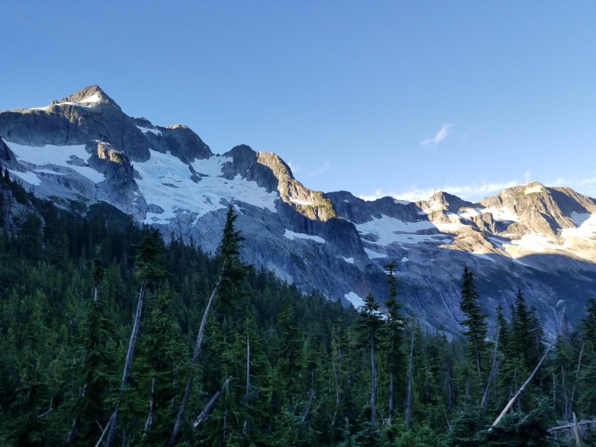
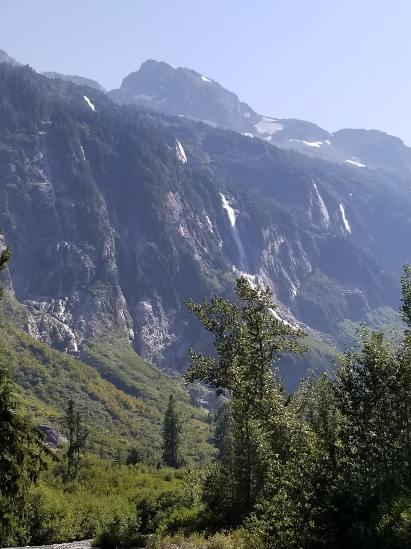
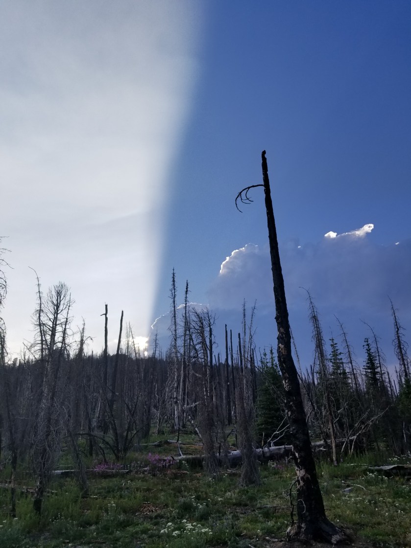
There was almost no traffic on the way up. After about an hour, views started appearing through the trees. I passed a ski resort and finally reached a large area of buildings and parking lots. While it was geared for mostly winter visitors, there was a fair amount of activity. As I walked through, I kept my eyes peeled for an outlet. Most of my batteries were low. Fortunately, as I passed the ski patrol building I noticed on the front by the road it had a covered outlet. When I tested it, it was live. So, I took about 45 minutes to charge my phone and “brick” battery.

May need the umbrella…
Foxglove grows wild.

My next stop was to get on a trail. This area was designed for people to get out of their cars and hike for a half hour. The trail was clear and clean. It led up to a trail junction that led to a famous overlook called artists point. As I filtered some water near the trail, a couple went by with their two dogs not on leashes.

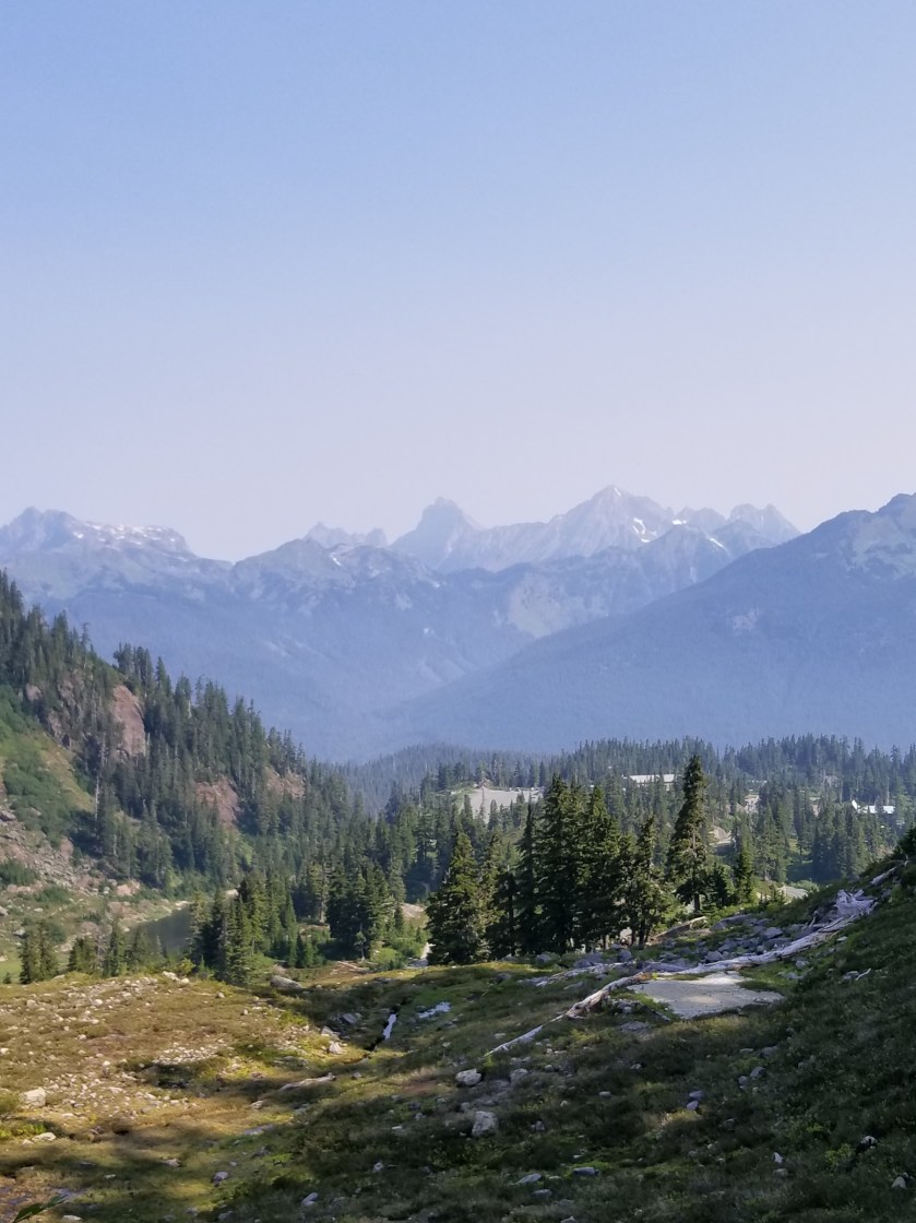
At the juncture, there was another parking lot that was full. It led to a popular location Lake Ann. I checked the trail register and the usual characters were still two days ahead. Just as I was leaving, another couple walked up with their dog not on a leash.

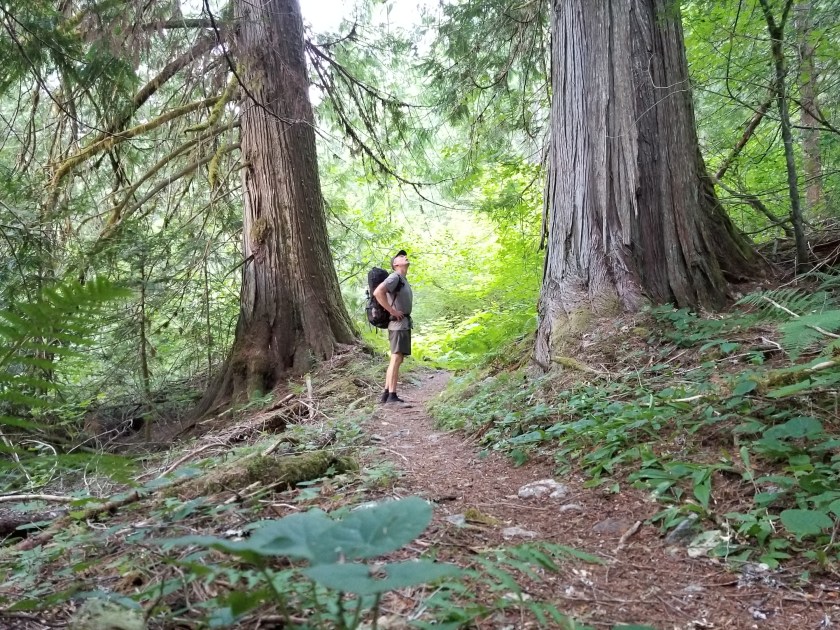
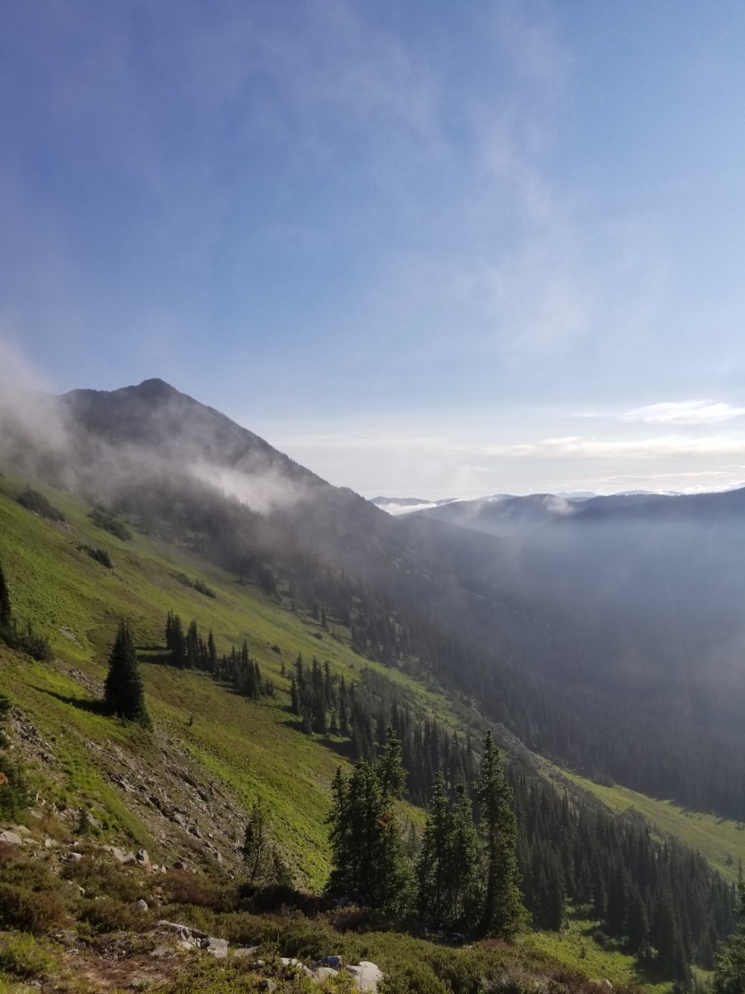
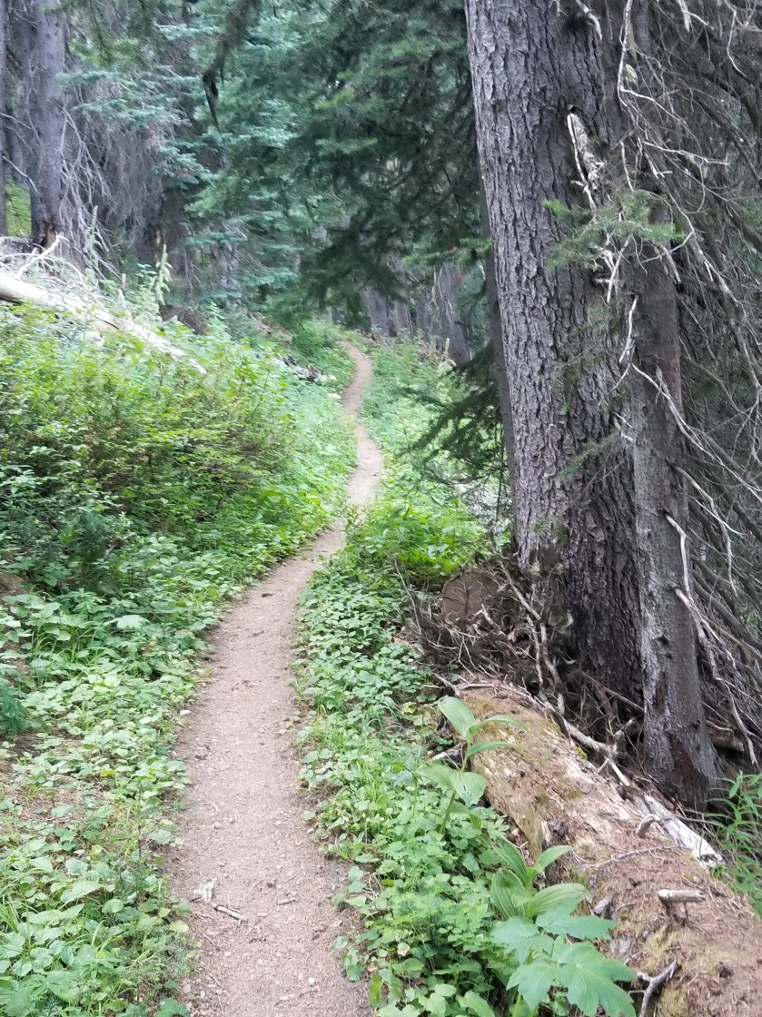
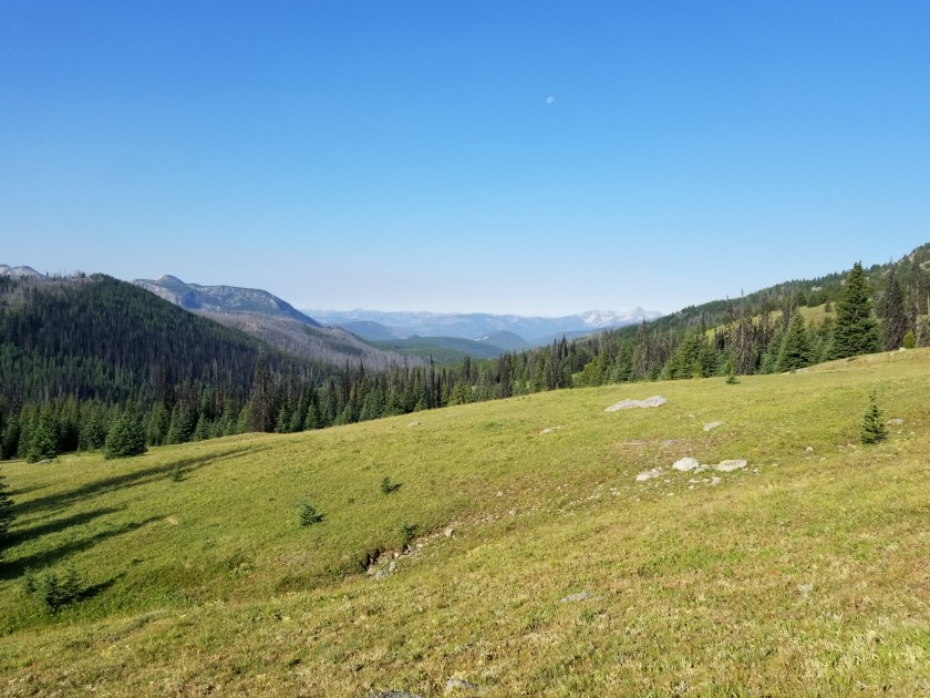
The trail to Lake Ann was populated and fairly easy. Just when I was going to need to pass through a gaggle of hikers surrounding a stream crossing, my journey veered away to the Swift Creek trail. It was classic PNT. One moment lots of people on a well defined trail, the next walking down a barely discernible path in a meadow.

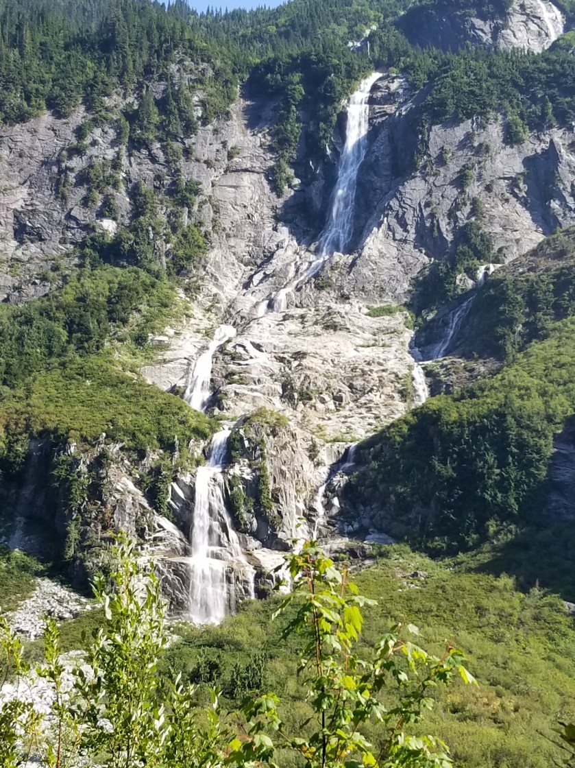
The map made it look like the trail paralleled the creek and then gradually descended to cross it. At first the map was accurate, but after about an hour, the trail started going uphill. I was concerned and checked my GPS location. I was about 300 feet above where the trail was drawn on the map. However, I had not seen any junctions and I could sometimes see footprints going the same way, so I stuck with it. Eventually the trail did descend, but it sure didn’t match the map.

They look a lot better than they taste.
This fella refused to face the camera. Great camouflage, though.

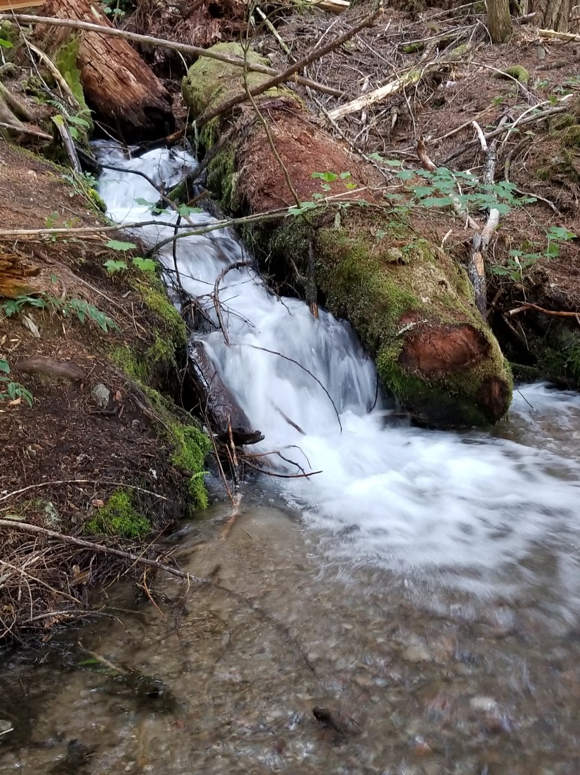
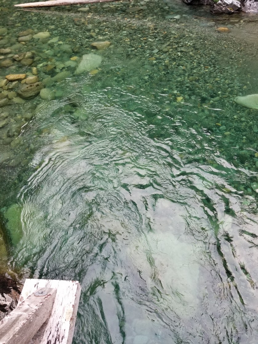
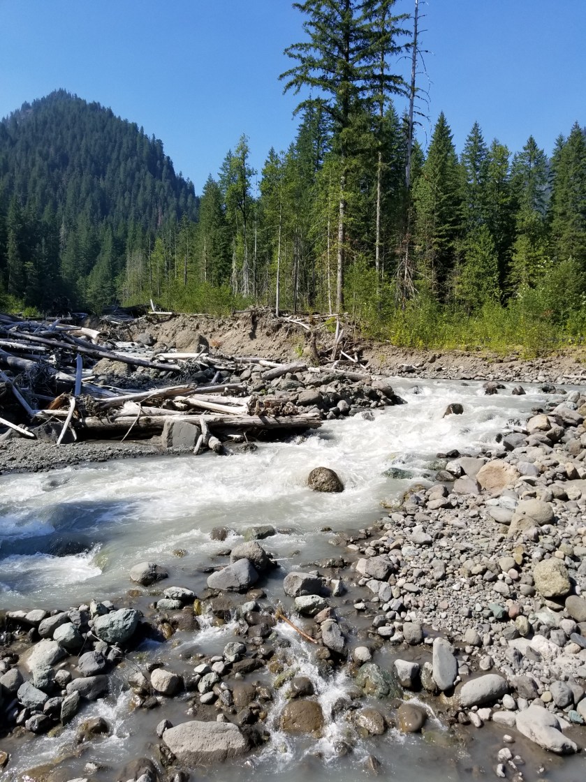
There had been several references to Swift Creek being dangerous to ford. Steep canyons combined with snowmelt can create this situation. When I finally got to the crossing, the creek was good sized, but not intimidating. A twist was that somebody had installed a zip-line that was about 7 feet above two parallel cables that all crossed the stream. Somebody had flung a towel over the top (zip) cable and seemingly crossed (or tried crossing) hanging on to the towel and tightrope walking their way across. No thank you. I just went down stream about 50 feet, found a slight widening in the stream and moved across. It was cold and it was fast, but the water barely reached them hem of my shorts. It took less than a minute. It reminded me of the Grand Enchantment Trail where there was a lot of hysteria about crossing the Rio Grande, but when I did it, it was super easy.

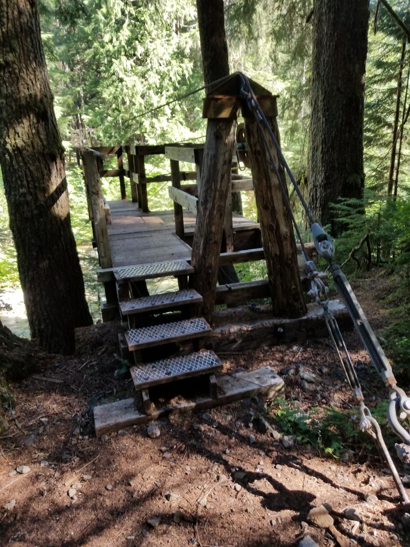
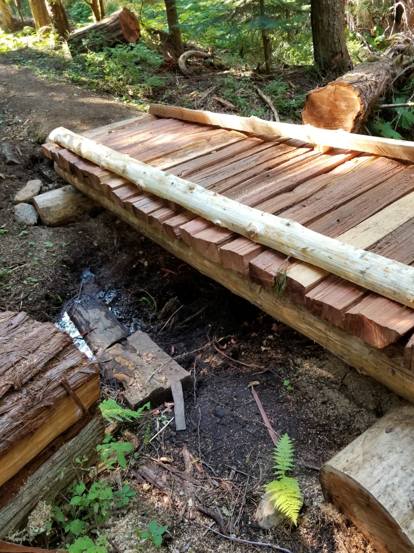
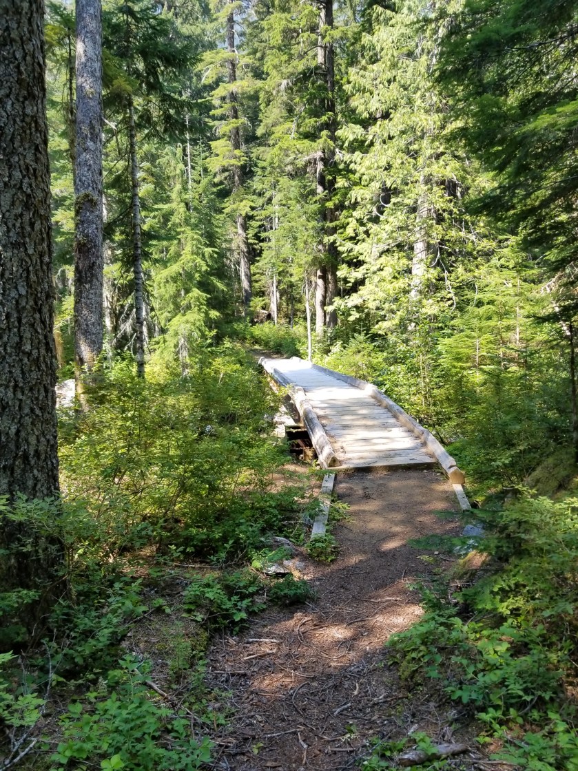
I still had another river crossing ahead. This one was on a creatively made bridge. Apparently each spring local volunteers come out and create the bridge. It was pretty good work.

Notice how silty the water has become from snowmelt.

I skipped the Baker Hot Springs and crunched down the abandoned forest road that was the trail. At the trailhead, there was a car campground. I walked through it and was pleasantly surprised to find a vacant spot. I dropped off my pack and ran down to purchase the camp spot. Walking back, I noticed that the three consecutive spots leading to my spot were occupied by a family. I guess they were going for a compound look. The had cats, dogs, bikes, pickup trucks, RVs, a boat, and an ATV.

After a little light drinking at the site next to mine, they did head off to bed at a reasonable hour. I had pitched my tent near the stream so the white noise of the creek would offset car campground noises.

This family highlighted an economic subset of our country that may not be highly visible to the average person, but is very clear on these backpacking trips. Specifically, there is a class of people that invest heavily in assets that depreciate. I cannot count the number of modest homes I have passed where the yard is covered with a late model pick-up, a boat, ATV, and/or an RV. If it is all new, then there is easily $5,000 to $10,000 of value just wasting away each year. Heaven forbid they bough on credit. I always am curious what these people have in their three digit plans(401 and 529). Obviously there is some pleasure derived, but adding up licenses, insurance, maintenance and these items are a real economic drain.

I discovered I had managed to place my tent on a fine set of tree roots, I was too tried to do anything except scoot around until I was able to lay down in an intuitive yoga position that avoided touching a root but was guaranteed to make me stiff tomorrow.

This tree was determined to grow even though it started life on top of a rock.
Among small ferns, a white flower that looks like baby’s breath is quite attractive.

Continue reading “Crowds to Solitude to Crowds”

At the Base of Mount Baker

August 8, 2018. From Whatcom Pass to Mount Baker.

I was the first one up. Got my food and took off downhill. The glaciers on this side of the Pass were bigger. I wish the sun was higher to bring out the beautiful blue of the ice that is at the center of the glaciers.

The air had cleared and I was cruising downhill. I knew I had a long day ahead of me as I needed to get to the base of the Mount Baker highway.

After breakfasting on several spider webs, I stopped and had some trail mix. I was brushing my teeth near a stream and a couple showed up. They were out for few days. Just as they were leaving, a group of five ladies came by. They just said “hi” and passed by.

Later, I came to the famous cable car over a river with the improbable name of Chilliwack. The cable car is a two seat basket. You get in and pull yourself across.

I couldn’t figure out how to video the trip across. About halfway across, I did stop and notice how frayed the pulling rope was. Definitely a unique way of crossing a stream.

At the other side a mother with two kids and her dad had differing levels of enthusiasm about the ride ahead. Mom was far less enthusiastic than the little boy.

As the day wore on and I approached a popular trailhead, there were scores of people, all shapes and sizes and ages. One couple I met at the apex of Hennegan Pass. They had full packs and some climbing gear. They knew about the PNT and offered me rides since they lived right near the trail in Alger. Really nice folks.

I continued a long, shadeless grind downhill. For the first time in weeks, I broke out the umbrella for shade. It was wonderful. Not sure why I have such a Mary Poppins complex against using it more often.

I reached the trailhead and began a long walk on a gradually declining gravel road. One car did offer me a ride, but I declined.

I went past a cordoned off area that had a few dozen bee hives right beside the road. Not sure what the bees were pollinating, but I didn’t want another sting and went by swiftly.

The evening was warm and windless. I had a freak event happen. I was just walking along and about 100 feet into the forest, a good-sized dead tree just snapped and fell straight over. Random.

I finally reached a developed forest service campground at the bottom of the climb up the Mount Baker highway. It was called Silver Fir. All the places were taken. I looked at places to stealth camp, but didn’t see anything good. Then, I used their handpump to get water. I filled up my three liter platypus bag, but the water looked a bit off.

I crossed the highway to a lot used by the highway department. It also had some snowshoeing routes for winter. I went down a gravel road and after a quarter mile saw a small clearing where I could fit my tent.

I ate as it darkened and got into my tent. The water I obtained from the campground was so rusty it made me wonder how long it had been since my tetanus shot.

It was one of those nights where I don’t even remember putting my head down before I was fast asleep.

Massive Trees

August 7, 2018. From Big Beaver Camp to Whatcom Pass.

I was glad to get moving in the morning. I could smell the smoke in the air and feel the building heat.

Fortunately, most of my morning would be spent gradually heading upstream along Big Beaver Creek.

There were two immediately striking features in the morning. First, the bluish, opaque stream colored by the grit from snowmelt. Second the huge cedars and western hemlock. Massive trunks supported a canopy of branches a hundred feet up.

This environment was good for toads and their offspring. When I first saw the forest floor moving, I thought it large ants.

This skinny guy was hard to see.
This one was not so hard to see.

The trees were interesting. Their size meant they truly blocked out sunlight from plants below. It struck me how little life there was. Hardly any songbirds, scarcely a sign of deer or squirrels. Cedars and hemlocks produce tiny cones and consume all light. In poignant contrast, the mosquitoes were large, numerous, and happy to see me.

This cedar had to be 20+ feet in circumference.
Quick, who is older?

Due to the absence of wildlife and wind, the cathedral-like forest was hushed, like when you walk into a large empty church. If you stopped, there was an overwhelming sense of space and silence (except for the tinny buzz of mosquitoes).

When light penetrated, it would occasionally reveal an intricate spider web. Try as I might, I cannot get a satisfactory picture of a spider web.

I found a charming stream and got some water that was not silty.

Later, I met a group of two guys and one lady, all young and in a hurry. Selfishly, I was hopeful they had been hiking a while and therefore had cleared all the spiderwebs on the trail. No such luck. Just after I passed the next campground, the webs started again.

A bit later, I met another two-men, one-woman group. They were from South Carolina, up for a friend’s wedding. Fun people.

I climbed over a ridge from Big Beaver Creek and dropped steeply into the next valley with the unimaginative name of Little Beaver Creek. No idea what the would’ve done if there was a medium sized beaver.

Subtly, the flies began to dominate the mosquitoes. Less quick to bite, their size and relentlessness made them more irritating.

One thing about federal parks or recreation areas: they do bridges right.

I made my way up the valley. It got high enough that there was snow and glacier up high across the way. With the heat, the melt created numerous waterfalls. Visually, it was mesmerizing.

Whatcom (pronounced watt come) Pass was my reserved campsite. It had a legendary reputation as an intense climb. It lived up to its reputation. Near the top, some of the wood buttressing the slope had dissolved.

The gray timbers were there to shore up the gravel trail above.

The campsite had a reputation as prone to bear visits. As a result, I ate my dinner about a quarter mile away to cut down on odors. There was a boulder field with a lot of pikas who squeaked their annoyance at me.

I was the last to arrive at the reserved campsite, so I got the least attractive campsite. The best tent pad looked straight down the valley. Mine looked north at a boulder field. I hung up my food and got my tent put together.

I heard the Pikas going off. Then I heard a large rock tumble. I looked and at the edge of the boulder field was a good sized black bear pointed uphill (away). don’t know the proper way to size black bears, but he looked like four Labrador Retrievers mushed together. If you’ve suffered through earlier blog posts, you know I am not a fan of bears. I yelled and he moved a bit and looked at me. Finally, I clapped loudly and he scurried uphill and away from the Pass, in to the trees.

My neighbors came over to see about the ruckus. We had a good chat and they all said they had hung their food. As you can imagine, I did not sleep too well, startling awake to the slightest sound. As you can equally imagine, nothing happened. When I reflected on this bear’s behavior, he seemed to just want to go over the pass and avoid humans. The biggest wildlife lesson on this trip is that animals very much use passes and saddles as transportation highways.

Happy Panther

August 6, 2018. From stealth camp on Ross Lake to Big Beaver Camp.

Excited to resupply and get my electronics charged, I was up early and moving. I crossed beautiful blue Ruby Creek and found a series of educational displays that gave the history of the Skagit valley before the dam.

On the “Happy Panther Trail” i passed a few waterfalls. I recorded a video of the downhill portion and was amused to see the video makes it actually seem like a backwards-flowing waterfall. I am easily amused.

I approached the dam with some excitement and just a hint of fear about heights. It was an amazing structure. I learned over to take a picture looking down…stupid.

After I crossed the dam, I immediately detected two smells from Ross lake Resort: cooked food (yum) and fuel (not yum).

I eventually made it to the resort. It is unique because the whole resort (office, cabins, boat facilty) floats on the lake and is only accessible to boat or walking. It has an exclusive reputation, with reservations often needing to made two years in advance.

They had my package, and let me charge up my gear. It was interesting when around 10:00 all the guests showed up and wanted their canoes. Kayaks, motor boats. After an hour, it was calm again. The resort was friendly with one lady offering me many delicious strawberries. Later, she cooked bacon for BLTs for the staff lunch and I was close to offering o e of my internal organs in exchange for some bacon.

I was able to call home and work out a way to get some shoes to replace my disintegrating pair.

Eventually, I packed up and left in the afternoon heat. It was just a four mile hike to my designated campsite at Big Beaver Campground. As I approached, I first passed the equestrian campground with places to tie up stock. Past that, I approached the boat campground. There were about 20 frenetic teenage voices. I had heard some employees discussing a boy scout troop when I was at the resort. I immediately turned around and went back to the isolated, empty, and quiet equestrian campground.

I swam in the reservoir and rinsed my clothes. That felt great. The hot, dry air quickly dried my wet clothes. I stored my food and backpack in the metal bear box. I was easily off to dreamland despite being able to hear snippets of teen noises from the boat campground far away.

Longest Day Yet

August 5, 2018. Sky Pilot Pass to Ross Lake.

Everything was damp when I woke up: inside and outside of the tent, my sleeping bag, the ground and plants. Fortunately, I did not die in a landslide, although I did hear a smaller one during the night.

I got ready for the day. I put on my wind pants and jacket. Then, with much hesitation, and a hint of irony, dry socks inside wet shoes.

Sure enough, all foliage was wet and it hung over the trail. Thus, every step on the trail liberated the water onto me. My water resistant gear simply channeled all water to my shoes. The day was sunny and dry, so I knew this was temporary. I entertained myself by thinking of words to describe my situation: damp, dank, sodden, wet, moist, waterlogged, inundated….

Yes. You will get wet.

By the time I reached the steep area where my paranoia focused last night, the amount of rainfall was obviously less and the trails in tact.

Around 10:30, I shed the wind pants and jacket. It was a great day, but unfortunately the wind was from the south and thus it blew in smoke from a fire. I loved the views, even when they weren’t clear. This area had magnificent views around Devils (sic) Dome and elsewhere.

Which is Prettier?

This is, I believe, Jack Mountain.

I began the descent to Ross Lake, a reservoir built in the 1930s. I was assuming I would not like a long, flooded valley. Almost immediately, I began encountering hikers on the trail. I stopped counting switchbacks at 22 and uphill hikers at 16. One poor guy lagged his group and noted the gallon of water he was carrying seemed heavy. Yup.

The temperature steadily rose as I declined. By the time I reached the lake it must’ve been 90+. Thankfully, the westside trail gently ambled slightly up and down. The water was clear, cold, and beautiful. I couldn’t hate it.

The westside trail was well maintained and gently followed the reservoir.
The stump was about eight feet below the surface.
Life just wants to live. A dead stump provides (ill advised) hope for a young tree .

The trail led past an amazing spring, it dropped water down from about 12 feet. Underneath, the rock had chipped away and the stems and fronds of ferns grew down, gently waving in the breeze. Did I stand underneath that spring and let cold water shower me? You better believe it! What an amazing scene.

The stems of the ferns grew down and out. The fronds grew down, like fingers. With occasional small, cold drips catching then falling. I watched this for 15 minutes.

I wanted to get close to the dam so I could cross it early the next day to get my resupply package and charge my depleted electronics. The printed directory and maps showed a campsite called Ruby Pasture, but when I got there at 7:30, it did not exist. Instead I pushed on and stealth camped on a man-made ridge down towards the lake.

It had been a long day (14 hours and 28 miles) and my knees ached from the downhill pounding. Even though it was hot and mosquitoes were in my tent, I conked out right away.

There goes the Drought

August 4,2018 From Frosty Pass to just past Sky Pilot Pass.

In the morning I heard a couple more deer make their way across the pass while I tried to wake up. I was in a cloud. Literally. The cloud cover had dropped. However, it quickly lifted while I was packing, even showing hints of blue in the west.

I was going to spend a good chunk of the day on the Pacific Crest Trail, the Pacigic Northwest Trail’s famous cousin. Importantly, PCT hikers would be nearing the end of their 2,600 mile journey as Canafa was just a few miles north.

I packed swiftly and rambled down to the legendary trail. “Where did I go wrong?” I have hiked the Grand Enchantment Trail, Continental Divide Trail, Superior Hiking Trail, Border Route Trail, and now part of the PNT. Generally considered rougher trails, you could’ve knocked me over with a feather when I got on the PCT. 18 inches of perfect tread. Even over scree it was city-park easy.

Within 20 minutes, I met my first PCT hiker, a German lady who was excited to finish but needed to go back south to cover areas she skipped due to fire. She used hiking poles. Soon, others appeared. All were excited about their impending milestone, not a one interested in my trip at all. Which is ok.

I spent 12 miles on the PCT and met 14 hikers. All different shapes and ages. An observation I have about backpackers is that they do not look like they were picked in the first or second round in PE. All different types of people just decide to get up and go. I think that is absolutely great.

There were some great views from the PCT, including my first marmot of the trip.

All good things must come to an end. Eventually, I turned off the PCT on the trail to Devils Dome. Almost immediately there was a tree across the trail…welcome back to the PNT.

A tree across the PNT.

There had been some clouds, but nothing like thunderheads in the Midwest. I was hoping to camp up high again.

There some interesting flowers. The first one reminded me of a Dr. Seuss creature.

Around 4:00, I heard distant thunder. Within a half hour, I could see flashes and heard thunder nearby. This was bad given how dry the forests were. I was now going to just go over Sky Pilot Pass and camp early.

That plan changed when lightning struck very nearby. I used my satellite device to text my wife for any info on fires and weather. In the meantime, I stored my pack, grabbed my rain gear, and scooted downhill to wait out the lightning. It started raining, which was good for the forest.

Quickly, my wife texted me information on fires (none nearby), the weather (big rain), the position of Russian submarines in the north Pacific, and a new lead on Jimmy Hoffa’s body. I don’t know how she does it. Even more, I don’t know how I could do this without her.

Eventually, the thunder and lightning stopped. The rain diminished but the trail was a creek. I did make it over Sky Pilot Pass and located the flattish area indicated by the topographic map. I was pretty wet and the inside of the tent was my only dry sanctuary.

After eating dinner under the branches of a large spruce, I plopped down to sleep. As I was laying there, I heard a loud slow crashing sound, like a quiet herd of cattle slowly stampeding. I got out to look. I figured it out: landslide. I looked up and sure enough the hillside was steep and the good drenching just naturally loosened things up.

Back in the tent, I lay awake wondering about a landslide reaching me. Then, I looked at the map and, sure enough, tomorrow’s trail went across some very steep slopes. What if they washed out?

Then, I told myself to get a grip. Was I going to worry about plague and pestilence too? Enough. Worrying wasn’t going to change anything.

Once I got my head straight, it was a lot easier to get to sleep.

Another Day, Another Pass

August 3, 2018. From Bunker Hill to Frosty Pass.

Per usual, I got up in the middle of the night to adjust my fluid balances. I was surprised to look up and see no stars. Thick-minded, it took me a few seconds to realize I had solid clouds above me. I got back in my sleeping bag hoping it was just clouds, no rain. It would not be fun scrambling to set-up a tent on rocks in the dark.

In the morning, I was keen to get moving. Although I love being up high in open meadows, sometimes a lightly traveled trail like the PNT gets swallowed up by the robust meadow plants. I followed cairns for awhile, and then the trail entered a different burn area. This area was a lodge pole forest that had burned 15 years or so ago. Every year, more 40 foot tall skeletons of trees would topple over like the children’s game of pick up sticks.

The trail was faint. People had tried to make mini cairns. I was accepting at first, but after a couple hours (and more than a few cuts and bruises), it started to get annoying. It felt like the trail had not been tended to in five years. If the Forest Service treats a National Scenic Trail with such disregard, when will there be a critical mass? In other words, if maintenance waits for more hikers, but hikers wait for better rtails, how is the riddle solved?

At least there were huckleberries!

As if answering my question, after crossing the Pasayten River, I ran in to a trail crew. It was one person in charge and about eight teenagers. Because it was a Wilderness area, they were not allowed to use motors. So, no chainsaws, just the good old two person saw. It was a huge relief, I thanked each of them and shook their hand. Except for the one guy who was just laying down and napping. I figured he was a management trainee.

Tools of the trade for a trail crew.

I had a gradual climb up along the River. It was still overcast, which was actually good, keeping the temperature low for hiking. I did run across a chipmunk that had the chubbiest cheeks and was willing to come out for a photo. I presume this is what I look like at home when I get in to a bag of potato chips after 10 pm.

What chubby cheeks?

Later, I saw a pika which is probably the cutest animal on this trail.

Pika = Cute. Google it.

After I loaded up on water, and started soaking my dinner, I finally came across more hikers. They were three guys in their 40s or 50s eating dinner around a campfire. They wanted to chat with me while they ate dinner, but I wanted to get going as I had my heart set on sleeping up high again, this time at Frosty Pass.

I slogged my way up the switchbacks, climbing from 5,300 feet to over 6,400 feet above sea level. I did meet another backpacker on the way up. He was kind of an area expert having hiked numerous north cascade trails over time. He was very helpful. Not wanting to be rude, I did push off since my body was cooling off rapidly and I still had a climb left.

Eventually, I made it to Frosty Pass. It was very cool. Sorry. Again, these sound so funny to me when I am hiking.

The clouds were low, maybe 100 feet above, moving from west to east. They went over me, but covered the higher peaks to my left and right.

No cowboy camping tonight. I set up my tent. Then, I made a small fire. It was comforting and a great way to cap off the day and head to bed. Twice, deer scampered by over the pass, showing that humans are not the only ones who travel the path of least resistance.

The Battle for Bunker Hill

August 2, 2018. From Upper Cathedral Lake to Bunker Hill.

I had to pry my eyelids open in the morning. I wanted to hike, but my face wanted to sleep.

It was a crisp, sunny morning and the sun’s first rays crept through Cathedral Pass.

I followed the night-hikers footprints down the trail. I came to overlook a sweet, flat valley with a nice meadow in it. Somehow, the meadow had escaped the fires last year.

The footprints went on for more than an hour. They hiked quite a distance, presumably using headlamps. I have night hiked before but found the one-dimensional lighting from the headlamp a bit distorting and disorienting. I could hear their voices when I came to a trail junction that also included a back country ranger station.

I kept on hiking and noticed that Jackson’s footprints went a different direction. Sure enough, the route he followed was the bail out to Winthrop.

I now entered some very crispy hiking. It was hot and stepping over the many blow downs inevitably led to charcoal smears all over the legs. I did cross the Ashnola River and washed some of the soot off. There, I noticed my shoes were tearing again. I did the math and it was about 360 miles. At $120, Altra’s cost me a dollar every three miles.

Later, there was a reprieve where the trail popped out of the burn. It was after Sheep Mountain and around Quartz Mountain. Spectacular views while walking along high mountain meadows.

Unfortunately, the trail would descend again into the 2017 Diamond Creek burn.

Note: rubber tires on wheelbarrows burn easily.

I was pretty wiped out and tired by the time I descended down to Dean Creek. There were just a handful of footprints on the ash covered trail. My best guess was that One Direction was through here as there were three sets of prints that went in lock step.

I had to make one last push to reach my intended campsite: Bunker Hill. I hoped the Brits were not also camped there because then I would have to naturally retake Bunker Hill for the sake of history.

I raced the sun going down in the west as I heaved myself up to the top. A northwest wind was picking up and I was in that weird place where I am sweating and working hard, but the breeze is cooling exposed areas pretty fast.

I made it to the top. However, finding camping spots was a problem. True to the topographical maps, the top was flat. However, a coarse dried moss covered rocky ground. Plus, the stunted pines provided little protection from the wind.

I improvised and found a niche where some animals had smoothed out a rock free area. Using my umbrella, a few trees, and my backpack, I was able to set up a comfortable cowboy camp.

As the sun went down, I snagged another photo of the Canadian fire’s smoke plume.

I settled in to my sleeping bag, noting the wind was dying down. Soon, I was out like a light.

This is What I Hoped For

August 1, 2018. Goodenough Mountain to Upper Cathedral Lake

I woke up tired and a bit groggy. I was only up a little earlier than the sunrise. I wanted to catch it as it passed through the smoke plume. I was able to only get a few photos, nothing interesting.

There is one kind of tree that turns white when it burns. I “liked” the contrasts between the charred branches and white trunk on this one.

To me, this white trunk with blackened branches stood out in a ghostly way.

I soon was walking as the morning was just a little cold. I reached the peak of Goodenough Mountain. I spent some time wondering about the name. I could not recall anybody famous with that last name. Surely, the name could not be for an explorer. Can you imagine signing up for an adventure led by Colonel Goodenough? “We shall name that Mount Average, this one OkayPeak, and this one we will name after me, Goodenough Mountain.” It reminded me of the Oregon town named Dufur. The story goes that the pioneers were heading west and stopped at a site. The Lead Pioneer said “This will do for now” and the town name of Dufur was born.

When the trail headed downhill, I regained focus. I noticed that there was a lot of scrap barbed wire and a barbed wire fence, not items I would normally associate with a “Wilderness” area.

Folded barb wire laid up against a tree.

A lot of the day was spent on a trail contouring around mountains. It was nice trail and often provided beautiful, lush meadows with panoramic views. This is what I had imagined as the Pasayten.

I met one couple. they were on a ten day trip to Ross Lake. They were stopped at a stream tending to blisters from their boots after just one day. I hope they made it.

I saw a few interesting things along the way. First, the ants seemed to be in a hyperactive mode. Twice I went by large mounds of pine needles where the ants were frenetic. Just watching it made me itchy.

Second, I found another bird, beside the grouse, that does not like to fly. I came across ptarmigan mothers and their young. They are pretty gutsy or unimpressed by humans. The mother produces a low cooing sound. Fun creatures to watch.

Late in the day, I passed an old tungsten mine. A cabin had been refurbished and it looked like some people had occupied it so I did not go in.

There was also a much larger and longer original cabin. I went inside and it was dark, musty, and slightly dilapitated. Im not sure why so many people think carving their name in a historic piece of wood grants them immortality, but they try.

My goal for the night was to reach Upper Cathedral Lake, just after Cathedral Pass, the highest point on the official PNT at 7,550 feet above sea level. The last pass before reaching my goal was very cool. It was called Apex Pass. It was all larch trees. They are unique conifers in that their needles turn yellow and fall off in autumn. I bet his pass was stunning when all the larch are yellow and it is set against the green of neighboring pines.

Coming out of this meadow, I was complaining to myself about losing altitude just to have to climb again for Cathederal Pass. I looked up and saw it. It occured to me that the name Cathederal may not come just from the shape of the peak on the north side. It could be from words that kept coming in to my mind everytime I looked at it: Oh my god! Holy (crap)! God dang. If you’ve seen earlier blog posts, you know I am no wizard with the camera. I could not capture the powerful beauty of this monolith that shot up across from Amphitheater Mountain. What a highlight it was.

I reached the pass around 6:30. I could see my campsite as the lake was visible from the pass. I hurried down thinking it might be crowded. There was only one other camper there.

I snagged a nice place at the far western edge of the lake. I hoped the wind would die down so I could get a mirror image of the pass in the water, but it was not meant to be.

Still, having the rock wall next to me was cool. Except for when some rocks broke loose in the night and tumbled down. That, you might guess, made me a bit nervous, but not enough to keep me awake.

The only other odd note is that as I was falling asleep, two women hiked by conversing. Well, at least I heard two women talking, there could’ve been others, but I was impressed that they were going to do night-hiking in such a place.

Wish I could make this a screen saver.

To Hell with Roadwalking

July 31, 2018. From Oroville to Goodenough Mountain.

Not sure whether I’ve done the math here before, but I generally pack about 2 1/2 pounds of food per day. Seven days of food is thus 21 pounds.

I bring this up because there is a “taxi” service that could take me from the motel over 28 miles of paved roads to the start of a dirt road incline leading to the mountains. Given pack weight, temperatures around 100, and scenic value (nil), I broke down and took the taxi.

It was $40 for about 45 minutes through arid canyon country. Dan, the driver, seemed to only give hikers lifts. He refused to go up the dirt road that rose out of the canyon saying the road was too rough for his sedan.

I got dropped at the bottom of the Chopaka road. The air was smokey and warm, the road steep, and the valley below a sprawling cattle operation. I huffed and puffed my way up the hill and noted how very smooth the road was. If I were an entrepreneur in Oroville, I would offer rides up to the trail junction for $50.

Sun still blocked by smoke at 10:30 am.

Eerily, I was getting water, and I heard a strange whirring sound. I looked uphill for the source. It was two guys on motorcycles rolling downhill with their engines off. They were clad in black and did not acknowledge me.

Around 11:30 I left the dirt road and followed an abandoned jeep trail. I would catch glimpses of footprints and could see Jackson’s.

I passed an abandoned mine and cabin. Later, there was also an abandoned cowboy cabin in the appropriately named beef pasture. Cabins have an irresistible draw to Americans, conveying comfort, coziness, and peace. In reality, they were often harsh places of respite for hardworking folks at the fringe.

This side had the panoramic window.

The trail basically disappeared heading uphill in a meadow. Being an overachiever, I walked a quarter mile uphill further than I needed to. It was cooler in the mountains, but still the temp must’ve been upper 80s.

Thankfully, a beautiful developed spring was on the route. The water was so refreshing and cold. I downed a liter and a half, figuring I would rather carry the water in me than on me.

The trail got worse. Basically it was an abandoned jeep road that was crisscrossed by cow paths. At some point, it joined a real road. I decided to stay on the unabandoned road and it looked like it would intercept the next main route. Even when the road turned severely in the other direction, I rationalized that I was at least walking faster than I would’ve been on the official route. Eventually, my long-cut turned out ok, adding only an extra mile and a few hundred more feet in uphill elevation, the cost of stubbornness.

After the trail/road leveled out some, the wind picked up from the west and the temperature dropped a bit. The mosquitoes were gone. Unfortunately, that was because the flies were so pervasive no living thing remained for the mosquitoes to eat.

I passed a very impressive campground developed by the Okanogan Valley Back Country Horsemen, the same organization that built out Whistler Canyon and also the Fourth of July Trail. These guys were busy. And they did great work. They weren’t horsing around. (Sorry, that sounded really funny in my trail mind.)

A species I know to be a “Fattie”

After meandering on a wide dusty trail, I eventually came to another burn area. I needed to pass through this and climb to my targeted campsite: a saddle high up in Pasayten Wilderness.

Remarkably, the trail through the burn was good. At 6:00, I hydrated my dinner and tanked up on water, knowing I was sleeping up high. The small stream had some big trout.

I climbed Goodenough Mountain. The trail was clear at the start. I was glad that I was able to steadily climb despite a long day, heavy food, and four liters of water. About halfway up, though, it all went to hell in a hand basket. Some hikers went one way, the cows another. Fortunately, I guessed right: I went with the cows.

Cutting across the grassy face of the mountain, I came across some small springs.

Then, I ran into a small herd of cows and calfs. We danced the timeless dance of them running up the trail, me eventually catching up with them, and repeat. However, one of the cows was at the evolutionary vanguard and led the herd off the trail. Better yet, this was right before the trail led to a refurbished spring with a water tank and cold water.

Around 7:30 I reached the edge of the Wilderness.

Hard to believe this was a fake, forced smile.

I was exhausted, but needed to get a good campsite. This was a bit of a challenge because the top of the mountain had been burned in the fire. Combine standing dead, burned trees with the winds common on a mountain top, and camp selection gets tricky. At times like this I wished I had paid closer attention in geometry so I could figure where trees would fall and where I would be clear.

Eventually, I found a place about 100 feet off the trail. Ironically, Jackson’s footprints were there, too. He may have been looking for a campsite, but for sure he was likely taking a look at the smoke plume from the Canadian fire.

The plume was impressive from the gravel road below Goodenough.

There were some interesting sunset pictures. Fortunately, the strong western wind died down and I fell asleep up high in the charred forest waiting for the moon to rise.