Last night there was a distressing call from the woods. It sounded like a creature met its end. It made me realize how close to the trail I had camped. In a sick way, I hoped the poor creature was quite filling.
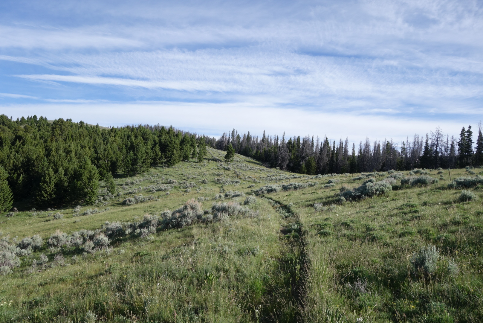
After some early blowdowns, the hiking quickly changed to high grass meadows. It is great to be able to see the trail stretch way out ahead and to be able to look down valleys and across at other mountains.
I hiked with Adam and Denali most of the morning. It was a good challenge to keep up wits them. AfteR lunch, I left ahead of them. According to both my maps, I took the correct turn. According to reality, I went to bacpacker’s hell. It was blowdowns, marshes, rocks, and bugs. When I pulled up the map on my phone, it assured me I was on course.
I eventually gave up and decided to angle downhill. I eventually found the correct, new trail. However, before that, I was able to see my first badger in nature.
Today I saw lots of animals: elk, deer, and the badger. Late in the day, I saw a mother Elk and her calf. Also, on a side trip to get water, I saw what I believe were wolves. At first I thought they were coyotes, but the way they walked and then ran indicated wolf.
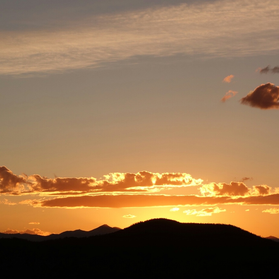
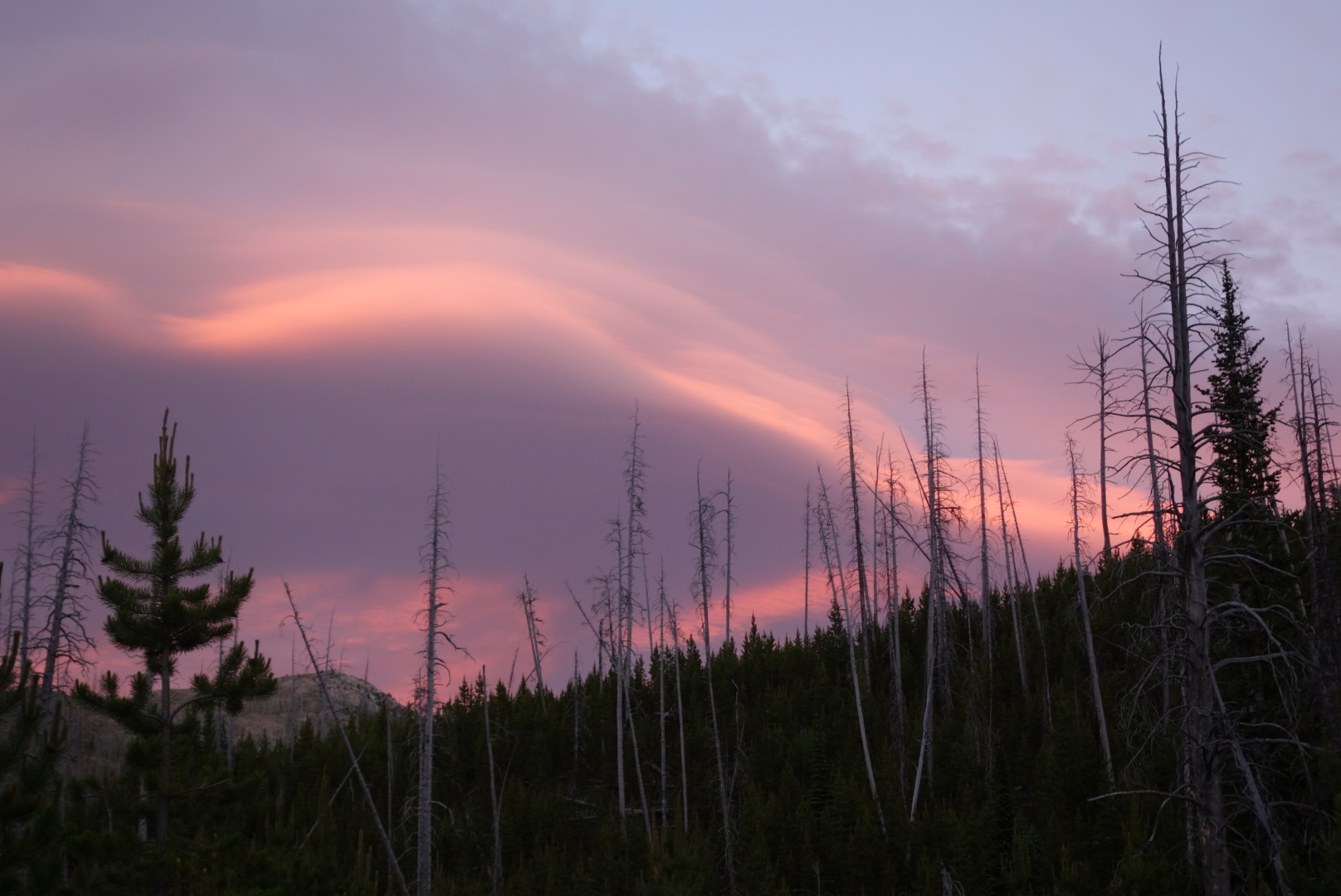
I was pretty beat by the end of the day. Still, got some fireworks in the form of sunset.
Last night I camped up high. Mountain winds are crazy. As the sun goes down, they start gusting and swirling as though undecided about a permanent direction. Then, they stop. It is like a person tossing and turning until the perfect position is found and then instant sleep.
Around 11:30 some creature was coming down the trail calling out. It was either a mother calling to her young or youngster calling for a parent. As it got close I made a bunch of noise because I did not want the reunion outside my tent.
I leapfrogged with Adam and Denali most of the day. They are a great couple that are strong hikers. Again the terrain is primarily lodgepole forest on hills. Water has been plentiful, but I am not sure how long that will last.
I had a strange experience. If you’re not familiar with a bird called a grouse, it’s primary survival tactic is to sit perfectly still alongside the trail until you are within 3 feet. Then it explodes into the air with wings flailing and making a squawk-ish sound. Invariably, I swear out loud and check to see if I had any involuntary secretions.
Well, this time instead of bursting into flight, it fluffed up, started squealing and squawking, and proceeded to chase me down the trail. After about three seconds, her bravado wore off and she must’ve realized I could easily kill her. As a result, she veered off trail and slowly became silent.
I received brand new shoes. I have worn the same brand with no problems. Now, I have two blisters on my left foot and one on the right. Ouch!
Finally returned to the trail. Got a ride from Mark, a local trail angel, who had already planned on giving a ride to 2 sobo hikers staying at the same motel.
My leg felt pretty good. I ended up getting close to 20 miles. The weather was great. Most of the terrain is rolling lodgepole forest. I saw a moose today that was running through the woods, no doubt glad he didn’t have big antlers.
The orthopedic physician didn’t shed any new light. X-rays were negative. Final diagnosis seems to be infection, banged up tendon, old age. Only the former is being treated.
Helena is a beautiful town. Little bit of trivia: it was named after Helena Minnesota. A couple hard-luck miners were about to abandon the area when they made a discovery in the area known as Last Chance Gulch.
I am planning on returning to the trail Saturday. I would love to be up high for the fireworks. My wife sent a great resupply package so I have plenty of food, new shoes, and duct tape.
The trail angel (Jamie) who picked me up and brought me into town has even followed up twice offering rides and a place to stay. She and her husband are very kind and definitely made this stranger feel welcome.
Plus, the lady who runs the motel (Jenny), took me to my orthopedic appointment and even picked me up. It could be I only meet the greatest people, but I suspect it is more likely that Montanans are generally kind and helpful people.
I have been restless. I have visited the library frequently, walked to get groceries, and visited a few historical sites. Oh, and I have been eating an embarrassing amount of food. I have not really hiked that far, but I’ve eaten like a starved squirrel that’s busted into the Fisher Nut factory.
I packed up quickly to get on trail. Surprisingly, I slept well even though I was close to the highway. I drank a lot of water from the nearby creek, filled my 2 liter platypus, made damn sure the top was screwed on tight, and started climbing up to the ridge.
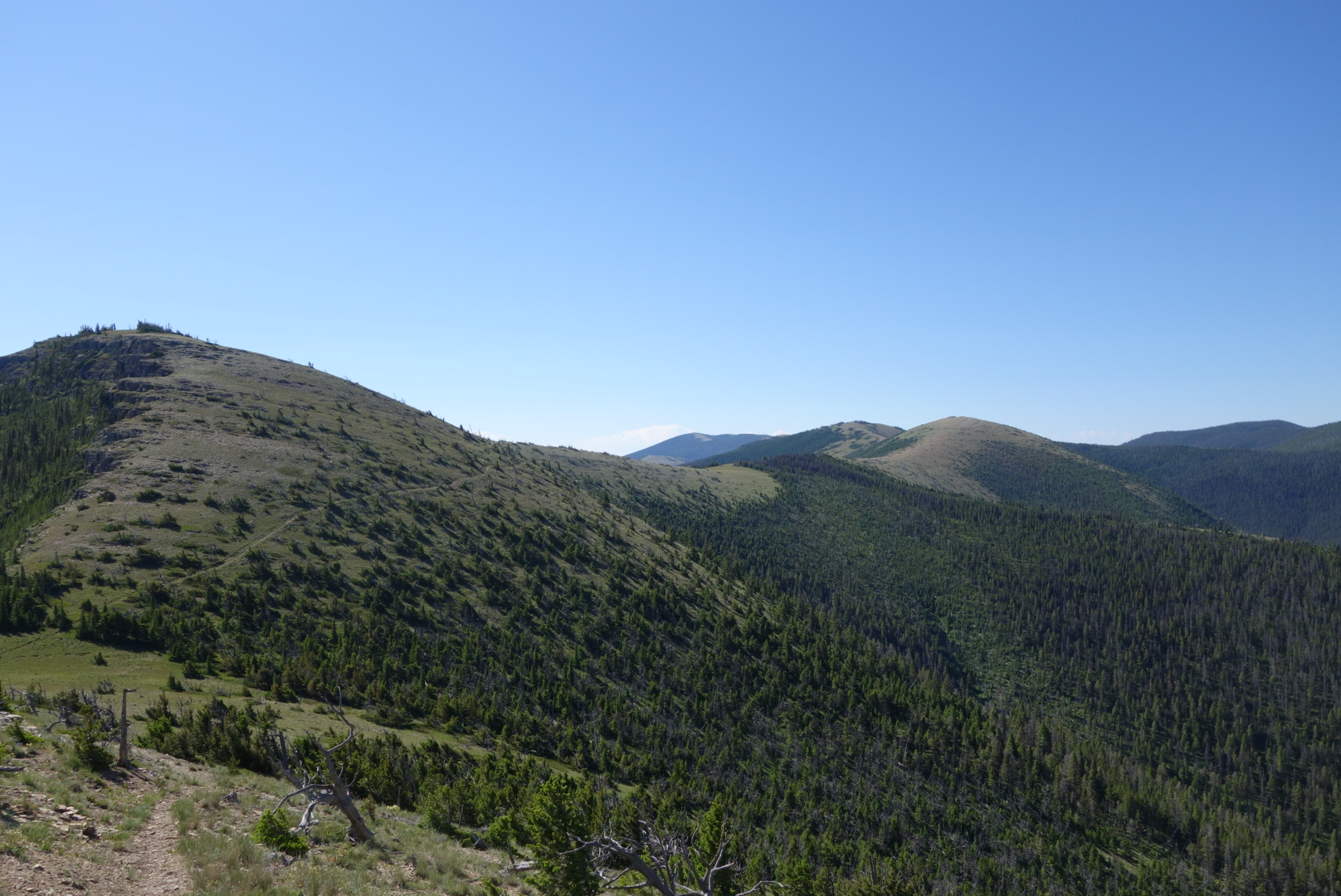
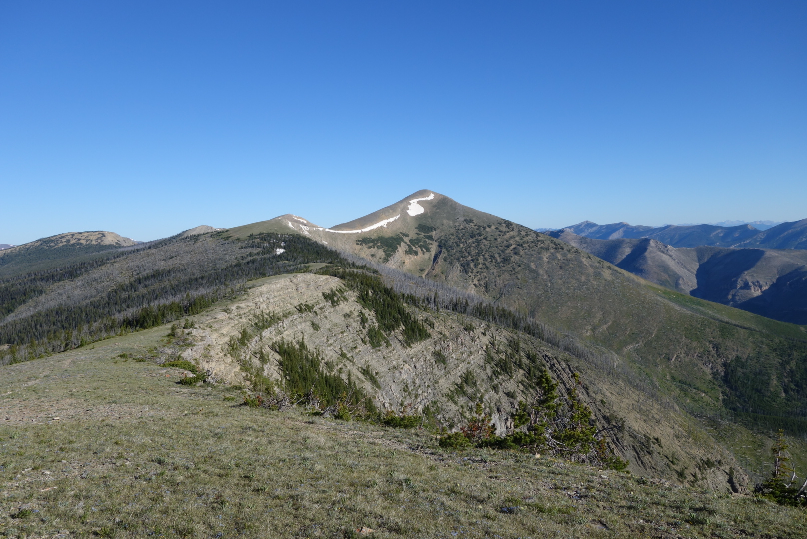
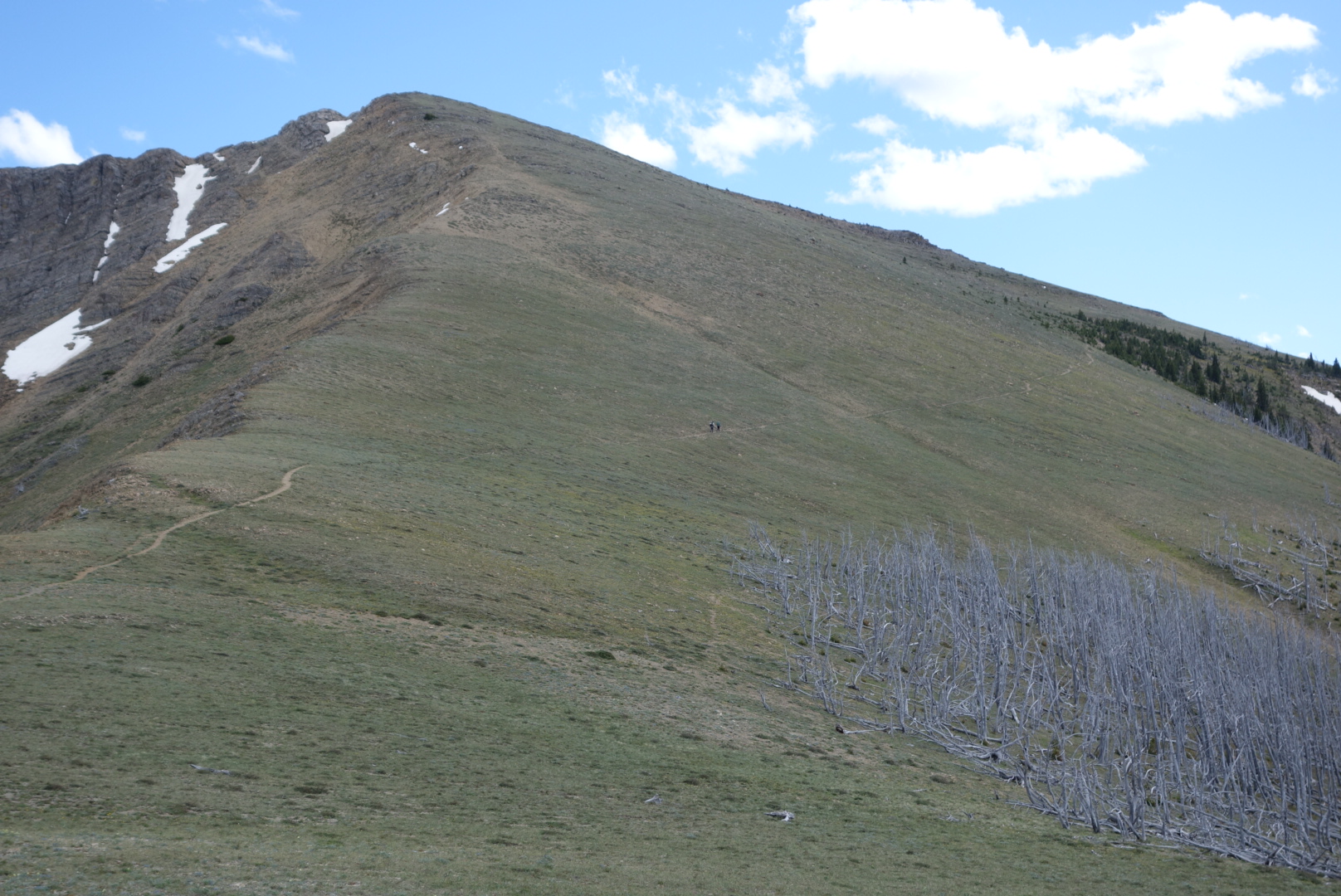
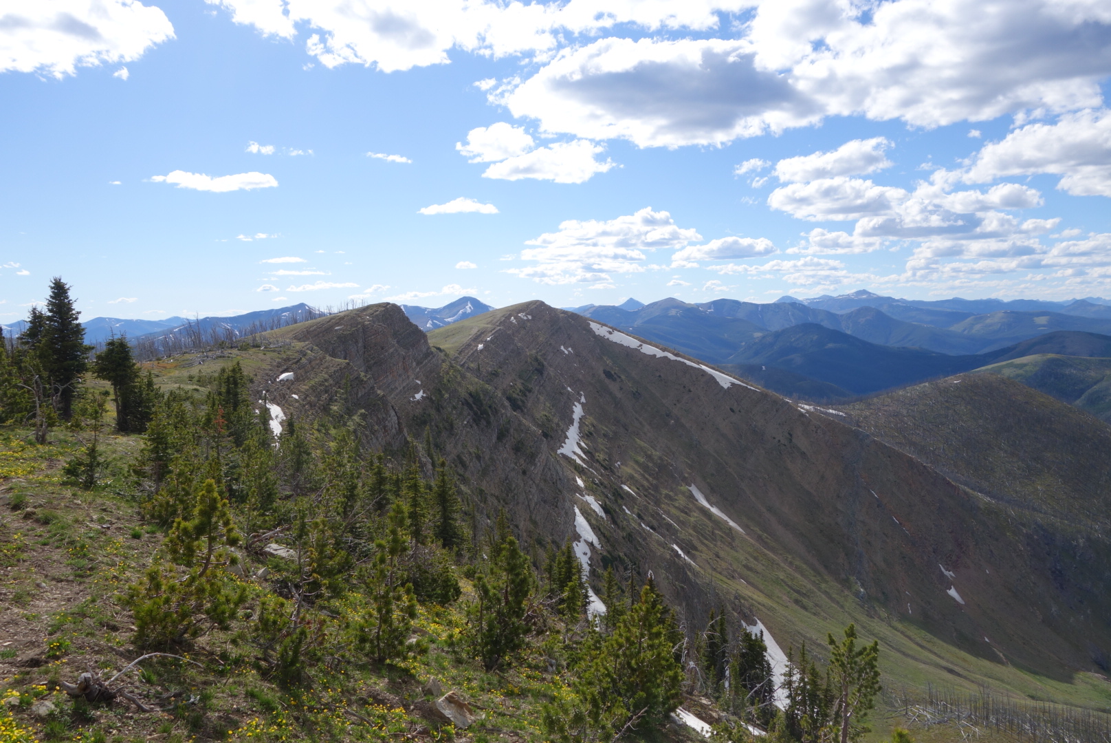
I love this section of the trail. Hiking up to one peak then down a ridge then up the next peak. With clear weather, there are sights in every direction. Most of the time it is open and exposed, but there are times when the trail goes through forests.
My leg was not getting better. I have developed this “life lesson from backpacking” which goes something like this. Some days you wake up with a pain. It feels awful and you are convinced there is something gravely wrong with you. You just hike through it for a day. So many times the pain just goes away. Rarely, like now, does the pain persist for more than a day. When it does persist, it warrants attention.
I kept turning around to see if the people who went to Lincoln were overtaking me. I did not see anyone. However, I did catch a moose that crossed the trail after I passed by.
It was hot and breezy up high. I thought originally I could complete a 12 mile section to water within 6 hours (7 to 1). However, I was slowing and it became clear I was not going to get there until 3:00. I had been nursing my water, taking drinks as rewards for reaching peaks. By 1:30 my urine stared getting darker and less productive. Although I have had heat exhaustion in the Arizona desert, I was experiencing dehydration for the first time. Fortunately, I still had some water left and immediately drank all of it.
I reached the highway pass (Flescher), reached the water source, downed 2 liters, and filled all my containers (4 liters total) for the next section. I was limping back up the highway to the pass from the water source when a work truck stopped in the middle of the highway and asked me if I was OK. A good rule of thumbthumb in life is that if somebody stops in the middle of a highway and asks you if you are OK, it means you do not look OK at all.
The lady asked me if I needed a ride in to Helena. I said I was just getting water and thought I might be ok. A car came up behind her and she had to move on. I had planned to hike the next section, hoping I could meet other hikers. Still, my leg was bothering me so much that my pace was continuing to slow. The lady turned her truck around and drove up to pass. I accepted her offer of a ride and I gave her my driver’s license so she could know who I was.
It was a tough decision. I had promised my wife I wouldn’t do anything stupid (well, beyond my normal range). I was getting slower, I was alone, the next section was about 60 miles which meant if things went real bad I would be even further from help.
This trail angel ended up taking me to the urgent care in Helena. She offered all kinds of support and was incredibly generous. I marvel at how good some people are. I tell my daughters to never pick up hitchhikers, especially ones that look like me.
The physician said my wounds were obviously infected and gave me a prescription. He was not as confident on the tendon issue and wanted me to see an orthopedic physician in the morning.
The last of a stray morning thunderstorm These amazing trees grow parallel to the ground due to the strong persistent winds.
Aside from some minor foot pain, the day started well. I had a flawless water strategy: camel up and then pack 3 liters. (Camel up means to drink a ton of water before you start…the idea being it is easier to carry it in you than on you.) The trail was up high all day, the weather was clear, and there was a water source about halfway through.
I started strong, eventually setting some distance between me and the others. My right foot, however was getting worse. It seemed like two things were happening: the tendon adjacent to the shin bone that controls the ability to point your foot down hurt and some of my cuts had not healed properly and the wounds were warm and red. Thus, while I could cruise pretty fast on flat or uphill, the down hill became more excruciating as the day passed.
I can’t do justice to describing the views. One direction looked out to the opening central part of Montana. Looking north I caught glimpses of the Glacier National Park mountains. Westward were snow capped peaks. It was 80 degrees and smog free.
Above tree line the trail does get a little obscure. Some people use a smartphone application to navigate. I’m enough of a old timer to look down on this as basically using a remote control to navigate the wilderness. Today, however, this old timer perspective sent me off through some rabbit holes. I, too would use my smartphone when I was confused, but I also only had about 40% left on the battery and was not scheduled to resupply for 5 more days.
Around 1:00 I came to a pass where water was only a quarter mile away. It was a pass where Lewis Meriwether had stopped on his return trip. At some point, I must’ve taken off my lightweight gray merino hoody and set it down. That was the last I saw of that piece of clothing.
It turns out that was not the only blunder. I use the plastic bottles branded as platypus. Flexible and easy to roll up when empty, they can expand to hold 2 liters of water. I filled one up and put it in my fancy new backpack that is waterproof. Not until later that day did I realize that the top has to be screwed on tightly to prevent leaks.
As the day wore on, I was a little frustrated as one hiker after another passed me by. They all intended to get to the next pass (Rogers) which has a highway where they would hitchhike into Lincoln, MT. I was limping along carrying food for another 5 days for an eventual resupply in Helena, MT.
At 8:00, I finally reached the pass. No hikers were there so they must’ve all got rides. I crossed the highway, found water, and began to set up camp. That is when I discovered how waterproof my backpack was. All my extra paper maps and my bag of electronics were submerged in the bottom. I tried to separate and dry the map pages with mixed results. I faced the grim reality I would not have a complete paper map set and my phone battery was down to 30%. My only hope at that point is that hikers would catch up to me and I could plead for some of their battery power and/or tag along with them.
I closed my eyes and tried to fall asleep to the sound of semis down-shifting as they pushed their rigs over the pass and started their descent.
I use a Delorme inReach product. It has a weather forecast feature. We awoke to sunny skies. We all made fun of the “forecast” which called for rain at 7:00 am, but within an hour it was a full throttled thunderstorm. But that was OK. That is because we were heading to the famous Chinese Wall and the sounds of thunder echoing off the wall were going to be amazing.
The others left camp before me, I tried to catch up, but got lost in some snowfields and had to angle my way over to where I eventually intercepted the trail. I still get a little nervous being off-trail in a wilderness area. But I continue to grow confident on using common sense and the topographical maps.
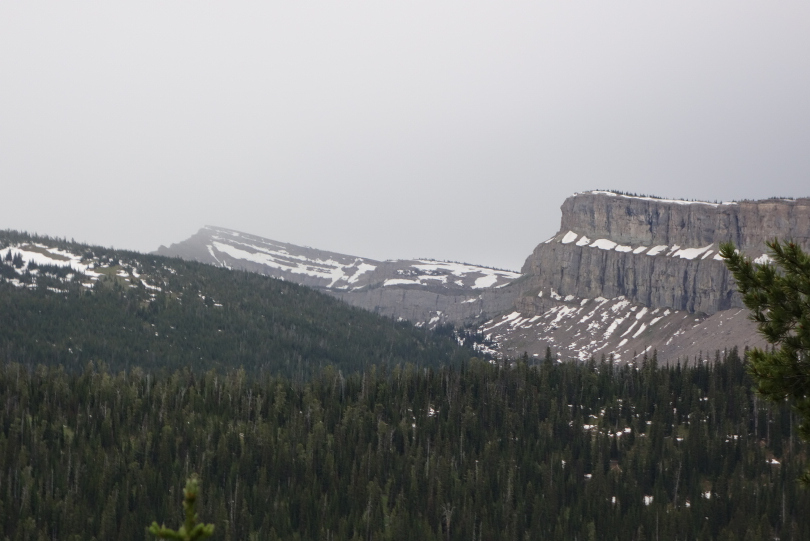
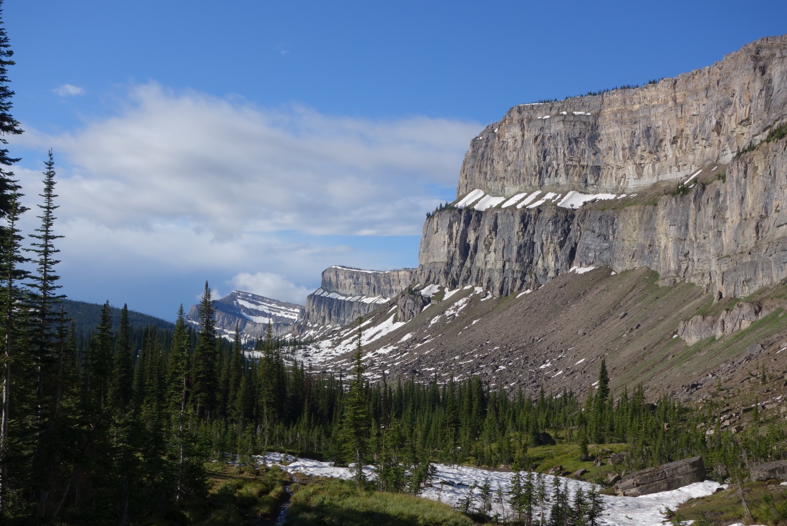
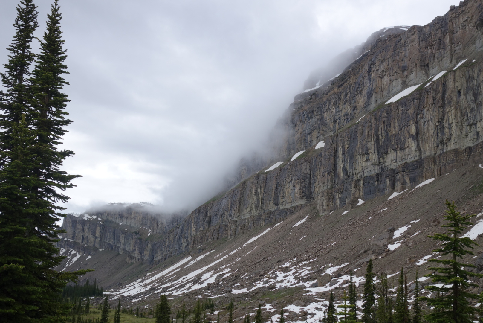
I reached the Chinese Wall about half-way through the thunderstorm. It cleared for about 30 minutes creating a photo-opp of the whole wall. However, after 30 minutes of clear sky, a day-long drizzle commenced.
Before leaving the Chinese Wall (it’s about 10 miles long) I was able to get some photos of low clouds swooping down the cliff face. It looked like something out of a movie set.
I eventually caught up to Grizzly’s group. We were all pushing for the next resupply point, Benchmark Ranch. Crunchmaster went ahead and found a site just as the rain was going to start up again. The problem was that we were in a forest that had burned about 10 years ago. Consequently, a lot of dead, burned trees were still standing, waiting for the right time to fall down. He found a clearing where it looked like if the trees at the edge blew over they would not reach the tents. Ended up finding a campsite in a clearing of dead trees. Fell asleep to wind and drizzle. Probably hiked about 23 miles in 12 hours.
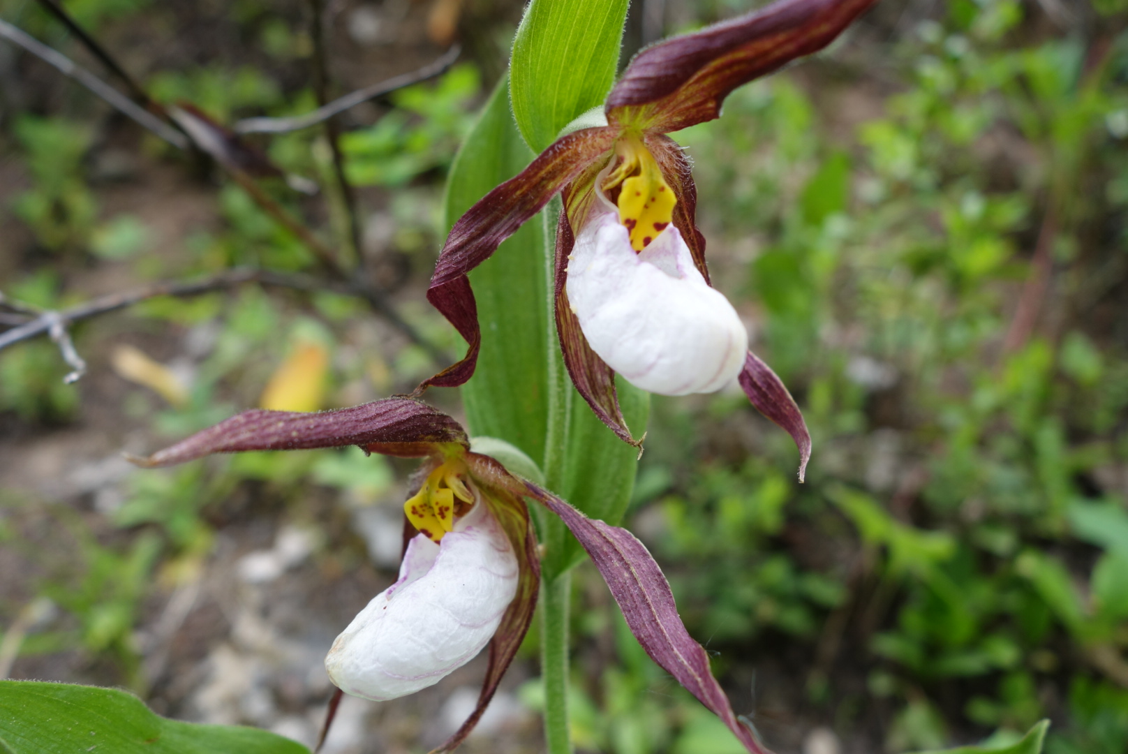
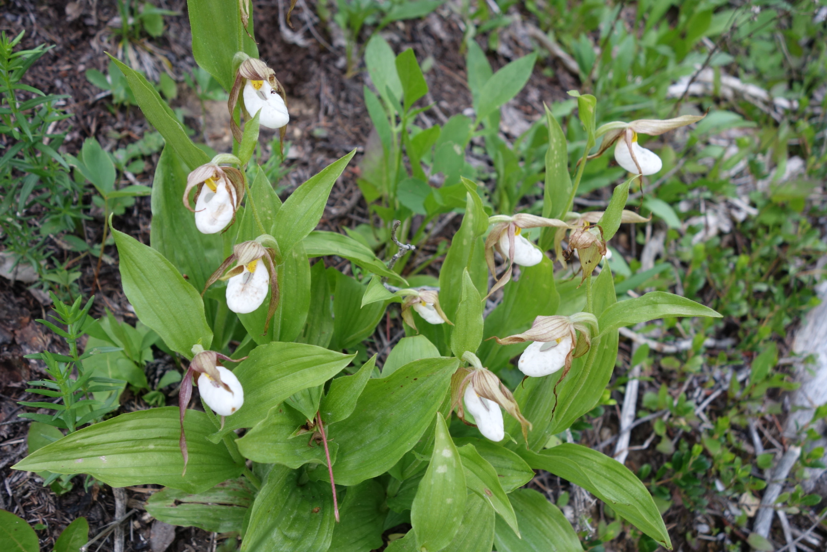
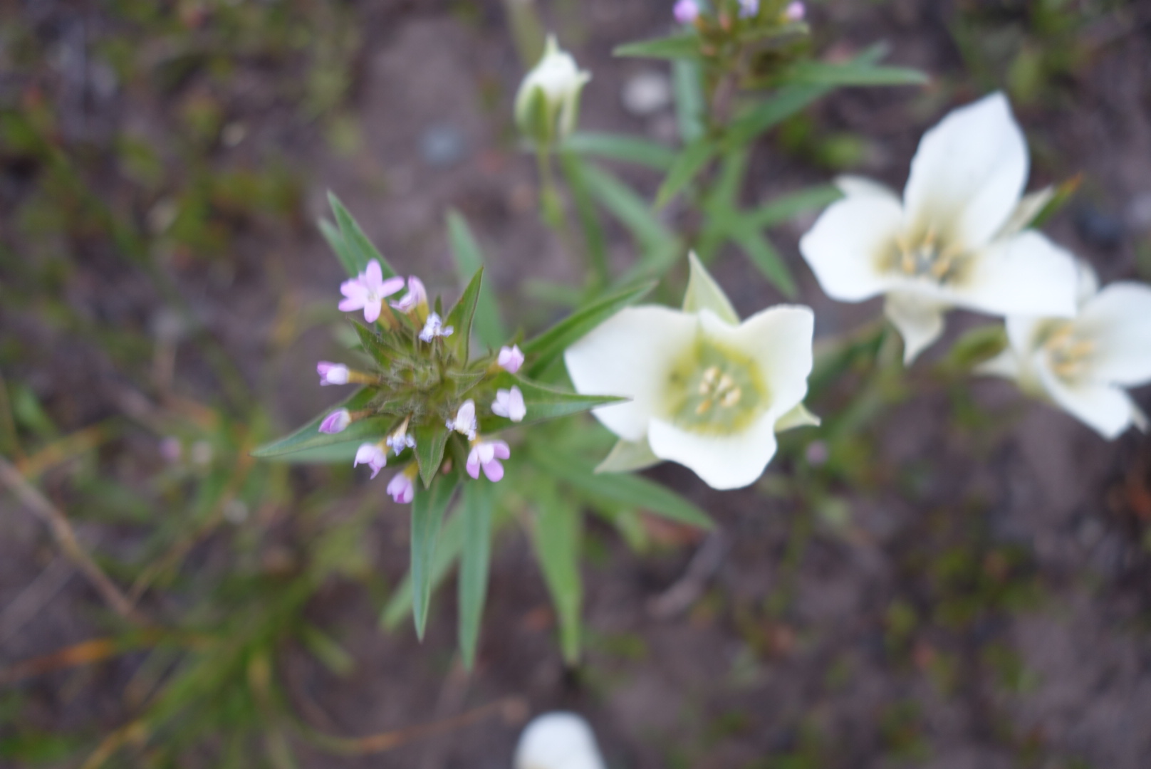
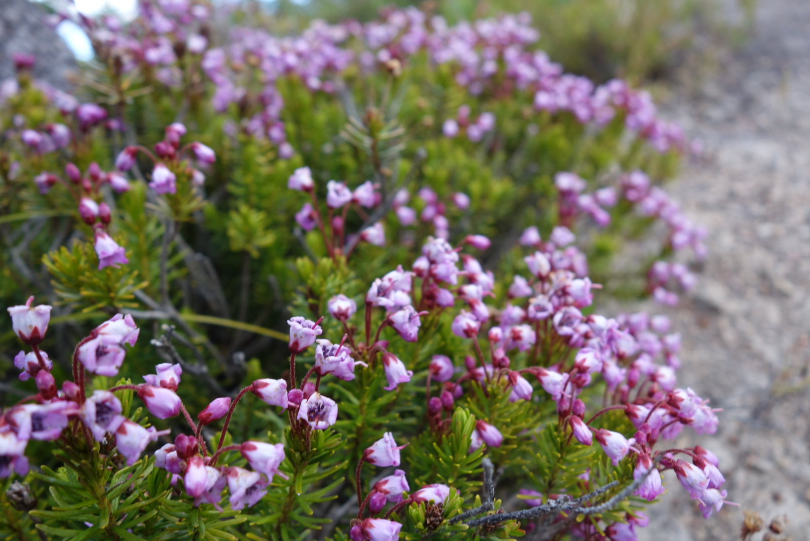
This beautiful plant only appeared 2 times, both near creeks. Any idea what it is?
Last night I had slept near a stream. That sounds nice, but I should’ve known better. You never want to sleep in a meadow or near a stream as these locations naturally draw condensation which you invariably end up packing away.
I did learn a neat trick for wet socks, though. Normally, people make a little fire and try to dry them over or near the flame. I experimented by placing flat rock over the edge of the fire. Rather than risk the possible loss of a sock due to flame (and in my case the release of toxic fumes). I heated the rock. It stayed warm for several hours after I put out the fire and went to sleep.
Now the trip has started to get interesting. I started hiking along the Dearborn River. The forest was extremely crowded as small pines competed for space in an area that must’ve burned 20 years ago. It was like walking along a path through a lush green grove of 6′ bristles.
Next, it was older forest. Later, the terrain finally busted out into drier and higher altitude mountain tops. Prior to this trip, I had envisioned walking along the roof line of America and having wide expansive views all around. It was finally happening.
As I climbed up one 8,000′ ridge, I paused to watch a black bear forage its way up the opposite ridge. Bears must just wake up in the morning looking for food and not stop looking until they fall asleep. For humans it is recommended that we need 1 gram of protein for each pound of body weight. If the same holds true for a 400 lb bear it would need to find the equivalent of 3.5 jars of Jif peanut butter per day.
I’ve been catching my feet on roots and rocks and my right foot is starting to hurt. I have managed to catch up to a different group of CDT hikers and we spent most of today passing each other. Eventually, however, the foot pain caused me to go real slow, especially down hill. To make matters worse, I had barely brought enough water to get me to the end of the day.
Eventually, I stopped at the next water source. The folks I just met (Gypsy Artist and Indie) were camped nearby and later I was glad to see Grizzly and company come in to camp.
I estimate that I hiked about 20 miles in 13 hours.
Oh Big Sky country, stop it.The trail climbs along the ridge.
(June 25) Most of the scenery today was scorched earth. It gave me a lot of time to think. I was hiking by myself. I woke up much earlier than the others. I had hiked in to the Benchmark Resort and obtained my resupply package. It was drizzly to start and then overcast.
The name Scapegoat Wilderness intrigued me. Who came up with that name? I know officially it was named in 1974 after Scapegoat Mountain, but didn’t somebody raise a hand to object? The full weight of Congress went ahead and honored a Wilderness area by naming it after a person who is blamed for the sins or shortcomings of others?
Not to sound like an old guy, but it used to be you honored people who would own up or fess up to something. I seem to recall there was a certain pride (and consequences) for accepting responsibility for what you did. I’m talking about the short, sweet “Yes, I did that” variety. Not the kind the modern athlete has their attorney prepare when they get caught doing something stupid.
Apparently, we needed to honor the scapegoat, the fall guy. The one who takes it for the team. I guess in today’s world with 24 hour digital access and scrutiny we need to have those folks around. One of the most famous (and tragic) I could recall was the TV station that announced the names of the pilots of an Asiana airliner that crashed in San Francisco. In case you don’t remember, the news station wrote out the names, displayed them and read them on the air: Captain Sum Ting Wong, Wi Tu Lo, Ho Lee Fuk, and Bang Ding Ow. So, who got blamed for this? a summer intern at the National Transportation Safety Board was blamed for “confirming” the names. Not the station reporter who made up the names, not the producer who was responsible for the show, not even the NTSB manager who presumably had the power to tell interns not to confirm information about airline crashes without approval. The summer intern as a scapegoat must get used a lot.
Sorry to rant about the name, but it was burned over country and I had time to think. One certainty for me is that I promise to visit the next wilderness area that Congress designates: the Imavictim Wilderness Area.
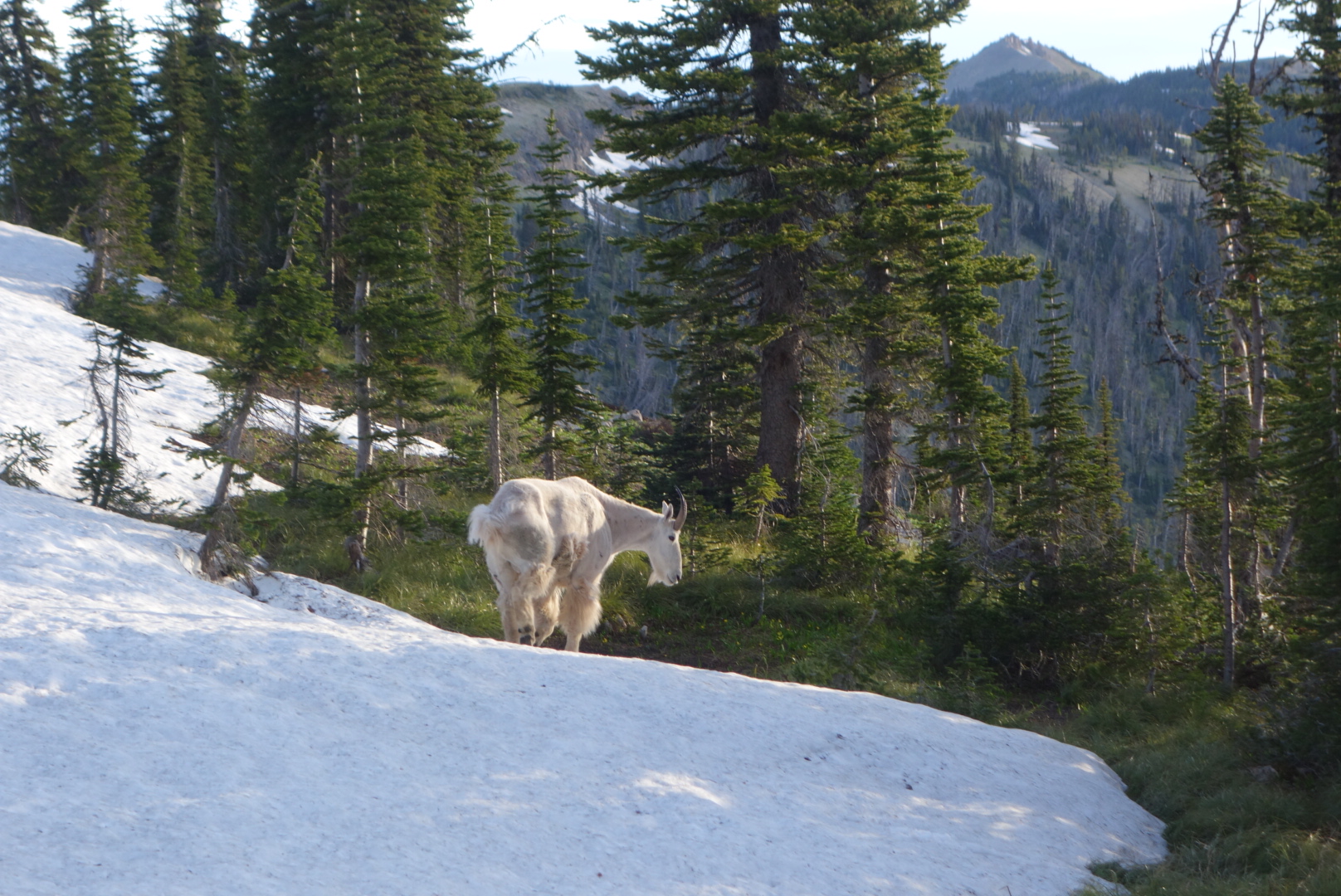
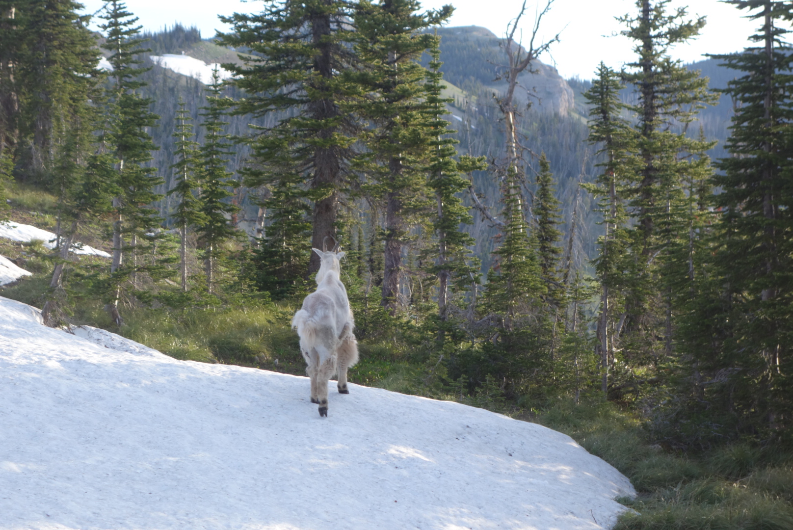
During the night, Lucky said he heard a crunching sound. We camped near a 30 foot snow field. Some critter probably walked across. In the morning, however, it was clear we had a new, temporary teammate.
An old mountain goat was hanging out within 15 feet of our camp, walking calmly back and forth. As luck would have it, my camera battery had drained due to cold. So I frantically tried to charge it while the goat was so close. Eventually I got a couple pictures of the old guy. The Bob Marshall Wilderness does deliver.
This old goat was patient with photos
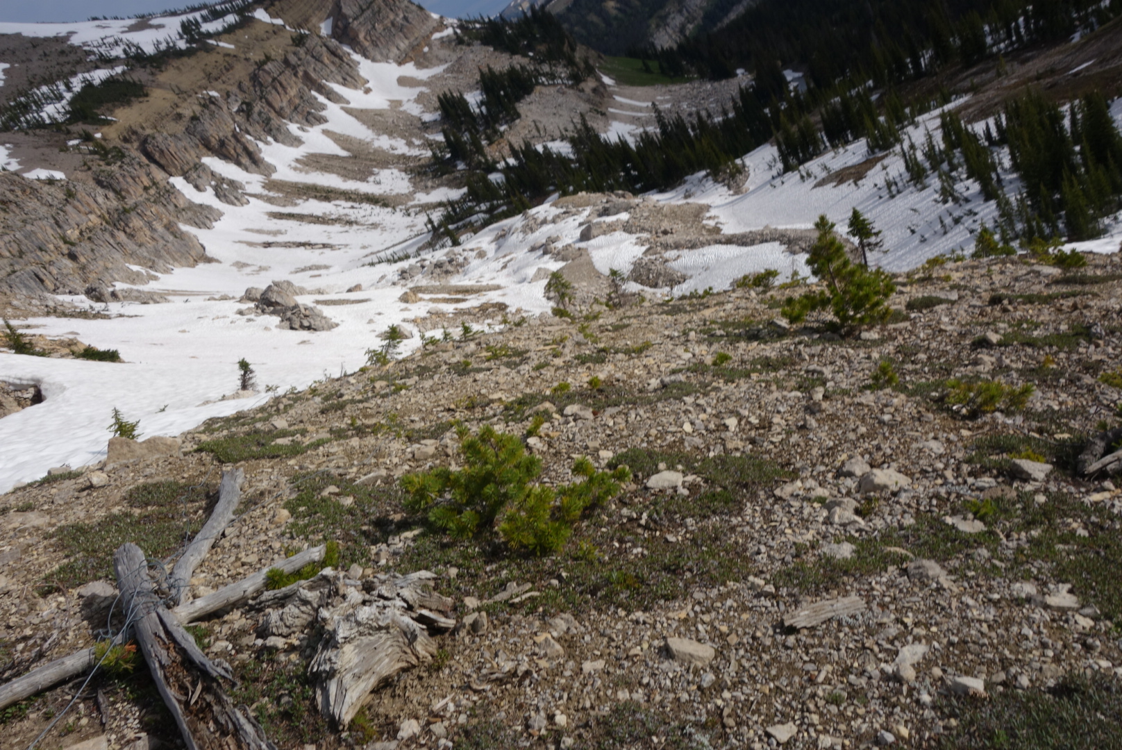
Our first challenge of the day was getting over Switchback Pass. This was supposed to me a smooth series of switchbacks that led easily over a high pass. However, due to the snow fields it was precarious. The trail was high on the steep snow fields. Since I am naturally brilliant, I had reduced pack weight in East Glacier by getting rid of my micro-spikes and ice-ax. We chose to go along the bottom of the snow field. This was slightly more level and had less snow. Of course, the trade-off was a sheer drop off of 100 feet if we slipped in the mud.
Thus far, Lucky has been our main pathfinder. I am pretty good with balance (that ballast I carry in the middle comes in handy) and open area routing. As a result, I led us over to a point directly below where the pass was located. The only thing between us and the pass was a steep snow field of about about 150 to 200 feet. At that point, I decided the only logical thing to do was to yield the lead to Lucky. He had microspikes and the Trail Name to make it all possible. Eventually we got on top and were very relieved.
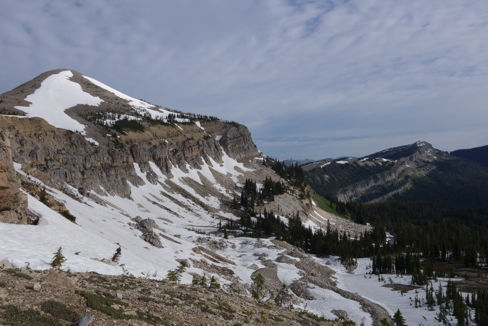
Looking down from Switchback Pass.The rest of the day found me hiking alone. Lucky’s injury was clearly hurting him. There were a lot of blowdowns and I scraped the heck out of my shins. I arrived at the Forest Service back country cabin at Pentagon Creek. Not only did my current group show up, but also the first team I started hiking with. The Forest Service outhouse was unlocked and most of us took advantage of the opportunity and gave high marks to the quality of the privy. We have been in the woods awhile.
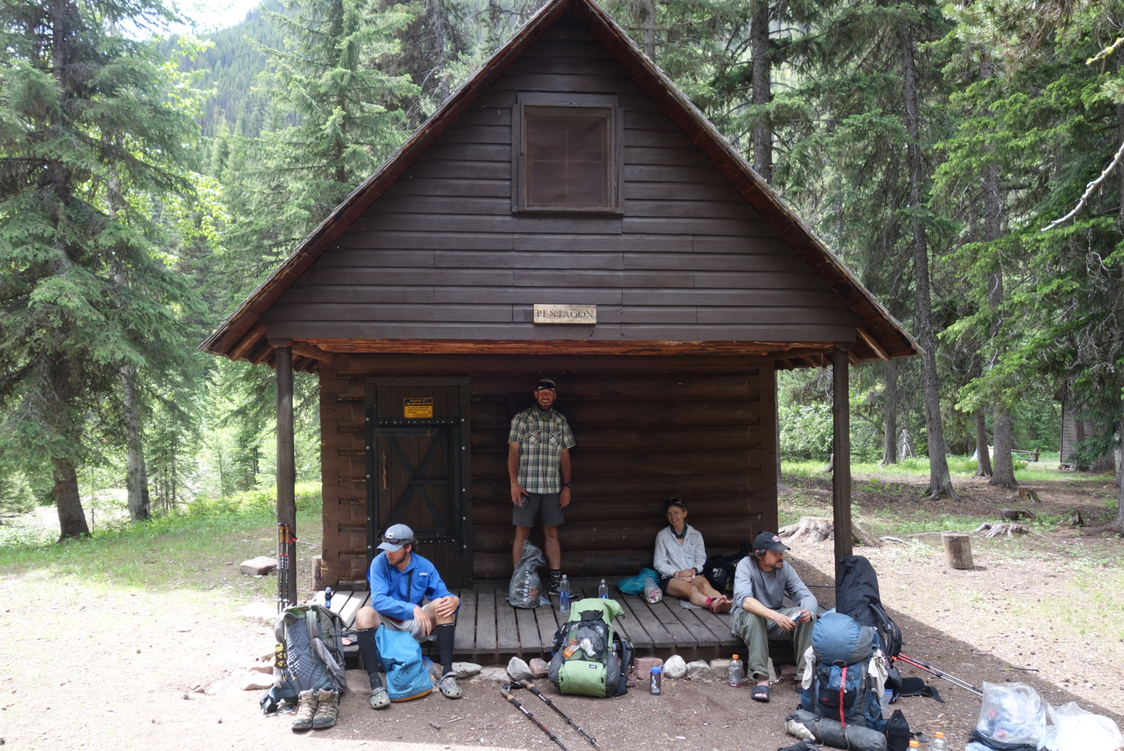
(Left to right) Crunchmaster, Grizzly, Snake Bite, and Lucky. Pentagon Cabin.As the afternoon wore on, I eventually found myself getting ahead of Lucky and STD, but trailing Grizzly and the others. I enjoyed the time and really appreciated the Bob Marshall Wilderness. It just has a feeling of being in the wild. I had read some comments about it being boring, but I truly felt like I was in remote wilderness.
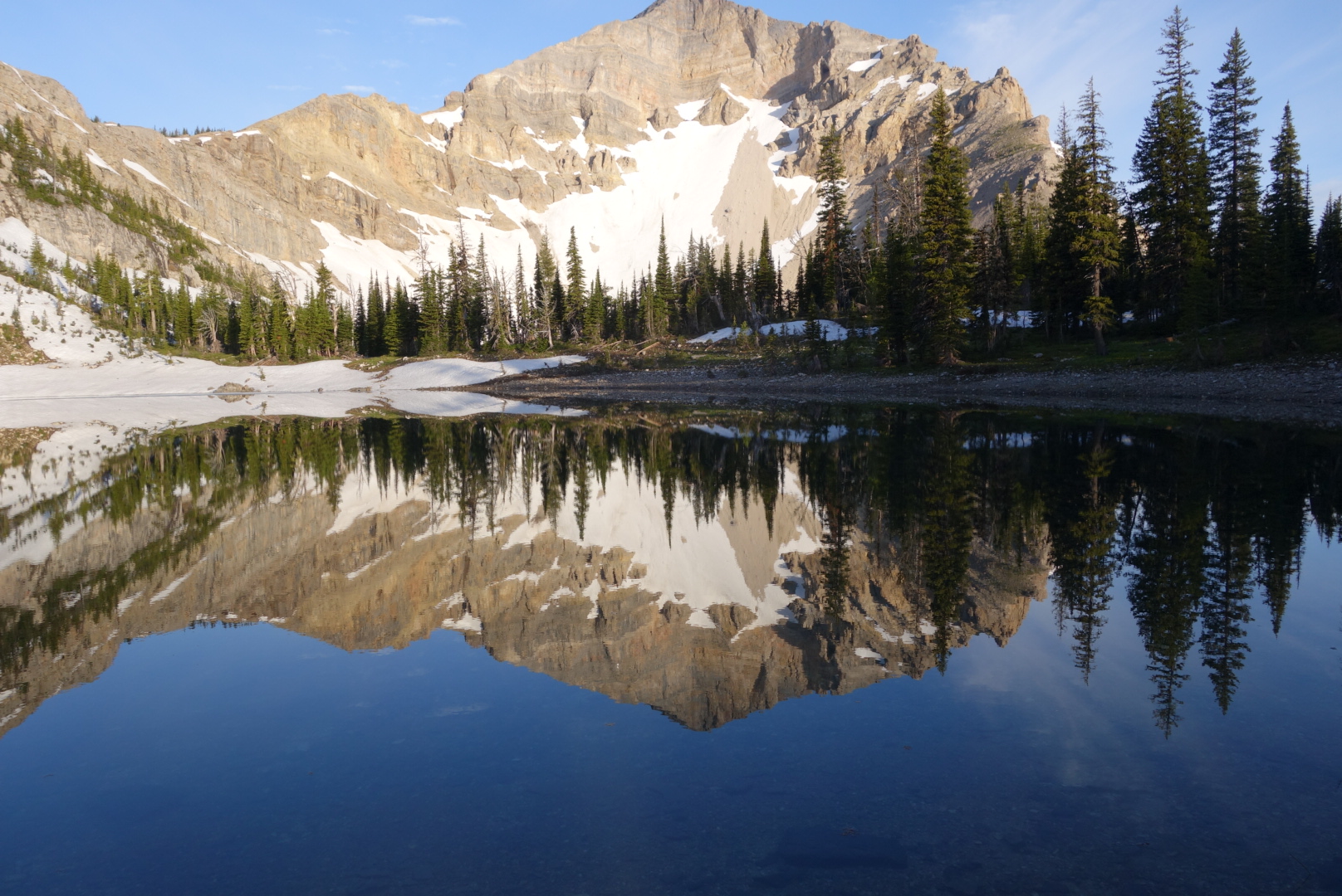
While navigating the many blowdowns, I eventually came to the last hill. It was a climb over Larch Hill to the day’s destination, My Lake. I chugged up the hill, my thighs protesting, my lungs working overtime. To take my mind off the challenge, I thought of what I would say when I reached the Grizzly group. When I finally staggered into the campsite, I told them “Look, you can camp anywhere you want, but I just want you to know that this is My Lake.” At first they thought I was insane, but quickly they realized the altitude had caused me to come up with corny humor.
Ironically, I fell sleep to the sound of jet engines as I was sleeping under some type of common flight path.