August 9th
Right away in the morning I met Qtip. We descended to the Green River and then headed upstream. The day would be easy ascent up along the River, then sharp, steep climbs the rest of the day.
The hike was beautiful. Immediately, there are the two big Green River Lakes. Then, Square Top Mountain appears. It is a textbook example of a monolith: a block of stone rising almost vertically with what appears to be a flat top. Later on, the trail follows the Green River which is colored by all the sediment.
There were a large number of backpackers and horse riders on the trail. At one point, there was a mini traffic jam. Most were weekend visitors.
Around mid-day, the climbing began. Qtip planned on taking an alternate that goes over a geological feature called Knapsack Col. Many CDT hikers do that. A col is a steep pass between two mountain peaks. I chose to skip this. To me, a steep climb up a boulder field to reach a place with not much of a view only to climb down the equally steep other side held little interest.
I lost sight of Qtip at the top of the first set of switch backs. I had a crappy hike when I went from Vista Pass to Cube Rock Pass. Basically, one climbs up a boulder strewn valley. At the base of the valley are the biggest boulders. Allegedly, the trail climbed from the base up to one side and was marked with cairns. Cairns, as you may recall, are rock piles, sort of land buoys. This works great in meadows, but, not surprisingly, is less effective among piles of rocks. After I boulder-hopped and smashed my hands and legs, I eventually found the “trail” and made it.

I got a little twisted around at the top but eventually sorted everything out. I needed to climb Shannon Pass to get to my destination. I was tired, bruised, and not loving the altitude. I kind of bonked, or hit a wall. After taking a late day snack break, I recharged and tackled Shannon Pass. I have a niece named Shannon and vowed to not hold my dislike of this pass against her.

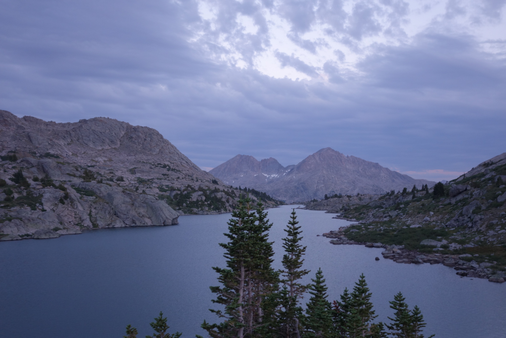
To help visualize, this terrain is all above treeline. It is craggy grey rocks jutting up, some small shrubs, and many lake fed by ice melt. It is austere. If you have been in the high Sierras you have a closr approximation.

I eventually came to a nice campsite on a ridge overlooking Upper Jean Lake. The clouds were interesting; they left the mountains around sunset, but consolidated above when it was dark. Even got a mild sprinkle overnight.