(June 27)
Gotta love the title, right? Brutal honesty.
Aside from some minor foot pain, the day started well. I had a flawless water strategy: camel up and then pack 3 liters. (Camel up means to drink a ton of water before you start…the idea being it is easier to carry it in you than on you.) The trail was up high all day, the weather was clear, and there was a water source about halfway through.
I started strong, eventually setting some distance between me and the others. My right foot, however was getting worse. It seemed like two things were happening: the tendon adjacent to the shin bone that controls the ability to point your foot down hurt and some of my cuts had not healed properly and the wounds were warm and red. Thus, while I could cruise pretty fast on flat or uphill, the down hill became more excruciating as the day passed.
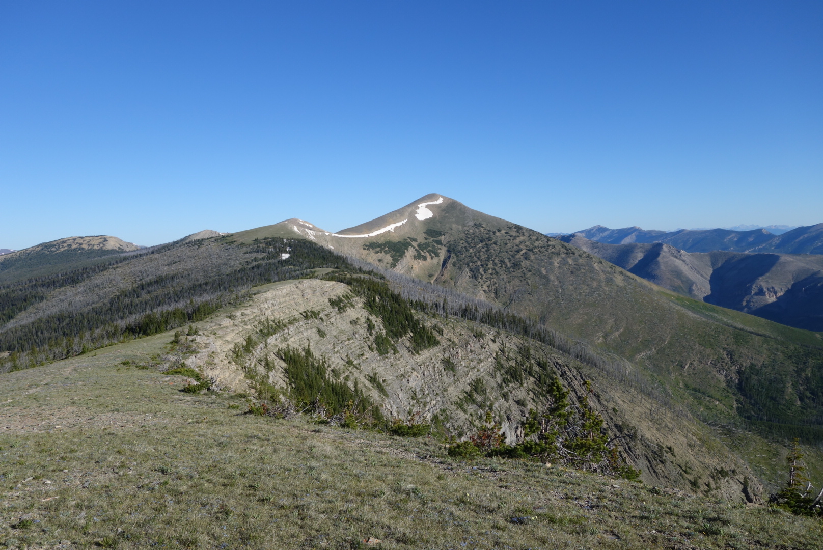
I can’t do justice to describing the views. One direction looked out to the opening central part of Montana. Looking north I caught glimpses of the Glacier National Park mountains. Westward were snow capped peaks. It was 80 degrees and smog free.
Above tree line the trail does get a little obscure. Some people use a smartphone application to navigate. I’m enough of a old timer to look down on this as basically using a remote control to navigate the wilderness. Today, however, this old timer perspective sent me off through some rabbit holes. I, too would use my smartphone when I was confused, but I also only had about 40% left on the battery and was not scheduled to resupply for 5 more days.
Around 1:00 I came to a pass where water was only a quarter mile away. It was a pass where Lewis Meriwether had stopped on his return trip. At some point, I must’ve taken off my lightweight gray merino hoody and set it down. That was the last I saw of that piece of clothing.

It turns out that was not the only blunder. I use the plastic bottles branded as platypus. Flexible and easy to roll up when empty, they can expand to hold 2 liters of water. I filled one up and put it in my fancy new backpack that is waterproof. Not until later that day did I realize that the top has to be screwed on tightly to prevent leaks.
As the day wore on, I was a little frustrated as one hiker after another passed me by. They all intended to get to the next pass (Rogers) which has a highway where they would hitchhike into Lincoln, MT. I was limping along carrying food for another 5 days for an eventual resupply in Helena, MT.
At 8:00, I finally reached the pass. No hikers were there so they must’ve all got rides. I crossed the highway, found water, and began to set up camp. That is when I discovered how waterproof my backpack was. All my extra paper maps and my bag of electronics were submerged in the bottom. I tried to separate and dry the map pages with mixed results. I faced the grim reality I would not have a complete paper map set and my phone battery was down to 30%. My only hope at that point is that hikers would catch up to me and I could plead for some of their battery power and/or tag along with them.
 I closed my eyes and tried to fall asleep to the sound of semis down-shifting as they pushed their rigs over the pass and started their descent.
I hikes 18 miles in 14 hours.


